

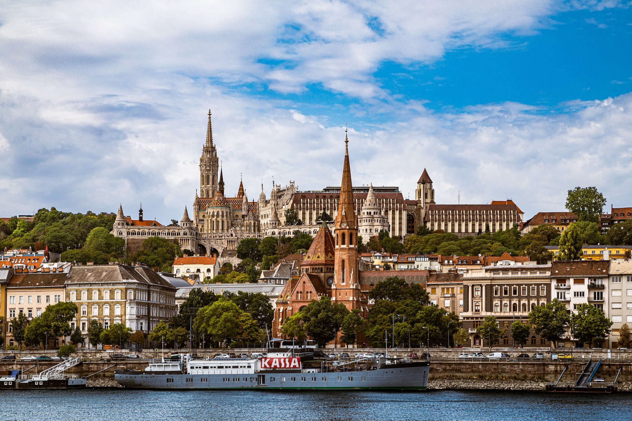
BUDAPEST DISTRICTS
There are 23 official districts in Budapest. Here you will find Geographic Setting, History & Development, District Identity, Landmarks & Areas of Interest, and Neighborhood information for all of them. Use the Visited Districts below to see deeper insights and observations from the districts visited by CityNeighborhoodsNYC
Visited Districts
-
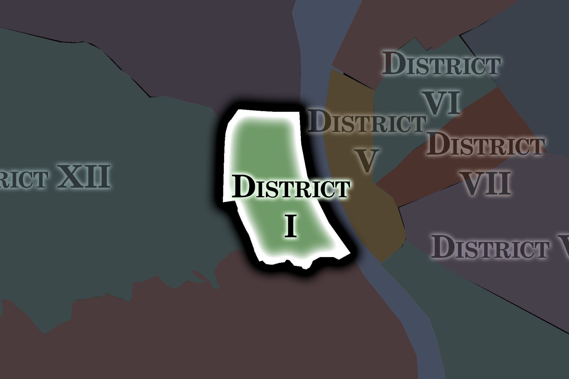
District I - Castle District
-
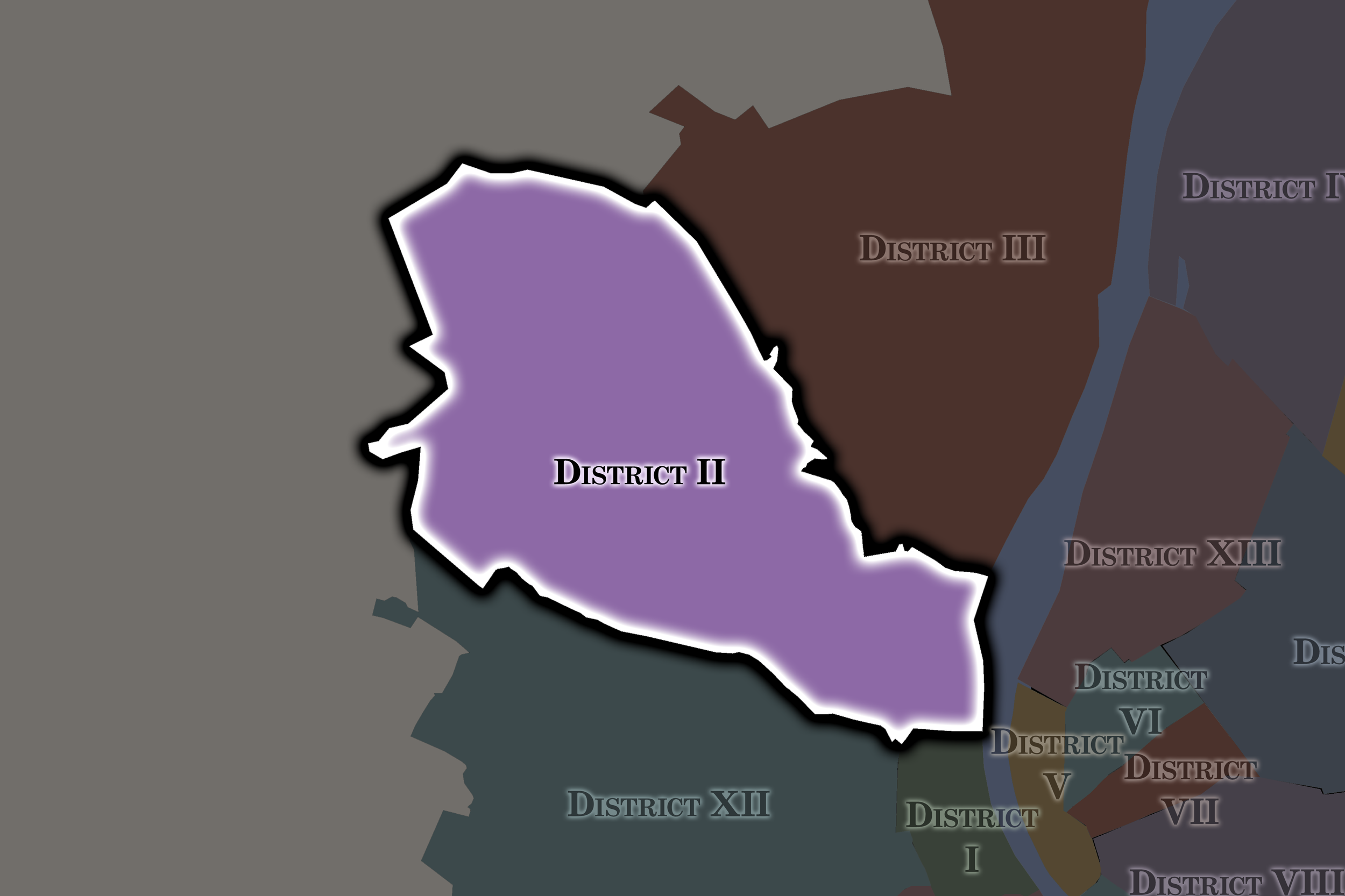
District II - Rose Hill
-
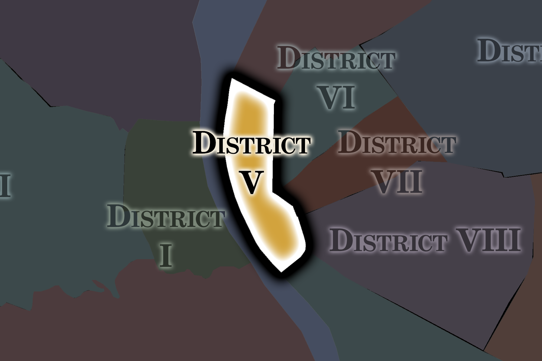
District V - Inner City / Downtown
-
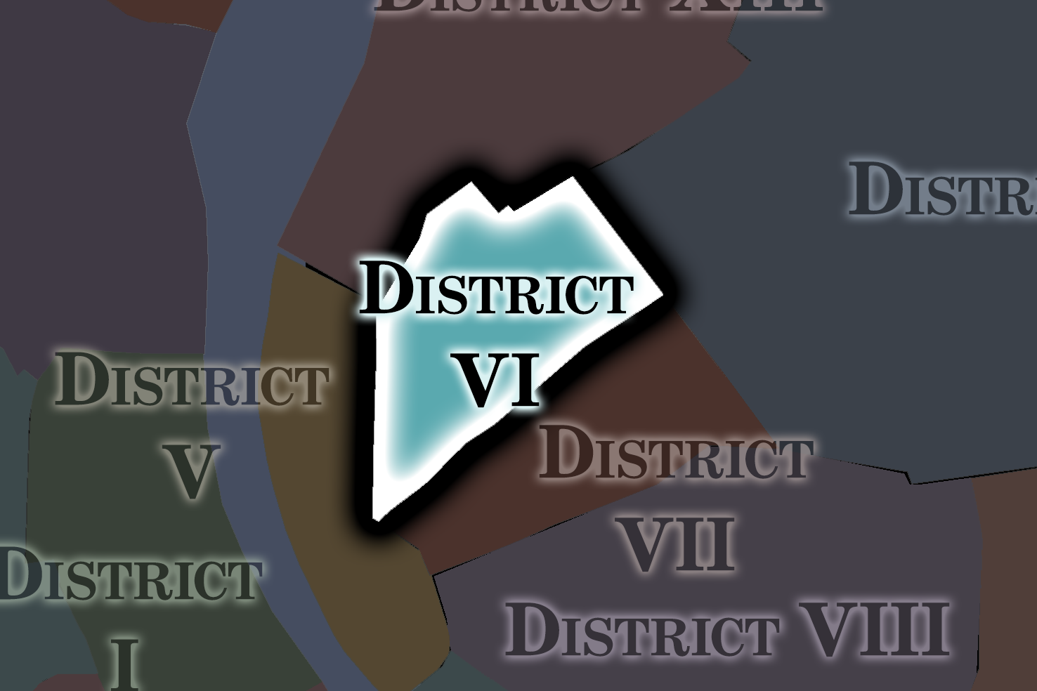
District VI - Theresa Town
-
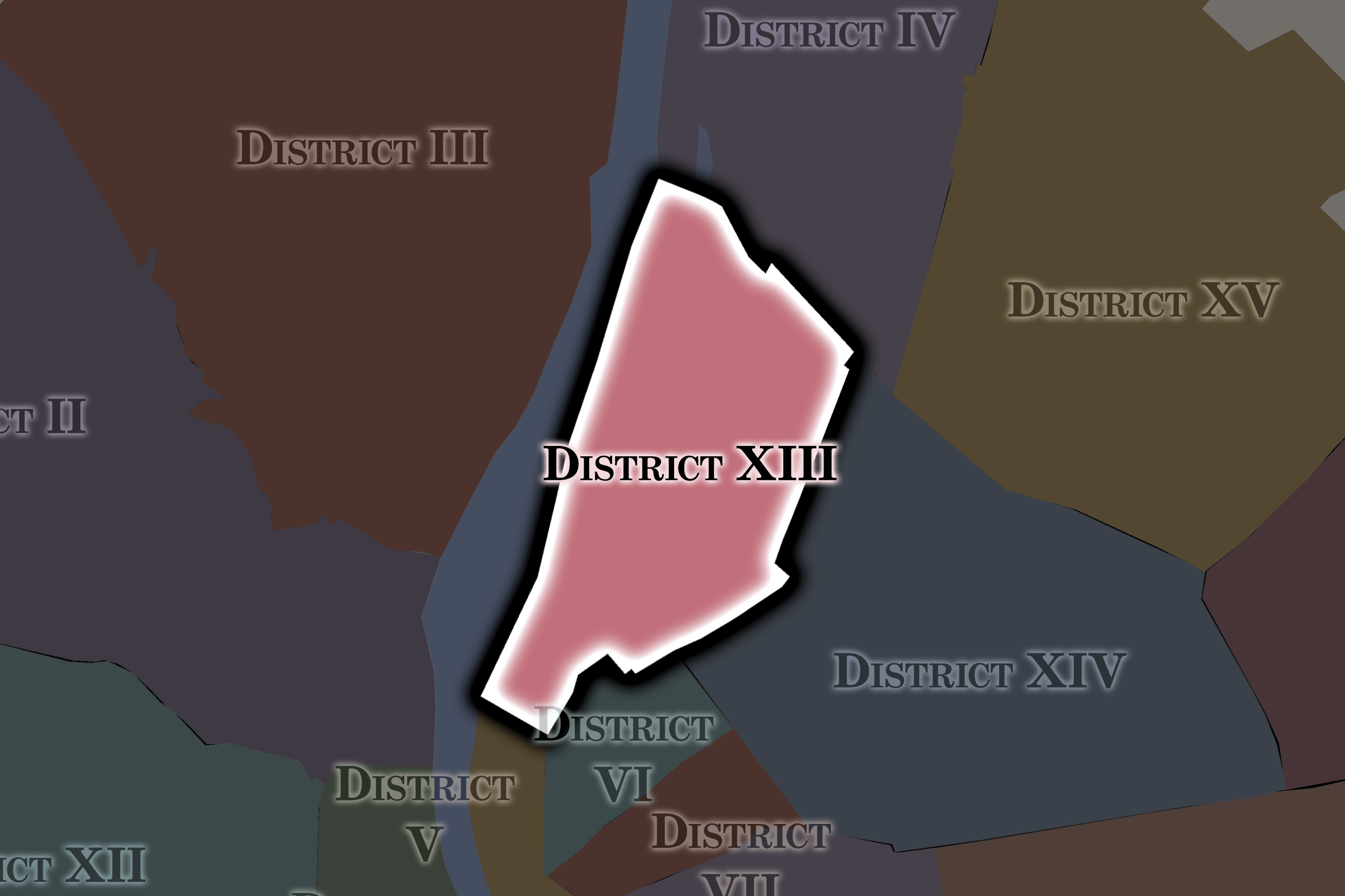
District XIII - Angel's Field
-
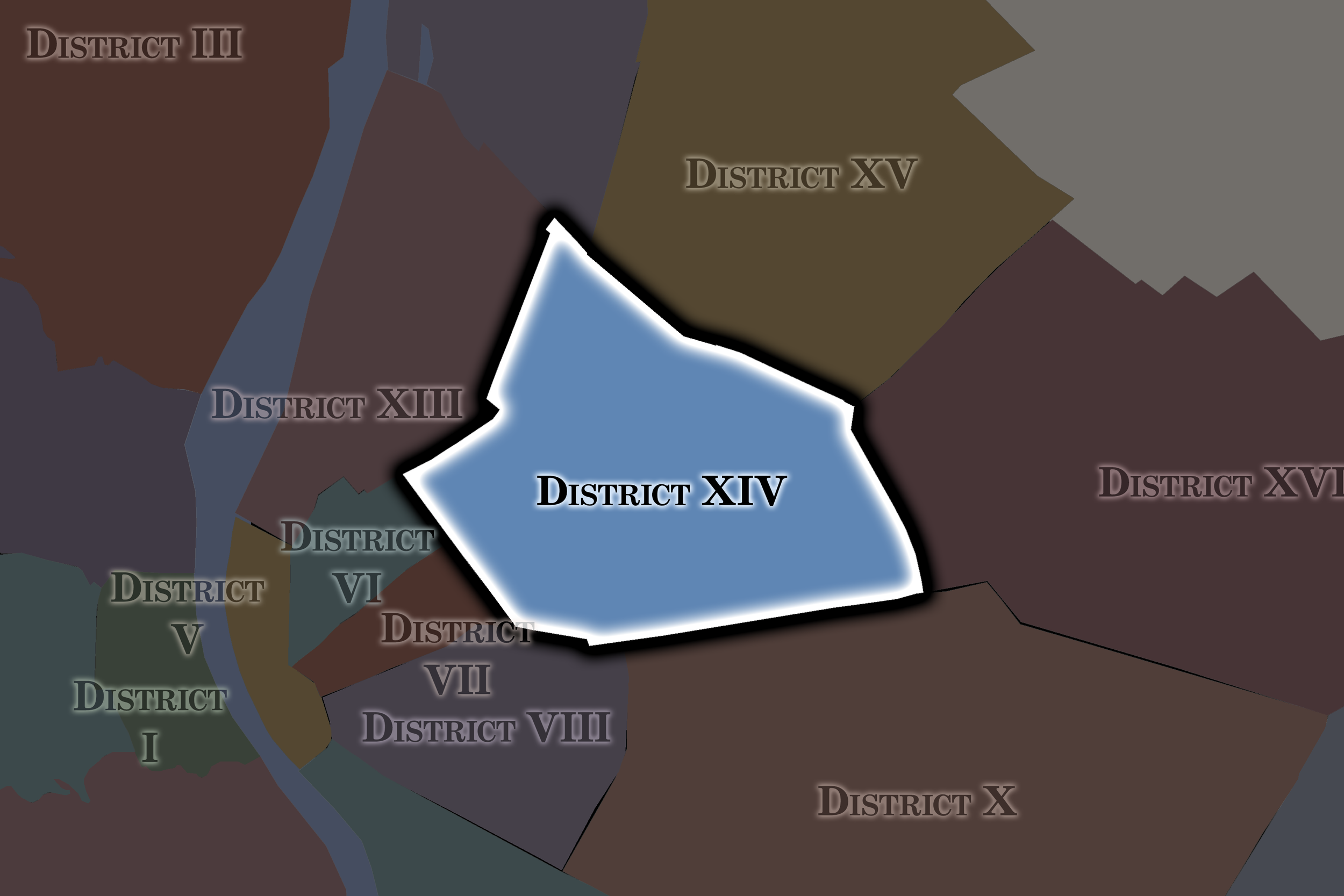
District XIV - The Nook
District I - Várkerület
-
District I, officially Várkerület, occupies a compact but exceptionally varied section of central Buda on the western bank of the Danube. It is bordered by District II to the north, District XII to the west, District XI to the south, and the river—and, across it, District V—to the east. Unlike the broad, flat urban fabric of central Pest, the district is organized vertically around Castle Hill, with the Danube waterfront below it, the slopes of Krisztinaváros to the west, Tabán descending toward the south, and a portion of Gellért Hill rising at the district’s southeastern edge. (Budapest Info)
That topography produces a district of remarkably compressed contrasts. The fortified plateau of the Castle Quarter sits above dense riverfront streets in Víziváros; broad green spaces such as Vérmező and the park-like remnants of Tabán interrupt the historic urban fabric; and stairways, retaining walls, tunnels and steep streets continually negotiate the difference between hilltop and river. District I is therefore both geographically central and physically distinct: one of Budapest’s smallest districts, yet one in which the relationship between hill, river and historic city is unusually visible. (UNESCO World Heritage Centre)
-
The district’s present form begins with the decision of King Béla IV to establish a fortified settlement on Castle Hill after the Mongol invasion of 1241–42. Buda subsequently became a royal center, and under later medieval rulers—particularly Sigismund and Matthias Corvinus—the castle and surrounding town developed into one of the political and cultural centers of the Hungarian kingdom. Ottoman occupation beginning in 1541 interrupted that development, and the recapture of Buda in 1686 left large areas damaged. Eighteenth-century reconstruction overlaid much of the medieval town with the Baroque streetscape that still characterizes the Castle Quarter, while Víziváros and the lower slopes below the fortress developed as working residential and commercial districts. (UNESCO World Heritage Centre)
The creation of Budapest in 1873 incorporated these old Buda neighborhoods into District I, which originally covered a considerably larger part of the western city. The later creation of District XI in 1934 and District XII in 1940 reduced District I to something closer to its present compact form. During the twentieth century, another major transformation occurred in Tabán, where a dense, village-like district of narrow streets and small houses was largely demolished during the 1930s. The Siege of Budapest in 1944–45 caused extensive destruction in and around Castle Hill, followed by decades of archaeological investigation, restoration and reconstruction. That process continues into the present, making District I not merely a preserved historic quarter but a landscape in which Budapest continually negotiates how its medieval, imperial, wartime and modern layers should coexist. (Budapest Portál)
-
Várkerület is the district in which Budapest most visibly presents itself as a historic capital. Castle Hill concentrates royal, governmental, religious and monumental architecture within a fortified urban fabric whose courtyards, gates, cobbled streets and Baroque houses differ sharply from the nineteenth-century boulevards across the Danube. The district therefore carries an outsized role in the public image of Budapest: the Buda Castle, Matthias Church and Fisherman’s Bastion form part of one of the city’s most recognizable panoramas and sit within the UNESCO-listed historic landscape of the Danube banks and Castle Quarter. (UNESCO World Heritage Centre)
Yet the district is not synonymous with the Castle. Víziváros remains a lived-in riverfront neighborhood; Krisztinaváros has a more residential, everyday character; Tabán now combines memory with green space; and the lower slopes and streets provide a much more intimate counterpoint to the ceremonial architecture above. This duality is essential to District I’s identity. It is simultaneously monumental and human-scaled, heavily visited and residential, reconstructed and genuinely old. The district government itself has emphasized this plurality, describing Várkerület as encompassing Budavár, Víziváros, Tabán, Gellérthegy and Krisztinaváros rather than treating the Castle as the whole district. (Budavar)
-
The Buda Castle Quarter is the district’s defining concentration of landmarks. The former Royal Palace now houses major cultural institutions including the Hungarian National Gallery and Budapest History Museum, while the civic portion of Castle Hill contains Matthias Church, Fisherman’s Bastion, Sándor Palace, Trinity Square, Vienna Gate and an unusually intact network of historic streets and houses. At the foot of the hill, the restored Várkert Bazár and the Buda end of the Chain Bridge connect the monumental upper city directly to the Danube. (Budapest Info)
Elsewhere, the district’s significance becomes more spatial than monumental. Batthyány tér and the riverfront frame one of Budapest’s most famous views across to Parliament; Víziváros preserves churches and streets associated with historic lower Buda; Vérmező provides a broad green counterweight to Castle Hill; and Tabán is important precisely because so little of its former dense settlement survives. These areas reveal that District I is best understood not as a collection of individual attractions but as a sequence of historic landscapes shaped by elevation, destruction, reconstruction and the Danube itself. (Budavar)
-
District I contains five official városrészek. Several extend beyond the district boundary, reinforcing the distinction between Budapest’s civic districts and its historically defined neighborhoods. (Budapest Portál)
Gellérthegy — the District I portion of the prominent hill rising south of Tabán; the neighborhood continues into District XI.
Krisztinaváros — the predominantly residential western and southwestern slopes below Castle Hill; it also extends into District XII.
Tabán — the historic valley and hillside settlement south of the Castle, much of which became parkland after twentieth-century demolition.
Vár — the walled Castle Hill neighborhood, encompassing both the historic civic town and royal palace complex.
Víziváros — the historic “Water Town” between Castle Hill and the Danube; it continues northward into District II.
(Jogtar)
District II - Rózsadomb
-
District II stretches across a remarkably large portion of northern Buda, extending from the Danube waterfront deep into the Buda Hills and almost to the western edge of Budapest. District III borders it to the north and northeast, District I and District XII lie to the south, while the Danube separates its inner eastern edge from Districts V and XIII. To the west and northwest, the district reaches Budapest’s municipal boundary and meets Budakeszi, Nagykovácsi, Remeteszőlős and Solymár. A narrow corridor through Hűvösvölgy effectively links its more urban southeastern portion with the extensive western and northern neighborhoods around Pesthidegkút. (Budapest Info)
Topography is one of the district’s defining characteristics. Dense inner-Buda streets around Víziváros, Országút and Margit körút quickly give way to the slopes of Rózsadomb, Rézmál, Szemlőhegy and Törökvész, then to increasingly wooded and suburban environments around Hűvösvölgy, Hárshegy and Pesthidegkút. Significant portions lie within or beside protected Buda Hills landscapes, and the district contains caves, forests, rock formations and peaks exceeding 400 meters in elevation. Few Budapest districts encompass so complete a transition from metropolitan riverfront to villa district to forested urban edge. (Budapest Info)
-
The district’s fragmented geography reflects an equally layered history. Medieval settlements such as Nyék and Gercse existed among the Buda hills, while royal hunting grounds and residences associated with medieval Hungarian rulers occupied parts of the area. During Ottoman rule, the thermal springs near the Danube remained important, and the tomb of the Bektashi dervish Gül Baba became one of the enduring monuments of Ottoman Buda. After the Habsburg reconquest, settlements were repopulated, including Hidegkút, where German-speaking Swabian settlers became an important part of local life. For centuries, much of what is now District II therefore remained a mixture of villages, vineyards, estates, woodland and the northern outskirts of Buda rather than continuous urban fabric. (Budapest II. District Council)
Modern transformation accelerated after the unification of Budapest. The opening of Margaret Bridge in 1876, new roads and later tram connections improved access to northern Buda, while the phylloxera epidemic of the 1880s destroyed the vineyards covering many hillsides. Former agricultural land increasingly became villas, summer homes and residential neighborhoods; Pasaréti út, opened in 1899, helped stimulate the development of Pasarét. World War II brought severe fighting during the Siege of Budapest, and Széna tér later became an important center of resistance during the 1956 Revolution. The creation of Greater Budapest in 1950 brought Pesthidegkút into District II and helped establish the district’s modern boundaries; subsequent decades filled many remaining slopes with residential development while leaving extensive western forests and low-density neighborhoods intact. (Budapest II. District Council)
-
District II is defined less by a single center than by extraordinary internal variety. Its innermost neighborhoods participate directly in central Budapest: Margit körút, Széll Kálmán tér, Millenáris and the Danube waterfront are dense, highly connected metropolitan environments. Climb uphill, however, and the city quickly loosens into villas, gardens and winding residential streets. Rózsadomb and the surrounding hills have long been associated with affluent residential Budapest, while Pasarét contains important examples of twentieth-century modern architecture. Farther west, Hűvösvölgy and the Pesthidegkút neighborhoods often feel closer to a leafy suburban town than to the monumental capital beside the river. (Archiv Masodik Kerulet)
Its natural landscape is equally central to its identity. Forests, caves, hiking routes and protected hillsides occupy an unusually large share of the district, producing a close interweaving of urban settlement and the Buda landscape. That combination explains why District II has never adopted a single historic neighborhood name as its district identity: its municipality explicitly notes that its many old városrészek possess their own individual histories. District II is therefore best understood as a collection of distinct Buda environments held together administratively—from Ottoman bath district and nineteenth-century urban streets to Bauhaus villas, pilgrimage sites, wooded hills and former village communities. (Budapest II. District Council)
-
The district’s landmarks reflect this range. Near the Danube, Gül Baba’s Tomb, the Lukács and Veli Bej baths and the surviving thermal-bath culture preserve traces of Ottoman and older Buda. Millenáris represents the adaptive reuse of former industrial space within contemporary inner Buda, while nearby Széll Kálmán tér functions as one of western Budapest’s major transportation nodes. In Pasarét, the Napraforgó Street experimental housing estate and Gyula Rimanóczy’s Pasarét church complex represent major episodes in Hungarian modern architecture. (Budapest II. District Council)
The landscape itself supplies many of District II’s most revealing sites. The Pál-völgyi and Szemlő-hegyi caves, Apáthy Rock, Hárshegy and Hűvösvölgy demonstrate how deeply the Buda Hills penetrate the capital. The Children’s Railway reaches Hűvösvölgy, while the ruins of the medieval Budaszentlőrinc Pauline monastery survive near Szépjuhászné. Farther outward, Máriaremete retains the identity of a pilgrimage center and Pesthidegkút preserves traces of the once-independent settlement absorbed into Budapest in 1950. (Budapest II. District Council)
-
District II contains 33 official városrészek—the largest number of any Budapest district. Their sheer number is itself revealing: this is not one historically unified neighborhood but an administrative district containing riverfront quarters, villa hills, wooded landscapes and former village settlements. Újlak and Víziváros cross into neighboring districts, while Budakeszierdő is likewise divided by administrative boundaries. (Jogtar)
For clarity, I would present them on the site in a compact list rather than trying to write a miniature history of all 33:
Adyliget — low-density outer residential area near Nagykovácsi.
Budakeszierdő — forested territory along Budapest’s western edge; only part lies in District II.
Budaliget — quiet garden-suburb territory formerly associated with Pesthidegkút.
Csatárka — hillside residential neighborhood above northern Buda.
Erzsébetliget — small outer-Buda residential area.
Erzsébettelek — residential enclave in the Pesthidegkút area.
Felhévíz — historic thermal-spring district along the Danube.
Gercse — historic rural territory associated with the medieval village and surviving church.
Hársakalja — residential area below the Hárs Hills.
Hárshegy — heavily wooded hill and recreation landscape.
Hűvösvölgy — wooded valley and major western transport/recreation gateway.
Kővár — outer residential territory near the northern municipal edge.
Kurucles — hilly residential neighborhood between Budakeszi út and Hűvösvölgy.
Lipótmező — green hillside district long associated with the former National Institute of Psychiatry and Neurology.
Máriaremete — outer residential and pilgrimage neighborhood.
Nyék — historic settlement area associated with medieval royal hunting grounds.
Országút — dense inner-Buda neighborhood around Margit körút and Széll Kálmán tér.
Pálvölgy — hillside neighborhood strongly associated with its cave system.
Pasarét — villa and residential district notable for twentieth-century modern architecture.
Pesthidegkút-Ófalu — historic core of the former independent community of Pesthidegkút.
Petneházyrét — lower-density western meadow and residential landscape.
Remetekertváros — garden-suburb neighborhood around Máriaremete.
Rézmál — villa-covered hillside between inner Buda and Rózsadomb.
Rózsadomb — prestigious hillside residential district whose name is often used more broadly for surrounding neighborhoods.
Szemlőhegy — villa neighborhood above the Danube, also associated with the Szemlő-hegyi cave.
Széphalom — low-density outer residential neighborhood.
Szépilona — transitional neighborhood near Budakeszi út and Hűvösvölgy.
Szépvölgy — valley and hillside territory adjoining the Buda Hills.
Törökvész — extensive elevated residential neighborhood north of Rózsadomb.
Újlak — historic Danube-side neighborhood divided between Districts II and III.
Vérhalom — central hillside villa neighborhood.
Víziváros — historic riverfront neighborhood divided between Districts I and II.
Zöldmál — residential hillside between Szemlőhegy, Csatárka and Törökvész.
District III - Óbuda-Békásmegyer
-
District III, Óbuda-Békásmegyer, occupies a broad swath of northern Buda along the western bank of the Danube. District II forms its southern and southwestern boundary, while the district reaches Budapest’s outer edge toward Solymár, Üröm, Budakalász and the Pilis region. Across the river lie parts of Districts IV and XIII. The Óbudai-sziget, or Óbuda Island, is also part of the district, extending its territory directly into the Danube. (Óbuda)
Its geography divides naturally between lowland and hills. East of the Bécsi út–Aranyhegyi út corridor, much of the landscape is flat and oriented toward the Danube; west of it, the terrain rises into the Buda and Pilis foothills. That produces striking internal contrasts: riverside recreation at Római-part, dense historic and modern urban fabric in Óbuda, extensive panel housing estates farther north, wetlands at Mocsárosdűlő, and increasingly low-density hillside development toward Hármashatár-hegy, Csúcshegy and the city boundary. The district therefore functions simultaneously as an inner-Buda historic center, major residential district and northern gateway between Budapest and its metropolitan hinterland. (Budapest Info)
-
Few Budapest districts contain historical layers as deep as District III. The Roman settlement of Aquincum developed here along the Danube frontier of the empire, leaving a civilian town, military installations, baths, roads, aqueducts and other remains that continue to emerge through archaeological excavation. The area later became medieval Buda before Béla IV shifted the principal fortified settlement southward to Castle Hill after the Mongol invasion. The older town continued as Óbuda—“Old Buda”—and revived after periods of destruction. Following Ottoman rule, Óbuda and nearby Békásmegyer were repopulated, including substantial German-speaking communities, while estates, textile production and later industrial development reshaped the Danube corridor. Óbuda joined Buda and Pest in the 1873 creation of Budapest; Békásmegyer remained independent until Greater Budapest incorporated it in 1950. (MeguJulo)
The district’s modern appearance owes even more to the second half of the twentieth century. Large-scale socialist housing construction began in inner Óbuda in the late 1960s and later transformed Békásmegyer and Kaszásdűlő. From the 1970s onward, five major panel estates were constructed along the north-south transport corridor, sometimes on undeveloped land and sometimes after wholesale clearance of older neighborhoods. By the late 1980s, these developments had created a nearly continuous urban corridor from Újlak to Békásmegyer. Post-socialist redevelopment added another layer: former industrial territories have acquired commercial, cultural and technology uses, most notably around the former gasworks and Graphisoft Park, while historic Óbuda has undergone sustained heritage-oriented rehabilitation. (Obuda City Planning Regulations)
-
Óbuda-Békásmegyer is perhaps best characterized by juxtaposition. Roman ruins can appear beside traffic corridors and modern offices; Baroque Fő tér and surviving low-rise streets coexist with some of Budapest’s largest panel housing estates; the industrial remnants of textile mills, gasworks and shipbuilding sit near museums, creative industries and technology campuses. The district’s history has repeatedly been built over rather than cleanly replaced, producing a landscape where archaeological, village, industrial, socialist and contemporary Budapest remain unusually close to one another. Its municipal identity consciously emphasizes this longevity, presenting District III as both one of Budapest’s oldest settled territories and a still-evolving part of the modern capital. (Óbuda)
The northern and western portions broaden that identity further. Békásmegyer combines a surviving older settlement memory with the enormous scale of its 1970s–80s housing estates; Rómaifürdő and the Római-part orient daily life toward the Danube; and the hillside neighborhoods become increasingly suburban and landscape-driven. District III therefore lacks a single dominant urban character. Its distinguishing quality is precisely the coexistence of Old Óbuda, Roman Aquincum, socialist mass housing, riverside leisure, former industry and the Buda foothills within one administrative territory. (Óbuda)
-
Aquincum Museum and Archaeological Park provides the clearest physical connection to the Roman city, complemented by other Roman remains scattered throughout the district, including the military amphitheater. Historic Óbuda centers on Fő tér, where the Town Hall, Zichy Palace and surrounding streets preserve a more intimate townscape largely absent from the modern housing estates nearby. The district also contains an unusually dense collection of cultural institutions, including the Óbuda Museum, Vasarely Museum, Kassák Museum, Kiscelli Museum, Goldberger Textile Collection and the historic Óbuda Synagogue. Together, these places reveal a district whose significance lies as much in industry, art and local history as in antiquity. (Óbuda)
Other defining places are landscapes rather than conventional monuments. Óbudai-sziget combines recreation, archaeological remains and the industrial legacy of the former shipyard and is internationally associated with the Sziget Festival. Római-part remains one of Budapest’s most distinctive informal riverfront recreation zones, while Mocsárosdűlő preserves an increasingly rare wetland environment within the city. The enormous housing environments of Óbuda, Kaszásdűlő and Békásmegyer are themselves historically important: they document the scale at which socialist planning transformed this once fragmented northern territory into a major continuous residential district. (Óbuda)
-
Under Budapest’s current official városrész system, District III contains 15 neighborhoods. This is worth emphasizing because older references frequently show a larger number: the municipal reorganization grouped several former units—including Aranyhegy, Ürömhegy and Péterhegy—and incorporated several hillside names into the broader Óbuda hegyvidéke designation. (MeguJulo)
Aquincum — the Danube-side territory centered on the remains of the Roman city and adjoining former industrial lands.
Aranyhegy–Ürömhegy–Péterhegy — a combined, predominantly low-density hillside district along Budapest’s northwestern edge.
Békásmegyer — northern district combining the memory of the former independent village with extensive twentieth-century housing estates.
Csillaghegy — residential area between Békásmegyer, the hills and the Danube corridor.
Csúcshegy — sparsely built hillside territory near Budapest’s outer boundary.
Hármashatár-hegy — largely natural and recreational hill landscape shared conceptually with the wider Buda Hills.
Harsánylejtő — comparatively new residential development on previously largely undeveloped hillside land.
Kaszásdűlő — major residential neighborhood shaped strongly by late-socialist housing development.
Mocsárosdűlő — low-lying open landscape and wetland of considerable ecological importance.
Óbuda — the historic core of the former independent town, including Fő tér and surrounding inner district.
Óbuda hegyvidéke — broad official grouping of the district’s western hillside neighborhoods and slopes.
Óbudai-sziget — the Danube island also widely known as Hajógyári-sziget, combining parkland, former shipyard territory and festival grounds.
Rómaifürdő — residential and recreational Danube-side neighborhood associated with the Római-part.
Solymárvölgy — outer valley territory along the northwestern edge of Budapest.
Újlak — historic Danube-side neighborhood divided between Districts II and III.
(Jogtar)
District IV - Újpest
-
District IV, officially Újpest, occupies the northern edge of Pest along the eastern bank of the Danube. District XIII lies immediately to the south, District XV borders it to the east, and Budapest’s municipal boundary separates its northern edge from communities including Dunakeszi. Across the Danube lies northern Buda, principally District III. The district belongs to the flat Pest Plain, with little of the topographic variation characteristic of Buda; instead, its geography is structured by the Danube, the north-south Váci út and railway corridors, and waterways such as the Szilas-patak. Its position along the river and the historic road and railway routes north from Pest profoundly influenced Újpest’s emergence as an industrial settlement. (Budapest Portál)
Within those boundaries, however, District IV contains several very different landscapes. The dense nineteenth- and early twentieth-century urban core of Újpest occupies the south-central portion of the district, while lower-density residential areas extend through Megyer and toward the northern edge. Káposztásmegyer introduces a markedly different late-twentieth-century planned environment of housing estates, open spaces and green corridors, while the western edge contains former and surviving industrial territories, riverfront land and the northern portion of Népsziget. Near the city boundary, the Megyeri Bridge and M0 motorway introduce metropolitan-scale infrastructure into an otherwise predominantly residential northern landscape. Current district planning recognizes this diversity by dividing Újpest into ten urban-development units even though the citywide official városrész system identifies six named neighborhoods. (Ujpest)
-
Although archaeological evidence demonstrates settlement in this part of the Pest Plain long before the modern era, contemporary Újpest is unusually young by Budapest standards. Its decisive development began during the 1830s on the Károlyi family’s Káposztásmegyer estate, where settlement was encouraged beside the Danube and the road leading north from Pest. Count István Károlyi formalized the new community in 1840, and the settlement that eventually took the name Újpest—literally “New Pest”—attracted craftsmen, merchants and manufacturers rather than developing primarily as an agricultural village. The opening of the Pest–Vác railway in 1846 further strengthened its strategic location. Leatherworking, woodworking, textiles, chemicals and other industries expanded rapidly, and by the late nineteenth century Újpest had developed from a planned settlement into one of Hungary’s most important industrial towns. (Ujpest)
Újpest became a town with an elected council in 1907 and continued developing as an independent industrial city until the creation of Greater Budapest in 1950, when it was incorporated into the capital as District IV; Istvántelek, formerly associated with Rákospalota, was incorporated into the new district at the same time. Industrial employment remained central during the socialist period, but the physical city changed considerably as older low-rise neighborhoods were supplemented or replaced by large housing developments. The most dramatic late-socialist expansion began in Káposztásmegyer in 1983, creating an entirely new residential environment in the district’s north. Since 1989, industrial restructuring, new commercial development and redevelopment around the historic center and Danube corridor have further diversified a district whose urban form still reveals its origins as an independent factory city. (Ujpest)
-
More than most of Budapest’s outer districts, Újpest retains the psychological and architectural imprint of having once been a city in its own right. Szent István tér functions as a recognizable civic center rather than merely a neighborhood square, with the City Hall, church, market and surrounding streets creating a compact town center distinct from central Pest. Grid-like residential streets, surviving nineteenth- and early twentieth-century buildings, former factories and workers’ neighborhoods reinforce that sense of historical independence. Even the district’s official name—Újpest rather than simply “District IV”—reflects the strength with which the former municipality continues to define contemporary local identity. The district’s own planning documents describe Szent István tér as its administrative and spiritual focus and emphasize its continuing importance to Újpest’s civic image. (Ujpest)
Yet modern District IV is considerably more varied than the old industrial city alone. Large housing estates, garden-suburb streets, post-socialist apartment developments and the spacious planning of Káposztásmegyer coexist with factories and industrial remnants along the Váci út and Danube corridors. Strong sporting traditions—particularly those associated with Újpesti TE and Újpest FC—add another layer to the district’s local identity, while Farkaserdő, the Szilas-patak corridor and the riverfront counter the conventional image of Újpest as primarily industrial. What distinguishes District IV from inner Pest is therefore not any single architectural style, but the continued coexistence of independent-town identity, industrial heritage, mass housing, suburban edges and metropolitan redevelopment.
-
Szent István tér is the clearest expression of historic Újpest. The square remains the district’s principal civic space, anchored by the distinctive Újpest City Hall and the large Roman Catholic parish church, while the modern Újpest Market Hall preserves the market function that has long helped make the square a center of everyday local life. Nearby streets retain elements of the older townscape, including the Újpest Synagogue, reflecting the substantial Jewish community that participated in the city’s nineteenth- and early twentieth-century commercial and industrial development. The district’s freestanding Újpest Water Tower is another powerful landmark of its rapid urban growth and municipal infrastructure. (Ujpest)
Farther from the historic center, other places reveal different dimensions of District IV. Szusza Ferenc Stadium and the broader Újpest sporting tradition represent an unusually strong element of local civic identity; Káposztásmegyer illustrates the scale and planning ideals of late-socialist residential expansion; and Farkaserdő provides one of northern Pest’s important green environments. Along the western edge, the Danube, the Újpest riverfront and the district’s portion of Népsziget preserve the relationship with water and industry that helped make the original settlement possible. At the far northwestern edge, Megyeri Bridge adds a twenty-first-century infrastructural landmark to a district whose built environment records successive phases of Budapest’s outward growth. (Budapest Portál)
-
Under Budapest’s current official system, District IV contains six városrészek. These should not be confused with Újpest’s ten contemporary planning units: the latter are urban-development divisions used by the district, while the six below are the officially recognized Budapest neighborhood names. Népsziget is shared with District XIII. (Jogtar)
Istvántelek — compact southeastern neighborhood separated from much of Újpest by railway infrastructure; historically associated with Rákospalota before joining District IV in 1950.
Káposztásmegyer — the large northern neighborhood containing extensive late-socialist housing development as well as open space, green corridors and newer residential construction.
Megyer — northern Újpest neighborhood whose name preserves the much older Megyer settlement tradition; today combining residential areas, industry and territory approaching the Danube.
Népsziget — elongated Danube island and riverfront landscape divided between District IV in the north and District XIII in the south.
Székesdűlő — sparsely developed northern-edge territory adjoining Budapest’s municipal boundary and the Megyeri Bridge approaches.
Újpest — the historic core and largest official városrész, encompassing the former independent industrial city and the principal civic center around Szent István tér.
(Jogtar)
District V - Belváros-Lipótváros
-
District V, Belváros-Lipótváros, occupies the central Danube frontage of Pest and forms the geographic and functional heart of much of central Budapest. The district stretches north from the vicinity of Fővám tér and the Liberty Bridge to Jászai Mari tér and Szent István körút, with the Danube forming its entire western edge. District XIII borders it to the north; Districts VI, VII and VIII lie along its eastern side; and District IX meets it at the south. Across the river are Districts I, II and XI. Unlike the elevated Buda districts opposite it, District V lies entirely on the flat Pest Plain, producing a dense and highly walkable urban fabric organized around the riverfront and the radial streets extending eastward from it. (E-Infószolgálat)
Despite its small area, District V contains two different urban structures. Belváros, to the south, retains traces of medieval Pest in its irregular street pattern, even though relatively little medieval architecture survives above ground. Lipótváros, to the north, is more deliberately planned, with broad streets, formal squares and a comparatively regular nineteenth-century grid. The Danube binds the two together through the embankments and promenade, while the Small Boulevard, Bajcsy-Zsilinszky út and Szent István körút create strong outer edges. The result is a compact district positioned simultaneously at the center of Budapest’s historic geography, national government, commercial life and international visitor economy. (Belváros-Lipótváros)
-
The southern half of District V occupies the oldest continuously urbanized core of Pest. A late Roman fort stood near today’s Március 15. tér, while medieval Pest developed here as a merchant settlement enclosed by defensive walls. The approximate course of those walls remains visible in the alignment of the Small Boulevard, while routes such as Váci utca, Kossuth Lajos utca and Kecskeméti utca preserve important medieval approaches to the city. Ottoman occupation and the destructive reconquest of Buda severely reduced Pest, but eighteenth-century repopulation brought renewed growth. By the end of that century, expansion beyond the demolished walls created new suburbs, including Lipótváros immediately north of the old center. The contrast between the organically evolved Belváros and planned Lipótváros therefore has unusually deep historical roots. (Belváros-Lipótváros)
The nineteenth century transformed Lipótváros in particular into the political, financial and administrative center of the emerging Hungarian capital. Danube regulation, construction of the embankments, new bridges and deliberate city planning reshaped the waterfront, while demolition of the enormous Újépület military complex opened the way for Szabadság tér and the surrounding banking and institutional quarter. Construction of the Hungarian Parliament established Kossuth Lajos tér as the symbolic center of national political life. The current District V boundaries date from the 1950 reorganization of Greater Budapest: the former District IV, Belváros, was joined to the inner portion of the old District V, while areas farther north became part of District XIII. World War II destruction and the 1956 Revolution added further layers, particularly around Kossuth tér, but the historic street network and extraordinary concentration of nineteenth- and early twentieth-century buildings survived sufficiently intact that the district’s entire territory is now subject to extensive heritage protection. (Belváros-Lipótváros)
-
Belváros-Lipótváros performs a role within Budapest far larger than its physical size. Lipótváros is the formal face of governmental and institutional Hungary: Parliament, ministries, courts, financial institutions, embassies and monumental public spaces occupy a district of imposing late nineteenth- and early twentieth-century buildings. Its architecture and public realm communicate authority deliberately, particularly around Kossuth tér, Szabadság tér and the Danube. Yet apartments, cafés, restaurants and local businesses remain threaded through this institutional landscape, preventing the northern district from functioning solely as an administrative enclave. Municipal planning documents describe this northern area as an interweaving of governmental and financial functions with an elegant residential city fabric. (Belváros-Lipótváros)
Belváros, meanwhile, is more commercially and socially animated. Váci utca, Ferenciek tere, the Danube promenade and surrounding streets combine historic churches, universities, hotels, offices, retail and intense visitor activity within a street pattern inherited from much older Pest. This southern half often supplies the everyday international image of Budapest as a walkable Central European capital, while Lipótváros supplies its monumental political image. Together they create a district that is simultaneously historic center, national capital, business district, residential neighborhood and tourism landscape. The tension between those overlapping roles—rather than a single homogeneous character—is one of District V’s defining qualities. (Belváros-Lipótváros)
-
In Lipótváros, the Hungarian Parliament and Kossuth Lajos tér form the district’s dominant national landmark and one of Budapest’s defining riverfront ensembles. Nearby Szabadság tér reveals another face of the governmental and financial quarter through monumental former bank buildings, public memorials and diplomatic institutions. St. Stephen’s Basilica anchors the southeastern portion of Lipótváros, while the Hungarian Academy of Sciences and Széchenyi István tér connect the district to the Pest end of the Chain Bridge. The Shoes on the Danube Bank memorial adds a very different form of significance, confronting the violence of the Arrow Cross period directly within the ceremonial riverfront landscape. The Parliament area is formally recognized as a national memorial site, while the entire district is subject to World Heritage and heritage-area protections. (Belváros-Lipótváros)
South of the historic Belváros–Lipótváros divide, Váci utca and the Danube Promenade express the district’s long commercial and visitor-oriented role, while Vigadó, Vörösmarty tér and the riverfront preserve the nineteenth-century transformation of Pest into an imperial metropolis. Március 15. tér exposes traces of the Roman fort beneath the modern city, and the nearby Inner City Parish Church incorporates an unusually long sequence of architectural history. Ferenciek tere and Kossuth Lajos utca reveal the continued importance of east-west movement through the old city core. These places are significant not simply as attractions, but because together they illustrate how successive versions of Pest have repeatedly occupied and reworked the same compact territory. (Belváros-Lipótváros)
-
District V contains just two official városrészek, and the division between them is unusually meaningful historically as well as administratively. Together they combine medieval Pest with the first major planned expansion north of the old walls. (Jogtar)
Belváros — the southern half of the district and historic core of Pest, characterized by traces of the medieval street system, dense mixed-use development, major commercial streets and the southern Danube promenade.
Lipótváros — the northern half, developed principally from the late eighteenth through early twentieth centuries and today defined by Parliament, governmental institutions, financial architecture, formal squares and substantial residential buildings.
District V - Field Notes
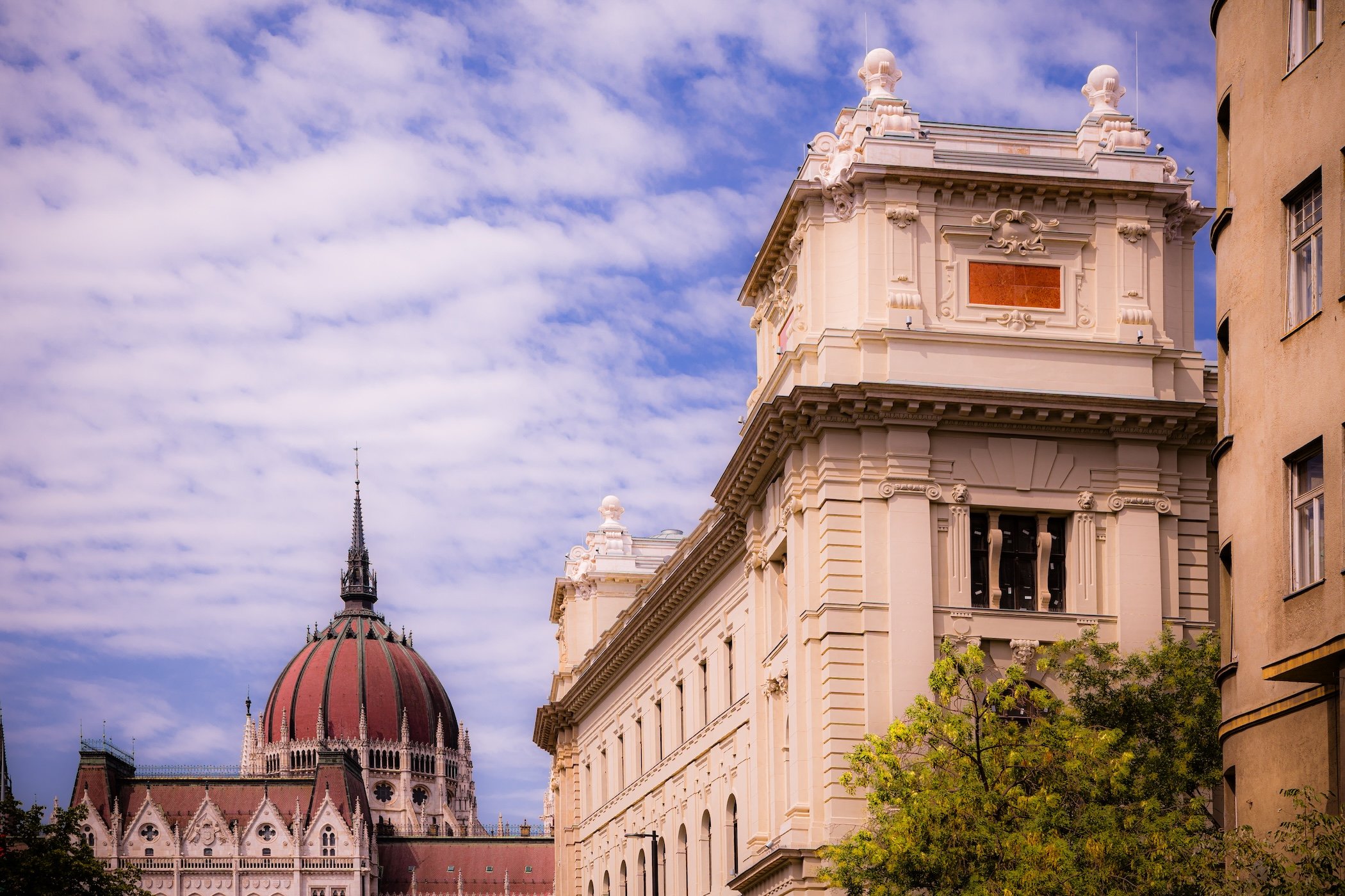
Approaching Parliament - Alkotmány u. - Kozma Ferenc u. - Lipótváros - District V
-
Crossing into District V brought an immediate change of scale. The tightly enclosed streets of the morning opened toward the Danube and, soon after, toward one of Budapest’s defining monuments: the Hungarian Parliament Building. Whatever arguments can be made against reducing a city to its landmarks, some places become landmarks precisely because nothing else can quite substitute for encountering them. Parliament was one of those places. Its sheer size, intricate architecture, position beside the river, and unmistakable silhouette made it impossible to regard as merely another stop along the route. To understand something of Budapest’s ambitions and self-image, it needed to be experienced at street level.
The walk continued along the Danube past the Shoes on the Danube Bank before returning to Parliament itself. Looking upward from near its base, the afternoon sun burned behind the building and reduced portions of its extraordinary detail to silhouette; a pigeon caught in flight added a fleeting bit of movement against all that monumental stone. From there the route continued north toward Margaret Bridge. By then, the combination of more than 90-degree heat, a transatlantic flight, and the decision to begin exploring almost immediately after arrival was finally winning. Yet District V had provided exactly the kind of first-day encounter that made stopping difficult: monumental Budapest beside everyday Budapest, the Danube carrying the city past architecture intended to appear almost permanent.
District VI - Terézváros
-
District VI, Terézváros, forms a narrow, elongated section of central Pest extending northeast from the vicinity of Deák Ferenc tér toward Dózsa György út and the edge of Városliget. It is bordered principally by District V to the west and southwest, District VII along Király utca and Városligeti fasor to the southeast, and Districts XIII and XIV toward its northern edge. Unlike the Danube-facing central districts, Terézváros has no river frontage; its geography is entirely urban and lies on the flat Pest Plain. Two of Budapest’s defining planning axes structure it: Andrássy út runs longitudinally through the district, while the Nagykörút crosses it at Oktogon as Teréz körút. (Jogtar)
That geometry produces perceptible differences within a very small district. South of the Nagykörút, Inner Terézváros is exceptionally dense, with tightly packed nineteenth-century blocks, theatres, restaurants and commercial streets extending toward the historic center. North of the boulevard, the street pattern gradually becomes somewhat more spacious around Andrássy út, Kodály körönd and the approach toward Városliget, although dense apartment buildings still dominate much of the district. At the western edge, Nyugati railway station, WestEnd and associated rail infrastructure introduce a very different metropolitan scale. These inner/outer distinctions are meaningful descriptions of Terézváros’s urban character, although they are not separate official városrészek.
-
Terézváros originated as part of the suburban zone that began spreading beyond the walls of Pest during the eighteenth century. What became known as Felső-Külváros, or Upper Suburb, initially contained gardens and agricultural land interspersed with growing numbers of workshops, shops and houses. The area received the name Terézváros in 1777, honoring Maria Theresa. Király utca emerged as one of its earliest important routes, carrying activity outward from central Pest toward the Városliget area. Population and construction accelerated during the nineteenth century as craftsmen, merchants and eventually substantial residential development transformed what had been an outer suburb into part of an increasingly continuous urban Pest. When Budapest was unified in 1873, the old Terézváros territory was divided along Király utca: the northern portion became District VI and retained the Terézváros name, while the southern District VII later received the name Erzsébetváros.
The decades after unification created most of the Terézváros visible today. Andrássy út, constructed as Budapest’s grand radial avenue, generated a sequence of monumental rental palaces, cultural institutions and increasingly spacious residential development toward Városliget. The Nagykörút provided the major transverse axis, while the present Nyugati railway station opened in 1877, replacing the earlier Pest station with an iron-and-glass terminal appropriate to the rapidly growing metropolis. The Hungarian State Opera opened in 1884, and the Millennium Underground began service beneath Andrássy út in 1896. The district’s extraordinarily concentrated late nineteenth-century building stock survived the twentieth century without wholesale redevelopment, preserving a coherent historic urban landscape later recognized through the inclusion of Andrássy út and its historic environment in Budapest’s UNESCO World Heritage site. (Terézváros)
-
Terézváros is one of Budapest’s clearest expressions of the late nineteenth-century metropolitan city. Along Andrássy út, monumental façades, cultural institutions and increasingly spacious residential architecture embody the ambitions of the post-1873 capital. Move only a block or two away, however, and that ceremonial landscape gives way to narrow streets lined almost continuously by historic apartment houses, ground-floor shops, cafés and workshops. The district therefore juxtaposes metropolitan display with some of Budapest’s densest everyday urban fabric. Its heritage is overwhelmingly architectural: the municipality has long emphasized the extraordinary concentration of protected eclectic and historicist buildings that gives Terézváros a degree of visual continuity unusual even within central Budapest. (Testületi Terezváros)
Culture and entertainment are equally important to the district’s identity. Nagymező utca and its surroundings form the traditional “Pesti Broadway,” concentrating theatres, performance spaces and nightlife near the Opera, while Liszt Ferenc tér and the Academy of Music reinforce Terézváros’s association with music and café culture. At the same time, Hunyadi tér and the residential streets beyond the Nagykörút maintain a more local rhythm, and Nyugati tér functions as one of Budapest’s busiest arrival and interchange points. Terézváros is therefore neither simply an entertainment quarter nor simply a prestigious historic district: it is a compact coexistence of culture, transportation, tourism, commerce and dense residential life organized around one of Budapest’s most important urban axes.
-
Andrássy út is the district’s defining urban space, not merely because of individual monuments but because the avenue itself records the transformation of Budapest into a nineteenth-century European metropolis. The Hungarian State Opera House is its most celebrated cultural landmark within Terézváros, while Oktogon demonstrates the deliberate intersection of Budapest’s radial and ring-road planning systems. Farther northeast, Kodály körönd marks the avenue’s transition toward a greener, more spacious residential character. Beneath the street, stations of the Millennium Underground preserve one of the city’s most important pieces of transportation history. (Terézváros)
Elsewhere, Liszt Ferenc tér and the Franz Liszt Academy of Music embody the district’s continuing musical identity, while Nagymező utca and its theatres define the Pesti Broadway tradition. Hunyadi tér, with its market hall and neighborhood public space, provides a more everyday counterpoint to the monumental avenue. At the western edge, Nyugati railway station remains both a major transport hub and one of Budapest’s great nineteenth-century engineering landmarks. The House of Terror on Andrássy út introduces a more difficult historical layer, interpreting the building’s associations with both the Arrow Cross and communist political police and demonstrating how Terézváros’s elegant streetscape also contains sites of twentieth-century trauma and memory. (Terézváros)
-
District VI presents the simplest case in Budapest’s current official neighborhood system: the entire district constitutes a single városrész, Terézváros. Terms such as Belső-Terézváros (Inner Terézváros) and Külső-Terézváros (Outer Terézváros) remain useful for describing differences in urban character on either side of the Nagykörút, but they are not separate official városrészek under Budapest’s current naming ordinance. (Jogtar)
Terézváros — the entire District VI, extending from the inner-city edge around Deák Ferenc tér and Bajcsy-Zsilinszky út through the dense cultural and residential districts surrounding Andrássy út and the Nagykörút to Dózsa György út near Városliget. Its single official neighborhood designation encompasses substantial internal variation rather than dividing those differences into separate civic neighborhood units.
District VI - Field Notes
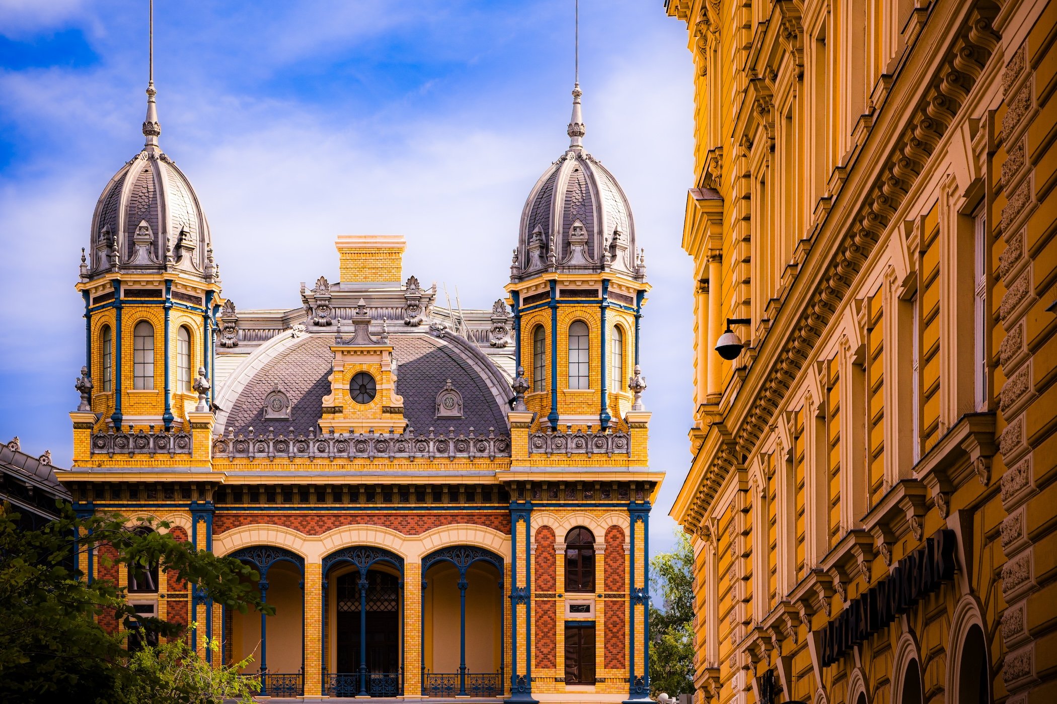
Western Railway Station - Jókai u. - Terézváros - District VI
-
My first steps in Budapest came beneath the blazing late-morning sun of District VI. Temperatures were already above 85°F and would climb beyond 93°F, but the harsh light and almost impossibly blue sky only intensified the first impression. Historic buildings leaned over narrow streets in long architectural canyons, their façades crowded with cornices, arches, balconies, sculpture and ornament. There was age everywhere, but almost none of the uniformity I associate with Haussmannian Paris. Here, individual architects seemed to have competed for attention, each building asserting its own personality while still contributing to a remarkably coherent nineteenth-century cityscape. The immediate impression was somehow the historical weight of Paris crossed with the close-quarter visual cacophony of Manhattan.
Equally compelling were the signs that this was not a city preserved beneath glass. Graffiti covered walls with the abandon of Brooklyn or Harlem. Plaster peeled. Corners crumbled. Protective netting concealed upper façades awaiting repair. Ironwork rusted. People without homes occupied corners within the same streets where elaborate historic buildings rose overhead. Yet cranes, scaffolding, construction crews and active restoration were everywhere as well. This did not feel like simple decline; it felt like a city being continuously used, weathered, repaired and changed. After the larger first-day circuit, a late lunch at the Cozy Café—an establishment that could have slipped effortlessly into Williamsburg—was followed by one final walk through the neighborhood around the hotel. New buildings, historic façades, graffiti, murals, sculpture and the Dancing Cranes of Renovation™ repeated the same contradictions encountered that morning. The brief coda confirmed what the opening hours had already suggested: Budapest had immediately become one of the most compelling cities I had ever photographed.
District VII - Erzsébetváros
-
District VII, officially Erzsébetváros, occupies a narrow wedge of central Pest extending northeast from the edge of the historic inner city toward Városliget. Király utca forms much of its western boundary with District VI, while Rákóczi út and Thököly út separate it principally from District VIII to the east and southeast. Károly körút marks the inner-city edge beside District V, and the district reaches Dózsa György út near District XIV at its northeastern end. Entirely situated on the flat Pest Plain and without Danube frontage, Erzsébetváros is one of Budapest’s most intensely urban districts: compact, densely built and strongly shaped by the radial routes leading outward from central Pest.
Although officially one városrész, its urban character changes noticeably from southwest to northeast. Belső-Erzsébetváros, inside the Nagykörút, contains the extraordinarily dense historic Jewish Quarter and contemporary nightlife district; the middle section around Erzsébet körút and Rottenbiller utca retains a predominantly nineteenth-century residential fabric; and the outer reaches toward Damjanich utca and Városliget become somewhat more spacious, with broad avenues and the villa-lined edge of Városligeti fasor. The district municipality itself distinguishes Belső-, Középső- and Külső-Erzsébetváros as areas of different architectural character, although these are planning and descriptive divisions rather than separate official városrészek.
-
Erzsébetváros originated within the much larger historic Terézváros, which spread across former gardens, fields and agricultural land outside the walls of Pest during the eighteenth and nineteenth centuries. Rapid population growth transformed the area into a dense suburb of craftsmen, merchants, workers and increasingly substantial apartment buildings. When Budapest was organized into districts following unification in 1873, Király utca divided the former Terézváros: the western side retained the District VI designation, while the eastern portion became District VII. The new district received the name Erzsébetváros in 1882, honoring Empress and Queen Elisabeth of Austria-Hungary. At that time the district extended considerably farther east than it does today; much of the territory that became District XIV, Zugló, remained part of Erzsébetváros until the 1930s.
The district’s extraordinary density and cultural complexity emerged during the rapid metropolitan expansion of the late nineteenth century. A substantial Jewish population made inner Erzsébetváros one of Budapest’s most important centers of Jewish religious, commercial and cultural life, while the outer district developed dense working-class apartment blocks and the fast-built neighborhood historically nicknamed Csikágó. The Holocaust transformed this landscape catastrophically: in late 1944 the Pest ghetto was established within inner Erzsébetváros, confining roughly 70,000 Jews to a tiny section of the district before its liberation in January 1945. After decades of postwar neglect and deteriorating housing, especially within the historic inner district, the period after 1989 brought restoration, reinvestment, tourism and new entertainment uses. From the 2000s onward, ruin bars and nightlife turned parts of Belső-Erzsébetváros into Budapest’s internationally famous “party district,” creating new economic vitality alongside persistent conflicts over noise, tourism, housing and neighborhood livability.
-
Erzsébetváros is defined above all by density and overlap. Nineteenth-century apartment houses crowd narrow streets and courtyards; synagogues, churches, cafés, small businesses, nightlife venues and residences occupy the same compact blocks; and architectural styles from classicism and historicism to Art Nouveau and modernism appear within an unusually continuous historic streetscape. The district has Budapest’s smallest territorial area but has long ranked among its most densely populated, giving public space particular importance and contributing to the intense pedestrian activity of its inner neighborhoods.
Its identity is also unusually layered. Erzsébetváros is simultaneously one of the most important landscapes of Hungarian Jewish heritage, a place of Holocaust memory, a long-established residential district and one of contemporary Budapest’s principal nightlife and tourism zones. Yet reducing it to either the “Jewish Quarter” or the “party district” misses much of the place. Farther from the inner-city entertainment core, streets around Rózsák tere, Bethlen Gábor tér and Városligeti fasor reveal a more residential Erzsébetváros associated with churches, schools, local shops and monumental late nineteenth-century apartment architecture. The tension between international destination and intensely inhabited neighborhood is therefore not incidental to District VII; it has become one of the central questions shaping its twenty-first-century identity.
-
The Dohány Street Synagogue is the district’s most internationally recognizable landmark and the monumental center of a much broader Jewish heritage landscape. Nearby, the Rumbach Street Synagogue and Kazinczy Street Orthodox Synagogue, together with former schools, community institutions, courtyards and residential buildings, document the extraordinary diversity of Jewish life that developed here during the nineteenth and early twentieth centuries. The same streets preserve the physical geography of the 1944–45 ghetto; Klauzál tér, the synagogue cemetery and contemporary memorial markers throughout the former ghetto make Holocaust memory inseparable from the district’s everyday urban fabric.
Other places reveal very different aspects of Erzsébetváros. Gozsdu Udvar embodies the reuse of historic courtyard architecture within the contemporary restaurant and nightlife economy, while Erzsébet körút preserves the monumental scale of Budapest’s Nagykörút. The New York Palace, Rózsák tere and its Church of St. Elizabeth, Bethlen Square and the outer district’s surviving historic apartment blocks extend the district’s identity beyond its best-known inner streets. Taken together, these places show Erzsébetváros as a district where religious heritage, metropolitan expansion, tragedy, residential life and twenty-first-century tourism continually occupy the same physical space.
-
Under Budapest’s current official városrész framework, the entirety of District VII constitutes a single official neighborhood: Erzsébetváros. This is an important distinction from the widely used terms Belső-Erzsébetváros, Középső-Erzsébetváros and Külső-Erzsébetváros. Those names remain useful—and are formally employed by the district for planning and architectural-character purposes—but the current Budapest-wide ordinance does not recognize them as separate városrészek.
Erzsébetváros — the complete territory of District VII, encompassing the dense Jewish and nightlife quarter nearest the historic center, the nineteenth-century apartment districts around the Nagykörút, and the more residential outer areas approaching Városliget.
District VIII - Józsefváros
-
District VIII, Józsefváros, occupies a broad section of central and eastern Pest extending from the Kiskörút almost to the Hungária körút. The district is bounded principally by Rákóczi út to the north, separating it from Erzsébetváros; Múzeum körút to the west beside District V; Üllői út to the south beside District IX; and the Hungária–Könyves Kálmán körút corridor toward District X. Its northeastern edge reaches the Kerepesi út and Dózsa György út area near District XIV. Like its neighboring central Pest districts, Józsefváros is almost entirely flat, but its relatively large east-west extent carries the visitor through markedly different layers of the city.
The inner district around the National Museum and Palotanegyed belongs unmistakably to central Budapest, with dense historic blocks and national institutions. Moving eastward, the urban fabric becomes increasingly varied: nineteenth-century working-class neighborhoods, markets and squares coexist with major university and hospital campuses, twentieth-century housing developments, railway infrastructure, cemeteries and former industrial land. Orczy-kert introduces one of the district’s most significant green spaces, while the outer neighborhoods around Kerepesdűlő, Ganz negyed and Százados negyed are physically separated from the inner district by large roads, railway corridors and specialized land uses. This spatial diversity is reflected in the district’s 11 official városrészek.
-
Most of present-day Józsefváros lay outside Pest’s medieval walls and remained dominated by gardens, fields and agricultural estates into the eighteenth century. Settlement gradually expanded outward along major roads such as today’s Rákóczi út, Baross utca and Üllői út, and in 1777 the growing suburb received the name Józsefváros, honoring the future Emperor Joseph II as well as St. Joseph, patron of the newly established parish. The catastrophic Pest flood of 1838 destroyed many of its early adobe buildings, after which stricter construction standards encouraged rebuilding in brick and stone. During the nineteenth century, the district developed striking internal contrasts: aristocrats constructed urban palaces near the new Hungarian National Museum, while farther east lower-income residential districts, workshops, markets, institutions and eventually railway and industrial facilities spread across what had previously been open land.
Budapest’s late nineteenth-century growth filled much of Józsefváros with the courtyard apartment houses that remain fundamental to its appearance, while hospitals, universities and state institutions established a concentration of public functions unusual even within the capital. In 1950 the district expanded eastward to the Hungária and Könyves Kálmán corridors, incorporating territory with railways, industrial areas and lower-density development. Józsefváros suffered especially severe physical damage during the 1956 Revolution, when fighting around Corvin köz and surrounding streets damaged more than a thousand buildings. Postwar underinvestment contributed to deterioration across many historic residential areas, and by the late twentieth century parts of Józsefváros had become associated with poverty and social exclusion. Since the 1990s, successive rehabilitation programs—from community-oriented renewal in Magdolna negyed to the large-scale Corvin Promenade redevelopment—have transformed substantial portions of the district while also generating debates about displacement, gentrification and the preservation of older urban fabric.
-
Józsefváros may be the most internally diverse of Budapest’s central districts. Palotanegyed contains aristocratic residences, universities, libraries and monumental institutions within one of Pest’s most architecturally distinguished historic environments. Only a short distance away, Magdolna, Csarnok and Népszínház negyeds preserve denser working-class traditions, busy markets and a highly diverse residential population. Farther east, Tisztviselőtelep offers an unexpectedly low-rise, garden-suburb environment, while Kerepesdűlő and Ganz negyed contain rail, cemetery and industrial landscapes almost entirely absent from the district’s inner streets.
The district is equally distinguished by the intensity of its institutional life. Semmelweis University and its associated clinics, the National University of Public Service, numerous schools and research institutions, the Hungarian National Museum and major cultural facilities give Józsefváros a powerful educational and civic presence. At the same time, its history of social inequality remains visible in housing conditions and in the sharp differences among neighborhoods. Contemporary Józsefváros is therefore neither the stigmatized “Nyócker” of popular stereotype nor simply an extension of fashionable inner Budapest. Its identity lies in the coexistence of palace quarter, student city, multicultural residential district, social-rehabilitation landscape, institutional center and rapidly redeveloping inner-city real estate market.
-
The Hungarian National Museum and surrounding Palotanegyed form the district’s most important concentration of nineteenth-century civic and cultural heritage. Nearby, the Metropolitan Ervin Szabó Library occupies the former Wenckheim Palace, while Mikszáth Kálmán tér and the surrounding palace streets demonstrate how aristocratic residential development helped shape inner Józsefváros. Farther east, Rákóczi tér Market Hall, Teleki László tér and Mátyás tér represent a more everyday civic geography rooted in neighborhood commerce and public life rather than national monumentality.
The district’s outer landmarks reveal still other histories. Orczy-kert and the Ludovika complex connect military, educational and recreational uses; the Fiumei Road Cemetery is one of Hungary’s principal national burial landscapes; and Corvin köz preserves the memory of one of the most important centers of armed resistance in 1956. Contemporary Corvin Promenade provides a radically different landmark—less because of any individual building than because it represents the scale of twenty-first-century redevelopment capable of remaking entire sections of the historic district. These sites together make Józsefváros unusually revealing as a record of Budapest’s social, political and architectural transformations.
-
Under the current Budapest-wide framework, District VIII contains 11 official városrészek. Unlike Districts VI and VII, these are not merely descriptive planning sectors: they are formally recognized neighborhood units, many with sharply different development histories and urban characters.
Corvin negyed — dense inner-city neighborhood transformed substantially by the Corvin Promenade redevelopment; also closely associated with the fighting of 1956.
Csarnok negyed — historic residential area centered on Rákóczi tér and its market hall, between József körút and the deeper residential fabric of Józsefváros.
Ganz negyed — outer district dominated historically by railway and industrial functions, with a much less residential character than inner Józsefváros.
Kerepesdűlő — large northeastern territory containing railway infrastructure and the Fiumei Road Cemetery alongside other specialized urban uses.
Losonci negyed — residential and institutional area strongly shaped by twentieth-century housing development and the extensive Semmelweis University clinic zone.
Magdolna negyed — historically working-class residential neighborhood that became a major focus of socially oriented urban-rehabilitation programs.
Népszínház negyed — dense and culturally diverse inner neighborhood extending from Rákóczi út toward Teleki László tér and Fiumei út.
Orczy negyed — mixed residential and institutional district centered around Orczy-kert and the Ludovika campus.
Palotanegyed — prestigious inner quarter surrounding the National Museum, distinguished by nineteenth-century aristocratic palaces, cultural institutions and universities.
Százados negyed — compact outer neighborhood between the Kerepesi út and railway corridors, geographically separated from much of inner Józsefváros.
Tisztviselőtelep — unusually low-rise, planned residential enclave developed principally for civil servants, with detached and semi-detached homes and a markedly suburban character.
District IX - Ferencváros
-
District IX, Ferencváros, extends southwest from the southern edge of central Pest along the Danube, creating one of Budapest’s clearest transitions from historic inner city to industrial and outer residential landscapes. Its northern boundary begins around Kálvin tér and Vámház körút beside District V, while Üllői út separates much of the district from Józsefváros, Kőbánya and Kispest to the east. The district reaches Határ út in the south and is bounded westward first by the Danube and then by the Ráckevei–Soroksári Danube branch, across which lie Buda and Csepel. The entire district lies on the flat Pest Plain, but the riverfront gives it a strong geographic orientation absent from several neighboring inner districts.
Ferencváros is unusually elongated, and its internal geography is organized in successive belts. Belső-Ferencváros lies between the Kiskörút and Nagykörút and forms part of central Budapest’s historic urban fabric. Középső-Ferencváros extends outward from the Nagykörút to the major railway corridor and combines dense nineteenth-century streets with extensive modern redevelopment. Beyond the railway, Külső-Ferencváros contains industrial, logistical, sporting and large-scale transportation landscapes, while the József Attila-lakótelep forms a distinct residential enclave near the district’s southeastern edge. This progression from inner-city apartment blocks to rail yards, warehouses, stadiums and planned housing is fundamental to understanding District IX.
-
Ferencváros developed from the southern portion of the eighteenth-century suburb that also produced Józsefváros. In 1792 it became a separate suburb and took the name Ferencváros, honoring Francis I. Early settlement followed the roads leading south from Pest and consisted largely of low houses, gardens, workshops and agricultural land. As elsewhere in low-lying Pest, the 1838 flood caused extensive destruction and accelerated rebuilding in more durable materials. During the second half of the nineteenth century, Ferencváros’s location beside the Danube and major rail corridors gave it a role markedly different from the more administrative or residential inner districts. Mills, warehouses, slaughterhouses, food-processing industries, freight facilities and working-class housing made it one of Budapest’s principal industrial and commercial gateways.
The twentieth century left Ferencváros with a particularly visible contrast between older urban fabric and large-scale redevelopment. Industrial decline and decades of underinvestment caused serious deterioration in the inner and middle residential districts after World War II, while new housing estates—including the József Attila-lakótelep—expanded the district’s residential character farther outward. From the late 1980s and especially after 1992, Középső-Ferencváros became one of Budapest’s most ambitious and internationally recognized urban-rehabilitation areas, combining restoration, demolition, new housing and redesigned public spaces. At the same time, the Danube waterfront farther south underwent dramatic post-socialist transformation as former industrial and railway lands gave way to cultural institutions, offices, housing and the new Millennium Quarter. That continuing process has made Ferencváros one of Budapest’s clearest examples of a district being repeatedly reinvented while still retaining substantial traces of its industrial and working-class past.
-
Ferencváros is a district of transitions. Belső-Ferencváros feels closely connected to central Pest: historic apartment buildings, university life, cafés and restaurants surround Ráday utca, Bakáts tér and Fővám tér. Középső-Ferencváros retains a denser residential character but visibly mixes restored nineteenth-century houses with contemporary apartment buildings and public spaces created through decades of rehabilitation. The outer district changes again, becoming more infrastructural and industrial, with railway corridors, warehouses, large sports complexes and broad roads replacing the fine-grained blocks of the center.
This diversity gives Ferencváros an identity that is simultaneously residential, industrial, cultural and institutional. Universities and student populations give the inner district youthful energy; Ferencvárosi TC and its football tradition provide one of Budapest’s strongest sporting identities; and the Danube waterfront has developed into a major cultural corridor. Yet traces of older Ferencváros remain visible in market buildings, workshops, surviving industrial structures and the streets associated with working-class life and writers such as József Attila. More than most central districts, Ferencváros makes Budapest’s historical movement outward legible: from old Pest, through nineteenth-century industrialization and twentieth-century mass housing, into contemporary redevelopment.
-
At the northern end of the district, the Great Market Hall at Fővám tér marks both the edge of central Budapest and the nineteenth-century modernization of food distribution and commerce. Nearby Ráday utca and Bakáts tér represent the historic civic and residential center of Belső-Ferencváros, while the Museum of Applied Arts on Üllői út provides one of Budapest’s great Art Nouveau landmarks. The Holocaust Memorial Center on Páva utca introduces a more difficult historical dimension within the residential fabric, while the Zwack Unicum complex preserves a direct connection to Ferencváros’s industrial and manufacturing traditions.
The southern Danube waterfront reveals the district’s more recent transformation. The National Theatre and Müpa Budapest form the cultural anchors of the Millennium Quarter, standing within territory once dominated by rail and industry. Nearby riverside development, the Rákóczi Bridge and the continuing redevelopment of former industrial parcels demonstrate the scale of post-socialist change. Farther inland, Groupama Aréna represents the enduring importance of Ferencvárosi TC, while the József Attila housing estate embodies a very different twentieth-century vision of urban life. Collectively, these places show why Ferencváros cannot be reduced to either an inner-city cultural quarter or an industrial suburb: both remain fundamental to its identity.
-
Budapest’s current official framework recognizes four városrészek in District IX. This is a useful place to apply the current-naming rule we established: older municipal and secondary materials often list Gubacsidűlő as a fifth Ferencváros neighborhood, but the current citywide ordinance adopted at the end of 2025 defines only the four units below.
Belső-Ferencváros — the oldest and most centrally urban portion, extending from Kálvin and Fővám tér to Ferenc körút and Boráros tér; characterized by historic apartment blocks, institutions, university activity and the Ráday utca corridor.
József Attila-lakótelep — planned residential estate near the southeastern edge of the district, physically and architecturally distinct from historic inner Ferencváros.
Középső-Ferencváros — mixed historic and contemporary residential district between the Nagykörút and the major east-west railway corridor; the principal focus of Ferencváros’s long-running urban-rehabilitation program.
Külső-Ferencváros — extensive outer territory beyond the railway, incorporating industrial and logistical land, major transport infrastructure, sports facilities and the southern riverfront along the Danube and Ráckevei–Soroksári branch.
District X - Kőbánya
-
District X, Kőbánya, occupies a broad section of eastern Pest near the geographic center of modern Budapest. It lies entirely on the Pest side of the Danube and has no river frontage, bordered by Districts VIII and IX toward the inner city, XIV to the north, XVI and XVII toward the east, and XVIII and XIX to the south. Major railway lines and radial roads—including Kerepesi út, Jászberényi út, Maglódi út and Üllői út—divide the district into strongly differentiated sectors, while the Hungária–Könyves Kálmán ring-road corridor marks much of its western metropolitan edge. Rather than possessing a single continuous urban center, Kőbánya is a patchwork of residential neighborhoods, industry, railway land, cemeteries, major institutions and extensive green spaces. Recent district planning describes its land use in unusually balanced terms: roughly one-third green space, one-third residential territory, and one-third industrial, commercial or institutional land.
Although Kőbánya belongs to the generally flat Pest Plain, its name—literally “stone quarry”—reflects an important local exception. The district developed around the Kőér or Ó-hegy rise, reaching roughly 147–148 meters and standing noticeably above the surrounding plain. Beneath and around it, centuries of quarrying created an extensive subterranean system, while former clay pits, vineyards and industrial extraction sites have left their own marks on the landscape. Parks including Óhegy park and the enormous Népliget, the open Felsőrákos areas, and the Újhegy lake landscape counterbalance some of Budapest’s most extensive industrial and transportation infrastructure.
-
Kőbánya’s development was shaped first by the resources beneath its soil. Medieval records already refer to the local Kőér hill, and intensive limestone extraction was underway by the seventeenth century as nearby Pest required increasing quantities of building stone. Quarrying produced an extensive network of underground chambers and tunnels, while the district’s surface supported vineyards and, later, clay extraction and brickmaking. During the nineteenth century these conditions encouraged increasingly specialized industry. The cool underground quarry spaces proved particularly suitable for fermentation and storage, helping Kőbánya emerge as the center of Budapest’s brewing industry; large breweries joined brickworks, food-processing plants, engineering works and other manufacturers. Railways and radial roads reinforced this industrial specialization, turning what had once been peripheral land outside Pest into one of the capital’s most important production landscapes.
Kőbánya became District X when Budapest was created in 1873, making it one of the capital’s original ten districts. The twentieth century gradually added large residential populations to the industrial landscape. Older neighborhoods around Szent László tér and Óhegy were supplemented after World War II by apartment construction, while the Óhegy housing developments spread between the 1960s and early 1980s and the large Újhegy estate was built principally during 1974–78 on territory previously associated with vineyards and extraction. Industrial restructuring after 1989 closed or transformed many factories and left substantial redevelopment sites, yet manufacturing, logistics, rail transport and large commercial institutions remain central to the district. Contemporary Kőbánya consequently preserves unusually visible traces of several economic landscapes at once: quarry, vineyard, factory district, socialist housing zone and post-industrial city.
-
Kőbánya is difficult to summarize through a single architectural image, and that diversity is fundamental to its identity. Around Szent László tér, historic civic buildings and tightly built residential streets form something resembling a traditional town center. Óhegy and Kőbánya-Kertváros contain quieter residential environments; Újhegy is defined in large part by late-socialist housing; and other portions of the district are dominated by railway lines, warehouses, factories, exhibition grounds, cemeteries and infrastructure. Major roads repeatedly divide these environments, giving Kőbánya a fragmented spatial character very different from the continuous street fabric of inner Pest. Current planning explicitly recognizes that almost every major Budapest land-use type appears somewhere within the district.
Its industrial inheritance remains particularly important. The name Kőbánya itself recalls extraction, while breweries, cellar systems, former brickworks and factory compounds preserve a history in which production was inseparable from the district’s growth. Yet describing Kőbánya simply as industrial overlooks its considerable green landscape and established residential communities. Népliget, Óhegy park and other open spaces sit alongside dense housing and manufacturing territory, while the district’s increasingly varied population and commercial activity contribute another contemporary layer. Kőbánya’s distinguishing character therefore lies in juxtaposition rather than uniformity: a working and residential district where Budapest’s industrial past, socialist expansion, extensive infrastructure and surprisingly large green spaces remain physically intertwined.
-
Szent László tér provides Kőbánya with its clearest historic civic center. Its dominant landmark, the Szent László Church, was built between 1894 and 1899 to designs by Ödön Lechner and combines historicist and Secessionist elements with the architect’s distinctive glazed-tile treatment. Nearby older monuments reveal earlier layers of Kőbánya: the Baroque Conti Chapel, built in 1739–40, survives from an era when the district remained largely rural, while the nineteenth-century Csősztorony recalls the vineyards that once covered Óhegy. The extensive brewery complexes and underground cellar system represent the industrial development that subsequently transformed the district.
Other landmarks operate at an entirely different scale. Népliget, developed from the nineteenth century onward as a large public park, remains one of Budapest’s largest green spaces; Hungexpo gives the district a national exhibition and events role; and the Új köztemető, opened in 1886, is Budapest’s largest cemetery and an important landscape of twentieth-century political memory as well as burial. These places reinforce Kőbánya’s unusual breadth: civic monument, industrial heritage, metropolitan park, infrastructure and memorial landscape coexist within the same district.
-
Budapest’s current official framework recognizes 11 városrészek within District X. The large number reflects Kőbánya’s fragmented development: rather than growing outward from one compact historic settlement, the district accumulated residential areas, factories, extraction zones, railway landscapes and peripheral land with very different histories.
Felsőrákos — extensive northeastern territory along the Rákos area, combining open land, commercial and industrial uses, residential development and important green corridors.
Gyárdűlő — western industrial and mixed-use territory whose name directly reflects its long association with factories and transportation infrastructure.
Keresztúridűlő — eastern outer district characterized by specialized land uses, cemetery territory and comparatively sparse residential development.
Kőbánya-Kertváros — low-density residential neighborhood at the eastern edge of Kőbánya, distinguished from the district’s larger housing estates and industrial zones by its garden-suburb form.
Kúttó — southern territory between major railway and road corridors, historically less densely residential and strongly shaped by transportation infrastructure.
Laposdűlő — inner-western Kőbánya between the Hungária corridor and major railway lines, dominated by large-scale commercial, institutional and transportation uses.
Ligettelek — relatively compact central-western neighborhood linking the historic core of Kőbánya with the Kerepesi út corridor.
Népliget — the district’s western park neighborhood, centered upon the extensive public green space of the same name.
Óhegy — one of Kőbánya’s historic cores, centered on the former quarry and vineyard hill and today combining older streets, parks and twentieth-century housing.
Téglagyárdűlő — territory named for the brickworks that once operated there and still strongly associated with industrial and specialized land uses.
Újhegy — major southeastern residential neighborhood shaped particularly by the large housing estate built during the 1970s, together with the lake and recreational landscape created from former extraction land.
District XI - Újbuda
-
District XI, Újbuda, occupies a large section of southern Buda extending from the Danube deep into the hills and southwestern edge of Budapest. Districts I and XII lie to the north, District XXII begins to the south, and Budaörs meets the district at the western municipal boundary. The Danube forms its long eastern edge, giving Újbuda a riverfront that ranges from the monumental surroundings of Gellért Hill and Szent Gellért tér to former industrial land and newer development around Lágymányos Bay. At approximately 33.5 square kilometers, Újbuda is one of Budapest’s largest districts and contains a much broader range of physical environments than its heavily urbanized inner neighborhoods initially suggest.
The district sits where the Buda Hills descend toward the Danube. Gellért Hill and Sas Hill introduce steep terrain and protected landscapes in the north, while Lágymányos and much of Kelenföld occupy lower, flatter ground created partly through centuries of river deposition and nineteenth-century regulation of the Danube. Farther west, Sasad, Gazdagrét and Madárhegy climb into rolling hills before the district opens toward Hosszúrét, Kőérberek, Kamaraerdő and the Budapest–Budaörs boundary. Railways, the Budaörsi út corridor, major tram routes and the Kelenföld transport hub reinforce Újbuda’s role as Budapest’s principal southwestern gateway.
-
Long before Újbuda became an urban district, its geography made the area important for settlement and movement. Archaeological evidence extends from prehistoric communities to the Roman period, when a substantial military settlement developed at Albertfalva south of Gellért Hill. For much of the later medieval and early modern eras, however, large portions of southern Buda remained agricultural land, vineyards, meadows or sparsely settled territory. The decisive modern transformation began during the nineteenth century. Construction of the Kopaszi dam and regulation of the Danube during the 1870s gradually reclaimed the marshy Lágymányos waterfront; when Budapest was unified in 1873, water still covered territory where universities, streets and buildings later appeared. The opening of the Franz Joseph—today Liberty—Bridge in 1896, followed by tram connections across it, integrated Lágymányos and Kelenföld much more closely into the growing metropolis.
Southern Buda remained part of District I until the 1930 administrative reforms created a separate District XI, which began operating in 1934 and was initially closely associated with the name Szentimreváros. Its present territorial form developed further in 1950 with the incorporation of Albertfalva and adjustments around Kelenvölgy. Postwar population growth then transformed enormous areas through planned housing: Albertfalva, Lágymányos, Kelenföld, Őrmező and eventually Gazdagrét received thousands of apartments between the 1950s and 1980s. Since 1989 another major transformation has occurred along former industrial and railway land. University expansion, Infopark, office development, Nádorkert, Kopaszi-gát and the adjoining BudaPart redevelopment have given the Danube corridor an increasingly contemporary identity, while the opening of Metro Line M4 in 2014 strengthened both the inner district and Kelenföld as major metropolitan centers.
-
Újbuda’s defining characteristic is range. Around Szent Gellért tér, Bartók Béla út and Móricz Zsigmond körtér, the district participates directly in Budapest’s historic inner city through dense blocks, cafés, cultural institutions and late nineteenth- and early twentieth-century architecture. Lágymányos immediately adds another identity through university campuses, riverside institutions and contemporary offices. Kelenföld and Őrmező contain some of Budapest’s most important examples of socialist-era mass housing and large-scale transportation planning, while Sasad, Madárhegy, Kelenvölgy and the western edge shift toward villas, detached homes and increasingly suburban landscapes. Újbuda’s architectural guidance recognizes everything from historic villas and low-rise garden districts to large housing estates and recent apartment development within the same administrative territory.
Education and innovation give this diversity a particularly strong unifying thread. The Budapest University of Technology and Economics, major Eötvös Loránd University faculties and the technology-oriented Infopark have made Lágymányos one of Hungary’s largest concentrations of higher education, research and knowledge-based employment. Nearby Bartók Béla út has simultaneously evolved into one of Budapest’s important contemporary cultural corridors. Yet this urban and intellectual identity exists alongside extensive residential communities and natural landscapes, including the slopes of Gellért Hill and Sas Hill and the forests of Kamaraerdő. Few Budapest districts move so quickly between historic city, university quarter, socialist housing landscape, new high-rise development and Buda hillside suburb.
-
The northern riverfront contains Újbuda’s most nationally recognizable landmarks. Gellért Hill rises above Szent Gellért tér, while the Gellért Hotel and thermal bath complex, Liberty Bridge and the Cave Church together express the district’s long relationship with the Danube, thermal water and central Budapest. Immediately south, the historic Budapest University of Technology and Economics campus and the newer ELTE Lágymányos campus turn the waterfront into one of the city’s principal academic landscapes. Bartók Béla út, Móricz Zsigmond körtér and the distinctive circular Gomba pavilion provide a more everyday civic and cultural center.
Farther south, Kopaszi-gát and Lágymányos Bay represent the reinvention of a former industrial and river-engineering landscape as recreation and high-density contemporary development. Infopark, the BudaPart development and the MOL Campus have introduced one of Budapest’s most conspicuously modern skylines. In a completely different register, the Kelenföld housing estate and transport center document late-socialist planning, while Gazdagrét—known nationally through the television series Szomszédok—has become culturally emblematic of another period of Hungarian urban life. The contrast among these sites illustrates how completely Újbuda spans the nineteenth, twentieth and twenty-first-century city.
-
Under Budapest’s current official framework, District XI contains 21 városrészek. This current list includes areas such as Infopark and Nádorkert as formally named neighborhoods alongside much older geographic names, illustrating how Budapest’s neighborhood system can incorporate newly developed urban identities as the city changes. Gellérthegy and Sashegy extend across district boundaries rather than belonging wholly to Újbuda.
Albertfalva — former independent settlement incorporated into Budapest and District XI in 1950; today a mixed residential area containing older village traces, housing estates and former industrial land.
Dobogó — small southwestern neighborhood near Budaörsi út and Balatoni út, still characterized in part by open or comparatively lightly developed land.
Gazdagrét — elevated western residential neighborhood dominated by the large housing estate constructed during the 1980s.
Gellérthegy — Újbuda’s portion of Gellért Hill and its slopes; the official városrész continues into District I.
Hosszúrét — western valley and low-density residential territory approaching Budapest’s outer edge.
Infopark — compact technology, office and research district adjoining the Lágymányos university campuses.
Kamaraerdő — wooded southwestern neighborhood at the metropolitan edge, combining recreation, forest and low-density development.
Kelenföld — one of Újbuda’s largest and most varied neighborhoods, encompassing historic residential areas, major socialist housing estates, rail infrastructure and commercial development.
Kelenvölgy — predominantly low-rise garden-suburb neighborhood on the district’s southern side.
Kőérberek — outer southwestern territory combining newer residential development, open space and the Kőérberki landscape.
Lágymányos — inner Danube-side neighborhood strongly associated with universities, dense residential streets and cultural life around Bartók Béla út.
Madárhegy — rapidly developed hillside residential area dominated by newer low-rise housing.
Nádorkert — former railway and industrial territory undergoing extensive residential and commercial redevelopment between Budafoki út and the Danube corridor.
Őrmező — compact residential neighborhood dominated by its 1970s–80s housing estate immediately west of the Kelenföld transport hub.
Örsöd — outer western neighborhood containing a mixture of residential, commercial and still comparatively open land.
Péterhegy — low-density hillside and garden-residential area south of Kelenföld.
Pösingermajor — sparsely developed territory near the western municipal boundary adjoining Budaörs.
Sasad — extensive hilly residential neighborhood characterized largely by villas, detached housing and greener streets.
Sashegy — Újbuda’s portion of Sas Hill, including residential slopes and protected natural landscape; the official neighborhood is shared with District XII.
Spanyolrét — western-edge neighborhood near Budaörs, historically open territory increasingly affected by suburban residential development.
Szentimreváros — historic inner core of modern Újbuda around Móricz Zsigmond körtér, Bartók Béla út and Villányi út, where southern Buda’s urbanization became especially pronounced around the turn of the twentieth century.
District XII - Hegyvidék
-
District XII, commonly known as Hegyvidék—“the Highlands” or “Mountain District”—occupies the elevated western side of Buda and contains some of Budapest’s most dramatic terrain. District II borders it principally to the north, District I lies to the east and District XI to the south, while the western edge reaches Budapest’s municipal boundary beside Budakeszi and Budaörs. Unlike the central Buda districts below it, Hegyvidék has no Danube frontage. Its geography instead turns inward toward the Buda Hills, rising from the denser urban environment around Krisztinaváros, Városmajor, Németvölgy and Böszörményi út through increasingly steep residential slopes to extensive forests and recreation landscapes.
The district contains János-hegy, Budapest’s highest point at approximately 528–529 meters, together with Svábhegy, Széchenyihegy and portions of Sashegy and the larger Buda hill system. Valleys including Zugliget and Kútvölgy divide the ridges, while large areas of Budakeszierdő, Jánoshegy and Csillebérc remain forested. This terrain creates perhaps the sharpest urban-to-natural transition within Budapest: dense apartment streets at the eastern base give way to villas, winding hillside roads and garden neighborhoods before the built city dissolves into woodland. The steep topography has also shaped transportation, producing some of Budapest’s most distinctive systems for overcoming elevation.
-
For centuries, the high Buda landscape was far less urban than the city below. Lower slopes were cleared for vineyards and agriculture, while higher areas served as woodland, hunting territory and sources of timber and stone. German-speaking settlers—whose presence contributed to the name Svábhegy, or Swabian Hill—cultivated parts of the landscape after the Ottoman period, and Buda’s wine culture flourished on the slopes until the phylloxera epidemic devastated vineyards during the late nineteenth century. Some abandoned vineyard land subsequently returned to woodland, while other parcels became available for villas and gardens. Beginning during the early nineteenth century, the clean air, wooded scenery and panoramic views of Svábhegy and Zugliget increasingly attracted artists, writers and wealthier Budapest residents seeking recreation outside the dense city. Inns and summer homes followed, transforming the hills into one of Budapest’s earliest leisure landscapes.
Improved transportation accelerated that transformation. Zugliget received early omnibus and horse-rail connections, while the rack railway opened from Városmajor toward Svábhegy in 1874, making the higher slopes significantly more accessible and encouraging permanent villa development. Hegyvidék remained within the enormous District I after Budapest’s unification until the 1930 reforms created new Buda districts; District XII began operating independently on July 1, 1940, incorporating substantial forest formerly associated with Budakeszi as well as established hillside neighborhoods. After World War II, recreation and institutional uses expanded through the Children’s Railway, the Csillebérc youth camp, research facilities and, in 1970, the Zugliget Chairlift. At the same time, increasingly permanent residential construction converted former summer-home and villa areas into some of Budapest’s most desirable neighborhoods, even as extensive forest remained protected from continuous urbanization.
-
Hegyvidék is distinguished from almost every other Budapest district by the degree to which landscape remains inseparable from urban identity. Many streets climb steep slopes, curve around ridges or terminate beside woodland rather than continuing through a regular grid. Detached houses, villas and small apartment buildings occupy much of the district, often within gardens and mature tree cover, although denser apartment and commercial streets appear around its lower eastern edge. Svábhegy, Istenhegy, Orbánhegy, Mártonhegy and related neighborhoods developed strong villa traditions, while lower areas such as Németvölgy and Krisztinaváros remain more closely connected to central Buda. The district’s generally low-density built form and extensive greenery have long made it one of Budapest’s most desirable residential areas.
Yet Hegyvidék is more than an affluent hillside suburb. Normafa, János-hegy, Zugliget and the surrounding forests function as recreational landscapes for the entire city, not simply for district residents. Hiking, skiing, running, cycling, panoramic viewpoints and distinctive transport systems have made the district part of Budapest’s collective leisure culture for nearly two centuries. This dual role—as residential Hegyvidék and metropolitan wilderness—creates its particular identity. The city is never entirely absent, visible below from countless slopes and viewpoints, but neither does the dense urban fabric ever fully conquer the hills.
-
Normafa and János-hegy form the district’s defining landscape. At 528 meters, János-hegy rises to Budapest’s highest point, crowned by the Erzsébet Lookout, completed in 1910 and named for Queen Elisabeth, who had visited the hill during the nineteenth century. The surrounding forest connects directly with Normafa, historically one of Budapest’s most popular excursion areas and today a major landscape for walking, running, winter recreation and panoramic views. The Children’s Railway, the Zugliget Chairlift and the historic rack railway make the journey through the hills nearly as characteristic of Hegyvidék as the destinations themselves.
The lower district contains another set of landmarks revealing Hegyvidék’s civic and cultural history. Városmajor serves as an important park and transport gateway between central Buda and the hills; the Bauhaus-influenced Városmajor church complex represents the district’s important twentieth-century architecture. Farkasréti Cemetery is one of Budapest’s principal burial grounds and contains the graves of numerous prominent Hungarian cultural and public figures. Jókai’s former Svábhegy property and other surviving villas preserve the nineteenth-century association between the hills and Budapest’s writers and artists, while the protected landscape of Sashegy demonstrates the ecological significance of rocky Buda habitats within an otherwise densely populated capital.
-
Budapest’s current official framework recognizes 18 városrészek in District XII. Their names reveal the importance of topography particularly clearly: hills, valleys and forests function as neighborhood identities in their own right. Budakeszierdő, Krisztinaváros and Sashegy cross administrative boundaries, demonstrating again that Budapest’s városrészek do not always fit neatly within a single district.
Budakeszierdő — extensive forest territory on Budapest’s western edge; the official neighborhood is divided among more than one Buda district.
Csillebérc — elevated wooded neighborhood associated with the former pioneer camp, research institutions and recreational landscape.
Farkasrét — predominantly residential hillside neighborhood closely associated with Farkasréti Cemetery.
Farkasvölgy — low-density valley and hillside residential area toward the district’s southwestern edge.
Istenhegy — established villa neighborhood on the slopes between the lower city and Svábhegy.
Jánoshegy — heavily forested neighborhood centered upon Budapest’s highest hill, the Erzsébet Lookout and major recreation routes.
Kissvábhegy — compact lower hillside residential neighborhood positioned close to central Buda.
Krisztinaváros — the District XII portion of the historic neighborhood descending toward central Buda; Krisztinaváros also extends into District I.
Kútvölgy — green, villa-dominated valley and hillside area historically associated with health and institutional uses as well as residences.
Magasút — small, low-density residential neighborhood in the southwestern hills.
Mártonhegy — garden and villa neighborhood occupying the slopes between Orbánhegy and the higher southwestern ridges.
Németvölgy — relatively dense lower Hegyvidék neighborhood around Böszörményi út and the district’s principal civic and commercial center.
Orbánhegy — established hillside residential neighborhood characterized largely by villas and small apartment buildings.
Sashegy — the District XII portion of Sas Hill, combining residential slopes with protected natural landscape; the neighborhood continues into District XI.
Svábhegy — historic highland neighborhood associated with nineteenth-century villas, summer residences, recreation and the rack railway.
Széchenyihegy — elevated residential and recreational neighborhood containing the upper terminus of the Children’s Railway and substantial green space.
Virányos — leafy villa and garden-residential neighborhood along the lower northern slopes toward Szilágyi Erzsébet fasor.
Zugliget — wooded valley historically central to Budapest excursion culture and today associated particularly with the Chairlift and access to the higher Buda Hills.
District XIII - Angyalföld
-
District XIII occupies a long section of north-central Pest along the eastern bank of the Danube, extending northward from the edge of the historic center around Szent István körút and Nyugati tér toward Újpest. The district lies entirely on the flat Pest Plain, and its surface was historically shaped by the Danube, whose riverfront remains one of its defining geographic features. District IV lies to the north, District XIV principally to the east, while Districts V and VI meet its southern edge; across the Danube are the Buda districts of II and III. Major transportation corridors—including Váci út, Lehel utca, Róbert Károly körút and the north–south railway lines—divide the district into distinct urban environments and connect central Budapest with its northern suburbs.
The relationship with the Danube changes considerably from south to north. Újlipótváros presents a dense, metropolitan riverfront lined with early twentieth-century apartment buildings and Szent István Park; farther north, Vizafogó combines housing estates, recreation, newer residential development and major aquatic facilities. Beyond it, former industrial waterfront around the Marina area has been transformed through extensive residential and commercial construction. The district also includes the southern part of Népsziget, a greener and far less formal Danube landscape associated historically with shipbuilding and riverside recreation. Away from the river, Angyalföld stretches eastward through former industrial zones, housing estates, older residential streets and increasingly prominent office development along Váci út.
-
For much of the eighteenth and early nineteenth centuries, the territory of present-day District XIII remained beyond the continuously built city of Pest, consisting of fields, vineyards and scattered riverside activity. That changed rapidly with Budapest’s nineteenth-century industrialization. The Danube, railways and Váci út made northern Pest particularly attractive for factories, mills, engineering works and transportation-related industries. By the turn of the twentieth century, Angyalföld had become one of Hungary’s major centers of machine industry, developing a strong working-class identity that would remain central to the area well into the socialist period. The southern district developed differently: around the future Újlipótváros, mills and smaller industrial facilities gradually gave way to middle-class apartment construction as central Pest expanded northward.
The present district emerged administratively in stages. District XIII was established as an independent district in 1938, assembled from territories previously belonging to Districts V and VI and briefly carrying the official name Magdolnaváros. Greater Budapest’s creation in 1950 brought Újlipótváros and Margaret Island into the district, although Margaret Island was removed from District XIII in 2013 and placed under direct capital administration. After World War II, large housing estates and new public institutions appeared while Angyalföld’s factories remained major employers. Since 1989, deindustrialization has driven another transformation: extensive stretches of the Váci út corridor and Danube waterfront have changed from factory landscapes into office districts, shopping areas and high-density residential developments, making District XIII one of Budapest’s clearest examples of large-scale post-industrial urban redevelopment.
-
District XIII has no single visual identity because its parts embody very different stages of Budapest’s urban development. Újlipótváros is dense, urbane and architecturally coherent, characterized particularly by interwar apartment houses, inner courtyards, cafés and the riverfront environment around Pozsonyi út and Szent István Park. Angyalföld preserves a very different inheritance: historically industrial and working-class, it combines surviving older houses, garden-city pockets, socialist housing estates and former factory sites increasingly occupied by offices and new apartment complexes. Vizafogó adds another layer through postwar planning, newer waterfront development and large-scale recreational facilities. The district’s architectural handbook explicitly treats these environments as distinct character zones rather than manifestations of one uniform district type.
What ties them together is continuous reinvention. Few Budapest districts have changed as extensively during the past century while retaining such recognizable local identities. Angyalföld’s industrial reputation remains part of its cultural memory even where factories have disappeared; Újlipótváros retains the atmosphere of a highly urban residential quarter despite its proximity to major business corridors; and the Váci út axis has become one of contemporary Budapest’s principal concentrations of offices and corporate development. Green-space investment along streets, housing estates and the Danube has added another contemporary theme to a district whose older reputation was much more strongly associated with industry.
-
In Újlipótváros, Szent István Park and the surrounding Danube-side apartment architecture provide perhaps the district’s most distinctive historic urban ensemble. Nearby Vígszínház, opened in 1896, represents the cultural expansion of Budapest beyond the traditional inner city, while Pozsonyi út and the Palatinus houses demonstrate the district’s especially strong interwar residential character. Lehel tér and its market connect this southern section with the more commercially and historically working-class environments farther north and east.
Farther north, the Dagály Thermal Bath and Duna Aréna embody the district’s long association with thermal water and aquatic recreation, while Vizafogó’s postwar housing and newer waterfront developments reveal successive generations of urban planning. Göncz Árpád városközpont, at the intersection of Váci út and Róbert Károly körút, functions as a major metropolitan transport, office and institutional node, while the Marina waterfront represents the dramatic redevelopment of former industrial land. Népsziget provides the opposite experience: former shipyard territory, riverside vegetation and surviving recreational traditions create one of the district’s least formal landscapes.
-
Budapest’s current official framework recognizes five városrészek within District XIII. This differs from older shorthand that often described the district principally as Angyalföld, Újlipótváros and Vizafogó: Göncz Árpád városközpont is now formally recognized as its own városrész, while the southern portion of Népsziget is likewise a distinct official neighborhood. Margaret Island is no longer part of District XIII.
Angyalföld — by far the largest neighborhood, historically shaped by industry and working-class settlement but now encompassing an exceptionally varied mix of garden-city streets, housing estates, offices, commercial development and new residential construction.
Göncz Árpád városközpont — compact metropolitan subcenter surrounding the intersection of Váci út and Róbert Károly körút, characterized by major transport connections, public institutions and contemporary office development.
Népsziget — the southern portion of the elongated Danube island, shared administratively with District IV and retaining a mixture of woodland, former industrial land and informal riverside recreation.
Újlipótváros — dense southern riverfront neighborhood developed primarily during the late nineteenth and first half of the twentieth century, noted particularly for its interwar apartment architecture, Szent István Park and strong residential identity.
Vizafogó — Danube-side neighborhood between Újlipótváros and northern Angyalföld, combining postwar housing estates, Dagály, Duna Aréna and extensive recent waterfront development.
District XIII - Field Notes
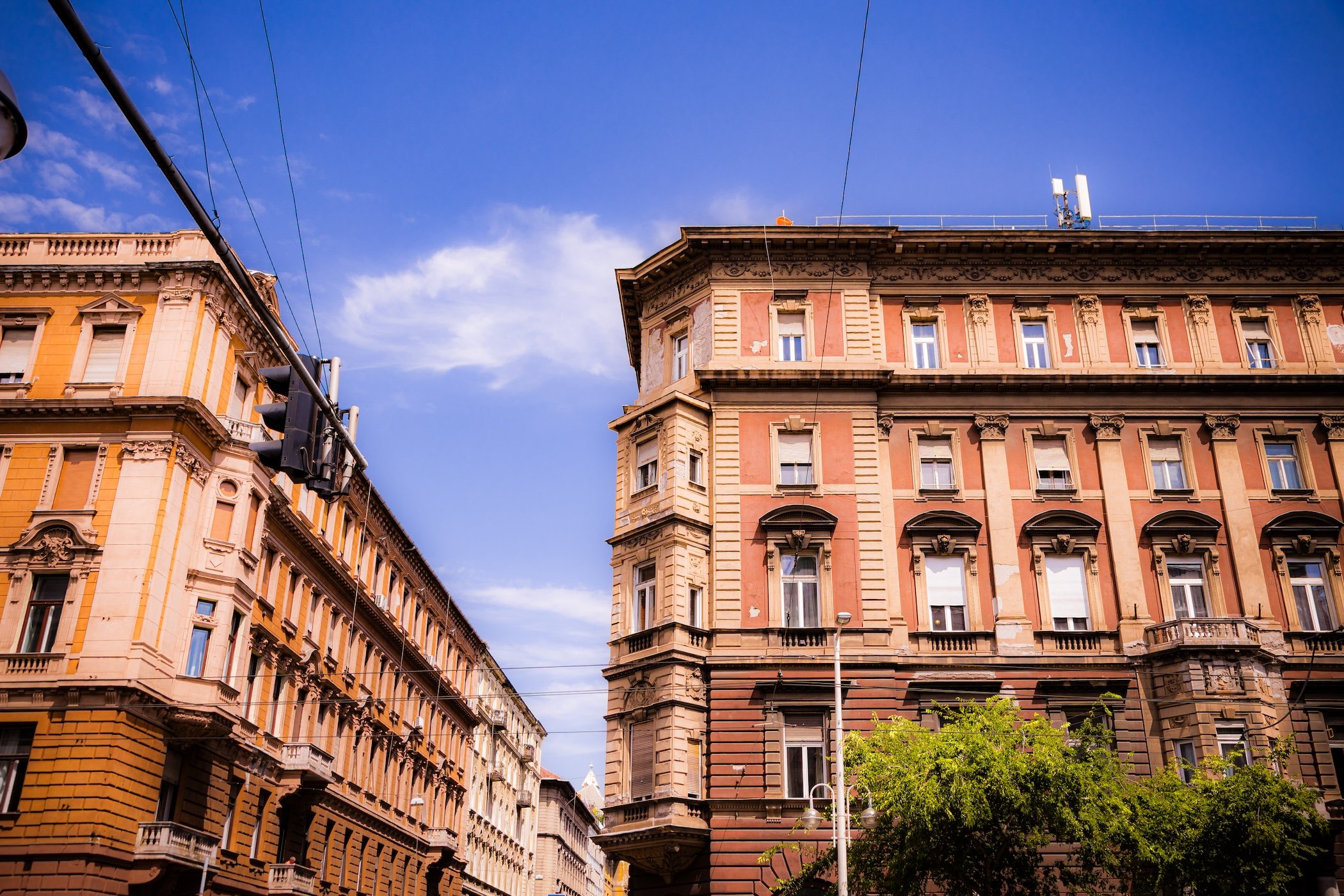
Hegedűs Gyula Canyon - Szent István krt. - Újlipótváros - District XIII
-
District XIII entered the day almost as an epilogue. After reaching Margaret Bridge, exhaustion and the accumulating heat had begun to take control, and the final portion of the loop followed Szent István körút back toward the hotel. Yet Budapest managed another shift in personality. The tighter streets of the earlier walk gave way to the broader scale of the boulevard, where the north side offered an extended procession of sunlit District XIII façades.
The architecture remained richly historic but felt more spacious and composed when viewed across the breadth of the street. Sculpted figures appeared directly upon façades and rooflines; ornamental details accumulated around windows and cornices; historical images and murals inserted fragments of Budapest’s past into the contemporary street. Then, among those older buildings, a modern glass façade—or an occasional heavier twentieth-century intervention—would suddenly interrupt the sequence. Even during a relatively brief passage along its southern edge, District XIII reinforced a lesson the city had been teaching all day: Budapest refuses visual ubiquity. Historical grandeur, later interventions and contemporary life continually coexist rather than arranging themselves into tidy chronological zones.
The walk continued along the Danube past the Shoes on the Danube Bank before returning to Parliament itself. Looking upward from near its base, the afternoon sun burned behind the building and reduced portions of its extraordinary detail to silhouette; a pigeon caught in flight added a fleeting bit of movement against all that monumental stone. From there the route continued north toward Margaret Bridge. By then, the combination of more than 90-degree heat, a transatlantic flight, and the decision to begin exploring almost immediately after arrival was finally winning. Yet District V had provided exactly the kind of first-day encounter that made stopping difficult: monumental Budapest beside everyday Budapest, the Danube carrying the city past architecture intended to appear almost permanent.
District XIV - Zugló
-
District XIV, Zugló, occupies a broad section of central-eastern Pest between the densely built inner districts and Budapest’s more suburban outer neighborhoods. It lies entirely on the Pest Plain and forms a transitional zone between the nineteenth-century city and the lower-density districts farther east. Its neighbors include District XIII to the northwest, District XV to the north, District XVI toward the east, District X to the southeast and the inner Districts VI, VII and VIII toward the southwest. Major routes—including Thököly út, Kerepesi út, Hungária körút, Nagy Lajos király útja and the approaches to Örs vezér tere—structure movement through a district whose neighborhoods developed at very different densities and periods. The Rákos-patak crosses the eastern and northern portions and provides an important natural and recreational corridor.
Zugló is particularly notable for the extent of its greenery. Városliget occupies its southwestern corner and is one of Budapest’s principal metropolitan parks, while tree-lined residential streets, garden districts and the Rákos-patak corridor extend that green character well beyond the park itself. At the same time, Zugló contains large housing estates, major sports facilities, railway infrastructure and dense urban neighborhoods approaching the inner city. The district therefore operates geographically as a transition: neither central Pest nor outer suburb, but a broad intermediate landscape where parkland, villas, apartment buildings and twentieth-century mass housing repeatedly meet.
-
Much of modern Zugló remained open countryside well into the nineteenth century. The area around Városliget, originally a marshy and wooded landscape outside Pest, began to be deliberately planted and improved during the eighteenth century and developed into one of the city’s earliest public recreation areas. Beyond it, parceling began during the 1830s in what became Herminamező, which developed as a destination for villas, summer residences, sanatoria and recreation. By the 1860s an elegant villa environment had emerged, while rapid construction from the 1880s extended settlement into areas such as Törökőr, Kiszugló, Nagyzugló and Alsórákos. The Millennium Exhibition of 1896 profoundly transformed Városliget and its surroundings, bringing monumental buildings, Heroes’ Square and the underground railway to the district’s western edge.
Zugló did not become an independent district until the twentieth century. Territory previously divided among Terézváros, Erzsébetváros and Kőbánya was reorganized as District XIV in 1935, initially under the name Rákosváros; the Zugló name became official in 1950. Twentieth-century development dramatically increased both its population and architectural diversity. Large housing estates were constructed from the 1950s through the 1980s, including developments along Kerepesi út, Nagy Lajos király útja, Kacsóh Pongrác út and Füredi utca, while earlier villa districts and garden neighborhoods survived between them. These projects transformed Zugló from a largely low-density suburban landscape into a populous urban district without completely erasing the greenery that had distinguished it from inner Pest.
-
Zugló is often understood as one of Pest’s greenest and most residential large districts, but that description encompasses a remarkable range of urban forms. Herminamező and portions of Istvánmező preserve villas and historic institutional architecture; Alsórákos includes extensive lower-density residential areas; Törökőr and Kiszugló feel more continuously urban; and Nagyzugló and Rákosfalva contain major twentieth-century housing estates. Városliget, meanwhile, operates at an entirely different scale as a citywide cultural and recreational landscape. The district’s own description emphasizes this intermediate position between Budapest’s centuries-old central districts and its outer neighborhoods.
That combination has given Zugló a reputation for residential livability without complete separation from metropolitan Budapest. Large quantities of mature vegetation, parks and comparatively quiet streets coexist with major transit corridors, stadiums, shopping areas and some of the capital’s busiest destinations. Its identity is less monumental than District V and less industrial than Districts X or XIII; instead, Zugló often reveals how Budapest expanded into formerly peripheral land while retaining substantial fragments of older recreational, villa and garden-city landscapes. The survival of those environments beside socialist housing estates and contemporary redevelopment makes the district an unusually clear record of Pest’s outward growth.
-
Városliget dominates Zugló’s place in Budapest’s public imagination. The park contains the Széchenyi Thermal Bath, Budapest Zoo and Botanical Garden, Vajdahunyad Castle, the City Park lake and skating rink, and major museum and cultural institutions, while Heroes’ Square marks the monumental transition between Andrássy út and the park landscape. These are not isolated tourist attractions so much as components of the large civic landscape created through nineteenth-century park planning and the Millennium celebrations. The thermal waters beneath Városliget also gave the western district an important bathing tradition and helped establish Széchenyi as one of Budapest’s defining public baths.
Immediately east and south of the park, Istvánmező contains Budapest’s principal concentration of major sporting architecture, including Puskás Aréna and surrounding athletic facilities. Elsewhere, Bosnyák tér functions as an important neighborhood center and market area, while Örs vezér tere anchors the district’s eastern edge as one of Budapest’s major transportation and commercial nodes. These places reveal Zugló’s metropolitan importance beyond Városliget: it simultaneously contains internationally recognized cultural landscapes, national sports infrastructure and residential centers serving everyday eastern Pest.
-
The current official system divides District XIV into eight városrészek. These correspond closely to long-established local identities and encompass environments ranging from metropolitan parkland and historic villas to large housing estates and comparatively suburban neighborhoods.
Alsórákos — Zugló’s largest neighborhood, historically associated with the Alsórákos meadows and the Rákos-patak; today a varied residential area containing garden streets, apartment development and large housing estates.
Herminamező — one of the earliest developed portions of modern Zugló, historically known for villas, summer residences, sanatoria and institutions near Városliget.
Istvánmező — inner neighborhood adjoining Városliget, characterized by substantial historic residential buildings and Budapest’s major concentration of national sports facilities.
Kiszugló — compact central neighborhood built largely through successive twentieth-century residential development, with Bosnyák tér forming an important nearby focus.
Nagyzugló — large eastern-central residential neighborhood containing both older family-house districts and extensive postwar apartment development.
Rákosfalva — southeastern neighborhood near Örs vezér tere, heavily shaped by twentieth-century housing development and the Rákos-patak corridor.
Törökőr — relatively dense southwestern Zugló neighborhood between the inner city and the district’s more suburban areas, combining historic housing, institutions and later apartment construction.
Városliget — Budapest’s major City Park landscape, containing extensive recreation, cultural institutions, thermal bathing and some of the capital’s best-known monumental public spaces.
District XV - Rákospalota–Pestújhely–Újpalota
-
District XV, officially Rákospalota-Pestújhely-Újpalota, occupies Budapest’s northeastern edge on the Pest Plain. District IV lies to the west, District XIV to the south and southwest, and District XVI to the southeast, while the district reaches Budapest’s municipal boundary toward Dunakeszi, Fót and other communities beyond the capital. Major railway lines, the M3 motorway corridor and the MÁV Körvasút strongly structure the district, reflecting its position as one of Budapest’s principal northeastern gateways. The terrain is generally flat, although the oldest settlement of Palota developed on slightly elevated ground near the Szilas-patak, where higher land offered a more favorable location within what was historically a wetter plain.
The physical district is unusually spacious by inner-Budapest standards and includes extensive low-rise residential territory, housing estates, commercial zones and open land. Rákospalota occupies much of the north and west, Pestújhely forms a comparatively compact garden-city environment toward the south, and Újpalota’s large panel housing estate dominates the southeast. The Szilas-patak and associated green spaces provide a natural corridor across portions of the district, while the northern and eastern edges include less densely built land. Large shopping and commercial complexes along Szentmihályi út add another distinct landscape to a district historically organized around independent settlements rather than continuous metropolitan blocks.
-
The oldest component of District XV is Rákospalota, whose predecessor—known first as Nyír and later Palota—developed as a medieval village near the Szilas-patak. The surviving historic church on Kossuth utca incorporates remains associated with a church dating to around 1200. The settlement repeatedly suffered depopulation during warfare but re-emerged, eventually coming under the Károlyi family during the nineteenth century. Proximity to Pest encouraged intensive market gardening, while the Pest–Vác railway opened in 1846 and transformed Rákospalota into both a commuter settlement and popular suburban excursion area. Population growth, villas, industry and the opening of the MÁV railway workshops accelerated its urbanization. Pestújhely emerged separately from land parcelled as Széchenyitelep beginning in the late 1890s; it became an independent municipality in 1909, while Rákospalota acquired town status in 1923.
Both communities lost their administrative independence with the creation of Greater Budapest in 1950, when Rákospalota and Pestújhely were combined to form District XV. The most dramatic subsequent intervention came after 1968, when agricultural and open land in southeastern Rákospalota was transformed into the enormous Újpalota housing estate. Approximately 16,000 apartments were constructed, and at its peak the estate housed around 60,000 residents, creating an entirely new urban center that contrasted sharply with the older low-rise districts nearby. Since 1989, Szentmihályi út and the M3 corridor have attracted major retail and commercial development—including Pólus Center and AsiaCenter—adding a regional shopping role to a district still strongly shaped by the identities of its former independent communities.
-
District XV is perhaps best understood as three different urban histories occupying one administrative district. Rákospalota retains the strongest sense of an old settlement: winding remnants of historic village streets, churches, modest detached houses, garden-city neighborhoods and civic centers preserve an atmosphere that can feel surprisingly distant from central Budapest. Pestújhely developed much later but likewise retains a comparatively intimate low-rise environment based on early twentieth-century parceling and its brief period as an independent municipality. Both demonstrate how much of modern Budapest was created by absorbing communities that already possessed recognizable identities of their own.
Újpalota provides the dramatic counterpoint. Broad open spaces, tall panel apartment blocks, planned schools and services, and the geometric street system express the very different priorities of late-socialist mass housing. Mature trees and green areas now soften what was originally an entirely new urban environment, but the scale remains fundamentally different from neighboring Pestújhely and historic Rákospalota. Commercial centers and outer-city infrastructure add still another character along the district’s major roads. What unites District XV is therefore not a uniform architectural language but a strong sense of locality within metropolitan Budapest—old town, early suburban municipality and planned socialist city functioning side by side.
-
Historic Rákospalota contains the district’s most important concentration of older architecture. Around Széchenyi tér and the historic settlement center, churches, civic buildings and surviving low-rise streets preserve the memory of the former town. The Kossuth Street Roman Catholic church occupies a particularly important site incorporating medieval remains, while the collection of religious buildings along and near Régi Fóti út—including the former synagogue and Protestant structures—records the diversity of the community that developed as Rákospalota urbanized. The MÁV-telep, constructed during the early twentieth century for railway workers, is another especially distinctive heritage landscape: its planned street grid, gardens and surviving Secession-influenced buildings form an unusually coherent historic residential ensemble.
Pestújhely preserves a different early twentieth-century suburban environment around its churches, neighborhood streets and former institutional grounds, including the extensive former Észak-Pesti Kórház site. Újpalota itself should also be understood as an area of interest rather than merely a residential backdrop: the scale and planning of the housing estate document one of Budapest’s largest experiments in late-socialist urbanism. Nearby Pólus Center and AsiaCenter represent the district’s next major transformation after 1989, when its position near the M3 and metropolitan edge made it a major destination for large-scale retail and automobile-oriented development.
-
The present official framework is unusually straightforward: District XV contains three városrészek, and all three appear in the municipality’s formal name—Rákospalota, Pestújhely and Újpalota. Their boundaries make explicit what the landscape already suggests: the district is not a single neighborhood divided into smaller sections, but the administrative union of three places with markedly different origins and urban forms.
Pestújhely — compact southern neighborhood originating as the late nineteenth-century Széchenyitelep subdivision and independent municipality from 1909 until 1950; predominantly low-rise and garden-residential in character.
Rákospalota — by far the largest and oldest neighborhood, encompassing the historic village and town center, garden districts, MÁV-telep, later housing estates, commercial and industrial territory, and substantial outer-city land.
Újpalota — planned southeastern neighborhood constructed principally from 1968 onward, dominated by one of Budapest’s largest panel housing estates and subsequent commercial development around Szentmihályi út.
District XVI - Kertváros
-
District XVI occupies a broad section of eastern Pest where the Pest Plain begins to meet the Gödöllő Hills, giving it a noticeably more varied landscape than many of the flatter districts closer to the Danube. The Szilas-patak crosses the district, while its northern and eastern edges meet the municipalities of Csömör, Kistarcsa and Nagytarcsa outside Budapest. District XV lies to the northwest, District XIV to the west, District X to the southwest and District XVII to the southeast. The district has no Danube frontage and sits well beyond Budapest’s dense nineteenth-century core, connected to the inner city principally by the Kerepesi út–Veres Péter út corridor and the H8/H9 suburban railway system. (Bp16)
Its physical form is overwhelmingly low-rise and green. Detached houses, gardens and tree-lined streets dominate Árpádföld, Cinkota, Rákosszentmihály and much of Sashalom, while Mátyásföld combines this garden-city character with an especially significant historic villa quarter. The landscape becomes more open toward the municipal boundary, particularly around Cinkota and the Szilas valley. Naplás-tó, created as a flood-control reservoir on the Szilas-patak, and the adjoining woodland form one of eastern Pest’s most substantial natural environments. Thus, despite being fully incorporated into Budapest for more than seventy-five years, District XVI retains the spatial character of several suburban settlements joined together rather than that of a single continuous metropolitan district. (Budapest Info)
-
The district’s oldest settlement is Cinkota, documented in the medieval period and occupied with considerable continuity despite the upheavals that affected the wider Budapest region. Rákosszentmihály likewise has medieval antecedents, although the settlement largely disappeared during the Ottoman period before its territory was gradually repopulated. The decisive transformation of the modern district came during the late nineteenth century, when improved transport from Pest encouraged subdivision and suburban settlement. Rákosszentmihály expanded rapidly after large estates were parcelled for housing, becoming an independent municipality in 1902. Sashalom developed from the Ehmann-telep subdivision and separated from Cinkota in 1923, while Mátyásföld began in 1887 as an intentionally planned villa and summer-house colony, with wide streets, large plots and elaborate late nineteenth- and early twentieth-century residences. It became an independent municipality in 1933. (Bp16)
All four independent municipalities—Cinkota, Mátyásföld, Rákosszentmihály and Sashalom—were incorporated into Budapest on January 1, 1950, creating District XVI; Árpádföld, previously associated with Cinkota, later emerged as the fifth formally recognized városrész. Socialist-era development concentrated particularly around Mátyásföld, where the former airfield, the Ikarus bus works and Soviet military facilities influenced employment, infrastructure and housing construction. Estates including the Jókai, Lándzsa and Centenáriumi developments introduced apartment blocks without fundamentally overturning the district’s low-rise suburban character. After 1989, the decline or transformation of major industrial and military sites coincided with renewed residential construction, reinforcing District XVI’s role as one of Budapest’s principal garden-suburban environments. (Bp16)
-
District XVI is perhaps Budapest’s clearest example of a multi-centered garden district. It has no historic urban core equivalent to Belváros, Óbuda or Újpest; instead, local identity remains strongly tied to the former communities from which the district was assembled. Cinkota retains traces of an old village and religious center, Mátyásföld preserves an unusually ambitious villa landscape, Rákosszentmihály has the feel of a mature suburban town, Sashalom forms a more compact civic and commercial center, and Árpádföld represents a quieter outer residential environment. The municipality itself foregrounds these five names in its public identity, reflecting the continued importance of the constituent places rather than simply the district number. (Bp16)
What unites them is the kertváros, or garden-city, character. Low building heights, private gardens, mature vegetation and relatively quiet residential streets remain dominant even where twentieth-century apartment estates or former industrial sites intervene. This makes District XVI very different from both the dense central districts and the large panel-estate landscapes found elsewhere in outer Pest. Its metropolitan connection is strong—particularly through the suburban railway and Kerepesi corridor—but visually and socially much of the district remains closer to an agglomeration of small towns and villa suburbs than to conventional inner Budapest.
-
Old Cinkota contains some of the district’s deepest historical layers. The Cinkota Evangelical Church occupies a site associated with medieval settlement and later became an important center of Lutheran life after Slovak settlers arrived following the Ottoman period. Nearby historic religious buildings, cemeteries and remnants of the Beniczky estate reinforce Cinkota’s identity as an old community rather than a twentieth-century suburb. At the opposite end of the district’s historical spectrum, the Mátyásföld villa quarter preserves the planned environment created after 1887, where eclectic, Secessionist and other turn-of-the-century residences stand on unusually spacious lots. The neighboring Erzsébetliget recalls Mátyásföld’s development as a leisure and recreational destination. (Bp16)
Mátyásföld also contains the remains and memory of an important early Hungarian airfield, established during the 1910s and closely connected with aircraft manufacture and later military use. Farther north and east, Naplás-tó and the Cinkotai forest introduce an entirely different form of significance. The reservoir was created during the 1970s for flood protection but has become one of eastern Budapest’s major natural and recreational landscapes. These places collectively capture District XVI’s unusual range: medieval village, turn-of-the-century villa suburb, industrial and aviation history, and contemporary garden-city landscape. (Bp16)
-
Budapest’s current official városrész system recognizes five neighborhoods in District XVI. The list is unusually stable and closely reflects the communities whose separate histories produced the modern district. (NJT)
Árpádföld — northern garden-suburban neighborhood originally associated with Árpád- and Anna-telep and historically part of Cinkota; characterized predominantly by detached housing and quieter outer-city streets.
Cinkota — the district’s oldest settlement, preserving historic village institutions and religious architecture while extending outward through residential areas toward Naplás-tó and Budapest’s eastern boundary.
Mátyásföld — planned late nineteenth-century villa settlement distinguished by its historic residential architecture, Erzsébetliget, former airfield and later industrial and institutional development.
Rákosszentmihály — extensive western neighborhood that grew rapidly through late nineteenth- and early twentieth-century subdivision and retains a strong low-rise suburban and former-independent-town identity.
Sashalom — centrally positioned residential neighborhood created largely through late nineteenth- and early twentieth-century suburbanization, today containing much of District XVI’s civic and commercial activity.
(NJT)
District XVII - Rákosmente
-
District XVII, officially Rákosmente, occupies Budapest’s far eastern edge and, at roughly 54.8 square kilometers, is the largest of the city’s 23 districts by area. District XVI lies to the northwest, District X to the west and District XVIII to the southwest, while the district meets Nagytarcsa, Pécel, Maglód and Ecser beyond Budapest’s municipal boundary. Although technically part of the Pest Plain, Rákosmente is considerably more undulating than most of central Pest, approaching the foothills of the Gödöllő and Monor–Irsai hill systems. (Hatvani Zoltán)
The Rákos-patak provides the district’s principal natural east-west axis and also gives Rákosmente and several of its neighborhoods their names. Railways running toward Hatvan and toward Szolnok divide the district into strong linear sectors, while Pesti út–Jászberényi út functions as its principal connection toward inner Budapest. Large areas remain remarkably open for a capital-city district: forests, agricultural land and undeveloped tracts lie between extensive low-rise residential neighborhoods. At the southeastern edge, the Merzse Marsh preserves one of Budapest’s most important surviving wetland environments. This combination of low-density settlement and substantial open land makes Rákosmente physically closer in places to Budapest’s surrounding towns than to its traditional inner districts. (Hatvani Zoltán)
-
Rákosmente grew not from one suburban extension of Pest but from several older communities. Rákoscsaba and Rákoskeresztúr have medieval origins, their histories shaped by agricultural estates and the Rákos landscape long before Budapest expanded eastward. During the nineteenth century, rail connections and the growth of the capital encouraged new settlement. Rákosliget originated in the 1890s as a planned housing community connected with the Munkás-Otthon cooperative; its first residents arrived around the turn of the century and it became an independent municipality in 1907. Rákoshegy likewise developed out of Rákoskeresztúr and became independent during the early twentieth century, while Rákoskert emerged through later residential subdivision. The result was a belt of communities whose inhabitants often worked in Budapest while retaining distinct municipal identities. (Rákosliget Almanach)
Modern District XVII was created on January 1, 1950, when Rákoscsaba, Rákoshegy, Rákoskeresztúr and Rákosliget were incorporated into Greater Budapest. Postwar development preserved much of the low-rise character of the former settlements but substantially transformed Rákoskeresztúr, where a large housing estate and new district center were constructed principally from the 1970s onward. Newer residential areas such as Madárdomb and Akadémiaújtelep added further layers without producing a continuously dense city. Since 1989, suburban-style growth has continued as houses and residential developments have occupied portions of former agricultural or open land, reinforcing Rákosmente’s position as both a Budapest district and part of the wider eastward metropolitan fringe. (Hatvani Zoltán)
-
Rákosmente retains perhaps the strongest “collection of towns” quality of any Budapest district. Rákoscsaba, Rákosliget, Rákoshegy and Rákoskert continue to possess recognizable local centers, churches, housing patterns and identities, while Rákoskeresztúr functions as the principal administrative and commercial center of the entire district. Between them lie railway corridors, streams, forests and open land that often reinforce rather than erase the historical distinctions among the neighborhoods. Budapest’s current official system recognizes nine separate városrészek here, but even that administrative list only partly conveys the persistence of older settlement identities. (NJT)
Low-rise detached and garden housing dominates much of the district, making the large Rákoskeresztúr housing estates particularly conspicuous by contrast. This gives Rákosmente a visual rhythm unlike most of inner Budapest: village-scale churches, modest suburban homes and broad green edges can suddenly give way to panel towers or major arterial roads before returning to quieter residential streets. Its relative distance from the center has encouraged particularly strong local institutions and neighborhood loyalties. What distinguishes Rákosmente is therefore not simply its peripheral location, but the survival of multiple communities whose individual identities remain legible inside Budapest.
-
The Podmaniczky–Vigyázó Castle in Rákoskeresztúr represents the district’s estate and aristocratic history, with origins in the eighteenth century and later associations with the Podmaniczky and Vigyázó families. The surrounding historic Rákoskeresztúr center contrasts strongly with the large-scale twentieth-century residential and commercial development nearby. Rákosliget provides another important heritage landscape: its planned streets, former municipal buildings and churches preserve the character of the independent settlement created around the turn of the twentieth century. (Budapest City)
Other landmarks reveal Rákosmente’s cultural and natural breadth. Rákoshegy is closely associated with Béla Bartók, who lived there during part of the early twentieth century, while historic churches and villas survive across several former municipalities. The Merzse Marsh Nature Conservation Area, between Rákoskert and the airport landscape, is particularly important because it preserves a wetland ecosystem within Budapest’s boundaries. The Rákos-patak and Keresztúr forest similarly demonstrate that in District XVII the landscape itself is one of the principal defining “sites”—a counterpoint to the monumental architecture that characterizes Budapest’s central districts. (Budapest File)
-
Budapest’s current ordinance recognizes nine official városrészek in District XVII, unchanged from the nine-part system used in recent district planning. Several represent former independent municipalities; others emerged through twentieth-century subdivision and planned residential development. (NJT)
Akadémiaújtelep — western residential neighborhood developed principally after the creation of Greater Budapest, adjoining the older Régiakadémiatelep area.
Madárdomb — compact, relatively recent low-rise residential enclave within the broader Rákoskeresztúr area, distinguished by its planned streets and bird-themed street names.
Rákoscsaba — one of the district’s oldest settlements, occupying the eastern portion of Rákosmente and retaining a strong historic village and garden-suburban identity.
Rákoscsaba–Újtelep — twentieth-century residential expansion of Rákoscsaba toward Rákosliget and Rákoskeresztúr, dominated by detached and garden housing.
Rákoshegy — former independent municipality south of Rákoskeresztúr, characterized by low-rise residential streets and strong associations with early twentieth-century suburban culture.
Rákoskeresztúr — historic settlement and present administrative center of District XVII, combining surviving older fabric with the district’s principal concentration of large socialist-era housing estates and commercial services.
Rákoskert — eastern garden-suburban neighborhood approaching Budapest’s municipal boundary, notable for low-density housing and proximity to Merzse Marsh.
Rákosliget — planned turn-of-the-twentieth-century settlement originally created through cooperative housing and independent as a municipality from 1907 until 1950; still distinguished by its coherent residential structure and local civic identity.
Régiakadémiatelep — small residential neighborhood created through the subdivision of former Hungarian Academy of Sciences estate land and distinguished from the later Akadémiaújtelep development.
(NJT)
District XVIII - Pestszentlőrinc-Pestszentimre
-
District XVIII, Pestszentlőrinc-Pestszentimre, occupies a large section of southeastern Pest at Budapest’s metropolitan edge. District XVII lies to the north and northeast, District X to the northwest, District XIX to the west, while District XX and District XXIII approach its southwestern side; beyond Budapest lie communities including Vecsés and Gyál. The district is entirely on the Pest side and broadly flat, its geography shaped less by relief than by an unusually strong network of radial transportation routes. Üllői út, Gyömrői út, Nagykőrösi út, several railway lines and the access routes to Budapest Ferenc Liszt International Airport divide the district into numerous distinct residential sectors. (Archive BP18)
Despite its association with the airport, most of District XVIII is residential. Large areas consist of detached houses, gardens and relatively low-rise streets, interrupted by more intensely built housing estates such as Havanna and Lakatos. The Péterhalmi forest/Halmierdő landscape forms an important green separator between portions of Pestszentlőrinc and Pestszentimre, while the eastern district opens dramatically into the vast airport complex at Ferihegy. This juxtaposition—quiet garden suburbs beside national-scale transportation infrastructure—is one of the district’s defining geographic characteristics. (Archive BP18)
-
The modern history of Pestszentlőrinc begins with the Szent Lőrinc and Péteri estates, which came under Antal Grassalkovich during the eighteenth century. A manorial center developed at Szentlőrinc, of which the small Grassalkovich or Szent Lőrinc Chapel from the early 1760s remains the most important survivor. From 1799, Ferenc Xavér Mayerffy developed the estate as a model agricultural property and cultivated vines on land later known as Ferihegy. During the second half of the nineteenth century, Budapest’s expansion and the arrival of multiple railway lines triggered intensive subdivision. A fashionable villa colony appeared around Gyöngyvirág utca during the 1870s, while factories, brickworks and other industries attracted working families. Pestszentlőrinc eventually became an independent municipality in 1910 and obtained town status in the 1930s. Pestszentimre developed separately farther south from the former Péteri lands and achieved municipal independence from Soroksár in 1930. (Archive BP18)
Both communities became part of Budapest in 1950, when they were combined as District XVIII. The reconstructed Ferihegy airport opened for civilian aviation that same year and subsequently expanded into Hungary’s principal international air gateway, giving the district a national function unlike that of any other Budapest residential district. Postwar housing construction added another major layer: Lakatos and Szent Lőrinc introduced larger planned estates, while the Havanna housing estate replaced the earlier State Housing Estate beginning in 1977, ultimately creating thousands of apartments in ten- and eleven-story blocks. Subsequent decades have combined rehabilitation of these estates with continued low-rise residential development and commercial growth, but the historical patchwork of separately named telepek—residential colonies and estates—remains exceptionally visible in the district’s civic geography. (Archive BP18)
-
District XVIII is fundamentally a residential outer-city district assembled from many small communities rather than a single dominant urban center. Pestszentlőrinc contains civic, commercial and institutional concentrations along Üllői út and around its older settlement areas, while Pestszentimre retains a stronger garden-suburban and former-independent-town identity farther south. Between and around them lie dozens of named residential colonies whose identities often originated in individual estates, subdivisions, factories or housing schemes. This helps explain why District XVIII has one of Budapest’s largest official városrész counts despite lacking the density or monumental complexity of central Pest. (Archive BP18)
The airport introduces an exceptional counterpoint to this neighborhood scale. Ferenc Liszt International Airport connects District XVIII directly to international movement, aviation and logistics, yet only a few kilometers away streets can have an intimate suburban character of detached homes, gardens and modest local centers. Large socialist-era housing estates create another visual rupture, particularly Havanna, whose towers and generous open spaces contrast sharply with neighboring Bókaytelep or Szent Imre-kertváros. District XVIII’s identity therefore comes from contrast between the local and the metropolitan: a mosaic of highly specific residential communities sharing territory with Hungary’s principal international gateway.
-
The small Szent Lőrinc, or Grassalkovich, Chapel is one of the district’s most important historic monuments. Dating from the early 1760s, it survives from the manorial center around which modern Pestszentlőrinc eventually developed. Nearby Bókay-kert preserves another layer of this estate landscape: the former nineteenth-century Herrich/Bókay property later became an important public recreation and sports space. These sites provide rare physical continuity with a period before the surrounding district was subdivided into suburban streets. (Archive BP18)
At a completely different scale, Ferenc Liszt International Airport is inseparable from the district’s modern identity. The historic Terminal 1 building is itself protected heritage, while the larger airport complex occupies an enormous portion of eastern District XVIII and extends the district’s significance far beyond its residential population. The Havanna housing estate is equally important to understanding twentieth-century Pestszentlőrinc: its construction between the late 1970s and mid-1980s created one of the district’s most recognizable planned landscapes. Pestszentimre’s local center, churches and garden streets provide the opposite end of the spectrum, preserving the identity of the former independent settlement incorporated into Budapest in 1950. (Archive BP18)
-
Under Budapest’s current 2025–26 official framework, District XVIII contains 23 városrészek. This is an especially important place to use the new nomenclature rather than simply reproducing older Budapest lists. For example, the current ordinance uses Krepuska Géza-telep rather than the older Alacskai úti lakótelep label as the formal neighborhood name, Lakatos-lakótelep rather than Lakatostelep, and Havanna-lakótelep and Szent Lőrinc-lakótelep as the current official forms. (NJT)
Almáskert — low-density outer residential neighborhood in Pestszentimre near Budapest’s southern municipal boundary, named for the orchards formerly associated with the area.
Bélatelep — small northern residential enclave near the District XVII boundary, parcelled from former estate land during the early twentieth century.
Belsőmajor — outer Pestszentimre neighborhood developed from former agricultural estate land and still characterized largely by low-density housing.
Bókaytelep — established Pestszentlőrinc garden-residential neighborhood surrounding the historic Bókay estate area and associated civic facilities.
Erdőskert — southern-edge garden neighborhood adjoining Budapest’s boundary, dominated by detached housing and comparatively spacious plots.
Erzsébettelep — northern Pestszentlőrinc residential neighborhood near major railway and road infrastructure.
Ferihegy — large eastern neighborhood dominated overwhelmingly by Budapest Ferenc Liszt International Airport and associated transportation and logistical infrastructure.
Ganzkertváros — outer garden-city neighborhood south of central Pestszentlőrinc, predominantly low-rise and residential.
Ganztelep — northeastern residential area whose development was connected historically with industrial and transport-oriented growth around Pestszentlőrinc.
Gloriett telep — mixed residential neighborhood whose name preserves the memory of the Gloriette viewing structure associated with the 1814 military festivities held on the Szentlőrinc estate.
Halmierdő — green and predominantly low-density territory around the forest landscape separating major sections of the district.
Havanna-lakótelep — large late-socialist housing estate constructed principally from 1977 through the mid-1980s, dominated by ten- and eleven-story residential blocks and extensive communal open space.
Kossuth Ferenc-telep — Pestszentimre residential neighborhood created through early twentieth-century subdivision of former estate land.
Krepuska Géza-telep — southern residential neighborhood incorporating the area traditionally known as the Alacskai úti housing estate; the current official name honors physician Géza Krepuska.
Lakatos-lakótelep — compact postwar housing-estate neighborhood developed principally during the 1960s and subsequent decades.
Liptáktelep — central Pestszentlőrinc neighborhood whose name preserves associations with the former Lipták industrial complex and surrounding residential development.
Lónyaytelep — established residential neighborhood connected historically with the nineteenth-century villa and subdivision development of Pestszentlőrinc.
Miklóstelep — compact residential neighborhood between railway infrastructure and Üllői út, developed through the subdivision of older estate territory.
Rendessytelep — predominantly low-rise neighborhood adjoining the Kispest boundary and the railway corridors of western Pestszentlőrinc.
Szemeretelep — historically villa- and garden-oriented neighborhood north of Üllői út, today strongly influenced by its proximity to airport access routes and railway infrastructure.
Szent Imre-kertváros — low-density garden-city neighborhood characterized principally by detached residential streets.
Szent Lőrinc-lakótelep — planned twentieth-century apartment-estate neighborhood adjoining older Pestszentlőrinc residential areas.
Újpéteritelep — southern garden-residential neighborhood within Pestszentimre, its name preserving the older Péteri place-name associated with the area before incorporation into Budapest. (NJT)
(NJT)
District XIX - Kispest
-
District XIX, Kispest, occupies a compact section of southeastern Pest between the inner industrial belt and Budapest’s larger outer residential districts. District IX lies to the northwest, District X to the north, District XVIII to the southeast and District XX to the southwest. Entirely situated on the flat Pest Plain and without Danube frontage, Kispest is structured principally by major transportation corridors rather than natural topography. Üllői út forms its most important urban axis, while Határ út, Nagykőrösi út, railway lines and the approaches toward Budapest’s airport define substantial portions of its edges. (Budapest Info)
Within this relatively small territory, the urban form changes dramatically. Much of Kispest consists of regular residential streets inherited from its nineteenth-century subdivision, supplemented by twentieth-century apartment blocks and the large housing developments constructed along Üllői út. Wekerletelep, by contrast, forms a remarkably coherent planned garden-city environment of low-rise houses, curving and radial streets, gardens and tree-lined public spaces. This juxtaposition between ordinary outer-Pest urban fabric, large-scale postwar housing and one of Budapest’s most distinctive planned residential landscapes gives District XIX an unusual amount of variety for its size. (Kispest)
-
Modern Kispest began with the subdivision of former Szentlőrinc estate land during the late 1860s. In 1869, 811 residential plots were laid out in a regular checkerboard pattern between what are now Rákóczi utca, Üllői út, Jahn Ferenc utca and Ady Endre út. The new settlement separated administratively from Vecsés and became the municipality of Kispest in 1871. Its proximity to Budapest and improving transportation encouraged rapid growth among workers, craftsmen and small businesses, while industry expanded around the growing settlement. By 1920 Kispest had roughly 52,000 residents, and in 1922 it formally became a town. (Kispest)
The most consequential addition was Wekerletelep, created through a state workers’ housing program beginning in 1908. Conceived in response to Budapest’s severe housing shortage, it applied garden-city principles to thousands of modest homes arranged around landscaped streets and communal spaces; construction continued, with interruptions during World War I, into the interwar period. Kispest was incorporated into Budapest as District XIX in 1950. Beginning in the 1970s, another major intervention transformed the Üllői út corridor: thousands of older homes were demolished as approximately 12,100 prefabricated apartments were constructed across a 125-hectare redevelopment area, while Metro Line M3 strengthened Kispest’s role as a transportation and commercial center for southern Pest. The district visible today consequently embodies three particularly clear stages of development: nineteenth-century suburban town, early twentieth-century garden city and late twentieth-century metropolitan housing district. (Lechner Központ)
-
Kispest retains a strong sense of having developed as a place before becoming merely a district of Budapest. Its older streets preserve the relatively modest scale of the independent town: detached houses, small apartment buildings, neighborhood shops, churches and civic institutions occupy a regular street network quite different from central Pest’s monumental blocks. The postwar housing estates and transportation complexes added much greater scale without entirely removing that underlying town structure. Kispest’s twentieth-century history as a center of industry, organized labor, culture and sport further contributed to a local identity that remained recognizable after incorporation into Budapest. (Kispest)
Wekerletelep gives the district a second identity powerful enough to stand beside Kispest itself. Its low-rise houses, gardens, broad tree-lined streets and carefully composed squares represent a deliberate alternative to the dense tenement city that was expanding elsewhere in Budapest. The community traditions that have persisted there reinforce the physical distinction: Wekerle is not simply an architecturally unusual housing estate, but a neighborhood whose residents continue to identify strongly with the place. The contrast is therefore central to District XIX—conventional suburban Kispest alongside one of Central Europe’s most distinctive early planned garden communities. (Kispest)
-
Wekerletelep is the district’s defining architectural landscape. Its plan adapts international garden-city principles to Hungarian architectural traditions, with low-rise dwellings arranged around gardens, greens and neighborhood institutions. At its center, Kós Károly tér forms an unusually complete civic ensemble. Károly Kós designed several of the square’s most distinctive buildings and gateways, while numerous other Hungarian architects contributed to the estate as a whole. What makes Wekerle important is not a single building but the preservation of an entire conception of urban life in which housing, greenery, public space and community infrastructure were planned together. (Kispest)
Historic Kispest provides a different collection of landmarks. Its civic and religious buildings around Városház tér and Templom tér, together with the early twentieth-century street fabric, preserve traces of the independent town. The Kispesti Munkásotthon, opened in 1923, reflects the district’s strong working-class cultural traditions and became a significant local venue for lectures, performances and community life. These places complement Wekerletelep rather than compete with it: one represents Kispest as an organically developing suburban town, the other a consciously designed social experiment in residential planning. (Kispest)
-
Under Budapest’s current official framework, District XIX contains only two városrészek. Other names such as Kispest-Kertváros, Felső-Kispest or the Kispest housing estate remain useful locally or descriptively, but they are not separate official városrészek. (NJT)
Kispest — the large remainder of District XIX, incorporating the historic independent town, traditional residential streets, twentieth-century housing estates, civic center and major transportation corridors.
Wekerletelep — the distinct planned garden-city neighborhood begun in 1908, characterized by low-rise housing, gardens, tree-lined streets and the architecturally unified center at Kós Károly tér.
(NJT)
District XX - Pesterzsébet
-
District XX, Pesterzsébet, occupies southern Pest along the eastern bank of the Ráckevei–Soroksári Danube, the regulated eastern branch of the Danube around Csepel Island. District IX lies to the north, District XIX to the northeast, District XVIII to the east and District XXIII—Soroksár—to the south; across the water lies District XXI, Csepel. The district belongs to the Pest Plain and is generally flat, although its surface rises gradually eastward from the river. Major traffic corridors largely skirt or divide the district: Határ út marks much of the northern edge, Nagykőrösi út and the M5 approach lie toward the east, while Helsinki út, the suburban railway and the main railway corridor run roughly parallel to the river. (Terport)
Pesterzsébet is overwhelmingly residential, but its landscapes range from dense civic and apartment development in Erzsébetfalva to small-lot garden neighborhoods across Kossuthfalva, Pacsirtatelep, Szabótelep and portions of Gubacsipuszta. The western edge is markedly different: the Ráckevei–Soroksári Danube introduces waterside recreation, sports facilities, bath culture, boathouses and open landscapes around Gubacs. To the southeast, Gubacsipuszta retains larger green spaces including the Újtelep park forest. The result is a district whose metropolitan edges often carry the heaviest infrastructure while much of its interior remains surprisingly intimate and residential.
-
The name Gubacs reaches much further into history than modern Pesterzsébet, but the present district principally emerged from nineteenth-century suburbanization. During the 1860s the former Gubacs estate remained sparsely populated sandy land. Parceling beginning in 1868 allowed workers, craftsmen and other modest-income residents to acquire comparatively affordable plots outside Budapest. In 1870 one of the new settlements received the name Erzsébetfalva in honor of Queen Elisabeth; another became Kossuthfalva, with Lajos Kossuth’s permission. These settlements separated from Soroksár in 1897 to form the independent municipality of Erzsébetfalva. Rapid population growth followed: the community acquired town status in the early 1920s and took the name Pesterzsébet in 1924, later becoming Pestszenterzsébet in 1932. (Pesterzsébeti Múzeum)
World War II bombing caused serious destruction, after which a new administrative and architectural era began. In 1950 Pestszenterzsébet and neighboring Soroksár were incorporated into Budapest together as District XX. Major reconstruction during the 1960s and 1970s replaced substantial portions of the older low-rise town with multi-story and prefabricated apartment housing, particularly around the district center, although large garden-suburban areas survived. The historical connection with Soroksár ended administratively after a local referendum: on January 1, 1995, Soroksár became the independent District XXIII, leaving Pesterzsébet in its present form. Since then, public investment has increasingly emphasized the district center and the Ráckevei–Soroksári Danube waterfront, including recreation, bathing and pedestrian environments. (Pesterzsébeti Múzeum)
-
Pesterzsébet retains the character of a working residential town absorbed by the metropolis. Unlike inner Pest, its identity is not built around monumental avenues or continuous multi-story blocks. Much of the district consists of small plots and one- or two-story houses arranged on regular streets, particularly in Kossuthfalva, Pacsirtatelep and Szabótelep. Around central Erzsébetfalva, however, large apartment blocks and postwar housing estates stand beside surviving historic buildings, civic institutions and older commercial streets. This mixture reflects the twentieth-century reconstruction that transformed Pesterzsébet without completely erasing its earlier suburban structure. Current district planning still identifies small-lot garden development as one of the environments most characteristic of Pesterzsébet. (Pesterzsébet Hivatalos oldala)
The district center provides a particularly strong sense of local identity. Kossuth Lajos utca—locally “Kosuti”—functions as a pedestrian-oriented civic and commercial spine rather than merely another Budapest shopping street, while museums, cultural institutions, churches and public squares reinforce the feeling of an independent local center. The river provides an equally important counterweight. Pesterzsébet’s Ráckevei–Soroksári Danube waterfront combines boating, bathing, sports and green space, giving a district generally associated with dense residential southern Pest a substantial recreational identity. The relationship between small-town urbanism and the river is therefore as important to Pesterzsébet as its postwar housing estates. (Pesterzsébeti Múzeum)
-
The historic center around Kossuth Lajos utca and Kossuth Lajos tér contains Pesterzsébet’s principal civic and cultural institutions, including its architecturally prominent Town Hall and nearby churches, shops and public spaces. The Pesterzsébet Museum, Gaál Imre Gallery and long-established Csili Cultural Center preserve the district’s local historical and artistic traditions. Their significance lies in demonstrating that Pesterzsébet developed a cultural and civic life of its own before—and after—its incorporation into Budapest. (Pesterzsébeti Múzeum)
Along the Ráckevei–Soroksári Danube, the Pesterzsébet Jódos-Sós Gyógy- és Strandfürdő is particularly distinctive for its iodine-saline medicinal water, while the restored Hullám boathouses, Duna promenade, swimming facilities and other recreational spaces maintain the district’s historic relationship with the river. Gubacs therefore functions as more than a peripheral waterfront: it provides one of the major landscape identities of the district. Farther east, the Újtelep park forest and associated open space in Gubacsipuszta add a substantial green component to otherwise densely settled southern Pest.
-
The current official framework recognizes six városrészek in District XX. This is a useful case where current official geography should take precedence over simplified older descriptions that treated “Pesterzsébet” itself as the neighborhood name. The six presently recognized units are Erzsébetfalva, Gubacs, Gubacsipuszta, Kossuthfalva, Pacsirtatelep and Szabótelep. (NJT)
Erzsébetfalva — the historic and contemporary core of Pesterzsébet, containing the principal civic center, pedestrian commercial streets and a heterogeneous mix of older houses, multi-story development and panel housing.
Gubacs — western neighborhood adjoining the Ráckevei–Soroksári Danube, characterized by riverfront recreation, bathing and boating facilities, sports uses, the Gubacs housing estate and areas separated from the rest of the district by rail and major roads.
Gubacsipuszta — spacious southeastern neighborhood combining residential development with large green areas, including the Újtelep park forest, and major institutions such as the Jahn Ferenc South Pest Hospital.
Kossuthfalva — predominantly low-rise, garden-residential neighborhood close to the district center, descended from one of the two original nineteenth-century settlements from which modern Pesterzsébet developed.
Pacsirtatelep — garden-suburban residential neighborhood distinguished by substantial greenery and neighborhood public spaces, with portions approaching the Helsinki út economic and transportation corridor.
Szabótelep — small-lot garden neighborhood on the eastern side of the district, retaining a strongly low-rise residential character despite its proximity to Nagykőrösi út and the M5 approach.
District XXI - Csepel
-
District XXI, Csepel, occupies the northern portion of Csepel Island, making its geography unique among Budapest’s districts. It sits between the main Danube channel on the west and the narrower Ráckevei–Soroksári Danube on the east. Across the main river are Districts XI and XXII; across the eastern branch lie Districts IX, XX and XXIII. To the south, the district reaches Budapest’s municipal boundary beside Szigetszentmiklós. Rather than belonging naturally to either the historic Buda hills or the Pest Plain, Csepel occupies its own island landscape within the Danube system. (Csepel)
Water and industry divide the district spatially. Csepel-Szigetcsúcs, at the northern tip, contains enormous logistical, port and undeveloped territories; immediately south, the former Csepel Works dominates the western side while Csepel-Belváros forms the principal urban center to the east. Farther south, the district becomes increasingly residential through Csillagtelep, Erdőalja, Kertváros and Királymajor before opening into the garden streets, sandy terrain and greenery of Királyerdő. The western Danube shore remains strongly connected with industrial and infrastructure uses, whereas the Ráckevei–Soroksári Danube supports quieter recreational and ecological landscapes. This pronounced north–south progression—from port to factory city to garden suburb—is fundamental to Csepel’s geography. (Csepel)
-
Csepel’s present urban structure begins in an unusually literal way with disaster and relocation. The great Danube flood of 1838 devastated the old village, after which the settlement was rebuilt on higher ground. The replacement village was deliberately laid out with a more regular structure: two principal parallel streets organized around a central square, today’s Szent Imre tér. That planned nineteenth-century nucleus remains legible in the contemporary center. Yet the event that transformed Csepel from village to industrial city came in 1892, when the Weiss brothers established an ammunition-related workshop beside the navigable Danube. It became the foundation of the enormous Weiss Manfréd industrial complex, later Csepel Művek. The factory constructed worker housing and social institutions as its workforce expanded, and by World War I it had become one of Hungary’s largest industrial enterprises. (Csepel)
Industry drove extraordinary population growth and urbanization during the first half of the twentieth century. The HÉV connection began operating in 1912, while the development of the Csepel Free Port during the interwar period strengthened the island’s role in national transportation and trade. Csepel became a town in 1949 and was incorporated into Budapest as District XXI on January 1, 1950. Under socialism, the former Weiss Manfréd works became one of Hungary’s showcase industrial complexes, while large housing estates and public institutions were constructed for a rapidly expanding population. After 1989, the decline and fragmentation of heavy industry profoundly altered the district’s economic base. The vast former Csepel Works nevertheless remains active as a multi-company industrial area, while logistics, smaller businesses and redevelopment increasingly coexist with the inherited factory landscape. (Csepel)
-
More than almost any other Budapest district, Csepel carries the identity of a factory city. The scale of the former Csepel Works, the workers’ housing associated with it, the transport infrastructure and the district’s social history make industry more than a historical land use: it shaped the physical city and generations of local identity. Even after the collapse of the old industrial system, factory buildings, chimneys, workshops and industrial streets remain among the district’s most distinctive visual environments. Csepel’s twentieth-century housing estates add another strong architectural layer, especially in Belváros, Csillagtelep, Erdőalja and Királymajor. (Csepel)
Yet Csepel is equally capable of overturning that industrial image. Királyerdő is one of Budapest’s largest and most established garden-suburban neighborhoods, with irregular streets shaped by sandy terrain, detached houses and substantial greenery. Kertváros provides another planned low-rise residential environment, while the Ráckevei–Soroksári Danube introduces boating, recreation and ecologically valuable shoreline. The Tamariska-domb protects unusual sandy grassland habitat within the residential south. Csepel’s identity therefore comes from an exceptionally strong duality: heavy-industry Budapest and waterside garden Budapest occupy the same island, sometimes only a few kilometers apart. (Csepel)
-
The vast Csepel Művek complex is indispensable to understanding District XXI. Rather than a conventional single landmark, it is an industrial city within the city: factory halls, roads, gates and surviving historic structures record the enormous economic and social influence of the Weiss Manfréd works and their socialist successors. Nearby Szent Imre tér represents the civic counterpoint. Its arrangement descends from the post-1838 reconstruction of Csepel, and the square remains the center of Belváros, surrounded by the parish church, municipal buildings and other institutions. The juxtaposition between civic center and factory gate encapsulates much of historic Csepel. (Csepel)
The district’s water landscapes reveal another side. Csepel Free Port occupies a major portion of Szigetcsúcs and preserves the island’s national transportation and logistical role, while the Ráckevei–Soroksári Danube supports the Kis-Duna waterfront, boating and recreation. In Királyerdő, Tamariska-domb preserves protected sandy vegetation and provides a striking natural contrast with the industrial north. These landscapes matter because together they reveal Csepel’s extraordinary range: national port, factory complex, nineteenth-century town center, socialist housing, garden suburb and protected natural environment all exist within a single island district. (Csepel)
-
Under Budapest’s current official framework, District XXI contains 13 városrészek. The present nomenclature consistently identifies them with the Csepel- prefix—Csepel-Belváros, Csepel-Királyerdő, and so forth—which is the form I would use throughout CityNeighborhoods. The system encompasses historic settlement, industrial territories, housing estates, garden districts and the enormous northern Szigetcsúcs. (NJT)
Csepel-Belváros — the civic and commercial center around Szent Imre tér, combining surviving traces of the nineteenth-century town with substantial postwar housing, shops, institutions and excellent HÉV connections.
Csepel-Csillagtelep — large residential neighborhood south of Belváros, developed principally through twentieth-century planned housing and functioning as a substantial local center in its own right.
Csepel-Erdőalja — residential district south of the center containing contrasting housing environments, including taller panel development around Kossuth Lajos utca and lower-scale estate housing farther south.
Csepel-Erdősor — southern residential neighborhood combining several housing estates, garden-suburban streets and the Kiserdő green area.
Csepel-Gyártelep — western industrial neighborhood dominated by the enormous former Csepel Művek complex together with adjoining residential territory; the clearest surviving landscape of Csepel’s industrial identity.
Csepel-Háros — southwestern outer neighborhood beside the main Danube and Budapest’s boundary, characterized by low-density, partially developed and formerly agricultural territory quite different from central Csepel.
Csepel-Kertváros — planned eastern garden district created principally after World War I for civil servants, officials and other residents, distinguished by its regular street network, detached houses and quieter residential character.
Csepel-Királyerdő — Csepel’s largest major residential neighborhood, developed across former sandy and wooded terrain between the world wars; characterized by detached homes, irregular streets, greenery and the protected Tamariska-domb.
Csepel-Királymajor — compact housing-estate neighborhood beside the Ráckevei–Soroksári Danube, constructed largely for paper-mill workers and distinguished by apartment blocks surrounded by communal green space.
Csepel-Ófalu — northern residential and mixed-use territory preserving the name of “Old Village,” although much of its present landscape is fragmented by industry, infrastructure and later redevelopment.
Csepel-Rózsadomb — southwestern Danube-side neighborhood combining residential territory, floodplain landscape and economic or industrial uses; unrelated in character to Buda’s better-known Rózsadomb despite sharing the name.
Csepel-Szabótelep — northeastern mixed neighborhood between Belváros and the Ráckevei–Soroksári Danube, containing older residential streets, housing estates, garden-city fabric and industrial territory around the former paper works.
Csepel-Szigetcsúcs — the enormous northern tip of Csepel Island, containing the Free Port, logistics and utility infrastructure as well as substantial undeveloped land; one of Budapest’s largest long-term redevelopment territories and geographically the district’s closest point to the inner city.
(Csepel)
District XXII - Budafok-Tétény
-
District XXII, officially Budafok-Tétény, occupies the southwestern edge of Buda along the right bank of the Danube. District XI lies immediately to the north, while the municipal boundary brings the district into contact with Budaörs, Törökbálint, Diósd and Érd to the west and south. Across the Danube lies Csepel Island. Unlike the steep central Buda Hills, the district occupies the Tétényi Plateau and the long slopes descending from it toward the river, where limestone and dolomite bedrock is covered in places by loess soils historically well suited to viticulture. Major corridors such as Nagytétényi út, Balatoni út and the parallel railway lines connect the district with central Budapest and the southwestern metropolitan region. (Budafok Téteny)
Topography plays an unusually important role in the district’s character. Elevated residential neighborhoods and former vineyard slopes descend toward older settlement centers and the comparatively level Danube corridor, while the limestone beneath Budafok has been extensively quarried, leaving a remarkable system of underground chambers and cellars. The district also contains substantial natural landscapes: the Tétényi-fennsík preserves protected dry grassland and rare species, while Háros-sziget protects an unusually intact floodplain forest along the Danube. The Hosszúréti-patak crosses the northern district before reaching the river, adding another natural corridor to a territory that remains significantly greener and less continuously urbanized than inner Buda. (Budafok Téteny)
-
The district contains some of southern Buda’s oldest settlement layers. The Roman military fort of Campona stood at present-day Nagytétény as part of the Danubian frontier system, while medieval Tétény developed into a market town by the fifteenth century. The Ottoman period devastated the settlements of the area, after which Tétény was repopulated beginning in the early eighteenth century, substantially by German-speaking settlers. Farther north, the territory that became Budafok belonged after 1698 to Prince Eugene of Savoy’s Csepel estate and was known as Promontorium because of its function as a vineyard slope. Promontor developed as an independent settlement from 1739, its population relying heavily upon viticulture, stone quarrying and the extensive cellars created within the limestone. Budatétény—known as Kistétény until 1915—developed more diffusely from former vineyard territory associated with Nagytétény. (Budafok Téteny)
The phylloxera epidemic of 1886 destroyed much of the vineyard economy but helped redirect the district toward wine processing and industry rather than ending its association with wine. New railways, followed by the suburban railway reaching Budafok in 1899 and Nagytétény in 1909, supported breweries, sparkling-wine production, match manufacturing and other industries. Promontor was renamed Budafok in 1886 and became a town in 1926, while Baross Gábor-telep developed as a physically separate residential settlement beginning around the turn of the twentieth century. World War II, the postwar expulsion of much of the area’s German-speaking population, new industry and housing construction substantially altered the social landscape. In 1950 Budafok, Budatétény and Nagytétény were incorporated into Greater Budapest as District XXII, but the physical distinctions among the former settlements remained remarkably persistent. (Budafok Téteny)
-
Budafok-Tétény is one of Budapest’s clearest examples of a district whose identity still rests upon several older settlements rather than one unified urban center. Budafok is the most urbanized component, with a recognizable civic center, hillside streets and an extraordinary subterranean landscape associated with wine and sparkling-wine production. Budatétény has a more dispersed residential character in which villas, detached houses, twentieth-century housing and major commercial development coexist. Nagytétény retains the scale and historical memory of an older town, while Baross Gábor-telep feels more explicitly like an outer garden suburb. The transitions among them remain visible even though all four now belong to the same Budapest district. (Budafok Téteny)
The district’s most distinctive cultural identity, however, comes from wine, stone and landscape. Quarrying created the cellars; the hills supported vineyards; and after phylloxera destroyed the old viticultural economy, Budafok reinvented itself as a center of wine storage, education and sparkling-wine production. That heritage survives physically in kilometers of cellars and institutionally through wineries and wine education. At the same time, substantial low-rise housing, gardens, protected hillsides and Danube landscapes give Budafok-Tétény a much less metropolitan appearance than central Buda. Industry, railway infrastructure and large commercial sites complicate that suburban image, producing a district in which historic villages, wine cellars, factories, villas, garden suburbs and natural landscapes remain closely interwoven. (Budafok Téteny)
-
The Budafok cellar system is arguably the district’s defining built landscape. Limestone quarrying produced enormous underground spaces that were subsequently adapted for wine storage, making the caves beneath Budafok inseparable from the district’s later wine and sparkling-wine industries. The Törley complex is particularly important: the company became one of Hungary’s defining producers of sparkling wine, and its surviving cellars, visitor center and family mausoleum continue to connect contemporary Budafok with that industrial and cultural history. The Barlanglakás Emlékkiállítás preserves another consequence of the same geology—the use of excavated limestone spaces as dwellings rather than cellars. (Budafok Téteny)
In Nagytétény, the Száraz–Rudnyánszky Castle, generally known as Nagytétény Castle, is an important work of Hungarian late-Baroque architecture, although the museum within it remains closed for renovation as of 2026. Nearby, Campona Victrix Archaeological Park presents the remains and history of the Roman auxiliary fort that once guarded this stretch of the Danube frontier. Beyond the built heritage, the Tétényi Plateau and Háros Island demonstrate that the district’s significance is also ecological: protected grassland above and floodplain forest below preserve landscapes that contrast sharply with the urbanized Danube corridor between them. (Museum.hu)
-
Budapest’s current official framework recognizes four városrészek in District XXII. This is considerably simpler than the district’s rich vocabulary of local place-names: Rózsavölgy, Háros, Rózsakert, Promontor and other names remain historically and locally important, but they are not separate official városrészek under the current citywide system. The four official units are Baross Gábor-telep, Budafok, Budatétény and Nagytétény. (NJT)
Baross Gábor-telep — low-rise garden-suburban settlement near Budapest’s southwestern boundary, developed principally from turn-of-the-twentieth-century parceling on land historically associated with Nagytétény. Its separation from the older town helped it develop a particularly strong neighborhood identity. (Budafok Téteny)
Budafok — the northern and most urbanized official neighborhood, encompassing Budafok’s historic center, former vineyard slopes, extensive cellar system, wine and industrial landscapes, Danube frontage and officially also Háros- and Hunyadi-sziget. (NJT)
Budatétény — predominantly residential middle portion of the district, descended from the former Kistétény vineyard settlement and characterized by villas, garden neighborhoods, later housing development and major commercial areas along the Nagytétényi corridor. (Budafok Téteny)
Nagytétény — southern historic settlement with roots extending through Roman Campona and medieval Tétény, today combining an old town center, Baroque heritage, residential districts and Danube-side territory at Budapest’s southwestern edge.
District XXIII - Soroksár
-
District XXIII, Soroksár, forms the southernmost district on the Pest side of Budapest. Pesterzsébet—District XX—lies to the north, while District XVIII borders it toward the northeast and east. Beyond Budapest’s boundary are Gyál, Alsónémedi and Dunaharaszti, while the Ráckevei–Soroksári Danube forms the long western edge, separating Soroksár from Csepel Island. The district is strikingly flat, generally lying only about 99–110 meters above sea level. Its landscape was shaped by the Danube, windblown sand and fine loess-like sediments, while the Gyáli-patak and drainage channels cross formerly wet and flood-prone portions of the plain. (Soroksár)
Soroksár is also one of Budapest’s least continuously urbanized districts. Large stretches of agricultural, logistical and undeveloped land separate compact residential communities, and municipal material has described nearly two-thirds of the district as outer territory. The historic settlement follows Grassalkovich út near the Danube, while rail lines, the H6 HÉV, Haraszti út, Ócsai út and the M5/M51 transportation system connect a series of smaller residential settlements with enormous commercial, agricultural and logistical areas. The Ráckevei–Soroksári Danube and Molnár-sziget provide an extensive waterside landscape, while Péterimajor contains the Soroksár Botanical Garden. The river’s floating bogs are among the district’s most distinctive natural features. (Soroksár)
-
Present-day Soroksár was decisively shaped by eighteenth-century resettlement following the destruction and depopulation associated with Ottoman rule. The Grassalkovich estate encouraged settlers—many of them German-speaking—to establish a new agricultural community during the early 1700s. Houses developed principally along the road leading toward Pest, while farming, viticulture, livestock raising and river-related activity supported the settlement. Soroksár received market-town status and the right to hold fairs in 1759, and its Baroque parish church was constructed between 1758 and 1761. The Ráckevei–Soroksári Danube was central to the local economy: watermills around Molnár-sziget processed locally grown rye, helping connect Soroksár’s agricultural production with the expanding capital to the north. (Soroksár)
Nineteenth- and twentieth-century metropolitan growth gradually transformed this agricultural town. Kispest separated from Soroksár in 1871 and Szentlőrinc in 1877; the Budapest–Kelebia railway reached the settlement in 1882, followed by the suburban railway toward Dunaharaszti in 1887. New residential colonies—including Millenniumtelep, Újtelep, Hets-telep and others—developed through parceling during the early twentieth century. In 1950 Soroksár was incorporated into Budapest together with Pesterzsébet as District XX, a union that lasted for more than four decades. A successful local referendum in 1992 initiated separation, and on January 1, 1995 Soroksár became the independent District XXIII, Budapest’s newest-numbered district. That restoration of administrative independence reinforced an already strong local identity and remains crucial to understanding Soroksár today. (Soroksár)
-
Soroksár retains an unusually strong small-town and even village character within Budapest. Around Hősök tere and Grassalkovich út, the historic center preserves a recognizable civic core of churches, municipal buildings, shops and traditional streets. Templom utca is especially important: its surviving one-story, gable-fronted and historically side-aligned houses preserve elements of the settlement structure created by Soroksár’s German-speaking population. Beyond the center, low-rise detached housing dominates Millenniumtelep, Vargatelep, Hets-telep and much of the southern district. Even the more urban Szentlőrinci úti housing estate in Újtelep remains an exception within a district where extensive sections still feel physically separated from metropolitan Budapest. (Soroksár)
At the same time, Soroksár operates at a scale much larger than its residential population might suggest. Agricultural land, wholesale commerce, major railway corridors and large logistical and industrial territories occupy extensive sections between the neighborhoods and Budapest’s southern boundary. This gives the district a particularly pronounced dual identity: traditional streets, gardening and riverside recreation coexist with freight movement and metropolitan-scale infrastructure. The Danube branch adds another dimension through boating, wetlands and leisure landscapes. Soroksár consequently stands apart from most Pest districts as a place where historic Swabian town, outer suburb, agricultural landscape, logistics center and river environment remain simultaneously legible. (Soroksár)
-
The historic center around Hősök tere, Grassalkovich út and Templom utca is Soroksár’s most important architectural landscape. The Baroque Nagyboldogasszony Roman Catholic Church, constructed between 1758 and 1761, anchors Hősök tere, while the old and new town halls and the Reformed church reinforce its civic role. Templom utca is protected at the capital level because its continuous streetscape preserves much of the traditional settlement pattern and surviving house types associated with the old Swabian town. These buildings matter collectively: rather than presenting isolated monuments, the center still communicates the scale and spatial organization of Soroksár before incorporation into Budapest. (Soroksár)
The Ráckevei–Soroksári Danube and Molnár-sziget express another foundational part of the district’s identity. The island takes its name from the many watermills once associated with the river and Soroksár’s rye-growing economy; today it combines residential and recreational use with the Tündérkert leisure area. Farther outward, Soroksár Botanical Garden at Péterimajor originated in the 1960s as a teaching and research collection for horticultural education and has grown into an important botanical and recreational landscape. Together with the Danube’s floating bogs, these environments show how unusually substantial a role natural and cultivated landscapes continue to play within Budapest’s southernmost district. (Soroksár)
-
District XXIII is particularly important for our decision to use the most current civic organization available. Until very recently, official Budapest lists recognized only a much smaller number of Soroksár városrészek while many other names existed primarily through local usage and district planning. On December 30, 2025, Budapest adopted a new citywide neighborhood annex at Soroksár’s request, formally establishing 12 official városrészek in District XXIII. Consequently, names such as Apostolhegy, Hets-telep, Molnár-sziget, Orbánhegy, Péterimajor, Sólyom-telep, Történeti központ, Vargatelep and Wesselényi-telep now have official status rather than merely local recognition. (NJT)
Apostolhegy — riverside territory south of the historic center between Haraszti út and the Ráckevei–Soroksári Danube. Its name derives from one of Soroksár’s historic vineyard hills, which eighteenth- and nineteenth-century maps show planted with vines. The current official spelling is Apostolhegy, without a hyphen. (NJT)
Hets-telep — small northern riverside settlement adjoining the former Gubacs Island landscape. It developed from property associated with lawyer Ödön Hets and was increasingly subdivided for residential use during the early twentieth century. The 2025 ordinance establishes Hets-telep as the official spelling, rather than the historically common Hetsch-telep. (NJT)
Millenniumtelep — compact garden-residential settlement south of central Soroksár. Although subdivision was envisioned around the Hungarian Millennium period, substantial development began during the 1910s; by the 1920s it had largely acquired its present form. The H6 HÉV remains its principal public-transport connection. (Soroksár)
Molnár-sziget — island enclosed by the Ráckevei–Soroksári Danube and its side branch. Historically associated with the numerous watermills that processed Soroksár’s grain, it later became a recreational and summer-house landscape and today also contains the Tündérkert leisure area. (NJT)
Orbánhegy — former vineyard territory between the railway, Grassalkovich út, Haraszti út and Millenniumtelep. Nineteenth-century maps preserve its wine-growing character, while contemporary development is substantially residential and outer-suburban. (NJT)
Péterimajor — geographically separate outer settlement associated historically with agriculture and later with horticultural education and research. It contains the Soroksár Botanical Garden and territory connected with the university teaching farm that played an important role in the neighborhood’s twentieth-century development. (NJT)
Soroksár — under the new ordinance, this name has a precise residual geographic meaning: it encompasses the portions of District XXIII not assigned to the other eleven official városrészek. It therefore covers substantial outer, agricultural, economic and infrastructural territory rather than functioning simply as another name for the historic center. (NJT)
Soroksár-Újtelep — northern residential neighborhood that began developing during the 1920s on former Lóállás-dűlő land. Its built environment includes traditional low-rise streets as well as the Szentlőrinci úti housing estate, constructed around 1990–91 and unusual within Soroksár for its concentration of multi-story apartment blocks. (Soroksár)
Sólyom-telep — compact settlement whose growth was closely connected with the establishment of the Soroksár textile factory during the 1920s. Residential parcels were created opposite the factory, producing a small working-community landscape east of the historic center. (Soroksár)
Történeti központ — the newly formalized Historic Center, encompassing the core around Hősök tere, Grassalkovich út, Templom utca and surrounding traditional streets. Its separate official recognition is particularly useful because it distinguishes the old Swabian civic center from the much larger residual Soroksár városrész. (NJT)
Vargatelep — predominantly residential area north and east of the historic center, separated from older Soroksár in part by the railway. Its present form developed through subdivision beginning around the late nineteenth and early twentieth centuries, and the neighborhood retains a primarily low-rise suburban character. (NJT)
Wesselényi-telep — small outer residential settlement east of the railway, with origins in early twentieth-century parceling around Vecsési út. Its name commemorates Miklós Wesselényi, remembered as the “Flood Boatman” for his role during the great Pest flood of 1838. (NJT)
Explore Budapest
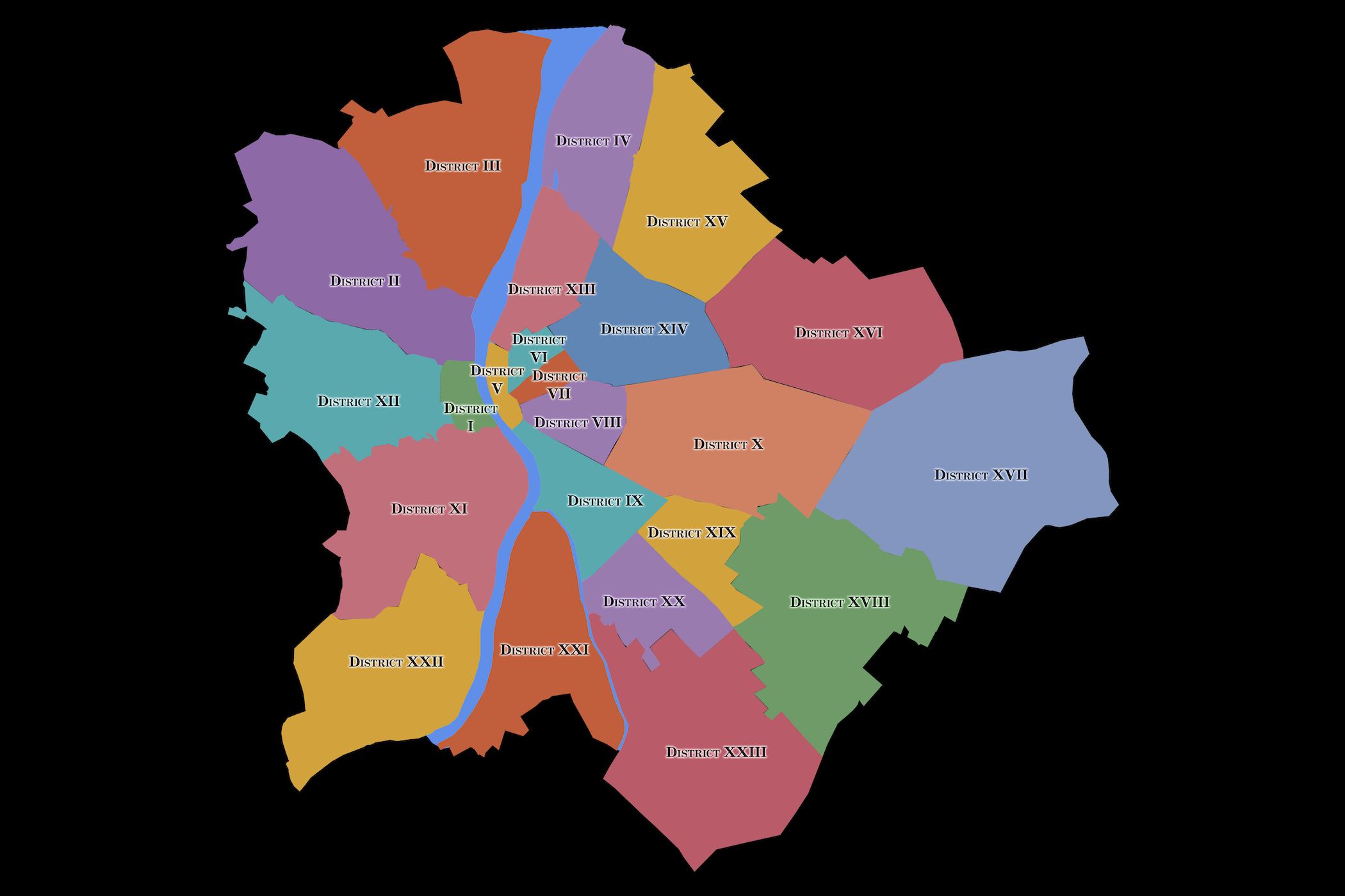
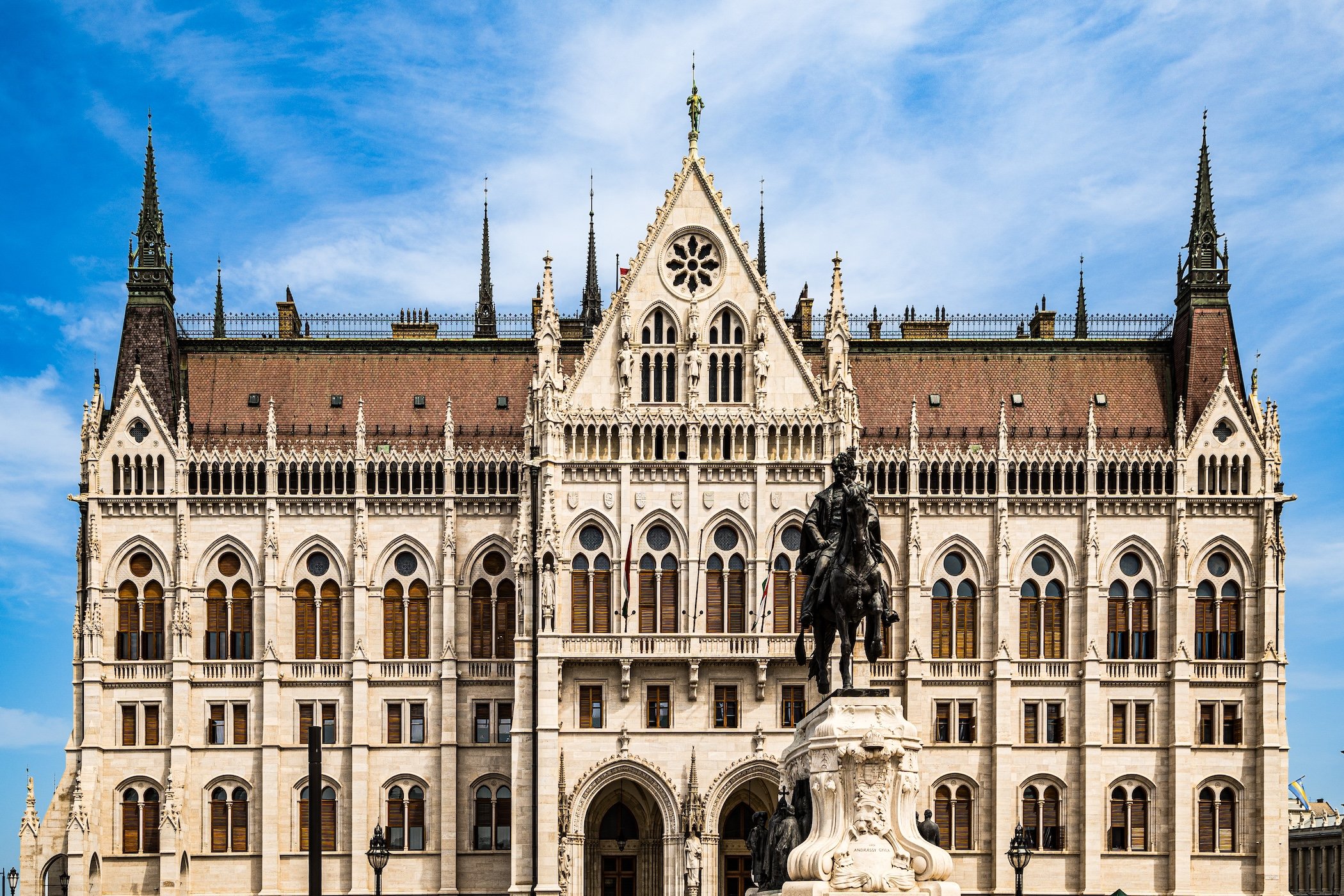
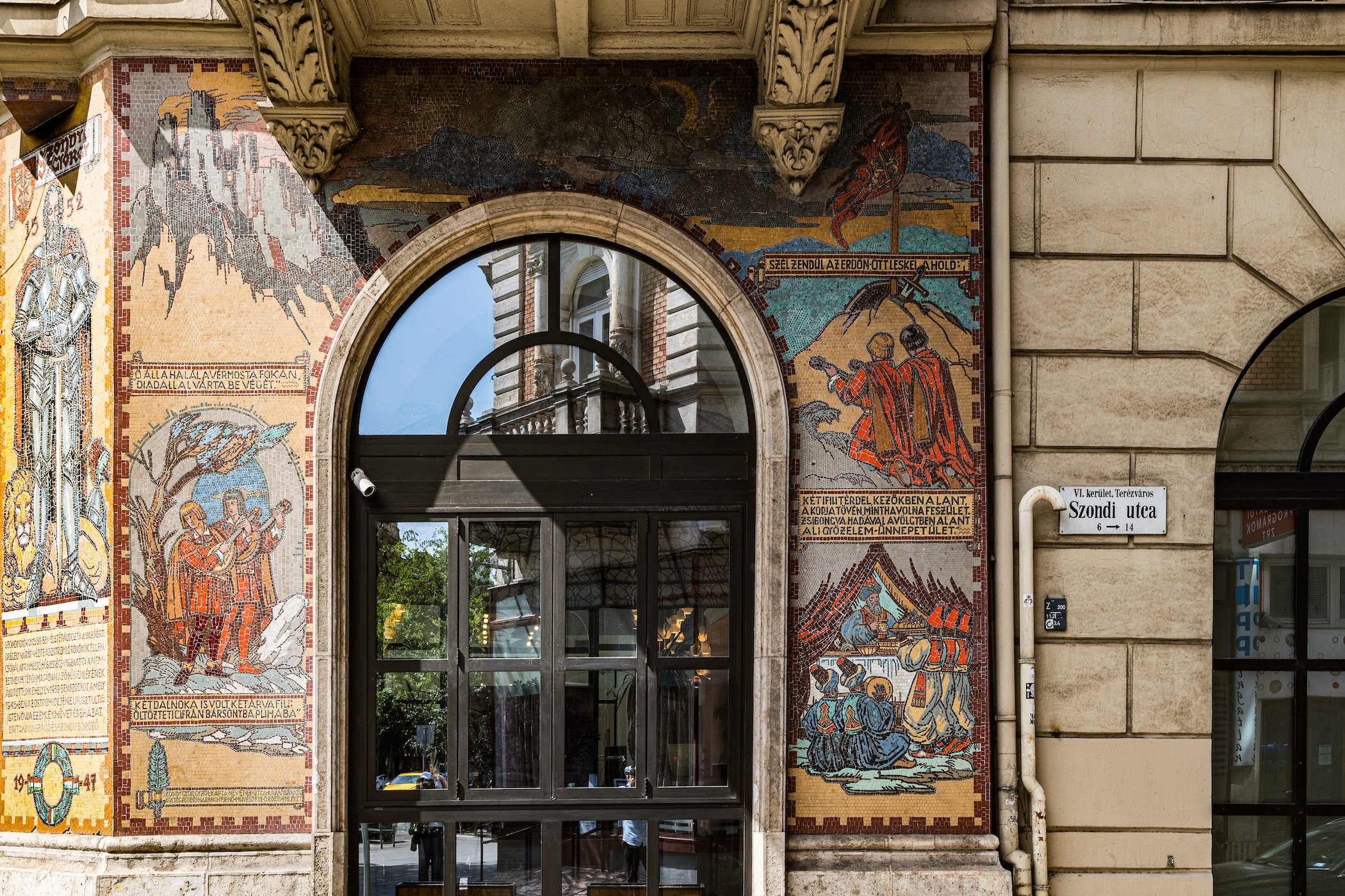

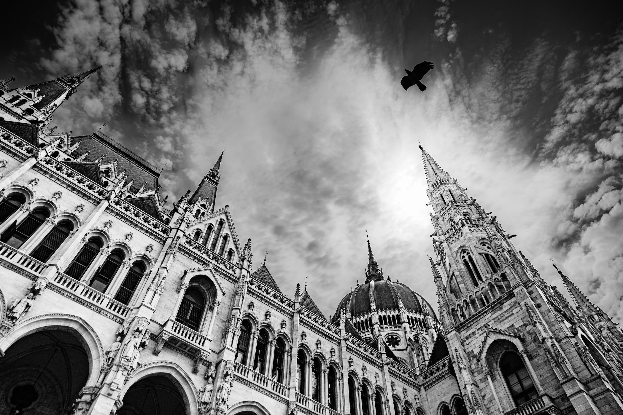
Explore Worldwide
-

Explore cities through their geography, history, neighborhoods, photography, and the observations gathered by CityNeighborhoods along the way.
-

Discover significant places beyond the city scale—from historic landmarks and cultural sites to landscapes, monuments, and destinations worthy of deeper exploration.
-

Explore CityNeighborhoods by country, bringing together its cities, featured sites, smaller destinations, and journeys across the wider landscape.
-

Follow the themes that cross borders and connect places—revealing shared histories, contrasting identities, recurring patterns, and unexpected relationships across the world.
-

Go behind the exploration through essays on photography, walking, observation, mapping, and the ideas and methods that shape CityNeighborhoods Worldwide.