
11e - POPINCOURT
Arrondissements
Welcome to the 11e - Popincourt neighborhood page! Here at CityNeighborhoods Paris, we explore 11e - Popincourt as an arrondissement, one of 20 primary civic districts in Paris — the broad organizing layers that contain administrative quarters, neighborhood councils, cultural neighborhoods, histories, monuments, and lived local identities. Long associated with workshops, popular politics, nightlife, and dense residential streets, the 11e Arrondissement - Popincourt stretches between Bastille, Oberkampf, République, and Nation. Its identity is energetic and lived-in, shaped less by monuments than by cafés, ateliers, markets, and civic intensity. Part of an ongoing project to walk and photograph every neighborhood in Paris, this page explores 11e - Popincourt through maps, district identity, history, and photography.
Part of an ongoing project to walk and photograph every neighborhood in Paris, this page explores the 11e - Popincourt through maps, district identity, history, and photography.


The Map
Geographic Setting
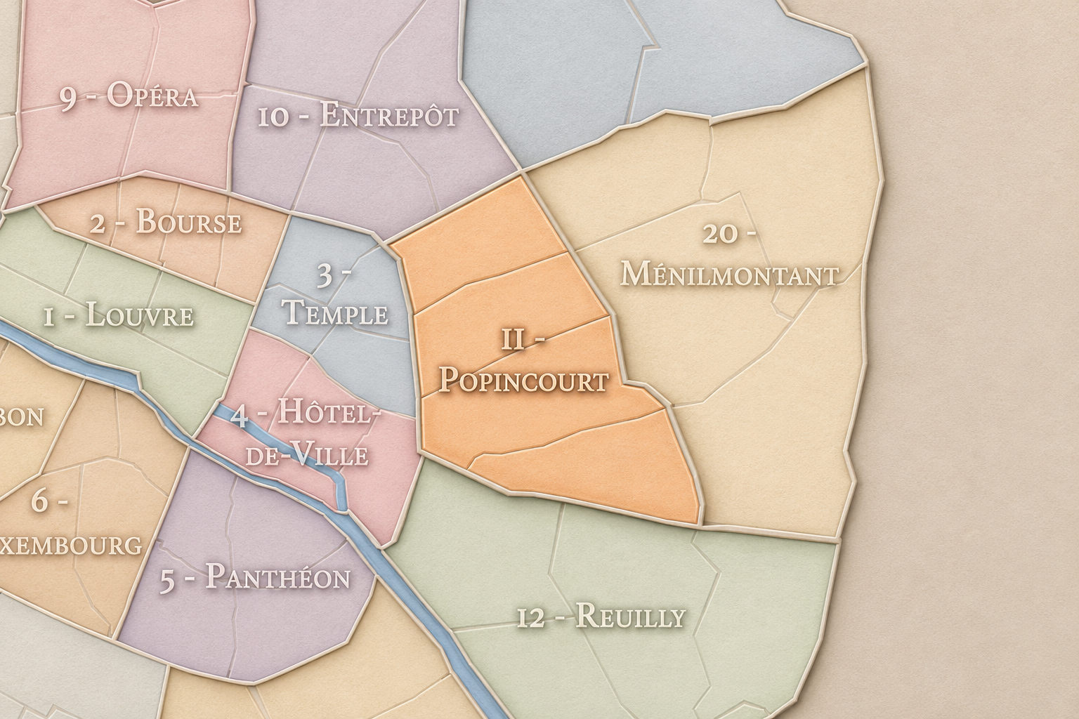
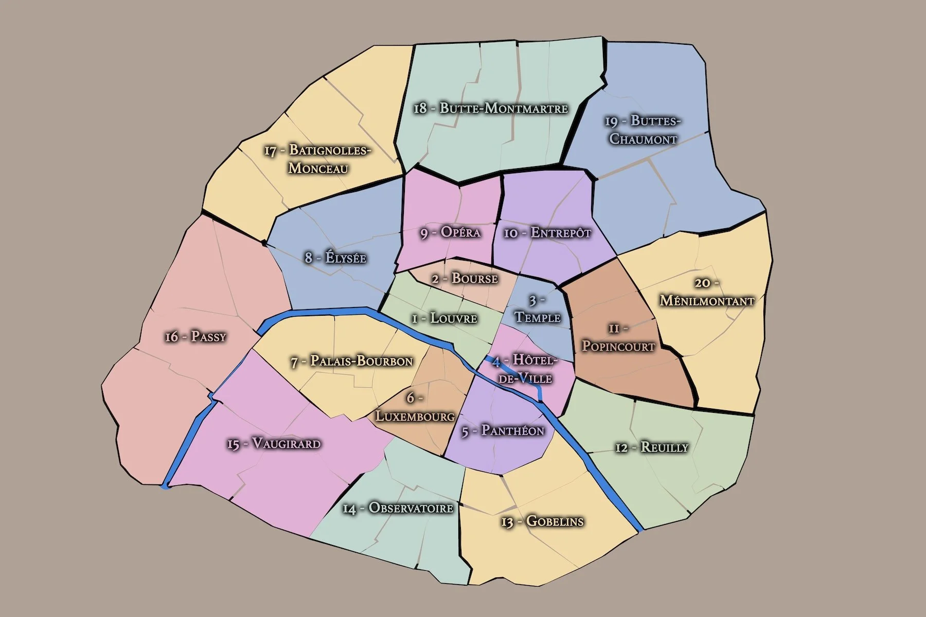
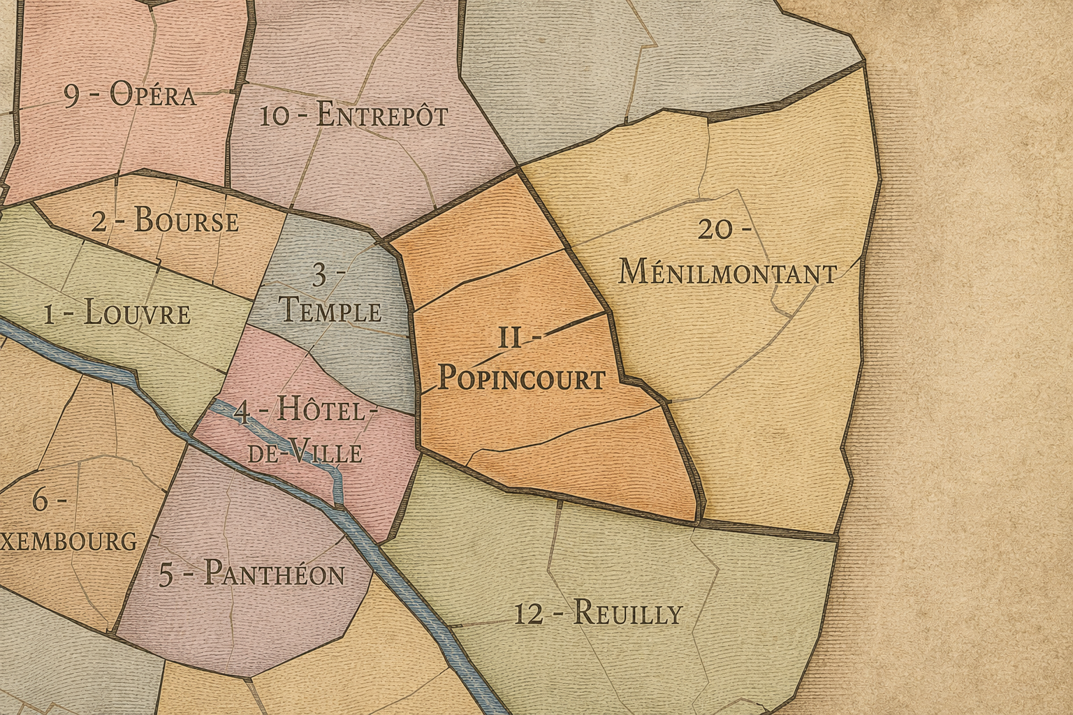
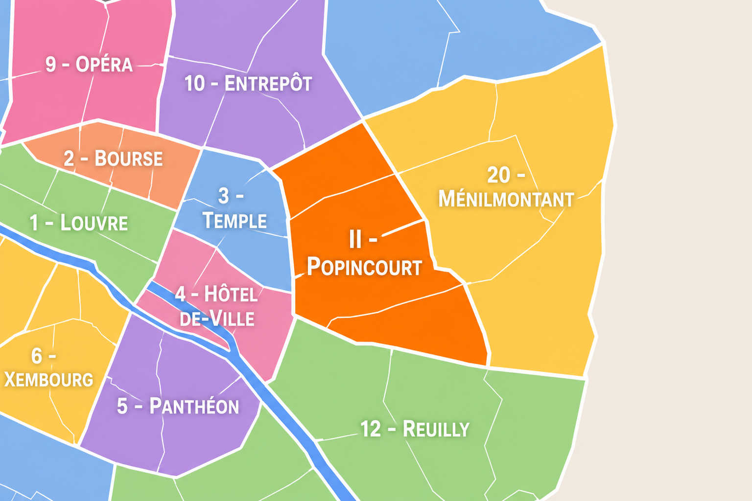
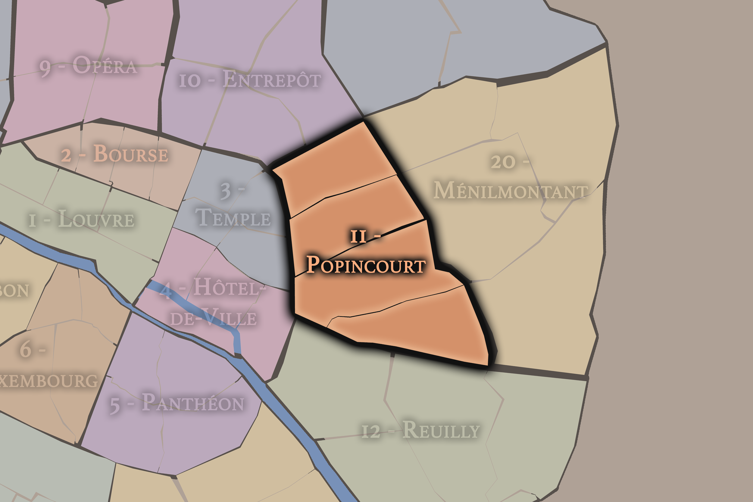
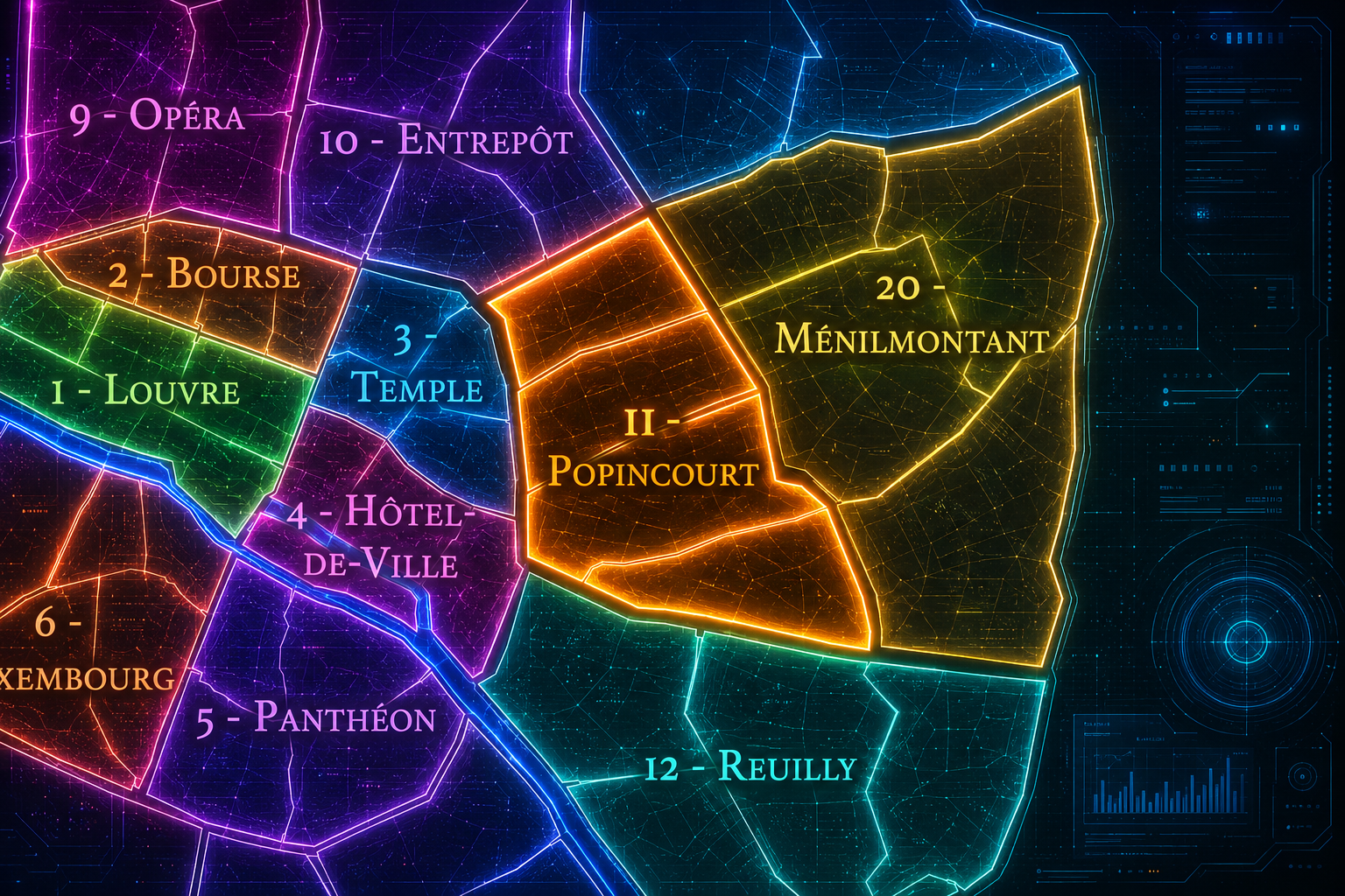
The 11e arrondissement occupies a dense and dynamic position on the Right Bank of Paris, east of the historic center and between several of the city’s most active urban corridors. It is bordered by the 3e and 4e arrondissements to the west, the 10e to the north, the 20e to the northeast, and the 12e to the southeast. Its western edge reaches toward Place de la République and the Marais, while its southern edge meets the Bastille area and the routes leading toward the Faubourg Saint-Antoine.
The arrondissement is defined by density, movement, and neighborhood life rather than by a single monumental landscape. It contains some of Paris’s most important public squares and corridors — République, Bastille, Oberkampf, Voltaire, Richard-Lenoir, Parmentier, and the streets around Charonne and Faidherbe. It is a district of workshops, courtyards, cafés, markets, nightlife, schools, small businesses, apartment blocks, former industrial spaces, and public gathering.
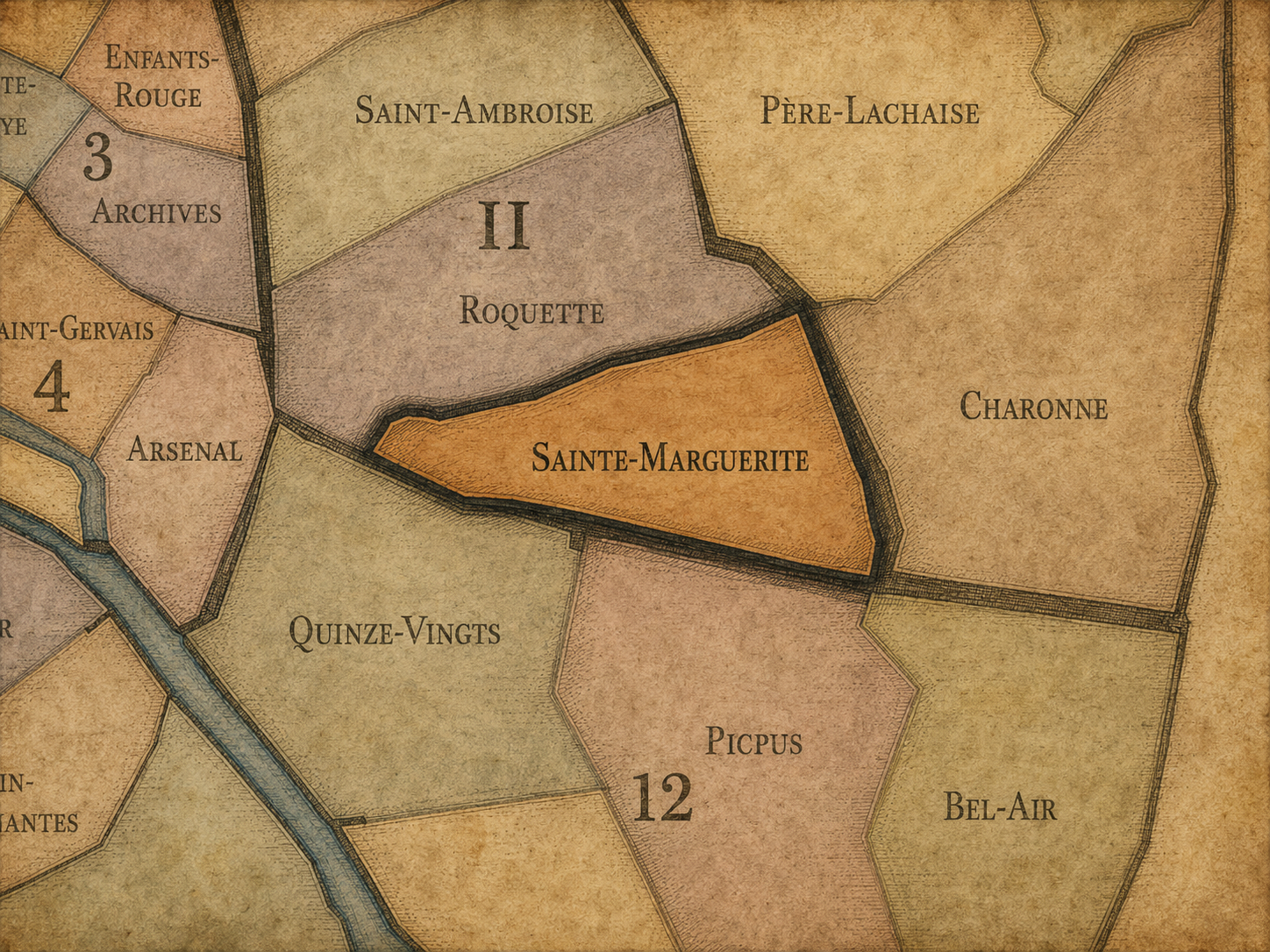
The 11e arrondissement is divided into four administrative quarters: Folie-Méricourt, Saint-Ambroise, Roquette, and Sainte-Marguerite. Together, they form one of the clearest expressions of eastern Paris: historically working-class, politically charged, artisan-driven, socially mixed, and increasingly shaped by restaurants, bars, design, creative offices, and residential reinvestment.
The 11e is therefore an arrondissement of energy rather than ceremony. It is not the Paris of royal gardens, national ministries, or grand museum riverfronts. It is the Paris of streets in use: protest routes, nightlife corridors, neighborhood cafés, former craft districts, immigrant businesses, market streets, and the everyday intensity of a city that is lived more than staged.
Arrondissement Identity
Etymology and Origins
The arrondissement’s administrative name, Popincourt, comes from an old local place-name associated with the eastern Right Bank. The name survives most visibly through Rue Popincourt and through the arrondissement’s formal administrative identity. Unlike names such as Louvre, Panthéon, Opéra, or Élysée, Popincourt is not widely recognized internationally, which gives the arrondissement a different kind of identity: less monumental, more local, older, and embedded in the geography of eastern Paris.
The name is tied to the pre-modern landscape of faubourgs, estates, roads, religious foundations, and settlements that developed beyond the older city center. Before the 11e became associated with Bastille, Oberkampf, République, Voltaire, Charonne, or nightlife, it was part of the eastern expansion of Paris — an area where suburban villages, workshop streets, religious lands, and routes toward the countryside gradually became urbanized.
The name Popincourt therefore suits the arrondissement in a quiet but meaningful way. It preserves the memory of a district that was not born as a ceremonial center, but as a working and transitional part of the city. Its identity developed from the movement between old Paris and the eastern faubourgs, between craft and industry, between local street life and political upheaval.
Civic Framework
The 11e arrondissement is one of the twenty municipal arrondissements of Paris and remains a distinct local civic unit with its own mairie. It is not part of Paris Centre, which groups only the 1er, 2e, 3e, and 4e arrondissements. Its civic identity is shaped by its role as one of the city’s most densely inhabited and socially active arrondissements, with a strong history of neighborhood organization, political expression, and public life.
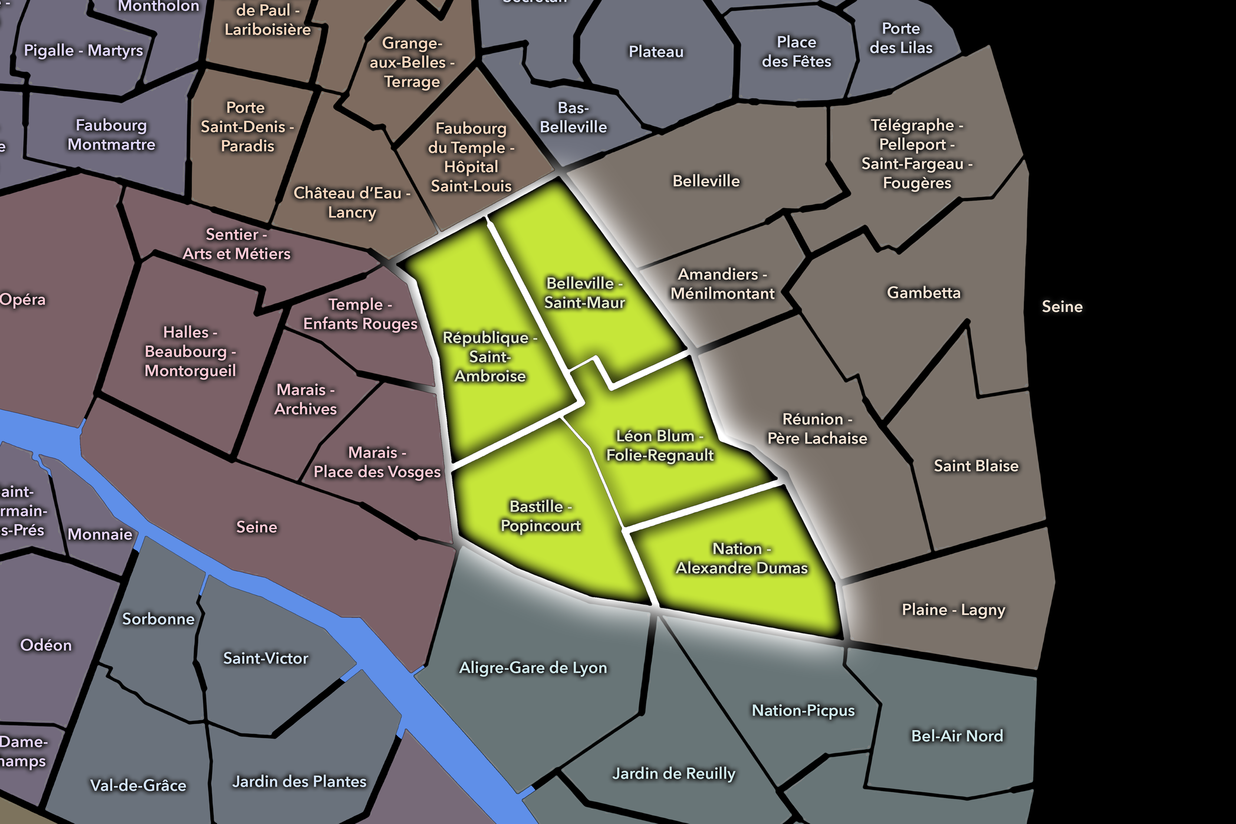
The arrondissement’s four administrative quarters — Folie-Méricourt, Saint-Ambroise, Roquette, and Sainte-Marguerite — provide its official internal structure. These quarters are especially useful because the 11e is often understood through overlapping cultural geographies: Oberkampf, République, Bastille, Voltaire, Charonne, Faidherbe, Parmentier, and the Faubourg Saint-Antoine edge. The official quarters help organize these identities without reducing the arrondissement to one nightlife zone, one political square, or one historic corridor.
For this project, the 11e is treated as both an official geographic layer and a cultural-historical district. Its civic framework helps distinguish the arrondissement from the Marais to the west, the canal and station landscapes of the 10e to the north, the faubourg and cemetery landscapes of the 20e to the east, and the Bastille–Reuilly transition of the 12e to the south. The 11e is the connective district among them: dense, expressive, residential, social, and deeply shaped by eastern Paris street life.
Parisian Identity
The 11e arrondissement holds a distinctive place in Paris as one of the city’s great districts of everyday energy, political expression, and neighborhood sociability. It is one of the places where Paris feels less ceremonial and more lived: apartment windows, cafés, corner bars, small workshops, schools, bakeries, courtyards, markets, bike lanes, protest routes, and evening crowds all make the district feel active at street level.
Its Parisian identity is strongly tied to the history of eastern Paris. The arrondissement grew from faubourgs, artisans, manufacturing, working-class streets, and revolutionary memory. The proximity of Bastille and République gives the 11e a civic charge that goes beyond architecture. Demonstrations, public gatherings, political marches, and social movements have long passed through or gathered near its edges and avenues, giving the district a reputation for public voice and urban participation.
At the same time, the 11e has become one of the city’s most recognizable contemporary social districts. Oberkampf, Parmentier, Charonne, Faidherbe, and Bastille-adjacent streets are associated with cafés, restaurants, bars, music, design, and nightlife. The arrondissement’s identity rests in the tension between older working Paris and newer cultural Paris: former workshops and modest streets now house restaurants, studios, boutiques, creative offices, and apartments, while the memory of labor and political life remains visible beneath the surface.
Neighborhood Distinction
The 11e arrondissement is distinguished by its density and its social range. It is not built around a single monumental symbol, and it is not easily reduced to one neighborhood identity. Instead, it is made from a set of overlapping street cultures: the civic vastness of République, the nightlife and restaurants of Oberkampf and Parmentier, the Bastille and Roquette corridors, the residential and workshop fabric of Saint-Ambroise, and the Faubourg Saint-Antoine edge near Sainte-Marguerite.
Its four administrative quarters express this range. Folie-Méricourt gives the arrondissement a northern and northwestern identity tied to République, Oberkampf, nightlife, mixed residential streets, and creative activity. Saint-Ambroise forms a central quarter around the church and the Voltaire–Parmentier axis, with a strong neighborhood and institutional character. Roquette connects the arrondissement to Bastille, the former prison landscapes, Père-Lachaise approaches, nightlife, and the old eastern routes. Sainte-Marguerite gives the southern portion of the arrondissement its connection to the Faubourg Saint-Antoine, furniture-making, workshops, courtyards, and artisan history.
The arrondissement’s distinction also lies in the way it changes over short distances. One street can feel residential and quiet; the next can be crowded with bars, restaurants, or demonstrations. It is dense but not uniform, fashionable but not polished in the manner of western Paris, historic but not preserved as a museum district. The 11e is Paris in use: adaptable, crowded, expressive, and alive.
Neighborhood Connections
Every neighborhood belongs to a wider Parisian fabric.
-
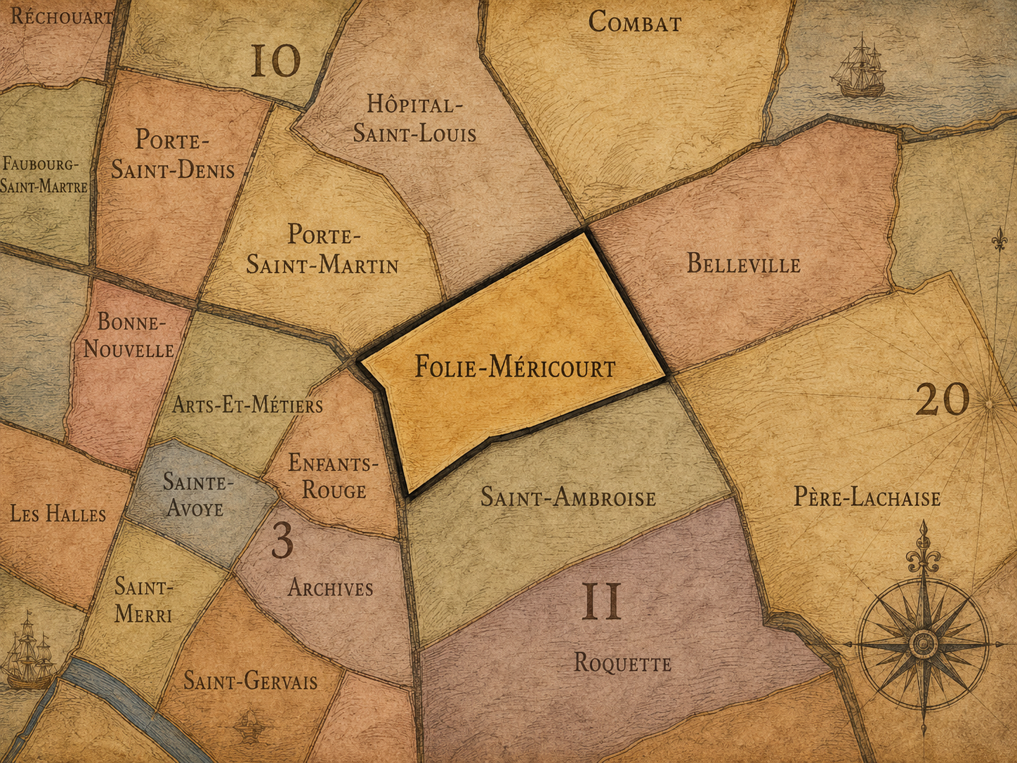
Folie-Méricourt
-
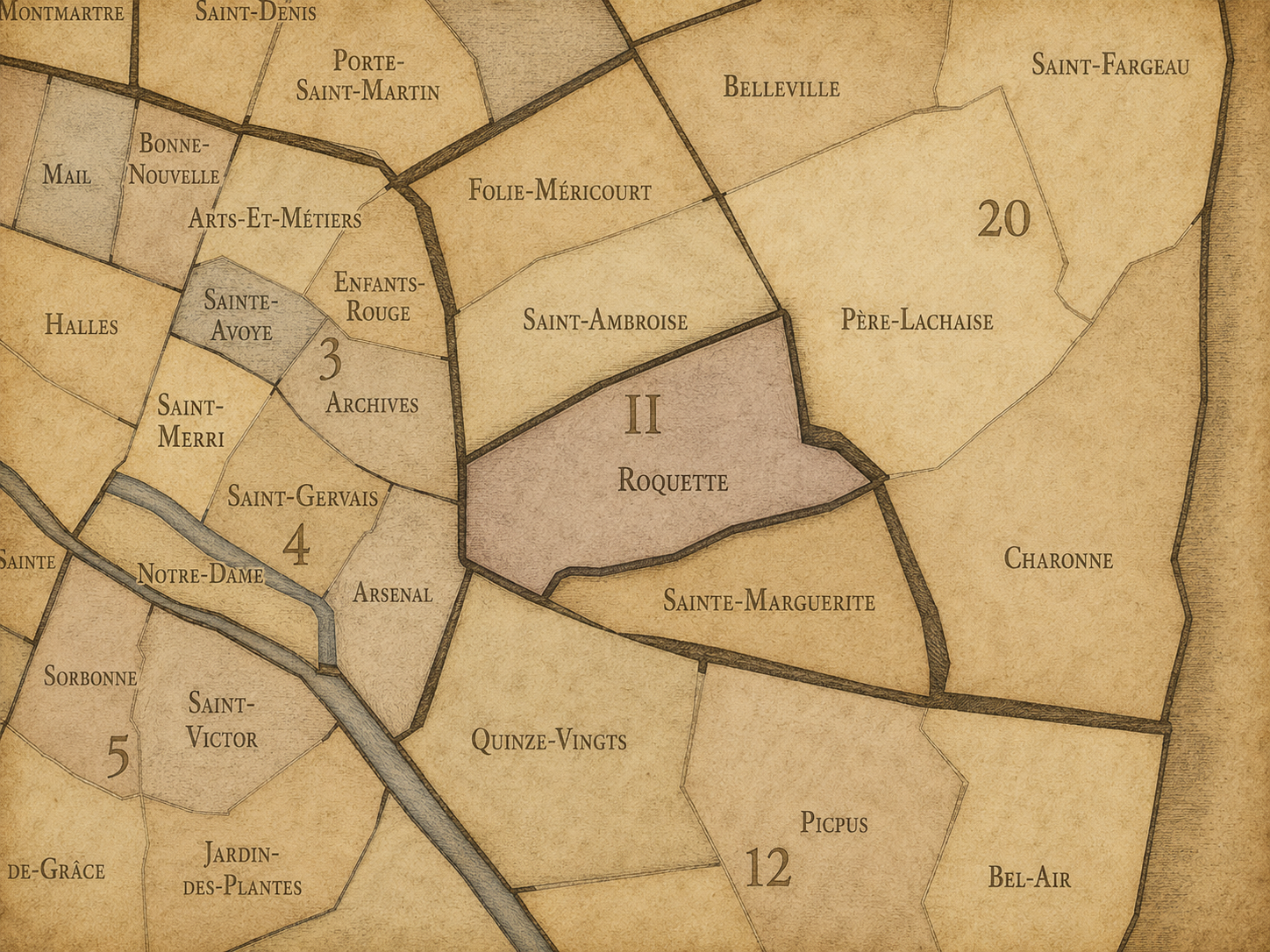
Roquette
-
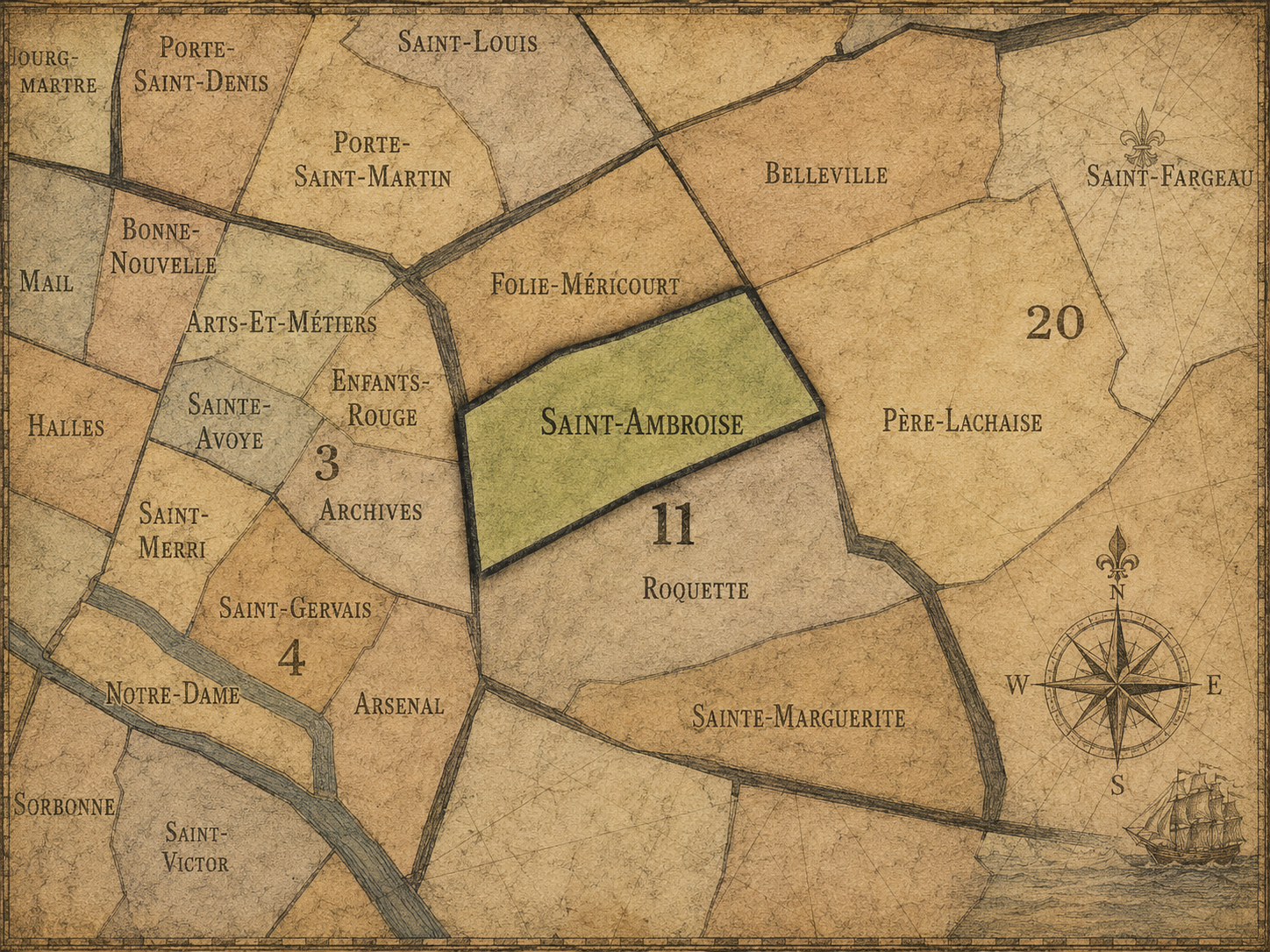
Saint-Ambroise
-
Sainte-Marguerite
-
11e — Popincourt
-

Rive Droite
The History
Origins
The origins of the 11e arrondissement lie in the eastern expansion of Paris beyond the older fortified city. Before it became an urban arrondissement, the area was shaped by roads leading east, religious lands, scattered settlements, suburban estates, and the gradual growth of faubourgs outside the historic core.
The future arrondissement occupied a transitional zone between the city and its eastern approaches. This geography encouraged movement, labor, workshops, markets, and settlement beyond the more tightly controlled center. Rather than emerging from one great monument or one royal plan, the district grew through a practical urban logic: routes, trades, fields, religious institutions, and the expansion of working Paris.
The names that now structure the arrondissement — Popincourt, Roquette, Sainte-Marguerite, Saint-Ambroise, Folie-Méricourt — preserve traces of this older landscape. They speak to a Paris of local places and former properties, long before the district became identified with dense apartment streets, revolutionary memory, nightlife, and contemporary neighborhood culture.
16th–17th Century
During the 16th and 17th centuries, the future 11e arrondissement became more closely tied to the growth of eastern Paris. The routes leading toward the countryside and the eastern faubourgs became increasingly important, and the area began to absorb more religious institutions, residences, trades, and early workshop activity.
The Faubourg Saint-Antoine, along the southern edge of the future arrondissement, grew into one of the most important artisan districts of Paris. Its association with furniture-making, carpentry, and skilled trades would become central to the long-term identity of the 11e and neighboring 12e. The presence of workshops and courtyards gave the district a material and laboring character distinct from the more aristocratic quarters of western Paris.
This period also strengthened the arrondissement’s role as an edge district: close to the old city, but open enough for work, settlement, and movement. By the end of the 17th century, the foundations of the future 11e were visible in its eastern faubourg geography, artisan culture, religious sites, and growing connection to the public routes of Paris.
18th Century
In the 18th century, the future 11e arrondissement became increasingly urbanized and increasingly associated with the working and artisanal life of eastern Paris. The Faubourg Saint-Antoine continued to develop as a major center of crafts, especially furniture and related trades. Workshops, courtyards, and small manufacturing spaces helped define the social and physical structure of the district.
The area’s proximity to Bastille also gave it political importance. The eastern faubourgs were home to many workers, artisans, and residents who would play an important role in the revolutionary atmosphere of late 18th-century Paris. The district’s geography — near the fortress-prison of the Bastille, yet outside the older elite core — placed it close to one of the great symbolic flashpoints of the Revolution.
By the end of the 18th century, the future 11e had become one of the key landscapes of popular Paris. It was a district of labor, craft, density, and political possibility. Its later identity as expressive, restless, and socially engaged has deep roots in this period.
19th Century
The 19th century transformed the 11e arrondissement into one of the great working-class and industrial districts of Paris. Workshops, small factories, courtyards, apartment buildings, and commercial streets expanded across the area. The arrondissement’s artisan identity continued, especially around the Faubourg Saint-Antoine, while new forms of manufacturing and urban density intensified its social character.
The century also brought strong political associations. Eastern Paris played a major role in revolutionary and insurrectionary movements, and the 11e’s streets, boulevards, and neighborhoods were part of that wider geography of public unrest, barricades, and civic struggle. The district’s proximity to Bastille, République, and Père-Lachaise gave it a place within the political imagination of Paris.
Urban modernization reshaped the arrondissement as well. New boulevards and avenues, including Boulevard Voltaire and the routes connecting République and Bastille, changed movement through the district. Yet the 11e retained a dense, mixed, and laboring texture behind those larger corridors. It became an arrondissement of contrasts: broad political avenues and hidden workshops, public squares and interior courtyards, dense housing and small industry.
By the end of the 19th century, the 11e had a clear identity as a district of labor, politics, production, and eastern Paris life. It was not peripheral anymore, but it retained the energy of a faubourg: close to the center, yet socially and culturally distinct from it.
Early–Mid 20th Century
In the early and mid 20th century, the 11e arrondissement remained deeply tied to working-class Paris. Workshops, small factories, artisan trades, neighborhood cafés, markets, schools, and apartment houses shaped daily life. The district’s social fabric was dense and local, with strong ties to labor, political organization, and community life.
The arrondissement also continued to carry political significance. Its avenues and squares were part of the geography of demonstrations, union activity, public gatherings, and civic expression. The memory of revolution and the practices of modern political life overlapped in the streets between République, Bastille, Voltaire, and the eastern neighborhoods.
During the wars, occupation, and reconstruction years, the 11e absorbed the pressures felt across Paris while retaining its identity as a lived and working district. Its residents, small businesses, schools, religious institutions, and workshops formed the backbone of a neighborhood life less visible to tourists but central to the everyday city.
The early and mid 20th century therefore preserved the arrondissement’s identity as practical, political, and socially grounded. It was Paris not as monument, but as neighborhood, labor, and street.
Late 20th Century
The late 20th century brought significant change to the 11e arrondissement. As manufacturing and traditional workshop activity declined or changed, many older industrial and artisan spaces were adapted to new uses. Former courtyards and workshops became studios, offices, apartments, galleries, restaurants, and cultural venues. The arrondissement’s inherited flexibility made this transformation possible.
The district also became increasingly associated with nightlife and youth culture. Oberkampf, Bastille, Parmentier, and Charonne developed stronger reputations as places for bars, music, restaurants, and evening social life. This new layer did not erase the arrondissement’s working-class past, but it changed its public image. The 11e became one of the places where eastern Paris felt increasingly creative, sociable, and desirable.
At the same time, the arrondissement remained politically and socially active. République and Bastille continued to serve as major gathering points for demonstrations and public expression. The 11e’s history as a district of civic voice adapted to new forms of activism, public assembly, and cultural visibility.
By the end of the 20th century, the 11e had become a district in transition: still marked by labor and popular history, but increasingly shaped by culture, nightlife, gentrification, and new residential appeal.
21st Century
In the 21st century, the 11e arrondissement is one of the most energetic and socially visible districts in Paris. It is known for restaurants, cafés, bars, music venues, design studios, independent shops, markets, and dense residential life. Areas such as Oberkampf, Charonne, Faidherbe, Bastille, and Parmentier have become strongly associated with contemporary Parisian sociability.
The arrondissement also continues to carry the political identity of eastern Paris. République and Bastille remain among the city’s most important places for demonstrations, vigils, marches, and public gatherings. The 11e is often where private life and public voice meet: residents live above cafés and shops; demonstrations move through major avenues; nightlife fills former working streets; and neighborhood life continues amid constant change.
Contemporary pressures are also visible. Rising housing costs, gentrification, tourism, nightlife noise, commercial turnover, and the transformation of former workshop spaces all affect the arrondissement’s social balance. The 11e remains diverse and active, but its older working-class identity has been partially reworked by new patterns of consumption, culture, and residence.
Even so, the arrondissement retains its fundamental character as a district of use and intensity. It is not a passive heritage zone. It is a place where Paris continues to make itself through streets, crowds, arguments, meals, work, music, memory, and everyday life.
Spirit and Legacy
The 11e arrondissement is Paris as street life, labor, and public voice. Its legacy is rooted in the eastern faubourgs: workshops, courtyards, artisans, political movements, dense housing, neighborhood cafés, and the routes between Bastille and République.
It is not one of the city’s grand ceremonial arrondissements, and that is precisely its strength. The 11e represents the Paris that works, gathers, protests, eats, drinks, makes, adapts, and lives close together. Its history is written less in isolated monuments than in patterns of use: the workshop behind the courtyard, the café on the corner, the march along the boulevard, the evening crowd on Rue Oberkampf, the old craft street remade but not forgotten.
The name Popincourt preserves a local identity beneath the more famous geographies of Bastille, République, Voltaire, Oberkampf, and Charonne. It reminds us that the arrondissement’s power is not only symbolic, but neighborhood-based. The 11e is a district of continuity through change — popular, restless, sociable, political, and alive with the everyday force of eastern Paris.
The Photography
Visual Identity

The visual identity of each Paris district begins with its position in the city’s layered geography. Before the photographs arrive, the maps establish a first way of seeing: where the district sits, what civic layer it belongs to, which boundaries define it, and how it connects to the surrounding fabric of Paris. In CityNeighborhoods Paris, cartography is not merely orientation; it is part of the visual language of the project.
As the photographic archive grows, this section will continue to develop through images gathered on foot. Streets, façades, monuments, markets, parks, river edges, passages, signs, textures, and everyday details will gradually reveal how each district presents itself visually. The goal is not only to show what a place looks like, but to trace how its identity becomes visible through form, atmosphere, memory, and use.
Through The Lens

CityNeighborhoods Paris is built from walking, looking, and returning. Each district is approached through photography as a way of paying attention: to the obvious landmarks and the quieter details, to historic structures and ordinary streets, to the moments where civic geography becomes lived experience. The camera becomes a tool for noticing how Paris changes from one district to the next, and how each place holds its own relationship to the larger city.
As photographs are processed and added, this section will become a more specific visual record of the district. Future updates may include dated field notes, galleries, and reflections from individual walks. For now, the page remains part of the larger CityNeighborhoods effort to document every Paris neighborhood through maps, history, identity, and photography — one district, one walk, and one visual encounter at a time.
If you visit Paris, these ideas can help inspire your own photography.


Paris: J’Espere, Je Rêve, Je Vive
Paris Photo Gallery
Paris Flâneur Notes
Flâneur Notes document the walks, photographs, light, and street-level observations behind this neighborhood entry. Learn more about the Spirit of the Flâneur.


Explore Paris
-

The twenty arrondissements form the civic spiral of Paris, organizing the city into its broad local districts of government, identity, and daily life.
-

Each arrondissement is divided into four official administrative quarters, giving Paris a more precise civic and geographic framework.
-

The conseils de quartier bring participation to street level, giving residents a voice in neighborhood needs, public space, and local civic life.
-

Les Deux Rives trace Paris through the Seine’s two banks, revealing how the Rive Droite and Rive Gauche shaped the city’s civic power, commerce, learning, art, and cultural identity.
-

Cultural neighborhoods reveal the Paris people recognize through history, cafés, architecture, memory, atmosphere, and local belonging.