
5e - SAINT-VICTOR
Quartiers Administratifs
Welcome to the Saint-Victor neighborhood page! Saint-Victor is a quartier administratif — an administrative quarter — one of 80 such districts across Paris. As a quartier administratif of the 5e Arrondissement - Panthéon, Saint-Victor belongs to a formal layer of Parisian geography and descends from the Latin Quarter toward the Seine. Saint-Victor is shaped by the old Abbey of Saint-Victor, the Institut du Monde Arabe, and the scholarly and riverfront landscapes near Jussieu.
Part of an ongoing project to walk and photograph every neighborhood in Paris, this page explores 5e Saint-Victor through maps, district identity, history, and photography.


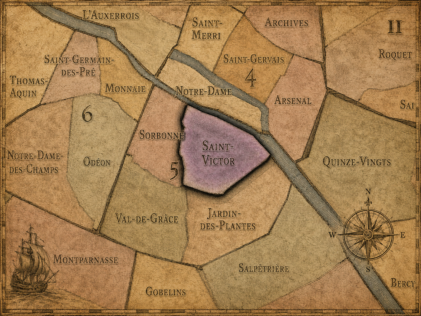
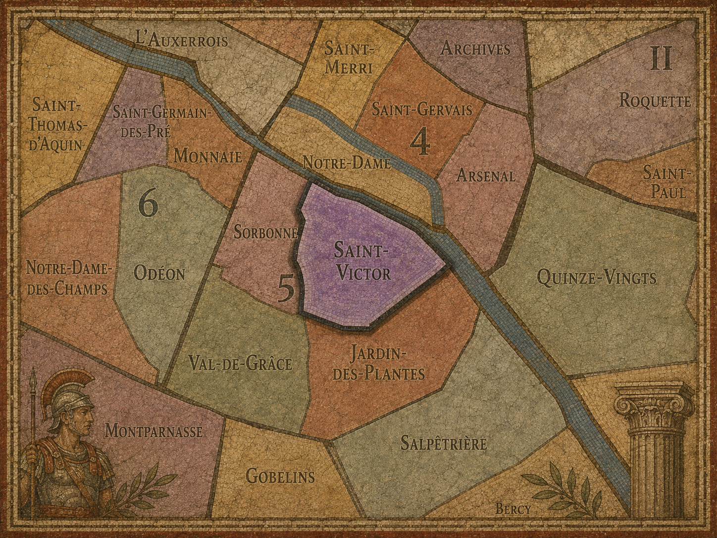
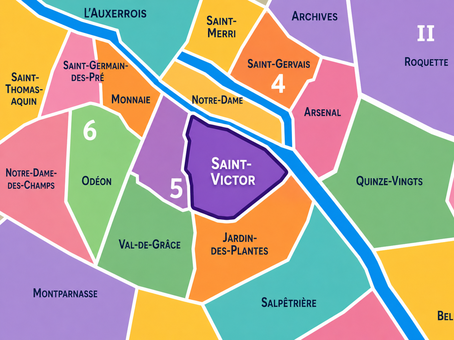
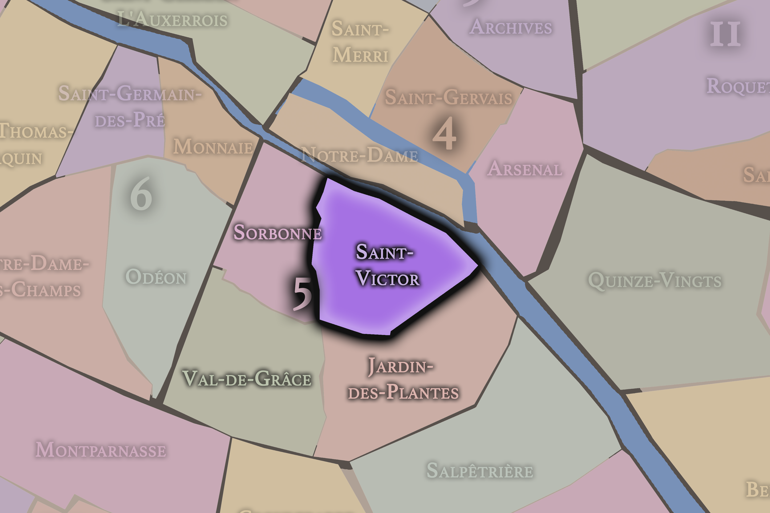
The Map
Geographic Setting
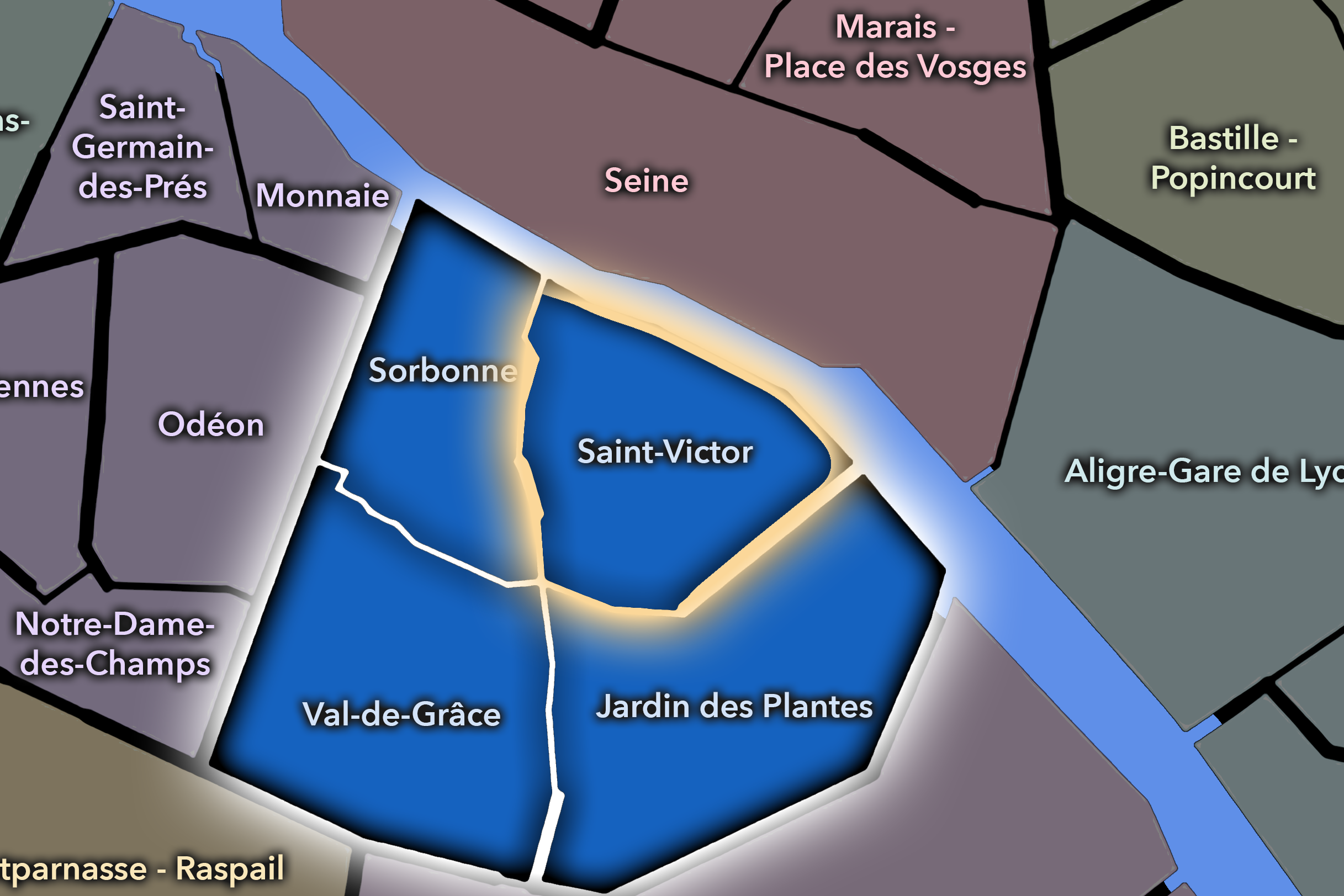
Saint-Victor occupies the northeastern portion of the 5th arrondissement, where the Latin Quarter descends toward the Seine and the old eastern Left Bank gathers around riverfront streets, university institutions, abbey memory, and the threshold between medieval Paris and the scientific landscapes of Jussieu and the Jardin des Plantes. It lies south of the Seine, east of Sorbonne, north of Val-de-Grâce, and west of Jardin-des-Plantes. Its geography is shaped by the meeting of river, hill, school, church, and old monastic ground.
The quarter includes and borders some of the most important landscapes of the eastern Latin Quarter: the area around Place Maubert, Rue des Écoles, Rue Monge, the Jussieu campus, the Collège des Bernardins, the Institut du Monde Arabe nearby along the Seine, the quays of Saint-Bernard and de la Tournelle, and the older street pattern leading toward Saint-Julien-le-Pauvre, Saint-Nicolas-du-Chardonnet, and the former abbey lands of Saint-Victor. It is a quarter of transitions: from the river to the hill, from medieval schools to modern universities, from monastic enclosure to public education, from old Left Bank streets to the more open institutional spaces of the eastern 5th.
Unlike Sorbonne, whose name concentrates the iconic academic identity of the Latin Quarter, or Jardin-des-Plantes, whose character is defined by natural history and public science, Saint-Victor is more layered and less easily reduced to one image. It is the Latin Quarter’s eastern hinge — a place where scholarship, religion, riverfront, institutional expansion, and urban memory meet.
Administrative Quarter Identity
Etymology and Origins
The name Saint-Victor comes from the former Abbey of Saint-Victor, one of the great medieval religious and intellectual institutions of Paris. Founded in the early 12th century, the abbey stood in this eastern Left Bank landscape and became a major center of theology, learning, manuscript culture, and monastic life. Although the abbey itself was suppressed during the Revolution and later demolished, its name survived in the administrative quarter.
That survival is important. Saint-Victor is a name of absence as much as presence. Unlike Notre-Dame, where the building still dominates the quarter, or Jardin-des-Plantes, where the garden remains the visible anchor, Saint-Victor is named for an institution that largely vanished from the streetscape. The name therefore asks the visitor to read the city historically. It points toward a lost monastic world beneath the modern university district.
The name also deepens the identity of the Latin Quarter. Parisian scholarship is often associated with the Sorbonne, but Saint-Victor reminds us that the intellectual life of the Left Bank was never confined to one institution. Monasteries, colleges, schools, churches, libraries, and teaching communities all helped form the district’s academic and spiritual landscape. Saint-Victor preserves one of those older scholarly lineages within the modern civic map.
Civic Framework
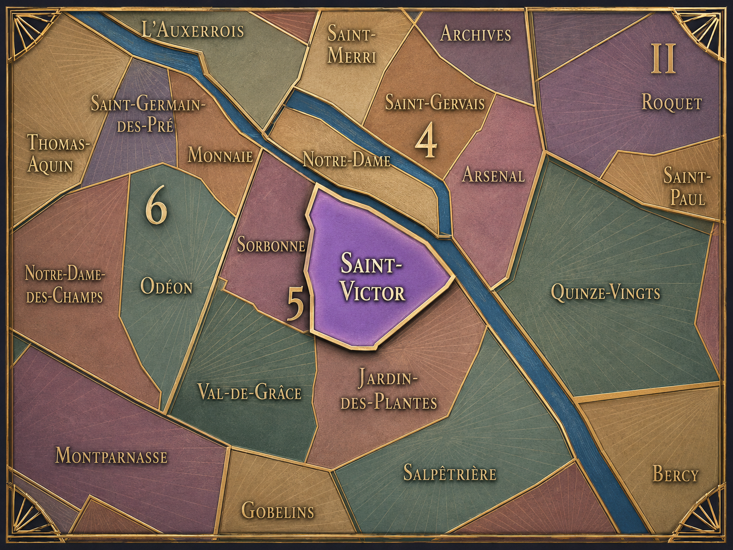
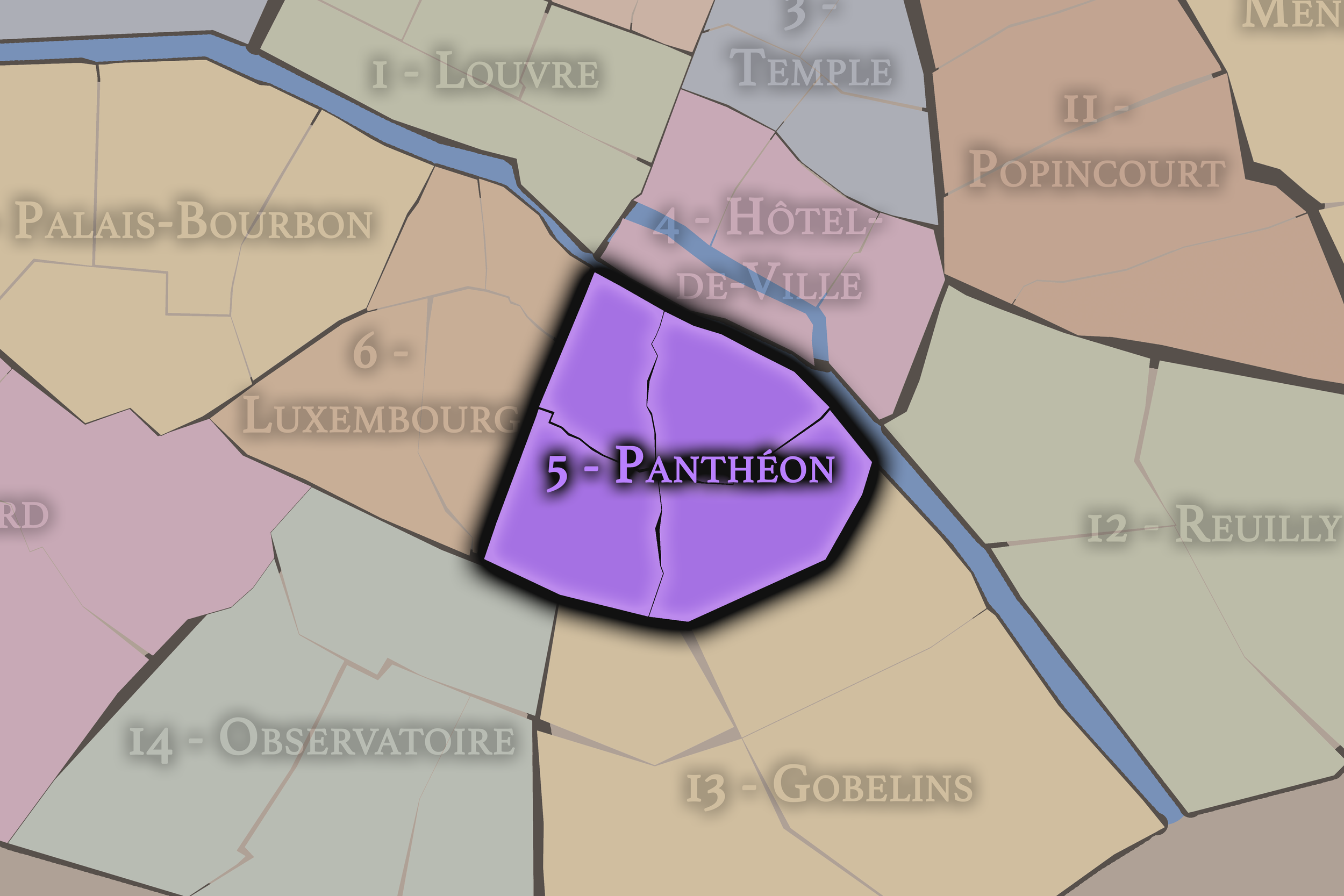
Within the official geography of Paris, Saint-Victor is one of the four administrative quarters of the 5th arrondissement, alongside Sorbonne, Val-de-Grâce, and Jardin-des-Plantes. It occupies the northeastern sector of the arrondissement, giving official shape to the eastern Latin Quarter between the Seine, the university corridors, and the scientific and institutional landscapes around Jussieu.
As an administrative quarter, Saint-Victor clarifies an area often described through neighboring or overlapping names: the Latin Quarter, Jussieu, Maubert, the quays, the eastern 5th, or the edge of the Jardin des Plantes. The official name gathers these fragments into a civic unit rooted in older monastic memory. It reminds us that the modern academic and institutional landscape did not appear on empty ground, but on a site already shaped by centuries of religious and intellectual life.
The quarter’s civic identity also shows the particular complexity of the 5th arrondissement. This arrondissement is not only the Latin Quarter in a broad cultural sense; it is a set of smaller official landscapes, each with its own emphasis. Sorbonne carries the classic university identity. Val-de-Grâce carries conventual, medical, and residential memory. Jardin-des-Plantes carries natural history. Saint-Victor carries the eastern Left Bank’s older religious-scholarship and institutional transition.
Neighborhood Distinction
Saint-Victor differs from the other quarters of the 5th arrondissement through its relationship to vanished monastic power, riverfront education, and the eastern expansion of the Latin Quarter. Sorbonne is the symbolic heart of university Paris, dense with students, churches, libraries, bookshops, and the old intellectual mythology of the Left Bank. Jardin-des-Plantes turns toward botany, natural history, museums, green space, and the scientific study of the living world. Val-de-Grâce is more residential, medical, and hill-bound, shaped by the former abbey, hospital, and quieter streets south of the Panthéon.
Saint-Victor is more liminal. It is not as monumental as Sorbonne, not as garden-centered as Jardin-des-Plantes, and not as inwardly residential as Val-de-Grâce. It is a quarter of institutional overlap: old abbey memory, modern university campuses, riverfront culture, religious survivals, and urban corridors leading between the central Latin Quarter and the eastern Left Bank.
It should also be distinguished from the Latin Quarter as a whole. Saint-Victor belongs to the Latin Quarter, but it gives that larger cultural district one of its less mythologized forms. It is not only the quarter of medieval students and cafés. It is the quarter of abbey ruins remembered by name, modern lecture halls, scientific education, and the city’s long conversion of religious ground into secular knowledge.
Parisian Identity
Saint-Victor expresses Paris as a city where learning changes form but remains rooted in place. The quarter’s identity begins with a medieval abbey and continues through the modern university landscape. The old religious school, the monastic library, the lecture hall, the laboratory, the campus, and the riverside cultural institution all belong to the same long story: Paris as a city that organizes itself around knowledge.
This gives Saint-Victor a quieter but profound Parisian character. It is not the most picturesque corner of the Latin Quarter, nor the most iconic. Much of its modern landscape is more institutional than romantic. Yet that is precisely why it matters. Saint-Victor reveals that Parisian identity is not only made from preserved medieval streets and famous façades. It is also made from adaptation — from old forms of learning becoming new ones.
The quarter also has a strong river consciousness. Its northern edge along the Seine connects it visually and spatially to Île Saint-Louis, Notre-Dame, and the Right Bank. This relationship gives Saint-Victor a sense of openness that contrasts with the tighter, uphill streets of the Latin Quarter. It is a place where scholarship looks toward the river, and where the Left Bank’s intellectual history remains connected to the city’s oldest geography.
Neighborhood Connections
Every neighborhood belongs to a wider Parisian fabric.
-
5e - Panthéon
-
Saint-Victor
-
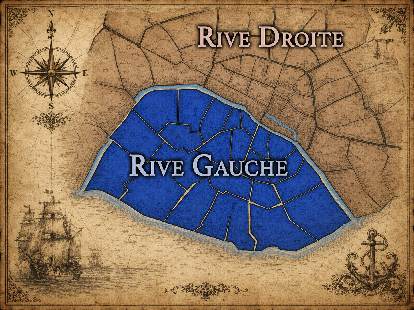
Rive Gauche
-
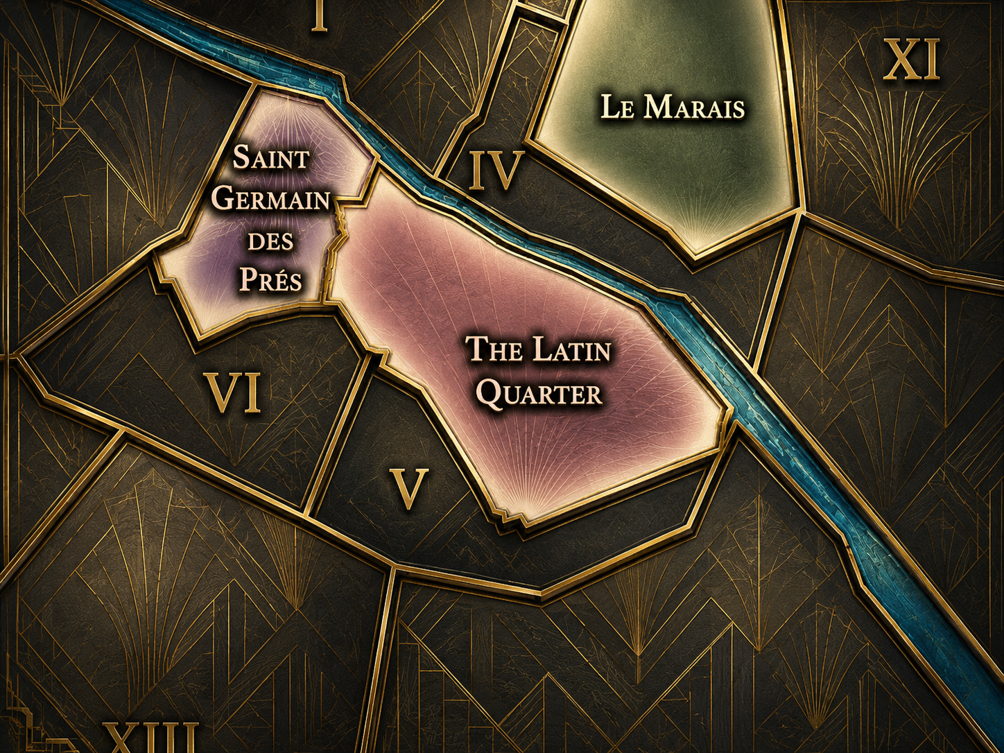
Latin Quarter
The History
Origins
The origins of Saint-Victor lie in the medieval development of the eastern Left Bank, outside the oldest island core but close enough to become part of the growing intellectual and religious city. The Abbey of Saint-Victor was founded in the early 12th century and became one of the major centers of Augustinian learning in medieval Paris. Its schools, library, and theological influence helped make the eastern Left Bank an important complement to the university world that later became identified with the Latin Quarter.
Before the modern quarter existed, the area was shaped by religious institutions, roads, river approaches, gardens, and fields gradually drawn into the orbit of the city. The abbey gave the landscape a spiritual and scholarly center. Around it, the Left Bank continued to develop through colleges, churches, residences, markets, and routes connecting the river to the hill.
Saint-Victor’s origin story is therefore inseparable from the history of Parisian learning. It is a reminder that the Latin Quarter was not born from a single institution, but from a network of religious and educational communities. The quarter’s name preserves one of the most important of those communities, even though the built remains are fragmentary.
16th–17th Century
In the 16th and 17th centuries, Saint-Victor remained tied to the religious and intellectual landscape of the eastern Latin Quarter. The abbey continued to occupy an important place in the district’s memory and institutional life, while the surrounding area became more urbanized. Streets, colleges, churches, residences, and gardens shaped a neighborhood that remained both scholarly and religious.
This was also a period when the Latin Quarter’s older medieval institutions existed alongside new intellectual, scientific, and religious currents. Paris was changing, but the Left Bank retained its association with study, debate, theology, and education. Saint-Victor’s monastic heritage gave the quarter a particular character within that world: not simply university, but abbey scholarship.
The riverfront and nearby eastern approaches also mattered. Saint-Victor stood between the dense core of student Paris and the more open eastern landscapes that would later give rise to the Jardin des Plantes and other scientific institutions. The quarter’s future as a hinge between older learning and modern institutional Paris was already being prepared.
18th Century
In the 18th century, Saint-Victor stood within a Left Bank world increasingly shaped by Enlightenment thought, scientific curiosity, and institutional change. The old abbey remained part of the district’s religious inheritance, while nearby landscapes such as the Jardin du Roi expanded the scientific identity of the eastern 5th. The quarter’s intellectual surroundings became increasingly diverse: theology, natural history, medicine, classical learning, and public inquiry all overlapped across the arrondissement.
The abbey’s meaning also shifted as the authority of religious institutions came under new forms of scrutiny. Like many monastic and church properties in Paris, Saint-Victor belonged to an older order that would be dramatically transformed by the Revolution. Its buildings, lands, library, and institutional memory became vulnerable to the political and civic reorganization of France.
The French Revolution marked a rupture. The Abbey of Saint-Victor was suppressed, its properties nationalized, and its physical presence eventually erased or absorbed into the changing city. The name survived, but the institution that produced it largely vanished. This loss is one of the central facts of the quarter’s identity.
19th Century
The 19th century transformed Saint-Victor from a landscape of vanished monastic power into part of the modern academic and institutional Left Bank. With the abbey gone, the area’s identity was reshaped by new streets, educational institutions, scientific development, and the modernization of Paris. The quarter remained tied to learning, but the form of that learning became increasingly secular and public.
The eastern 5th arrondissement developed through schools, museums, laboratories, and institutions connected to the broader Latin Quarter and the Jardin des Plantes. The area around what would become Jussieu continued to grow as part of Paris’s academic geography. Saint-Victor’s old monastic identity did not disappear entirely; it became one layer beneath a modern landscape of university and scientific activity.
The 19th century also changed the riverfront and the surrounding urban fabric. Quays, bridges, and new circulation patterns strengthened the quarter’s connection to the Seine and to the rest of central Paris. Saint-Victor became less a self-contained religious district and more a piece of the modern city’s educational and infrastructural map.
Early–Mid 20th Century
In the early and mid 20th century, Saint-Victor continued to function as part of the institutional eastern Latin Quarter. Its streets and surrounding blocks were shaped by schools, university life, hospitals, religious survivals, residential buildings, riverfront movement, and the ongoing presence of nearby scientific and cultural institutions. The quarter’s old abbey memory remained in the name, while its daily life became increasingly modern and academic.
The development of university facilities in and around Jussieu gave this portion of the 5th arrondissement a stronger institutional profile. The quarter was not as picturesque as older student streets around the Sorbonne, but it became part of the practical infrastructure of higher education and research. This distinction is important: Saint-Victor carried the working architecture of knowledge, not only its romantic image.
During the upheavals of war, occupation, liberation, and postwar reconstruction, the quarter remained within the intellectual and civic life of the Left Bank. Its institutions, streets, and riverfront continued to connect the old city to modern Paris, even as the meaning of education and public life changed across the century.
Late 20th Century
In the late 20th century, Saint-Victor was increasingly defined by the expansion and modernization of the university landscape, especially around the Jussieu campus. The large-scale institutional architecture of the period gave parts of the quarter a different visual character from the older medieval and early modern streets associated with the classic Latin Quarter. This was not the Left Bank of romantic narrow lanes alone; it was also the Left Bank of slabs, campuses, lecture halls, research buildings, and public institutions.
The Institut du Monde Arabe, opened in the late 1980s near the Seine at the edge of the quarter’s cultural geography, added a major architectural and cultural presence to the eastern Left Bank. Its modern façade and mission of cultural exchange reinforced the idea of Saint-Victor and its surroundings as a place where Parisian knowledge meets wider worlds — scholarly, scientific, historical, and international.
This period deepened the contrast within the quarter. Medieval abbey memory, modern university buildings, riverfront culture, and nearby historic churches coexisted in a district that could feel less visually unified than some parts of Paris, but conceptually rich. Saint-Victor became a reminder that modern institutions are also part of the city’s heritage, even when their architecture unsettles older expectations.
21st Century
In the 21st century, Saint-Victor remains one of the key institutional and transitional quarters of the 5th arrondissement. Its identity is shaped by the continued presence of university life, scientific and cultural institutions, historic churches, riverfront movement, and the eastern Latin Quarter’s relationship to both the Seine and the Jardin des Plantes. It is a quarter of study and passage, less theatrical than Sorbonne but deeply connected to the intellectual life of the city.
Today, Saint-Victor is also important as a landscape of urban layering. The name recalls a vanished abbey. The streets carry older Left Bank traces. The university buildings speak to 20th-century educational expansion. The riverfront opens toward Notre-Dame, Île Saint-Louis, and the Right Bank. The nearby Jardin des Plantes and Institut du Monde Arabe extend the quarter’s field of meaning toward science, nature, and global culture.
For CityNeighborhoods: Paris, Saint-Victor is valuable because it complicates the idea of the Latin Quarter. It shows that learning in Paris is not only medieval cloisters, cafés, and old colleges. It is also vanished monasteries, modern campuses, institutional blocks, scientific corridors, riverfront museums, and the ongoing conversion of sacred and scholarly ground into contemporary urban life.
Spirit and Legacy
Saint-Victor is the quarter of remembered learning. Its spirit is quieter than the Sorbonne’s, less visible than Notre-Dame’s, and less gardened than Jardin-des-Plantes, but it carries one of the deepest intellectual lineages of the Left Bank. The name of the old abbey remains as a thread connecting medieval theology, monastic scholarship, revolutionary rupture, modern education, and the present-day city.
Its legacy is transformation through knowledge. Abbey became memory. Monastic learning became secular institution. Religious ground became university landscape. The eastern Latin Quarter became a place where Paris could continue to study, teach, and reinterpret itself. Even where the original buildings are gone, the quarter’s name keeps the older intellectual geography alive.
To walk Saint-Victor is to move through a Paris of traces and continuities. The quarter does not reveal itself through one great monument alone. It asks to be understood through relationships: river and hill, abbey and university, old church and modern campus, sacred memory and public knowledge. In Saint-Victor, neighborhood identity becomes a form of inheritance — not preserved whole, but carried forward through the changing institutions of the city.
The Photography
Visual Identity

The visual identity of each Paris district begins with its position in the city’s layered geography. Before the photographs arrive, the maps establish a first way of seeing: where the district sits, what civic layer it belongs to, which boundaries define it, and how it connects to the surrounding fabric of Paris. In CityNeighborhoods Paris, cartography is not merely orientation; it is part of the visual language of the project.
As the photographic archive grows, this section will continue to develop through images gathered on foot. Streets, façades, monuments, markets, parks, river edges, passages, signs, textures, and everyday details will gradually reveal how each district presents itself visually. The goal is not only to show what a place looks like, but to trace how its identity becomes visible through form, atmosphere, memory, and use.
Through The Lens

CityNeighborhoods Paris is built from walking, looking, and returning. Each district is approached through photography as a way of paying attention: to the obvious landmarks and the quieter details, to historic structures and ordinary streets, to the moments where civic geography becomes lived experience. The camera becomes a tool for noticing how Paris changes from one district to the next, and how each place holds its own relationship to the larger city.
As photographs are processed and added, this section will become a more specific visual record of the district. Future updates may include dated field notes, galleries, and reflections from individual walks. For now, the page remains part of the larger CityNeighborhoods effort to document every Paris neighborhood through maps, history, identity, and photography — one district, one walk, and one visual encounter at a time.
If you visit Paris, these ideas can help inspire your own photography.


Paris: J’Espere, Je Rêve, Je Vive
Paris Photo Gallery
Paris Flâneur Notes
Flâneur Notes document the walks, photographs, light, and street-level observations behind this neighborhood entry. Learn more about the Spirit of the Flâneur.


Explore Paris
-

The twenty arrondissements form the civic spiral of Paris, organizing the city into its broad local districts of government, identity, and daily life.
-

Each arrondissement is divided into four official administrative quarters, giving Paris a more precise civic and geographic framework.
-

The conseils de quartier bring participation to street level, giving residents a voice in neighborhood needs, public space, and local civic life.
-

Les Deux Rives trace Paris through the Seine’s two banks, revealing how the Rive Droite and Rive Gauche shaped the city’s civic power, commerce, learning, art, and cultural identity.
-

Cultural neighborhoods reveal the Paris people recognize through history, cafés, architecture, memory, atmosphere, and local belonging.