
10e - HÔPITAL-SAINT-LOUIS
Quartiers Administratifs
Welcome to the Hôpital-Saint-Louis neighborhood page! Hôpital-Saint-Louis is a quartier administratif — an administrative quarter — one of 80 such districts across Paris. As a quartier administratif of the 10e Arrondissement - Entrepôt, Hôpital-Saint-Louis belongs to a formal layer of Parisian geography and is anchored by its historic hospital and bordered by the Canal Saint-Martin. This gives the quarter a distinctive mix of medical history, waterside streets, residential life, and northeastern Parisian renewal.
Part of an ongoing project to walk and photograph every neighborhood in Paris, this page explores 10e Hôpital-Saint-Louis through maps, district identity, history, and photography.


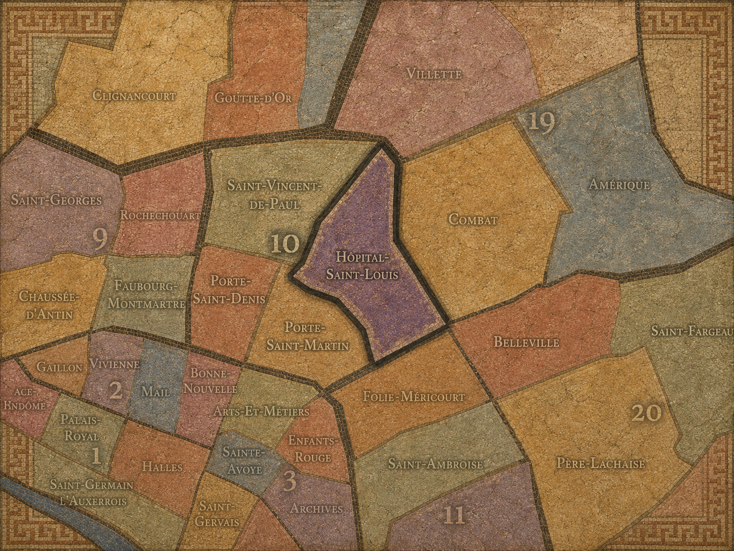
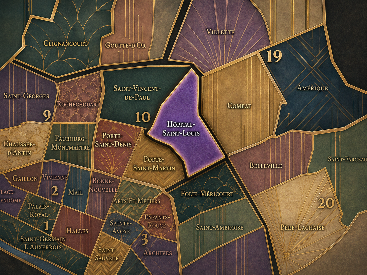
The Map
Geographic Setting
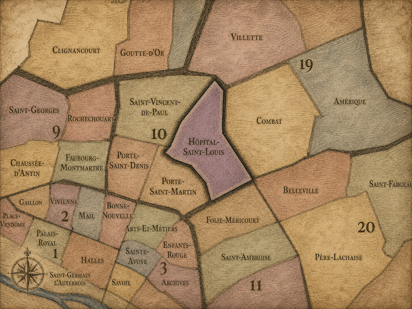
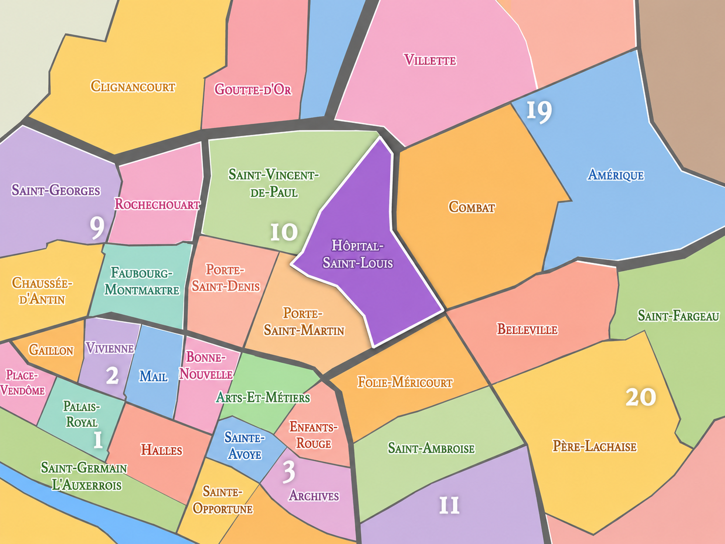
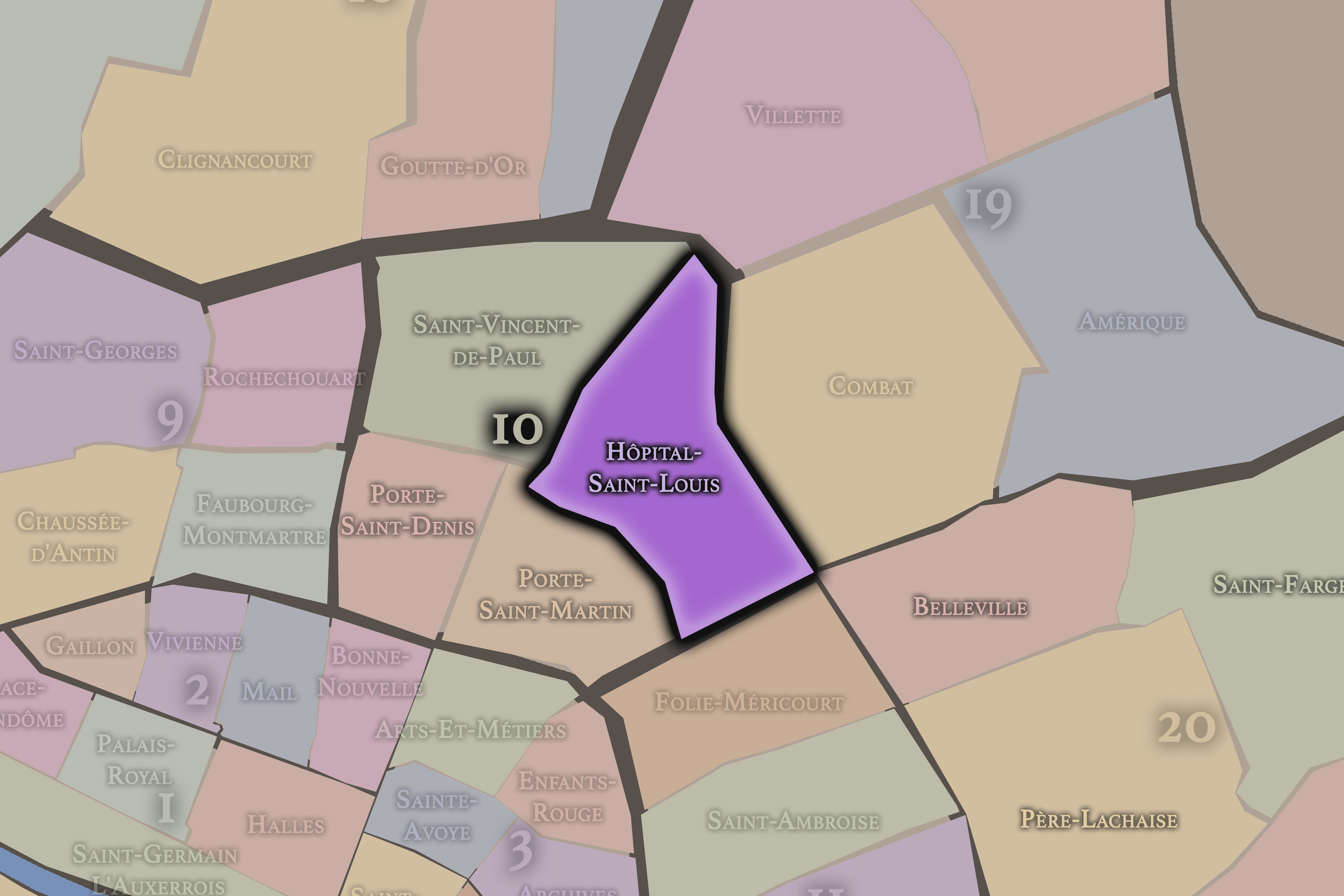
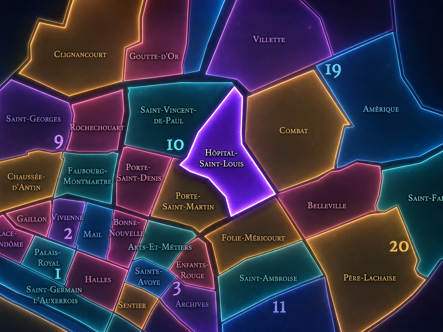
Hôpital-Saint-Louis occupies the southeastern portion of the 10th arrondissement, where the old northeastern edge of Paris gathers around canal water, hospital walls, working streets, residential blocks, and the transitions toward République, Belleville, La Villette, and the Faubourg du Temple. It lies east of Porte-Saint-Martin, south and east of Saint-Vincent-de-Paul, and near the boundary with the 11th arrondissement, forming one of the 10th’s most distinctive interior landscapes: less defined by railway grandeur than by institutional enclosure, neighborhood movement, and the quiet gravity of care.
The quarter is anchored by the Hôpital Saint-Louis, one of Paris’s historic hospitals, whose brick-and-stone architecture and enclosed grounds still give the neighborhood a powerful center of identity. Around it stretch streets such as Rue Bichat, Rue de la Grange-aux-Belles, Rue du Faubourg-du-Temple, Rue de Lancry, Rue Juliette-Dodu, Rue Alibert, and the approaches to the Canal Saint-Martin. The hospital sits close to one of the city’s most animated contemporary walking corridors, yet it carries an older and more solemn memory: plague, public health, medical care, and the city’s effort to protect itself from crisis.
Unlike Porte-Saint-Martin and Porte-Saint-Denis, whose identities are shaped by gates, boulevards, theaters, and old routes into Paris, Hôpital-Saint-Louis is more inward. Its geography is not organized around a triumphal arch or railway station, but around an institution set apart from the street. It is a quarter where the city pauses around walls, courtyards, wards, and the long civic duty of healing.
Administrative Quarter Identity
Etymology and Origins
The name Hôpital-Saint-Louis comes directly from the Hôpital Saint-Louis, founded under Henri IV in the early 17th century and named for Saint Louis, King Louis IX of France. The hospital was created in response to public health needs, especially the recurring threat of plague, and was deliberately located outside the densest center of Paris to isolate contagious disease from the crowded urban core.
The name therefore carries both royal and medical meaning. “Saint-Louis” links the institution to one of the most revered kings in French history, a figure associated with piety, justice, and sanctified monarchy. “Hôpital” grounds that reverence in practical civic service: the care of bodies, the management of illness, the containment of epidemic threat, and the responsibility of the city toward the vulnerable and sick.
As an administrative quarter name, Hôpital-Saint-Louis is unusually direct and humane. It does not name a market, a gate, a theater, a former village, or an aristocratic estate. It names a hospital. That gives the quarter a moral center. Its identity begins with the body in crisis and the city’s obligation to respond.
Civic Framework
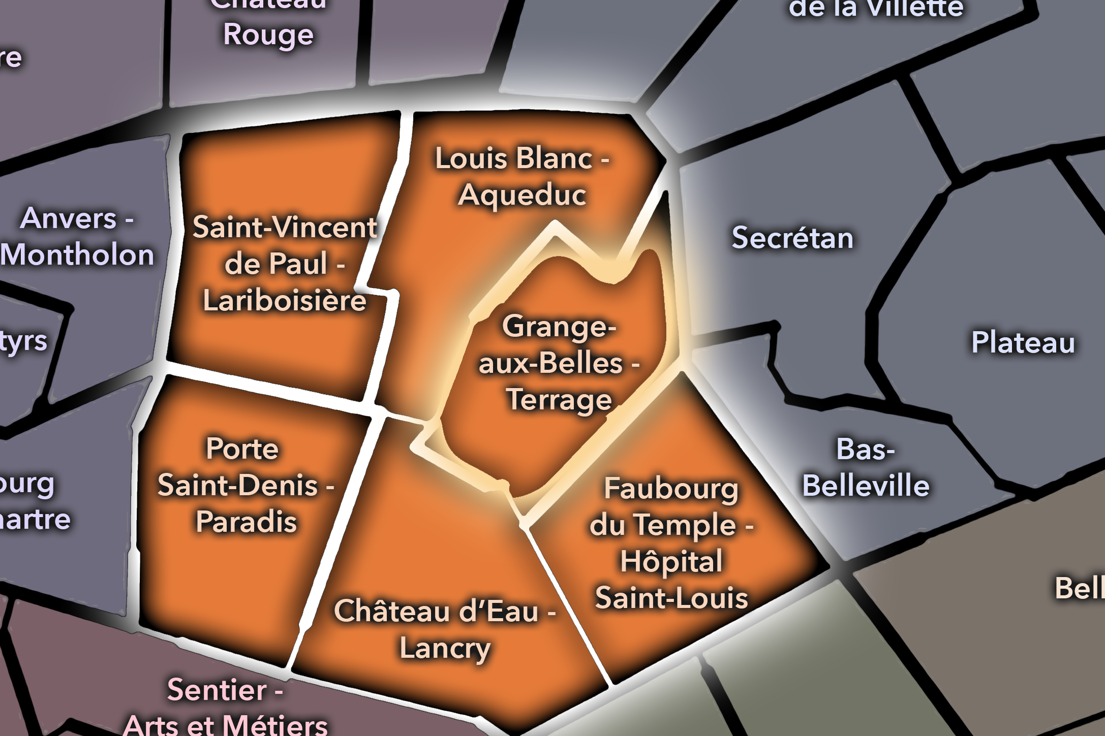
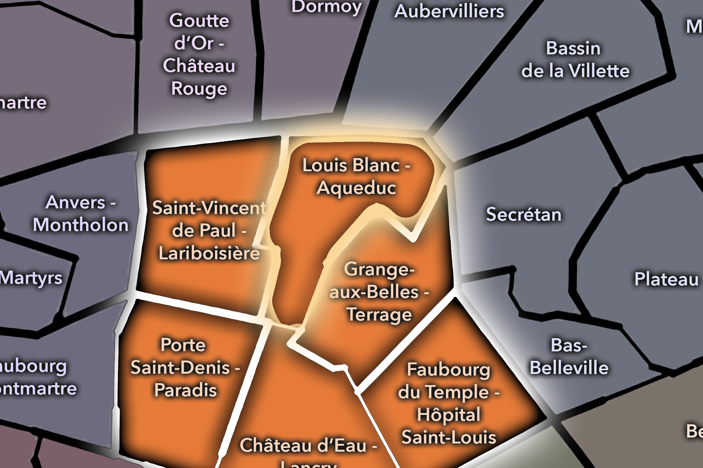
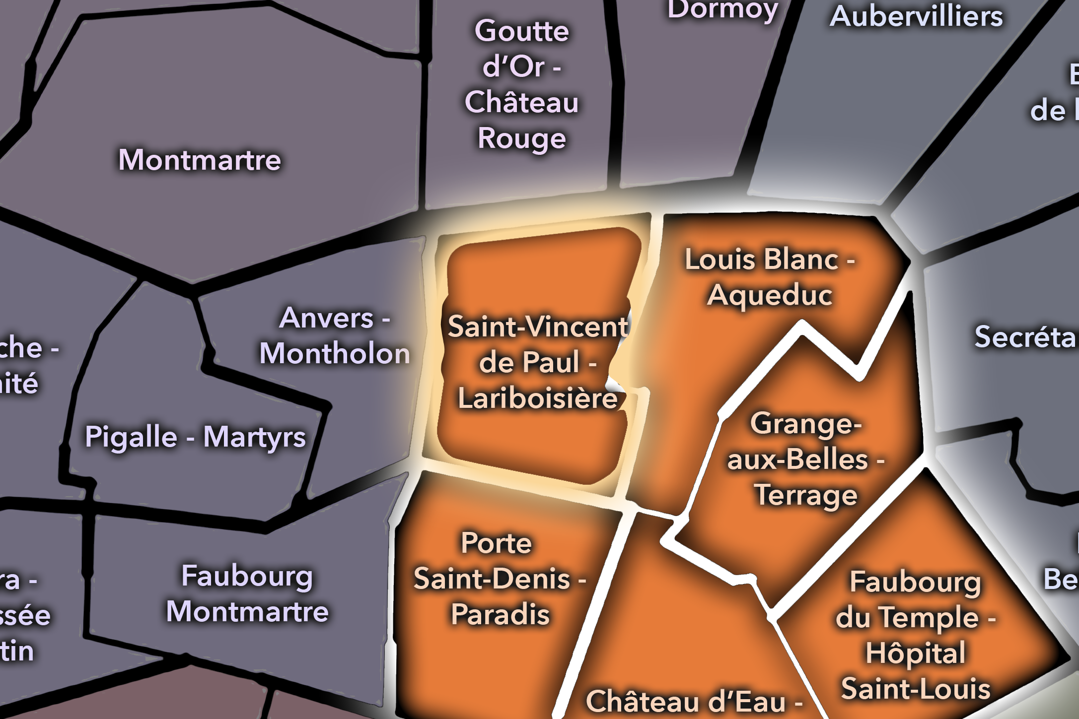
Within the official geography of Paris, Hôpital-Saint-Louis is one of the four administrative quarters of the 10th arrondissement, alongside Saint-Vincent-de-Paul, Porte-Saint-Denis, and Porte-Saint-Martin. It occupies the arrondissement’s southeastern sector, connecting the hospital district to the Canal Saint-Martin, the Faubourg du Temple, the République edge, and the residential and commercial streets that lead toward Belleville and the northeastern city.
As an administrative quarter, Hôpital-Saint-Louis gives civic shape to an area that can otherwise be described through several neighboring identities: Canal Saint-Martin, République, Faubourg du Temple, Goncourt, Belleville edge, or the hospital district. The official name restores the hospital as the defining anchor, reminding us that this part of the 10th arrondissement is not only animated by cafés, canals, nightlife, and residential streets, but also by one of Paris’s long-standing medical institutions.
This civic frame is especially useful because the 10th arrondissement is often understood through movement: stations, boulevards, gates, canals, and routes outward. Hôpital-Saint-Louis adds a different kind of structure. It is not primarily a place of transit, but of care. It gives the arrondissement an interior stillness that balances the movement around it.
Neighborhood Distinction
Hôpital-Saint-Louis differs from the other quarters of the 10th arrondissement through its institutional and medical identity. Saint-Vincent-de-Paul is strongly shaped by the Gare du Nord, Gare de l’Est, churches, rail corridors, and the great arrival landscapes of northern Paris. Porte-Saint-Denis and Porte-Saint-Martin are defined by old city gates, boulevard theaters, historic routes, and the lively commercial corridors between the old center and the northeastern faubourgs.
Hôpital-Saint-Louis is quieter, more enclosed, and more residential in tone. Its defining landmark is not a gate of entry, but a place of treatment. Its streets carry the energy of the canal and surrounding neighborhoods, but the hospital gives the quarter a distinct gravity. It is a place where the public life of the street meets the private vulnerability of illness.
It should also be distinguished from Canal Saint-Martin as a cultural district. The canal has become one of the area’s strongest contemporary identities, associated with waterside walking, cafés, bridges, boutiques, and young urban leisure. Hôpital-Saint-Louis overlaps with that world, but it is not reducible to it. The hospital gives the quarter an older civic and medical depth beneath the canal’s more visible contemporary atmosphere.
Parisian Identity
Hôpital-Saint-Louis expresses Paris as a city of care under pressure. The quarter’s identity begins with one of the great urban questions: how does a dense city respond to disease? The hospital’s early purpose was tied to isolation, treatment, and public health in a period when epidemics could reshape urban life. Its location outside the older center reflected a practical and moral decision: the sick had to be cared for, but contagious illness also had to be managed spatially.
This gives the quarter a Parisian identity very different from the city’s more celebrated landscapes of beauty, pleasure, and display. Hôpital-Saint-Louis belongs to the Paris of necessity. Its architecture is dignified, but its meaning is not ornamental. It exists because cities are fragile, bodies are vulnerable, and public life depends on institutions that often remain quiet until crisis makes them visible.
At the same time, the quarter is not only solemn. Around the hospital, the neighborhood has become one of the 10th arrondissement’s most active and layered urban environments: canal walks, cafés, apartment streets, schools, shops, and the constant movement between République, Belleville, and the northern stations. Hôpital-Saint-Louis therefore holds a distinctly Parisian contrast: care and leisure, enclosure and street life, historic medicine and contemporary neighborhood energy.
Neighborhood Connections
Every neighborhood belongs to a wider Parisian fabric.
-
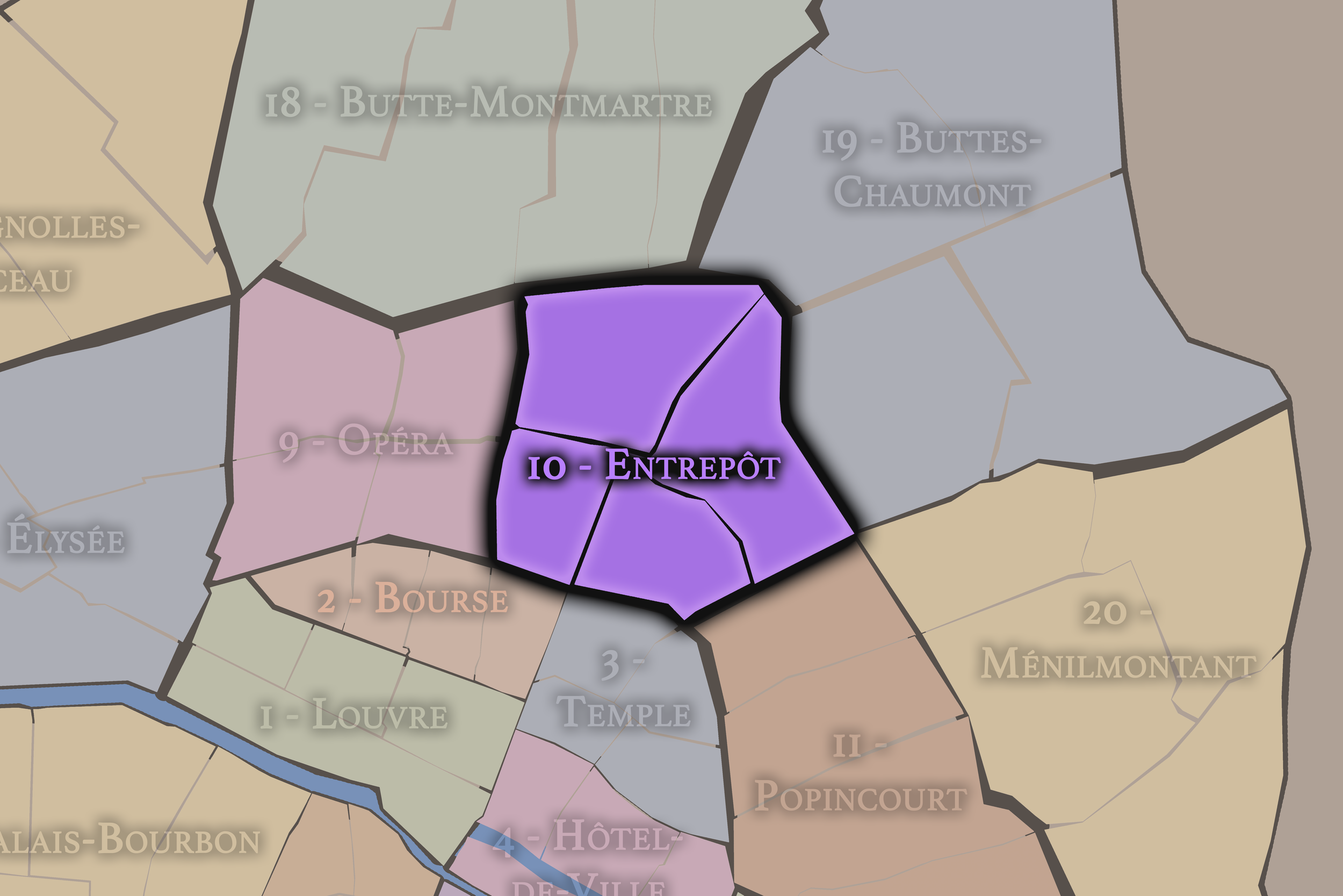
10e — Entrepôt
-
Grange-aux-Belles - Terrage
-
Louis Blanc - Aqueduc
-
Saint-Vincent de Paul - Lariboisière
-

Rive Droite
The History
Origins
The origins of Hôpital-Saint-Louis lie in the early modern response to epidemic disease and the expansion of Paris beyond its older walls. Before the area became part of the modern 10th arrondissement, it stood outside the densest central city, in a landscape of fields, roads, religious properties, workshops, and suburban development north and east of the old Right Bank.
The hospital was founded in the early 17th century under Henri IV after devastating outbreaks of plague revealed the need for a dedicated institution outside the city center. Its design and placement reflected both medical understanding and urban fear: the sick needed care, but contagious illness required distance from the crowded neighborhoods of central Paris. The hospital’s origin is therefore inseparable from the spatial logic of public health.
From the beginning, the institution shaped the surrounding landscape. It was not simply inserted into an existing dense neighborhood; it helped define the area’s future identity. Around the hospital, the city would later expand, but the original logic remained legible: a place set apart for care, gradually absorbed into the growing city.
16th–17th Century
In the 16th century, the future Hôpital-Saint-Louis quarter remained beyond the main body of Paris, part of the outer northeastern landscape through which roads, fields, religious lands, and early faubourg development connected the city to the surrounding countryside. This peripheral position would become essential to the hospital’s creation.
The decisive moment came in the 17th century. The Hôpital Saint-Louis was built in the reign of Henri IV as a response to plague and infectious disease. Its architecture drew on the language of order and enclosure: pavilions, courtyards, walls, and controlled circulation. The hospital was meant to separate and treat, to organize illness within a disciplined environment beyond the crowded core of the city.
This period established the quarter’s enduring identity. Unlike many neighborhoods whose names came from organic street life, Hôpital-Saint-Louis was shaped by institutional purpose from the beginning. It was a civic answer to danger — a built expression of public health before modern medicine had the tools it would later develop.
18th Century
In the 18th century, Hôpital-Saint-Louis continued to serve as an important medical institution on the northeastern edge of Paris. The surrounding area remained less formal and less prestigious than the western districts, but it was increasingly drawn into the life of the expanding city. Roads, faubourgs, workshops, small industries, and residential development gradually thickened the urban fabric around the hospital.
The hospital’s role remained tied to the management of illness, but medical understanding was changing. Paris in the Enlightenment era became increasingly attentive to questions of classification, hygiene, public welfare, and institutional reform. Hospitals were not only places of charity; they became subjects of civic thought, administrative concern, and emerging medical knowledge.
The French Revolution transformed the wider institutional landscape of Paris, including religious and charitable foundations. In this new order, hospitals and public care became part of the reorganized civic responsibility of the state and city. Hôpital-Saint-Louis survived not as a remnant of royal charity alone, but as part of the modernizing system of urban medicine.
19th Century
The 19th century reshaped Hôpital-Saint-Louis and its quarter through medical specialization, urban expansion, and the development of the northeastern arrondissements. As Paris grew outward, the hospital was no longer at the distant edge of the city. Streets, housing, workshops, canals, and transportation networks gathered around it, making the institution part of a denser urban neighborhood.
The hospital became especially important in dermatology and the treatment of skin diseases, giving it a specialized medical identity within Paris. This reinforced the quarter’s association not only with care, but with medical knowledge and clinical observation. In the 19th century, Parisian medicine became internationally influential, and institutions such as Hôpital Saint-Louis contributed to that reputation through teaching, classification, and practice.
The construction and growing importance of the Canal Saint-Martin also shaped the surrounding neighborhood. The canal brought water infrastructure, transport, warehouses, industry, and later a distinctive urban landscape of locks and bridges. Hôpital-Saint-Louis therefore stood within a quarter where medicine, labor, infrastructure, and residential growth increasingly overlapped.
Early–Mid 20th Century
In the early and mid 20th century, Hôpital-Saint-Louis remained a major medical institution embedded within a dense working and residential district. The hospital continued to treat patients, train doctors, and contribute to specialized medical knowledge, while the surrounding streets held the mixed life of the 10th arrondissement: workers, immigrants, small businesses, cafés, schools, workshops, and canal-side activity.
The quarter’s medical identity carried special significance during times of crisis. Wars, occupation, liberation, public health emergencies, and postwar reconstruction all shaped the meaning of hospitals in Paris. Hôpital-Saint-Louis was part of the city’s infrastructure of survival — not always visually dramatic, but essential to the life of the capital.
During this period, the surrounding neighborhood remained more practical than polished. The canal and nearby faubourg streets carried industrial and working-class associations. The hospital’s dignified architecture stood within a district of everyday necessity. That contrast gave the quarter its particular strength: an institution of care at the center of a city that continued to work, struggle, and change around it.
Late 20th Century
In the late 20th century, Hôpital-Saint-Louis continued to evolve within a changing 10th arrondissement. The hospital remained a major medical anchor, while the surrounding Canal Saint-Martin area began to shift gradually from industrial and working-class associations toward new residential, cultural, and leisure identities. The transformation was uneven, but increasingly visible.
As warehouses, workshops, and older commercial uses changed or disappeared, cafés, restaurants, galleries, boutiques, and renovated apartments began to reshape parts of the neighborhood. The canal became more valued as public space, and the district gained a new atmosphere of urban sociability. Yet the hospital’s presence kept the quarter tied to a deeper civic function than leisure alone.
This period gave Hôpital-Saint-Louis a layered modern identity. It was no longer simply a hospital set within a working district, nor merely a canal-adjacent neighborhood in transition. It became a place where older public health infrastructure, medical specialization, residential change, and cultural reinvestment all coexisted.
21st Century
In the 21st century, Hôpital-Saint-Louis remains one of the 10th arrondissement’s most meaningful quarters. The hospital continues to anchor the neighborhood, while the surrounding streets participate in the contemporary identity of the Canal Saint-Martin area: cafés, bridges, restaurants, apartments, shops, schools, nightlife, and a steady flow of walkers moving between République, Goncourt, and the northern stations.
Today, the quarter’s identity depends on balance. The canal-side atmosphere can make the area feel lively, youthful, and recreational, but the hospital reminds the neighborhood of an older and more serious civic purpose. In a city increasingly shaped by lifestyle districts and visual branding, Hôpital-Saint-Louis keeps the reality of public care at the center of the map.
For CityNeighborhoods: Paris, Hôpital-Saint-Louis is essential because it shows how an administrative quarter can be defined by responsibility. It is not only a historic hospital district, not only a canal neighborhood, and not only a residential section of the 10th. It is a place where Paris’s public health history, institutional architecture, working-class surroundings, and contemporary urban life remain deeply intertwined.
Spirit and Legacy
Hôpital-Saint-Louis is the quarter where Paris remembers that cities must care for bodies as well as build monuments. Its spirit is humane, enclosed, resilient, and quietly profound. It belongs to hospital walls and canal bridges, wards and courtyards, street cafés and medical corridors, epidemic memory and everyday neighborhood life.
Its legacy is the transformation of isolation into belonging. A hospital built outside the crowded city to manage plague became absorbed into the modern city itself. A place once set apart for contagion became a neighborhood anchor. Medical care, public health, teaching, and research gave the quarter a civic identity that has endured across centuries.
To walk Hôpital-Saint-Louis is to encounter Paris through care rather than spectacle. The quarter does not ask to be admired in the way of a grand avenue or cathedral. It asks to be understood as one of the city’s essential moral landscapes: a place where vulnerability, knowledge, architecture, and public duty meet inside the fabric of daily life.
The Photography
Visual Identity

The visual identity of each Paris district begins with its position in the city’s layered geography. Before the photographs arrive, the maps establish a first way of seeing: where the district sits, what civic layer it belongs to, which boundaries define it, and how it connects to the surrounding fabric of Paris. In CityNeighborhoods Paris, cartography is not merely orientation; it is part of the visual language of the project.
As the photographic archive grows, this section will continue to develop through images gathered on foot. Streets, façades, monuments, markets, parks, river edges, passages, signs, textures, and everyday details will gradually reveal how each district presents itself visually. The goal is not only to show what a place looks like, but to trace how its identity becomes visible through form, atmosphere, memory, and use.
Through The Lens

CityNeighborhoods Paris is built from walking, looking, and returning. Each district is approached through photography as a way of paying attention: to the obvious landmarks and the quieter details, to historic structures and ordinary streets, to the moments where civic geography becomes lived experience. The camera becomes a tool for noticing how Paris changes from one district to the next, and how each place holds its own relationship to the larger city.
As photographs are processed and added, this section will become a more specific visual record of the district. Future updates may include dated field notes, galleries, and reflections from individual walks. For now, the page remains part of the larger CityNeighborhoods effort to document every Paris neighborhood through maps, history, identity, and photography — one district, one walk, and one visual encounter at a time.
If you visit Paris, these ideas can help inspire your own photography.


Paris: J’Espere, Je Rêve, Je Vive
Paris Photo Gallery
Paris Flâneur Notes
Flâneur Notes document the walks, photographs, light, and street-level observations behind this neighborhood entry. Learn more about the Spirit of the Flâneur.


Explore Paris
-

The twenty arrondissements form the civic spiral of Paris, organizing the city into its broad local districts of government, identity, and daily life.
-

Each arrondissement is divided into four official administrative quarters, giving Paris a more precise civic and geographic framework.
-

The conseils de quartier bring participation to street level, giving residents a voice in neighborhood needs, public space, and local civic life.
-

Les Deux Rives trace Paris through the Seine’s two banks, revealing how the Rive Droite and Rive Gauche shaped the city’s civic power, commerce, learning, art, and cultural identity.
-

Cultural neighborhoods reveal the Paris people recognize through history, cafés, architecture, memory, atmosphere, and local belonging.