
17e - BATIGNOLLES
Quartiers Administratifs
Welcome to the Batignolles neighborhood page! Batignolles is a quartier administratif — an administrative quarter — one of 80 such districts across Paris. As a quartier administratif of the 17e Arrondissement - Batignolles-Monceau, Batignolles belongs to a formal layer of Parisian geography and retains the feel of a village absorbed into the city, with Square des Batignolles, market streets, cafés, rail-side histories, and newer landscapes around Parc Martin-Luther-King.
Part of an ongoing project to walk and photograph every neighborhood in Paris, this page explores 17e Batignolles through maps, district identity, history, and photography.


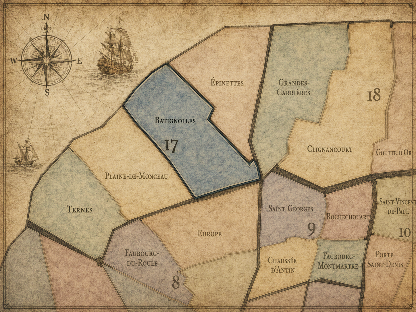
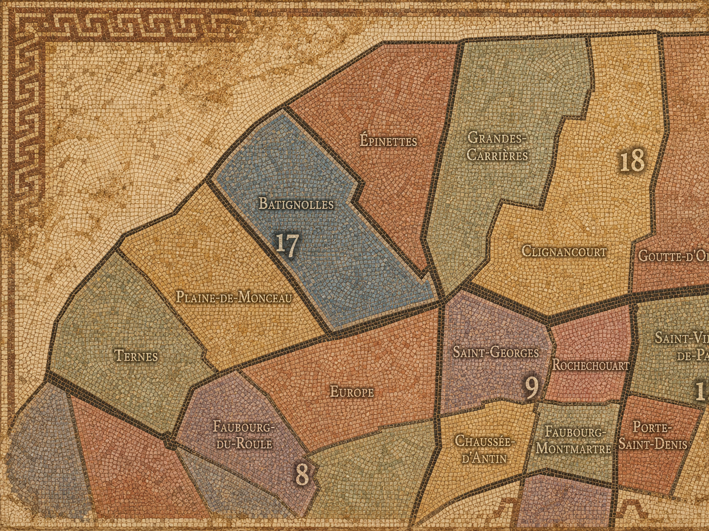
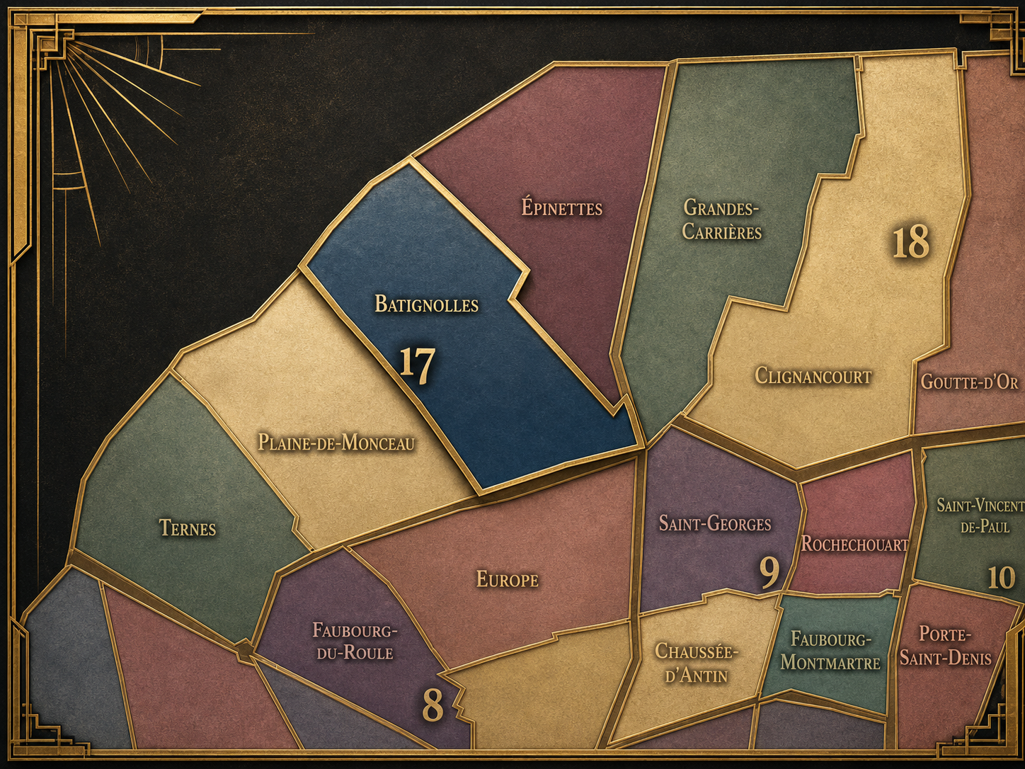
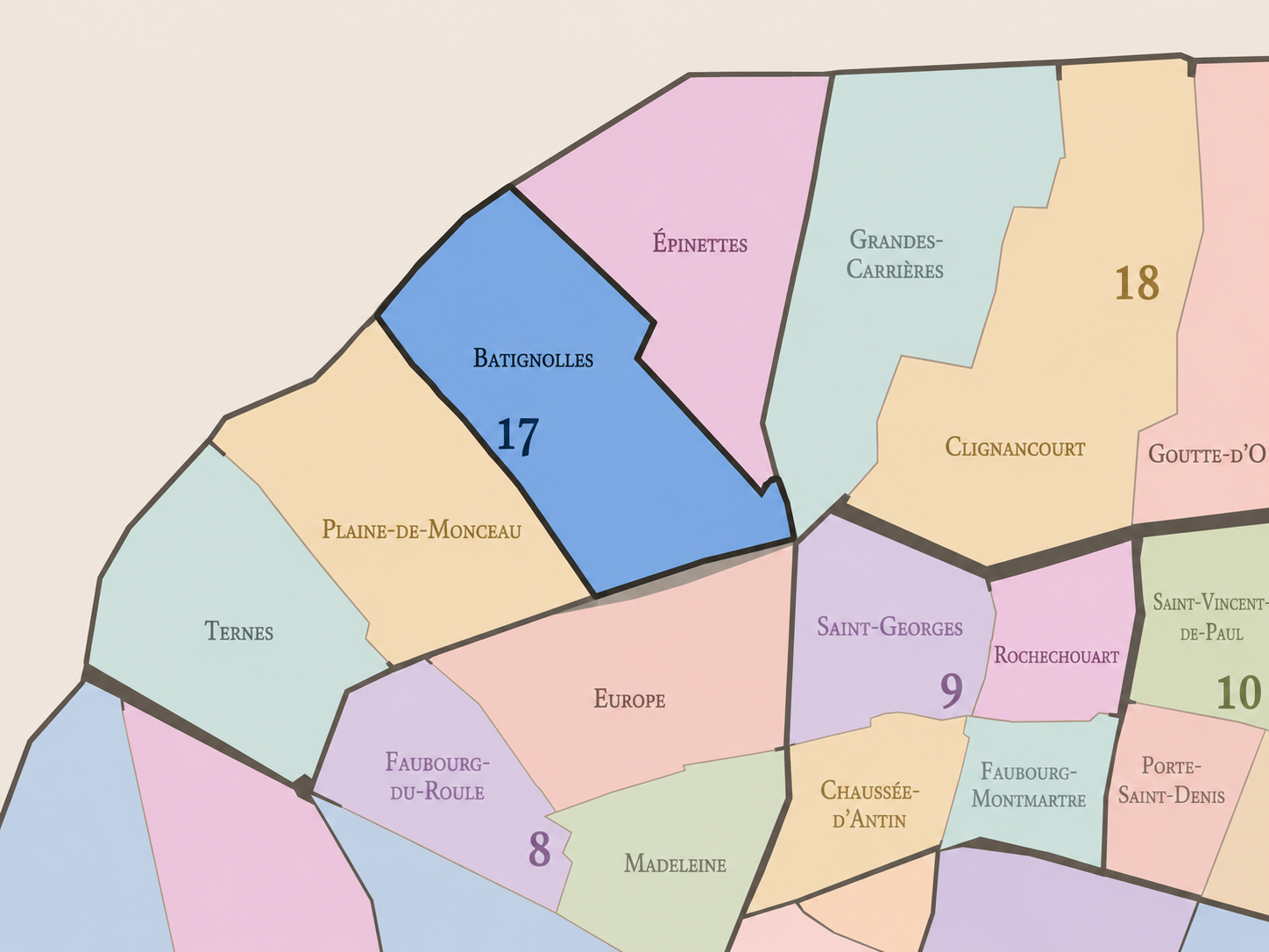
The Map
Geographic Setting
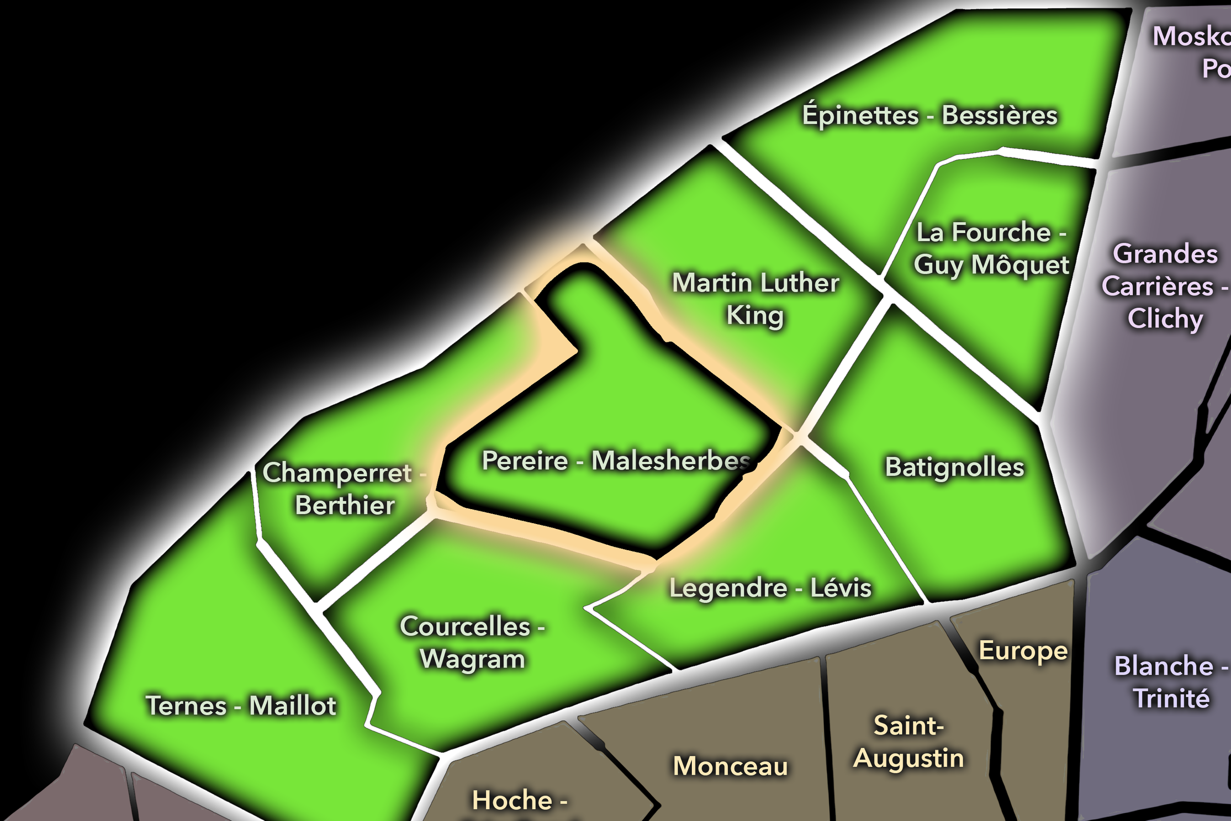
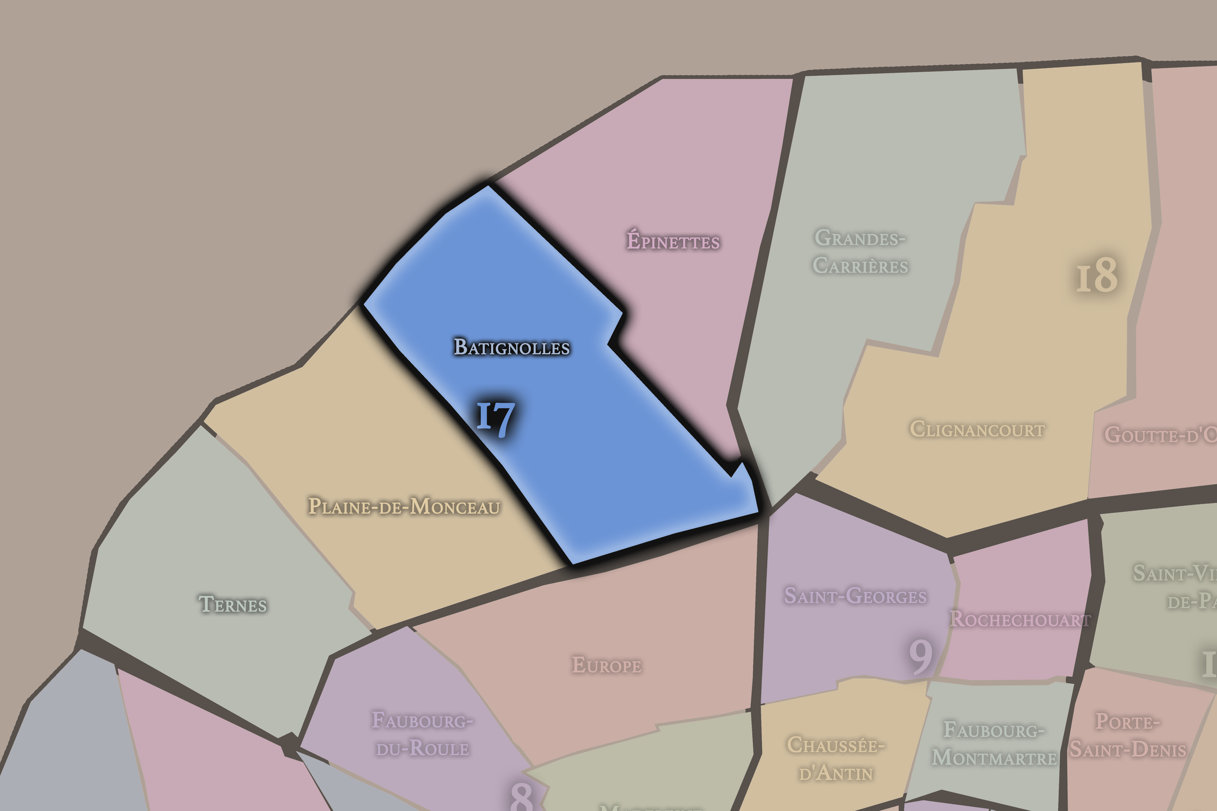
Batignolles occupies the eastern and southeastern portion of the 17th arrondissement, where the old village landscape north of Paris meets the rail corridors of Saint-Lazare, the residential streets around Place de Clichy and Rome, the civic center around the mairie, and the newer urban extensions of Clichy-Batignolles to the north. It lies east of Plaine-de-Monceaux, south and southeast of Épinettes, and west of the 18th arrondissement’s Grandes-Carrières and Clignancourt landscapes. It is one of the 17th arrondissement’s most recognizable quarters because it preserves a strong village-neighborhood identity inside a dense metropolitan district.
The quarter’s geography is shaped by Rue des Batignolles, Rue Legendre, Rue des Dames, Rue Lemercier, Rue de Rome, Boulevard des Batignolles, Avenue de Clichy, Square des Batignolles, the Batignolles cemetery, the railway tracks leading to Gare Saint-Lazare, and the northern redevelopment zones around Martin Luther King Park and the Tribunal de Paris. This is a quarter where several forms of Paris meet: older village streets, 19th-century residential expansion, railway infrastructure, bourgeois apartment blocks, neighborhood commerce, and large-scale 21st-century redevelopment.
Unlike Ternes, whose identity is more western and tied to the Arc de Triomphe, Porte Maillot, and the prestigious routes toward Neuilly, or Plaine-de-Monceaux, whose character is more Haussmannian, bourgeois, and park-adjacent, Batignolles feels more intimate and local. It is the 17th arrondissement as village memory, café life, street markets, school routes, small parks, and the transformation of former industrial rail lands into a new northern urban district.
Administrative Quarter Identity
Etymology and Origins
The name Batignolles comes from an older locality north of Paris, long before the area became part of the capital. Its exact etymology is debated, but it is often connected to old land or settlement terms associated with the plains and fields beyond the city. Like many names on the former edge of Paris, Batignolles preserves the memory of a place that existed before the arrondissement system, before annexation, and before the dense urban fabric of the modern city.
The name became strongly associated with the village and later commune of Batignolles-Monceau, which developed outside Paris before being annexed in 1860. This is central to the quarter’s identity. Batignolles is not merely a neighborhood invented by modern real estate or lifestyle branding. It has a genuine former-village and former-commune history, which explains why the name remains so resonant in the 17th arrondissement today.
There is also a softness to the name that matches the neighborhood’s contemporary image. “Batignolles” suggests a place more local than monumental, more residential than ceremonial. That does not mean the quarter lacks historical depth. Rather, its identity comes from being a former outside that managed, even after annexation, to retain a recognizable neighborhood tone.
Civic Framework
Within the official geography of Paris, Batignolles is one of the four administrative quarters of the 17th arrondissement, alongside Épinettes, Plaine-de-Monceaux, and Ternes. It occupies the arrondissement’s southeastern sector and provides the official civic frame for the old Batignolles village core, the residential streets around the mairie, the Square des Batignolles, the rail-edge landscapes, and part of the broader Clichy-Batignolles transformation.
As an administrative quarter, Batignolles helps clarify a district that is often described through overlapping lived names: Batignolles village, Rome, Place de Clichy edge, Brochant, Clichy-Batignolles, Martin Luther King, or the northern rail yards. Those names each identify one layer of the area. Batignolles is the official frame that gathers the older village, the 19th-century quarter, the railway inheritance, and the contemporary redevelopment into one mapped unit.
This civic frame is especially useful because Batignolles has expanded in meaning over time. For some, it evokes the old streets near Square des Batignolles and Rue des Batignolles. For others, it now includes the newer eco-district around Martin Luther King Park. The administrative quarter gives those layers a stable base while allowing the cultural understanding of Batignolles to keep evolving.
Neighborhood Distinction
Batignolles differs from the other quarters of the 17th arrondissement through its strong village identity, its railway-edge history, and its contemporary role as one of Paris’s most visible examples of neighborhood reinvention. Ternes is more western, prestigious, and connected to the Arc de Triomphe, Avenue des Ternes, Porte Maillot, and the routes toward Neuilly. Plaine-de-Monceaux is more classically bourgeois and Haussmannian, tied to Parc Monceau, grand apartment buildings, private mansions, and the refined expansion of western Paris. Épinettes is more northern, working-class in memory, and associated with the former industrial and residential edge near Clichy and Saint-Ouen.
Batignolles sits between these worlds. It is more intimate than Plaine-de-Monceaux, more village-like than Ternes, and more polished in contemporary identity than parts of Épinettes. Its distinction lies in the coexistence of old and new neighborhood forms: the square, the market street, the mairie, the cafés, the rail trench, the old cemetery, the former workshops, the redevelopment parks, and the new civic architecture rising on former railway land.
It should also be distinguished from Clichy-Batignolles. Clichy-Batignolles is a major redevelopment area and contemporary planning identity within and near the northern part of the quarter. Batignolles is broader and older. Clichy-Batignolles is one chapter in the neighborhood’s transformation; Batignolles is the deeper civic and historical frame.
Parisian Identity
Batignolles expresses Paris as a city of absorbed villages and renewed edges. It is one of those quarters where the capital’s expansion can still be felt in the texture of the street. The neighborhood is Parisian now, unmistakably so, but it still carries the memory of having once been outside Paris — a village and commune with its own life before the city crossed the boundary and absorbed it.
This gives Batignolles a particularly appealing Parisian identity. It has enough density to feel urban, enough local commerce to feel lived-in, enough parks and squares to feel breathable, and enough village memory to feel distinct from the monumental center. It is not Paris as royal axis or museum landscape. It is Paris as neighborhood: social, walkable, domestically scaled, and anchored by routine.
The quarter also shows how contemporary Paris reuses its infrastructural edges. The railway lands that once separated, stored, moved, and supported the city have become the ground for new housing, parkland, public buildings, and environmental planning. In Batignolles, the former edge of the village and the former edge of the rail system both become sites of urban renewal.
Neighborhood Connections
Every neighborhood belongs to a wider Parisian fabric.
-
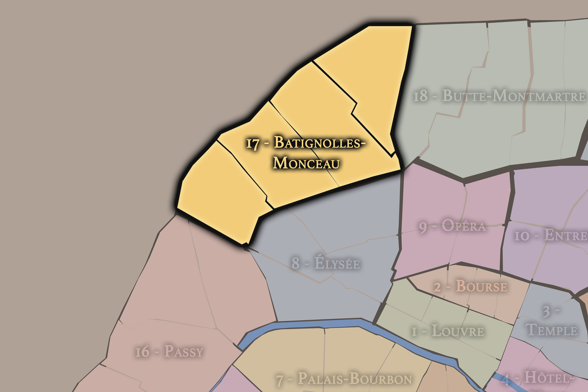
17e — Batignolles-Monceau
-
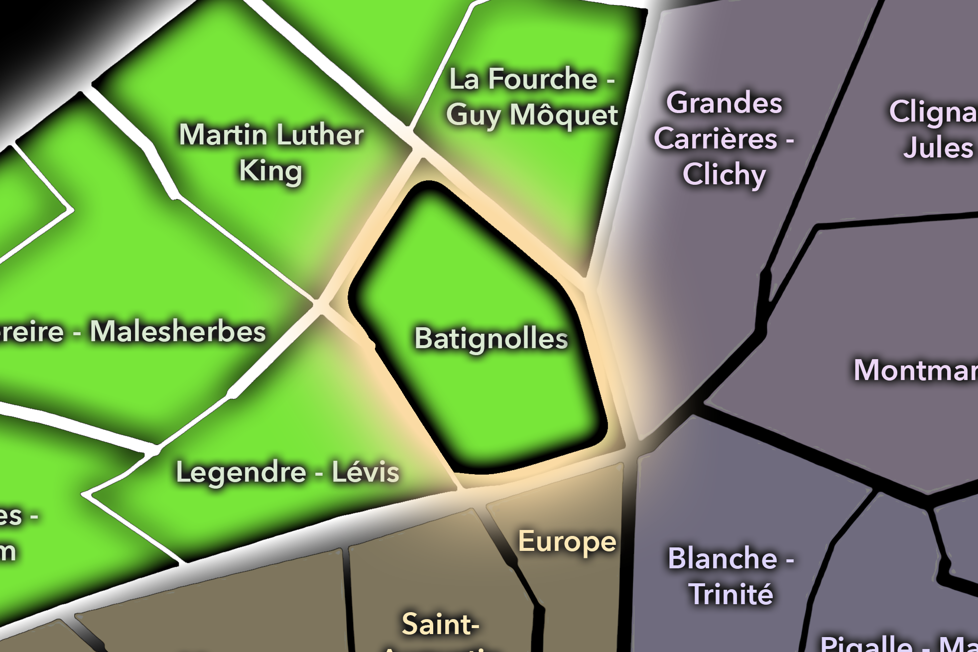
Batignolles
-
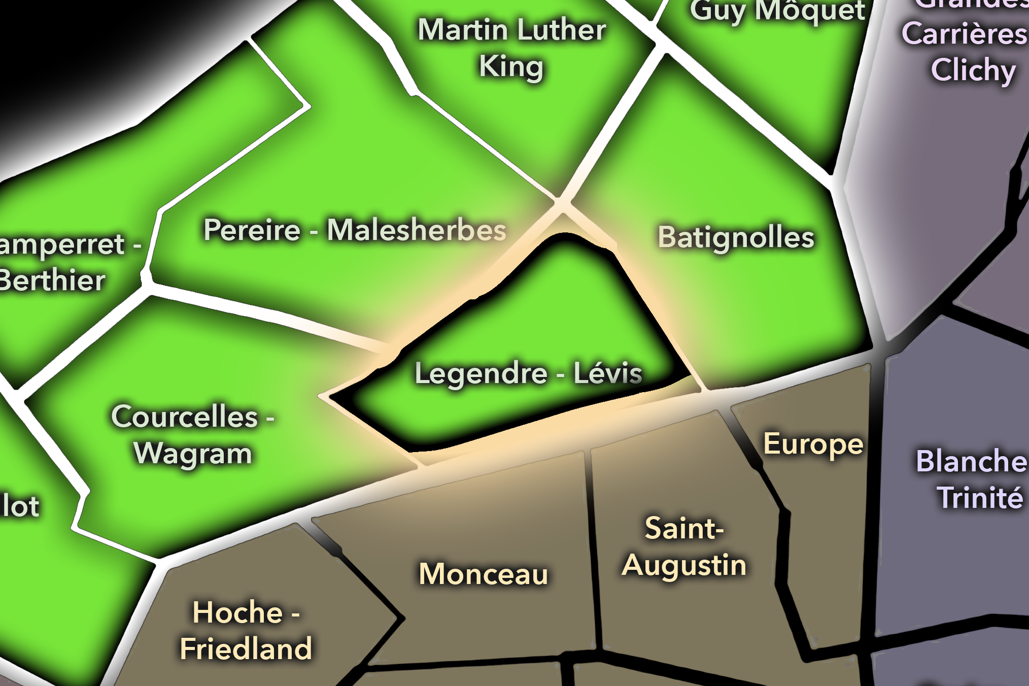
Legendre - Lévis
-
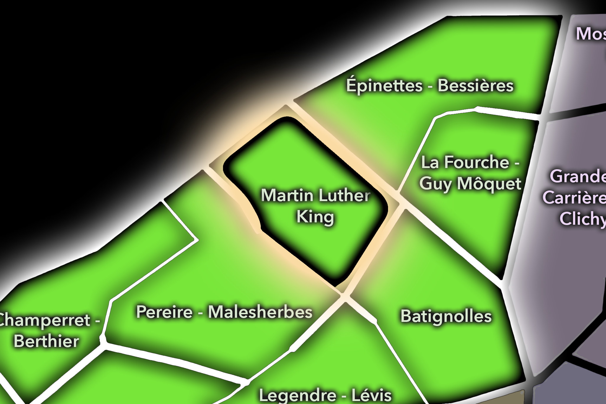
Martin Luther King
-
Pereire - Malesherbes
-

Rive Droite
The History
Origins
The origins of Batignolles lie in the northern outskirts of Paris, on lands that were once outside the city’s older walls and beyond the denser fabric of the central Right Bank. Before it became a Parisian quarter, the area consisted of fields, roads, scattered settlement, small industries, gardens, and land connected to the villages and communes north of the capital.
Its development accelerated as Paris expanded outward in the 18th and especially 19th centuries. The area became part of Batignolles-Monceau, a commune that grew rapidly because of its proximity to Paris and the pressures of urban expansion. People could live outside the capital while remaining tied to its economy, transport, commerce, and social life. This condition of nearness without incorporation shaped the neighborhood’s early identity.
Batignolles therefore began as a threshold place. It was not remote countryside, but it was not yet Paris proper. It was one of the settlements that formed around the capital’s edge, absorbing population, activity, and identity before annexation made it part of the official city.
16th–17th Century
In the 16th and 17th centuries, the future Batignolles quarter lay well outside the dense urban core of Paris. The area belonged to the northern plain beyond the city, shaped by rural land, roads, fields, scattered houses, and the wider geography of villages and estates that surrounded the capital. It had no single monumental identity and was not yet an urban district in the later sense.
This outer condition is important because it explains the later village character of Batignolles. The neighborhood did not emerge from medieval Paris, nor from a royal square, nor from a major church foundation. It grew from the landscape beyond the city, where settlement could expand gradually and locally before being drawn into the metropolitan orbit.
By the end of the 17th century, Paris was increasingly pressing outward, but Batignolles remained part of the outer belt rather than the city itself. The quarter’s future would come through the slow conversion of peripheral land into suburban settlement, then into commune, and finally into Parisian neighborhood.
18th Century
In the 18th century, Batignolles became more closely tied to the expansion of Paris while still retaining its position outside the city. The northern outskirts developed through roads, residences, gardens, small businesses, and growing settlement. The area was increasingly influenced by the capital’s demand for housing and services, but it remained outside the formal urban core.
This was the period when the conditions for Batignolles’ later village and commune identity strengthened. The area’s relative affordability and proximity to Paris made it attractive for residents, artisans, and workers connected to the city. Its location north of the old center allowed it to grow with a different texture from the planned grandeur of western Paris.
By the end of the 18th century, the line between Paris and its outskirts had become increasingly porous. Batignolles was still not part of the capital, but its future was already tied to Paris’s growth. The quarter’s later identity as a former village absorbed into the city rests on this long pre-annexation development.
19th Century
The 19th century made Batignolles one of the defining growth districts of northwestern Paris. The commune of Batignolles-Monceau developed rapidly, drawing residents, workshops, businesses, and transportation infrastructure to the area. The railway approaches to Saint-Lazare became especially important, shaping the district’s northern and eastern edges and linking Batignolles to the modern systems of movement that transformed Paris.
In 1860, Batignolles-Monceau was annexed to Paris, and the area became part of the newly organized 17th arrondissement. This moment transformed Batignolles from an independent suburban commune into an official Parisian quarter. Yet the old identity did not disappear. The neighborhood retained a strong local center, with streets, squares, shops, and civic buildings that continued to preserve a village-like character.
The 19th century also gave Batignolles an important artistic and cultural layer. The area became associated with artists and writers who gathered around the broader Batignolles group, including figures connected to early Impressionism and modern painting. The quarter was not only a residential expansion zone; it was part of the changing cultural geography of Paris in the age of cafés, studios, railways, and modern urban life.
Early–Mid 20th Century
In the early and mid 20th century, Batignolles remained a residential and locally grounded quarter of the 17th arrondissement. Its streets held apartment buildings, shops, cafés, schools, markets, workshops, railway workers, families, and the daily life of a district that was fully Parisian yet still distinct from the more formal quarters nearby. Square des Batignolles and the surrounding streets reinforced the neighborhood’s sense of local center.
The railway landscape continued to shape the quarter’s identity. Tracks, workshops, depots, and rail-related land created both employment and separation. Batignolles lived beside the systems that connected Paris outward, but those same systems also created physical barriers and industrial edges. This tension between village life and infrastructure became one of the quarter’s defining conditions.
During war, occupation, liberation, and postwar recovery, Batignolles shared the experiences of residential Paris: shortages, disruption, local endurance, rebuilding, and demographic change. Its history in this period is less about one monumental event than about the persistence of neighborhood life through the pressures of the century.
Late 20th Century
In the late 20th century, Batignolles retained its local appeal while the former rail and industrial landscapes around it began to be reconsidered. As railway uses changed and the city looked for new opportunities for housing, parks, and public facilities, the northern parts of the quarter became important to debates about urban renewal. The rail-edge identity that had once constrained the neighborhood became the ground for future transformation.
The older Batignolles village core also gained renewed desirability. Its cafés, market streets, family atmosphere, and relative quiet made it attractive to residents seeking a neighborhood that felt local without being far from central Paris. This appeal contributed to rising property values and a gradual shift in the social profile of the area.
At the same time, the quarter’s working and rail-related memory did not vanish. Former workshops, railway edges, older apartment buildings, and local institutions preserved the traces of a more practical Batignolles beneath the increasingly polished neighborhood image. The late 20th century set the stage for the major transformations of the next era.
21st Century
In the 21st century, Batignolles has become one of the most significant examples of contemporary urban transformation in Paris. The Clichy-Batignolles redevelopment, built on former railway land, has added new housing, offices, public facilities, the large Martin Luther King Park, and the Tribunal de Paris, shifting the quarter’s northern identity from industrial edge to planned eco-district. This new landscape has expanded the meaning of Batignolles beyond the older village core.
Today, the quarter is defined by the dialogue between old and new. Around Rue des Batignolles and Square des Batignolles, the neighborhood retains its intimate, village-like atmosphere of cafés, shops, schools, and residential streets. To the north, the newer Clichy-Batignolles sector introduces larger blocks, contemporary architecture, environmental planning, public parkland, and metropolitan civic functions. Together, they make Batignolles one of the most layered quarters of the 17th.
For CityNeighborhoods: Paris, Batignolles is essential because it shows how administrative quarters can contain both historic neighborhood identity and active urban reinvention. It is not merely a charming village district, and not merely a redevelopment zone. It is a former outside turned Parisian neighborhood, then expanded again through the transformation of railway land into a new urban landscape.
Spirit and Legacy
Batignolles is the quarter where northwestern Paris turns village memory into modern renewal. Its spirit is local, sociable, and quietly inventive. It belongs to Square des Batignolles and market streets, railway edges and new parks, old cafés and contemporary housing, school routes and courthouse towers, the former commune and the city still remaking itself around it.
Its legacy is the transformation of periphery into neighborhood. Fields became village, village became commune, commune became Paris, and rail yards became a new district of parks, housing, and civic architecture. Through each change, Batignolles retained one essential quality: a sense of local coherence strong enough to survive absorption and reinvention.
To walk Batignolles is to encounter Paris as continuity through change. The quarter reminds us that neighborhoods are not fixed objects. They are living agreements between memory, infrastructure, daily use, and future plans. In Batignolles, neighborhood identity becomes renewal with roots — the old village still present, even as the city builds forward around it.
The Photography
Visual Identity

The visual identity of each Paris district begins with its position in the city’s layered geography. Before the photographs arrive, the maps establish a first way of seeing: where the district sits, what civic layer it belongs to, which boundaries define it, and how it connects to the surrounding fabric of Paris. In CityNeighborhoods Paris, cartography is not merely orientation; it is part of the visual language of the project.
As the photographic archive grows, this section will continue to develop through images gathered on foot. Streets, façades, monuments, markets, parks, river edges, passages, signs, textures, and everyday details will gradually reveal how each district presents itself visually. The goal is not only to show what a place looks like, but to trace how its identity becomes visible through form, atmosphere, memory, and use.
Through The Lens

CityNeighborhoods Paris is built from walking, looking, and returning. Each district is approached through photography as a way of paying attention: to the obvious landmarks and the quieter details, to historic structures and ordinary streets, to the moments where civic geography becomes lived experience. The camera becomes a tool for noticing how Paris changes from one district to the next, and how each place holds its own relationship to the larger city.
As photographs are processed and added, this section will become a more specific visual record of the district. Future updates may include dated field notes, galleries, and reflections from individual walks. For now, the page remains part of the larger CityNeighborhoods effort to document every Paris neighborhood through maps, history, identity, and photography — one district, one walk, and one visual encounter at a time.
If you visit Paris, these ideas can help inspire your own photography.


Paris: J’Espere, Je Rêve, Je Vive
Paris Photo Gallery
Paris Flâneur Notes
Flâneur Notes document the walks, photographs, light, and street-level observations behind this neighborhood entry. Learn more about the Spirit of the Flâneur.


Explore Paris
-

The twenty arrondissements form the civic spiral of Paris, organizing the city into its broad local districts of government, identity, and daily life.
-

Each arrondissement is divided into four official administrative quarters, giving Paris a more precise civic and geographic framework.
-

The conseils de quartier bring participation to street level, giving residents a voice in neighborhood needs, public space, and local civic life.
-

Les Deux Rives trace Paris through the Seine’s two banks, revealing how the Rive Droite and Rive Gauche shaped the city’s civic power, commerce, learning, art, and cultural identity.
-

Cultural neighborhoods reveal the Paris people recognize through history, cafés, architecture, memory, atmosphere, and local belonging.