
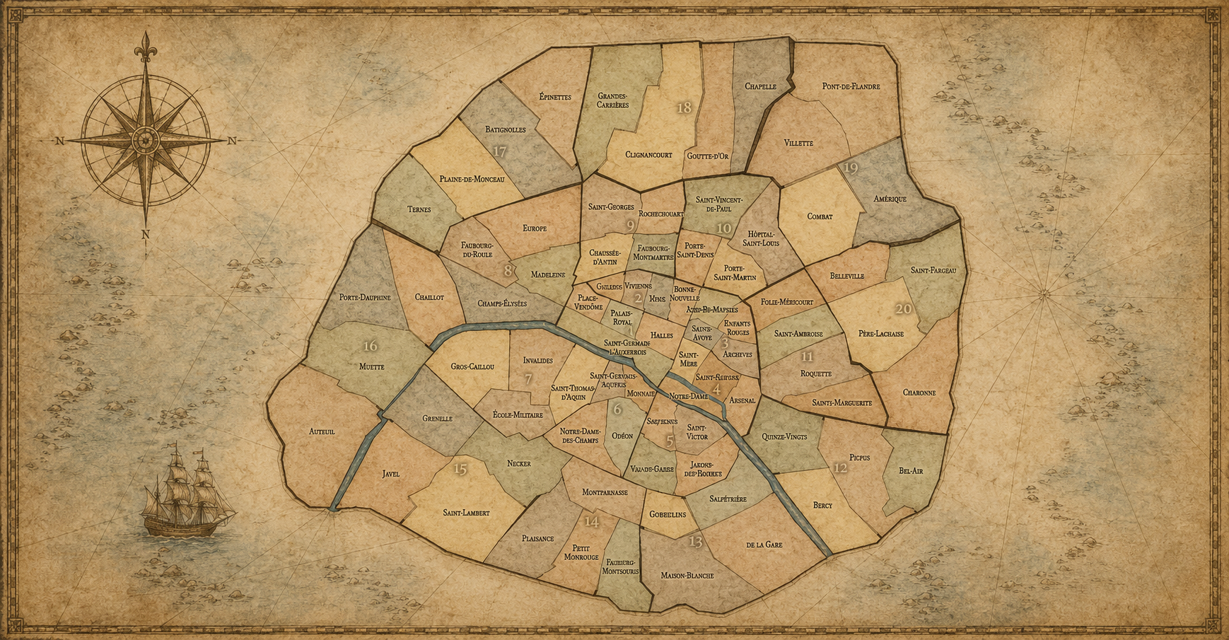
QUARTIERS ADMINISTRATIFS A-Z
A - Z
-
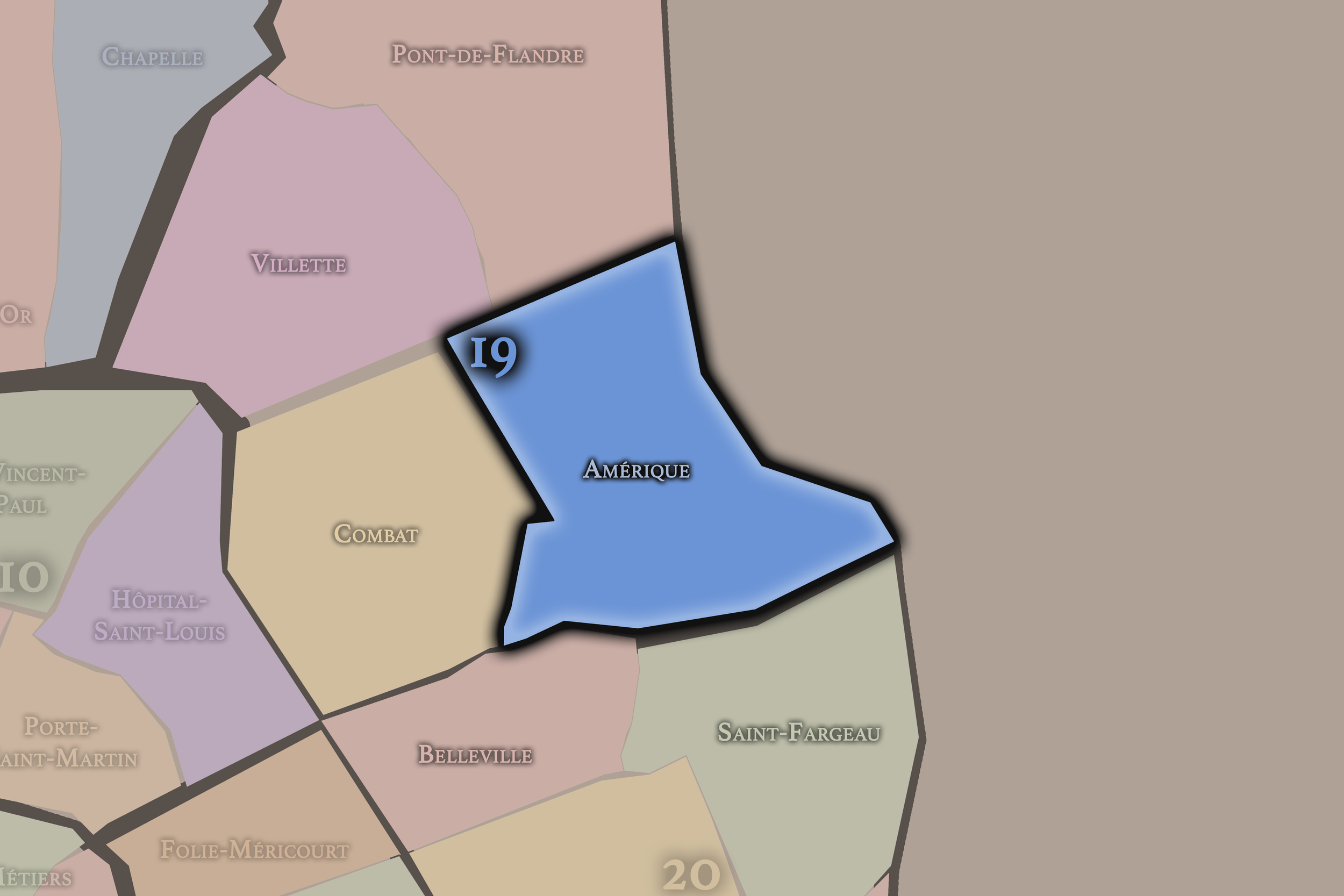
Amérique
19e Arrondissement — Buttes-Chaumont
75th Administrative Quarter
Amérique rises across the northeastern heights of Paris, with quarries, reservoirs, residential streets, and a less touristic but deeply local sense of hilltop neighborhood life.
-
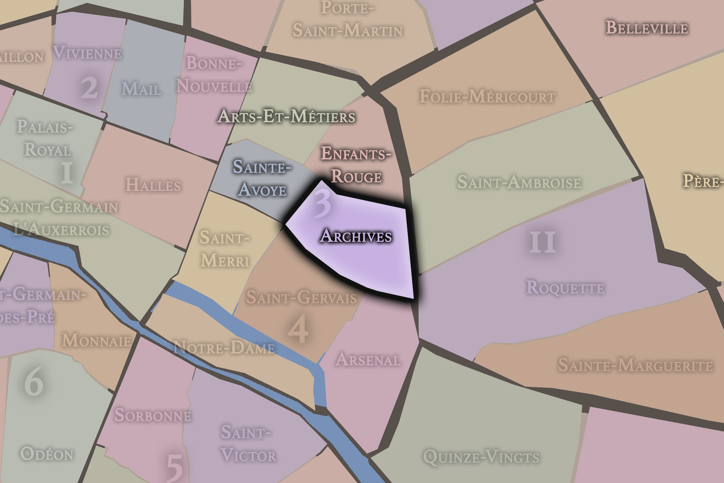
Archives
3e Arrondissement — Temple
11th Administrative Quarter
The Archives quarter holds some of the Marais’s most important civic and aristocratic memory, with historic mansions, museums, garden courtyards, and institutions that preserve the documentary life of France.
-
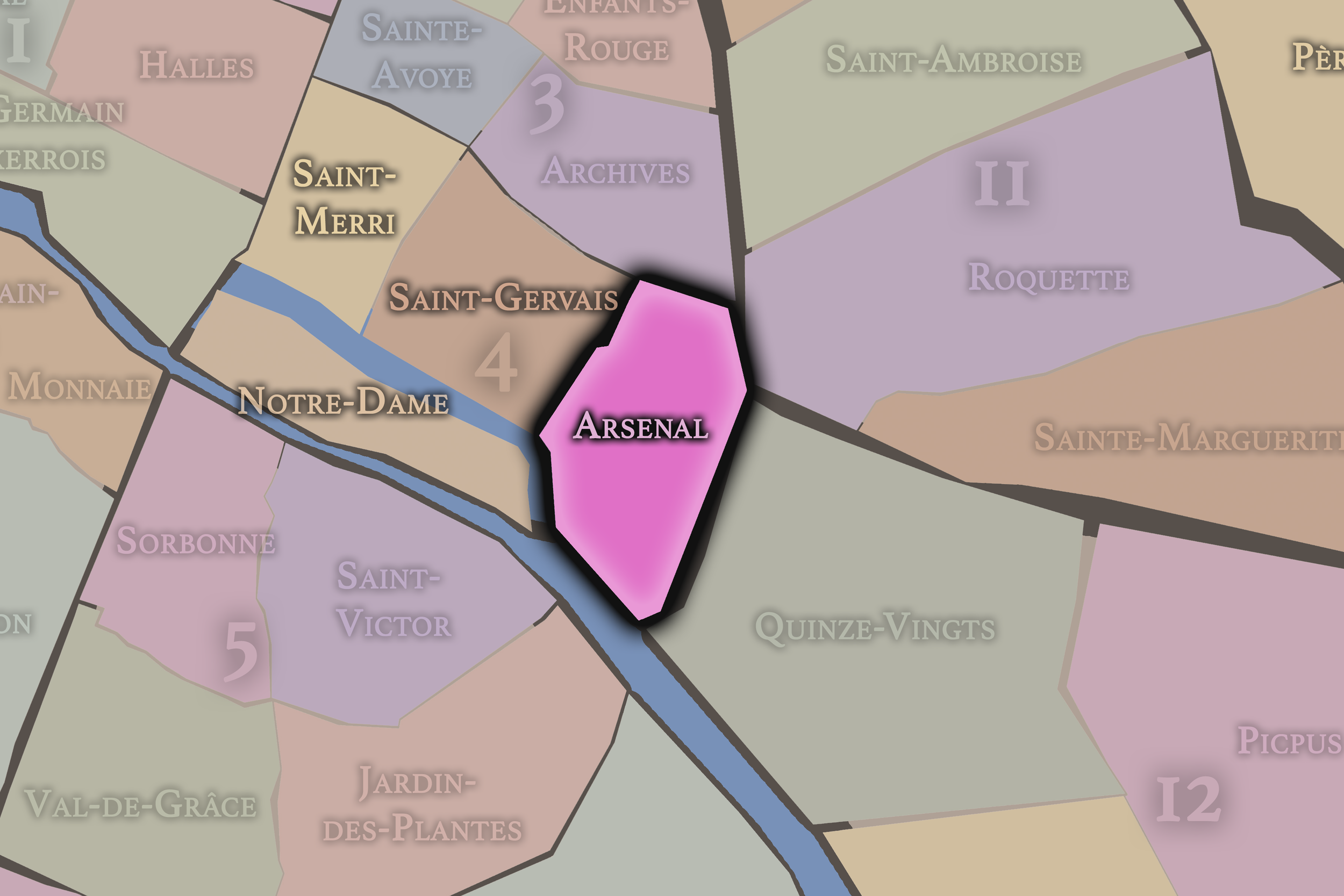
Arsenal
4e Arrondissement — Hôtel-de-Ville
15th Administrative Quarter
Arsenal stretches toward the Bastille and the Bassin de l’Arsenal, carrying traces of royal storehouses, revolutionary memory, waterfront infrastructure, and the transition from the Marais to eastern Paris
-
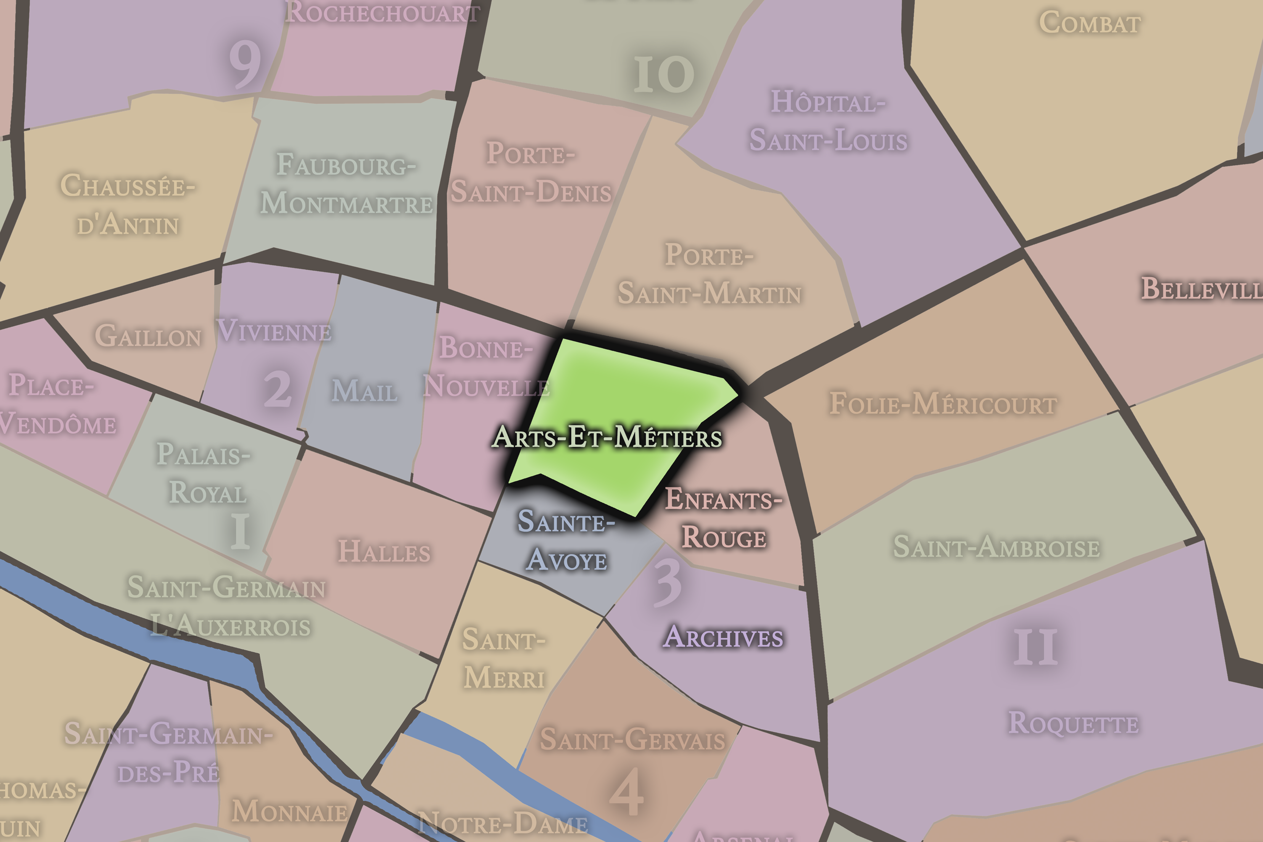
Arts-et-Métiers
3e Arrondissement — Temple
9th Administrative Quarter
Arts-et-Métiers is shaped by invention, craft, and urban industry, anchored by the Conservatoire des Arts et Métiers and surrounded by streets that carry the memory of workshops, commerce, and technical imagination.
-
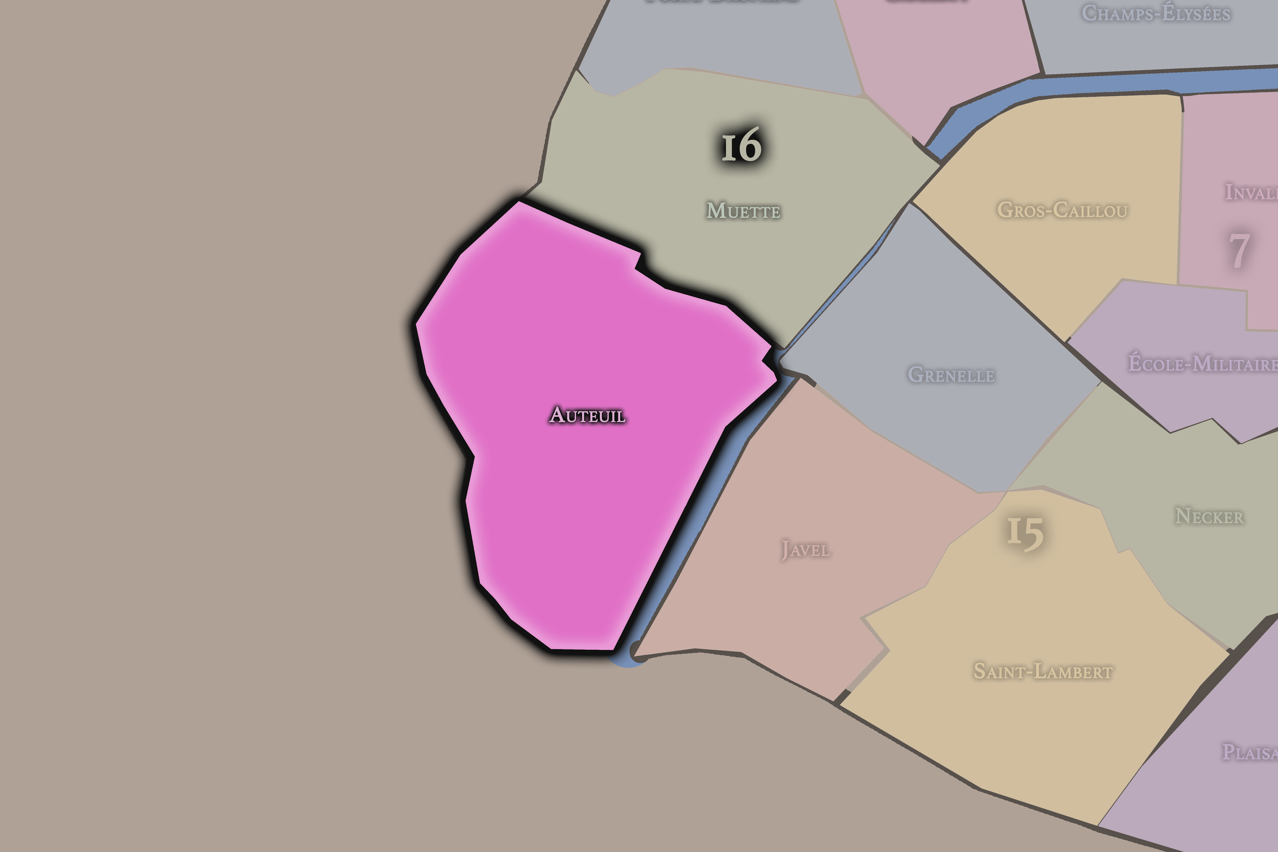
Auteuil
16e Arrondissement — Passy
61st Administrative Quarter
Auteuil preserves the atmosphere of an absorbed village, with villas, gardens, schools, churches, stadiums, and a western residential identity shaped by refinement, greenery, and distance from central Paris.
-
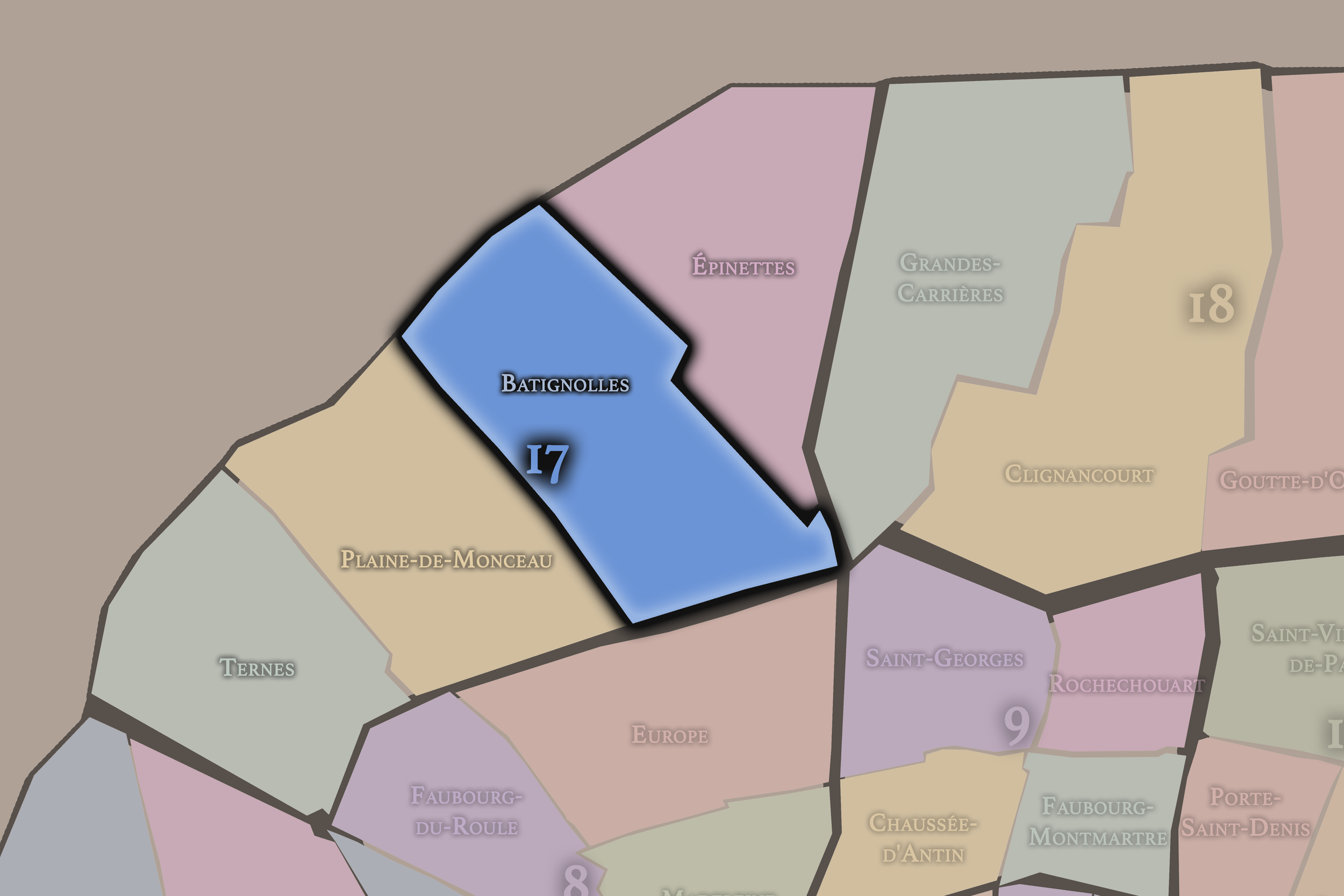
Batignolles
17e Arrondissement — Batignolles-Monceau
67th Administrative Quarter
Batignolles preserves the feel of a former village, with cafés, markets, squares, residential streets, and a creative neighborhood identity that remains distinct within the larger 17th arrondissement.
-
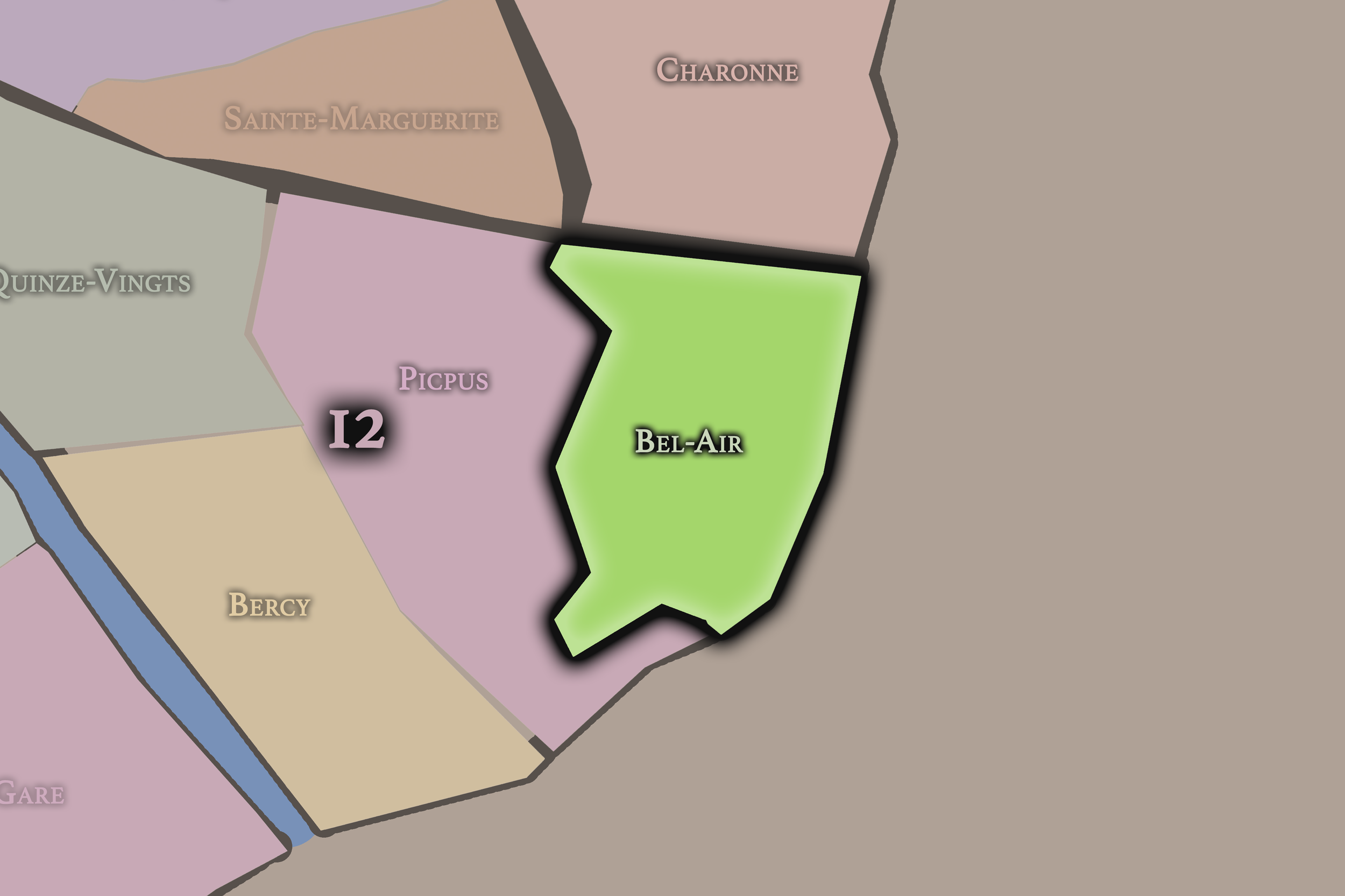
Bel-Air
12e Arrondissement — Reuilly
45th Administrative Quarter
Bel-Air is a quieter eastern quarter shaped by residential streets, schools, hospitals, and the approach to the Bois de Vincennes, offering a more spacious and everyday Parisian landscape.
-
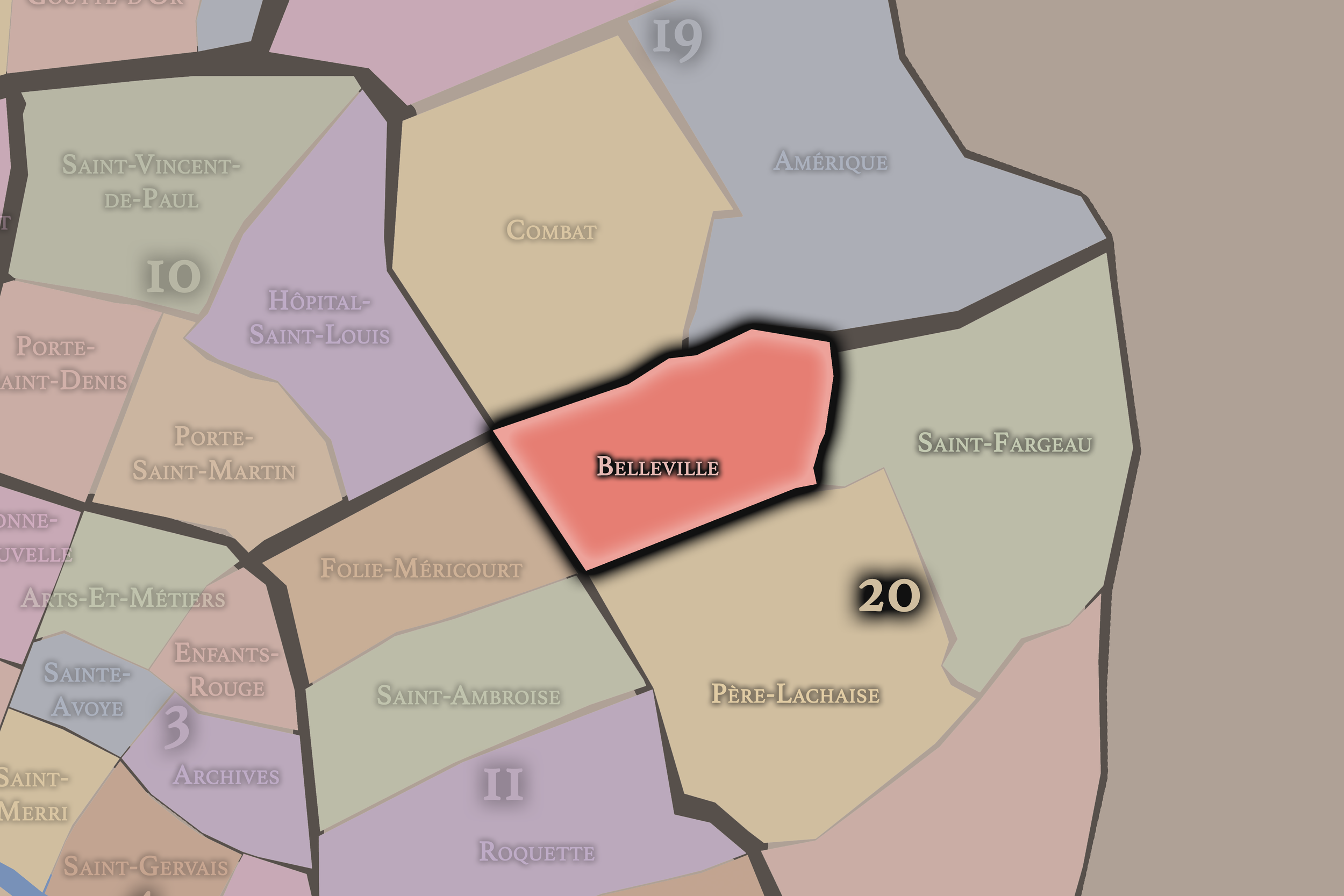
Belleville
20e Arrondissement — Ménilmontant
77th Administrative Quarter
Belleville is one of Paris’s great former village landscapes, known for hills, immigration, street art, music, working-class history, sweeping views, and a powerful neighborhood identity that exceeds official borders.
-
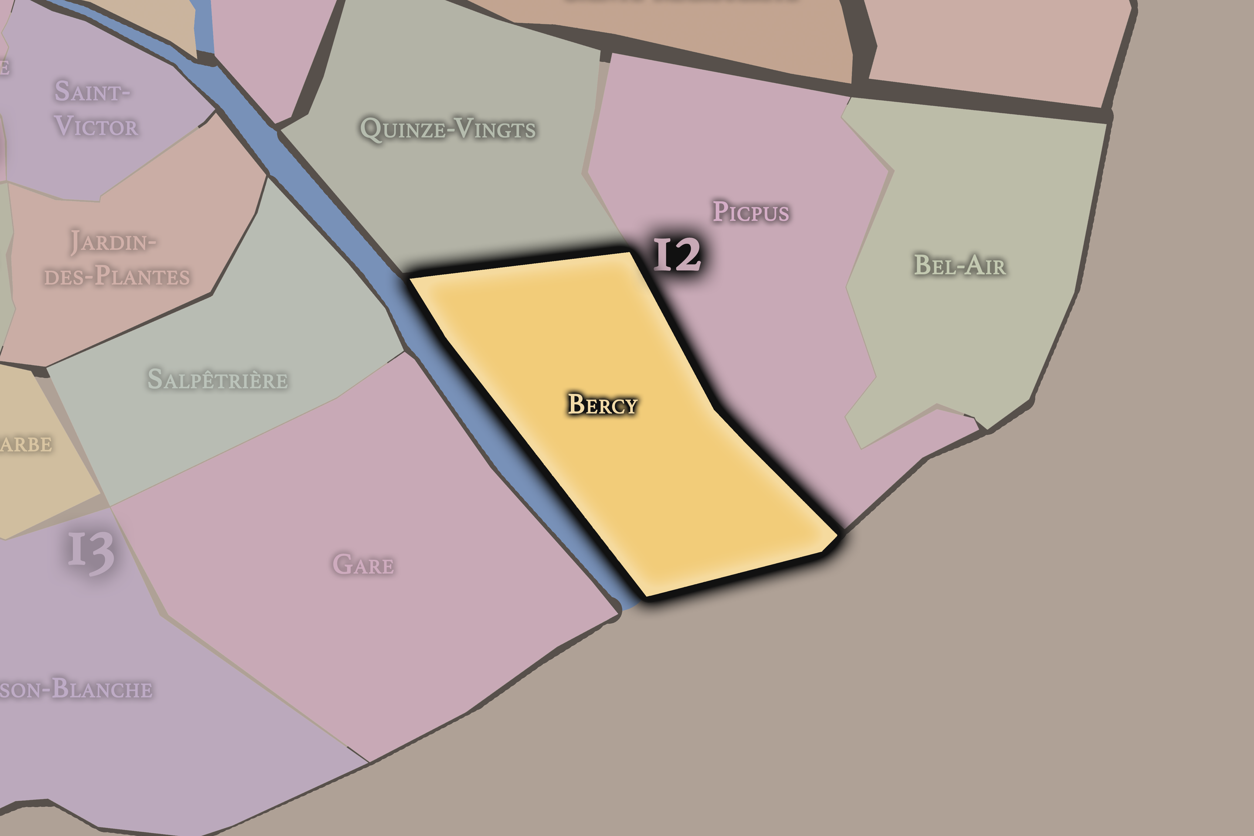
Bercy
12e Arrondissement — Reuilly
47th Administrative Quarter
Bercy is rooted in wine warehouses, river commerce, rail infrastructure, and later redevelopment, now combining parks, cultural venues, modern offices, and the Seine-side reinvention of eastern Paris.
-
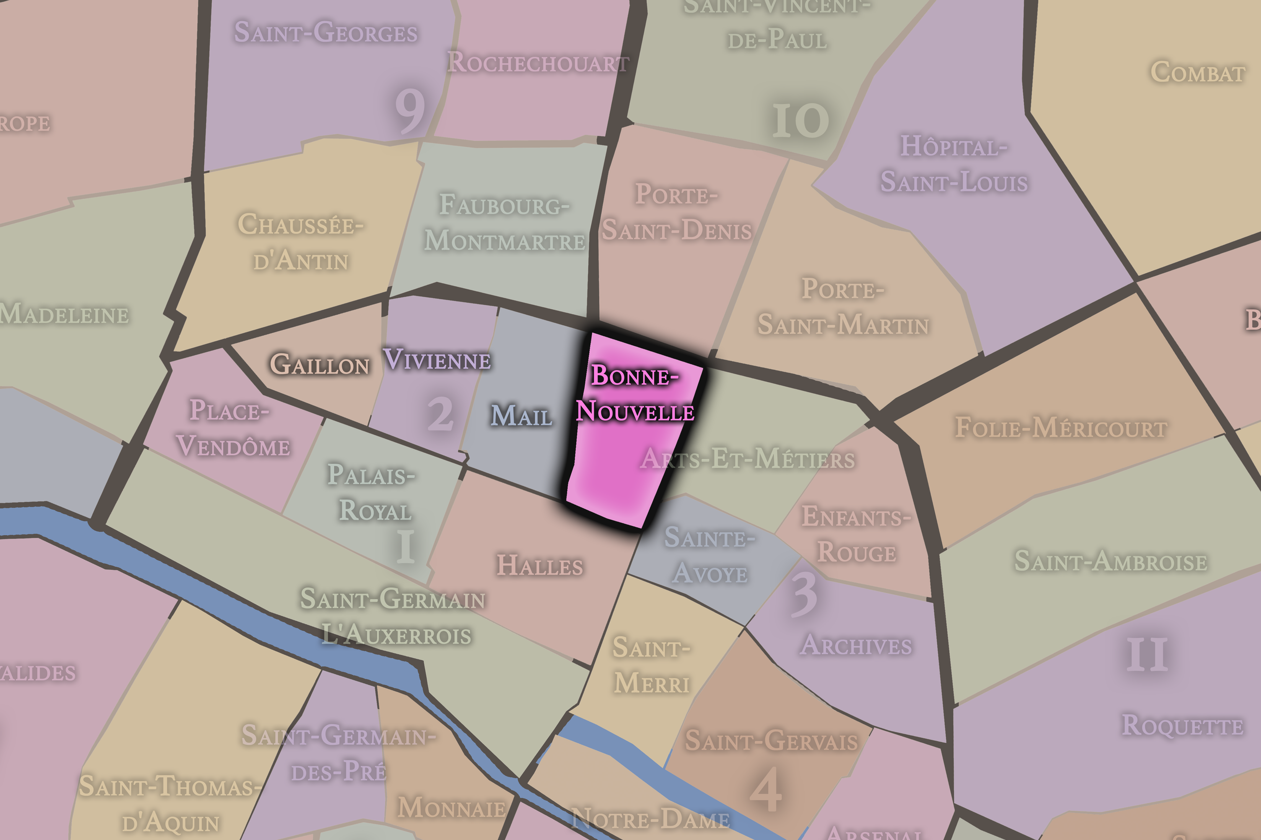
Bonne-Nouvelle
2e Arrondissement — Bourse
8th Administrative Quarter
Bonne-Nouvelle sits along one of the city’s great boulevard thresholds, mixing theater, printing, commerce, immigrant enterprise, and the layered energy of streets that have long connected central Paris to its northern districts.
-
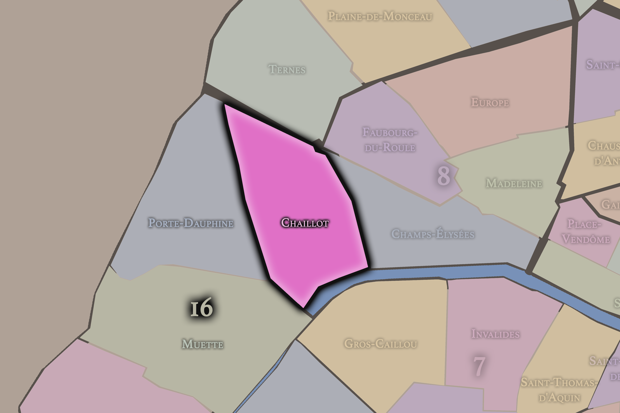
Chaillot
16e Arrondissement — Passy
64th Administrative Quarter
Chaillot is a monumental quarter overlooking the Seine, shaped by Trocadéro, museums, diplomatic streets, and some of the most dramatic views toward the Eiffel Tower.
-
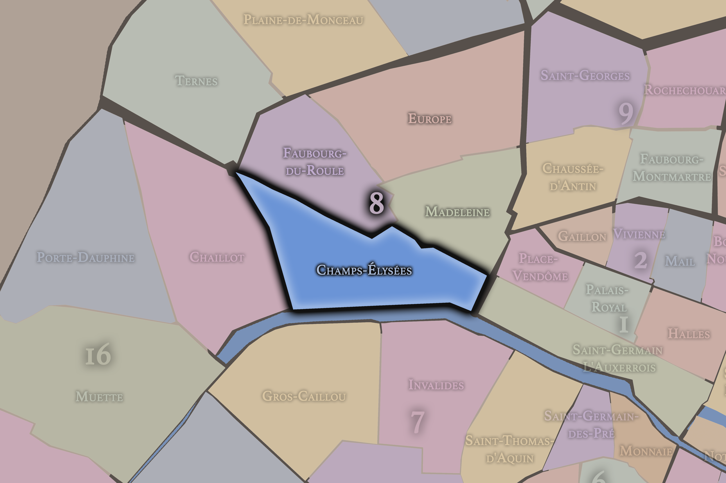
Champs-Élysées
8e Arrondissement — Élysée
29th Administrative Quarter
Champs-Élysées is one of the world’s great ceremonial avenues, linking gardens, theaters, luxury storefronts, national celebrations, and the axial drama between the Place de la Concorde and the Arc de Triomphe.
-
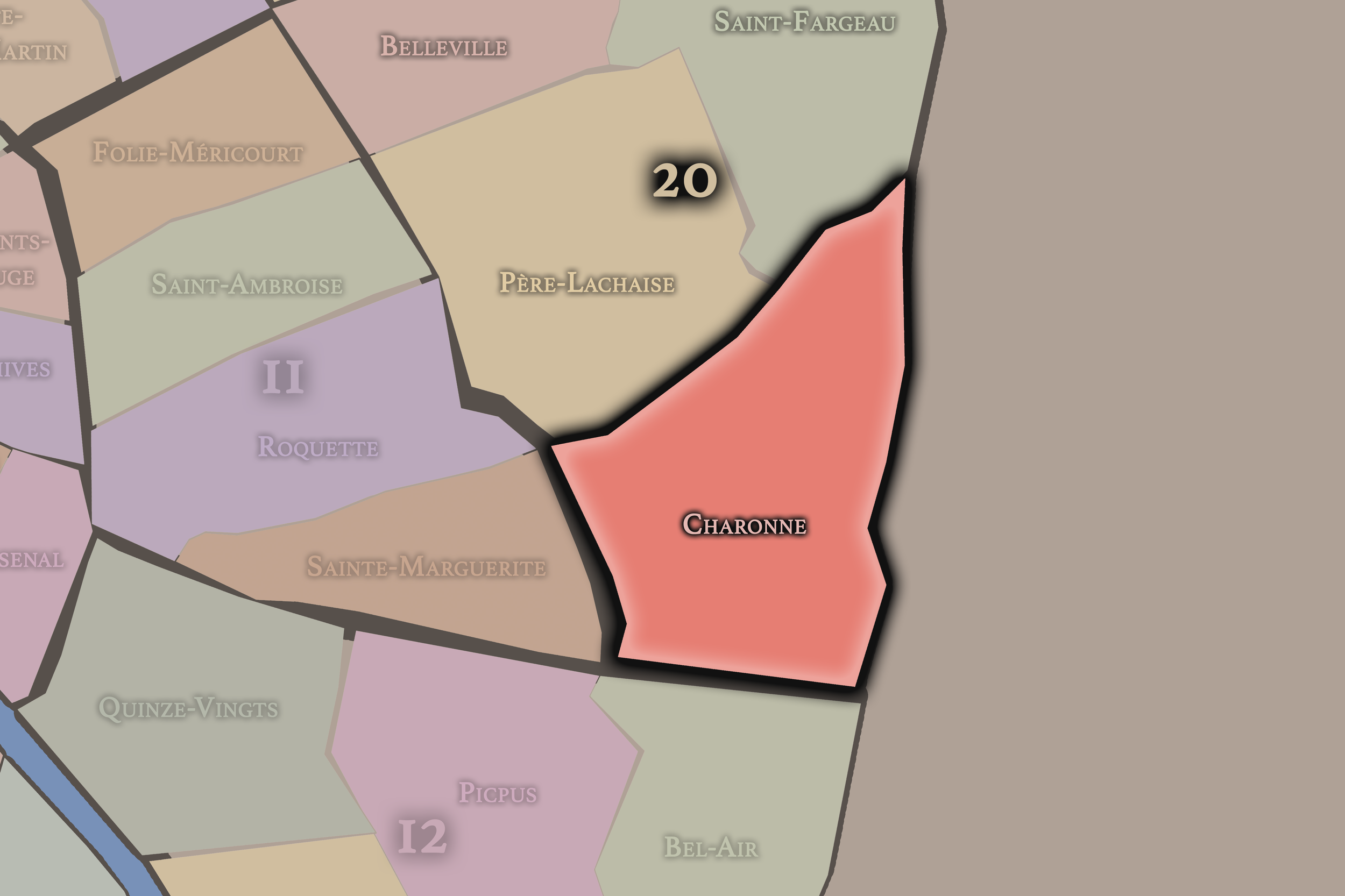
Charonne
20e Arrondissement — Ménilmontant
80th Administrative Quarter
Charonne preserves the memory of an absorbed village, with old church streets, working-class history, residential slopes, and one of the strongest examples of pre-annexation identity surviving inside modern Paris.
-
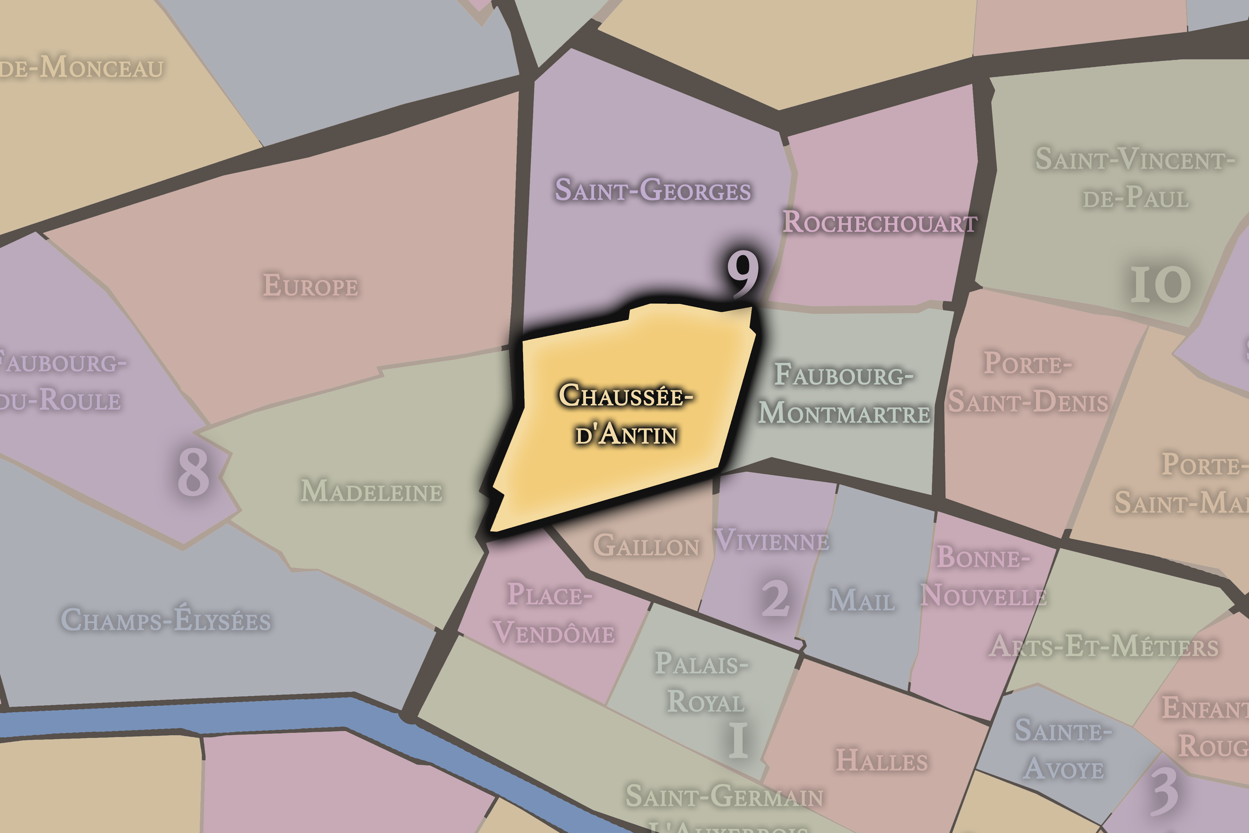
Chaussée-d’Antin
9e Arrondissement — Opéra
34th Administrative Quarter
Chaussée-d’Antin links the Opéra, department stores, banking streets, and grand boulevards, forming a quarter of commerce, spectacle, office life, and 19th-century metropolitan ambition.
-
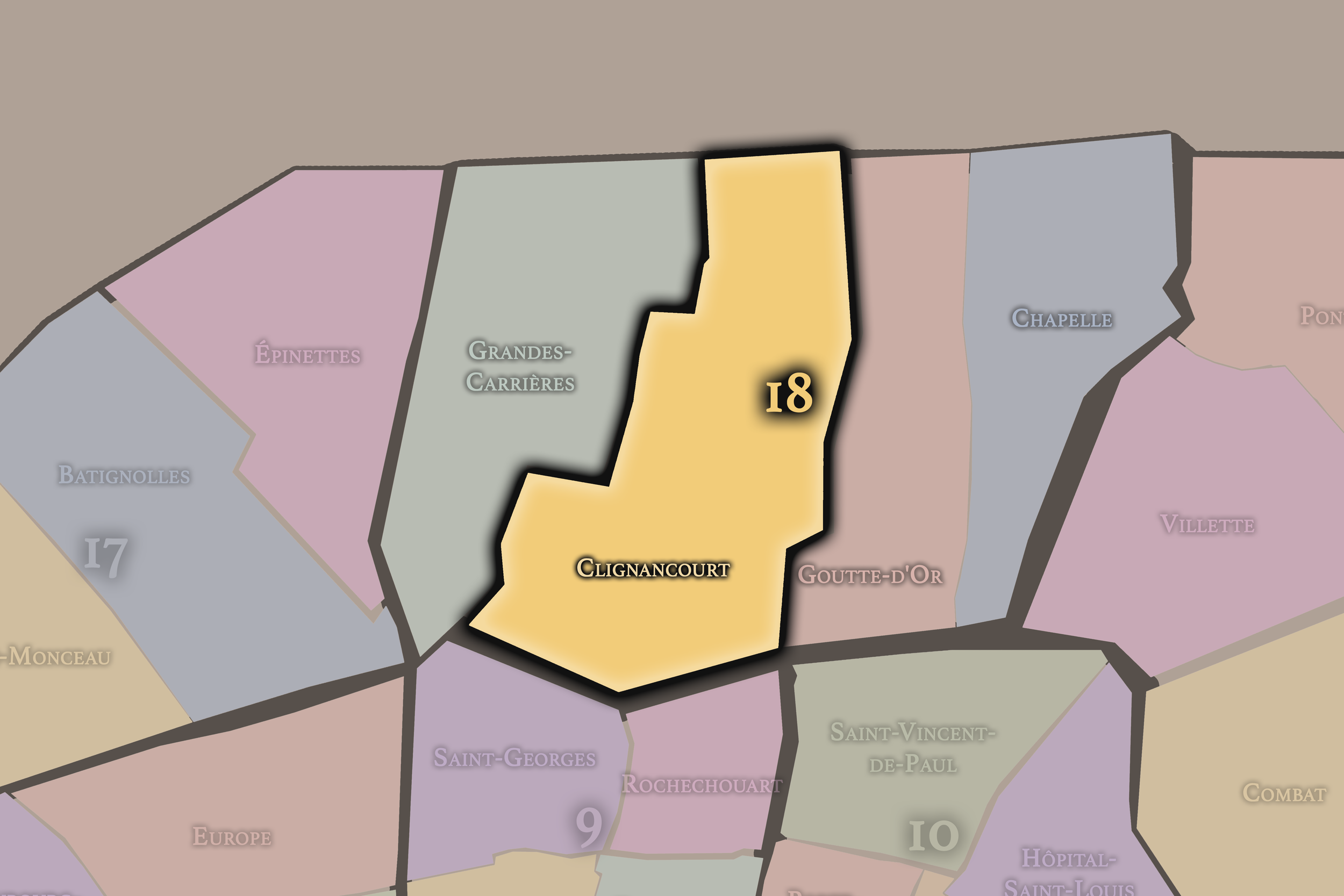
Clignancourt
18e Arrondissement — Butte-Montmartre
70th Administrative Quarter
Clignancourt carries the name of a former village and northern gateway, with busy commercial streets, markets, residential density, and the transition toward the Porte de Clignancourt.
-
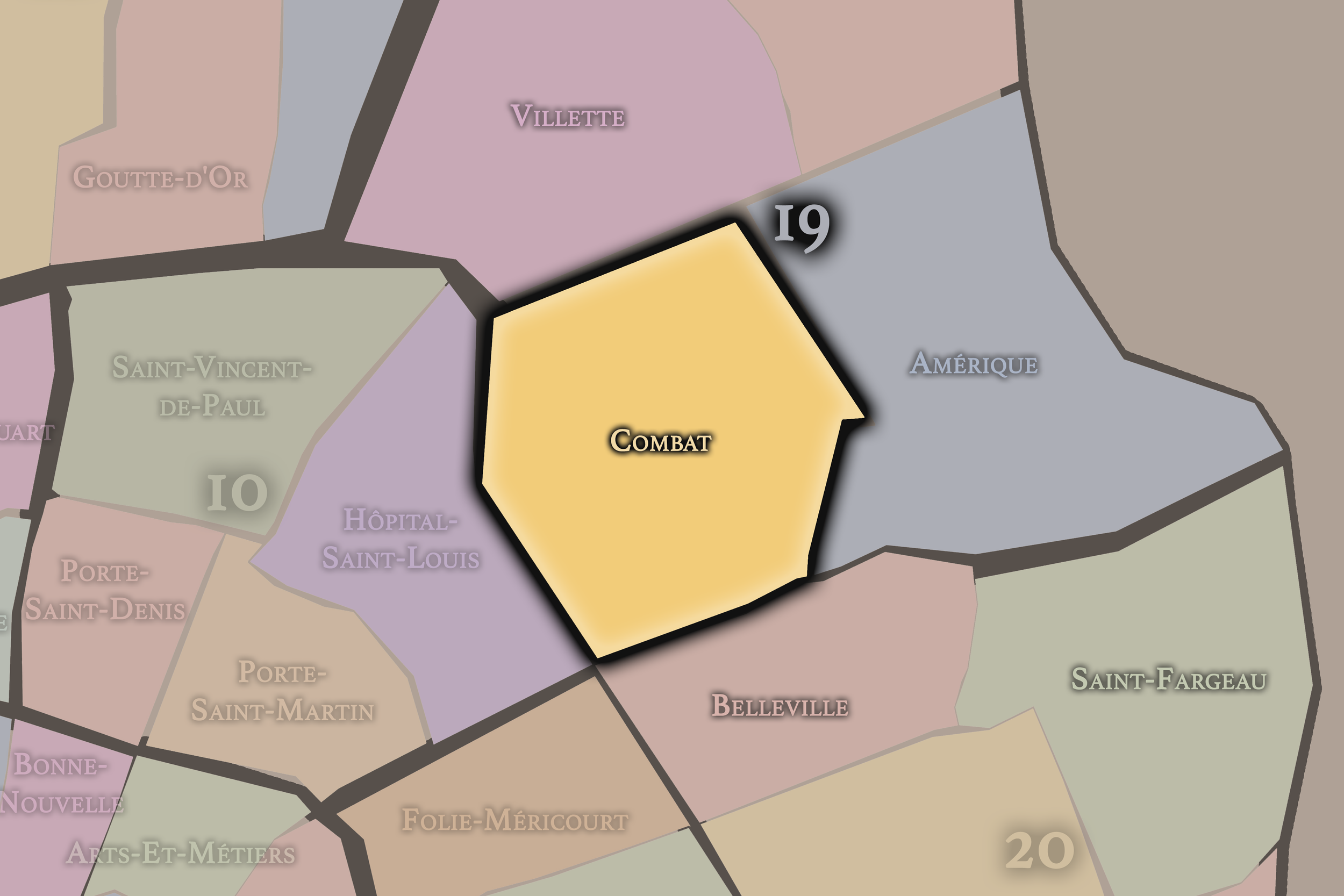
Combat
19e Arrondissement — Buttes-Chaumont
76th Administrative Quarter
Combat is associated with the Buttes-Chaumont, old quarry grounds, residential slopes, and the dramatic park landscape that gives the 19th arrondissement one of its most distinctive identities.
-
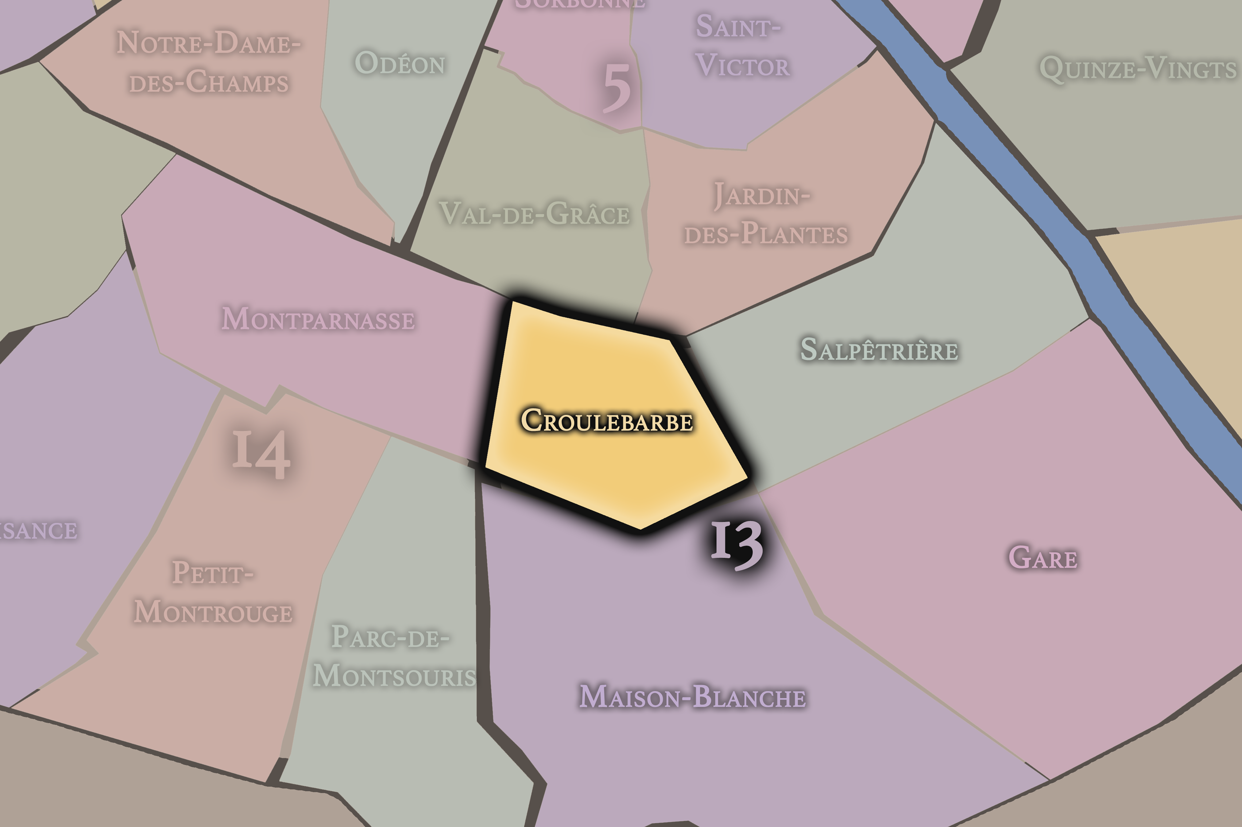
Croulebarbe
13e Arrondissement — Gobelins
52nd Administrative Quarter
Croulebarbe is a compact and somewhat hidden quarter near the Bièvre’s former course, with quiet streets, institutional edges, and the intimate texture of the older southern Left Bank.
-
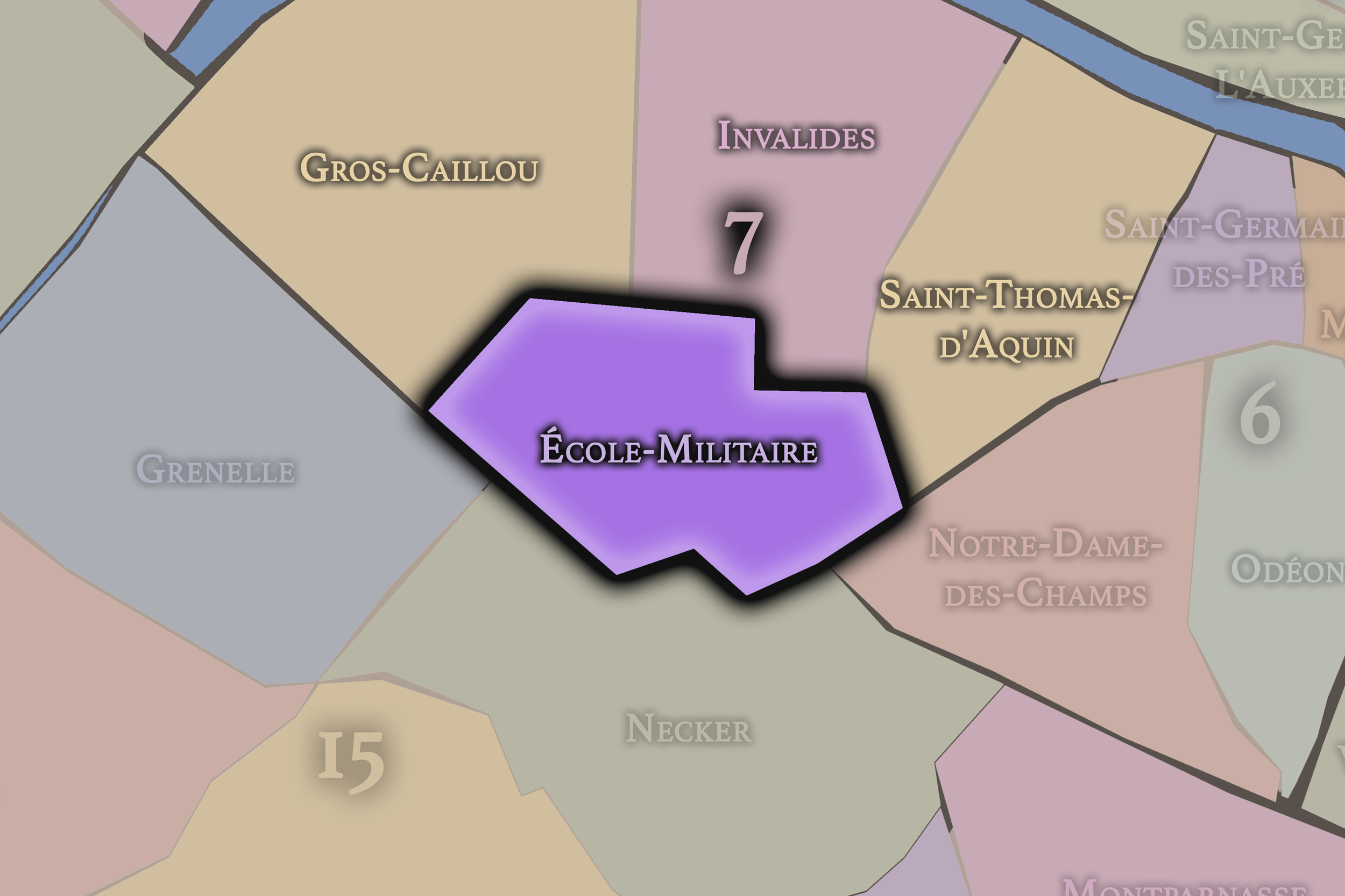
École-Militaire
7e Arrondissement — Palais-Bourbon
27th Administrative Quarter
École-Militaire stretches around the Champ de Mars and the military school, with open lawns, grand perspectives, diplomatic streets, and the Eiffel Tower’s monumental presence shaping its modern identity.
-
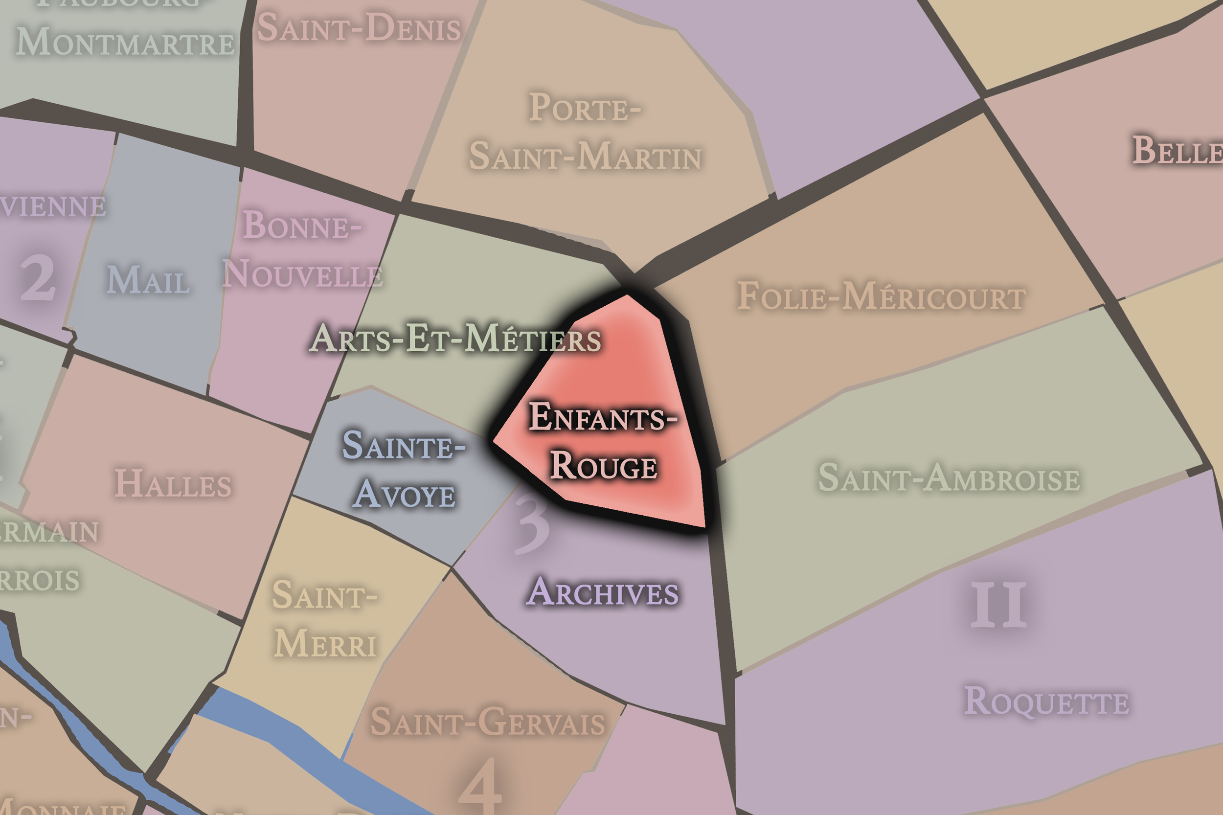
Enfants-Rouges
3e Arrondissement — Temple
10th Administrative Quarter
Named for one of Paris’s oldest market traditions, Enfants-Rouges blends market life, northern Marais streets, galleries, cafés, historic hôtels particuliers, and a lived neighborhood energy that feels intimate and textured.
-
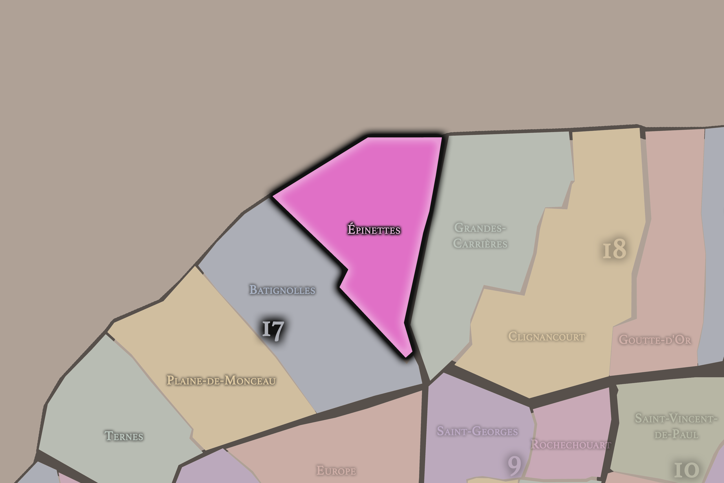
Épinettes
17e Arrondissement — Batignolles-Monceau
68th Administrative Quarter
Épinettes carries a more working and residential history, with dense apartment streets, former industrial edges, and the northern texture of Paris near Clichy and Saint-Ouen.
-
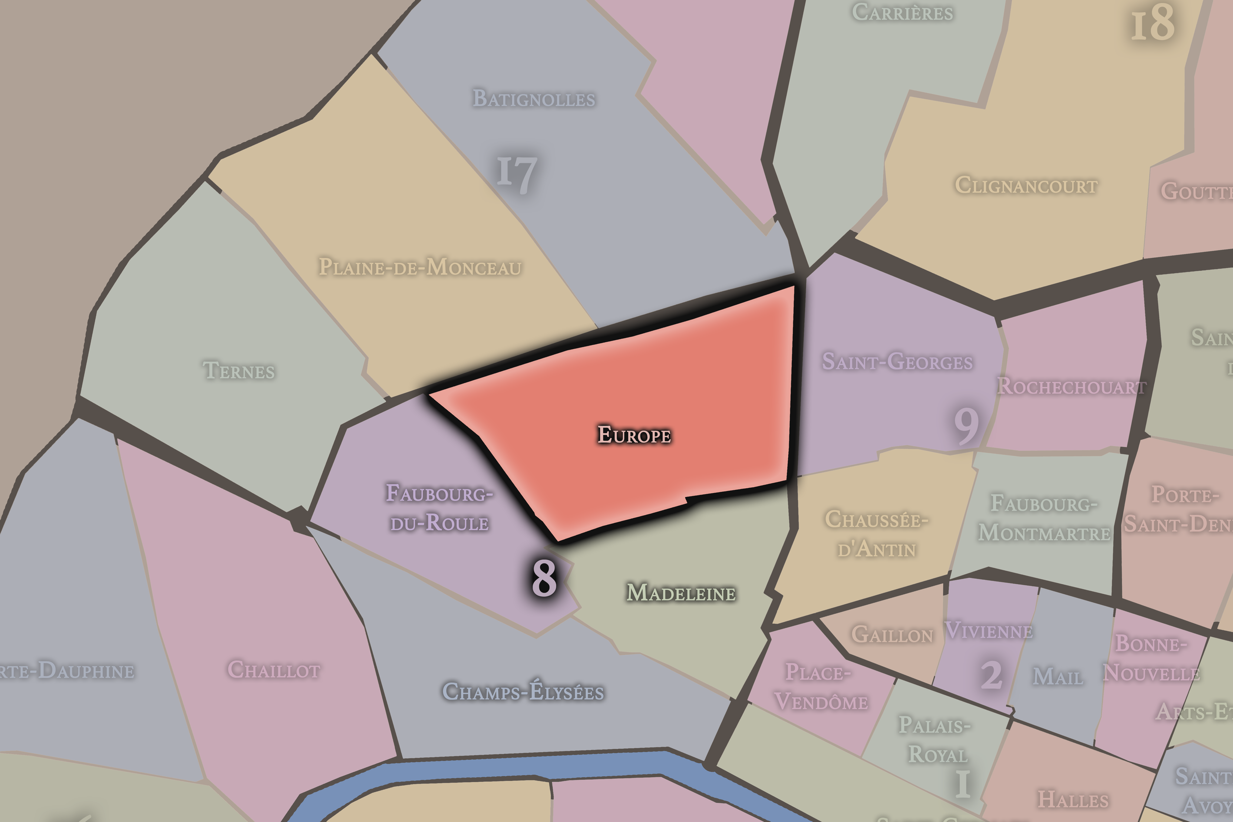
Europe
8e Arrondissement — Élysée
32nd Administrative Quarter
Europe is defined by railway-era urbanism, streets named for European capitals, Haussmannian apartment blocks, the Gare Saint-Lazare, and a 19th-century sense of movement, connection, and metropolitan expansion.
-
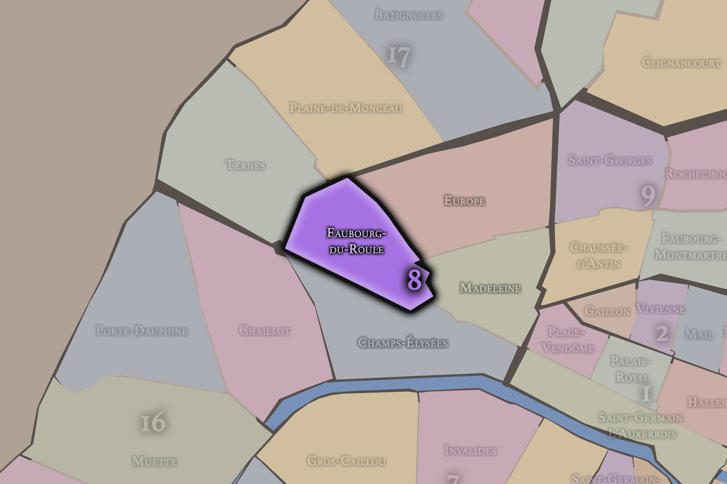
Faubourg-du-Roule
8e Arrondissement — Élysée
30th Administrative Quarter
Faubourg-du-Roule carries the memory of an old road beyond the city, now shaped by grand avenues, embassies, offices, luxury commerce, and the western expansion of Parisian prestige.
-
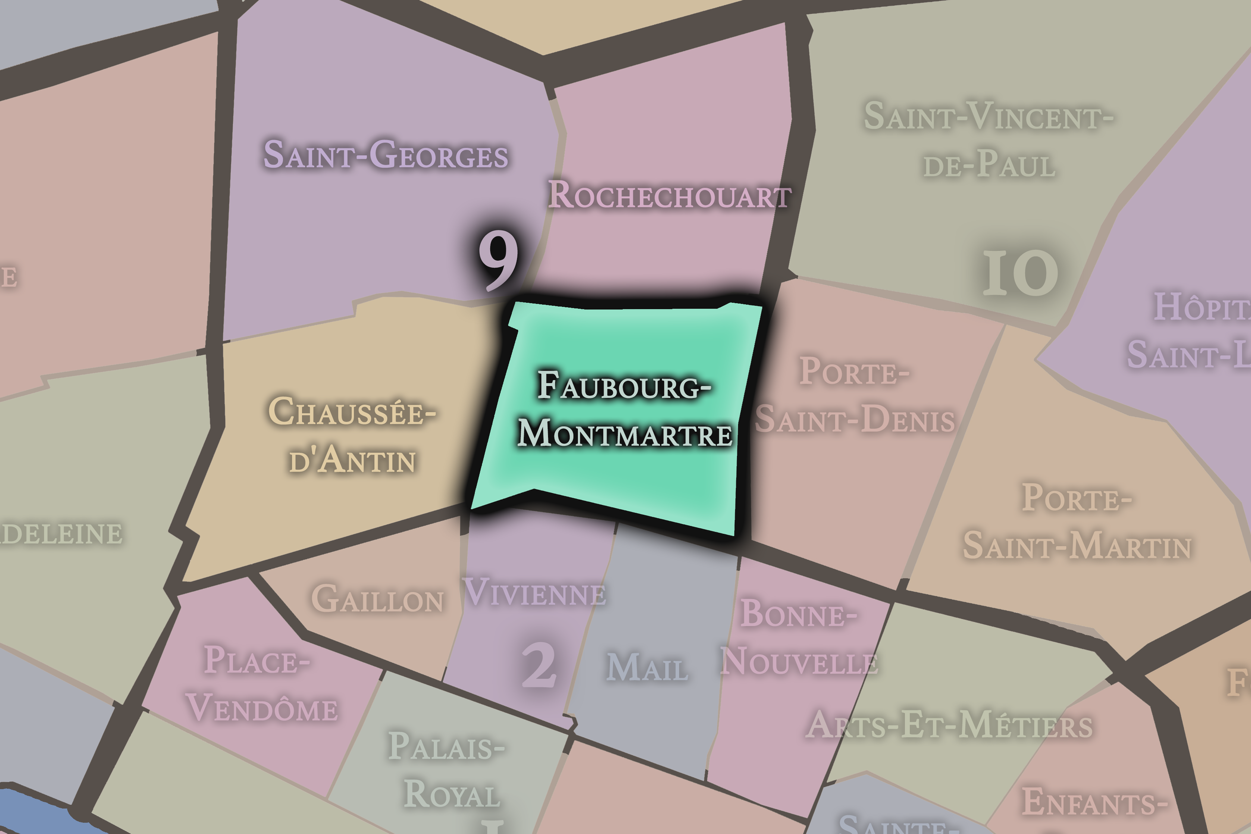
Faubourg-Montmartre
9e Arrondissement — Opéra
35th Administrative Quarter
Faubourg-Montmartre preserves the energy of old boulevard Paris, with theaters, passages, newspaper history, restaurants, and commercial streets that lead northward toward Montmartre’s former faubourg edge.
-
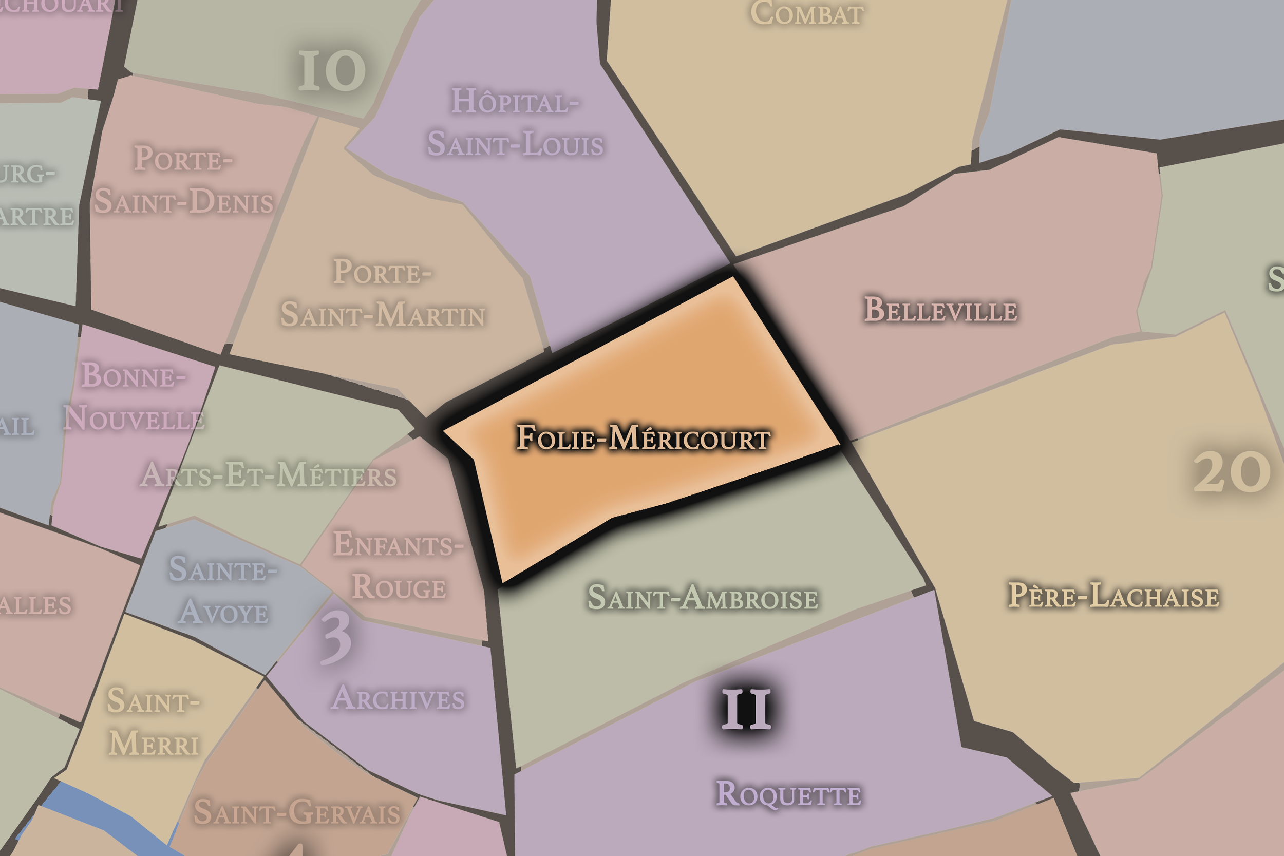
Folie-Méricourt
11e Arrondissement — Popincourt
41st Administrative Quarter
Folie-Méricourt is a lively eastern quarter shaped by cafés, nightlife, workshops, activism, and the streets between République, Oberkampf, and the northern edge of the Marais.
-
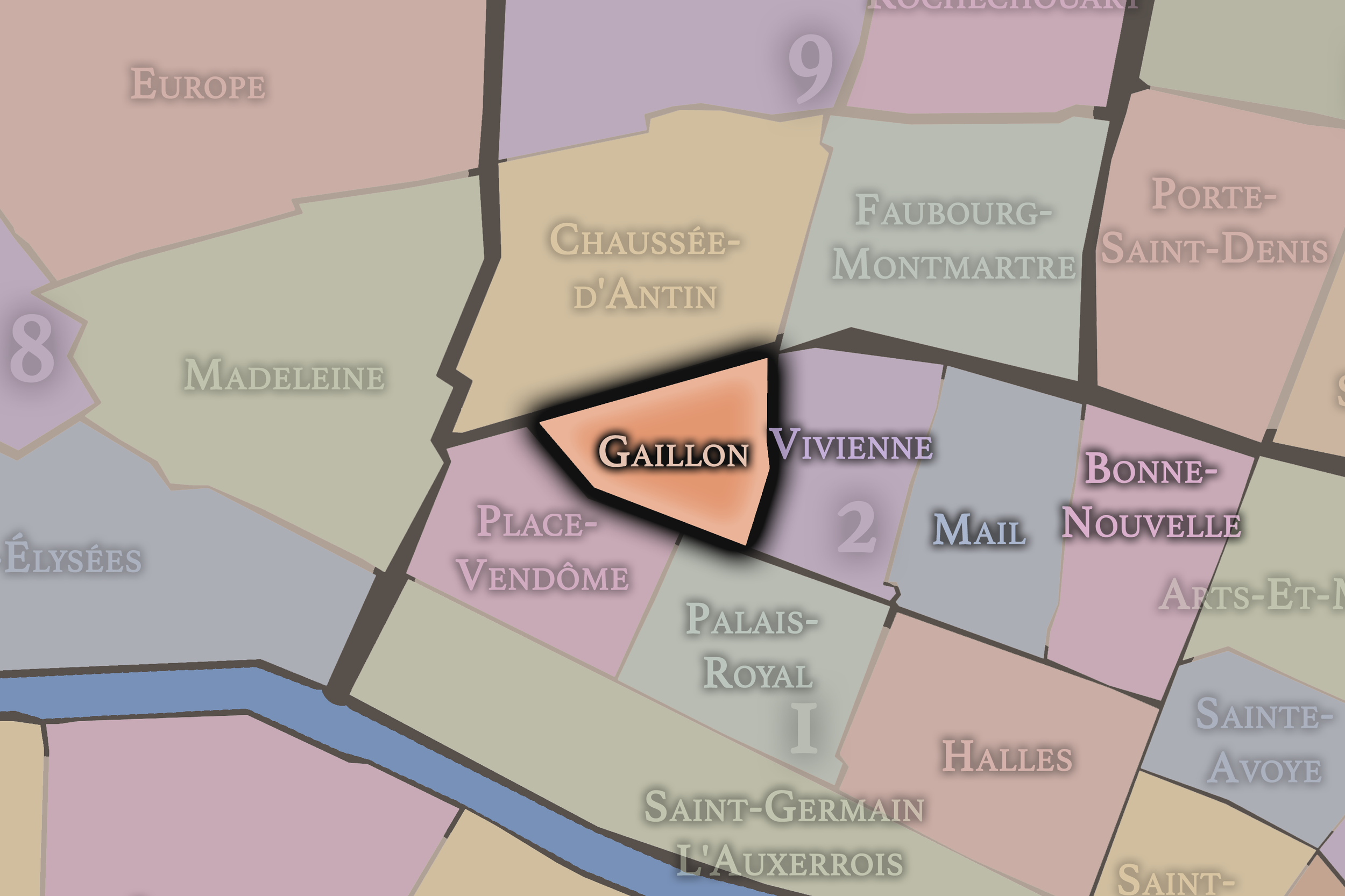
Gaillon
2e Arrondissement — Bourse
5th Administrative Quarter
Gaillon is a compact Right Bank quarter shaped by theaters, offices, banking history, and the elegant streets that link the Opéra district to the commercial fabric of central Paris.
-
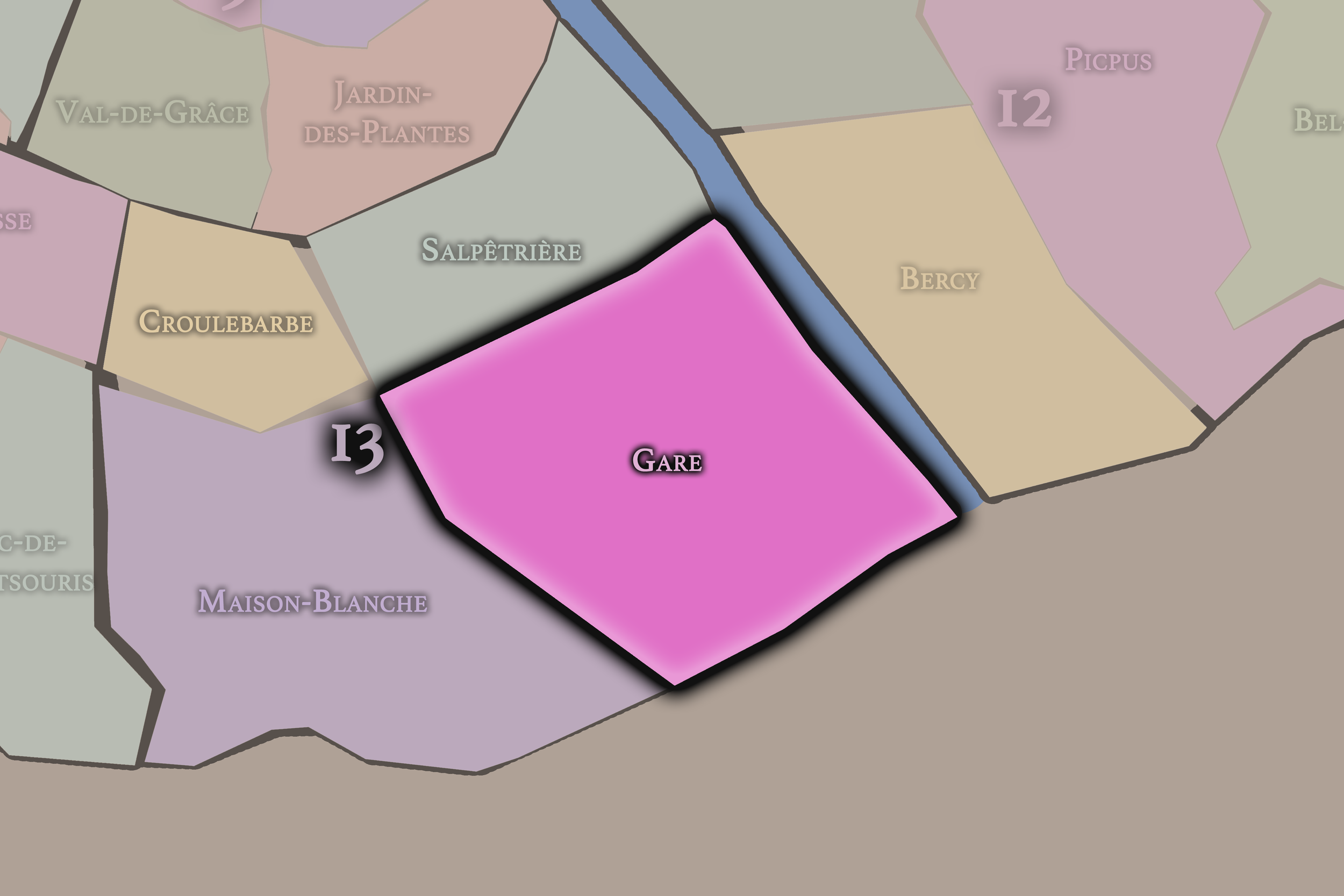
Gare
13e Arrondissement — Gobelins
50th Administrative Quarter
The Gare quarter is shaped by rail lines, the Seine, modern towers, and the transformation of former industrial land into one of Paris’s most ambitious contemporary urban landscapes.
-
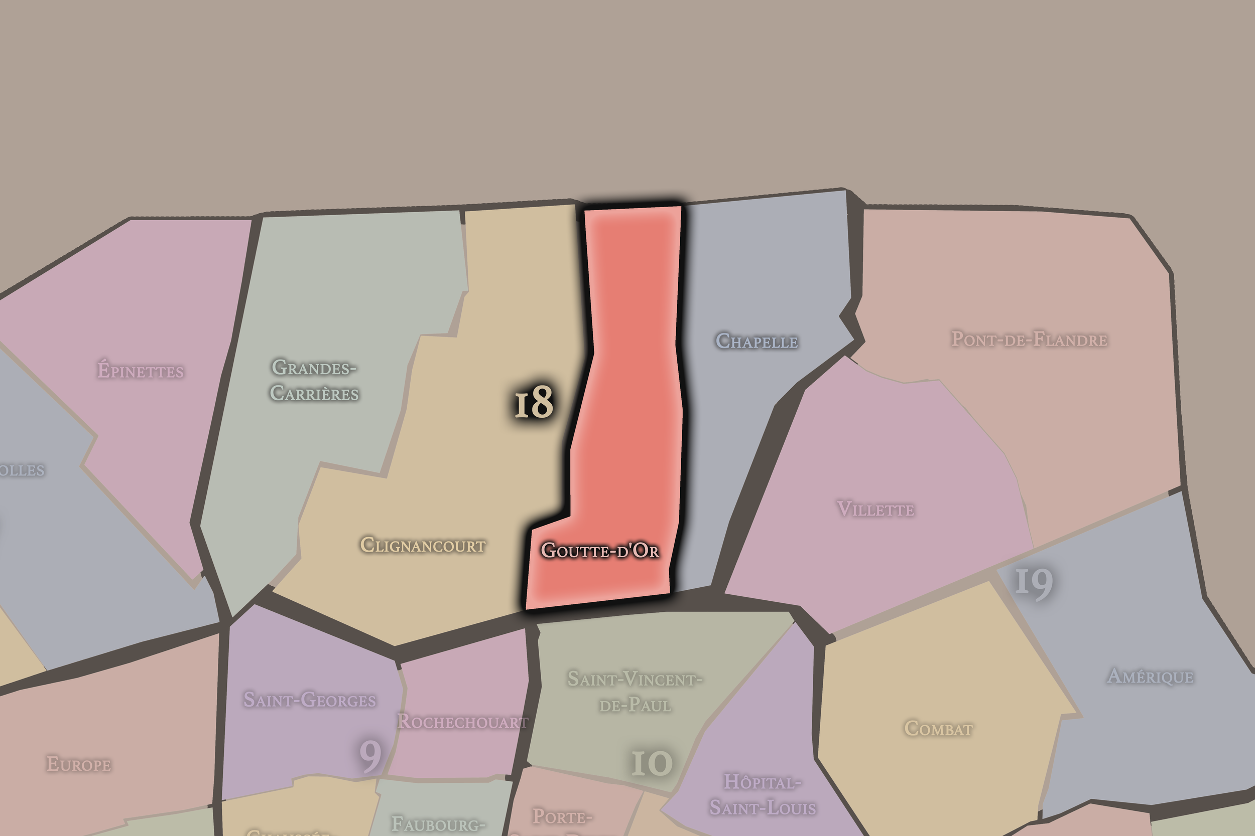
Goutte-d’Or
18e Arrondissement — Butte-Montmartre
71st Administrative Quarter
Goutte-d’Or is one of Paris’s most vivid multicultural quarters, shaped by immigration, markets, music, textiles, working-class history, and the dense streets below Montmartre.
-
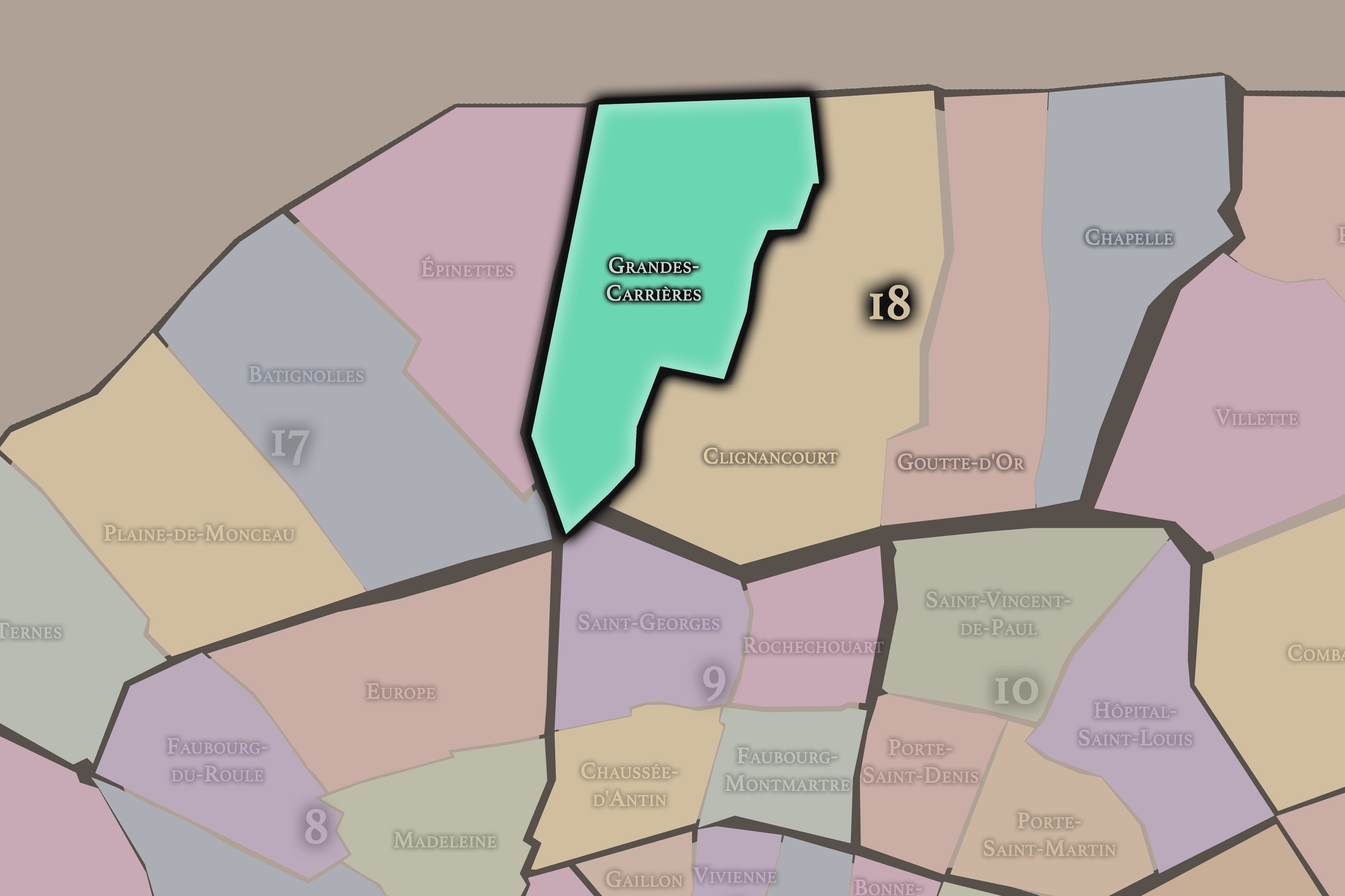
Grandes-Carrières
18e Arrondissement — Butte-Montmartre
69th Administrative Quarter
Grandes-Carrières recalls the quarry landscapes beneath Montmartre’s rise, now shaped by cemeteries, residential streets, studio history, and the western slopes of the 18th arrondissement.
-
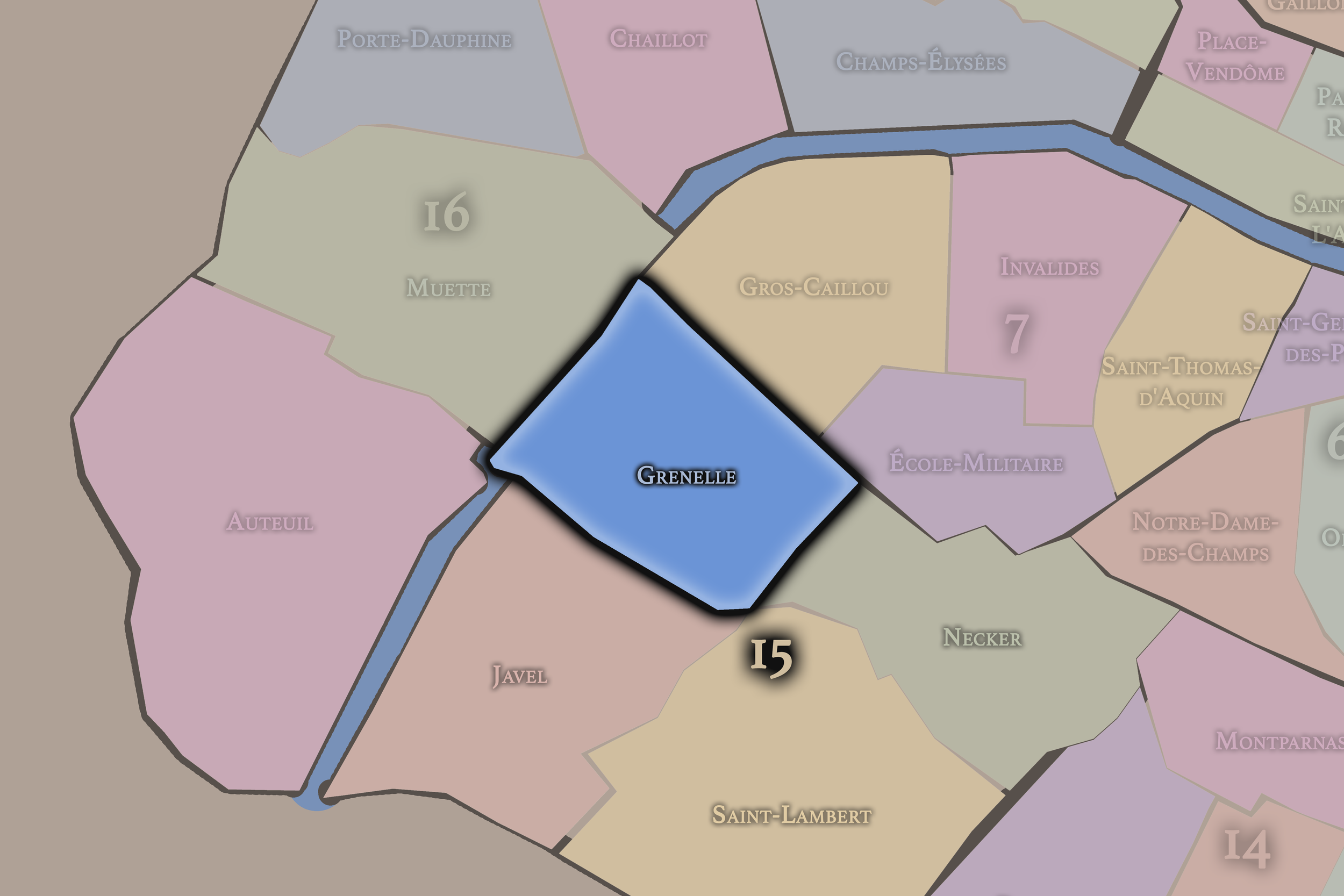
Grenelle
15e Arrondissement — Vaugirard
59th Administrative Quarter
Grenelle carries the memory of a former commune and planned village, now marked by broad avenues, commerce, apartment blocks, the Seine, and the modern urban life of southwest Paris.
-
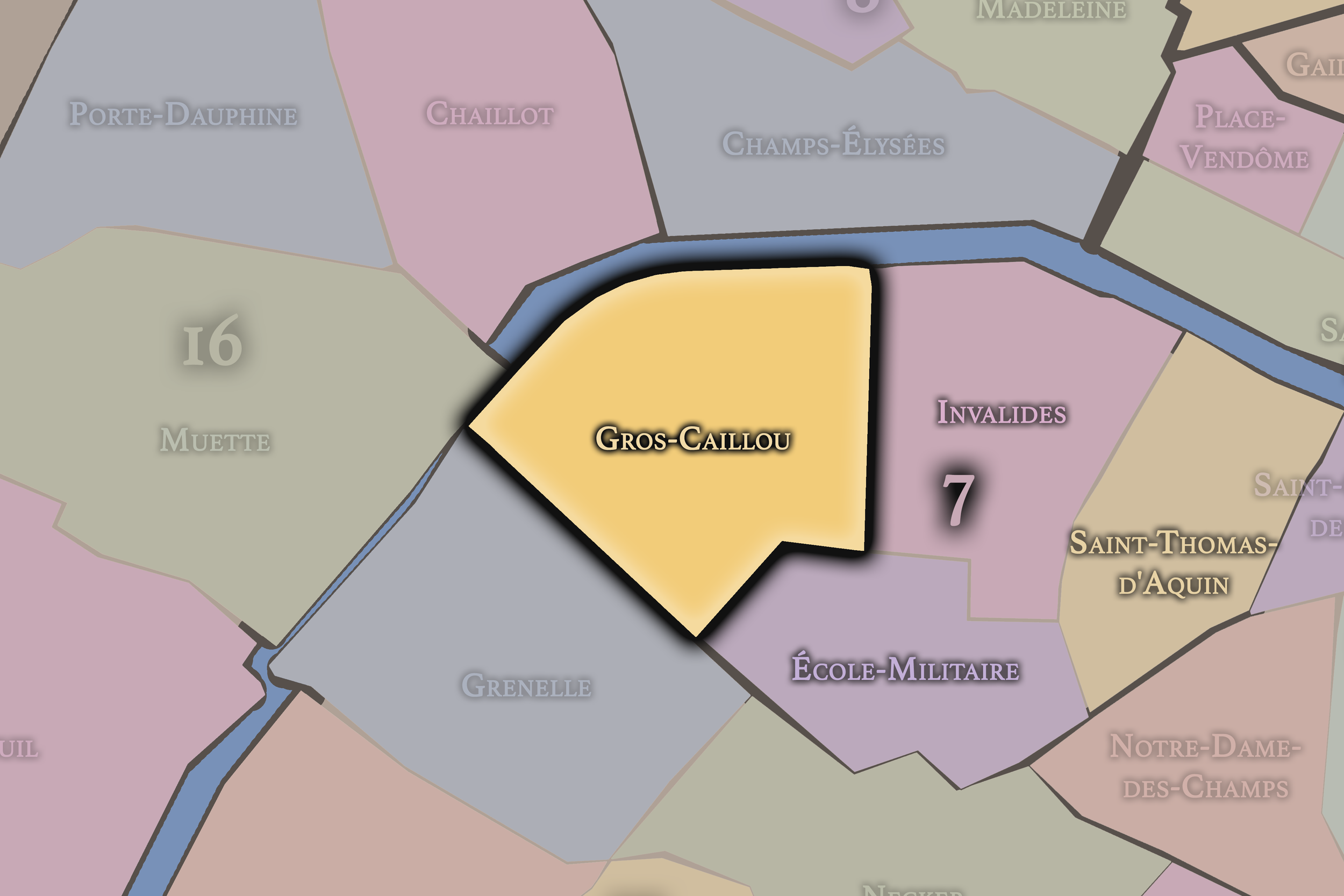
Gros-Caillou
7e Arrondissement — Palais-Bourbon
28th Administrative Quarter
Gros-Caillou is the home of the Eiffel Tower and balances tourist landmarks, residential streets, market life, and a village-like Left Bank identity tucked beneath the grandeur of western Paris along the Seine.
-
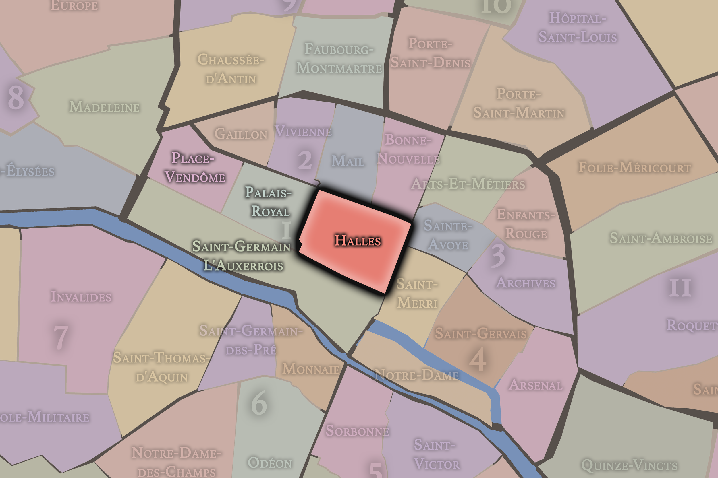
Halles
1er Arrondissement — Louvre
2nd Administrative Quarter
Once defined by the great central market of Paris, Halles remains a district of movement, commerce, underground passageways, church towers, shopping corridors, and the restless energy of the city’s historic crossroads.
-
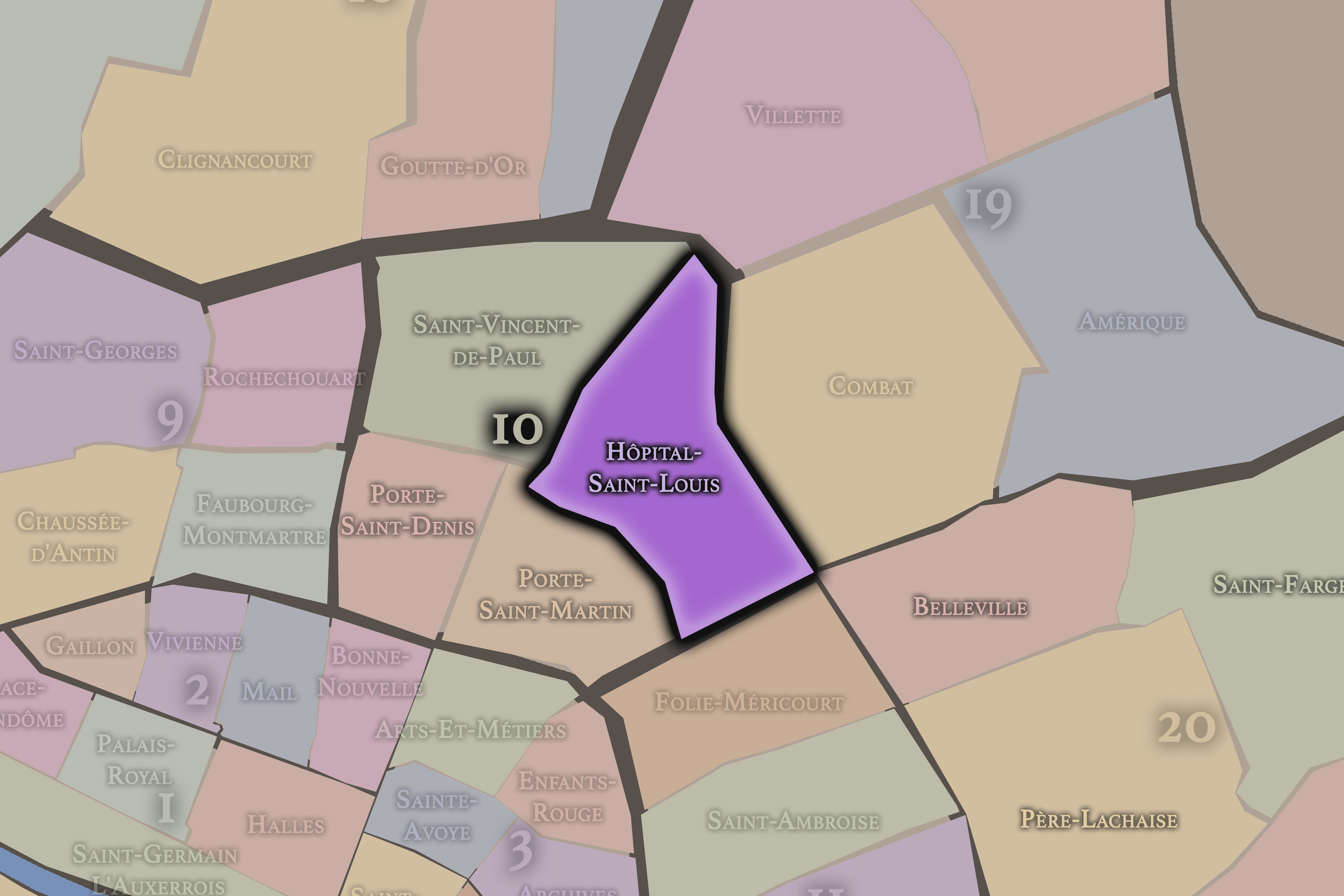
Hôpital-Saint-Louis
10e Arrondissement — Entrepôt
40th Administrative Quarter
Hôpital-Saint-Louis is anchored by the historic hospital and framed by canal-side neighborhoods, residential streets, cafés, and the softer eastern edge of the 10th arrondissement’s bustling civic landscape.
-
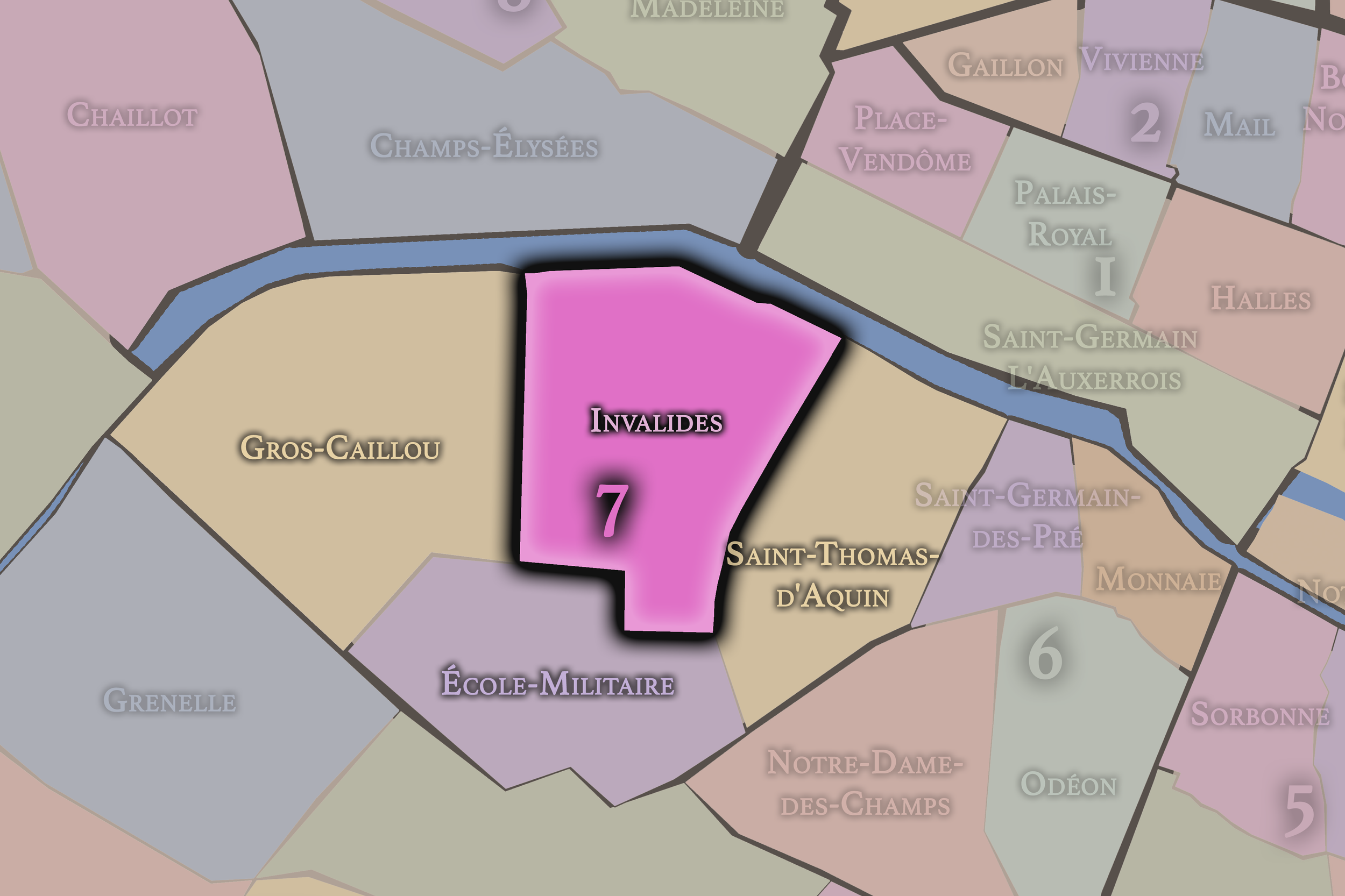
Invalides
7e Arrondissement — Palais-Bourbon
26th Administrative Quarter
Invalides is anchored by the great military complex and dome of Les Invalides, combining monumental state architecture, military memory, formal avenues, museums, and some of the city’s most ceremonial vistas.
-
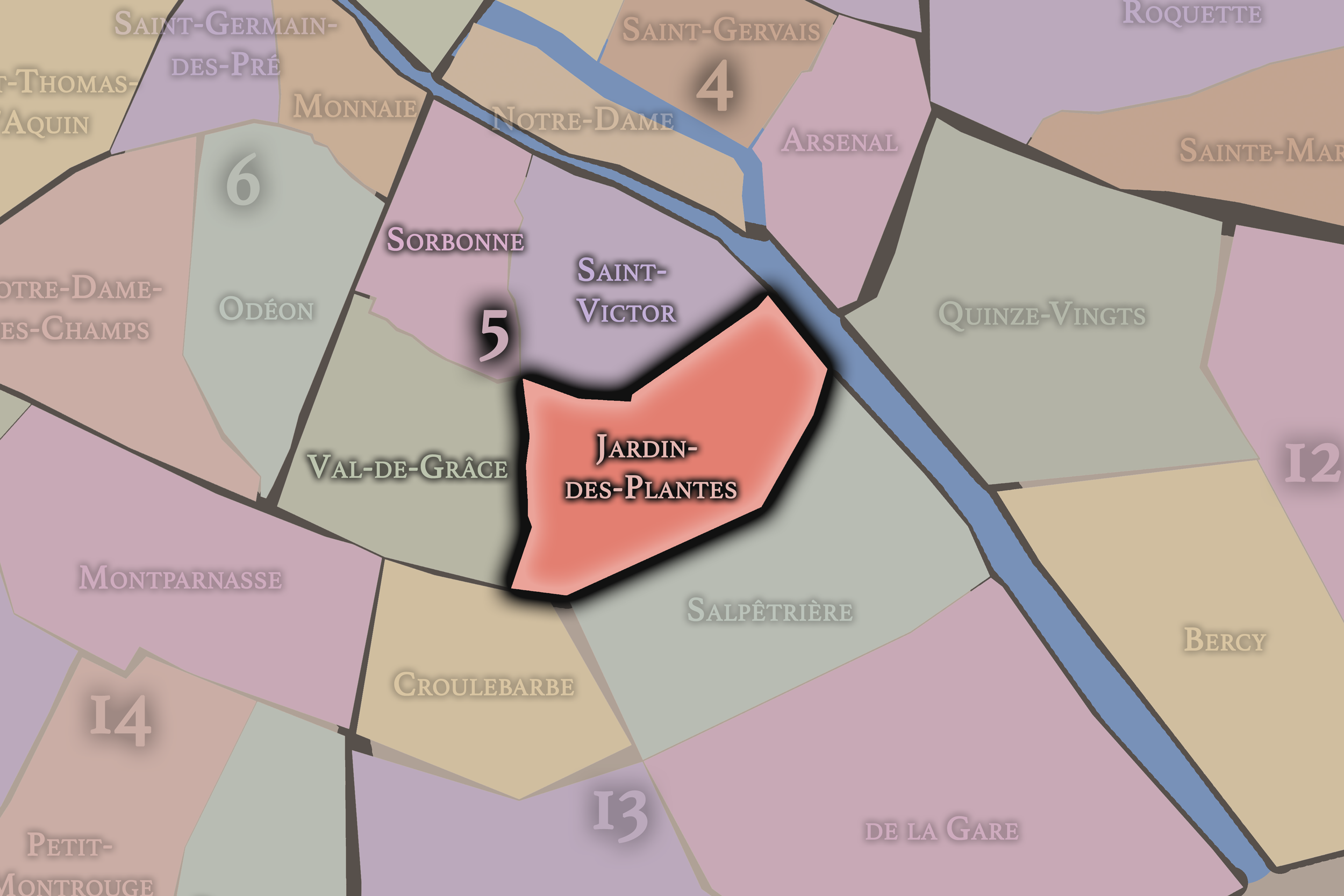
Jardin-des-Plantes
5e Arrondissement — Panthéon
18th Administrative Quarter
Defined by the great botanical garden and the Muséum national d’Histoire naturelle, Jardin-des-Plantes is a quarter of science, gardens, river edges, institutional architecture, and quiet scholarly depth.
-
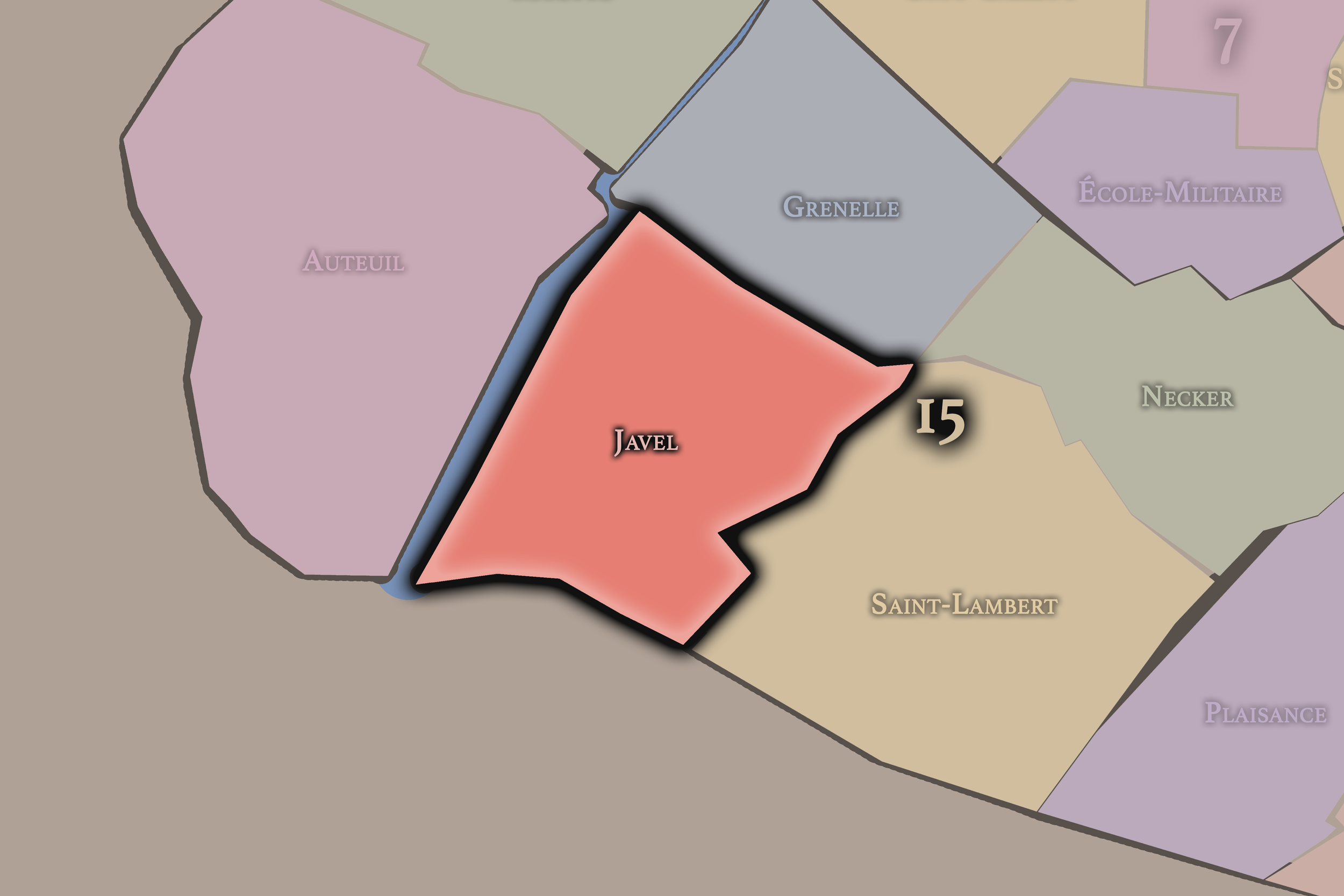
Javel
15e Arrondissement — Vaugirard
60th Administrative Quarter
Javel is rooted in industrial history along the Seine, later transformed by automobile manufacturing, modern housing, parks, riverfront redevelopment, and the western working edge of the 15th.
-
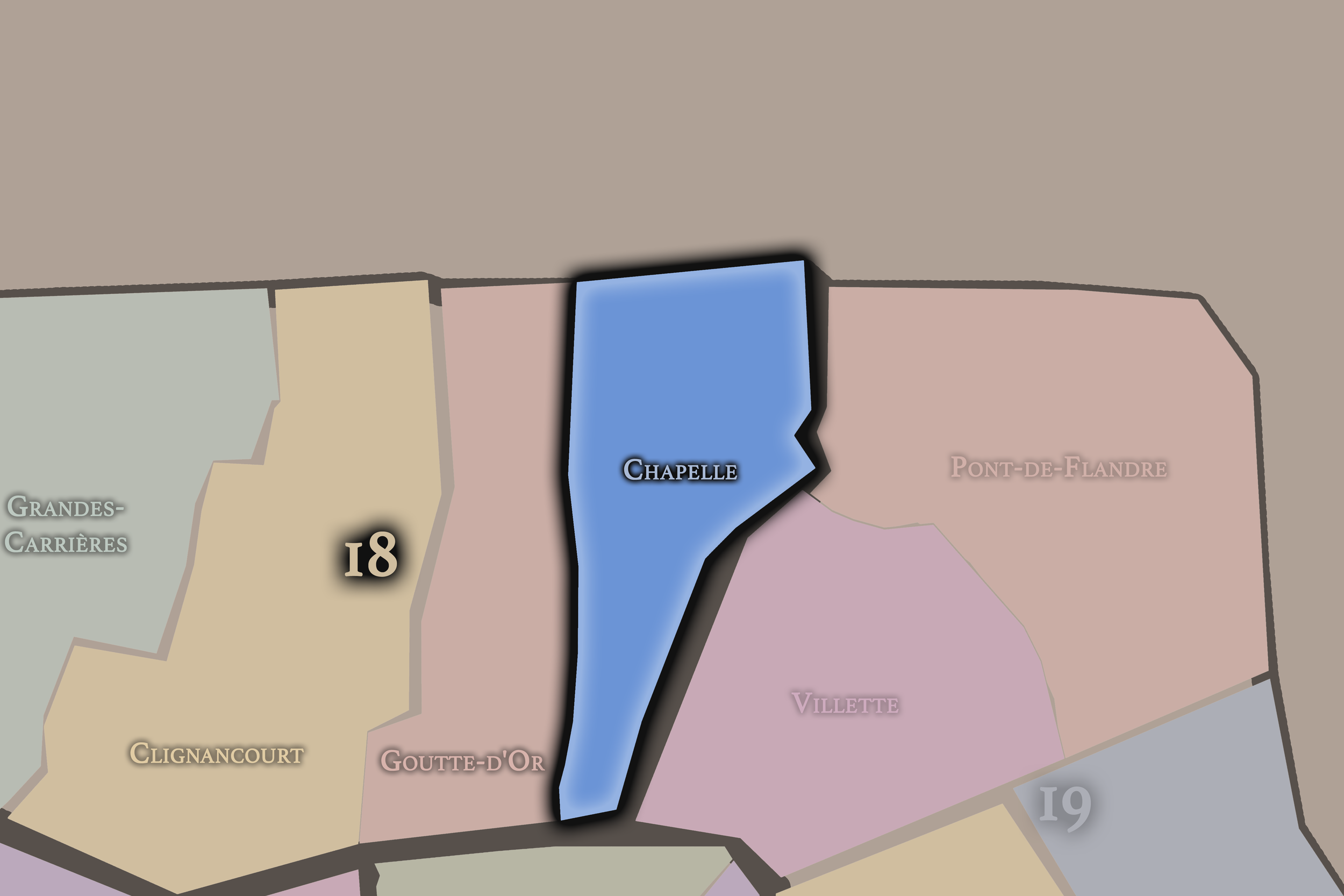
La Chapelle
18e Arrondissement — Butte-Montmartre
72nd Administrative Quarter
La Chapelle reflects the former village and industrial gateway north of the city, with rail corridors, immigrant communities, religious landmarks, and the strong urban identity of Paris’s northern edge.
-
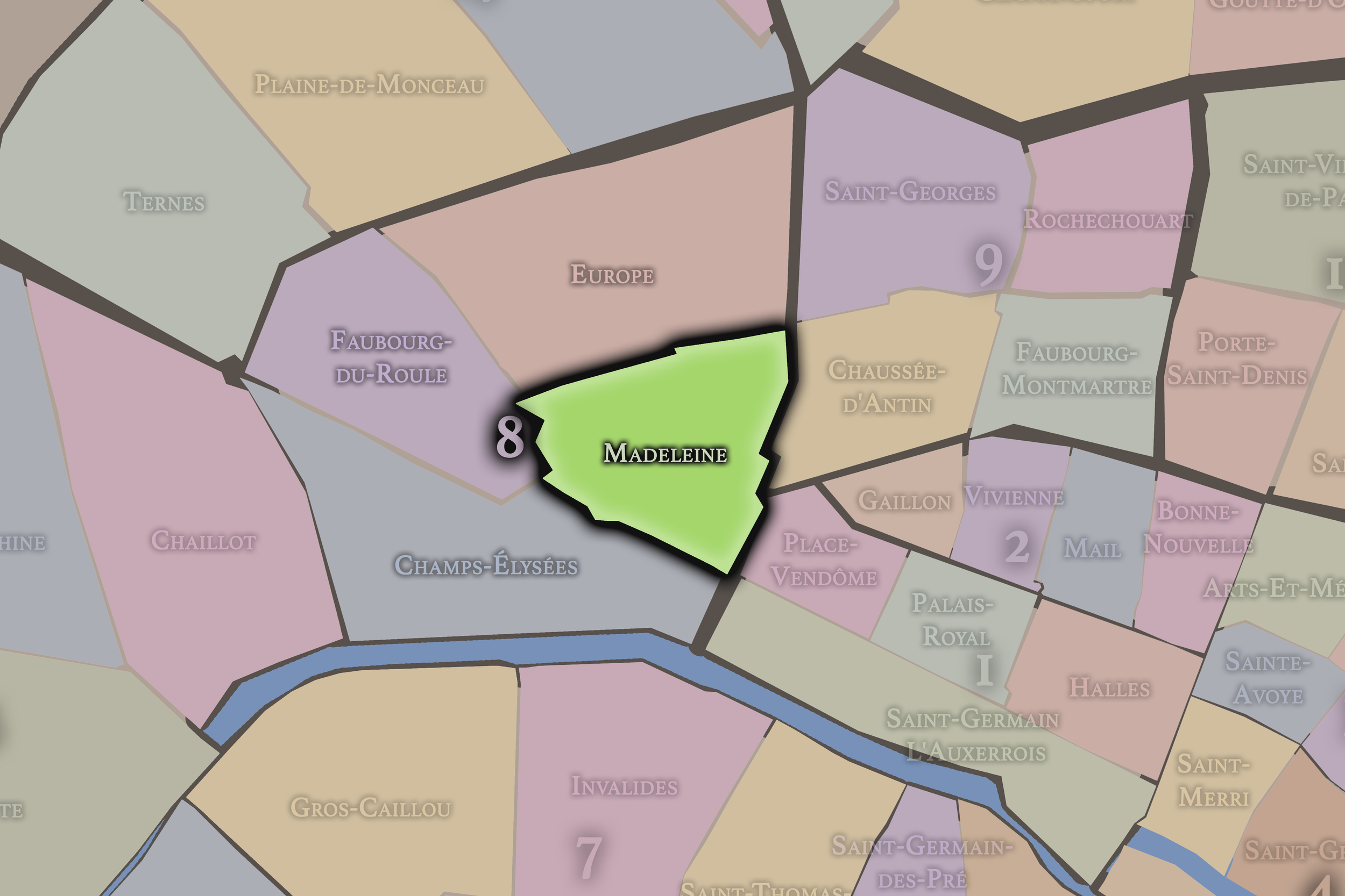
Madeleine
8e Arrondissement — Élysée
31st Administrative Quarter
Madeleine is centered on the monumental church and surrounding boulevards, with luxury food shops, grand hotels, diplomatic streets, and a polished Right Bank elegance near Opéra and Concorde.
-
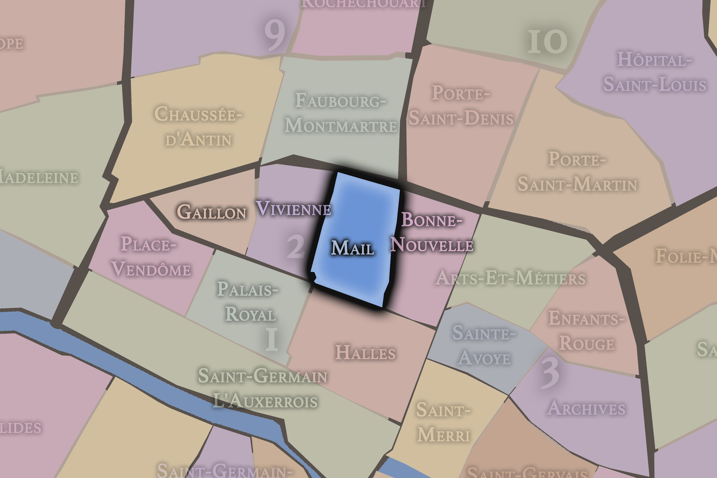
Mail
2e Arrondissement — Bourse
7th Administrative Quarter
The Mail quarter preserves the texture of old commercial Paris, with narrow streets, textile history, passageways, and a dense urban fabric that reflects the working and mercantile life of the central city.
-
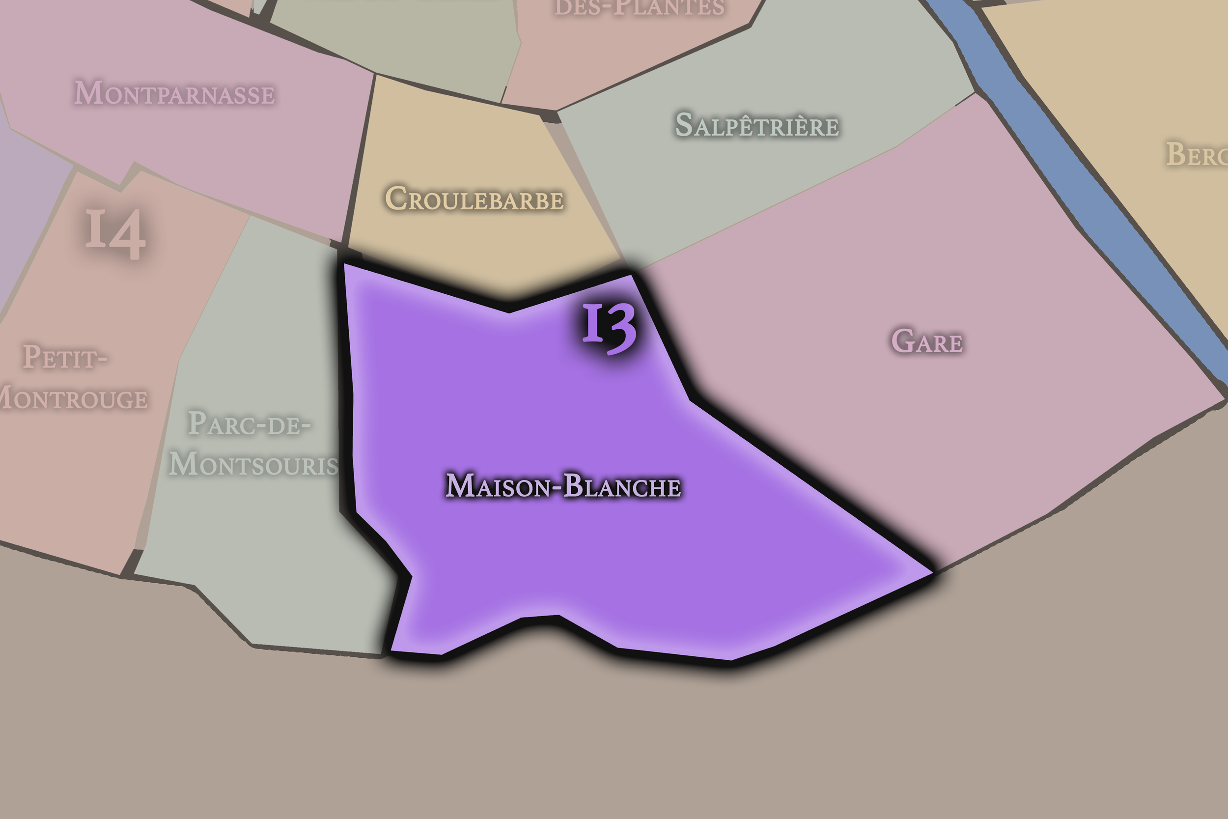
Maison-Blanche
13e Arrondissement — Gobelins
51st Administrative Quarter
Maison-Blanche stretches across southern residential Paris, with hills, avenues, Asian commercial life nearby, and a mixture of older village traces, modern housing, and everyday neighborhood streets.
-
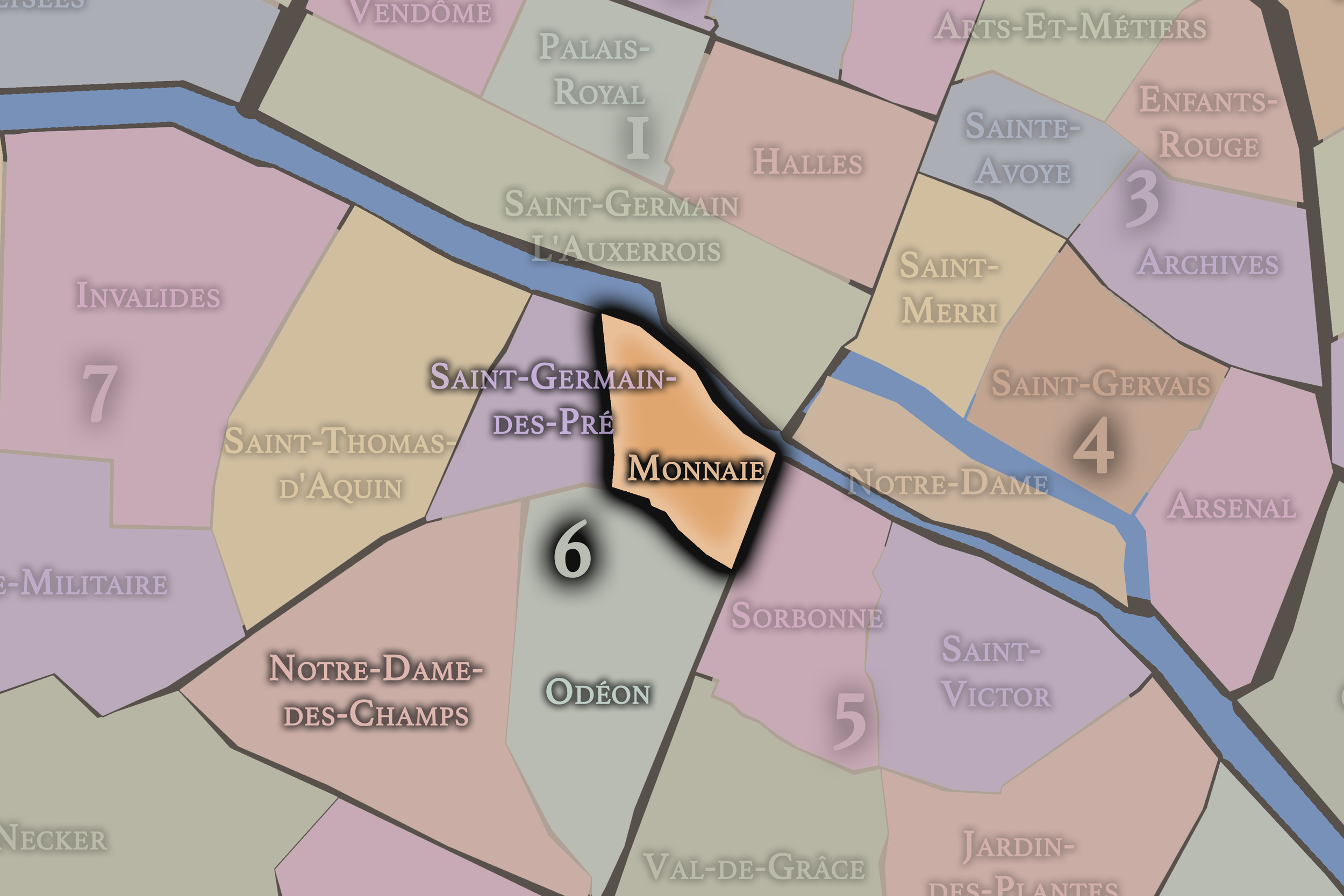
Monnaie
6e Arrondissement — Luxembourg
21st Administrative Quarter
Monnaie follows the Seine along a historic Left Bank edge, linking the old mint, riverfront quays, art dealers, bridges, and the dense cultural life between Saint-Germain and the historic core.
-
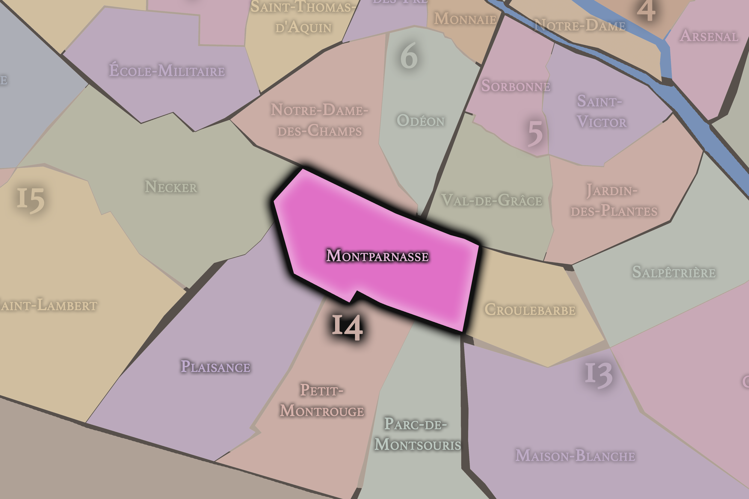
Montparnasse
14e Arrondissement — Observatoire
53rd Administrative Quarter
Montparnasse is tied to artists, cafés, studios, cemeteries, railway travel, and 20th-century bohemian mythology, even as its official quarter holds only part of that larger cultural district.
-
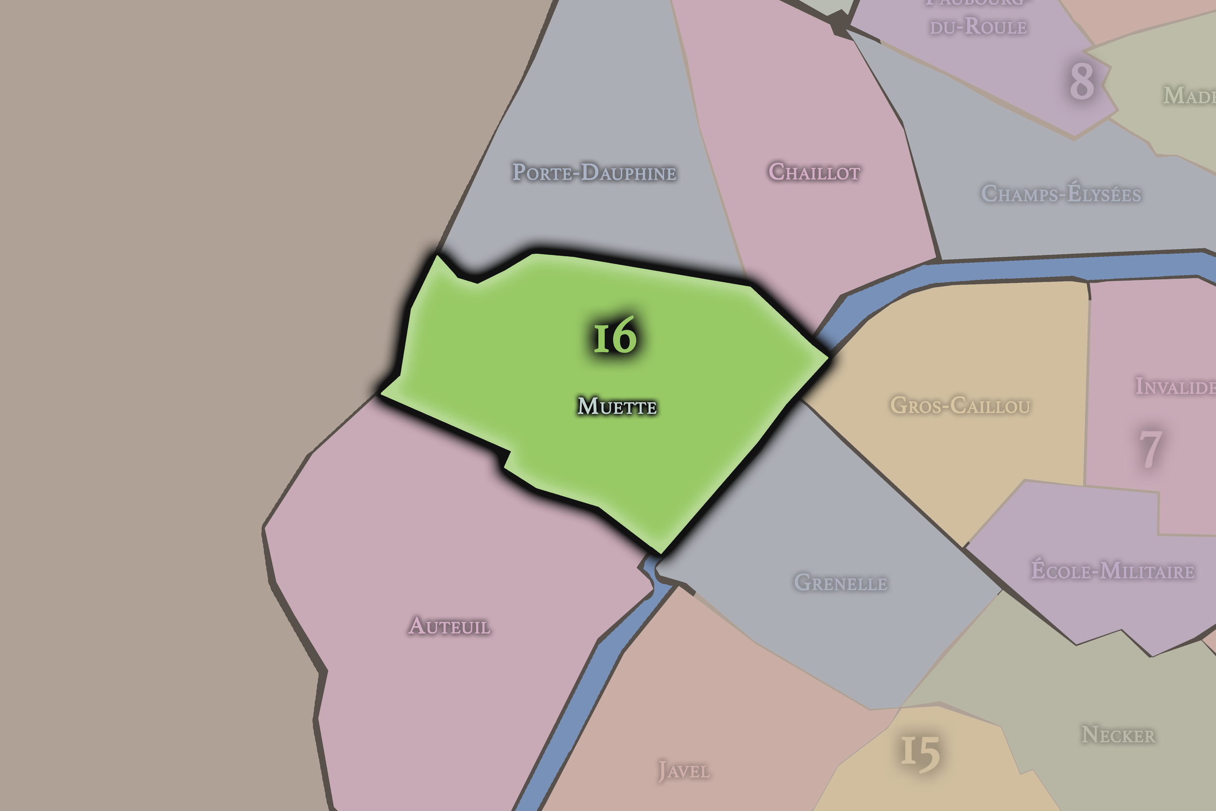
Muette
16e Arrondissement — Passy
62nd Administrative Quarter
Muette is associated with Passy, embassies, museums, quiet residential streets, and the elevated western slopes overlooking the Seine, carrying one of the 16th arrondissement’s most elegant identities.
-
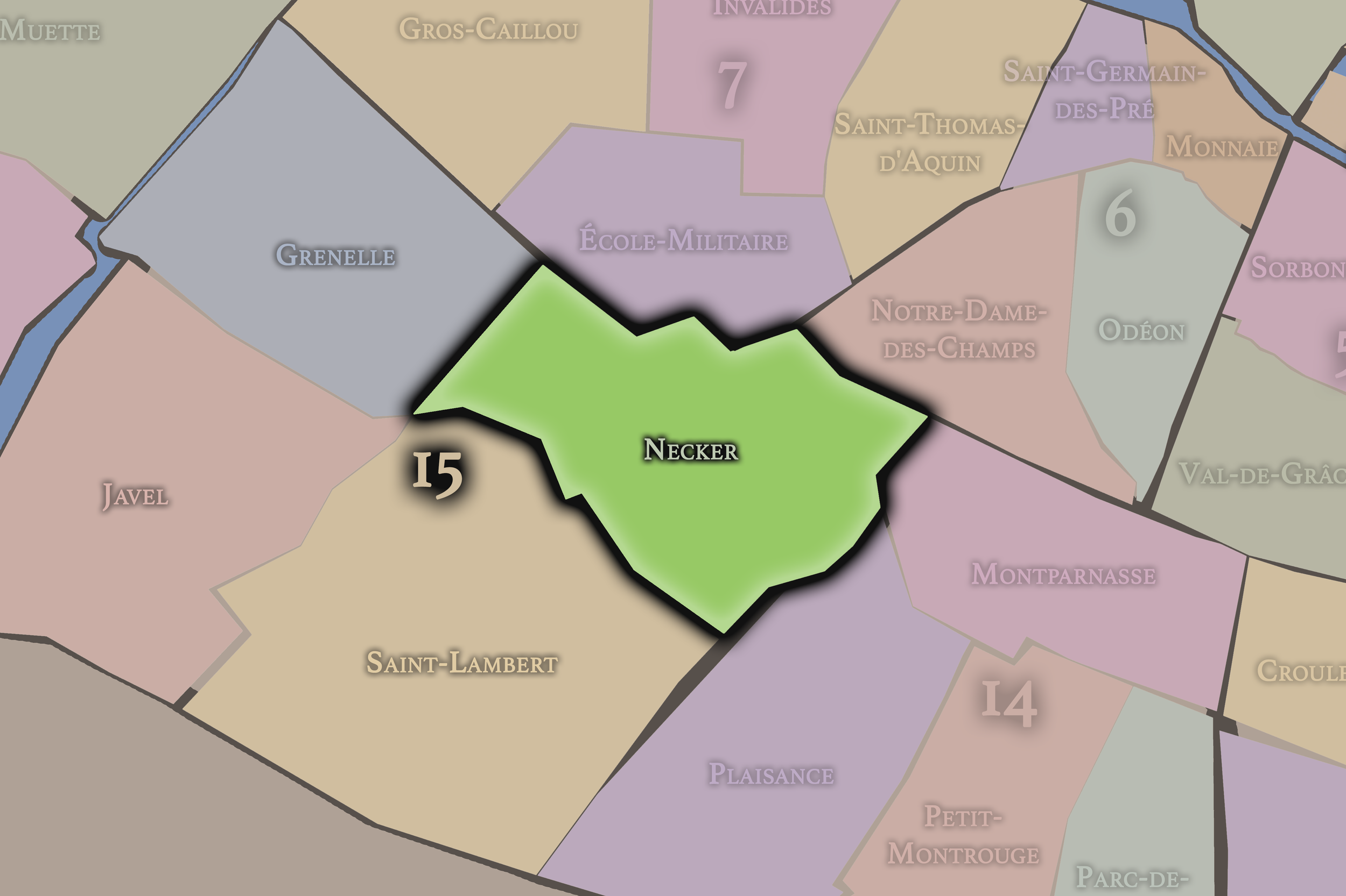
Necker
15e Arrondissement — Vaugirard
58th Administrative Quarter
Necker is shaped by hospitals, stations, civic institutions, and the neighborhoods around Montparnasse, combining medical history, transit, residential life, and the busy western Left Bank.
-
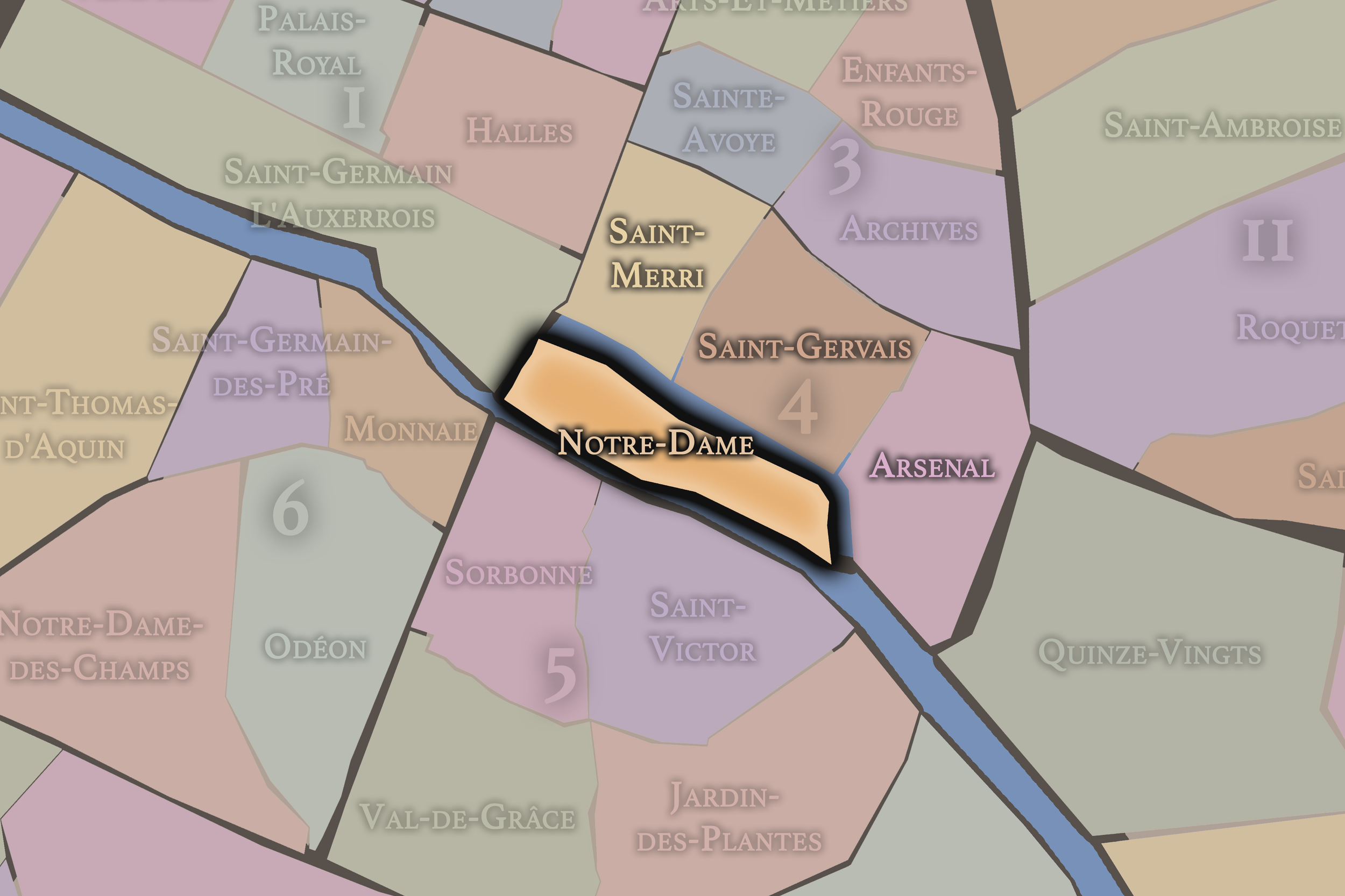
Notre-Dame
4e Arrondissement — Hôtel-de-Ville
16th Administrative Quarter
Set across the Île de la Cité and Île Saint-Louis, Notre-Dame is among the most historically concentrated quarters in Paris, with cathedral, river, palace, judicial, and island geographies gathered into one civic landscape.
-
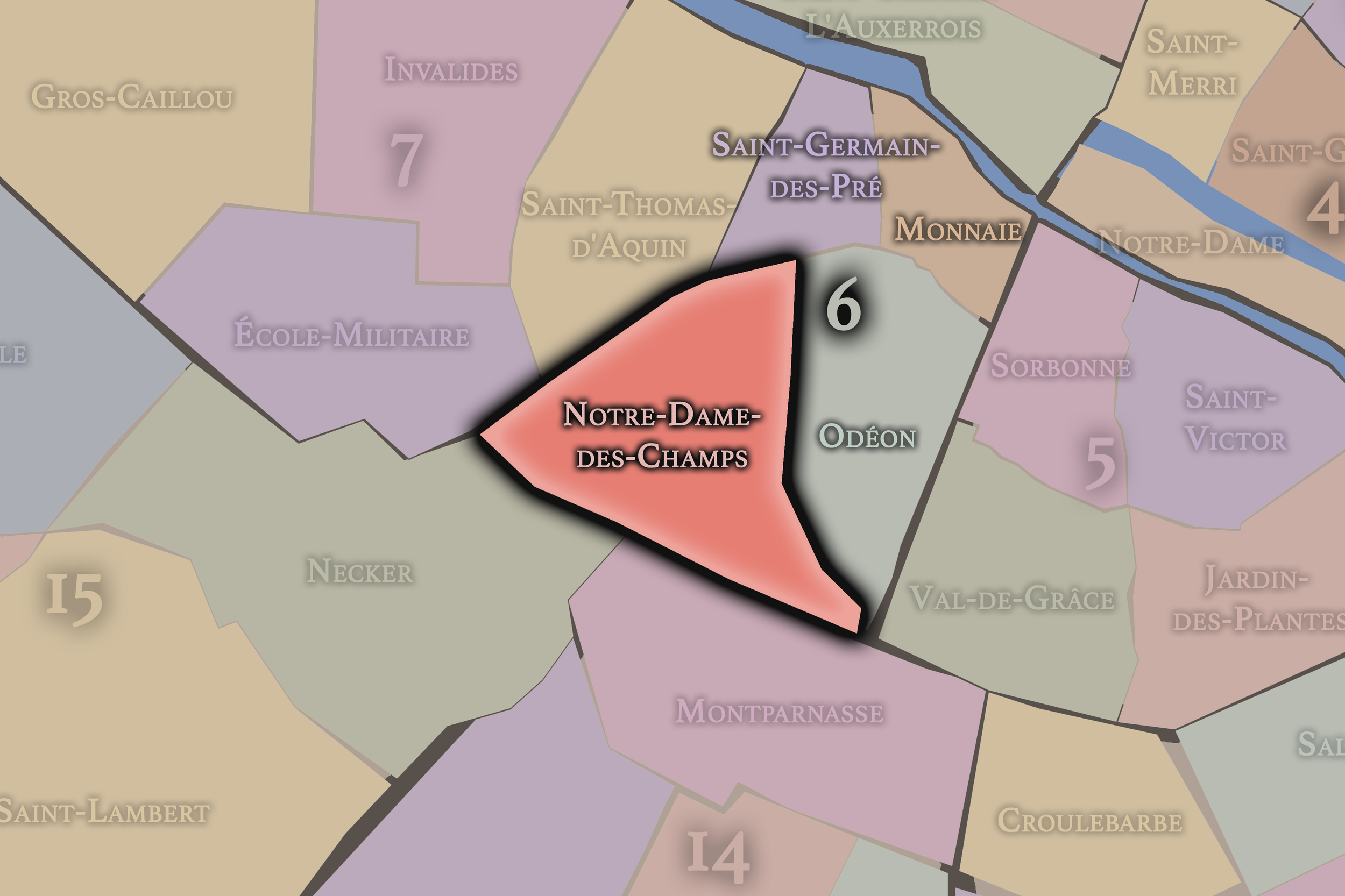
Notre-Dame-des-Champs
6e Arrondissement — Luxembourg
23rd Administrative Quarter
Notre-Dame-des-Champs carries a quieter Left Bank identity of studios, schools, religious institutions, residential streets, and artistic memory, stretching toward Montparnasse and the southern edge of Saint-Germain’s influence.
-
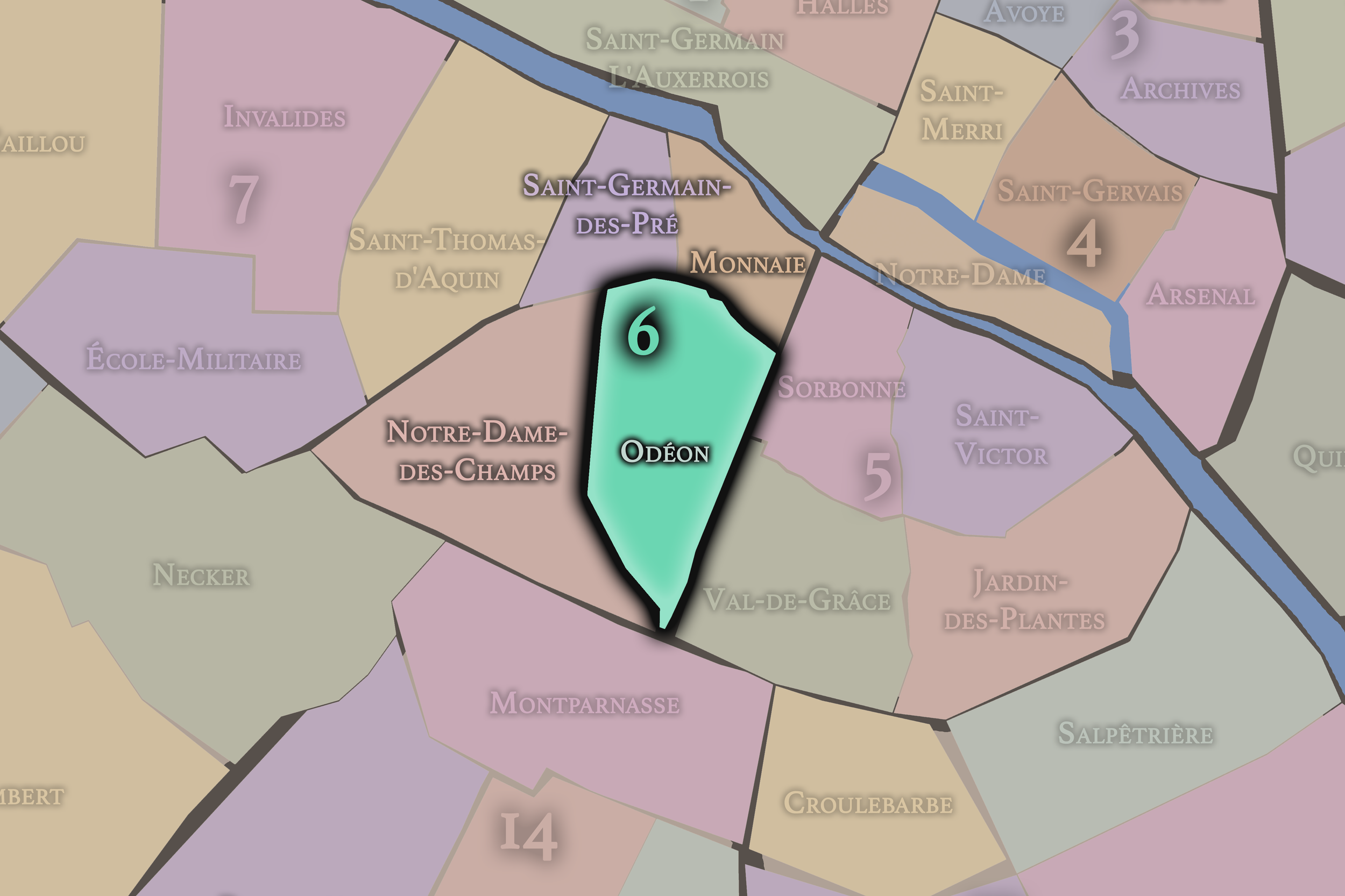
Odéon
6e Arrondissement — Luxembourg
22nd Administrative Quarter
Odéon is a theatrical and literary quarter, shaped by the Odéon theater, cafés, publishing history, student life, and the lively crossings between the Luxembourg Garden and Saint-Germain-des-Prés.
-
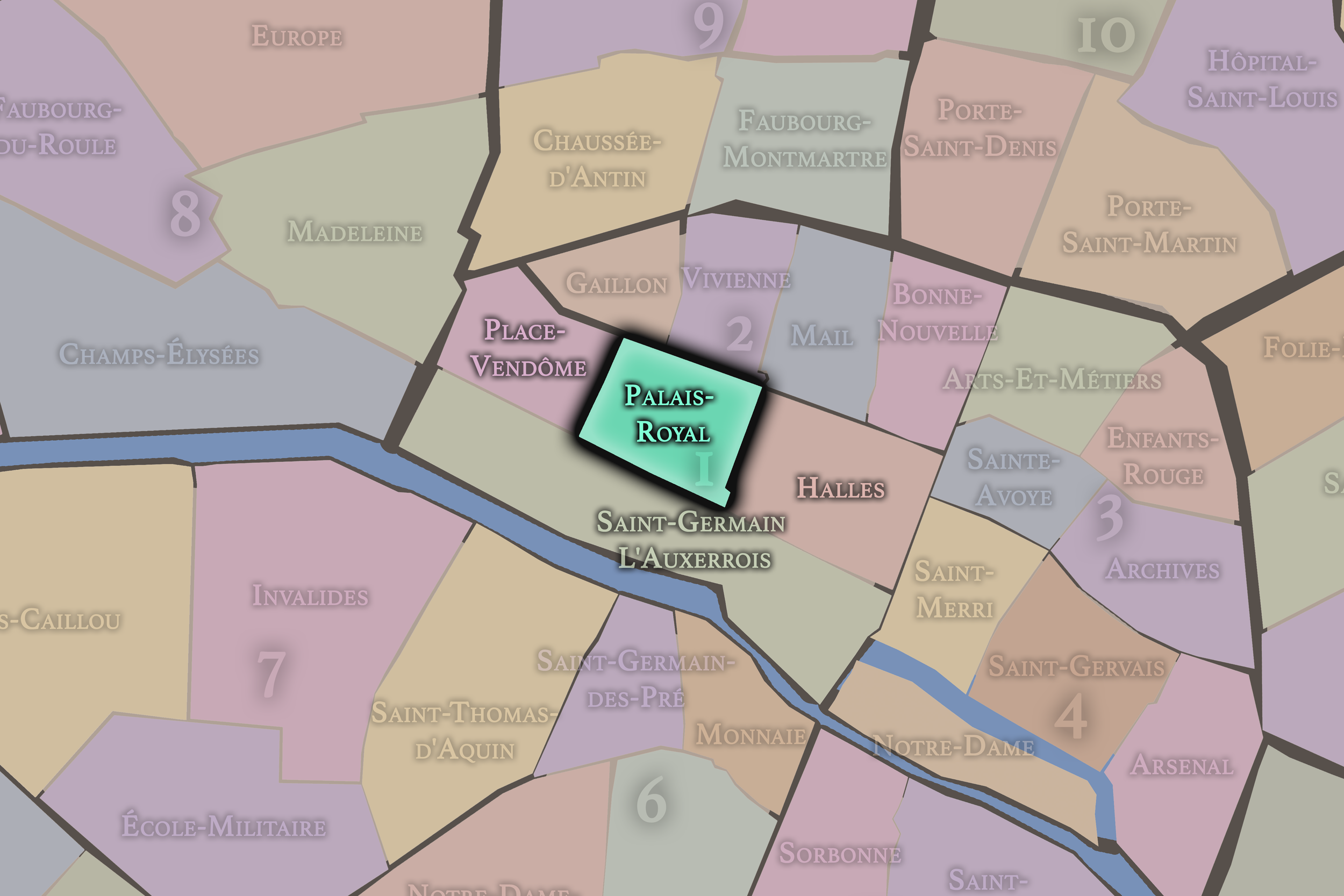
Palais-Royal
1er Arrondissement — Louvre
3rd Administrative Quarter
Centered on the arcades and gardens of the Palais-Royal, this quarter carries an elegant mixture of royal architecture, literary memory, covered passages, theaters, government buildings, and quiet interior courtyards.
-
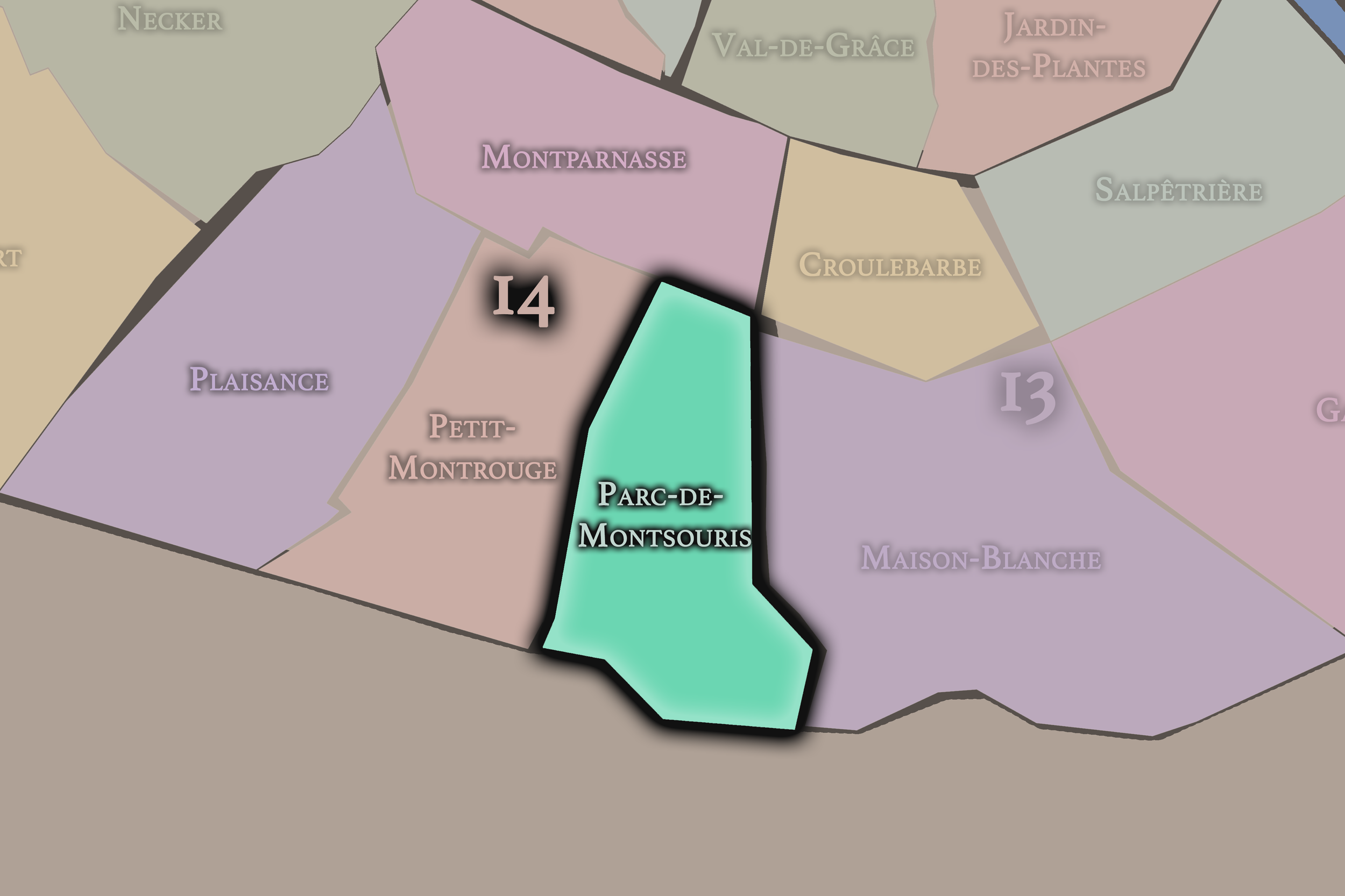
Parc-de-Montsouris
14e Arrondissement — Observatoire
54th Administrative Quarter
Parc-de-Montsouris is shaped by its great park, university campuses, residential streets, rail cuts, and the southern slope of Paris near the city’s edge.
-
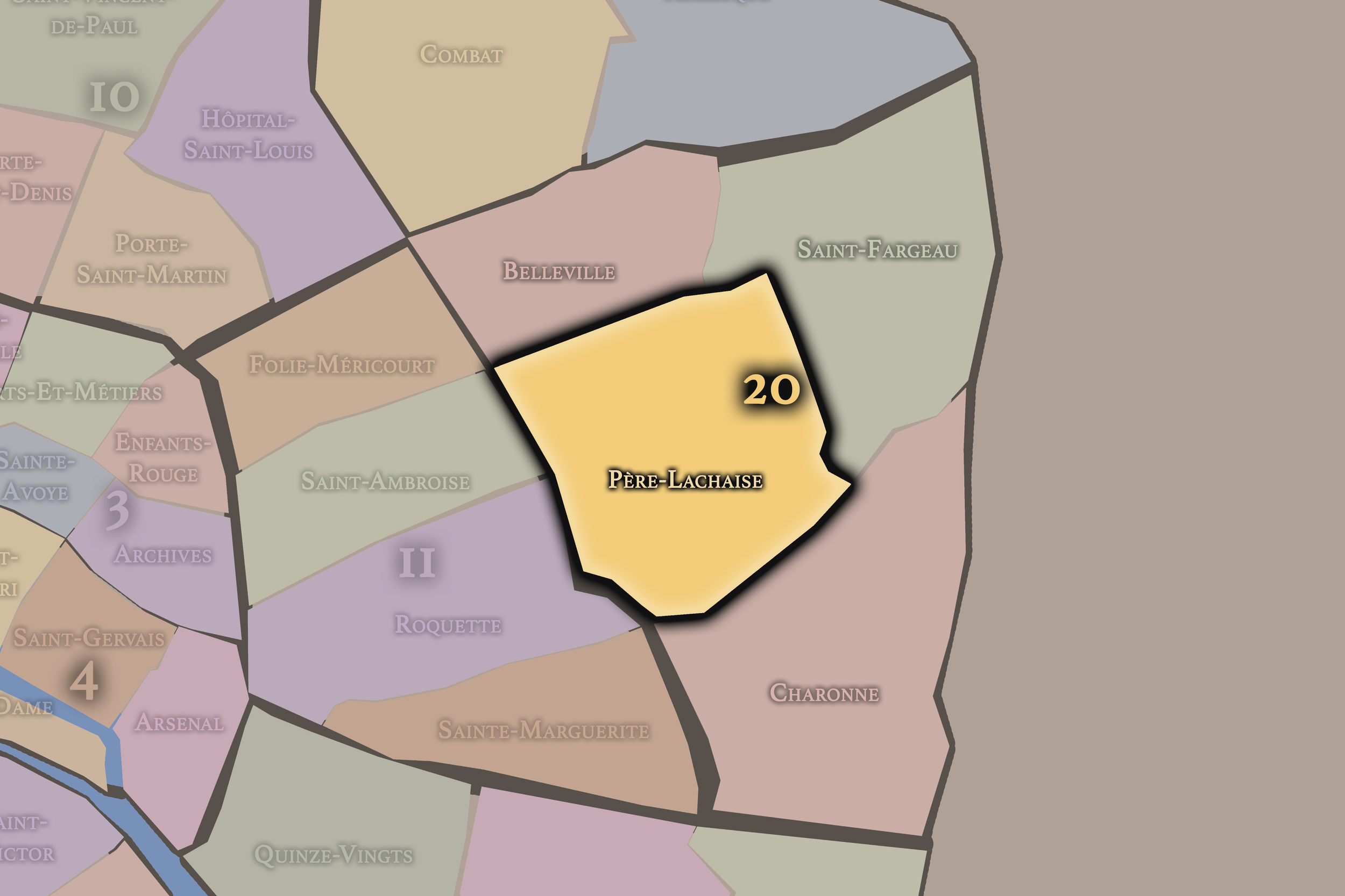
Père-Lachaise
20e Arrondissement — Ménilmontant
79th Administrative Quarter
Père-Lachaise is anchored by the famous cemetery, but its quarter also carries residential streets, memorial landscapes, eastern Parisian history, and the contemplative atmosphere of one of the city’s great civic spaces.
-
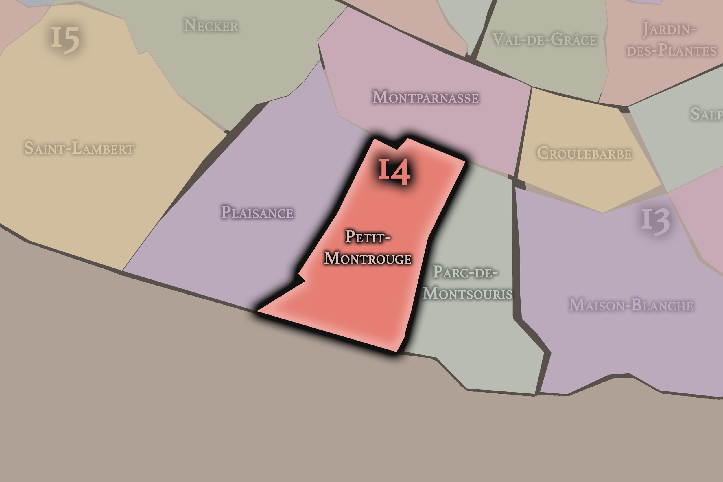
Petit-Montrouge
14e Arrondissement — Observatoire
55th Administrative Quarter
Petit-Montrouge preserves the name of a former suburban settlement, now a lively southern quarter of parish streets, shops, apartment blocks, and the everyday rhythm around Alésia.
-
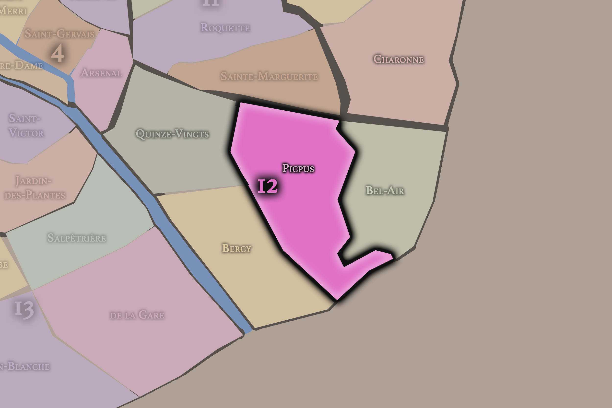
Picpus
12e Arrondissement — Reuilly
46th Administrative Quarter
Picpus carries deep religious and revolutionary memory, along with residential streets, cemeteries, institutions, and the transitional geography between Nation, Reuilly, and the eastern edge of the city.
-
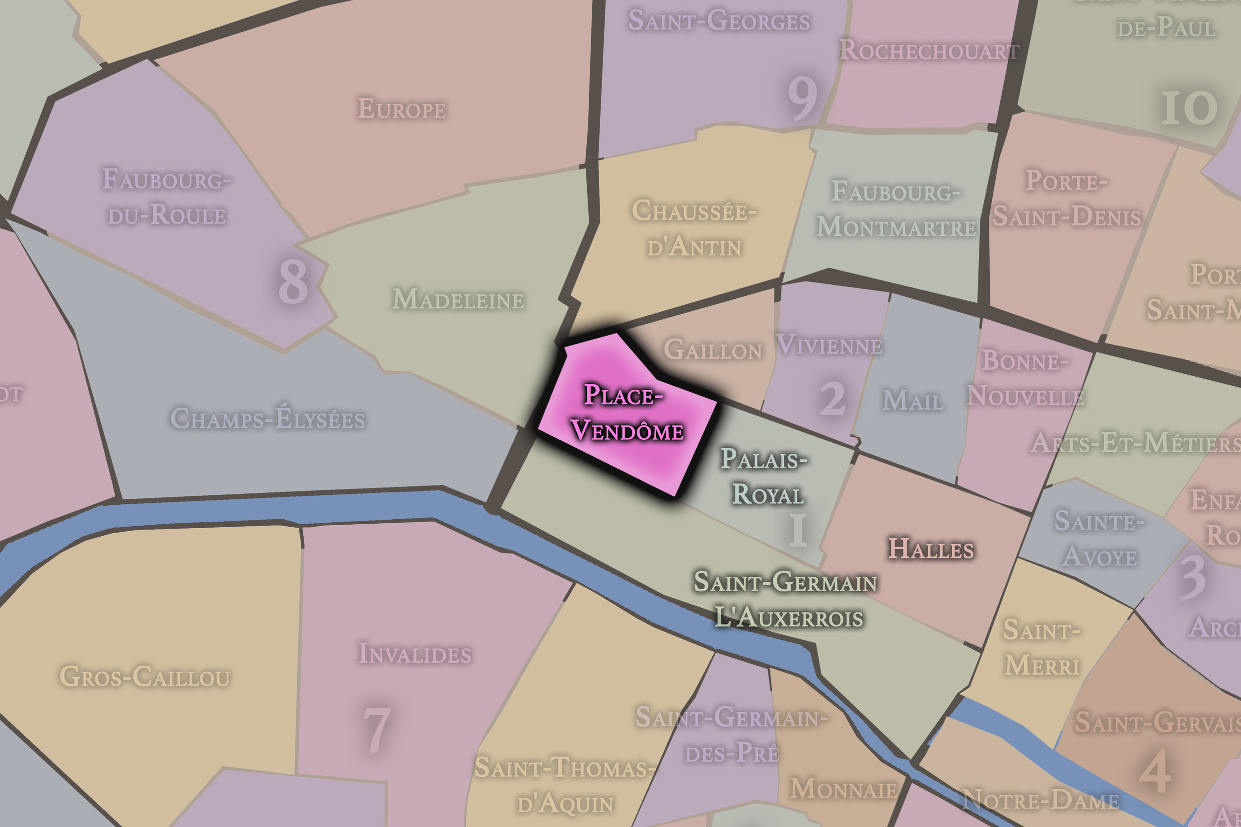
Place-Vendôme
1er Arrondissement — Louvre
4th Administrative Quarter
Place-Vendôme is one of Paris’s most polished urban stages, associated with formal architecture, luxury houses, jewelry, grand hotels, and the carefully composed grandeur of the royal and imperial city.
-
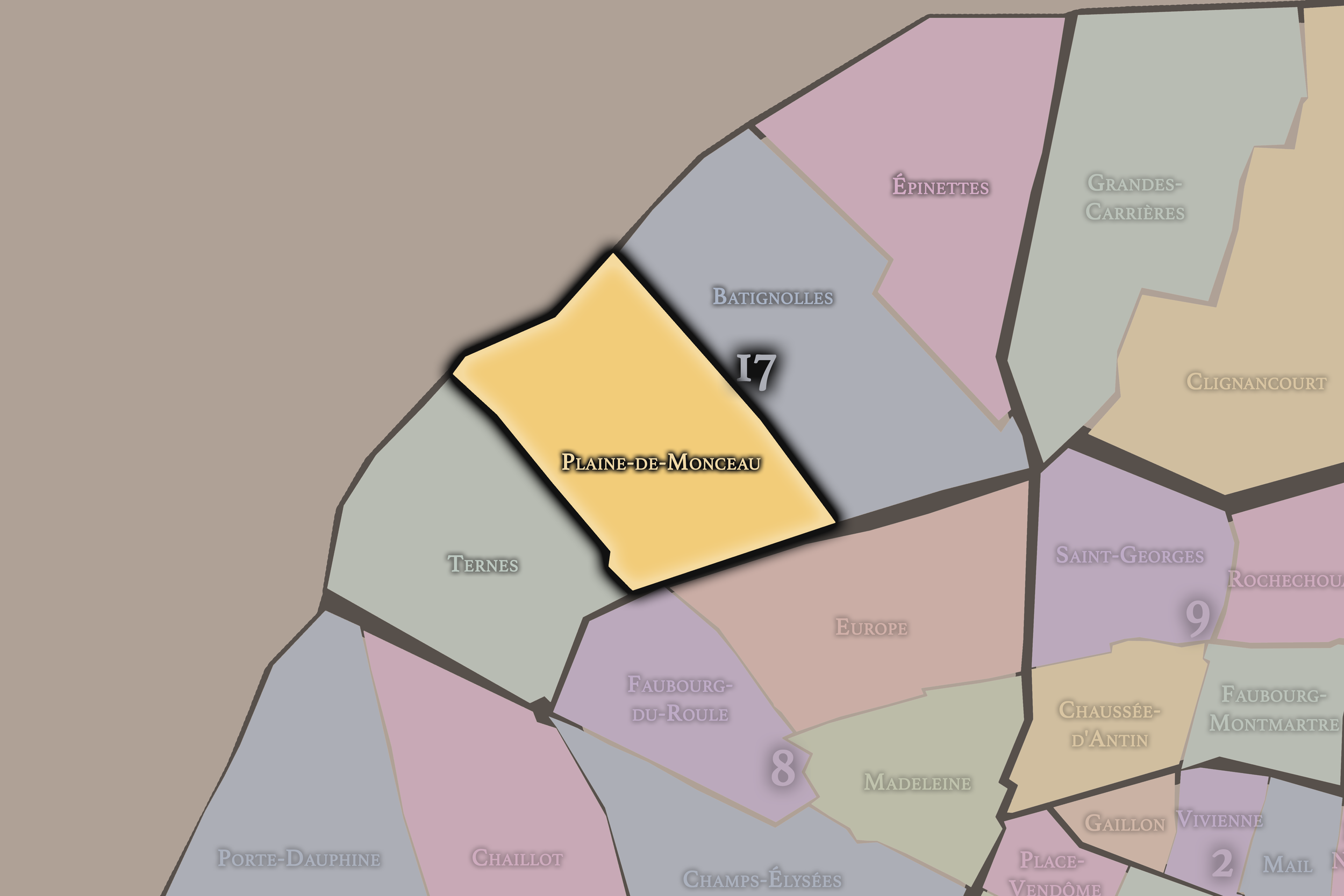
Plaine-de-Monceau
17e Arrondissement — Batignolles-Monceau
66th Administrative Quarter
Plaine-de-Monceaux is known for elegant 19th-century streets, mansions, parks, and a refined residential identity shaped by the expansion of western Paris under the Second Empire.
-
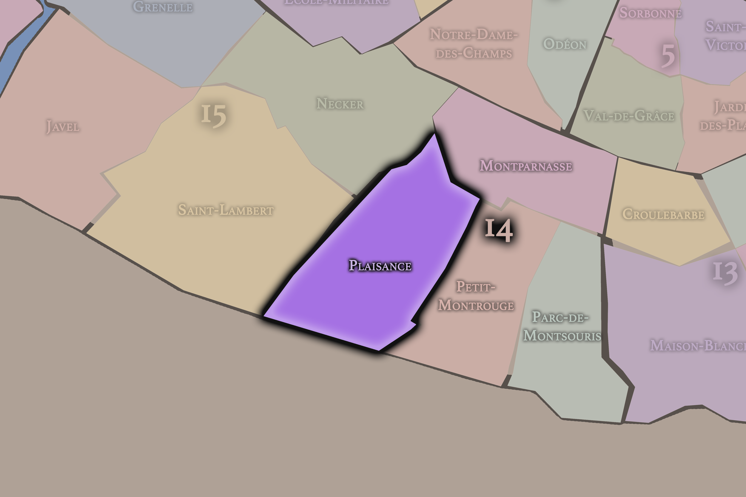
Plaisance
14e Arrondissement — Observatoire
56th Administrative Quarter
Plaisance carries the memory of a working and suburban Paris, with residential streets, former village edges, railway traces, and the intimate southern texture of the 14th arrondissement.
-
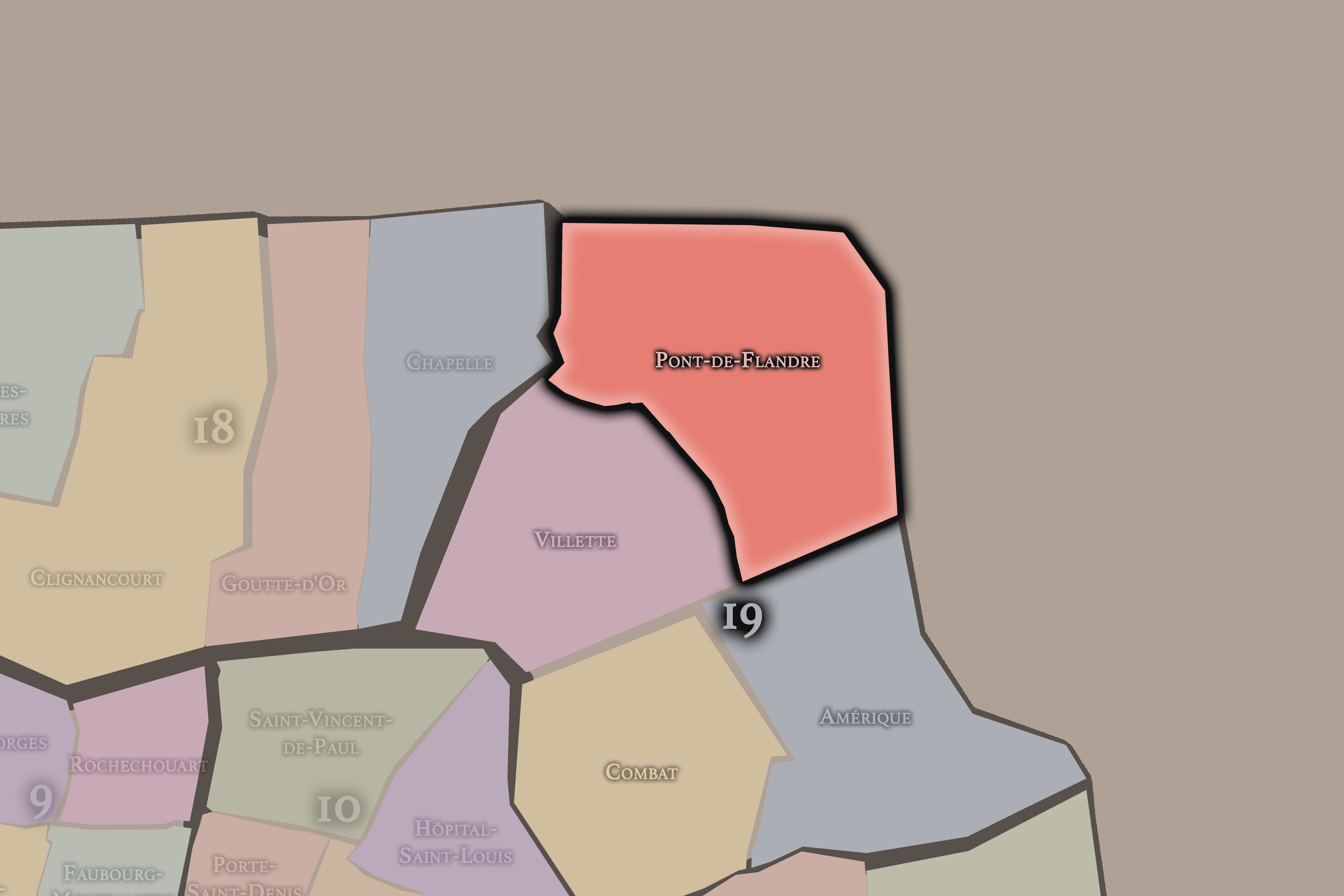
Pont-de-Flandre
19e Arrondissement — Buttes-Chaumont
74th Administrative Quarter
Pont-de-Flandre is shaped by canals, modern cultural spaces, transport corridors, and the Parc de la Villette, linking industrial memory with one of Paris’s boldest contemporary landscapes.
-
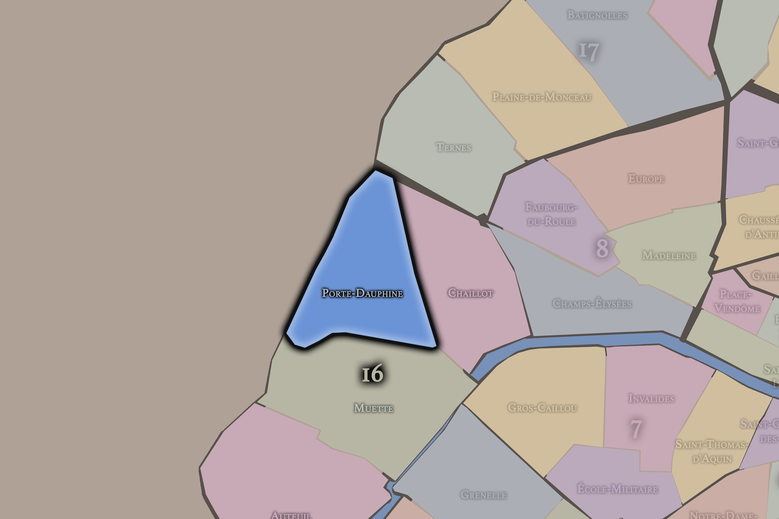
Porte-Dauphine
16e Arrondissement — Passy
63rd Administrative Quarter
Porte-Dauphine sits near the Bois de Boulogne and the western gates of Paris, combining grand avenues, residential calm, university life, and the city’s green outer edge.
-
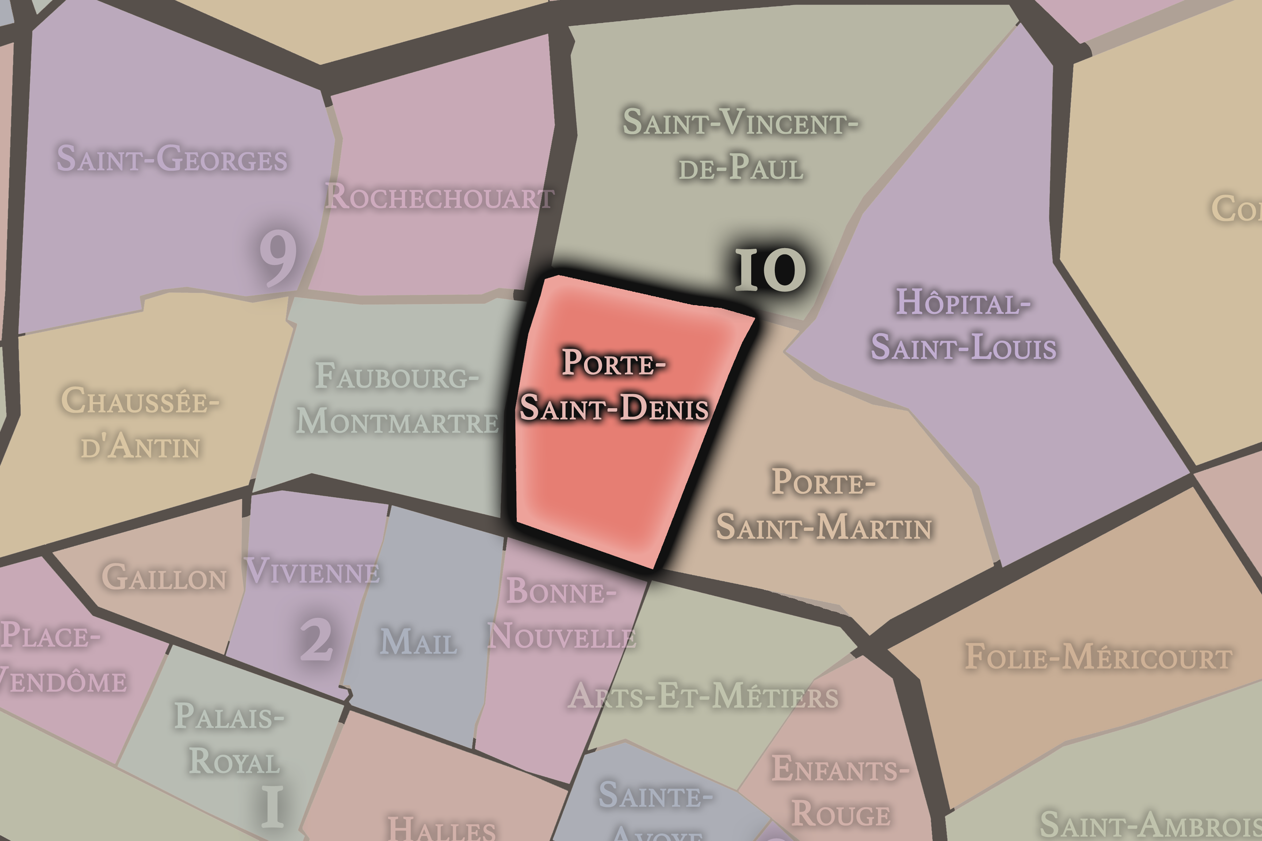
Porte-Saint-Denis
10e Arrondissement — Entrepôt
38th Administrative Quarter
Porte-Saint-Denis centers on one of the old triumphal gates of Paris, where boulevard life, theater history, working streets, and commercial density gather along a historic entrance to the city.
-
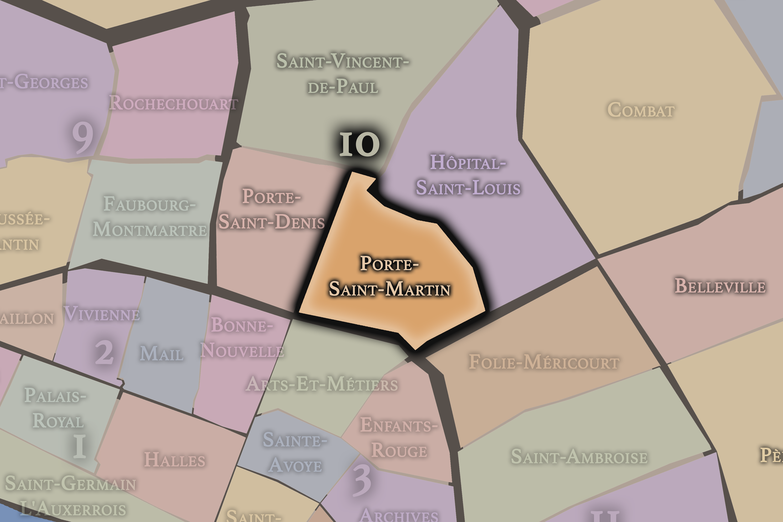
Porte-Saint-Martin
10e Arrondissement — Entrepôt
39th Administrative Quarter
Porte-Saint-Martin combines boulevard theaters, historic gates, canal approaches, and a restless urban texture where entertainment, transit, commerce, and northeastern Paris begin to overlap.
-
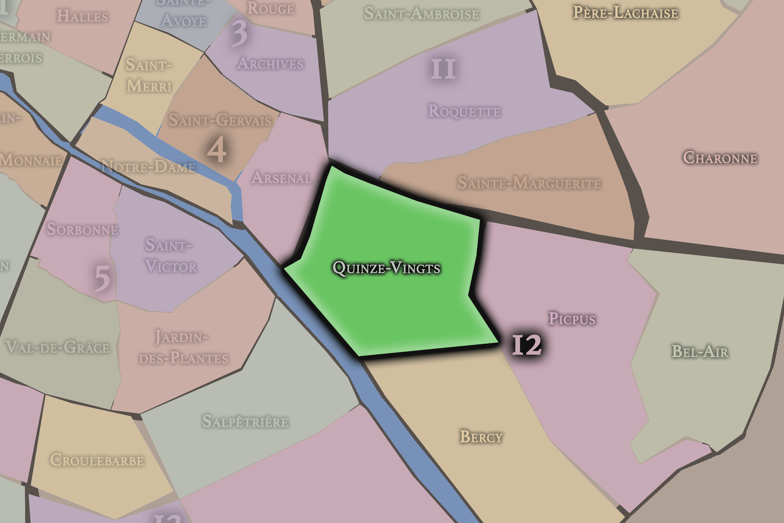
Quinze-Vingts
12e Arrondissement — Reuilly
48th Administrative Quarter
Quinze-Vingts is closely tied to Bastille, the Gare de Lyon, hospital history, and the movement of travelers, with busy streets and transit corridors shaping its western edge.
-
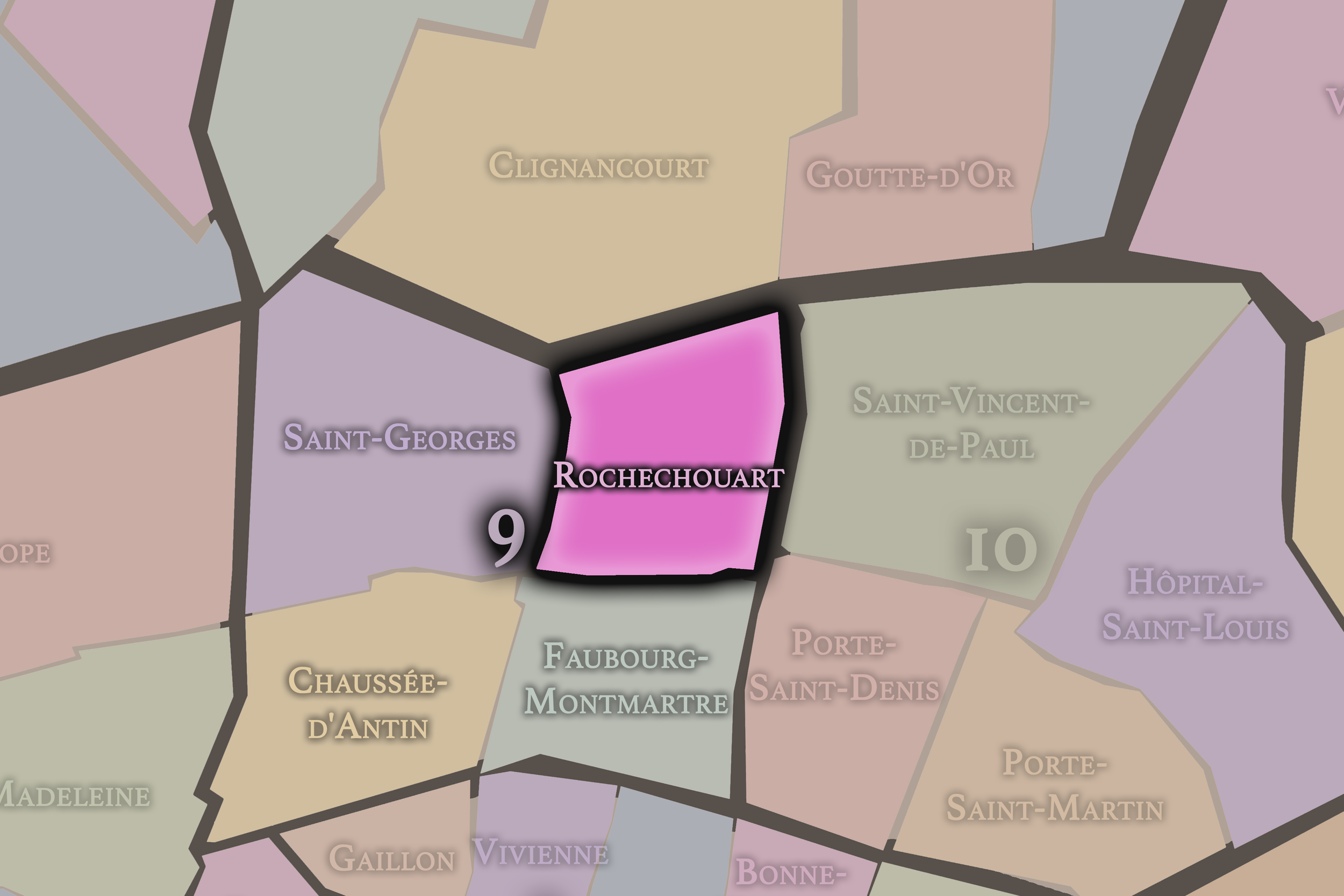
Rochechouart
9e Arrondissement — Opéra
36th Administrative Quarter
Rochechouart climbs toward the southern slopes of Montmartre, mixing music halls, religious institutions, residential streets, and the threshold between central Right Bank Paris and the hill’s more bohemian mythology.
-
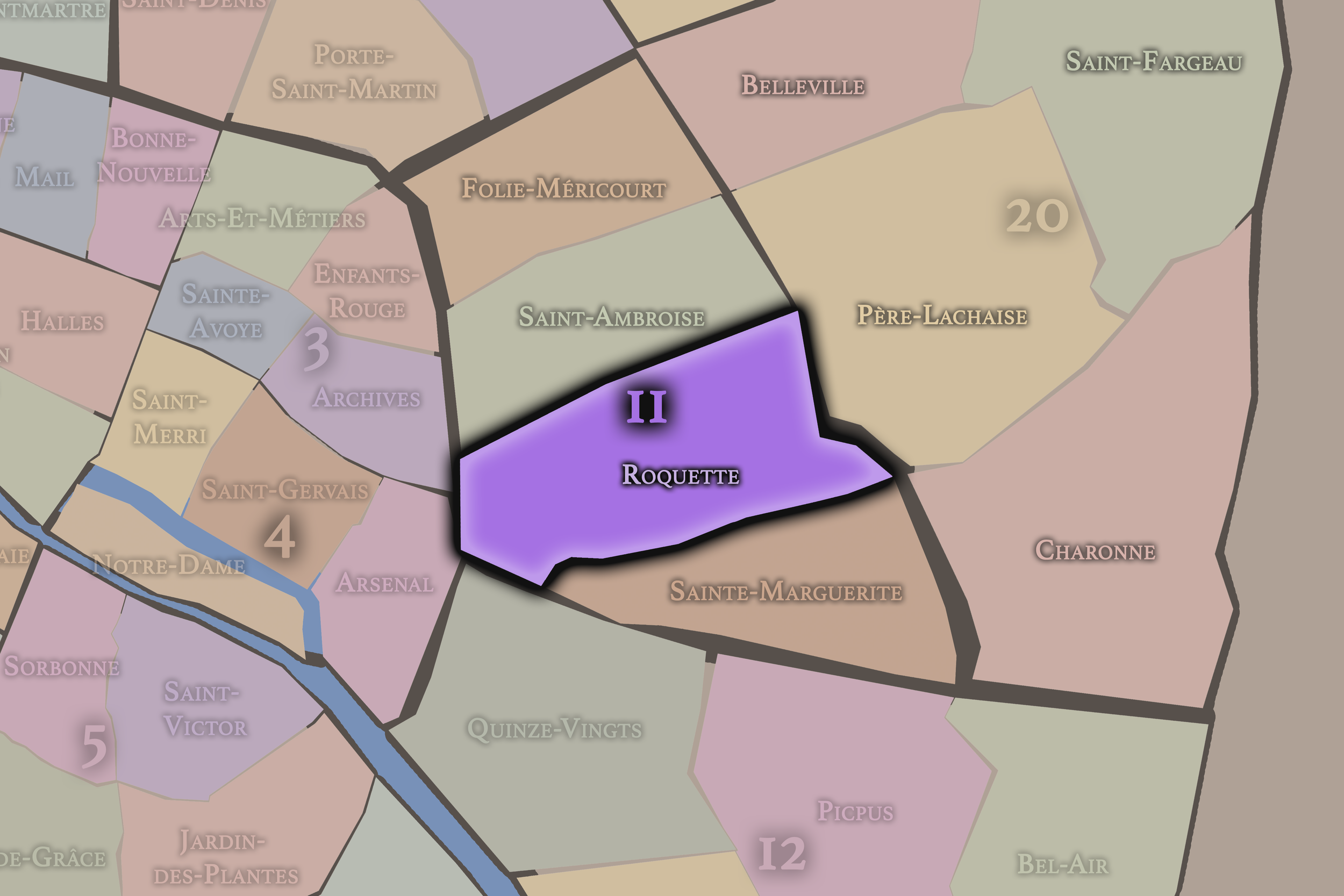
Roquette
11e Arrondissement — Popincourt
43rd Administrative Quarter
Roquette is associated with the Bastille side of the arrondissement, mixing nightlife, artisanship, working-class memory, prison history, and the dense street life of eastern central Paris.
-
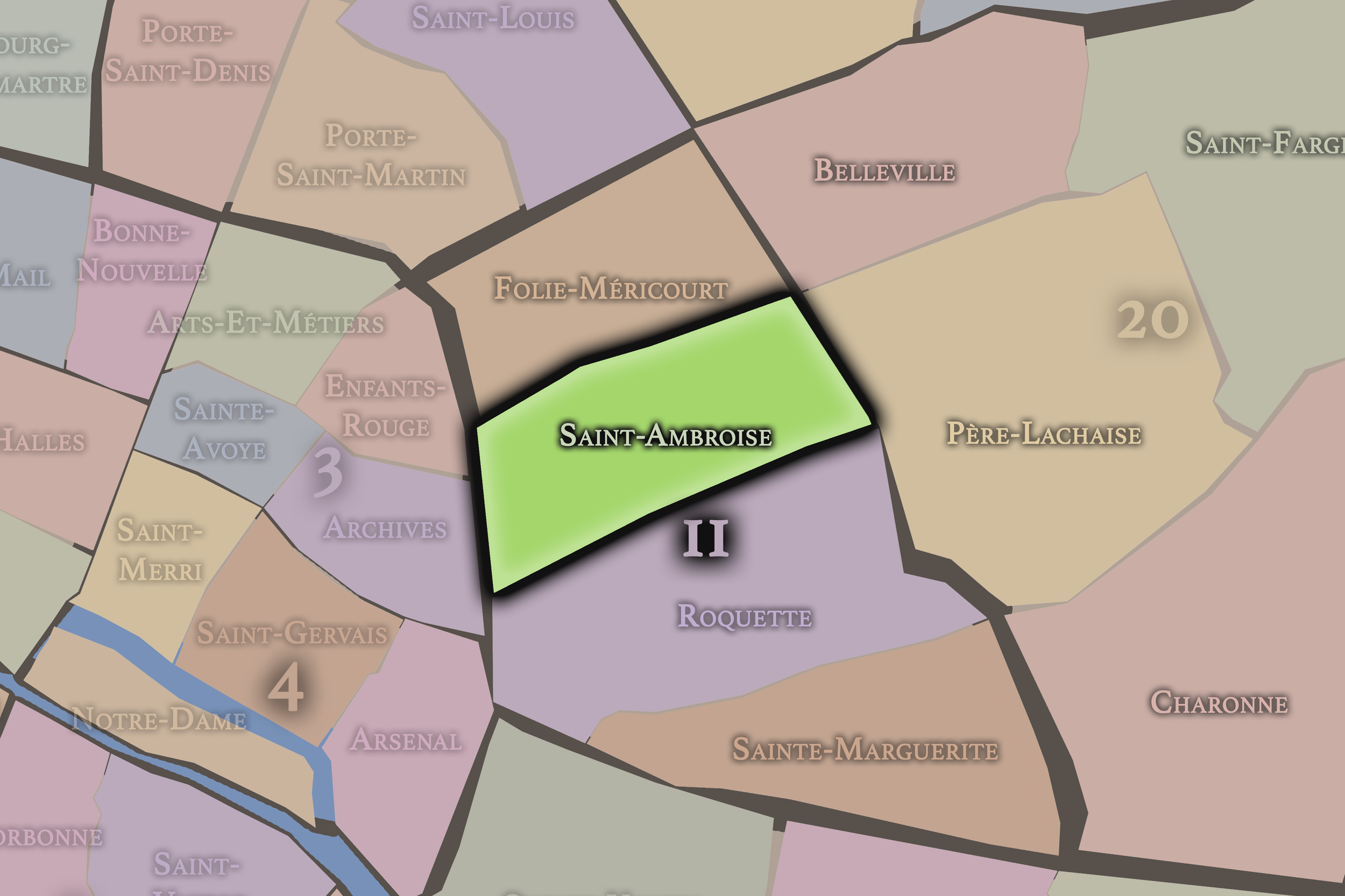
Saint-Ambroise
11e Arrondissement — Popincourt
42nd Administrative Quarter
Saint-Ambroise carries a more residential and civic identity, centered around its parish church and surrounding streets, with schools, small businesses, and neighborhood life woven through the heart of the 11th.
-
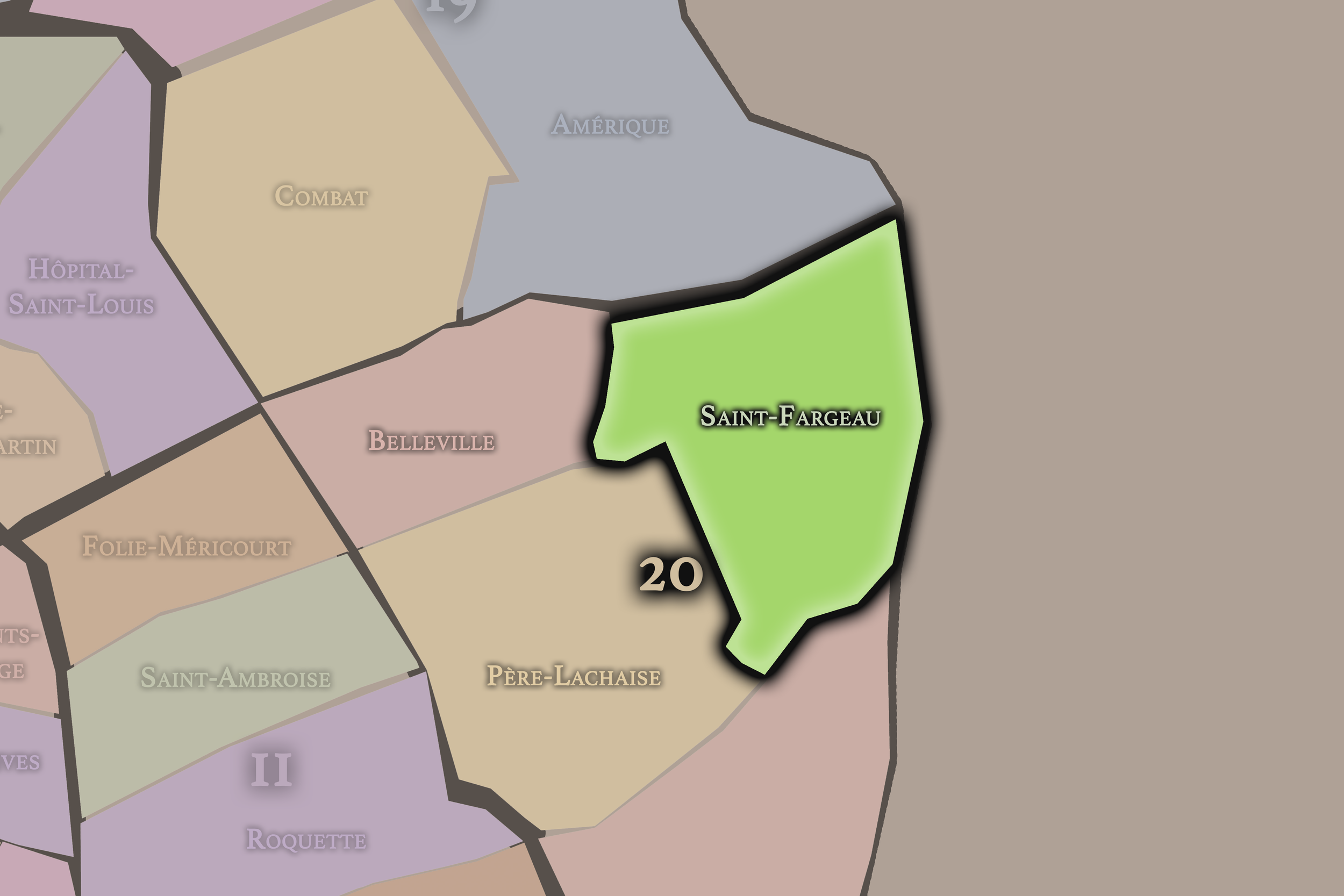
Saint-Fargeau
20e Arrondissement — Ménilmontant
78th Administrative Quarter
Saint-Fargeau occupies the northeastern heights of the 20th, with residential streets, modern housing, village traces, and a quieter local geography near the outer edge of Paris.
-
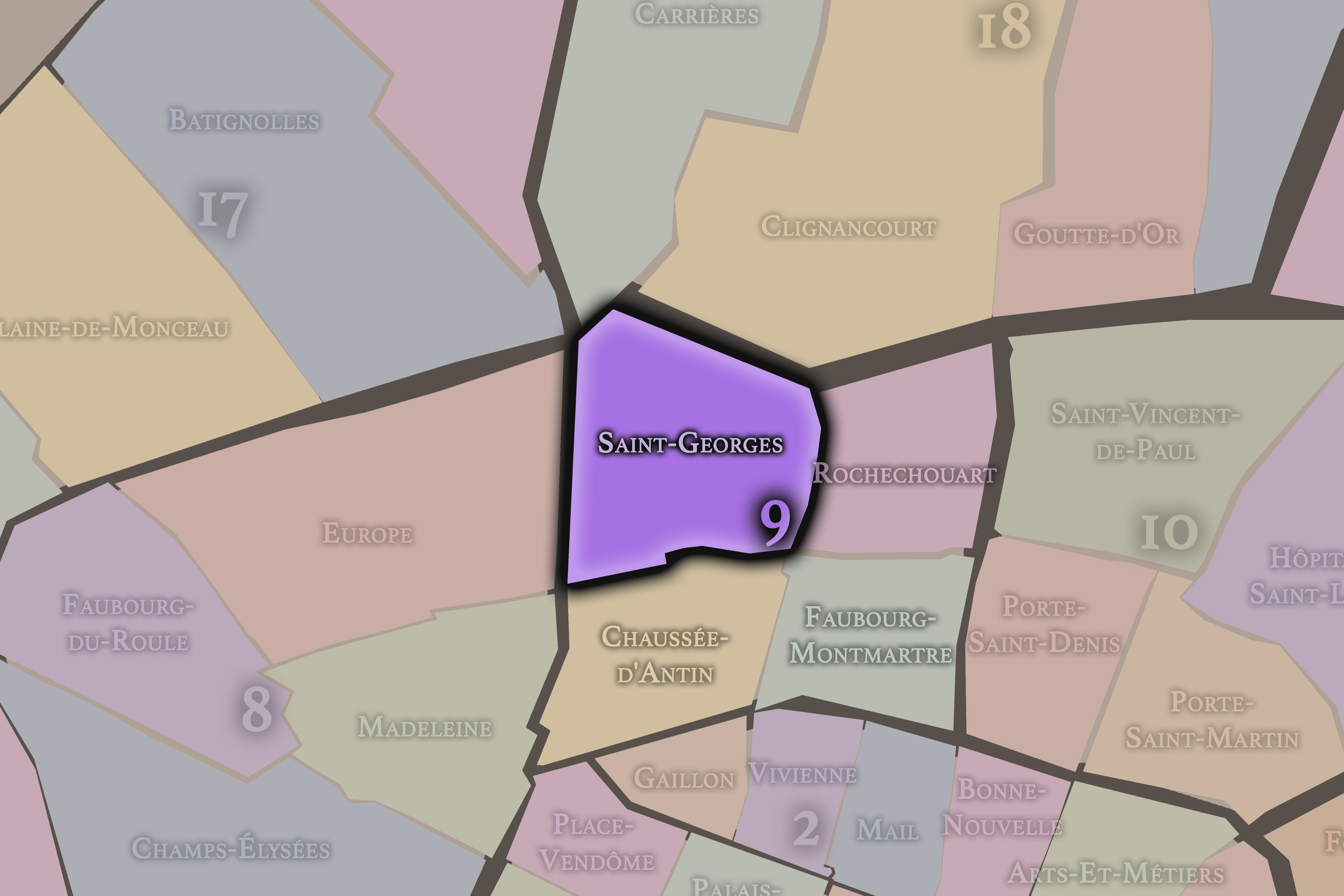
Saint-Georges
9e Arrondissement — Opéra
33rd Administrative Quarter
Saint-Georges is associated with the Nouvelle Athènes, Romantic-era Paris, theaters, artists’ homes, sloping streets, and the elegant residential fabric that rises toward Pigalle and Montmartre.
-
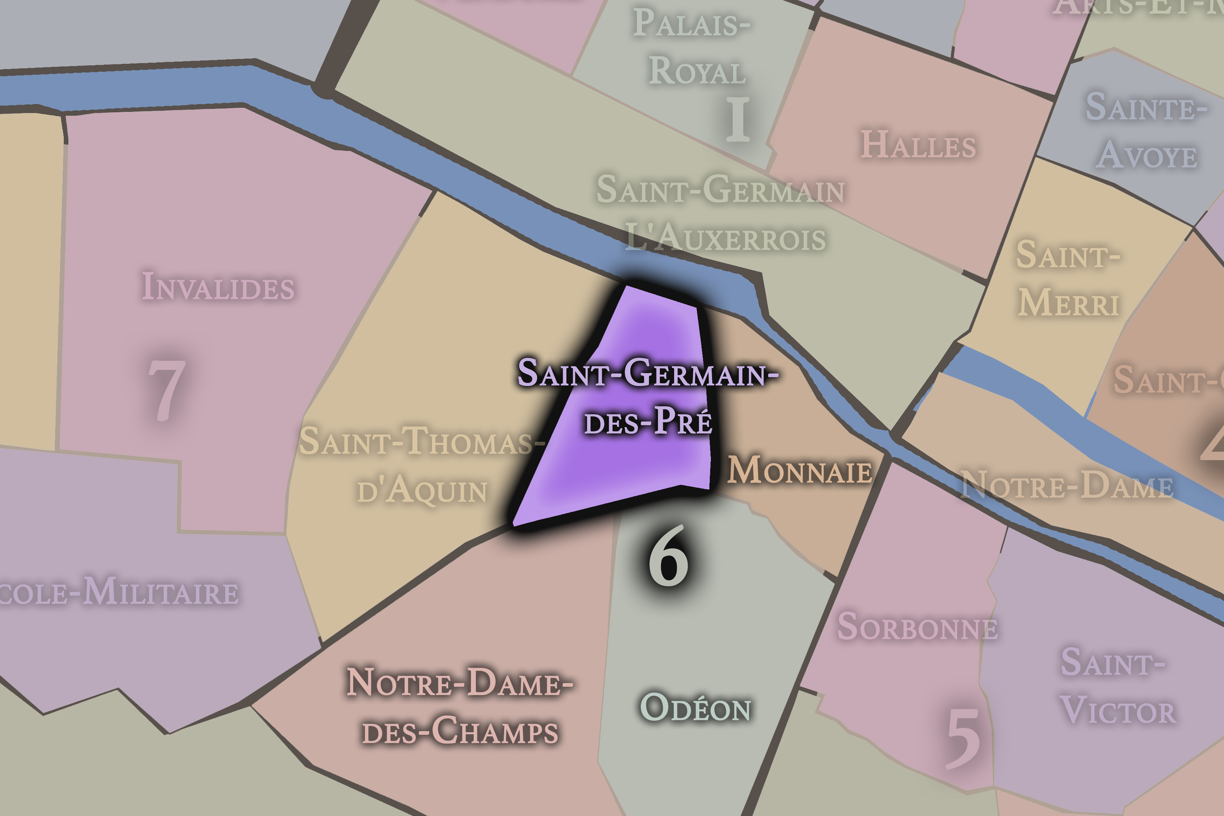
Saint-Germain-des-Prés
6e Arrondissement — Luxembourg
24th Administrative Quarter
Saint-Germain-des-Prés is one of Paris’s legendary cultural landscapes, associated with abbey history, cafés, galleries, publishing, postwar intellectual life, luxury boutiques, and the enduring romance of the Left Bank.
-
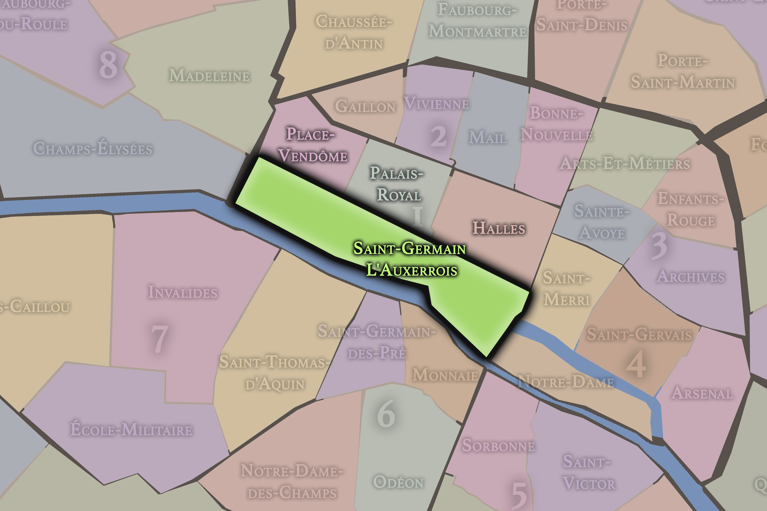
Saint-Germain-l’Auxerrois
1er Arrondissement — Louvre
1st Administrative Quarter
At the ceremonial heart of Paris, Saint-Germain-l’Auxerrois gathers the Louvre, the Seine, the eastern edge of the Tuileries, and some of the city’s deepest royal, civic, and monumental memory.
-
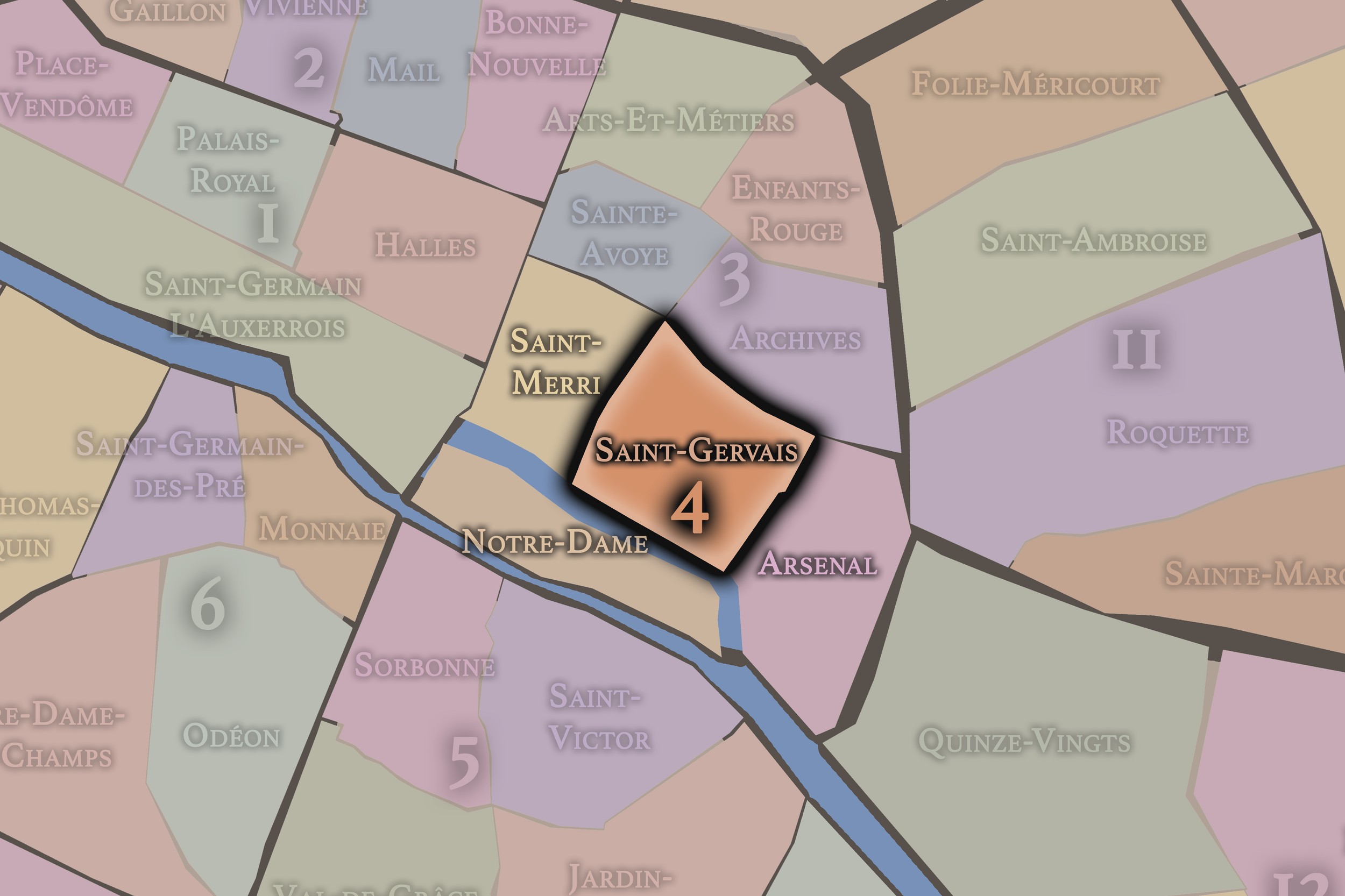
Saint-Gervais
4e Arrondissement — Hôtel-de-Ville
14th Administrative Quarter
Saint-Gervais is one of the old heartlands of the Right Bank, shaped by parish history, Hôtel de Ville, narrow Marais streets, Jewish heritage, civic monuments, and the long memory of central Paris.
-
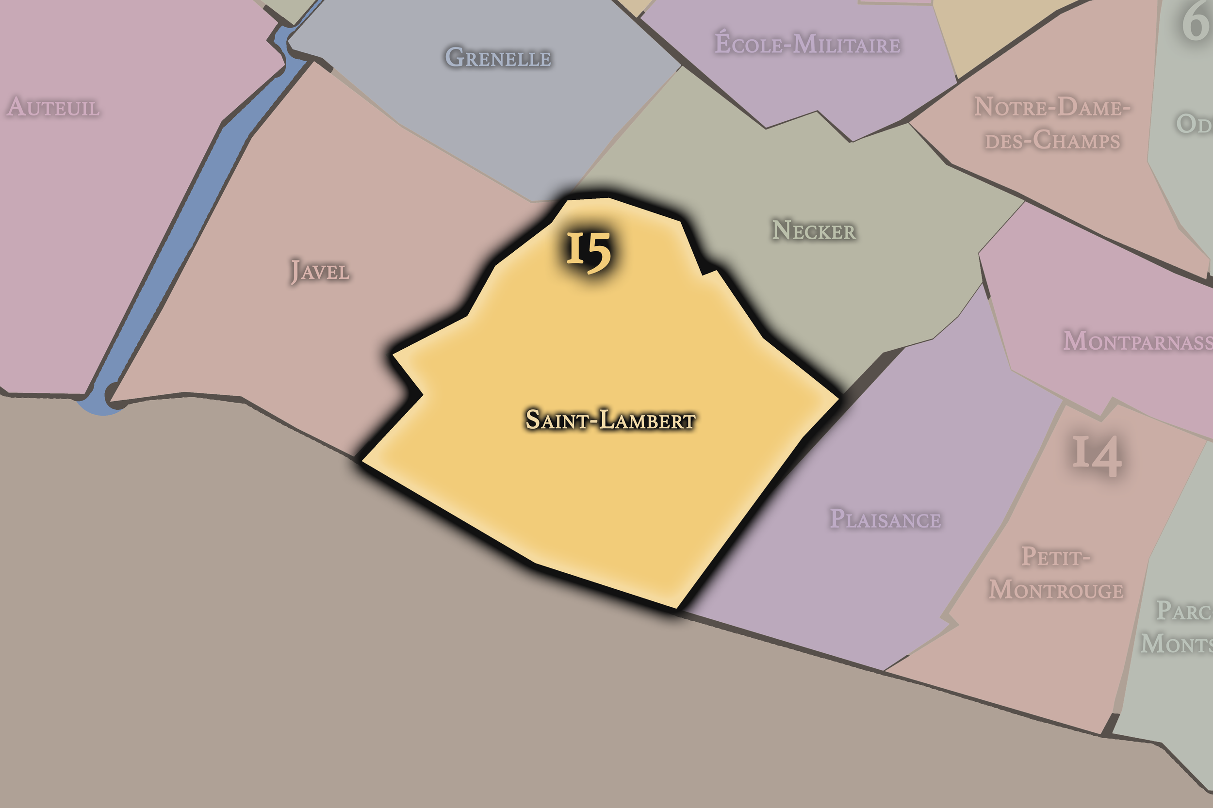
Saint-Lambert
15e Arrondissement — Vaugirard
57th Administrative Quarter
Saint-Lambert reflects the older village and parish identity of Vaugirard, with residential streets, markets, schools, and the broad everyday fabric of Paris’s largest arrondissement.
-
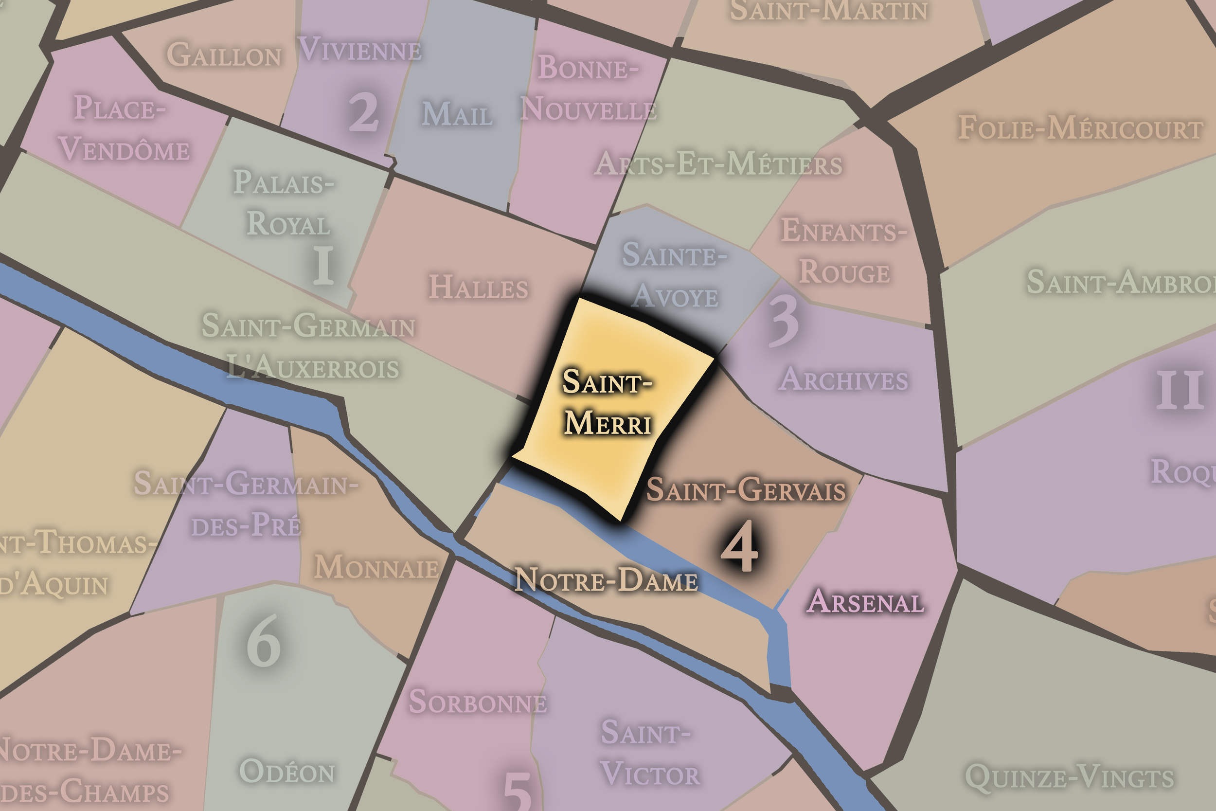
Saint-Merri
4e Arrondissement — Hôtel-de-Ville
13th Administrative Quarter
Saint-Merri brings together the area around Beaubourg, the Centre Pompidou, medieval church streets, lively pedestrian corridors, and the creative edge where historic Paris meets modern cultural experimentation.
-
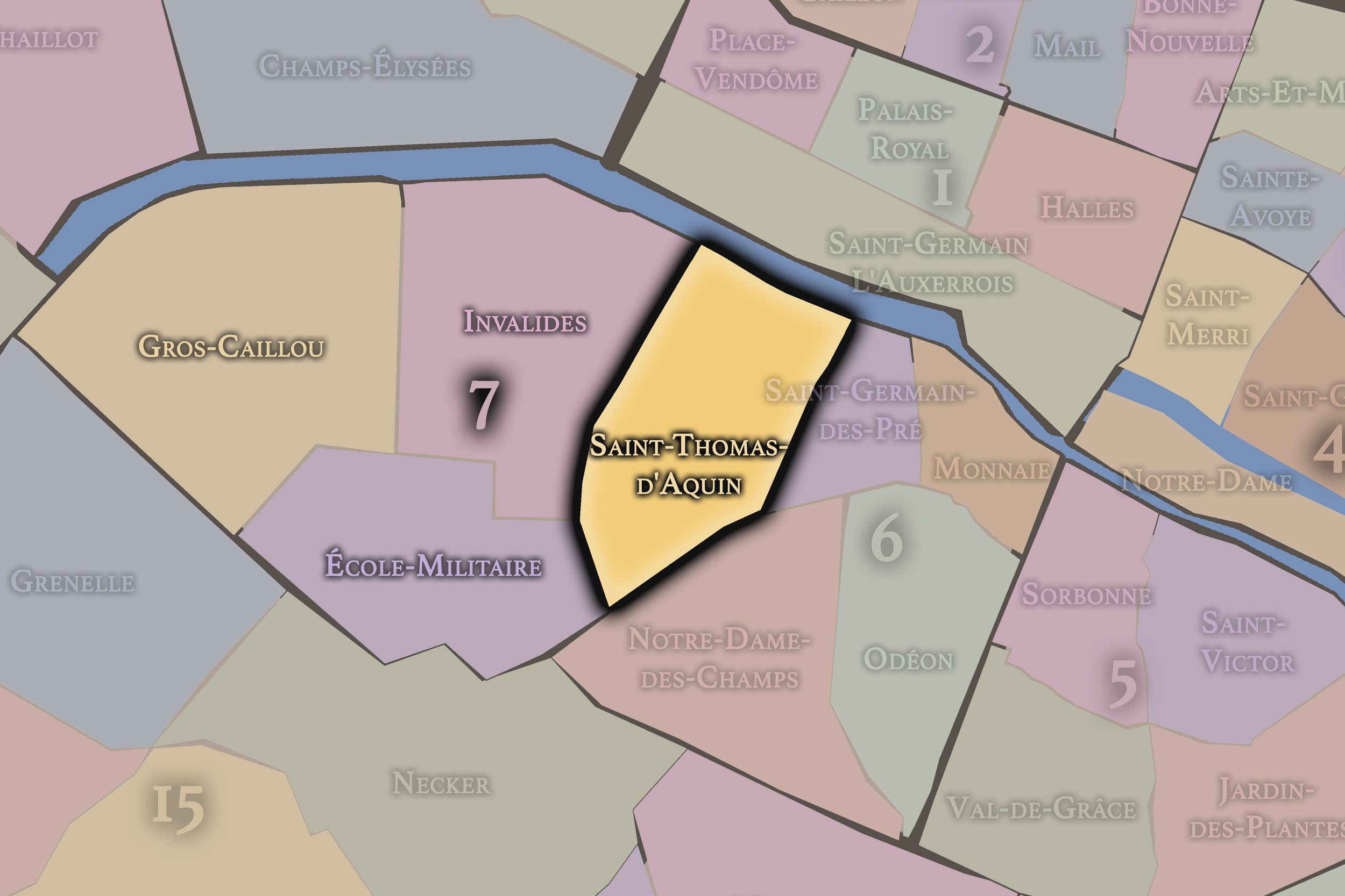
Saint-Thomas-d’Aquin
7e Arrondissement — Palais-Bourbon
25th Administrative Quarter
Saint-Thomas-d’Aquin is a refined Left Bank quarter of ministries, hôtels particuliers, religious institutions, antique dealers, and quiet streets that reflect the aristocratic and governmental character of the 7th arrondissement.
-
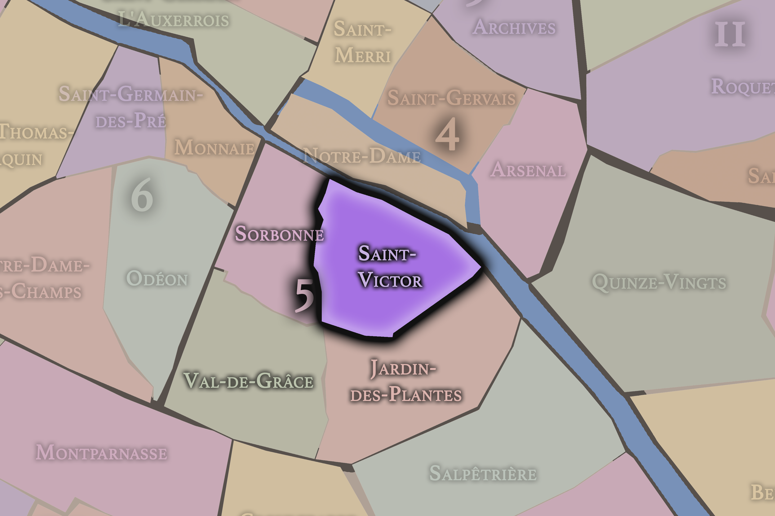
Saint-Victor
5e Arrondissement — Panthéon
17th Administrative Quarter
Saint-Victor sits between the Seine, the university world, and the Jardin des Plantes, carrying traces of abbey life, scholarship, scientific institutions, and the ancient intellectual fabric of the Left Bank.
-
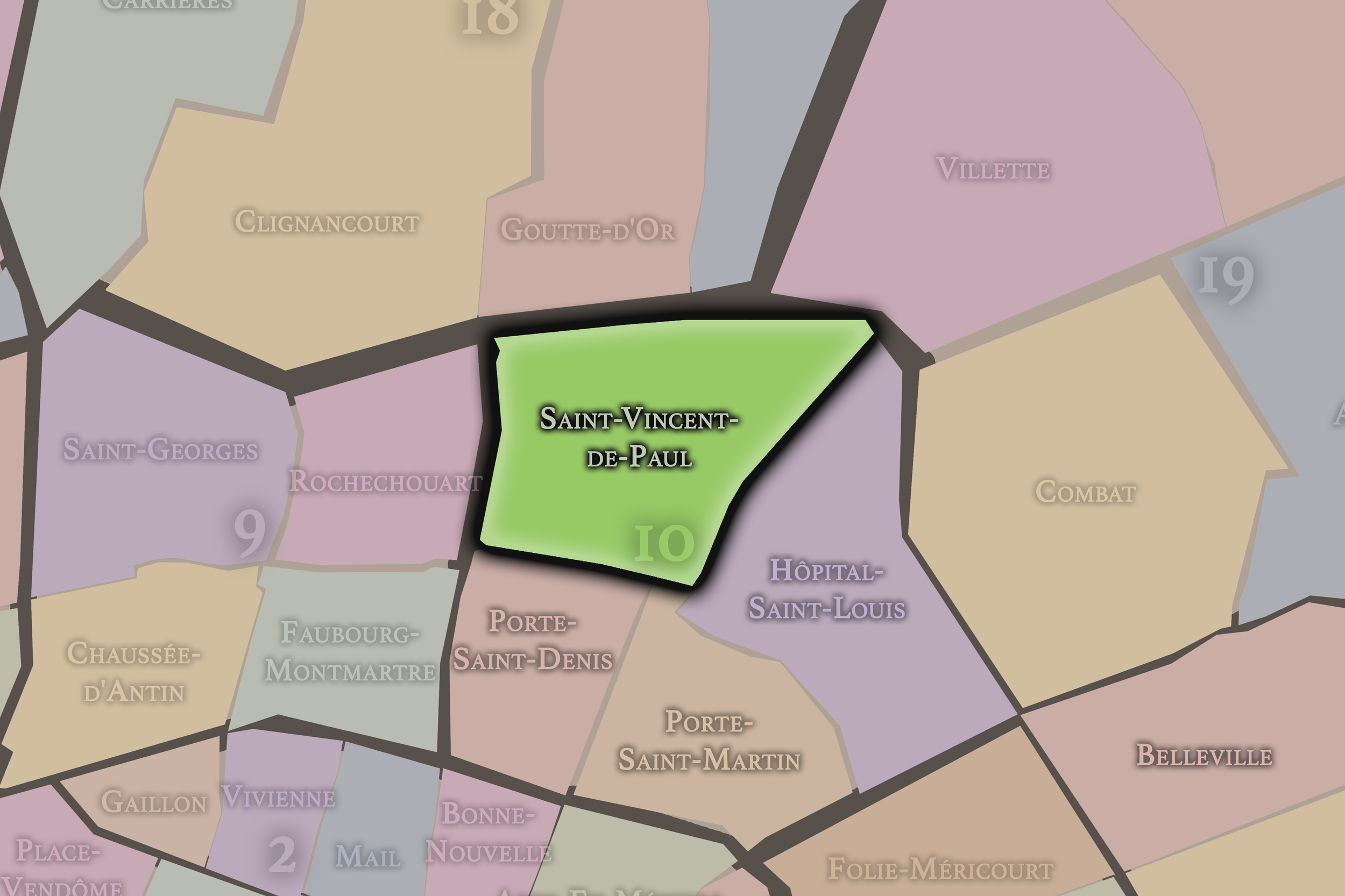
Saint-Vincent-de-Paul
10e Arrondissement — Entrepôt
37th Administrative Quarter
Saint-Vincent-de-Paul is shaped by the Gare du Nord, nearby institutions, church towers, rail corridors, and the powerful sense of arrival, movement, and immigration that defines this northern gateway.
-
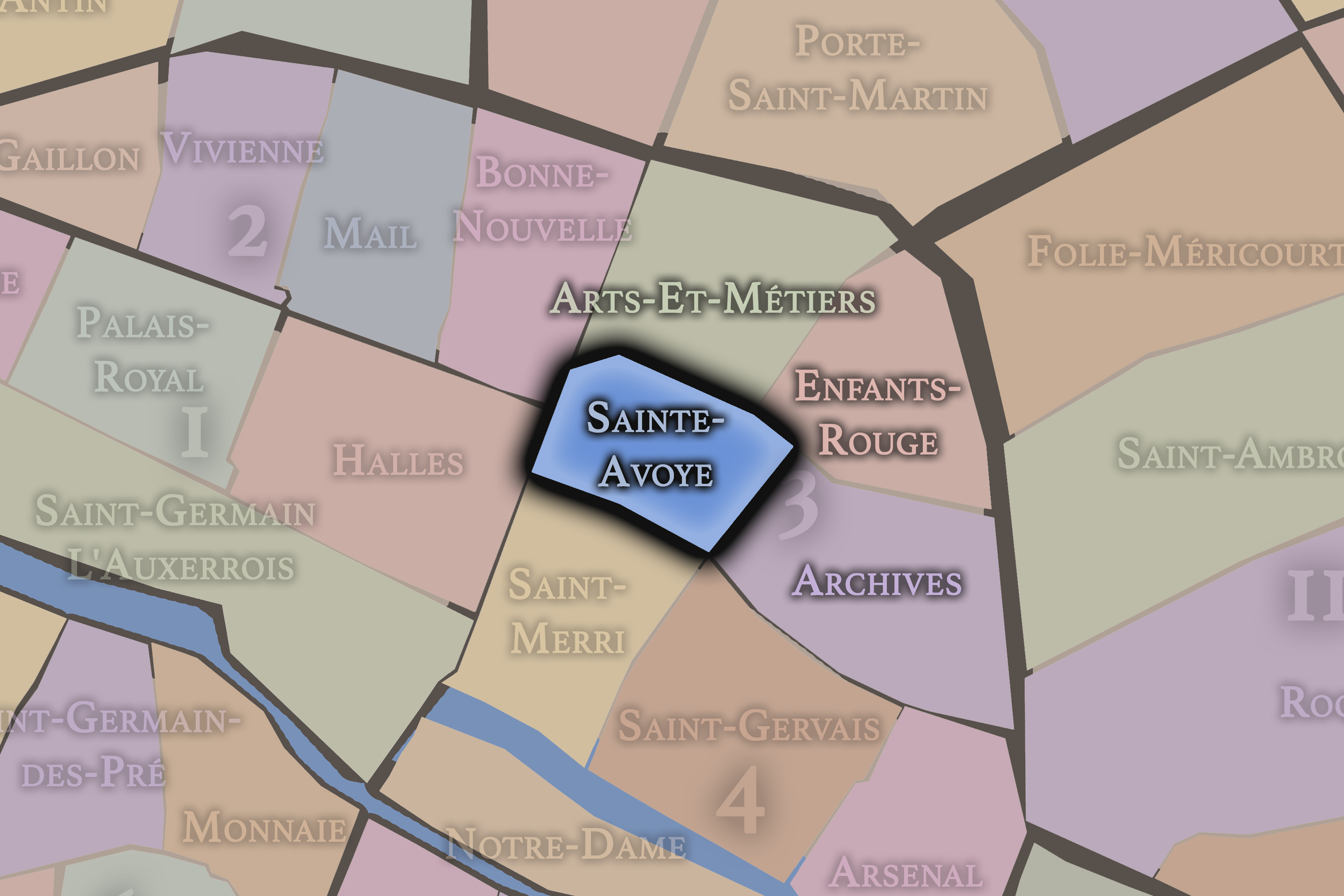
Sainte-Avoye
3e Arrondissement — Temple
12th Administrative Quarter
Sainte-Avoye lies within a dense and historic Marais fabric, where medieval street patterns, religious memory, commercial corridors, and later layers of creative and urban life overlap within a compact central quarter.
-
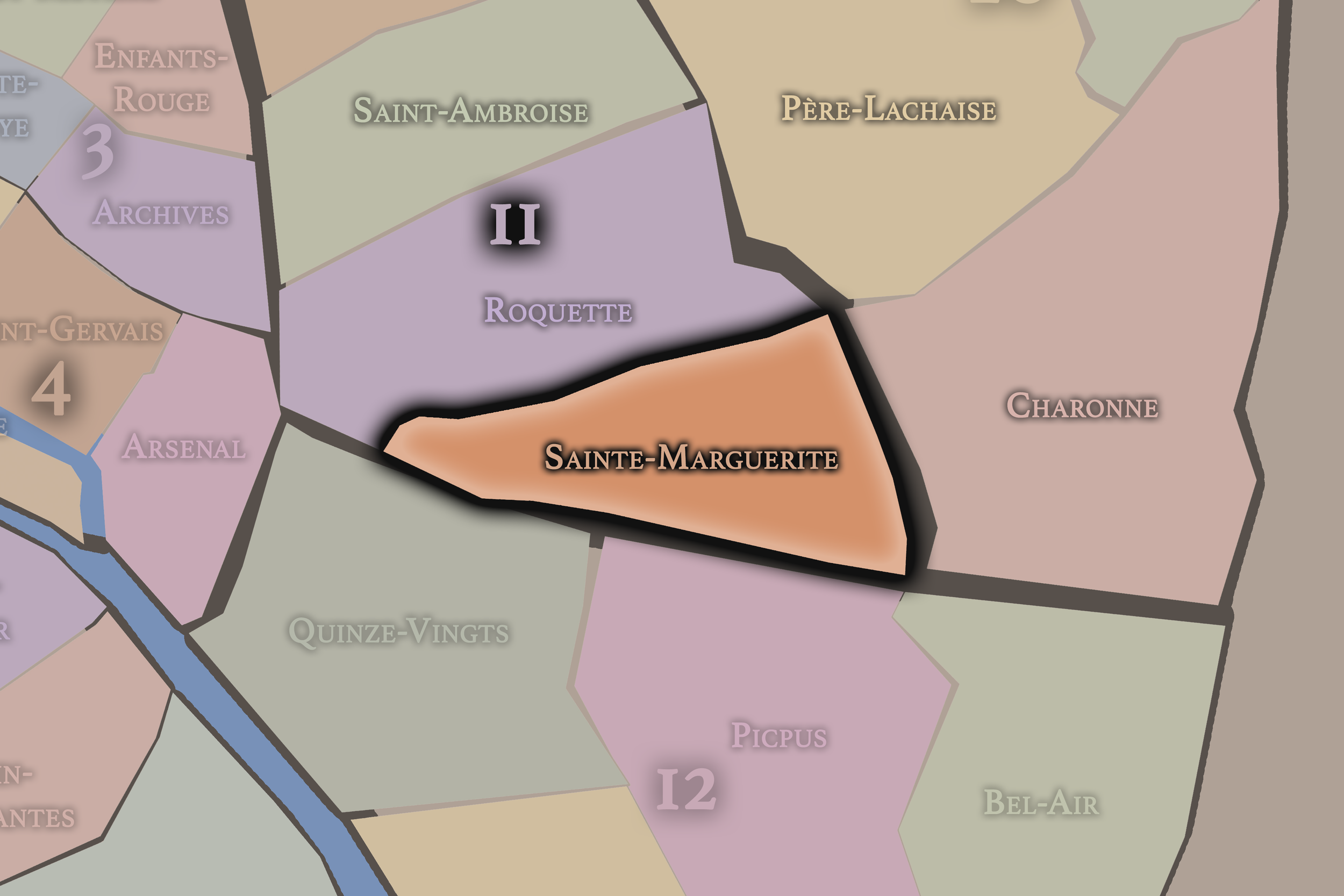
Sainte-Marguerite
11e Arrondissement — Popincourt
44th Administrative Quarter
Sainte-Marguerite stretches toward Nation and the Faubourg Saint-Antoine, holding traces of furniture-making, revolutionary memory, residential streets, and the long working history of eastern Paris.
-
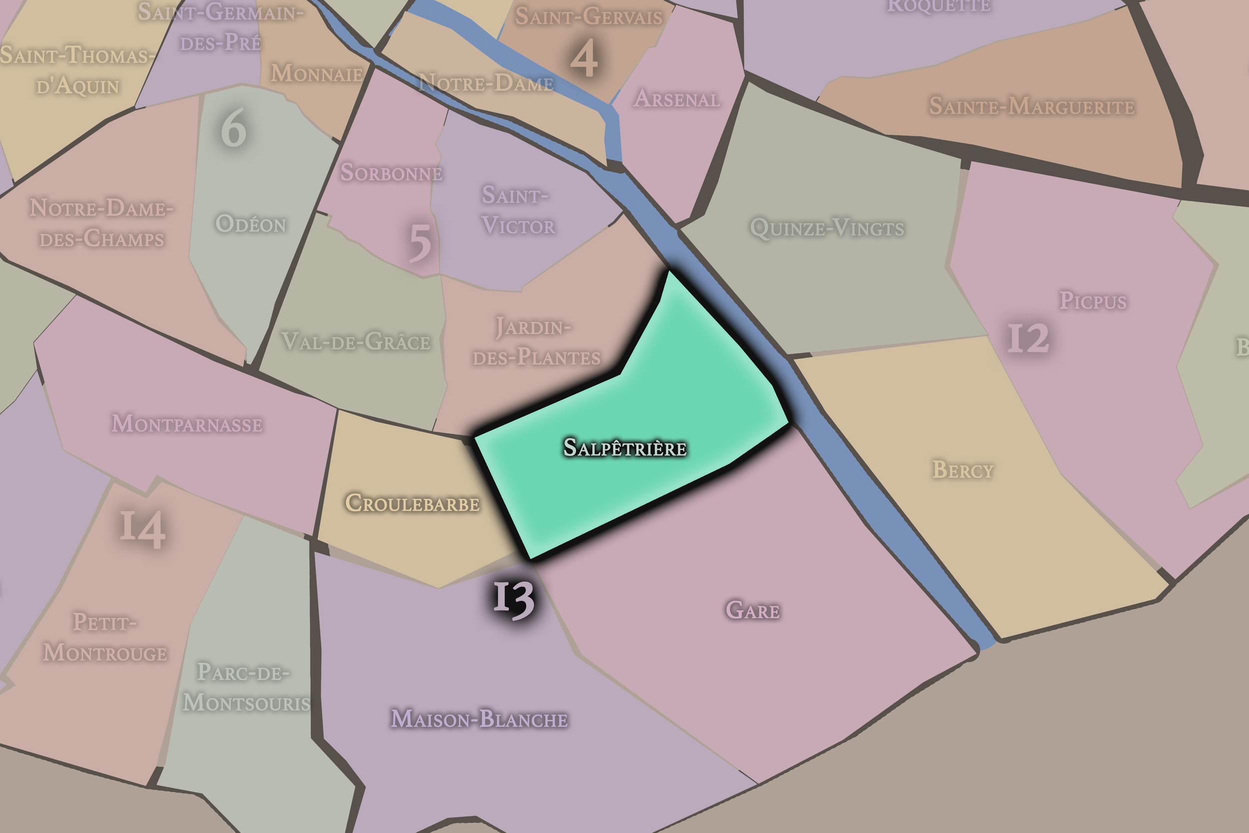
Salpêtrière
13e Arrondissement — Gobelins
49th Administrative Quarter
Salpêtrière is anchored by the vast hospital complex and its long institutional history, standing at the threshold of the Latin Quarter, Austerlitz, and the modern southeastern city.
-
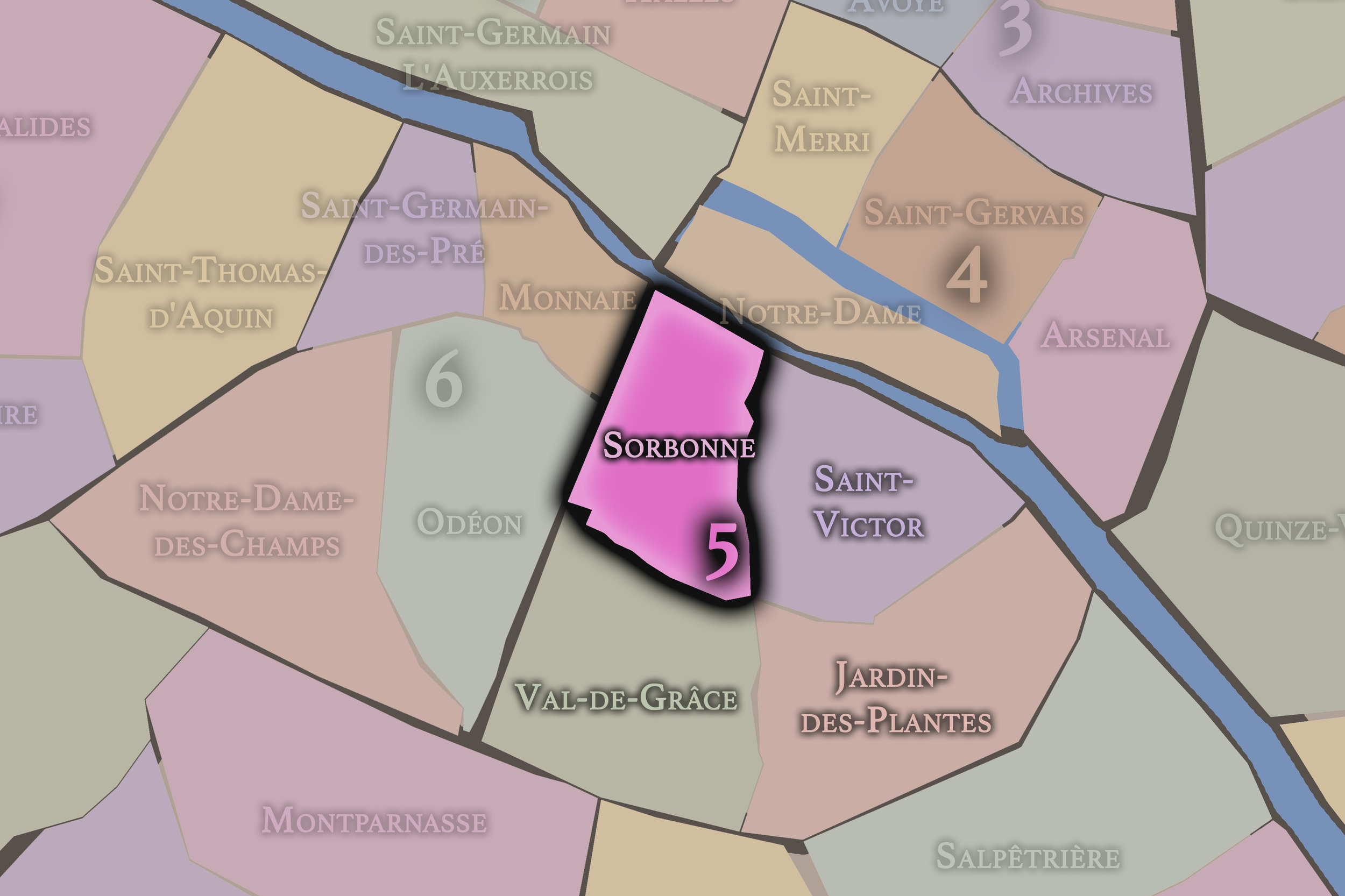
Sorbonne
5e Arrondissement — Panthéon
20th Administrative Quarter
Sorbonne is inseparable from the Latin Quarter’s scholarly life, with universities, bookshops, churches, student streets, and centuries of intellectual history gathered around one of Paris’s most enduring academic names.
-
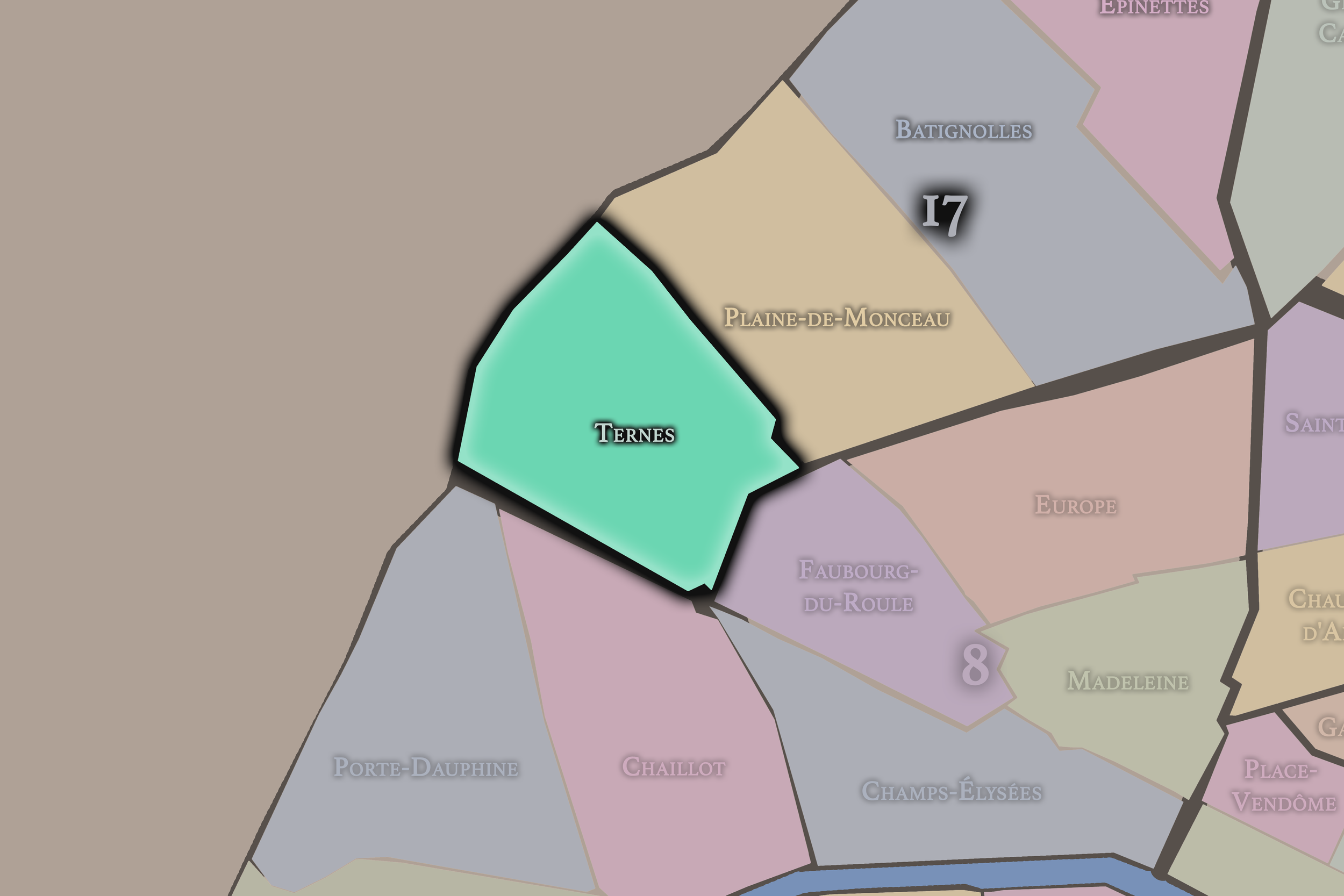
Ternes
17e Arrondissement — Batignolles-Monceau
65th Administrative Quarter
Ternes lies near the Arc de Triomphe and the western approaches to Paris, mixing markets, avenues, commerce, and the bourgeois residential fabric of the northwest city.
-
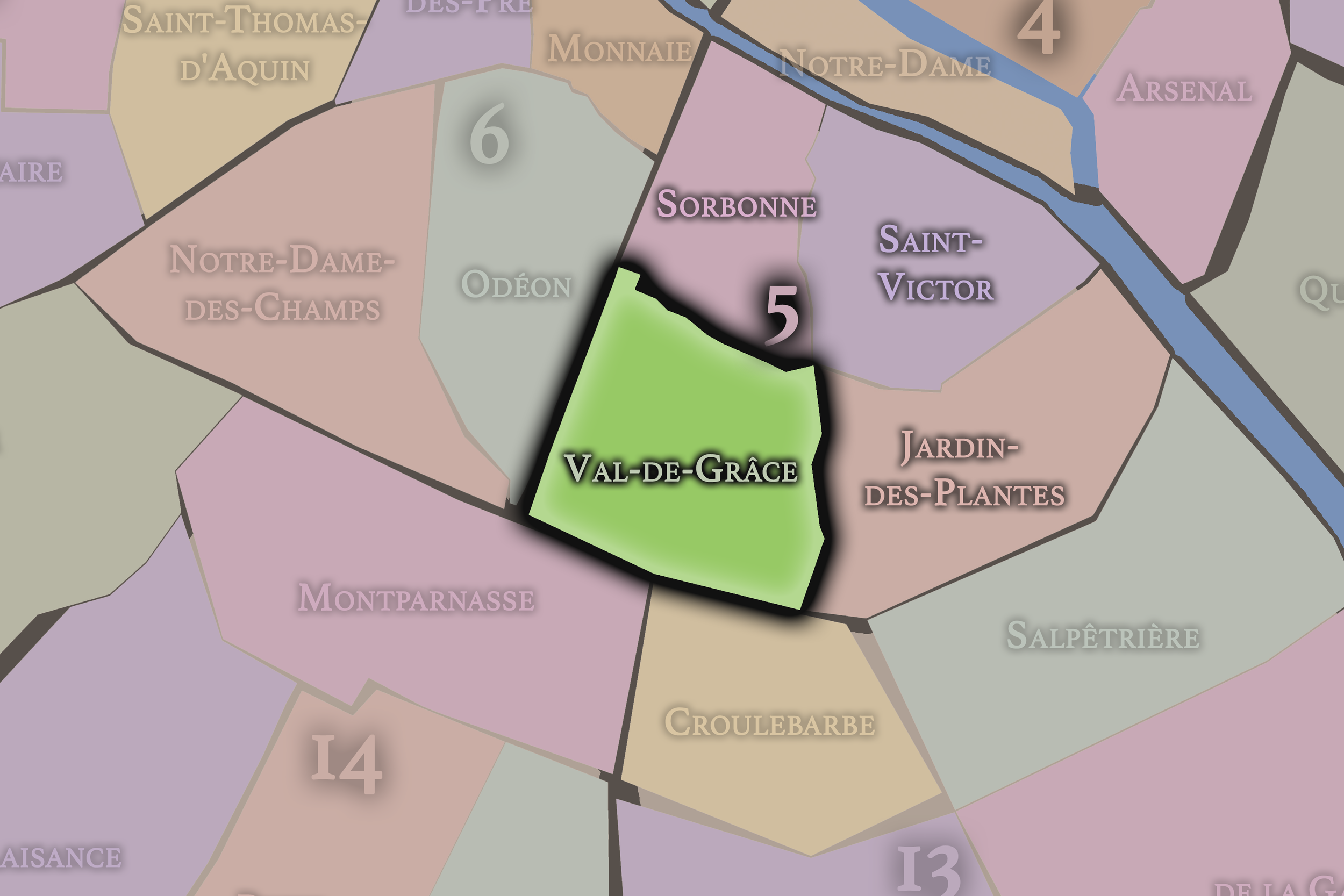
Val-de-Grâce
5e Arrondissement — Panthéon
19th Administrative Quarter
Val-de-Grâce rises through a Left Bank landscape of convent history, medical institutions, sloping streets, and residential calm, with the monumental church and former abbey anchoring its historic identity.
-
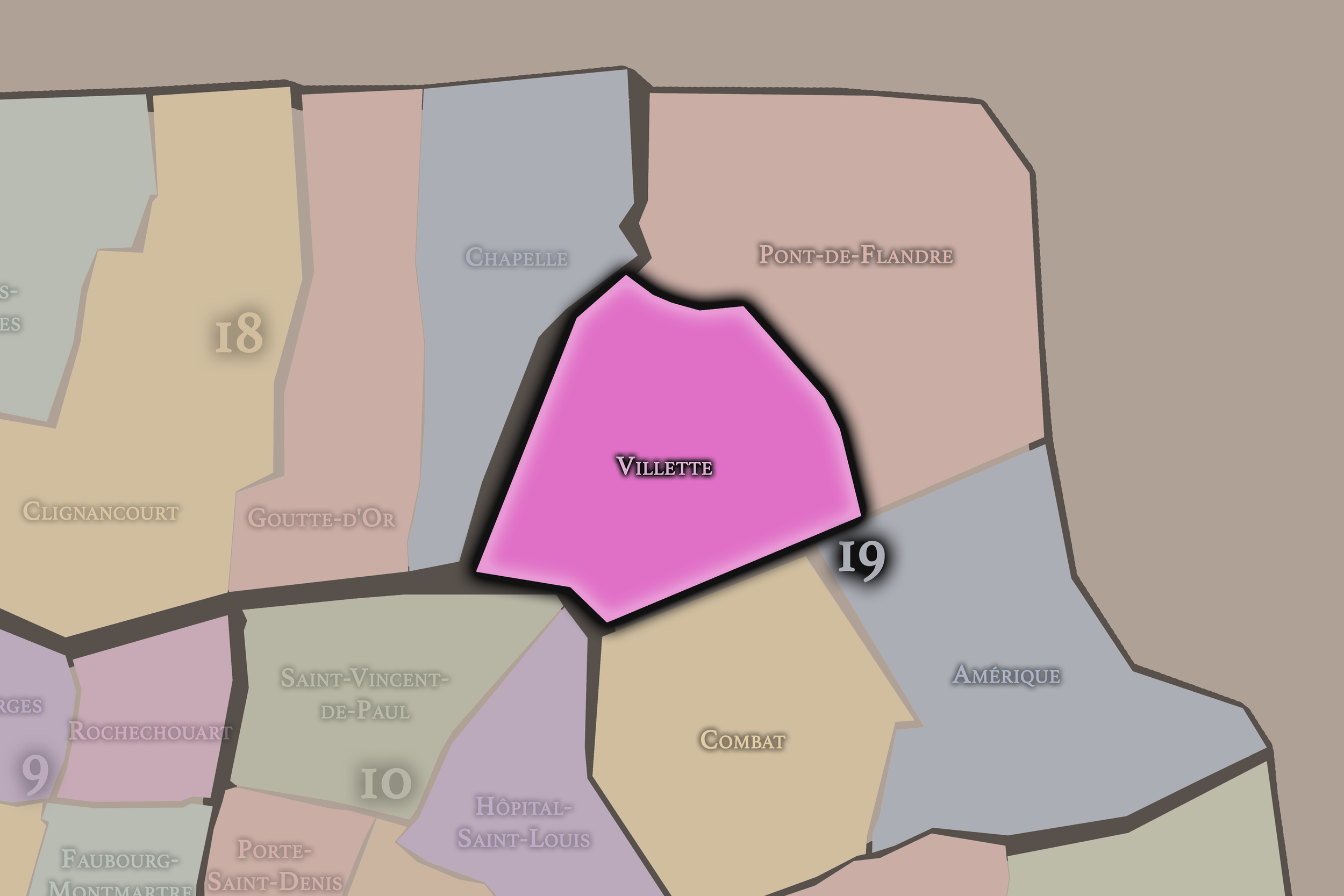
Villette
19e Arrondissement — Buttes-Chaumont
73rd Administrative Quarter
Villette is rooted in the former commune of La Villette, with canals, slaughterhouse history, cultural institutions, parks, and the large-scale reinvention of northeastern Paris.
-
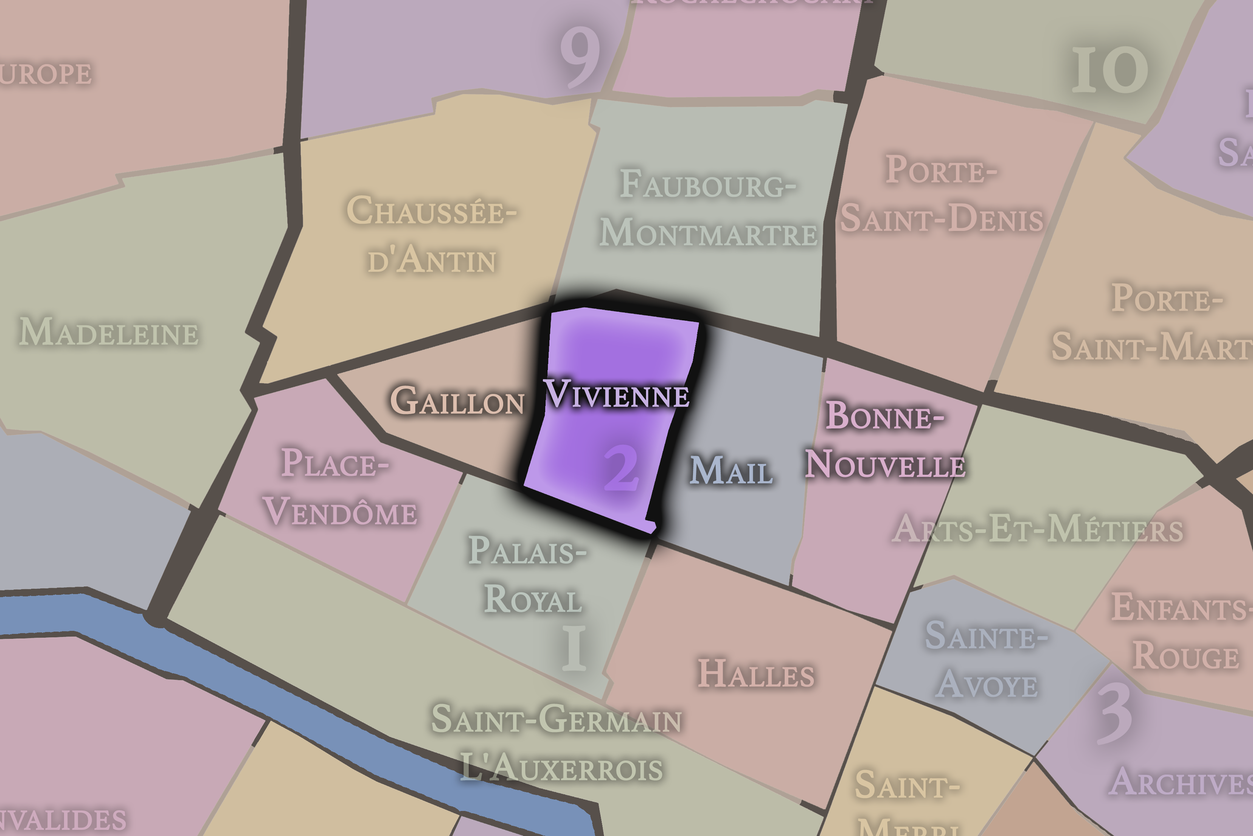
Vivienne
2e Arrondissement — Bourse
6th Administrative Quarter
Vivienne is closely tied to the Bourse, the Bibliothèque nationale, and the covered passages, combining financial history, literary institutions, arcaded interiors, and the refined density of the 19th-century Right Bank.
Explore Paris
-

The twenty arrondissements form the civic spiral of Paris, organizing the city into its broad local districts of government, identity, and daily life.
-

Each arrondissement is divided into four official administrative quarters, giving Paris a more precise civic and geographic framework.
-

The conseils de quartier bring participation to street level, giving residents a voice in neighborhood needs, public space, and local civic life.
-

Les Deux Rives trace Paris through the Seine’s two banks, revealing how the Rive Droite and Rive Gauche shaped the city’s civic power, commerce, learning, art, and cultural identity.
-

Cultural neighborhoods reveal the Paris people recognize through history, cafés, architecture, memory, atmosphere, and local belonging.