
18e - GOUTTE D’OR
Quartiers Administratifs
Welcome to the Goutte-d’Or neighborhood page! Goutte-d’Or is a quartier administratif — an administrative quarter — one of 80 such districts across Paris. As a quartier administratif of the 18e Arrondissement - Butte-Montmartre, Goutte-d’Or belongs to a formal layer of Parisian geography and is one of Paris’s most vivid multicultural quarters. Goutte-d’Or is centered around Barbès, Château Rouge, market streets, immigrant histories, and the dense urban fabric below Montmartre.
Part of an ongoing project to walk and photograph every neighborhood in Paris, this page explores 18e Goutte-d’Or through maps, district identity, history, and photography.


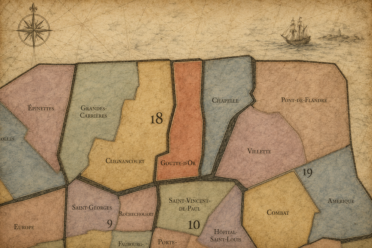
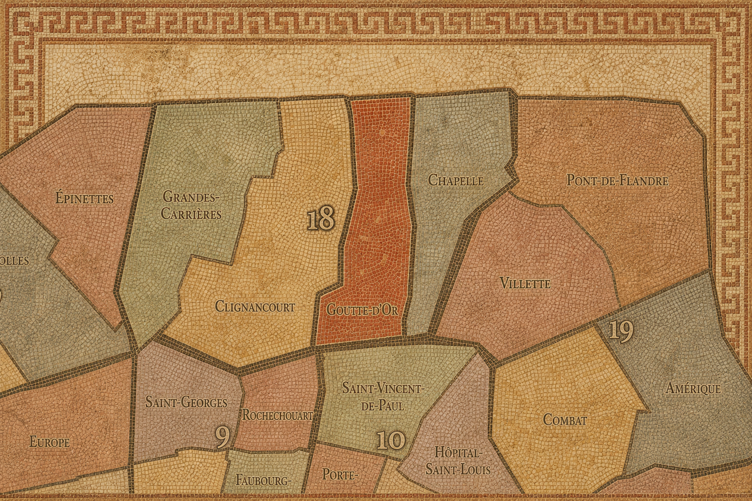
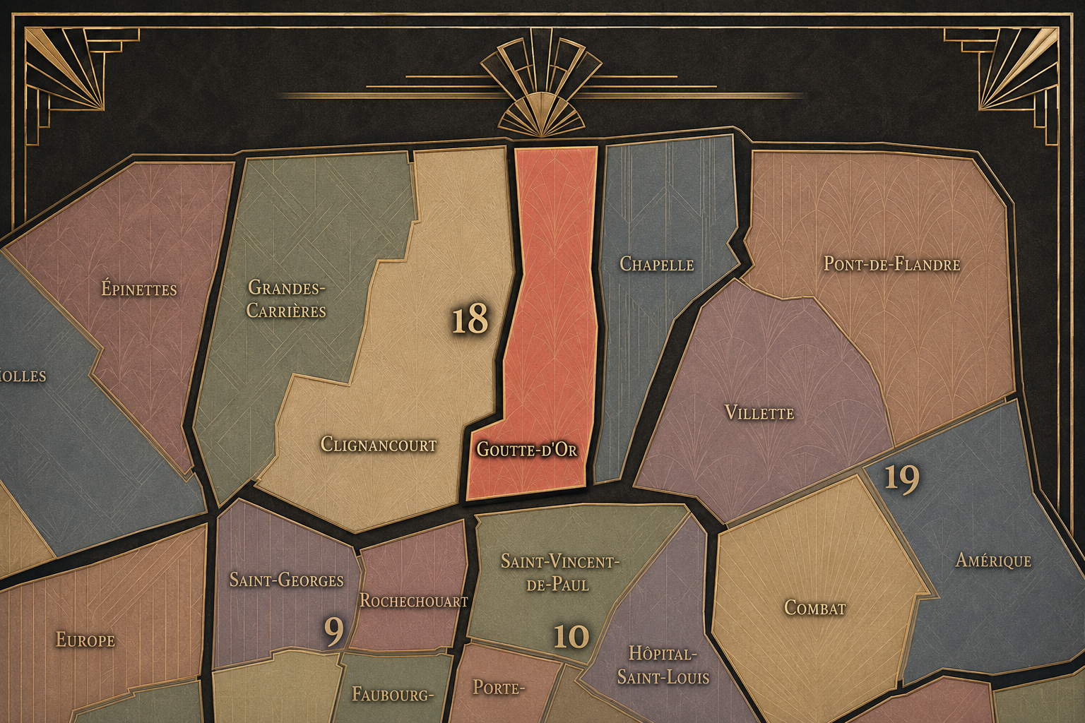
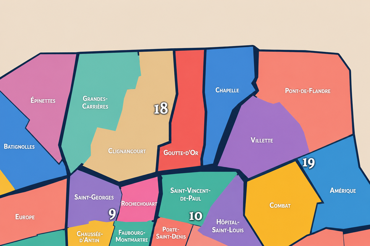
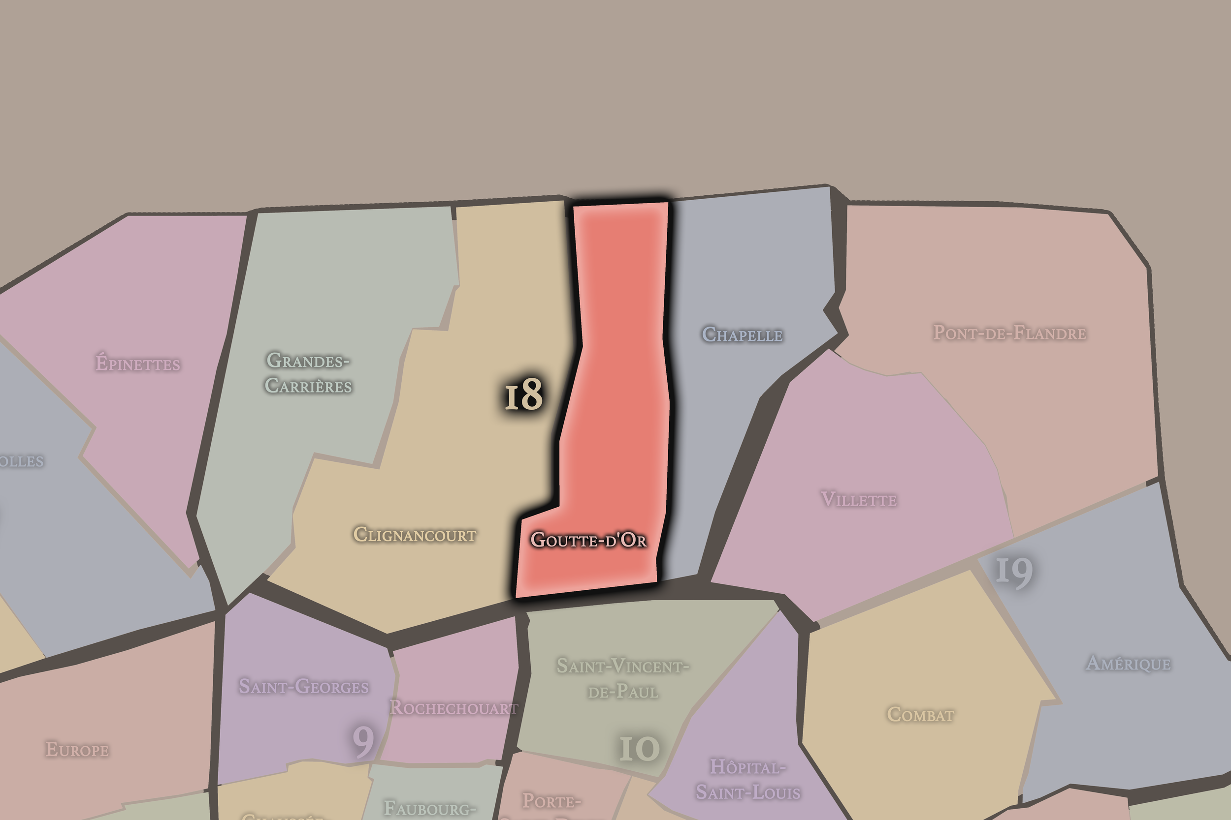
The Map
Geographic Setting
Goutte-d’Or occupies the southeastern portion of the 18th arrondissement, where Montmartre’s eastern slope descends toward Barbès, La Chapelle, Gare du Nord, and the dense northern corridors of Paris. It lies east and southeast of Montmartre, south of Clignancourt, west of La Chapelle, and along one of the most active seams between the historic hill, the railway city, and the multicultural street life of northern Paris. Officially, Goutte-d’Or is the 71st administrative quarter of Paris and one of the four quarters of the 18th arrondissement.
The quarter’s geography is shaped by Boulevard Barbès, Boulevard de la Chapelle, Rue de la Goutte-d’Or, Rue Myrha, Rue Polonceau, Rue des Poissonniers, Rue de Chartres, Rue Léon, Rue Doudeauville, Rue Stephenson, Rue Ordener, Château Rouge, Barbès-Rochechouart, and the rail corridors approaching Gare du Nord. It is a compact but intensely layered district: market streets, apartment blocks, social housing, religious institutions, African and Maghrebi commerce, street vending, cafés, schools, community organizations, and the constant pressure of movement between Montmartre, Barbès, La Chapelle, and the northern stations.
Unlike Montmartre, whose identity is elevated, touristic, and globally mythologized, Goutte-d’Or is lower, denser, more contested, and more immediately tied to the social realities of contemporary Paris. Unlike Clignancourt, whose northern identity turns toward Saint-Ouen and the Porte de Clignancourt, or La Chapelle, whose geography is more railway-industrial and infrastructural, Goutte-d’Or is the 18th arrondissement as street intensity: multicultural, working, commercial, vulnerable, resilient, and deeply expressive of Paris as a lived metropolis.
Administrative Quarter Identity
Etymology and Origins
The name Goutte-d’Or means “drop of gold.” It is generally associated with a white wine once produced in the small hamlet of La Goutte-d’Or, a locality historically connected to the former commune of La Chapelle before this area was absorbed into Paris. District references describe the quarter’s name as coming from the golden-colored wine produced in that hamlet.
That origin is striking because the modern quarter’s image is rarely pastoral. Today, Goutte-d’Or is associated with dense streets, immigrant commerce, Barbès, Château Rouge, market life, and the social complexity of northern Paris. Yet the name preserves an older landscape of vines, slopes, outer hamlets, and agricultural production. Before the quarter became one of the most urban and contested areas of the 18th arrondissement, it carried the memory of wine and open ground.
The name therefore holds a beautiful tension. “Goutte-d’Or” sounds almost lyrical — a golden drop — while the neighborhood’s modern history speaks of labor, migration, housing pressure, policing, activism, commerce, poverty, renewal, and cultural vitality. The old wine name has become attached to one of Paris’s most powerful contemporary street districts.
Civic Framework
Within the official geography of Paris, Goutte-d’Or is one of the four administrative quarters of the 18th arrondissement, alongside Montmartre, Clignancourt, and La Chapelle. It occupies the arrondissement’s southeastern sector and gives civic shape to the area around Barbès, Château Rouge, Rue de la Goutte-d’Or, Rue Myrha, Rue des Poissonniers, and the western edge of the rail landscape leading toward Gare du Nord.
As an administrative quarter, Goutte-d’Or helps clarify a district often described through stronger lived names: Barbès, Château Rouge, Dejean, Marx Dormoy edge, La Chapelle edge, or the lower eastern slope of Montmartre. These names remain important, but each captures only one layer. Goutte-d’Or is the official civic frame that gathers the old hamlet, the former La Chapelle inheritance, the market streets, the immigrant commercial corridors, and the social geography of the southeastern 18th into one mapped unit.
This civic frame is especially valuable because the quarter is often spoken about from the outside. It is frequently simplified as “rough,” “colorful,” “changing,” “immigrant,” “dangerous,” or “gentrifying.” The administrative quarter gives the area a more stable and respectful frame. It allows Goutte-d’Or to be understood not as a stereotype, but as a Parisian neighborhood with history, boundaries, institutions, commerce, culture, and lived complexity.
Neighborhood Distinction
Goutte-d’Or differs from the other quarters of the 18th arrondissement through its intense street life, its multicultural identity, and its position between Montmartre, Barbès, La Chapelle, and Gare du Nord. Montmartre is the quarter of the hill, Sacré-Cœur, artists’ mythology, tourism, stairways, cabarets, and village imagery. Clignancourt is more northern and boundary-facing, tied to Porte de Clignancourt, Jules Joffrin, and Saint-Ouen. La Chapelle is more eastern and infrastructural, shaped by rail corridors, industrial memory, immigrant commerce, and the routes around Gare du Nord and Porte de la Chapelle.
Goutte-d’Or is more compressed and socially immediate. Its distinction lies in the concentration of market life, immigrant entrepreneurship, dense housing, neighborhood activism, religious and cultural diversity, and the ongoing tension between popular Paris and metropolitan redevelopment. The Château Rouge area is especially important as a commercial center connected to African and Afro-diasporic food, textiles, hair salons, beauty shops, groceries, restaurants, and everyday exchange; descriptions of the broader Goutte-d’Or / Château Rouge area frequently emphasize its West African commercial and community role.
It should also be distinguished from Barbès. Barbès is a powerful crossroads identity centered around Boulevard Barbès, Barbès-Rochechouart, transit, shopping, and street movement. Goutte-d’Or is the administrative quarter behind and around that crossroads. Barbès is the threshold and shorthand; Goutte-d’Or is the broader civic neighborhood.
Parisian Identity
Goutte-d’Or expresses Paris as a city of migration, pressure, and reinvention. It is one of the places where the capital’s global identity appears most visibly at street level: languages, textiles, foods, religious practices, hair and beauty economies, family networks, remittances, informal exchange, official commerce, and everyday sociability. This is not the Paris of a frozen postcard. It is Paris as arrival, adaptation, and survival.
The quarter’s identity has often been contested because it sits at the intersection of race, class, religion, policing, public space, gentrification, and belonging. It is a neighborhood that some outsiders reduce to problems, while many residents and visitors experience it as lively, culturally rich, communal, and deeply urban. That tension is central. Goutte-d’Or is not an easy district to flatten into romance, and it should not be flattened into fear either.
In the CityNeighborhoods framework, Goutte-d’Or is essential because it reveals that Parisian identity is not only inherited through stone monuments or old village names. It is made daily through movement, commerce, migration, conflict, hospitality, and cultural production. Goutte-d’Or is Paris as urban expression in its most immediate sense: layered, noisy, beautiful, vulnerable, and alive.
Neighborhood Connections
Every neighborhood belongs to a wider Parisian fabric.
-
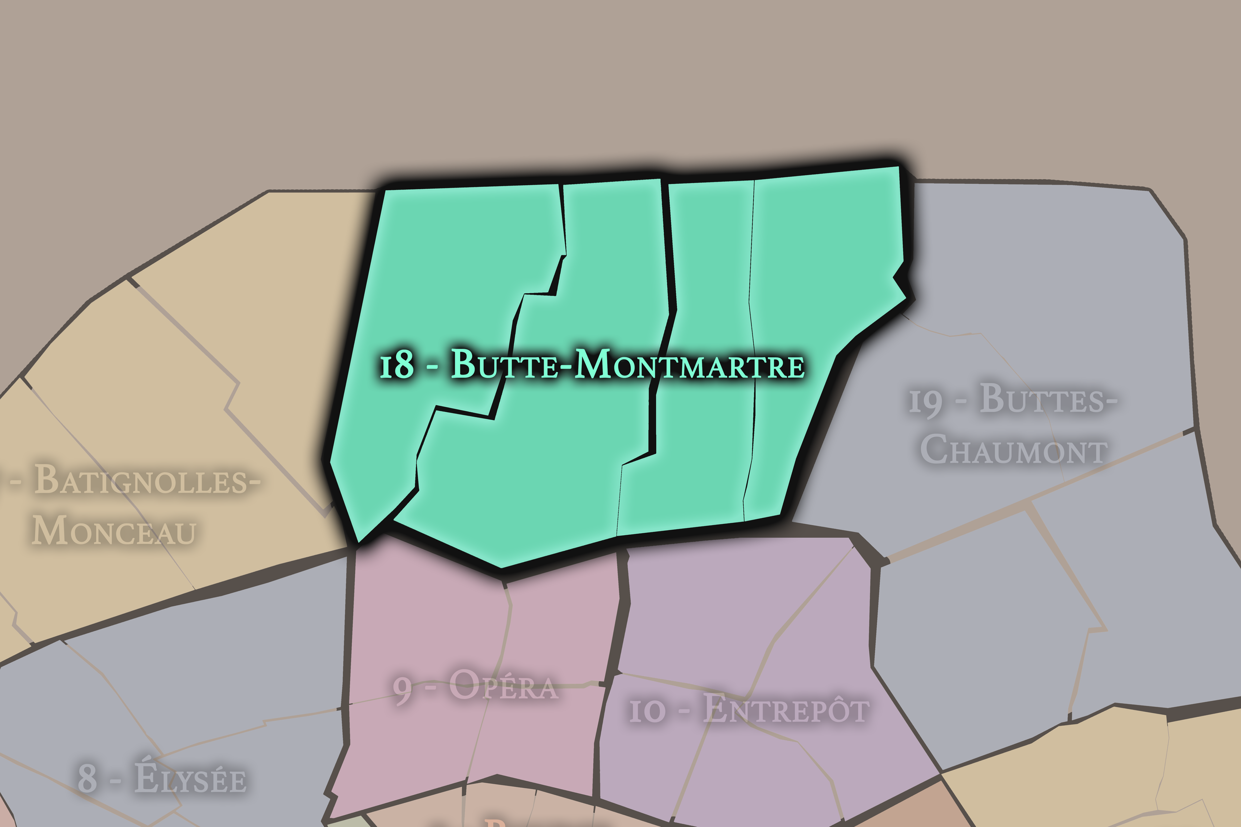
18e — Butte-Montmartre
-

Amiraux - Simplon - Poissonniers
-
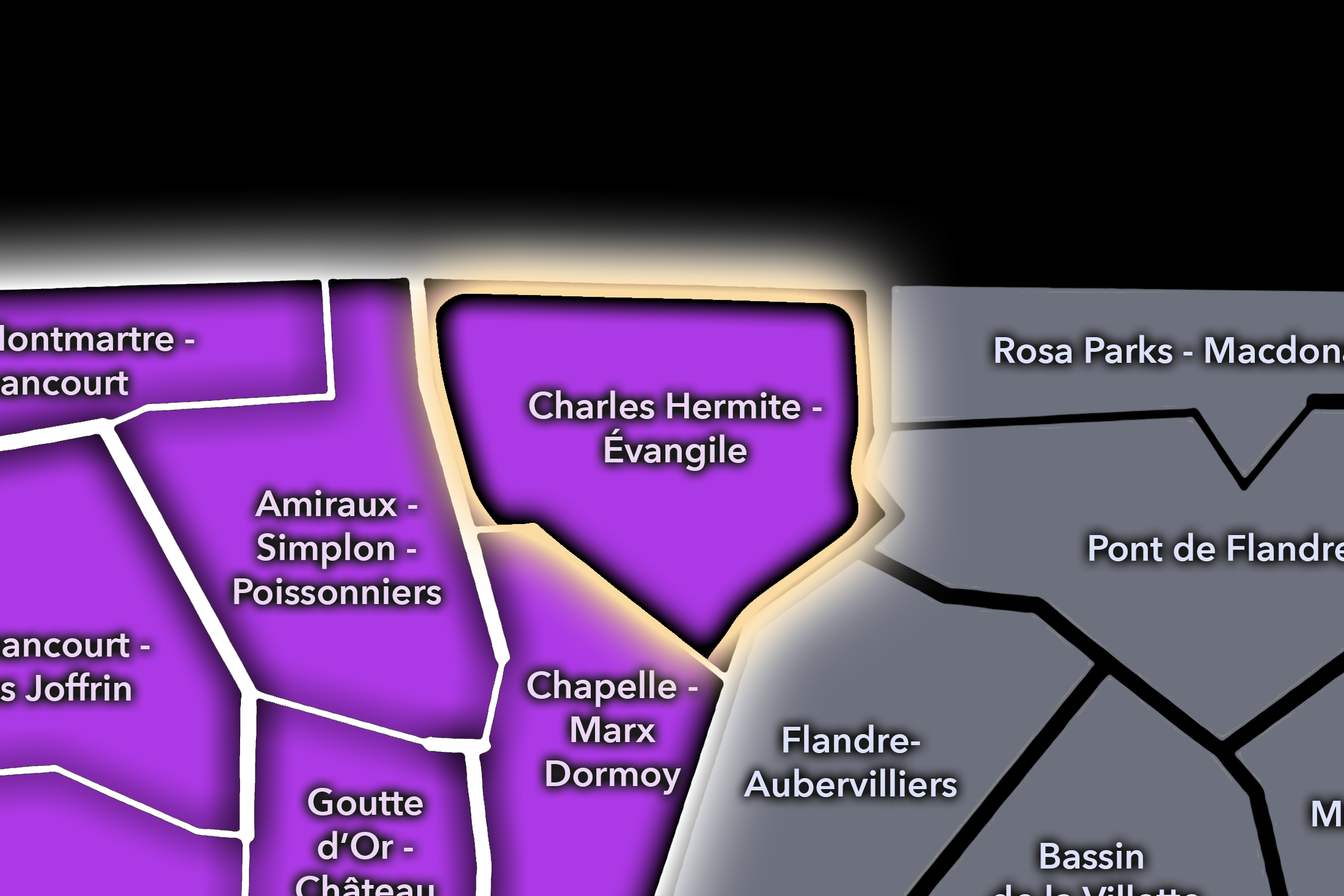
Charles Hermite - Évangile
-
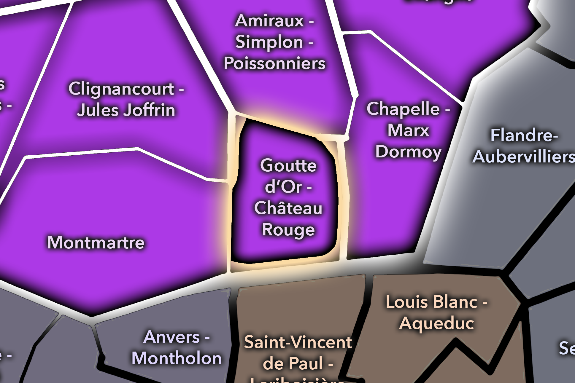
Goutte d’Or - Château Rouge
-
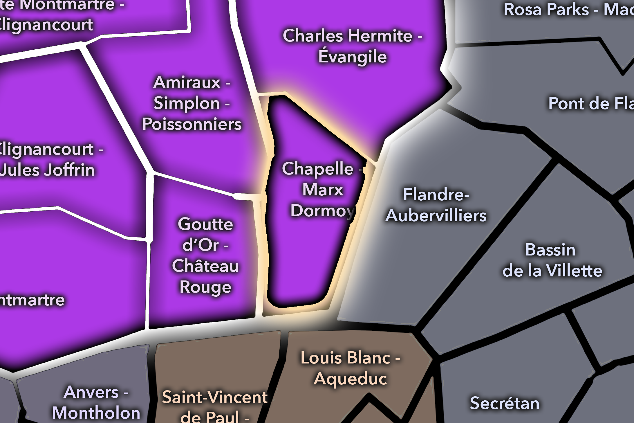
La Chapelle - Marx Dormoy
-

Rive Droite
The History
Origins
The origins of Goutte-d’Or lie in the outer northern landscape of Paris, connected to the former commune of La Chapelle and the lower slopes east of Montmartre. Before the area became a dense Parisian quarter, it belonged to a world of hamlets, vineyards, roads, fields, small settlements, and land outside the historic city. Its name’s association with wine preserves this pre-urban landscape, when the area was still tied to cultivation and the rural edge of the capital.
This outer condition shaped the district’s later development. Goutte-d’Or was not born as part of medieval central Paris, nor as an aristocratic quarter, nor as a grand boulevard landscape. It developed from the city’s edge — from land gradually pulled into the orbit of Paris through roads, labor, housing, industry, and annexation.
The quarter’s origin story is therefore one of transformation from hamlet to urban density. A place once known for golden wine became a neighborhood of workers, migrants, markets, and metropolitan intensity. The old name survived, but almost everything around it changed.
16th–17th Century
In the 16th and 17th centuries, the future Goutte-d’Or quarter remained outside the dense built fabric of Paris. It belonged to the northern outskirts near Montmartre and La Chapelle, where vineyards, fields, religious lands, roads, and small settlements shaped the landscape. The area was connected to Paris, but it was not yet part of the urban core.
This period helps explain the quarter’s name and early identity. The slopes and outer lands around Montmartre and La Chapelle supported cultivation, including vineyards in the broader northern landscape. Goutte-d’Or’s later association with a golden wine belongs to this older world of agricultural production near the capital.
By the end of the 17th century, Paris was pressing outward, but the future Goutte-d’Or still retained its outer character. It was near the city, influenced by the city, and increasingly tied to its growth, but not yet transformed into the dense district recognizable today.
18th Century
In the 18th century, the area around Goutte-d’Or became more closely tied to the expansion of Paris while still belonging to the northern outskirts. La Chapelle, Montmartre, and the roads leading toward Saint-Denis and the northern plain grew increasingly connected to the economic and social life of the capital. The boundary between city and surrounding settlements became more porous.
The older agricultural landscape began to give way gradually to more mixed uses: modest housing, small trades, roadside activity, and settlement shaped by proximity to Paris. Goutte-d’Or remained outside the old city, but it was no longer distant from it. The quarter’s future as an urban neighborhood depended on this growing pressure from the capital.
The French Revolution and later administrative changes altered the relationship between Paris and its surrounding communes, though Goutte-d’Or would remain outside the formal city until the 19th century. By the end of the 18th century, the old hamlet landscape was increasingly part of the northern urban belt waiting to be absorbed.
19th Century
The 19th century transformed Goutte-d’Or from outer hamlet landscape into a dense urban quarter. The area belonged historically to La Chapelle before being incorporated into Paris during the great 1860 annexation, when the capital absorbed surrounding communes and created the modern outer arrondissements. Accounts of the neighborhood’s history note that Goutte-d’Or was long part of the former commune of La Chapelle before incorporation into Paris in 1860.
Industrialization, railway expansion, population growth, and the rise of northern working-class Paris all reshaped the district. Its proximity to Gare du Nord, La Chapelle, Montmartre, and the northern routes made it attractive for workers, migrants from other parts of France, small businesses, lodging houses, workshops, and dense residential development. The old fields and vineyards were replaced by streets, apartment blocks, factories, yards, and commercial corridors.
This century established the quarter’s popular character. Goutte-d’Or became part of the Paris of workers and newcomers rather than elites and monuments. It was built through need: housing, labor, transport, and the pressure of a growing capital. The golden drop became an urban neighborhood.
Early–Mid 20th Century
In the early and mid 20th century, Goutte-d’Or remained a dense working-class quarter of northern Paris. Its streets held modest housing, shops, workshops, cafés, hotels, religious institutions, and the everyday life of people tied to the railway, industrial, service, and commercial economies of the surrounding districts. It was close to Montmartre, but its identity was much less romanticized than the hill above.
The quarter also became increasingly shaped by migration. Like many northern and eastern districts of Paris, it received populations arriving from elsewhere: first from other French regions and Europe, then from colonial and postcolonial geographies. North African migration became especially important in the postwar decades, gradually reshaping the area’s commerce, social life, and cultural identity.
During the wars, occupation, liberation, and postwar reconstruction, Goutte-d’Or shared the hardships of popular Paris: overcrowding, poverty, shortage, displacement, police control, and neighborhood resilience. Its history in this period is not best told through a single monument, but through streets where working people endured the pressures of the century.
Late 20th Century
In the late 20th century, Goutte-d’Or became one of Paris’s most visibly multicultural and socially debated quarters. North African, West African, and other immigrant communities gave the district a powerful commercial and cultural identity, especially around Barbès, Château Rouge, Rue Dejean, Rue des Poissonniers, and surrounding streets. Food markets, textile shops, beauty salons, restaurants, cafés, religious institutions, and informal networks made the quarter a major destination for diasporic Paris and the wider Île-de-France.
At the same time, the neighborhood faced serious challenges: substandard housing, poverty, overcrowding, drug activity in some areas, tensions around policing, public space conflicts, and waves of urban renewal. These realities shaped the quarter’s public reputation, sometimes unfairly reducing it to problem narratives. But they also generated strong local activism, community organization, and claims to belonging.
The late 20th century is essential to understanding Goutte-d’Or because it is when the quarter became one of the clearest symbols of postcolonial Paris. It was not just a place where immigrants lived. It became a place where Paris’s relationship to Africa, North Africa, Islam, race, labor, commerce, and national identity was negotiated in public.
21st Century
In the 21st century, Goutte-d’Or remains one of the most layered, dynamic, and contested quarters of Paris. It is still a major multicultural commercial district, especially around Château Rouge and the streets connected to African and Maghrebi food, fabrics, beauty, cafés, and everyday services. It is also increasingly affected by gentrification, renovation, new cultural venues, shifting retail, rising housing pressures, tourism spillover from Montmartre, and public-space redesign.
The City of Paris and the 18th arrondissement have included Goutte-d’Or in neighborhood-improvement processes such as “Embellir votre quartier,” launched locally in 2021 with public meetings, online contributions, workshops, and exploratory walks. This reflects the quarter’s continuing role as a place where urban policy, resident participation, street design, and social life are actively negotiated.
For CityNeighborhoods: Paris, Goutte-d’Or is essential because it shows how administrative quarters can reveal the contemporary city as powerfully as they reveal the historic one. Goutte-d’Or is not only a former hamlet, not only a working-class district, not only an immigrant neighborhood, and not only a gentrifying urban frontier. It is the official civic frame in which all of those layers meet — one of the clearest examples of Paris as lived, contested, and documented urban expression.
Spirit and Legacy
Goutte-d’Or is the quarter where northern Paris turns arrival into identity. Its spirit is dense, expressive, resilient, and alive with social meaning. It belongs to the old golden wine of a vanished hamlet, to Barbès crossings and Château Rouge markets, to apartment stairwells and street vendors, to fabrics and spices, to worship and protest, to cafés, hair salons, schools, associations, and the many forms of belonging made in public.
Its legacy is the transformation of outer ground into metropolitan voice. Vineyards became working streets. A hamlet became Paris. A popular district became a postcolonial crossroads. A neighborhood often spoken about from the outside became a place where residents, merchants, artists, activists, families, and newcomers continue to define Paris from within.
To walk Goutte-d’Or is to encounter the city without a filter. The quarter refuses the simplicity of the postcard and the cruelty of the stereotype. It asks to be read in layers: official, historical, cultural, lived, and contested. In Goutte-d’Or, neighborhood identity becomes urban expression — Paris speaking through movement, migration, struggle, commerce, memory, and the everyday dignity of streets that never stop remaking themselves.
The Photography
Visual Identity

The visual identity of each Paris district begins with its position in the city’s layered geography. Before the photographs arrive, the maps establish a first way of seeing: where the district sits, what civic layer it belongs to, which boundaries define it, and how it connects to the surrounding fabric of Paris. In CityNeighborhoods Paris, cartography is not merely orientation; it is part of the visual language of the project.
As the photographic archive grows, this section will continue to develop through images gathered on foot. Streets, façades, monuments, markets, parks, river edges, passages, signs, textures, and everyday details will gradually reveal how each district presents itself visually. The goal is not only to show what a place looks like, but to trace how its identity becomes visible through form, atmosphere, memory, and use.
Through The Lens

CityNeighborhoods Paris is built from walking, looking, and returning. Each district is approached through photography as a way of paying attention: to the obvious landmarks and the quieter details, to historic structures and ordinary streets, to the moments where civic geography becomes lived experience. The camera becomes a tool for noticing how Paris changes from one district to the next, and how each place holds its own relationship to the larger city.
As photographs are processed and added, this section will become a more specific visual record of the district. Future updates may include dated field notes, galleries, and reflections from individual walks. For now, the page remains part of the larger CityNeighborhoods effort to document every Paris neighborhood through maps, history, identity, and photography — one district, one walk, and one visual encounter at a time.
If you visit Paris, these ideas can help inspire your own photography.


Paris: J’Espere, Je Rêve, Je Vive
Paris Photo Gallery
Paris Flâneur Notes
Flâneur Notes document the walks, photographs, light, and street-level observations behind this neighborhood entry. Learn more about the Spirit of the Flâneur.


Explore Paris
-

The twenty arrondissements form the civic spiral of Paris, organizing the city into its broad local districts of government, identity, and daily life.
-

Each arrondissement is divided into four official administrative quarters, giving Paris a more precise civic and geographic framework.
-

The conseils de quartier bring participation to street level, giving residents a voice in neighborhood needs, public space, and local civic life.
-

Les Deux Rives trace Paris through the Seine’s two banks, revealing how the Rive Droite and Rive Gauche shaped the city’s civic power, commerce, learning, art, and cultural identity.
-

Cultural neighborhoods reveal the Paris people recognize through history, cafés, architecture, memory, atmosphere, and local belonging.