
LE MARAIS
Milieux Culturels
Le Marais unfolds through hôtels particuliers, Jewish history, LGBTQ+ cultural life, museums, galleries, and the old streets between Place des Vosges, Rue des Rosiers, and Hôtel de Ville. Part of an ongoing project to walk and photograph every neighborhood in Paris, this page explores Le Marais as a milieu culturel through maps, cultural identity, history, and photography.
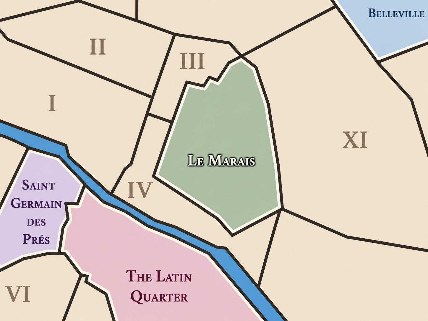


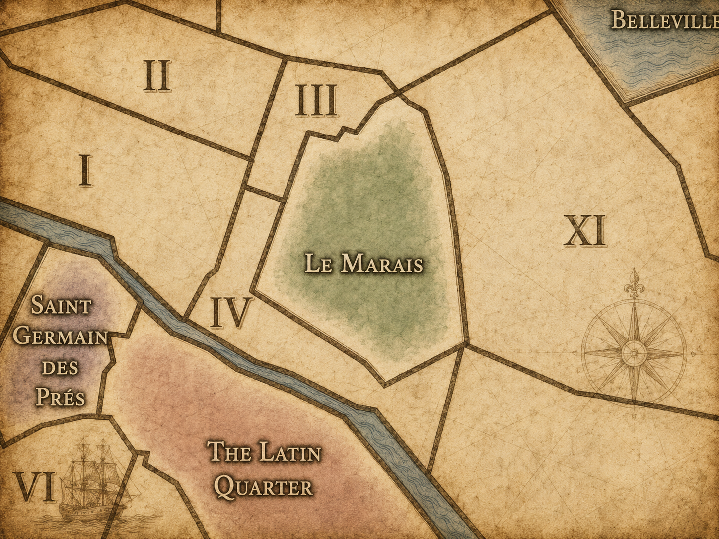
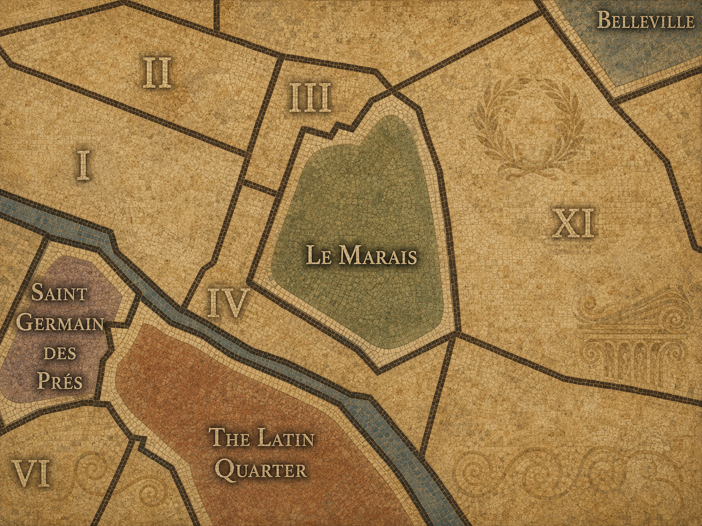
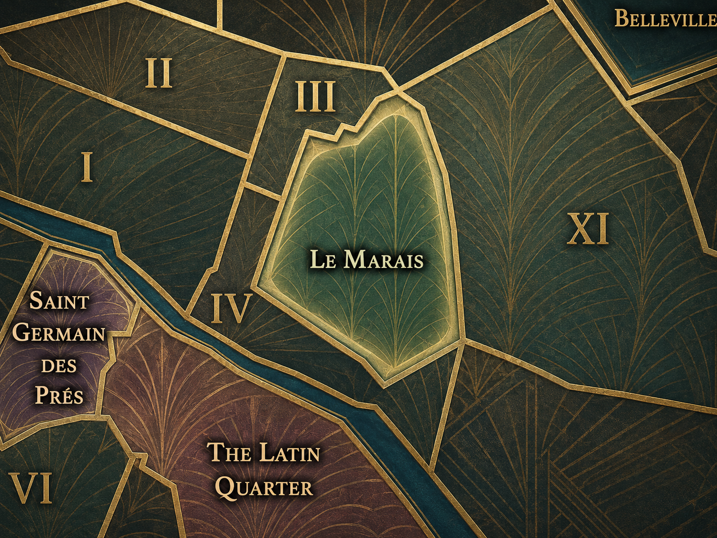
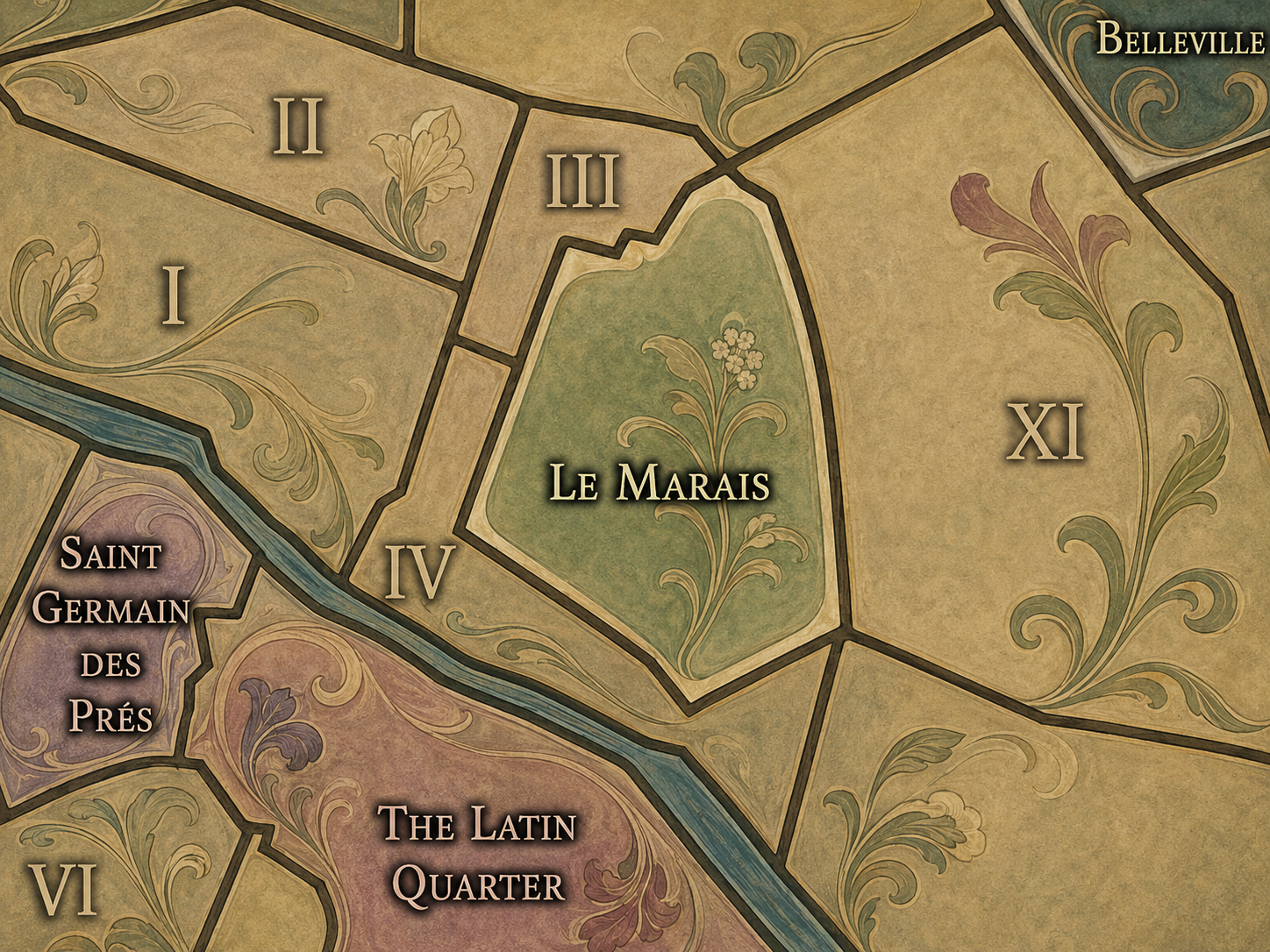
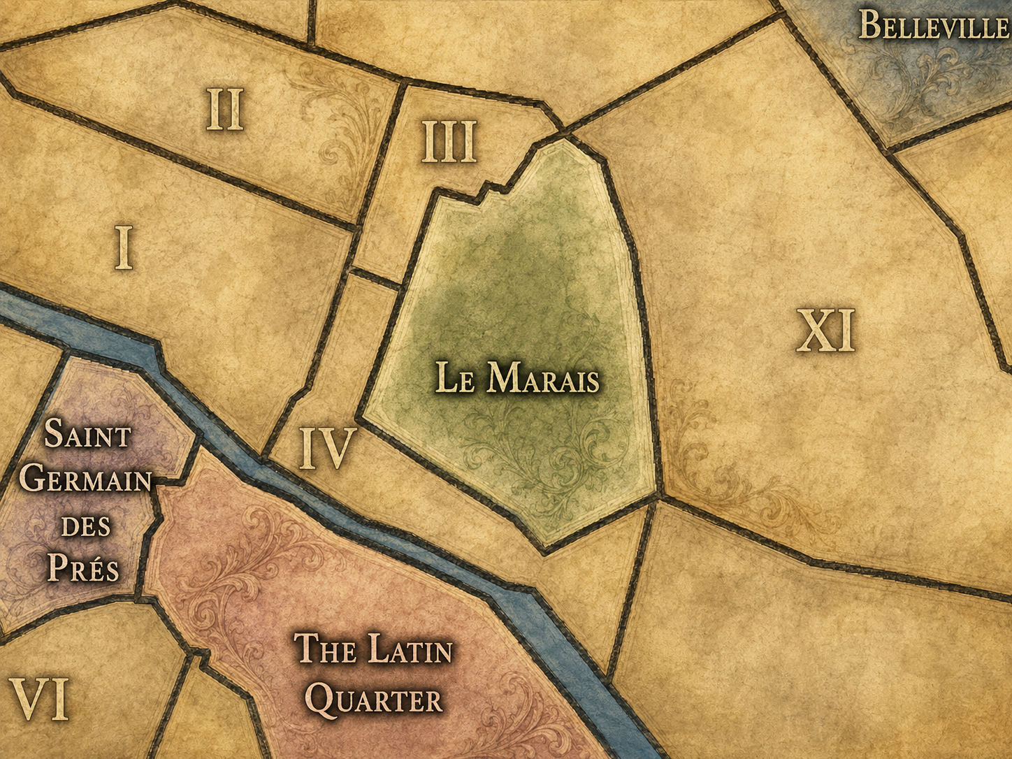
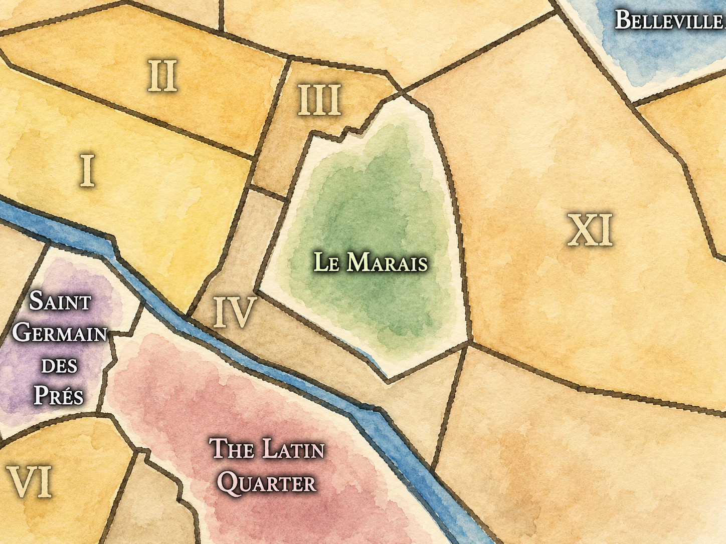
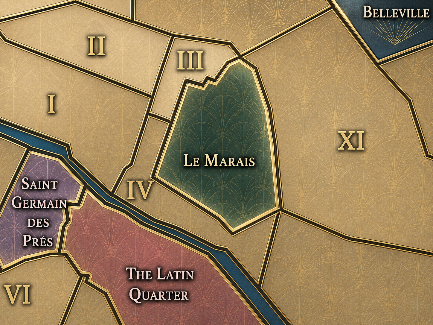
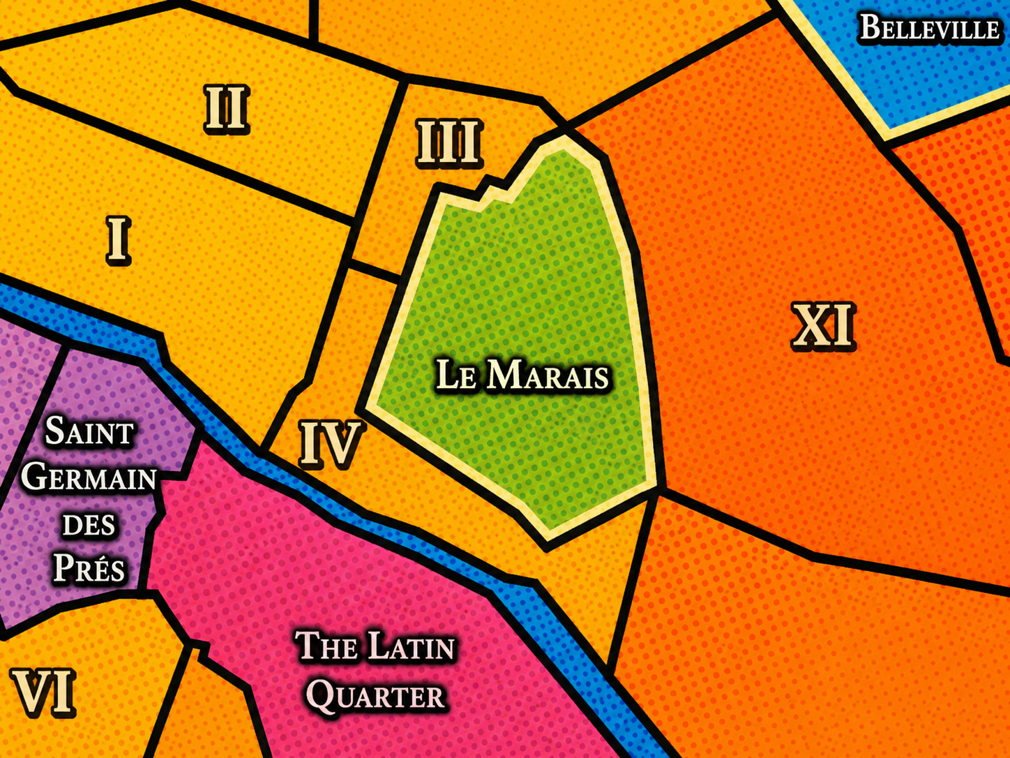
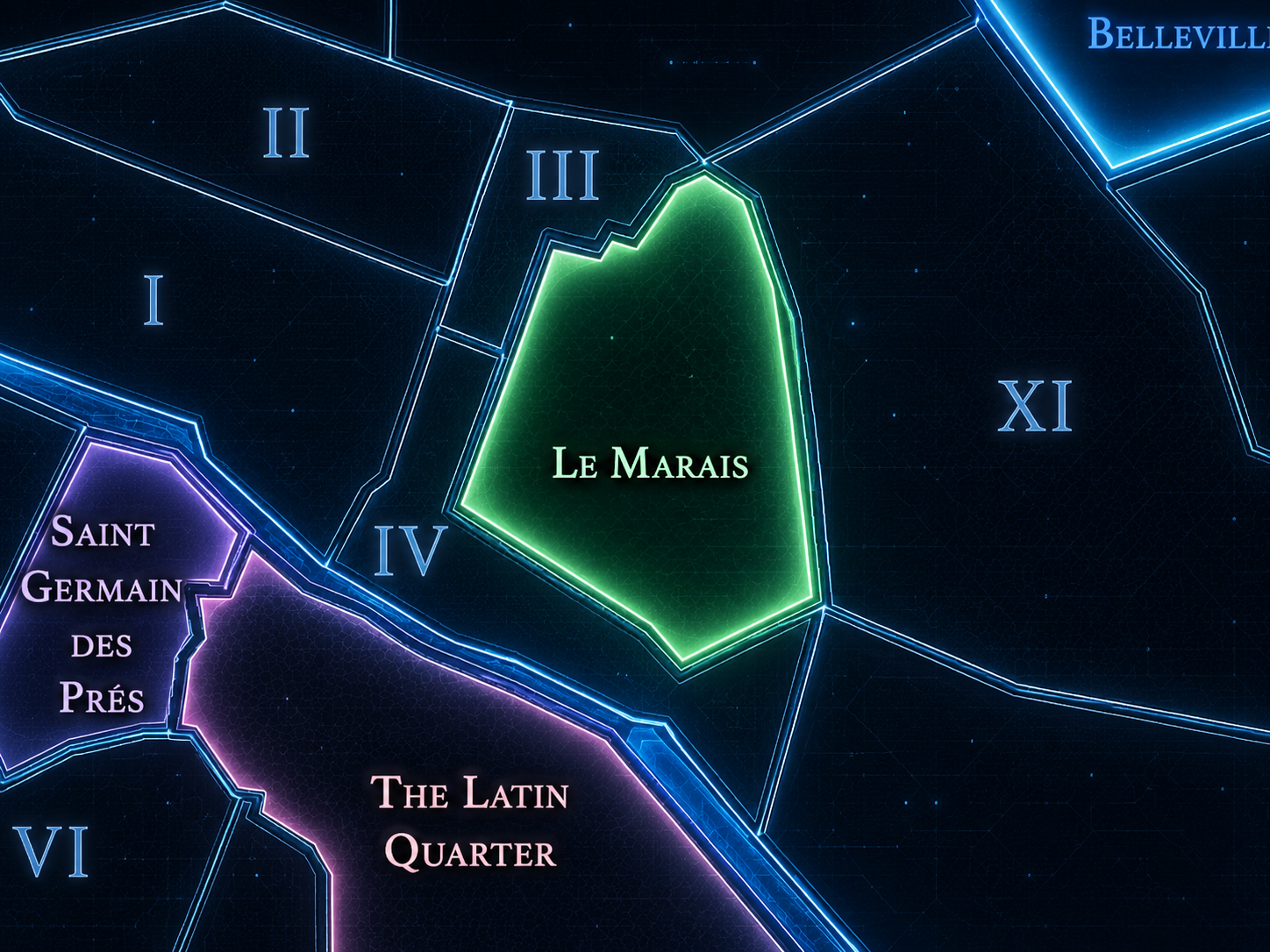
The Map
Cultural Boundaries
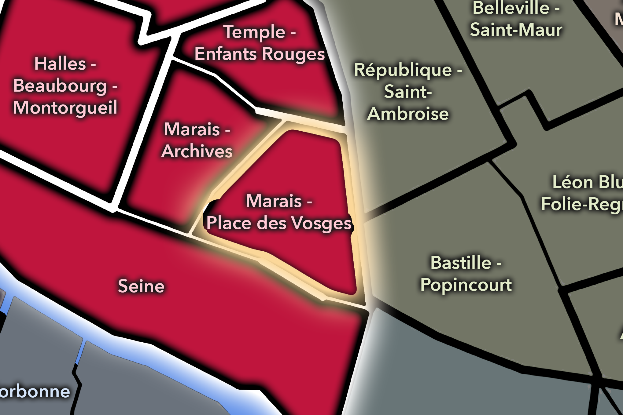
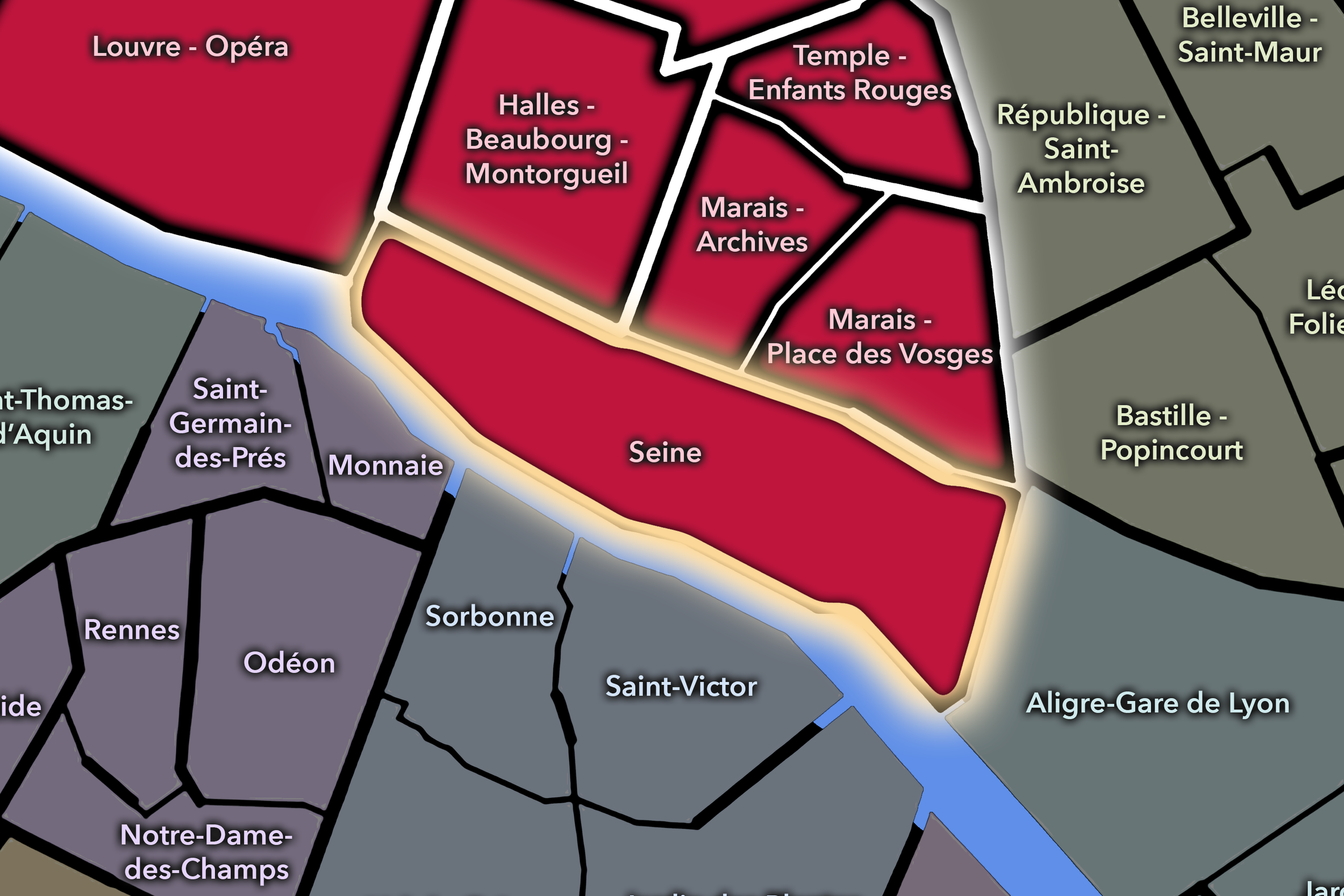
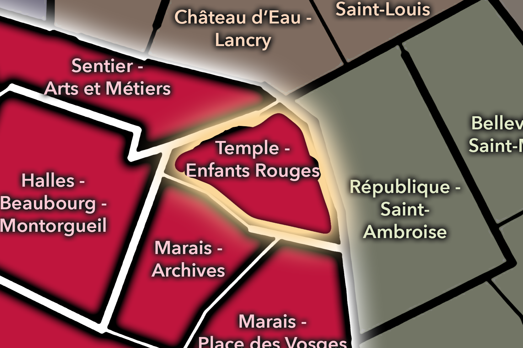
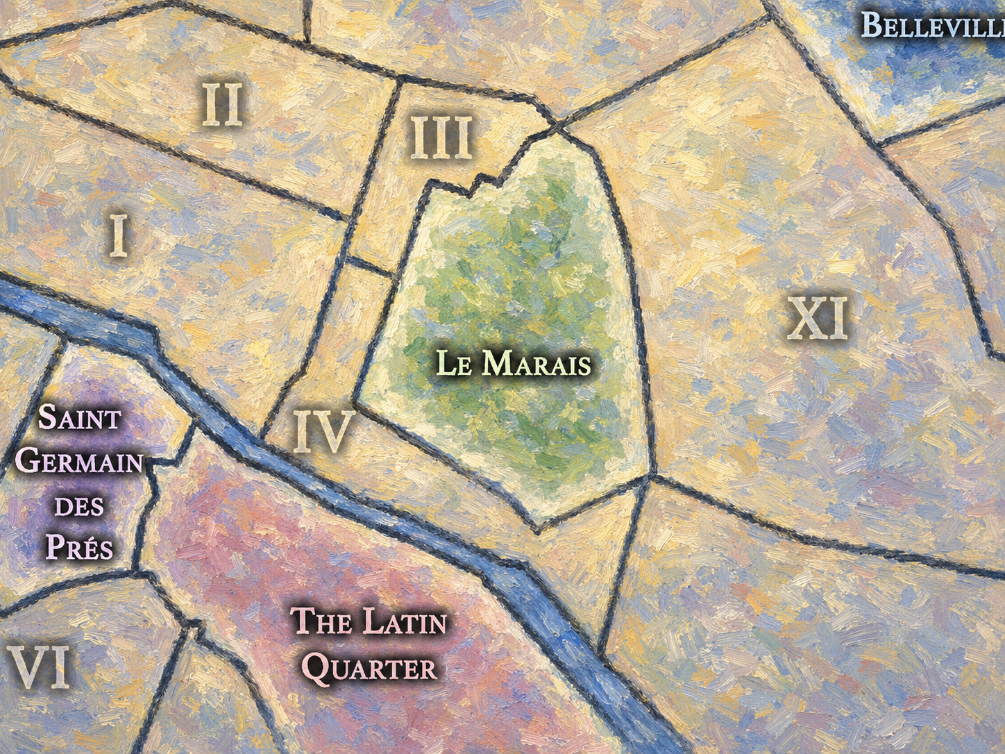
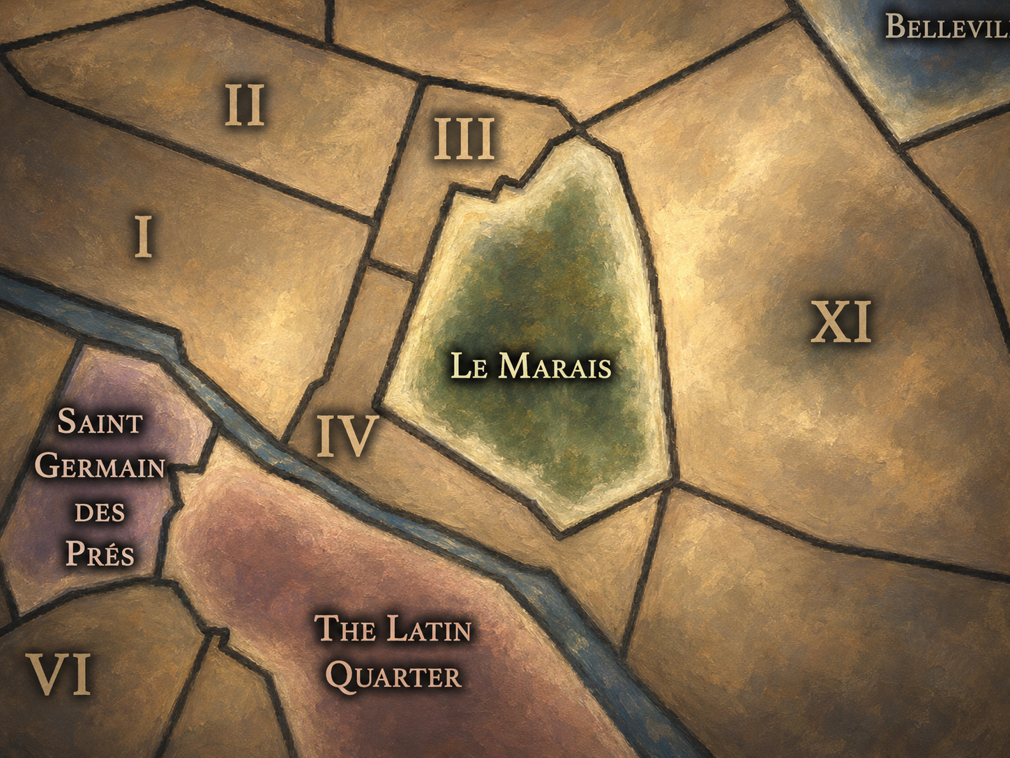
Le Marais occupies one of the most layered cultural geographies of central Paris, stretching across parts of the 3rd and 4th arrondissements on the Right Bank. Its core is generally understood to lie between the area around the Hôtel de Ville and the streets northward toward the historic mansions, museums, synagogues, galleries, boutiques, and older commercial lanes that give the neighborhood its dense cultural identity. The Place des Vosges, rue des Francs-Bourgeois, rue des Rosiers, the Hôtel de Sully, the Musée Carnavalet, and the Musée Picasso all sit within the larger Marais imagination.
Its boundaries, however, are not as fixed as those of an arrondissement or administrative quarter. The Marais overlaps several official quartiers and shifts depending on whether one is speaking historically, architecturally, socially, commercially, Jewishly, queerly, aristocratically, or touristically. At times, it is imagined narrowly around the old Jewish quarter and the rue des Rosiers; at others, more broadly as the preserved early-modern district between Beaubourg, République, Bastille, and the Seine.
For CityNeighborhoods, Le Marais is best understood as a Cultural Neighborhood rather than a single administrative unit: a historically recognizable urban world whose borders are meaningful, but not absolute. Its edges are porous because its identity is built from accumulated layers — marshland, monastery lands, aristocratic hôtels particuliers, Jewish memory, preservation politics, queer life, fashion, museums, cafés, galleries, and the everyday density of central Paris.
Cultural Neighborhood Identity
Etymology and Origins
The name Le Marais means “the marsh.” Before it became one of Paris’s most elegant and culturally complex neighborhoods, the area was associated with low-lying, poorly drained land north of the Seine. Over time, religious institutions, cultivation, drainage, and urban expansion transformed this marginal landscape into usable land, then into one of the most desirable quarters of early modern Paris.
The name preserves a memory of landscape beneath architecture. In this, Le Marais is especially revealing: its identity begins not with aristocratic salons or fashionable streets, but with terrain. The marsh became a garden, the garden became a noble district, the noble district became a preserved historic quarter, and the preserved quarter became one of the most symbolically layered neighborhoods in Paris.
Cultural Framework
Le Marais is one of Paris’s great neighborhoods of accumulation. Its cultural identity does not come from a single story, but from the survival and collision of many stories in a compact urban space. Few areas of Paris hold so many histories in such visible proximity: medieval streets, aristocratic mansions, Jewish institutions, revolutionary memory, museum culture, queer nightlife, fashion retail, galleries, cafés, and dense residential life.
Its framework is therefore layered rather than singular. The Marais is aristocratic Paris, but not only aristocratic. It is Jewish Paris, but not only Jewish. It is queer Paris, but not only queer. It is museum Paris, preservation Paris, boutique Paris, and everyday neighborhood Paris all at once. This is what gives it its unusual cultural charge. It is not merely picturesque; it is a place where different versions of Paris have occupied the same streets, sometimes harmoniously, sometimes uneasily, always visibly.
In the CityNeighborhoods framework, Le Marais is a Cultural Neighborhood because it shows how neighborhood identity can outlast political change, social change, and architectural fashion. Its older fabric survived enough for memory to remain legible. Its streets still hold the evidence of shifting power, faith, class, migration, sexuality, commerce, and cultural reinvention.
Parisian Identity
Le Marais helps define Paris as a city of preserved layers. It offers a counterpoint to the broad boulevards and monumental perspectives often associated with Haussmann’s Paris. Here, the city narrows, bends, and thickens. Streets feel older, courtyards are hidden behind gates, hôtels particuliers become museums, synagogues and shops hold communal memory, and fashion windows appear beside traces of medieval and early-modern Paris.
It is also one of the neighborhoods through which Paris expresses its complexity. The city’s identity is not only royal, revolutionary, artistic, or modern; it is also communal, marginal, adaptive, and self-reinventing. Le Marais embodies that multiplicity. It allows Paris to appear not as one historical image, but as a palimpsest: a place repeatedly rewritten without fully erasing what came before.
Neighborhood Distinction
Le Marais is distinct because it combines architectural preservation with intense cultural transformation. Many Paris neighborhoods are historically rich; many are fashionable; many have strong community identities. Le Marais is unusual because it is all of these at once.
Its streets can move quickly from aristocratic stone façades to Jewish bakeries and bookstores, from old convent lands to contemporary galleries, from quiet courtyards to crowded retail corridors, from museums of Parisian history to bars and cafés associated with queer life. This layering makes the neighborhood feel both intimate and theatrical. It is lived in, visited, protected, commercialized, remembered, and continually reinterpreted.
Its distinction also lies in its scale. Le Marais is walkable enough to feel like a cohesive neighborhood, but historically dense enough to stand as a miniature history of Paris itself. It is one of the places where the city’s identity is not simplified, but concentrated.
Neighborhood Connections
Paris neighborhoods are shaped by overlapping layers. This section shows how Le Marais connects to the broader CityNeighborhoodsParis map — through its rive, arrondissement, administrative quarters, conseils de quartier, and related Cultural Neighborhoods.
Civic & Cultural Foundations
-

Rive Droite
-
3e - Temple
-
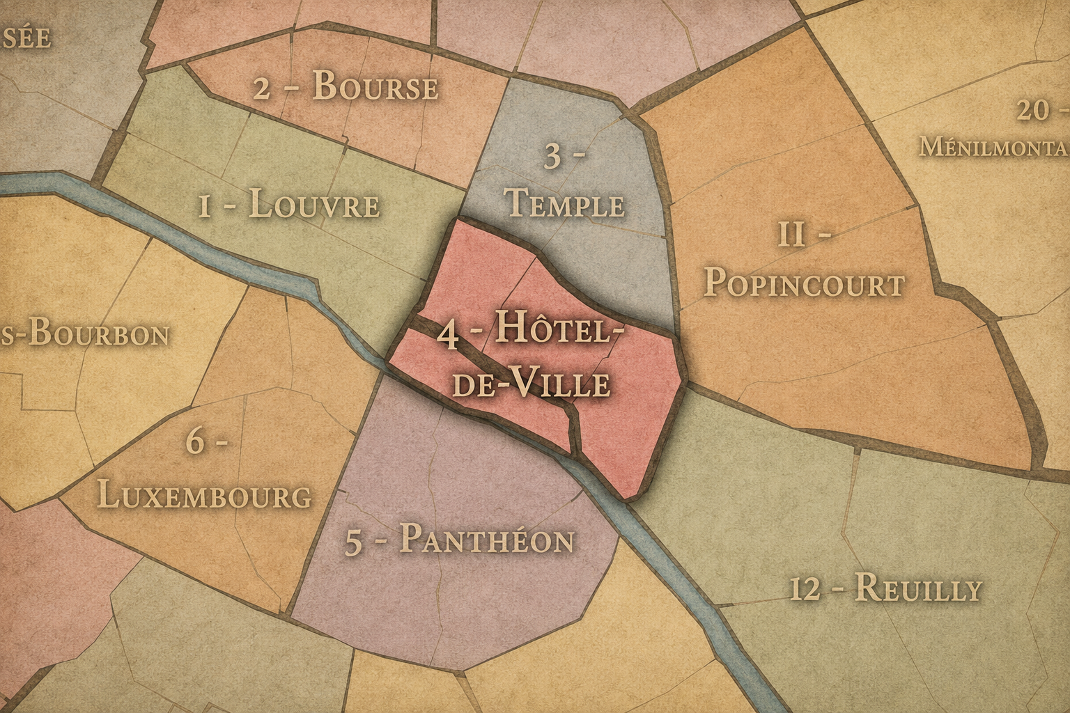
4e - Hôtel-de-Ville
Administrative Quarters
-
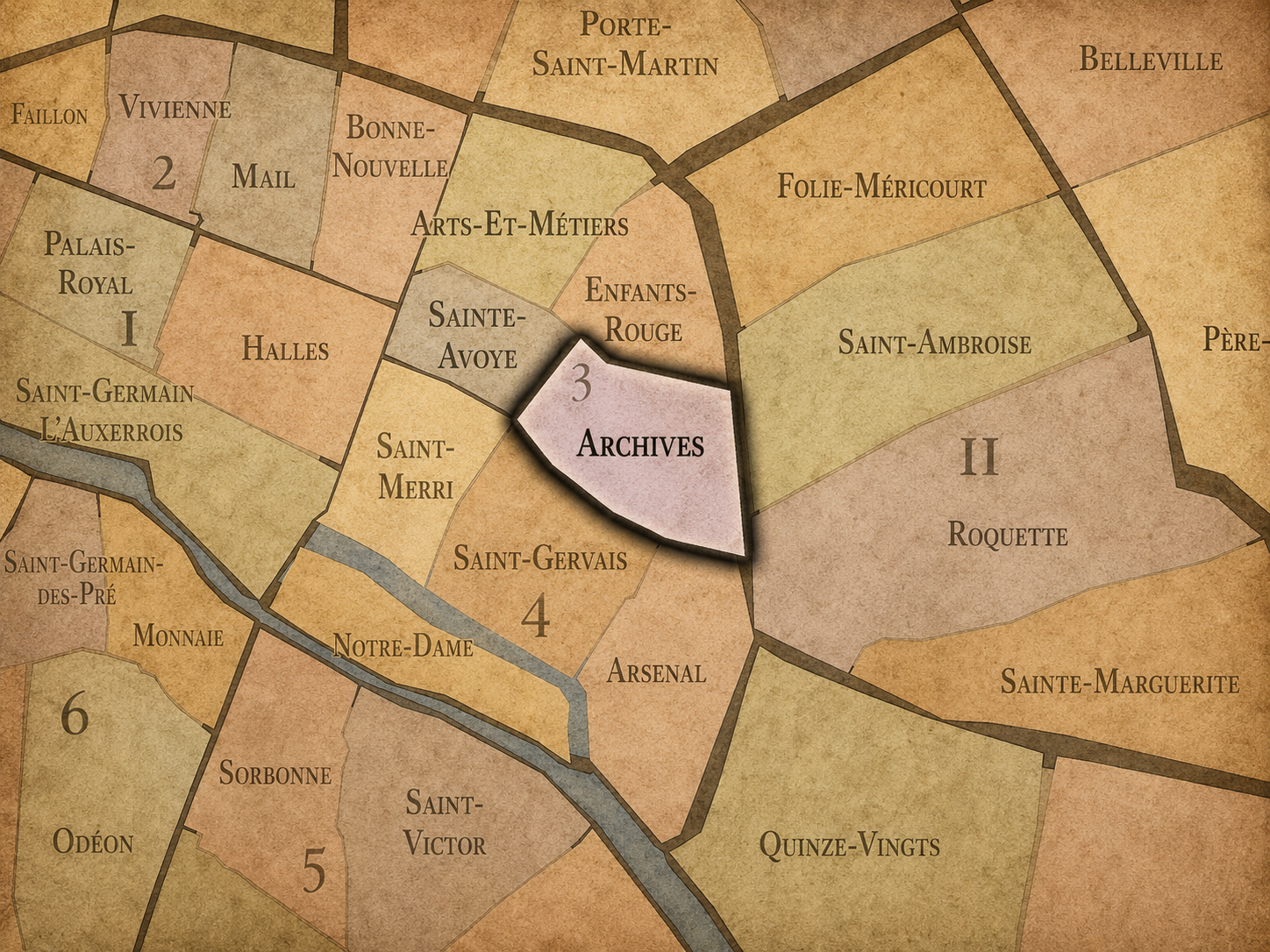
3e - Archives
-
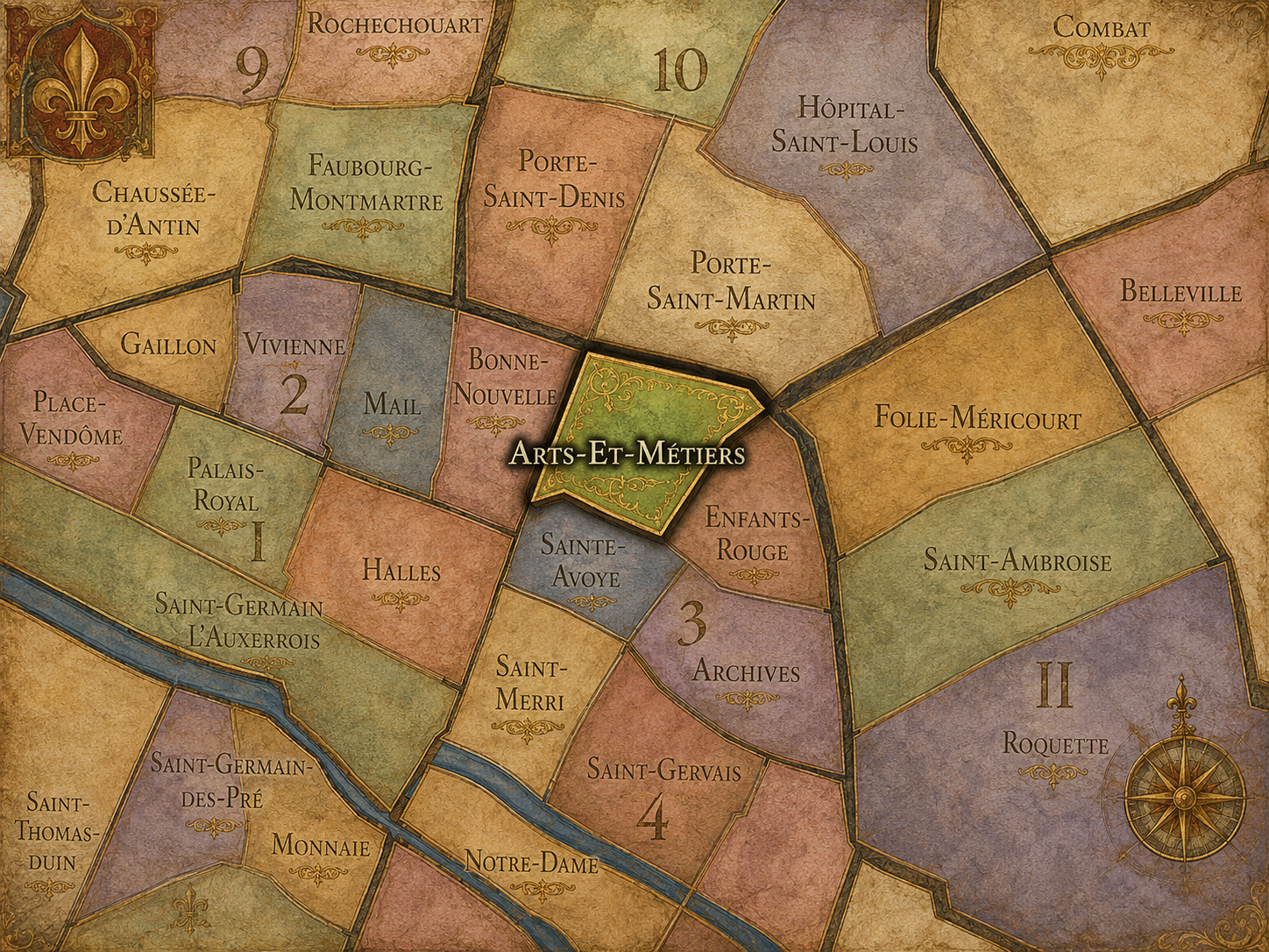
3e - Arts-et-Métiers
-
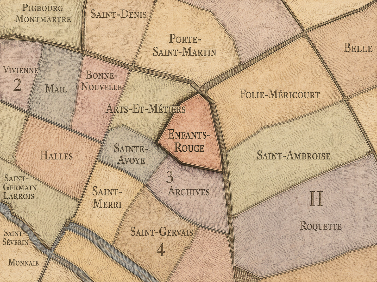
3e - Enfants-Rouges
-
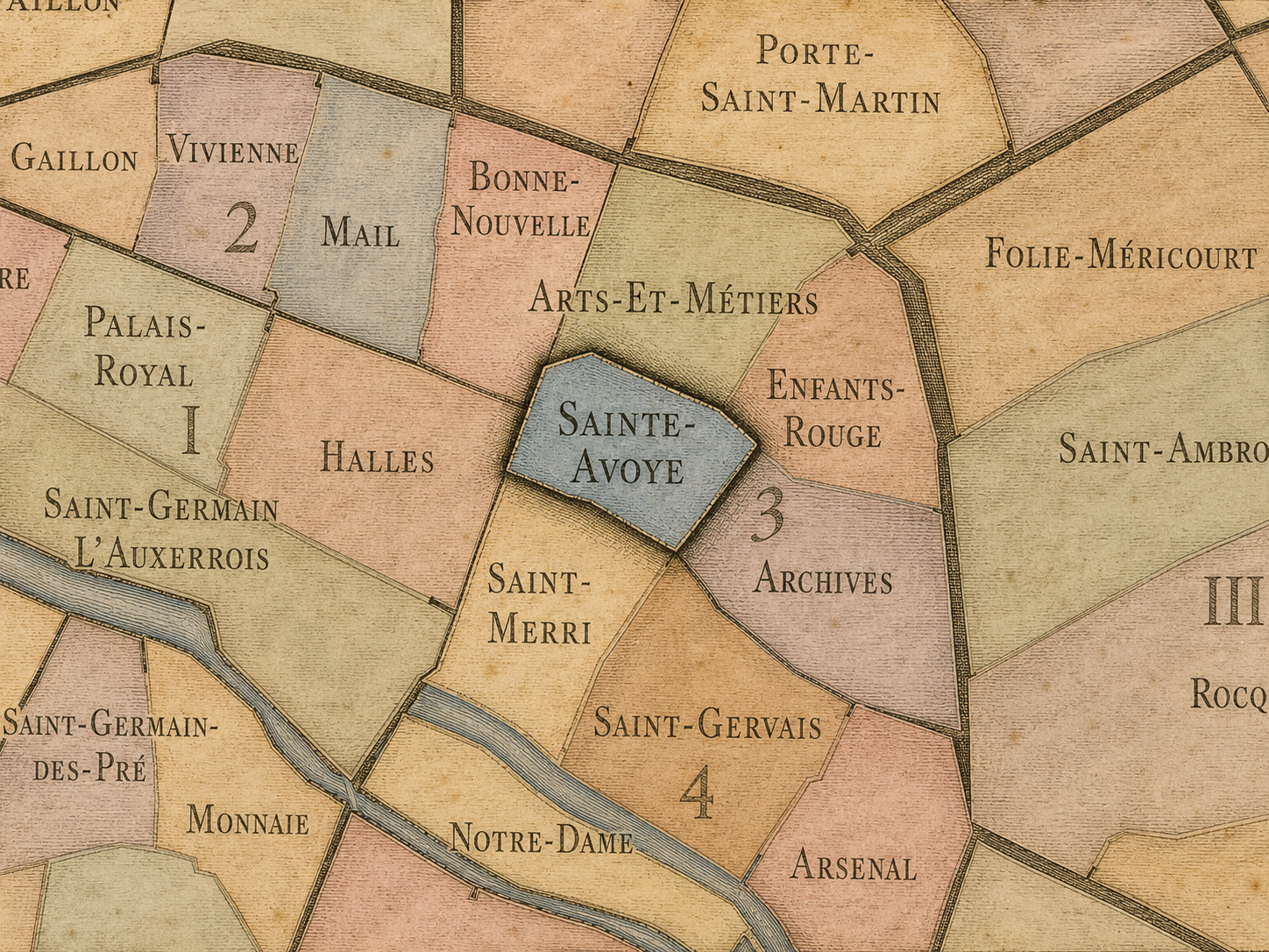
3e - Sainte-Avoye
-
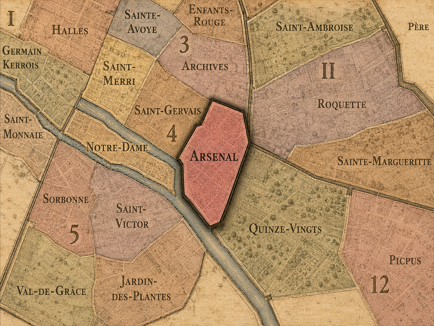
4e - Arsenal
-
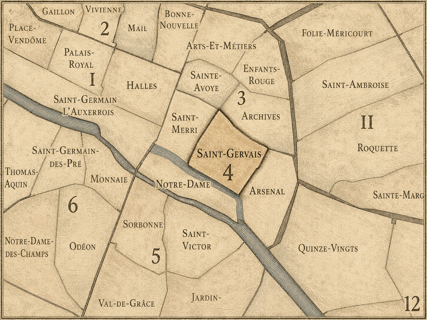
4e - Saint-Gervais
-
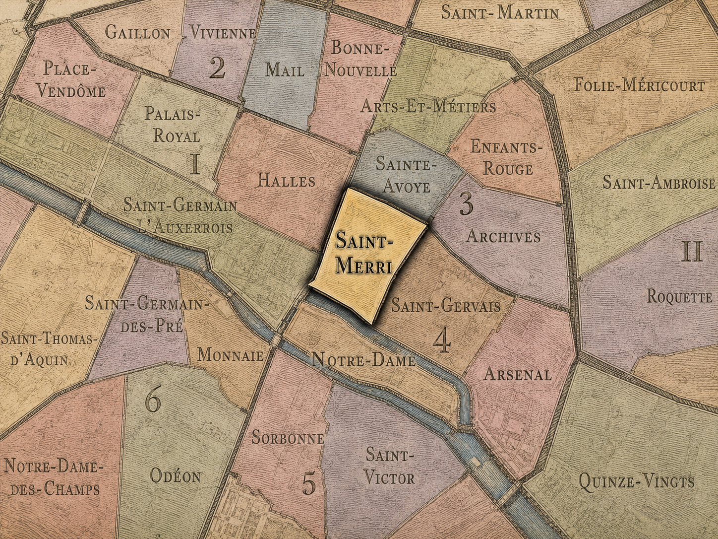
4e - Saint-Merri
Conseils de Quartier
-
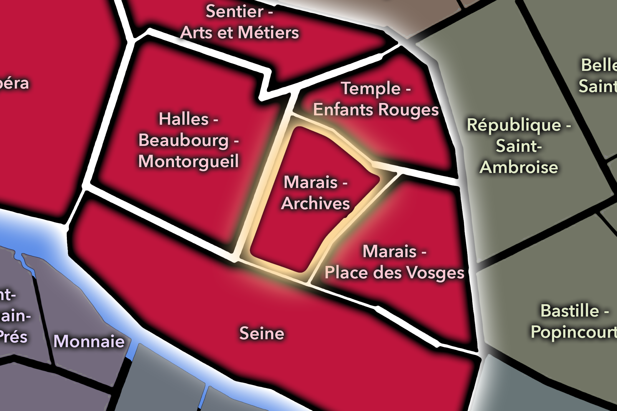
Paris Centre - Marais - Archives
-
Paris Center - Marais - Place Des Vosges
-
Paris Centre - Seine
-
Paris Centre - Temple - Enfants Rouges
The History
Origins
The origins of Le Marais lie in the landscape north of the Seine, where marshy ground gradually became cultivated, settled, and absorbed into the expanding city. Before its later prestige, the area existed on the edge of older Paris, shaped by drainage, religious landholding, agricultural use, and the slow transformation of marginal terrain into urban fabric.
Its early development was tied to the growth of the Right Bank and to the institutions that helped organize land beyond the densest medieval core. Religious communities, roads, fields, and enclosures began giving form to an area that would later become one of the city’s most sought-after districts.
Medieval / Early Formation
During the medieval period, the area that became Le Marais developed through religious foundations, fortified boundaries, markets, and noble or ecclesiastical landholdings. The expansion of Paris northward and eastward brought the former marshland closer to the city’s political and commercial life.
The construction of city walls and the growth of nearby institutions helped make the district more legible as part of Paris. Streets, churches, convents, and residences formed a denser fabric, while the proximity to royal and administrative power increased the appeal of the area. By the late medieval period, Le Marais had begun its long transformation from peripheral land into a district of influence.
Early Modern Paris
The early modern period was decisive for Le Marais. From the 16th into the 17th century, the neighborhood became one of the preferred residential areas of the aristocracy. Noble families built grand hôtels particuliers — private mansions organized around courtyards and gardens — giving the district much of its enduring architectural character.
The creation of the Place Royale, now Place des Vosges, under Henri IV helped anchor this aristocratic identity. The square became one of the great urban gestures of early modern Paris: orderly, elegant, and socially prestigious. Around it, Le Marais developed into a district of rank, refinement, and proximity to power.
Yet this aristocratic phase did not erase the neighborhood’s older complexity. Religious houses, artisans, servants, merchants, and narrower medieval streets remained part of the same fabric. Even at the height of its noble prestige, Le Marais was not a single-class enclave but a layered urban world.
18th Century
In the 18th century, Le Marais remained architecturally distinguished, but its social centrality began to shift. As aristocratic fashion moved westward toward the Faubourg Saint-Germain and other newer elite districts, some of the Marais’s great residences lost their previous prominence. The neighborhood did not disappear from Parisian importance, but its status changed.
This relative decline helped preserve much of its older fabric. Because Le Marais was not fully remade according to later ideals of urban modernity, many of its streets and mansions endured. The same process that reduced its fashionable prestige contributed to its long-term historical value.
The neighborhood also continued to hold varied populations and uses. Its mansions, workshops, religious sites, and commercial streets remained part of a dense urban environment, carrying forward the mix of elegance and everyday life that still shapes the Marais today.
19th Century
The 19th century transformed Paris, but Le Marais was not remade as completely as many other areas. Haussmann’s reconstruction cut new boulevards and altered parts of the city, yet the Marais retained a significant portion of its pre-Haussmann fabric. This survival later became central to its identity as one of the places where older Paris remained visible.
During the same period, the neighborhood became increasingly associated with Jewish life, especially around the rue des Rosiers and the surrounding streets of the Pletzl. Jewish communities, including immigrants from Eastern Europe in later decades, gave the Marais one of its most important cultural layers. Shops, synagogues, schools, foodways, languages, and communal institutions helped form a neighborhood identity that was both Parisian and diasporic.
The 19th century also intensified the contrast between the Marais’s noble architectural inheritance and its changing social reality. Former aristocratic spaces were subdivided, repurposed, or adapted to new uses. The district became less a seat of aristocratic power and more a dense, mixed neighborhood of residence, work, commerce, and community.
Early–Mid 20th Century
In the early 20th century, Le Marais remained a neighborhood of historic buildings, workshops, Jewish institutions, small commerce, and dense urban life. Its older streets and courtyards supported a mixture of residents, artisans, merchants, and immigrant communities. The Pletzl in particular became one of the most recognizable centers of Jewish Paris.
The Second World War marked one of the darkest chapters in the neighborhood’s history. Jewish residents of the Marais, like Jews across Paris and France, faced persecution, arrest, deportation, and murder during the Nazi occupation and the collaborationist Vichy regime. The neighborhood’s Jewish memory is therefore not only cultural and commercial, but also memorial and traumatic.
After the war, Le Marais carried both survival and loss. Its synagogues, plaques, schools, shops, and community spaces became part of a landscape where everyday life continued alongside memory. This dual presence — life and mourning, continuity and rupture — remains essential to understanding the neighborhood.
Late 20th Century
The late 20th century brought major preservation and reinvention. The Marais became central to the politics of historic conservation in Paris, especially after the 1962 Malraux Law encouraged the protection and restoration of historic urban districts. Many hôtels particuliers were restored, museums expanded, and the neighborhood’s architectural inheritance became one of its defining public identities.
At the same time, Le Marais became increasingly associated with contemporary culture, fashion, galleries, cafés, nightlife, and LGBTQ+ life. The neighborhood’s queer identity grew especially visible from the late 20th century onward, particularly around streets of the 4th arrondissement. This added another major layer to an already dense cultural geography.
The Marais also became more heavily visited and commercialized. Preservation made the district beautiful and desirable; desirability brought boutiques, tourism, rising rents, and changing patterns of local life. The neighborhood became both protected and transformed by its own appeal.
21st Century
In the 21st century, Le Marais remains one of the most culturally recognizable neighborhoods in Paris. It is a center of museums, fashion, galleries, Jewish memory, queer visibility, historic architecture, restaurants, boutiques, and dense pedestrian life. It is also one of the neighborhoods where the tensions of contemporary Paris are especially visible: preservation and commercialization, memory and consumption, local life and global tourism, community history and fashionable reinvention.
Its identity continues to evolve. Some older forms of neighborhood life have been pressured by rising costs and visitor-oriented commerce, while other cultural presences have adapted, endured, or become newly visible. The Marais remains a place of intense symbolic value because so many people understand it through different attachments: historical, religious, architectural, artistic, queer, commercial, residential, or personal.
For CityNeighborhoods, Le Marais stands as one of the clearest examples of why Cultural Neighborhoods matter. It cannot be understood only as part of the 3rd or 4th arrondissement, nor only through its administrative quarters. Its meaning comes from the accumulation of histories that have made it one of Paris’s most layered neighborhood worlds.
Spirit & Legacy
The spirit of Le Marais lies in its power to hold contradiction without losing coherence. It is elegant and wounded, preserved and changing, fashionable and memorial, aristocratic and communal, global and intimate. Its streets contain some of the most beautiful remnants of early modern Paris, but also some of the city’s most important histories of minority life, survival, reinvention, and belonging.
Its legacy is not simply that it preserves old Paris. It preserves the evidence that Paris has never been only one thing. Le Marais shows how a neighborhood can become a vessel for many identities at once: marshland transformed into noble quarter, noble quarter transformed into mixed urban district, Jewish neighborhood, museum district, queer neighborhood, fashion destination, and living city.
To walk Le Marais is to move through a Paris that remembers in layers. Its cultural importance comes not from purity, but from accumulation — from the way different communities, architectures, losses, pleasures, and reinventions remain visible in the same streets. That is why Le Marais is not merely a historic district. It is one of the essential Cultural Neighborhoods of Paris.
The Photography
Visual Identity

The visual identity of each Paris district begins with its position in the city’s layered geography. Before the photographs arrive, the maps establish a first way of seeing: where the district sits, what civic layer it belongs to, which boundaries define it, and how it connects to the surrounding fabric of Paris. In CityNeighborhoods Paris, cartography is not merely orientation; it is part of the visual language of the project.
As the photographic archive grows, this section will continue to develop through images gathered on foot. Streets, façades, monuments, markets, parks, river edges, passages, signs, textures, and everyday details will gradually reveal how each district presents itself visually. The goal is not only to show what a place looks like, but to trace how its identity becomes visible through form, atmosphere, memory, and use.
Through The Lens

CityNeighborhoods Paris is built from walking, looking, and returning. Each district is approached through photography as a way of paying attention: to the obvious landmarks and the quieter details, to historic structures and ordinary streets, to the moments where civic geography becomes lived experience. The camera becomes a tool for noticing how Paris changes from one district to the next, and how each place holds its own relationship to the larger city.
As photographs are processed and added, this section will become a more specific visual record of the district. Future updates may include dated field notes, galleries, and reflections from individual walks. For now, the page remains part of the larger CityNeighborhoods effort to document every Paris neighborhood through maps, history, identity, and photography — one district, one walk, and one visual encounter at a time.
If you visit Paris, these ideas can help inspire your own photography.


Paris: J’Espere, Je Rêve, Je Vive
Paris Photo Gallery
Paris Flâneur Notes
Flâneur Notes document the walks, photographs, light, and street-level observations behind this neighborhood entry. Learn more about the Spirit of the Flâneur.


Explore Paris
-

The twenty arrondissements form the civic spiral of Paris, organizing the city into its broad local districts of government, identity, and daily life.
-

Each arrondissement is divided into four official administrative quarters, giving Paris a more precise civic and geographic framework.
-

The conseils de quartier bring participation to street level, giving residents a voice in neighborhood needs, public space, and local civic life.
-

Les Deux Rives trace Paris through the Seine’s two banks, revealing how the Rive Droite and Rive Gauche shaped the city’s civic power, commerce, learning, art, and cultural identity.
-

Cultural neighborhoods reveal the Paris people recognize through history, cafés, architecture, memory, atmosphere, and local belonging.