
9e - OPÉRA
Les Conseils de Quartier
From the Palais Garnier and Boulevard Haussmann to Nouvelle Athènes, Pigalle, and the Grands Boulevards, the 9e’s conseils de quartier reveal the local civic structure behind a district known for theater, music, shopping, and urban spectacle. Part of an ongoing project to walk and photograph every neighborhood in Paris, this page explores the conseils de quartier of 9e Opéra through maps, local identity, civic geography, and photography.
Explore This Page


Explore the Conseils de Quartier of the 9e — Opéra.

Overview
Geographic Setting
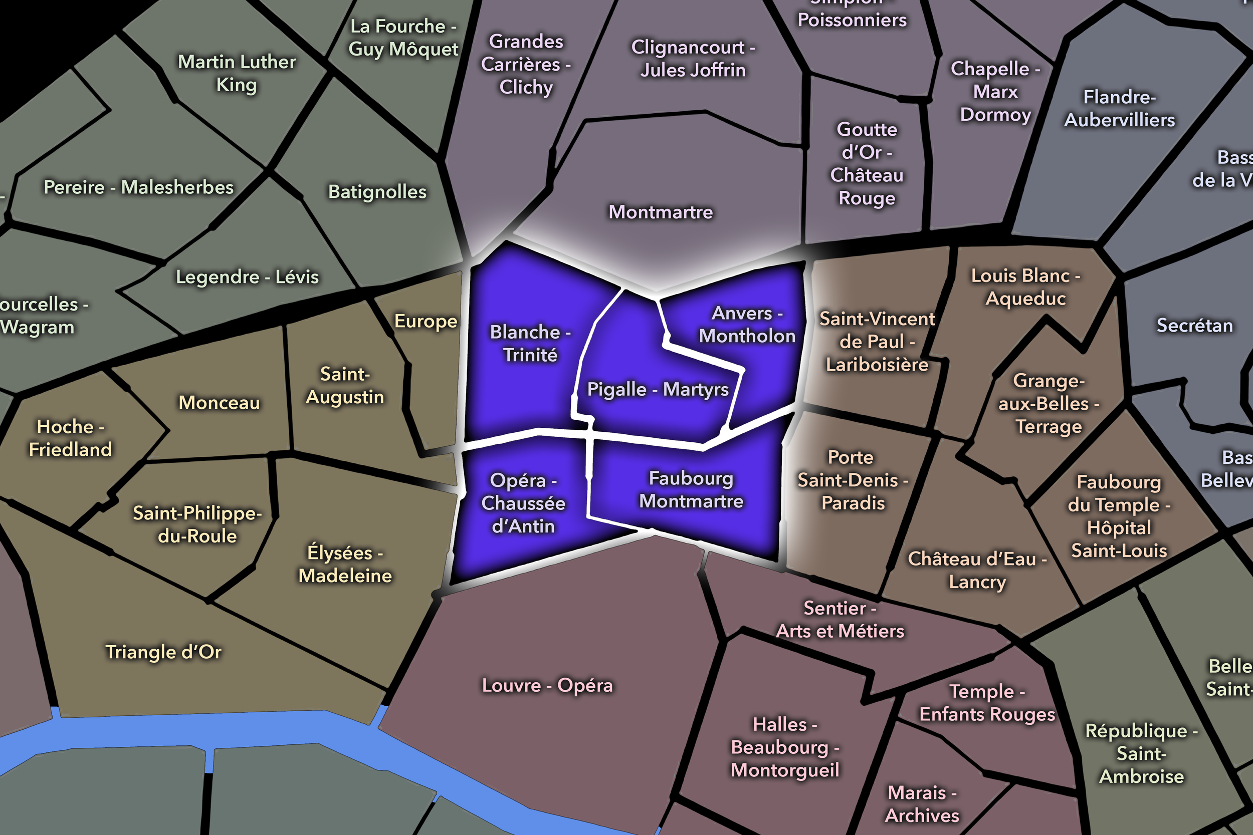
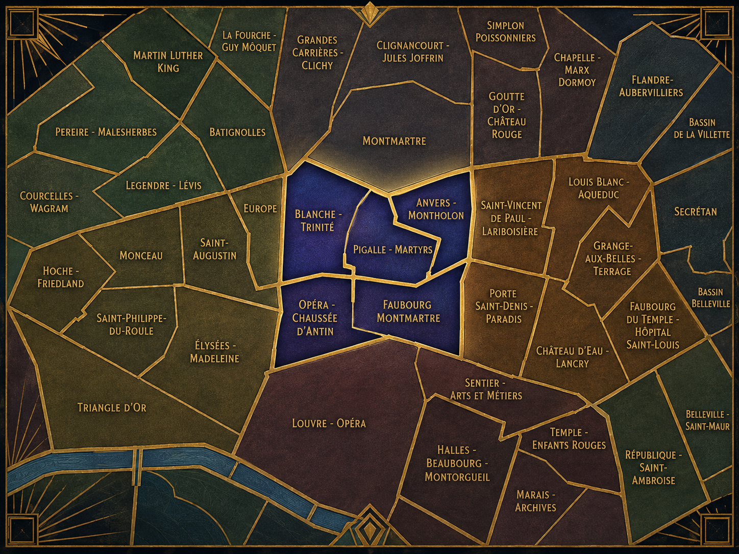
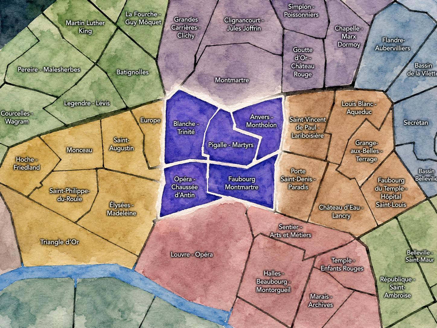
The Conseils de Quartier of the 9e organize local civic life across a compact but highly varied Right Bank arrondissement. Set between the Opéra district, the Grands Boulevards, the lower slopes of Montmartre, and the approach to Gare Saint-Lazare, the 9e gathers together theaters, department stores, office streets, residential hillsides, covered passages, cafés, schools, churches, synagogues, music halls, and commercial corridors within a relatively small urban frame. Its geography is shaped by movement: from the ceremonial and retail intensity around Opéra and Chaussée d’Antin to the more local streets of Pigalle, Martyrs, Montholon, Trinité, and the lower Montmartre edge.
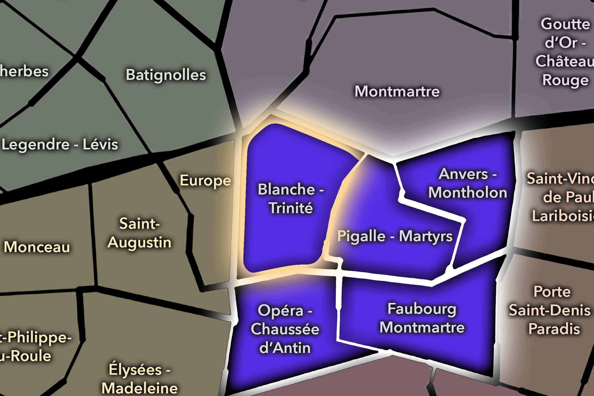
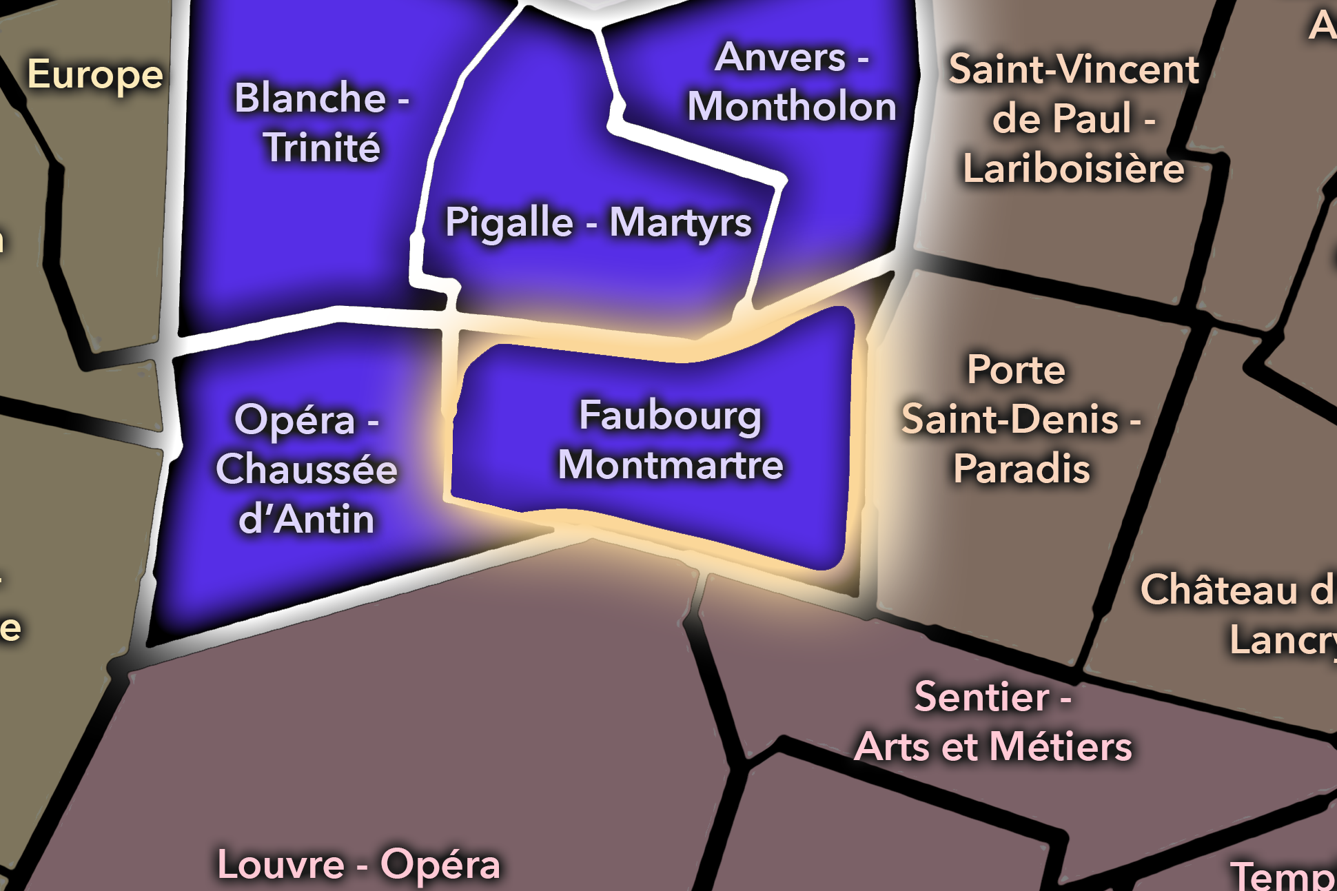
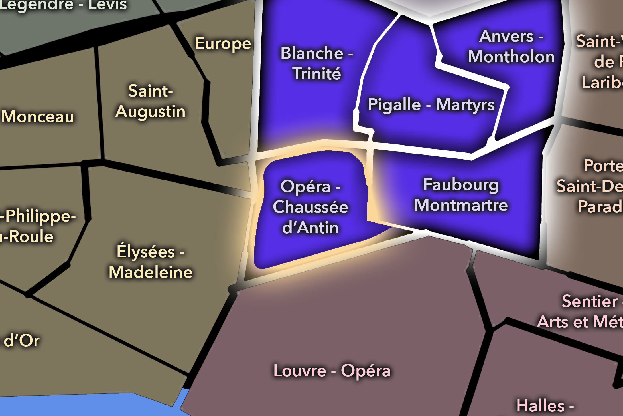
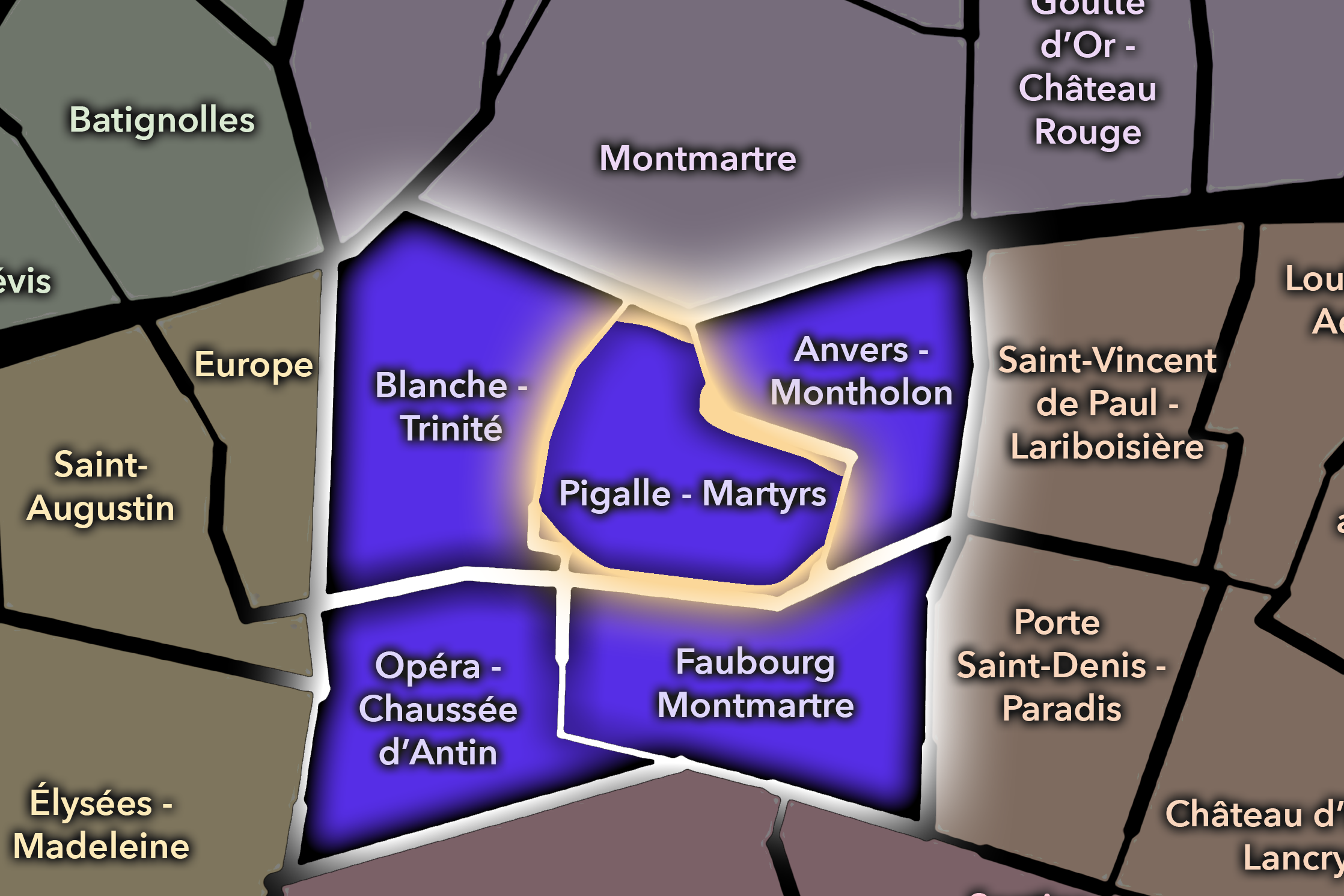
The 9e’s Conseil de Quartier structure divides this landscape into five civic territories: Pigalle-Martyrs, Anvers-Montholon, Blanche-Trinité, Faubourg Montmartre, and Opéra-Chaussée d’Antin. Unlike arrondissements whose CdQs simply mirror the four Administrative Quarters, the 9e’s councils create a more tailored local geography, distinguishing between the arrondissement’s performance districts, shopping districts, residential slopes, historic commercial corridors, and station-adjacent streets. This gives the CdQ layer a useful role in a district where the urban character can change quickly from boulevard to side street.
Together, these five CdQs reveal the 9e as a meeting point between public spectacle and everyday neighborhood life. Opéra-Chaussée d’Antin gathers the department stores, offices, hotels, and institutional corridors around one of Paris’s major commercial centers. Faubourg Montmartre connects the arrondissement to the Grands Boulevards, covered passages, theaters, restaurants, and older commercial streets. Blanche-Trinité links theater, nightlife, church, office, and residential geographies, while Pigalle-Martyrs and Anvers-Montholon carry the arrondissement upward toward the lower slopes of Montmartre, neighborhood food streets, music venues, and more intimate residential textures.
Civic Framework
The 9e’s Conseils de Quartier provide a neighborhood-level civic structure for an arrondissement whose identity is unusually tied to commerce, entertainment, transit, and cultural movement. The district is not dominated by one single monument or park, but by overlapping corridors of use: people arriving for shopping, work, theater, restaurants, nightlife, schools, offices, music halls, places of worship, and daily residential routines. The CdQs help translate those overlapping uses into smaller civic territories where local concerns can be understood more precisely.
The five-council structure reflects the arrondissement’s internal variety. Opéra-Chaussée d’Antin responds to the density of department-store shopping, office life, hotels, and transit around the Opéra / grands magasins axis. Faubourg Montmartre gathers the Grands Boulevards and historic commercial-passage landscape into a distinct civic area. Blanche-Trinité connects major entertainment streets with church, office, and residential environments, while Pigalle-Martyrs and Anvers-Montholon help separate the lower Montmartre edge into areas shaped by nightlife, market streets, schools, local commerce, and neighborhood-scale public spaces.
As a civic framework, the 9e’s CdQs help organize practical questions that arise in a district used by many different publics at once: pedestrian movement around shopping and theater corridors, nightlife and noise, commercial vitality, hotel and office activity, residential quality of life, school streets, public-space maintenance, and the balance between the arrondissement as a destination and the arrondissement as a lived neighborhood. The CdQ layer is especially useful here because the 9e’s local identity often appears in strips, slopes, passages, and corridors rather than in one easily bounded center.
Local Expression
Viewed through its Conseils de Quartier, the 9e becomes a collection of distinct Right Bank environments rather than a single Opéra-adjacent district. Opéra-Chaussée d’Antin expresses the arrondissement’s grand commercial face, where department stores, office buildings, hotels, theaters, transit access, and visitor movement define the urban rhythm. Faubourg Montmartre gives the 9e a more historic boulevard identity, shaped by passages, restaurants, theaters, cafés, and the layered commercial life of the older Right Bank.
Blanche-Trinité reveals the arrondissement’s theatrical and transitional character, where the lower Montmartre entertainment world meets churches, offices, schools, residences, and local squares. Pigalle-Martyrs carries the energy of music, nightlife, food streets, cafés, and the climb toward Montmartre, while Anvers-Montholon offers a more mixed local expression of residential streets, schools, gardens, religious institutions, and visitor movement along the northern edge.
The value of the CdQ layer in the 9e is that it makes visible the arrondissement’s fine-grained differences. Through its five councils, the 9e can be read at the scale of the theater entrance, the passage arcade, the department-store façade, the café terrace, the school street, the music venue, the market corridor, and the residential block tucked behind the boulevards. These CdQs reveal a Paris of performance and commerce, but also one of daily routines, local stewardship, and neighborhood life beneath the bright surfaces of the Right Bank.
Les Conseils de Quartier
Anvers-Montholon
Civic Profile
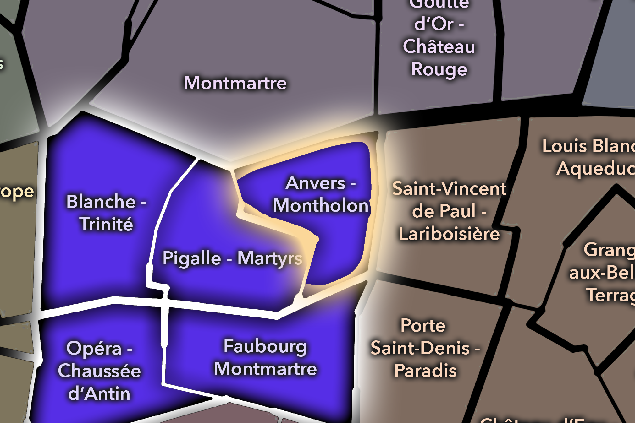
The Anvers-Montholon Conseil de Quartier organizes the 9e’s northeastern edge, where the arrondissement rises toward Anvers, Rochechouart, Montholon, and the lower approaches to Montmartre. It is a transitional civic territory: part residential hillside, part school-and-square neighborhood, part visitor corridor toward Sacré-Cœur, and part everyday northern 9e. Its local geography is shaped by Boulevard de Rochechouart, Rue de Maubeuge, Rue de Rochechouart, the Anvers transit node, Square Montholon, and the movement between the 9e, 10e, and 18e.
On the ground, Anvers-Montholon feels less polished than the southern 9e and more closely tied to the mixed urban life of northern Paris. It contains hotels, local cafés, schools, residential streets, music and theater edges, tourist routes, and ordinary neighborhood squares. Its civic themes center on pedestrian movement toward Montmartre, traffic and transit pressure, public-space maintenance around squares and boulevards, hotel and visitor activity, and the balance between local residential life and one of the city’s most familiar visitor approaches.
Anvers-Montholon: At a Glance
A curated list for you.
-

Major Streets
Boulevard de Rochechouart
Rue de Maubeuge
Rue de Rochechouart
Rue de Dunkerque
Rue Rodier
-

Public Spaces & Landmarks
Square Montholon
Anvers / Sacré-Cœur approach nearby
Église Saint-Vincent-de-Paul nearby
Théâtre de l’Atelier nearby
Lycée Jacques-Decour
-

Transit Access
Anvers
Barbès - Rochechouart nearby
Poissonnière
Gare du Nord nearby
Cadet nearby
-

Shopping & Dining
Rue de Rochechouart cafés
Boulevard de Rochechouart dining
Bouillon Pigalle nearby
Le Barbe à Papa / Anvers area
Local bakeries and hotel cafés
-

Hotels & Attractions
Anvers hotel district
Montmartre visitor corridor
Square Montholon neighborhood stop
Gare du Nord arrival edge nearby
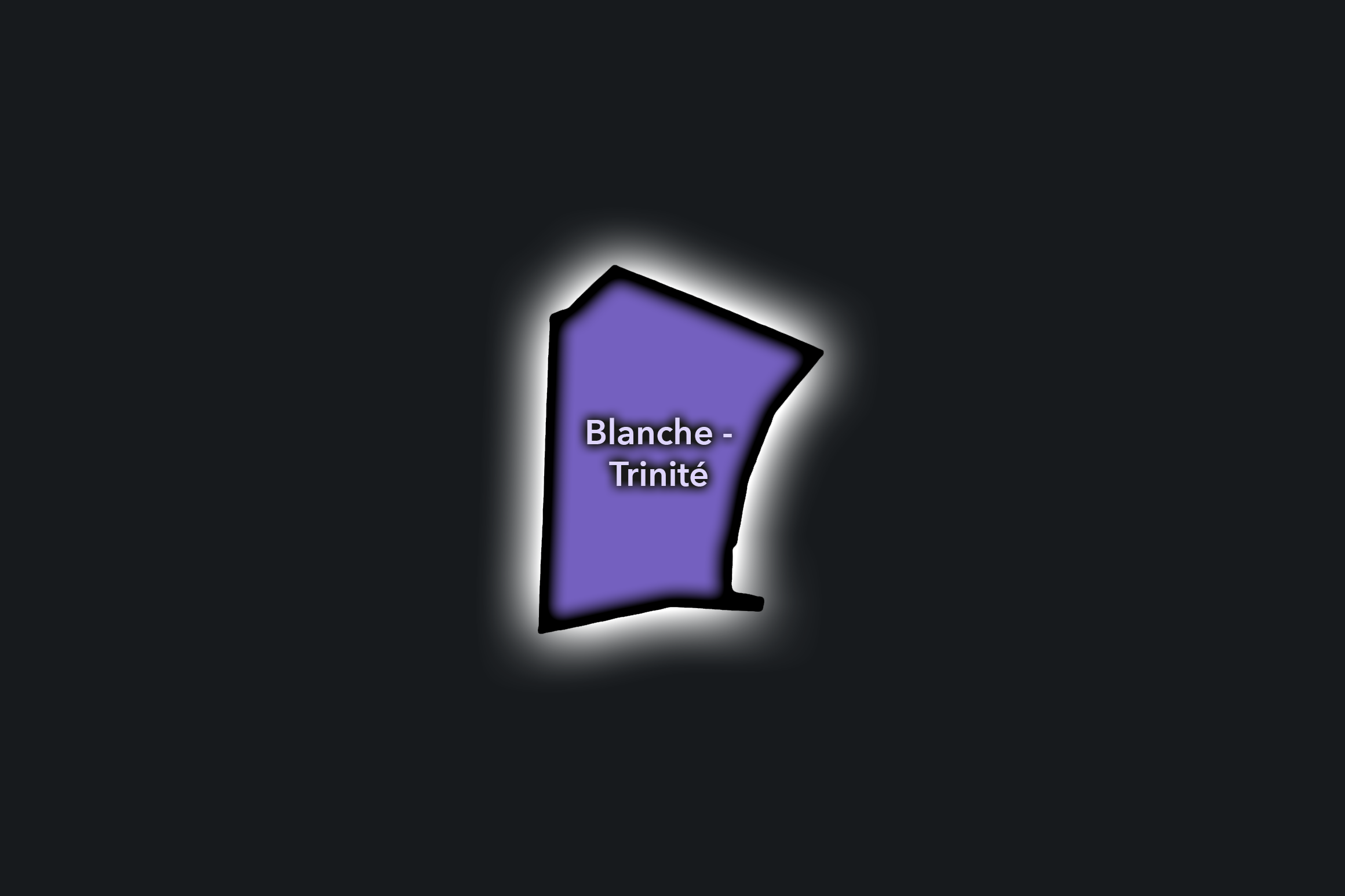
Blanche-Trinité
Civic Profile
The Blanche-Trinité Conseil de Quartier gives civic shape to the western-northern side of the 9e, where the theatrical edge of Blanche and Pigalle meets the church, square, office streets, residential blocks, and commercial corridors around Trinité. This CdQ sits between two strong urban identities: the entertainment and nightlife landscape near Boulevard de Clichy and the more formal, office-and-residential fabric around Église de la Sainte-Trinité, Rue de Châteaudun, and the approaches to Saint-Lazare.
On the ground, Blanche-Trinité feels like a hinge between spectacle and routine. The Moulin Rouge, theater streets, cafés, hotels, and nightlife venues shape one side of the district, while Trinité, schools, offices, churches, side streets, and transit movement create a more weekday civic rhythm. Its local concerns are therefore tied to mixed use: nightlife and noise, pedestrian circulation, hotel and theater traffic, residential quality of life, public-space comfort around squares and churches, and the effort to keep a district of performance and movement livable for those who use it daily.
Blanche-Trinité: At a Glance
A curated list for you.
-
Major Streets
Boulevard de Clichy
Rue Blanche
Rue de Clichy
Rue de Châteaudun
Rue de la Trinité
-
Public Spaces & Landmarks
Moulin Rouge
Église de la Sainte-Trinité
Place d’Estienne d’Orves
Casino de Paris
Théâtre de Paris
-
Transit Access
Blanche
Trinité - d’Estienne d’Orves
Pigalle nearby
Saint-Lazare nearby
Liège nearby
-
Shopping & Dining
Boulevard de Clichy restaurants and bars
Rue Blanche theater dining
Pink Mamma
Bouillon Pigalle nearby
Trinité / Châteaudun cafés
-
Hotels & Attractions
Moulin Rouge visitor district
Theater and performance corridor
South Pigalle hotel district
Trinité church and square
Montmartre / Pigalle approach
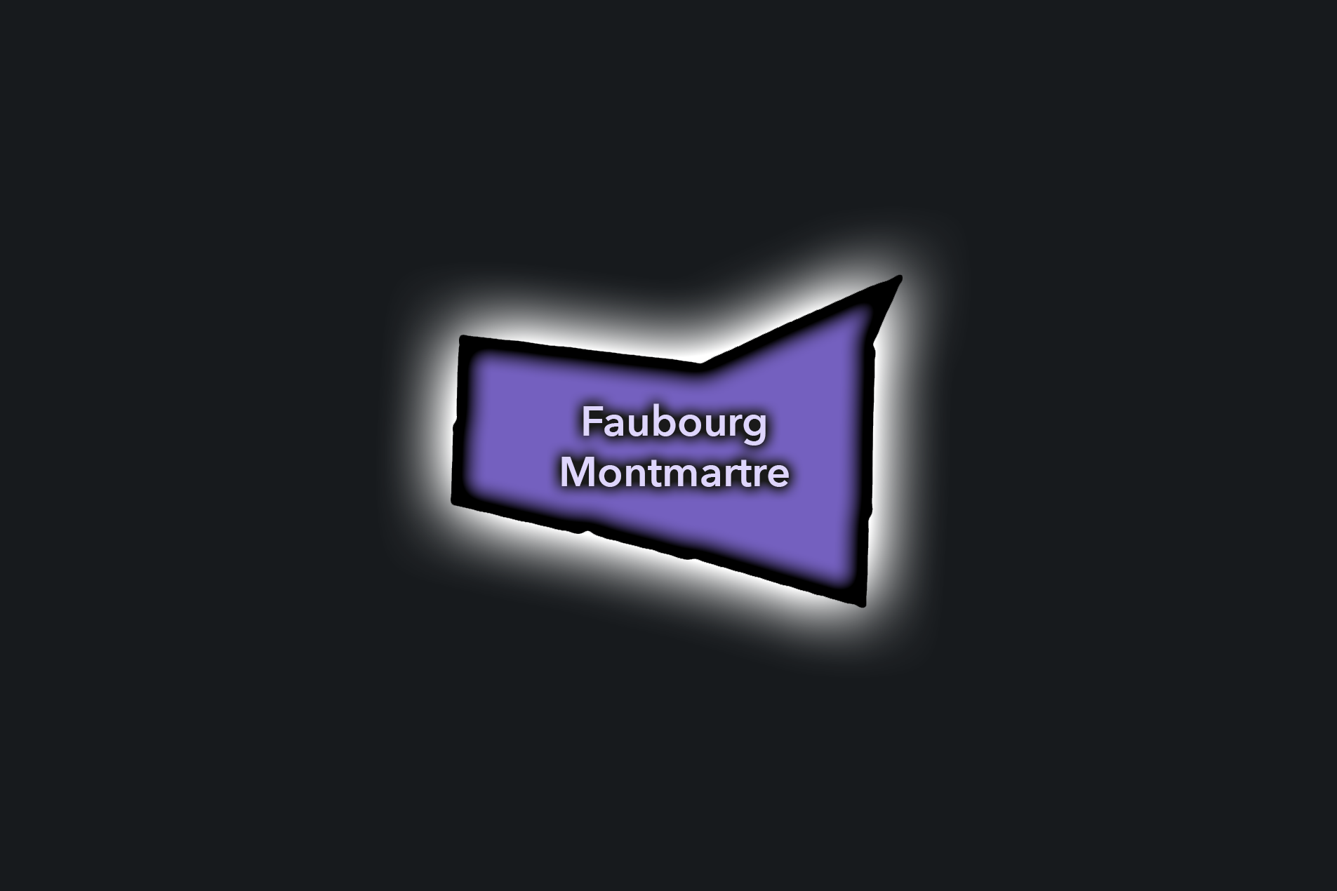
Faubourg Montmartre
Civic Profile
The Danube Conseil de Quartier organizes one of the 19e’s elevated and residential eastern landscapes, where the hill streets around Danube, Buttes-Chaumont, Place des Fêtes, and the approaches toward Porte des Lilas create a distinctive neighborhood geography. As a civic territory, it is shaped by apartment blocks, schools, local shops, public housing, sloped streets, gardens, transit access, and the strong topographic character that gives this part of the 19e a very different feel from the canal districts below.
On the ground, Danube feels residential, high-set, and locally focused. Its civic themes center on pedestrian comfort on sloped streets, access to green space, school and family movement, housing quality, local commerce, public-space maintenance, and the challenge of connecting hilltop neighborhood life to the larger transit and park systems of northeastern Paris. The CdQ layer is valuable here because it distinguishes a quieter but strongly lived part of the 19e, where daily civic life is shaped by elevation, housing, schools, and local public spaces.
Faubourg Montmartre: At a Glance
A curated list for you.
-
Major Streets
Rue du Faubourg Montmartre
Boulevard Montmartre
Rue Drouot
Rue Cadet
Rue de la Grange Batelière
-
Public Spaces & Landmarks
Passage Jouffroy
Passage des Panoramas
Hôtel Drouot
Folies Bergère nearby
Théâtre des Variétés nearby
-
Transit Access
Grands Boulevards
Richelieu - Drouot
Le Peletier
Cadet
Notre-Dame-de-Lorette nearby
-
Shopping & Dining
Passage des Panoramas dining
Rue Cadet food shops
Bouillon Chartier Grands Boulevards
Le Valentin / Passage Jouffroy
Hard Rock Café Paris nearby
-
Hotels & Attractions
Covered passages visitor route
Hôtel Drouot auction district
Grands Boulevards theater corridor
Folies Bergère entertainment area
Boulevard Montmartre hotel district
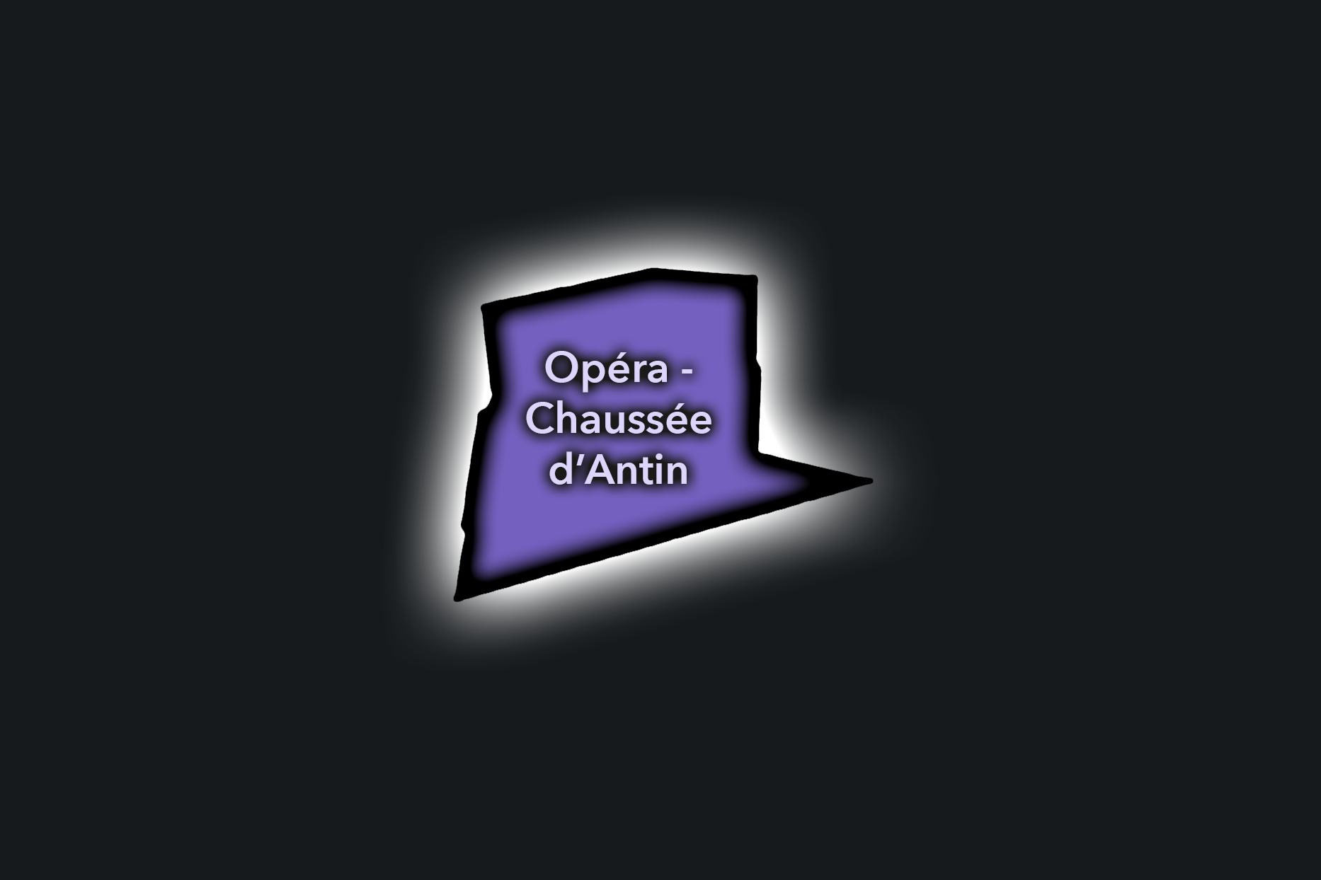
Opéra-Chaussée d’Antin
Civic Profile
The Opéra-Chaussée d’Antin Conseil de Quartier gives civic form to the 9e’s most formal commercial and institutional landscape, centered on the Opéra Garnier, the grands magasins, Boulevard Haussmann, Chaussée d’Antin, and the streets leading toward Madeleine, Saint-Lazare, and the Grands Boulevards. As a civic territory, it is shaped by shopping, office life, theater traffic, hotel use, transit, tourism, and the monumental presence of one of Paris’s great cultural landmarks.
On the ground, Opéra-Chaussée d’Antin feels metropolitan, polished, and heavily trafficked. Department-store crowds, office workers, theatergoers, hotel guests, commuters, and visitors all move through the same compact grid, giving the district an intensity very different from the more residential northern 9e. Its civic themes center on pedestrian circulation, transit and shopping flows, event traffic around the Opéra, public-space maintenance, commercial vitality, accessibility, and the challenge of keeping one of Paris’s busiest destination districts navigable and humane.
Opéra-Chaussée d’Antin: At a Glance
A curated list for you.
-
Major Streets
Boulevard Haussmann
Rue de la Chaussée d’Antin
Rue Scribe
Rue Auber
Rue Le Peletier
-
Public Spaces & Landmarks
Palais Garnier
Galeries Lafayette Haussmann
Printemps Haussmann
Opéra-Comique nearby
Place de l’Opéra
-
Transit Access
Opéra
Chaussée d’Antin - La Fayette
Havre - Caumartin
Auber
Saint-Lazare nearby
-
Shopping & Dining
Galeries Lafayette
Printemps
Café de la Paix
Boulevard Haussmann shopping district
Opéra / Auber brasseries
-
Hotels & Attractions
Palais Garnier visitor district
Grands magasins shopping route
Opéra hotel district
Boulevard Haussmann visitor corridor
Madeleine / Saint-Lazare nearby
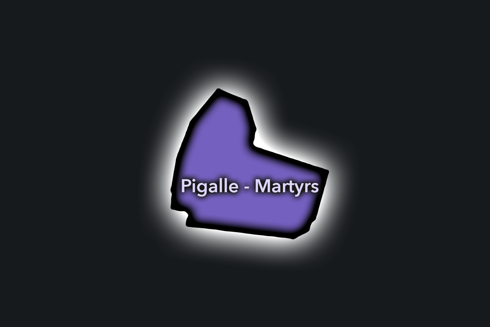
Pigalle-Martyrs
Civic Profile
The Pigalle-Martyrs Conseil de Quartier gives civic form to one of the 9e’s most energetic northern landscapes, where the lower slopes of Montmartre meet food streets, music venues, nightlife, cafés, small hotels, residential blocks, and the commercial rhythm of Rue des Martyrs. As a civic territory, it is shaped by the overlap of neighborhood shopping, visitor movement, evening activity, local schools, hillside streets, and the long cultural identity of Pigalle as a district of performance, pleasure, and everyday urban life. Rue des Martyrs is widely recognized as one of the area’s major commercial and food-shopping streets, linking the 9e and 18e around the Pigalle / Montmartre edge.
On the ground, Pigalle-Martyrs feels lively, vertical, and intensely used. The district moves from market-street charm and neighborhood cafés to performance venues, bars, boutique hotels, and the neon-edged identity of Pigalle. Its civic themes center on balancing nightlife with residential life, maintaining pedestrian comfort on busy narrow streets, supporting independent commerce, managing visitor pressure, and preserving the local food-street character that makes this northern edge of the 9e feel distinct from the more formal Opéra and boulevard districts below.
Pigalle-Martyrs: At a Glance
A curated list for you.
-
Major Streets
Rue des Martyrs
Boulevard de Clichy
Rue Frochot
Rue Victor Massé
Rue Jean-Baptiste Pigalle
-
Public Spaces & Landmarks
Place Pigalle
Église Notre-Dame-de-Lorette nearby
Square Jehan-Rictus nearby
Théâtre La Bruyère nearby
Lower Montmartre approaches
-
Transit Access
Pigalle
Saint-Georges
Notre-Dame-de-Lorette
Blanche nearby
Anvers nearby
-
Shopping & Dining
Rue des Martyrs food shops
Bouillon Pigalle
Buvette Paris
KB CaféShop
Rose Bakery / Rue des Martyrs area
-
Hotels & Attractions
Pigalle nightlife district
Rue des Martyrs walking route
Moulin Rouge nearby
South Pigalle hotel district
Montmartre approach route
The Photography
Visual Identity

The visual identity of each Paris district begins with its position in the city’s layered geography. Before the photographs arrive, the maps establish a first way of seeing: where the district sits, what civic layer it belongs to, which boundaries define it, and how it connects to the surrounding fabric of Paris. In CityNeighborhoods Paris, cartography is not merely orientation; it is part of the visual language of the project.
As the photographic archive grows, this section will continue to develop through images gathered on foot. Streets, façades, monuments, markets, parks, river edges, passages, signs, textures, and everyday details will gradually reveal how each district presents itself visually. The goal is not only to show what a place looks like, but to trace how its identity becomes visible through form, atmosphere, memory, and use.
Through The Lens

CityNeighborhoods Paris is built from walking, looking, and returning. Each district is approached through photography as a way of paying attention: to the obvious landmarks and the quieter details, to historic structures and ordinary streets, to the moments where civic geography becomes lived experience. The camera becomes a tool for noticing how Paris changes from one district to the next, and how each place holds its own relationship to the larger city.
As photographs are processed and added, this section will become a more specific visual record of the district. Future updates may include dated field notes, galleries, and reflections from individual walks. For now, the page remains part of the larger CityNeighborhoods effort to document every Paris neighborhood through maps, history, identity, and photography — one district, one walk, and one visual encounter at a time.
If you visit Paris, these ideas can help inspire your own photography.


Paris: J’Espere, Je Rêve, Je Vive
Paris Photo Gallery
Paris Flâneur Notes
Flâneur Notes document the walks, photographs, light, and street-level observations behind this neighborhood entry. Learn more about the Spirit of the Flâneur.


Explore Paris
-

The twenty arrondissements form the civic spiral of Paris, organizing the city into its broad local districts of government, identity, and daily life.
-

Each arrondissement is divided into four official administrative quarters, giving Paris a more precise civic and geographic framework.
-

The conseils de quartier bring participation to street level, giving residents a voice in neighborhood needs, public space, and local civic life.
-

Les Deux Rives trace Paris through the Seine’s two banks, revealing how the Rive Droite and Rive Gauche shaped the city’s civic power, commerce, learning, art, and cultural identity.
-

Cultural neighborhoods reveal the Paris people recognize through history, cafés, architecture, memory, atmosphere, and local belonging.