

What Is CityNeighborhoods Paris?
Click here to learn how to navigate CityNeighborhoods Paris

CityNeighborhoods Paris is a standalone sister site to the already-established CityNeighborhoods.NYC website.
CNParis is not a travel checklist, a restaurant guide, a hotel directory, or a ranking of the city’s most famous districts. It does not treat Paris as a collection of postcard names, nor reduce the city to a few familiar neighborhoods repeated from guidebook to guidebook.
Modeled after the successful methodology of its sister site, CityNeighborhoods.NYC, CityNeighborhoods Paris is a comprehensive photographic, civic, and cultural atlas of Paris — built to see the city not as a flat map, but as a layered urban fabric.
Most visitors are introduced to Paris through recognizable names: Le Marais, Montmartre, Saint-Germain-des-Prés, the Latin Quarter. Others learn the city through its twenty arrondissements, those spiraling municipal districts that shape so much of how Paris is mapped, described, and navigated. Both ways of seeing are useful. Neither is enough.
Paris is not only a city of arrondissements. It is not only a city of quarters. It is not only a city of name-dropped neighborhoods, monuments, museums, café streets, or cinematic atmosphere.
It is all of these at once — civic, cultural, political, historical, architectural, artistic, and lived.
CityNeighborhoods Paris exists to make those overlapping layers visible.
A City of Five Layers
This project organizes Paris through five major layers: three civic layers and two cultural layers.
The civic layers are the Arrondissements, the Administrative Quarters, and the Neighborhood Councils. These are the formal and semi-formal frameworks through which Paris is divided, governed, represented, and locally understood.
The cultural layers are the Deux Rives and the Cultural Neighborhoods. These describe broader patterns of geography, memory, identity, history, and urban imagination — the ways Paris is experienced beyond administrative boundaries.
The arrondissements give Paris its municipal structure. The administrative quarters divide each arrondissement into four official quarters, preserving older place-names and more localized civic identities. The Neighborhood Councils reveal how neighborhood-level civic life and local participation are organized. The Deux Rives — the Right Bank and Left Bank — express one of Paris’s most enduring geographic and cultural distinctions. The Cultural Neighborhoods trace the historic districts, named milieus, and lived identities that often cross official borders.
Each layer tells part of the truth.
None tells the whole truth alone.
A single Parisian place may sit within one arrondissement, belong to an administrative quarter, fall within a neighborhood council area, participate in the identity of a cultural neighborhood, and belong to the Right Bank or Left Bank. These layers do not cancel one another out. They deepen one another.
That is the mission of CityNeighborhoods Paris: to place these layers in conversation.
Beyond Arrondissements and Travelogue Cliché

The arrondissement is often the easiest way to organize Paris, and for good reason. It is official, recognizable, and deeply embedded in the city’s civic identity. But relying only on arrondissements can flatten Paris into twenty large containers.
Famous neighborhood names can create a different kind of confusion — but not because they are unworthy of attention (they absolutely are!), but because they are so often treated as shorthand - or a means to a travelogue end. But they’re more than the raw material for a list or heading. They are historical. They are commercial. They are cultural. They are lived.
But they are a mix of formal and informal. Some have clear boundaries; others shift depending on who is speaking, when, and why. Some command worldwide attention; others are the hidden gems known only to who walk and live their streets everyday.
CityNeighborhoods Paris does not treat these ambiguities as problems to erase. It treats them as part of what makes this city worth studying.
The goal is not to declare one final, correct version of Paris. The goal is to show how different versions of Paris overlap: the civic city, the historical city, the cultural city, the photographed city, the walked city, and the city people carry in memory.
A place like Le Marais cannot be fully understood only as just a name on a guidebook map. It is more than just a destination. It is tied to aristocratic urban form, Jewish Paris, queer Paris, museum culture, architectural preservation, political geography, administrative quarters, neighborhood councils, and the long evolution of Parisian memory.
The same is true across the city. Belleville, Pigalle, Passy, Les Halles, Montmartre, the Latin Quarter, and Saint-Germain-des-Prés all become more meaningful when seen not as isolated destinations, but as intersections within a larger urban fabric.
Paris is not a flat map.
It is a layered city.
A Way of Seeing

CityNeighborhoods Paris begins from the belief that places deserve attention.
A neighborhood is not only a name or a selfie destination. It is a convergence of streets, histories, buildings, institutions, borders, memories, habits, and meanings. It is shaped by government and daily life, by official maps and informal use, by architecture and atmosphere, by what is preserved and what is forgotten.
This project values precision, but not rigidity.
Boundaries matter because they reveal how a city organizes itself. But boundaries are not the whole story. They are guides, not verdicts. They help us understand where we are standing, while reminding us that lived places often exceed the lines drawn around them.
This project also values photography as a way of seeing.
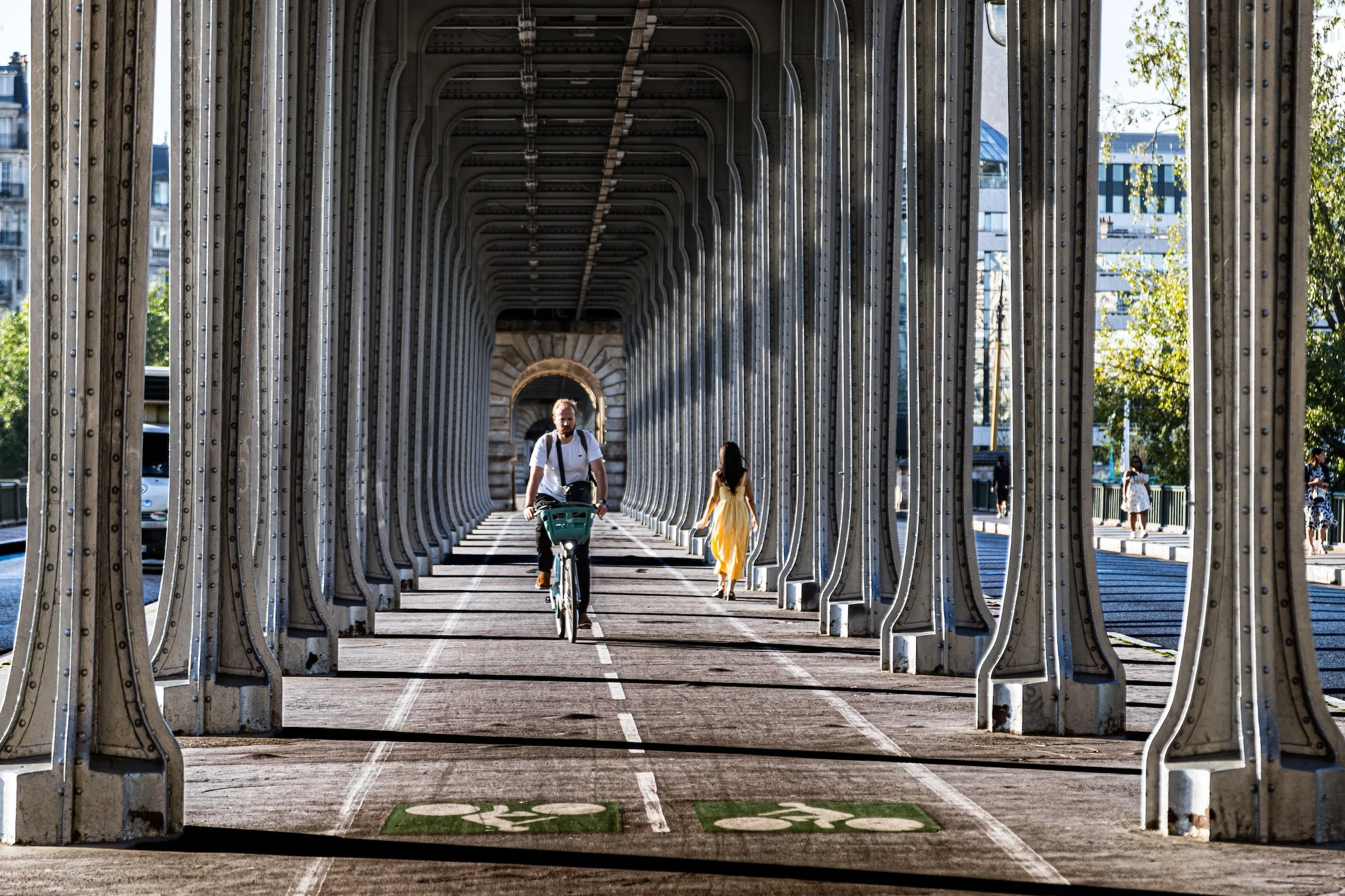
The maps, histories, and civic frameworks matter because they help explain where one is standing. But Paris is ultimately encountered at street level: in façades, bridges, courtyards, markets, transit stations, parks, cafés, shopfronts, monuments, signs, and small details that reward attention.
Photography slows the city down. It turns walking into a method of study. It asks what a neighborhood looks like, how it feels, what traces remain, what systems shape it, and what stories become visible when one looks carefully.
This is not meant to replace other ways of knowing Paris.
It is meant to add another one.
The Spirit of the Flâneur

The Spirit of the Flâneur is not aimless wandering, but attentive exploring — a way of moving through the city with openness, curiosity, and purpose.
CityNeighborhoods Paris is built through walking. Its maps provide structure. Its histories provide context. Its photographs provide evidence. But the project begins with the act of moving through the city on foot, allowing streets, borders, buildings, parks, cafés, monuments, passages, riverbanks, and ordinary details to reveal themselves in sequence. This is the work of the flâneur: the urban wanderer whose attention turns the city into a field of discovery.
The flâneur has historical and romantic roots in Paris, often imagined as a figure of the modern city: a walker, observer, interpreter, and witness to urban life. But for CityNeighborhoods, the flâneur is not merely a nostalgic literary figure. The idea has evolved into a method of inquiry. To walk without a rigid destination is not to walk without purpose. It is to remain open to what the neighborhood itself offers: the unexpected view, the quiet street, the architectural detail, the social rhythm, the changing light, the sudden boundary between one kind of place and another.
This kind of walking is deliberate, even when it appears directionless. It is guided by attention rather than itinerary. The camera helps record what is seen, but the experience is not only mechanical or visual. A neighborhood imprints itself not just on a lens, a film frame, or a digital sensor, but on the person walking through it. Its atmosphere, scale, movement, textures, sounds, light, and lived patterns become part of the encounter. The flâneur does not simply collect images from a place; the flâneur is changed by the act of noticing it.
CityNeighborhoods grows from that exchange. Each walk produces impressions, photographs, routes, questions, and fragments of understanding. Those raw encounters must then be processed, refined, and interpreted. In that sense, the project follows a photographic rhythm: the city is encountered in the field, gathered in images and notes, and later brought into focus through reflection. Like a raw photograph entering Lightroom, the experience of a neighborhood is adjusted, clarified, and shaped until it emerges as a thoughtful expression of a precise moment in time and place.
The Flâneur Notes preserve this process. They document the walks behind the neighborhood entries: the route, the weather, the light, the sequence of streets, the visual surprises, the moments of hesitation, and the discoveries that could not have been planned in advance. They are not formal histories, and they are not conventional travel guides. They are records of encounter — the lived bridge between map, photograph, and city.
Through this method, CityNeighborhoods Paris approaches the city not as a fixed collection of landmarks, but as a layered urban experience. Some neighborhoods are official. Some are historical. Some are cultural. Some are participatory. Some are contested. All are lived. The purpose of the project is to walk those layers, photograph them, study them, and return from the journey with a deeper way of seeing.
Why It Matters
To explore Paris well is not only to know where the Louvre is, or which arrondissement contains Montmartre, or whether the Latin Quarter has fixed borders.
It is to understand that every Parisian place belongs to a wider fabric — and that the fabric itself is part of the story.
That fabric is civic and cultural. It is historical and political. It is architectural and artistic. It is official and informal, mapped and remembered, photographed and walked. It appears in administrative divisions, in neighborhood councils, in riverbanks, in old quarters, in cultural memory, in street life, and in the way one part of the city speaks to another.
CityNeighborhoods Paris is for visitors, residents, researchers, photographers, urbanists, and curious wanderers who want to see that fabric more clearly.
It is for anyone who has wondered why one map says one thing and another map says something else. Why a neighborhood name appears in one context but disappears in another. Why a single street can feel like the seam between worlds. Why Paris can be at once orderly and elusive, structured and mythic, administrative and poetic.
The purpose of CityNeighborhoods Paris is not to simplify the city. Nor is it even to catalogue the city.
The purpose is to reveal what is embedded in its layers: a lived, shared, celebrated and immersive confluence of lived experiences.
CityNeighborhoods Paris is an invitation to read the city more deeply — one neighborhood, one boundary, one photograph, and one connection at a time.

Contact us
Interested in working together? Fill out some info and we will be in touch shortly. We can’t wait to hear from you!
Explore Paris
-

The twenty arrondissements form the civic spiral of Paris, organizing the city into its broad local districts of government, identity, and daily life.
-

Each arrondissement is divided into four official administrative quarters, giving Paris a more precise civic and geographic framework.
-

The conseils de quartier bring participation to street level, giving residents a voice in neighborhood needs, public space, and local civic life.
-

Les Deux Rives trace Paris through the Seine’s two banks, revealing how the Rive Droite and Rive Gauche shaped the city’s civic power, commerce, learning, art, and cultural identity.
-

Cultural neighborhoods reveal the Paris people recognize through history, cafés, architecture, memory, atmosphere, and local belonging.