
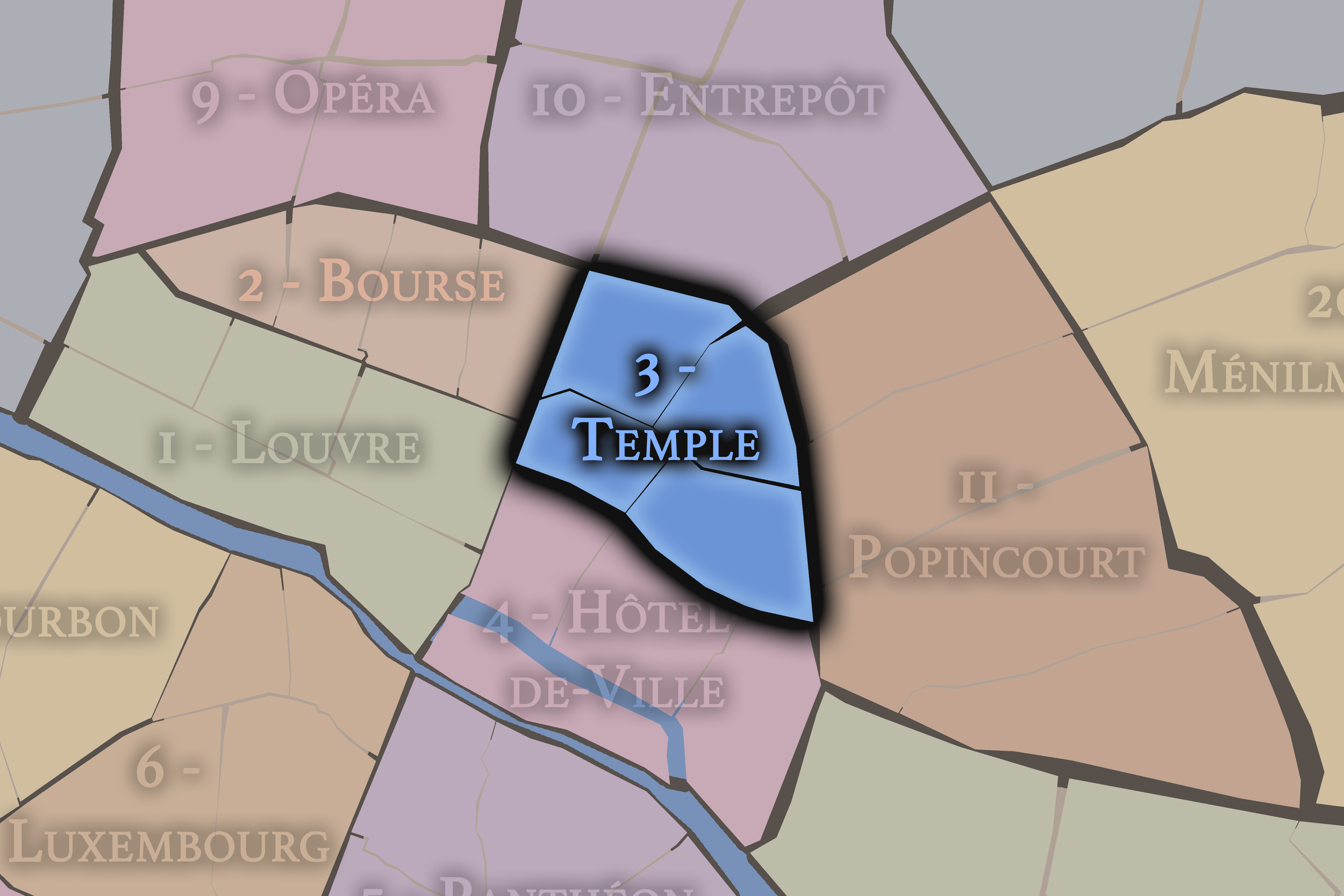
3e - TEMPLE
Arrondissements
The 3e Arrondissement unfolds through the northern Marais, where old hôtels particuliers, market streets, museums, and former industrial courtyards give the district its layered character. Around the historic Temple area and Rue de Bretagne, aristocratic Paris and everyday neighborhood life meet closely. Part of an ongoing project to walk and photograph every neighborhood in Paris, this page explores 3e - Temple through maps, district identity, history, and photography.


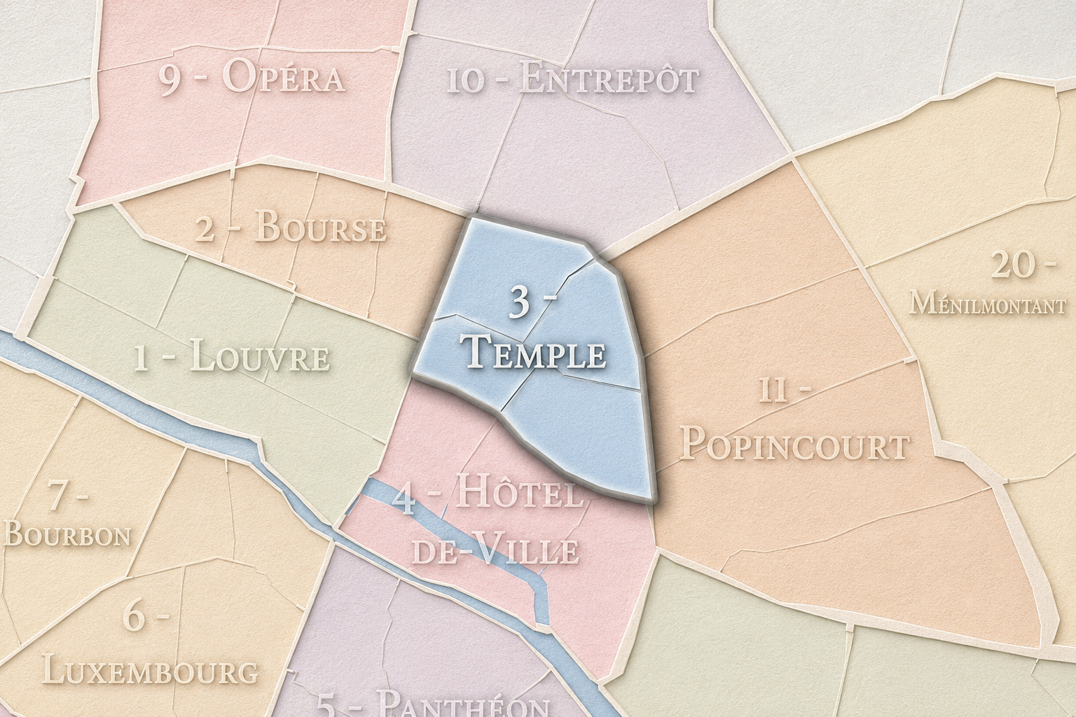
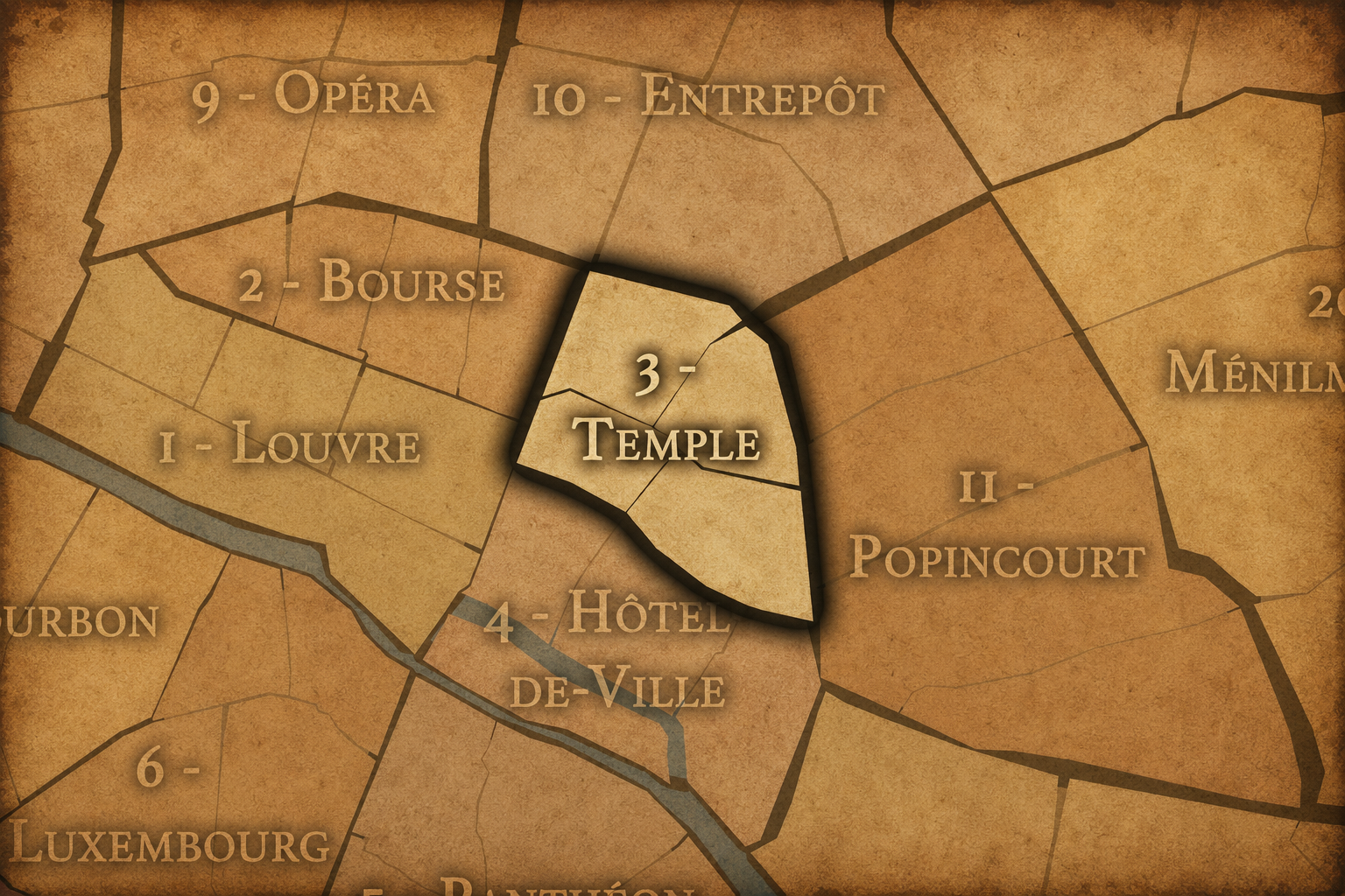
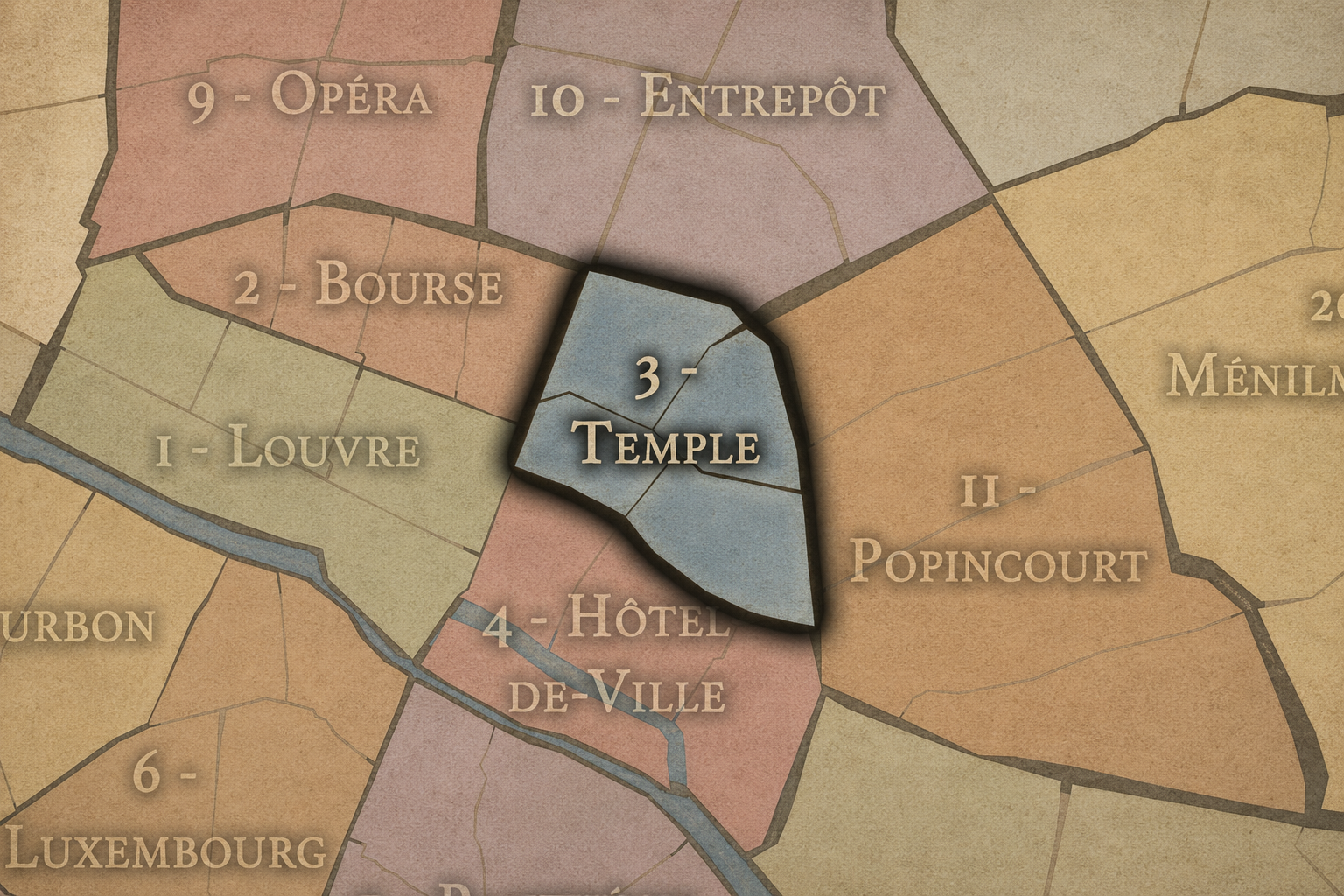
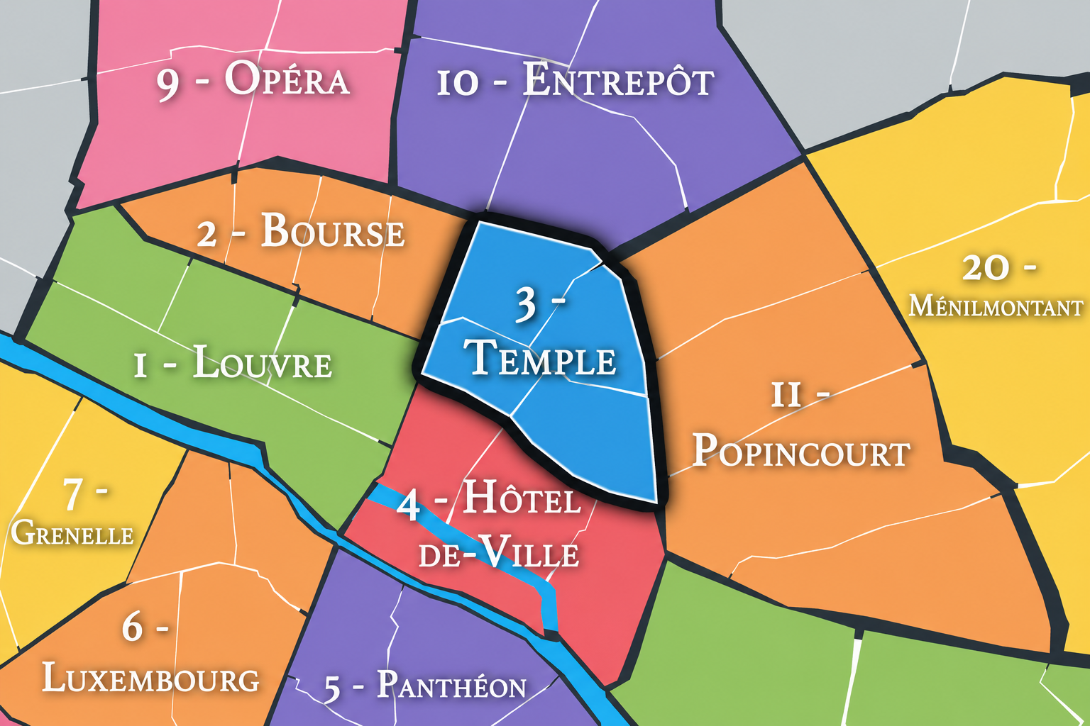
The Map
Geographic Setting
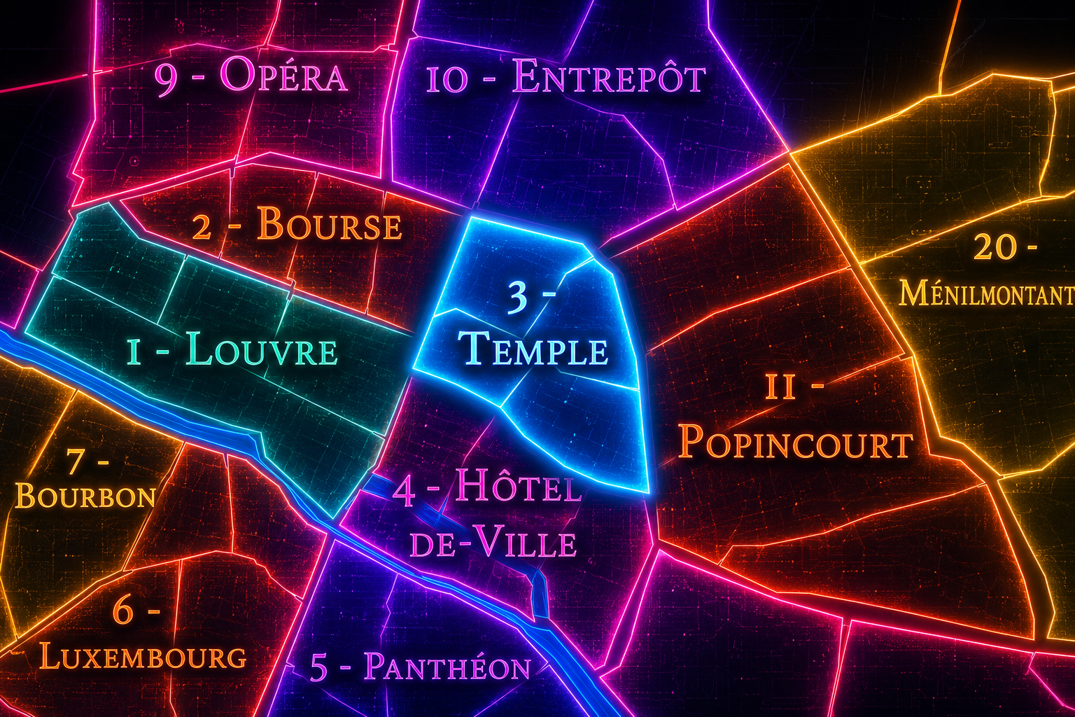
The 3e arrondissement occupies a compact area on the Right Bank of Paris, north of the 4e arrondissement, east of the 2e, west of the 11e, and south of the 10e. It sits within the historic core of the city, but unlike the 1er, which gathers royal and national monuments along the Seine, or the 2e, which concentrates commerce, finance, and passages, the 3e is defined by a quieter but deeply layered urban fabric: old religious foundations, aristocratic hôtels particuliers, market streets, workshops, museums, archives, and the northern portion of the Marais.
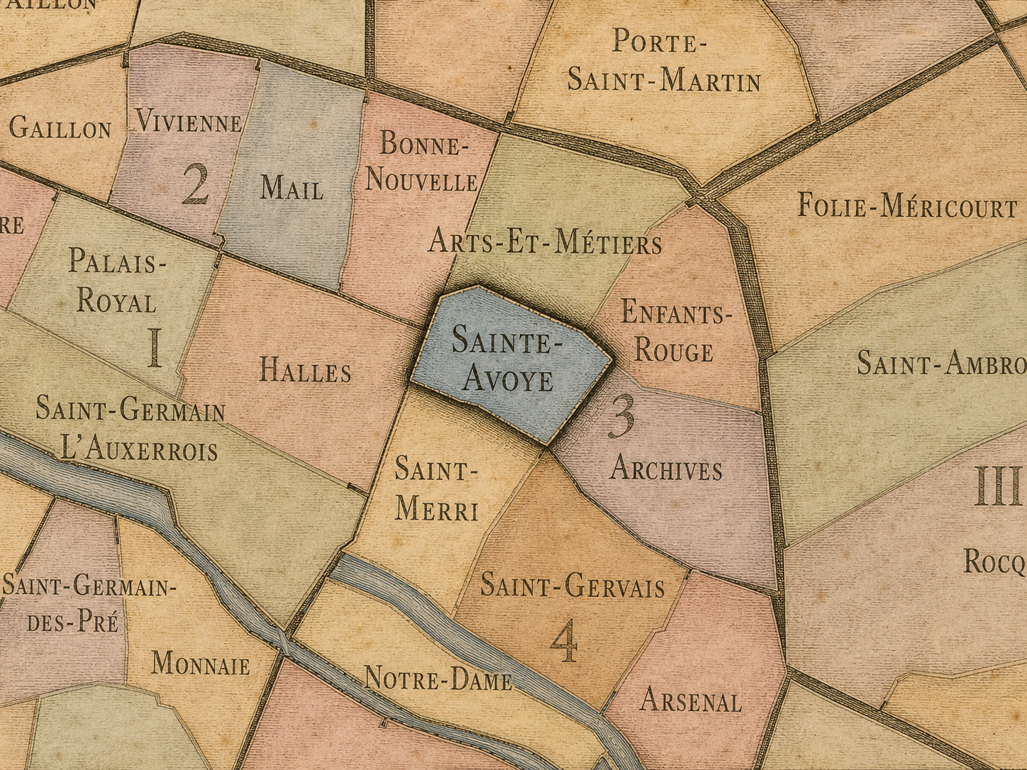
The arrondissement is often associated with the Temple and the Marais, but those identities are not identical. The Temple name points to the medieval presence of the Knights Templar and their fortified enclosure, while the Marais evokes the broader marshland-turned-aristocratic-quarter that extends across both the 3e and 4e arrondissements. The 3e therefore occupies an important middle position: it belongs to the historic Marais, but it also carries the specific memory of the Temple, the Archives, Arts et Métiers, Enfants-Rouges, and Sainte-Avoye.
The 3e arrondissement is divided into four administrative quarters: Arts-et-Métiers, Enfants-Rouges, Archives, and Sainte-Avoye. Together, they create an arrondissement of interiors, institutions, and layered urban memory: the former priory of Saint-Martin-des-Champs, the Conservatoire national des arts et métiers, the Marché des Enfants-Rouges, the Hôtel de Soubise and National Archives, the Carreau du Temple, and the narrow streets and hôtels particuliers of the northern Marais. These quarters make the 3e one of central Paris’s richest small-scale historical landscapes.
Arrondissement Identity
Etymology and Origins
The name Temple comes from the medieval enclosure of the Knights Templar, whose fortified religious and administrative complex stood in this part of Paris. The Temple was originally a fortified monastery associated with the Templars, built in the 12th century northeast of the medieval city. After the suppression of the order in the 14th century, the towers and enclosure took on new uses, including service as a royal prison.
The Temple name has remained embedded in the geography of the district through streets, squares, and institutions: Rue du Temple, Rue Vieille-du-Temple, Square du Temple, Carreau du Temple, and the broader memory of the former Enclos du Temple. Even where the medieval structures have disappeared, their imprint remains in the arrondissement’s identity. The 3e is therefore named not for a monument still standing in full form, but for an institutional and spiritual landscape whose traces survive in the city’s toponymy.
The arrondissement’s origins, however, extend beyond the Templars alone. This was part of the expanding Right Bank, where religious houses, market streets, workshops, aristocratic residences, and later public institutions formed a dense urban environment. Its identity grew from the overlap of sacred, military, commercial, administrative, and residential uses — a pattern that still defines the 3e today.
Civic Framework
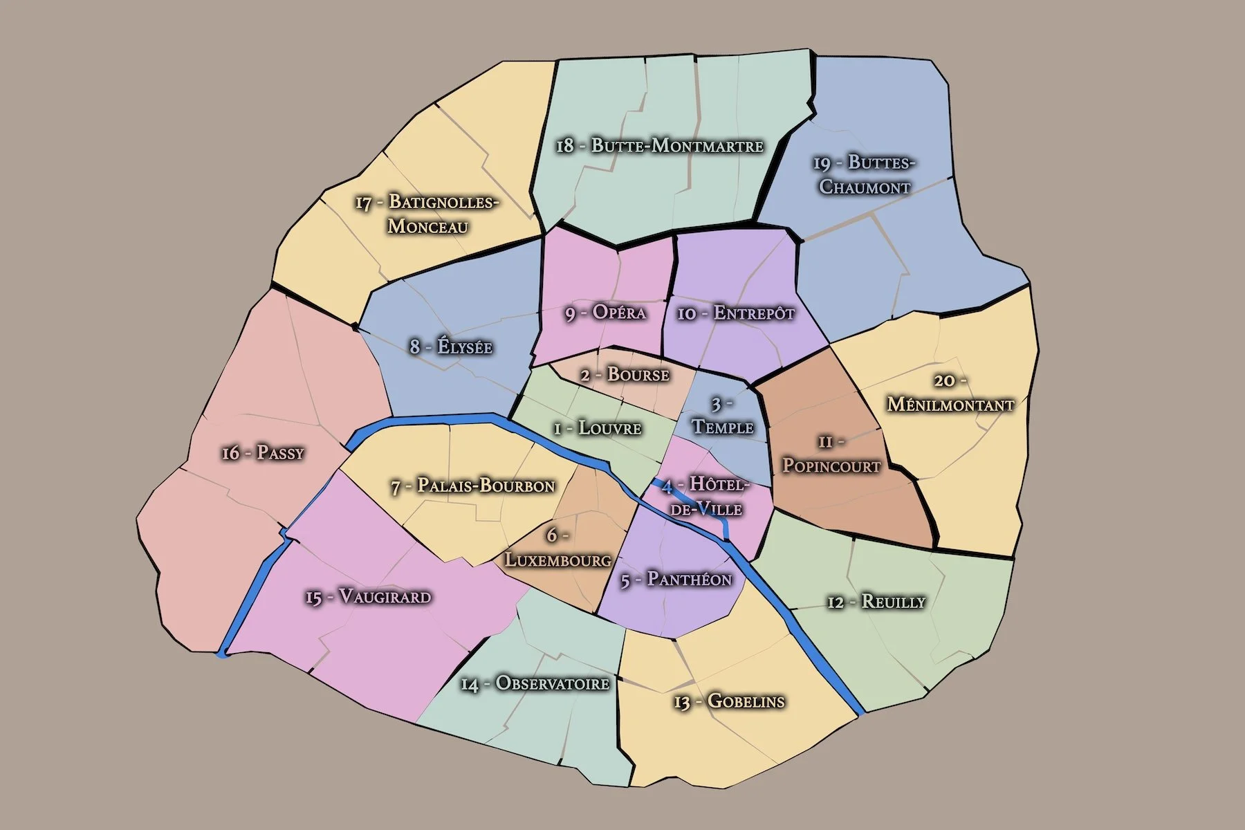
The 3e arrondissement is part of Paris Centre, the administrative sector created in 2020 that combines the 1er, 2e, 3e, and 4e arrondissements under a shared local mairie. Although the historic arrondissement boundaries and names remain meaningful for geography, culture, history, and navigation, the local civic administration of these four central arrondissements is now organized through the mairie of Paris Centre.
Within that modern framework, the 3e remains a distinct historic arrondissement. Its formal administrative quarters — Arts-et-Métiers, Enfants-Rouges, Archives, and Sainte-Avoye — continue to provide the official neighborhood-scale structure through which the arrondissement can be understood. These quarters help distinguish the 3e from the broader idea of “the Marais,” which often overlaps multiple administrative boundaries and can blur the specific identity of the arrondissement.
For this project, the 3e is treated as both an official geographic layer and a cultural-historical district. Its civic framework explains its place in contemporary Paris administration, while its older names, quarters, institutions, and built environment preserve the arrondissement’s distinctive role as one of the city’s great districts of preservation, adaptation, and civic memory.
Parisian Identity
The 3e arrondissement holds a distinctive place in Paris as one of the city’s great districts of layered continuity. It is central, historic, and culturally important, but its identity is less monumental than intimate. Its most powerful spaces are often found through streets, courtyards, market halls, museum interiors, former religious houses, and preserved townhouses rather than through broad ceremonial vistas.
Within the Parisian imagination, the 3e is closely tied to the northern Marais: a district of narrow streets, stone façades, galleries, food markets, fashion, design, Jewish and immigrant histories, LGBTQ+ visibility nearby and overlapping through the broader Marais, and a strong sense of lived historical texture. Yet the arrondissement also resists being reduced to a fashionable Marais shorthand. It contains the Temple’s medieval memory, the technical and industrial heritage of Arts et Métiers, the archival authority of the Hôtel de Soubise, and the everyday vitality of the Enfants-Rouges market quarter.
The 3e represents Paris as a city of reuse. Religious foundations became museums and institutions. Aristocratic residences became archives, cultural centers, and public heritage sites. Market spaces became culinary and social destinations. Former industrial and craft districts became places of design, galleries, offices, and residential life. The arrondissement’s Parisian identity lies in this ability to carry older forms forward without losing their texture.
Neighborhood Distinction
The 3e arrondissement is distinguished by its concentration of historical layers in a small geographic area. Unlike the 1er, which announces itself through large symbolic monuments, or the 2e, which reveals Paris through commerce, finance, and passages, the 3e is built around texture: façades, courtyards, former religious enclosures, market streets, hôtels particuliers, workshops, galleries, and civic institutions.
Its four administrative quarters give the arrondissement a varied internal structure. Arts-et-Métiers is associated with technical knowledge, invention, and the former priory of Saint-Martin-des-Champs. Enfants-Rouges carries the memory of one of Paris’s oldest covered markets and the social life of the northern Marais. Archives is shaped by the National Archives, grand hôtels particuliers, and the institutional memory of France. Sainte-Avoye forms a western and southwestern hinge toward Beaubourg, Rue du Temple, and the older commercial and residential fabric near the 4e.
The arrondissement’s distinction also lies in its scale. The 3e often feels quieter and more residential than the more intensely touristic parts of the 4e, while still remaining deeply central. It is a district where the historic city does not simply present itself as spectacle; it is lived through doorways, passages, markets, museum courtyards, and the steady adaptation of old buildings to new uses.
Neighborhood Connections
Every neighborhood belongs to a wider Parisian fabric.
-
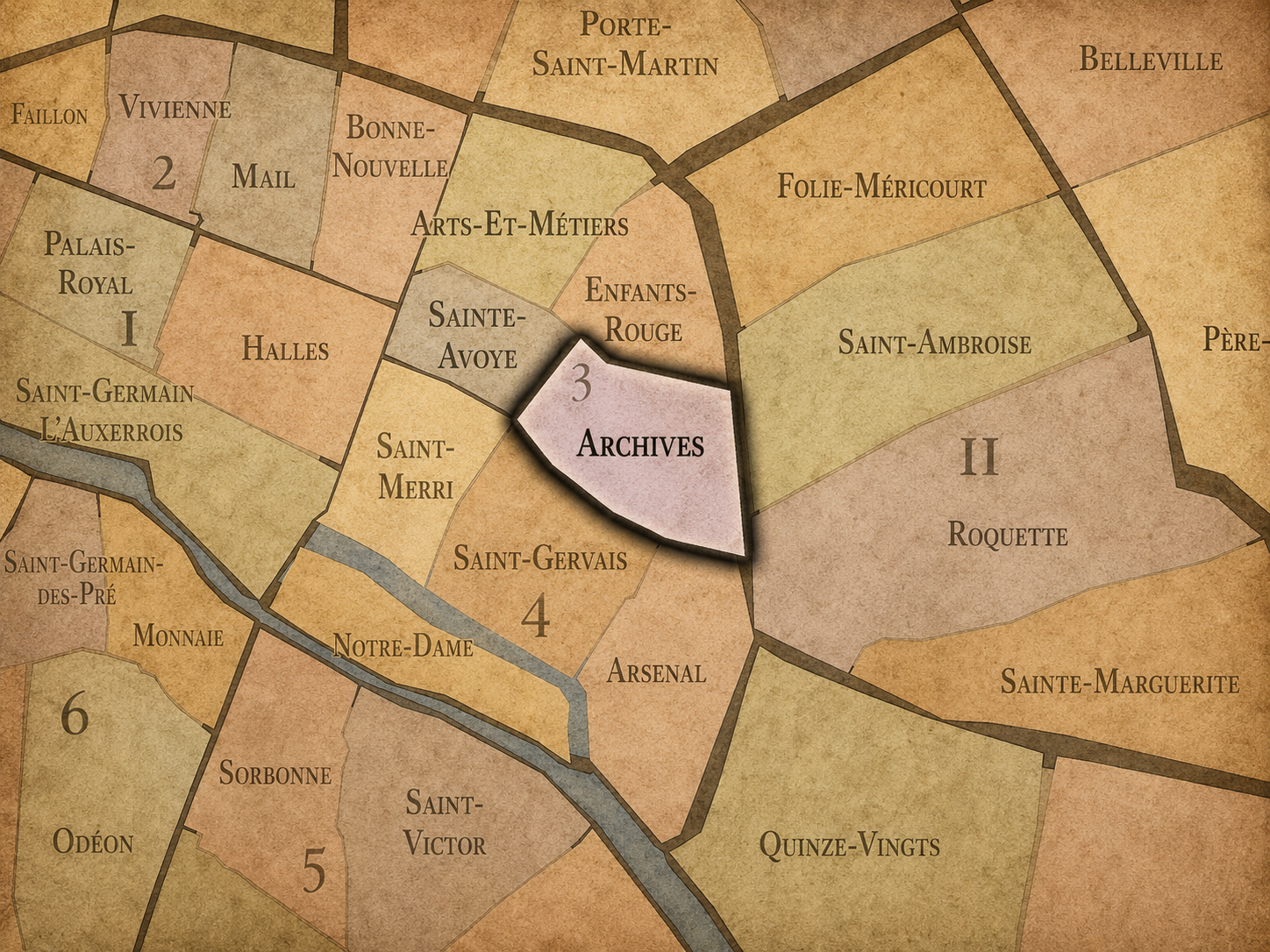
Archives
-
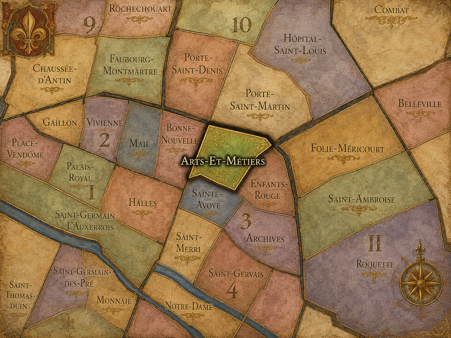
Arts-et-Métiers
-
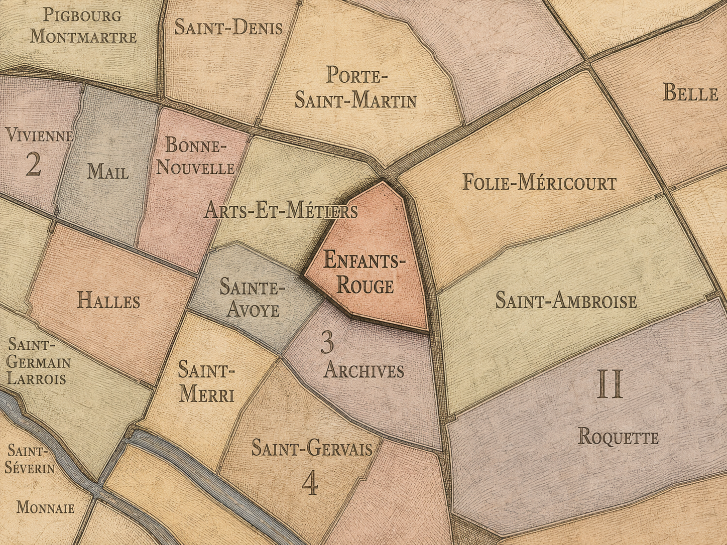
Enfants-Rouges
-
Sainte-Avoye
-
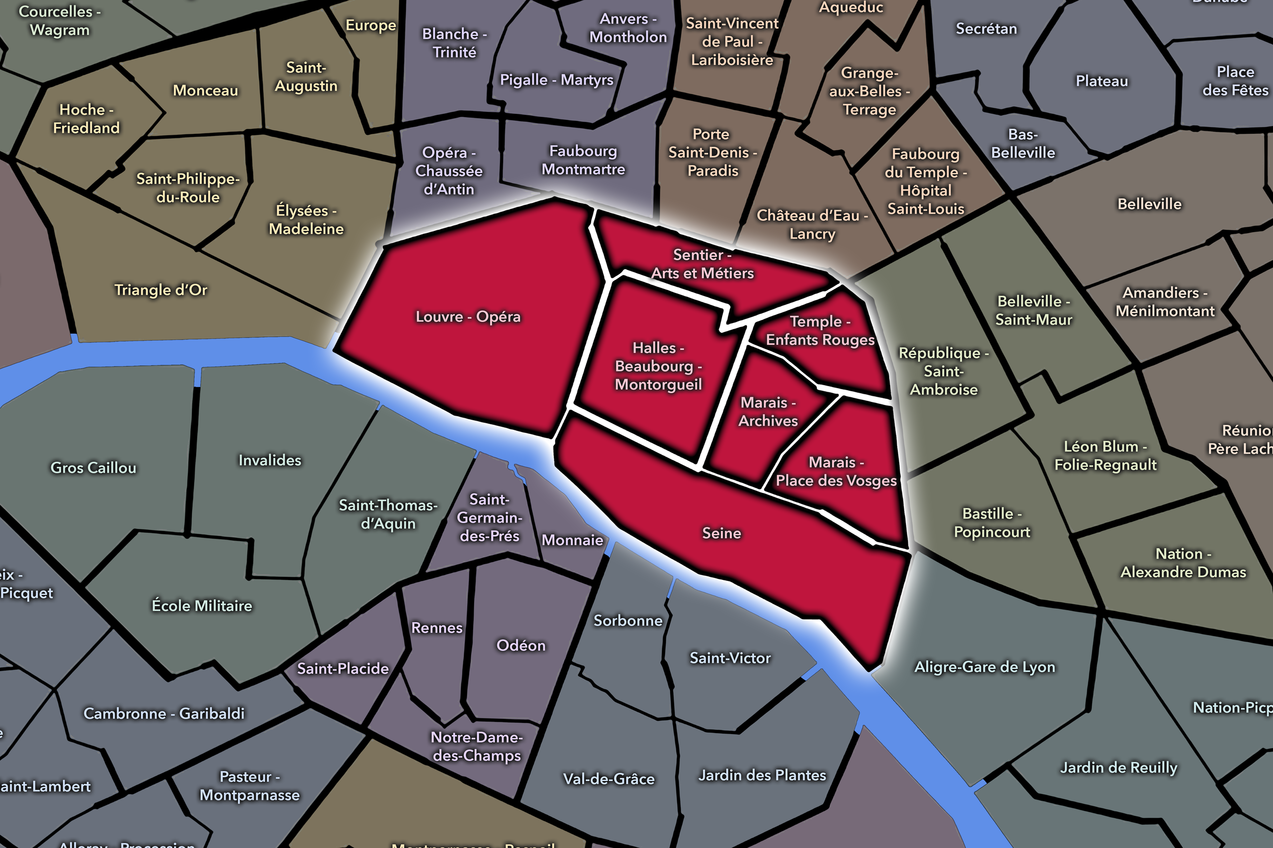
Paris Centre: 1er - 4e
-

Rive Droite
-
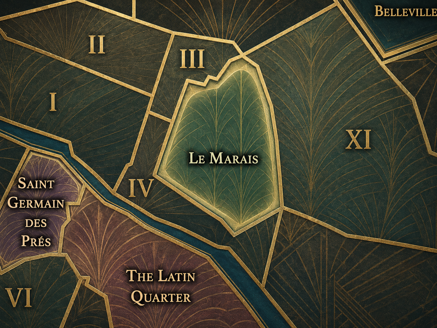
Le Marais
The History
Origins
The origins of the 3e arrondissement are tied to the expansion of Paris north of the Seine and east of the city’s earliest medieval core. Much of the area belonged to the broader development of the Right Bank as Paris grew beyond the Île de la Cité, extending into land that was gradually urbanized through streets, religious houses, markets, and enclosed institutional domains.
The Temple became one of the defining medieval presences in this landscape. The Templars established a fortified religious and administrative complex northeast of the older city, and the enclosure developed as a powerful site with military, spiritual, financial, and jurisdictional significance. Though the medieval towers and enclosure no longer stand in their original form, they gave the arrondissement its enduring name and much of its historical gravity.
At the same time, the future 3e was not only a Templar landscape. The area included religious institutions such as Saint-Martin-des-Champs, commercial streets, artisan activity, and the early formation of what would become the Marais. Its origins therefore lie in a mixture of enclosure and movement: walled religious and military domains beside streets of trade, craft, and urban expansion.
16th–17th Century
During the 16th and 17th centuries, the future 3e arrondissement became increasingly tied to the aristocratic and institutional development of the Marais. What had once been marshy and peripheral became one of the most fashionable quarters of Paris, as noble families and high officials built hôtels particuliers in the district and helped shape the architectural character still associated with the area.
This period also strengthened the district’s commercial and market life. The Marché des Enfants-Rouges was founded in 1615 and is widely identified as the oldest covered market in Paris; its name comes from a nearby orphanage whose children wore red clothing. That market history anchors the northern Marais in the practical life of provisioning, neighborhood exchange, and everyday sociability.
The 17th century therefore gave the arrondissement two of its defining identities: aristocratic refinement and neighborhood commerce. Grand residences, religious institutions, and enclosed domains stood not far from food markets, workshops, and narrow streets. This mixture of prestige and practicality remains central to the 3e’s character.
18th Century
In the 18th century, the future 3e arrondissement continued to develop as part of the historic Marais and the central Right Bank. Its hôtels particuliers, religious foundations, markets, and workshops formed a dense urban landscape where elite residence, institutional power, and everyday commerce existed side by side.
The Temple retained its symbolic and institutional importance, even as the medieval world that had produced it receded. After the suppression of the Templars centuries earlier, the Temple complex had taken on other uses, including its role as a prison. The district’s meaning therefore shifted from crusading religious order to royal and administrative control — a transformation that mirrors the larger evolution of Paris from medieval city to centralized capital.
By the end of the 18th century, the arrondissement’s historical layers had become especially dense. The Marais carried the memory of aristocratic residence; the Temple carried medieval and royal associations; the market quarters sustained local commerce; and the coming Revolution would transform many religious and aristocratic spaces into public, administrative, or national uses.
19th Century
The 19th century brought major changes to the 3e arrondissement, especially as Paris modernized and the uses of older buildings and institutions shifted. Religious, aristocratic, and private spaces were increasingly adapted into museums, administrative institutions, schools, workshops, and public facilities. This gave the arrondissement a new role as a district of preservation and transformation.
The Arts-et-Métiers quarter became especially important in this period’s story of modern knowledge and industry. The Conservatoire national des arts et métiers had been founded in 1794, and its museum became associated with the former priory of Saint-Martin-des-Champs, turning a medieval religious site into a place devoted to inventions, technology, science, and applied knowledge.
The 19th century also reshaped the Temple area itself. The old Temple complex was dismantled, and its memory survived through the urban fabric rather than through the full medieval structure. In this way, the arrondissement became a place where absence itself mattered: old enclosures disappeared, but names, street patterns, institutions, and public spaces continued to hold their traces.
Early–Mid 20th Century
In the early and mid 20th century, the 3e arrondissement remained a dense central district of residences, workshops, small businesses, markets, and institutions. Its older buildings continued to be adapted to contemporary uses, while the Marais as a whole experienced periods of decline, overcrowding, and uneven preservation.
The arrondissement’s market and craft identities remained important. The Enfants-Rouges area continued to express the neighborhood’s everyday life through food, commerce, and street-level exchange, while the Arts-et-Métiers area carried associations with technical education, tools, mechanics, and invention. The 3e was neither purely residential nor purely monumental; it was a mixed district of work, housing, trade, and memory.
At the same time, many older buildings in the Marais faced deterioration before later preservation movements brought renewed attention to their architectural and historical value. The 3e’s identity during this period was therefore marked by continuity under pressure: historic buildings remained, but not always with the recognition or care they would later receive.
Late 20th Century
The late 20th century brought a major shift in how the 3e arrondissement was valued and experienced. The broader Marais became increasingly associated with historic preservation, cultural institutions, galleries, fashion, design, and new forms of urban desirability. Buildings and streets that had once seemed old, crowded, or neglected were reinterpreted as heritage.
Museums and institutions became central to the arrondissement’s public identity. The Musée des Arts et Métiers preserved the technical and scientific inheritance of the Conservatoire; the National Archives at the Hôtel de Soubise anchored the district’s archival and institutional role; and cultural spaces throughout the arrondissement helped position the 3e as a district of memory and reinvention. The Hôtel de Soubise, located in the 3e, houses the Musée des Archives Nationales and part of the French National Archives.
The late 20th century also intensified the arrondissement’s connection to the evolving identity of the Marais. Shops, galleries, restaurants, and restored buildings brought new visibility and economic activity, while long-standing communities, market life, and older commercial structures continued to shape the district from within.
21st Century
In the 21st century, the 3e arrondissement has become one of central Paris’s most desirable and culturally layered districts. It is historic without feeling frozen, fashionable without being only ornamental, and central without the same monumental pressure found in the 1er or the same tourist density associated with some parts of the 4e.
The arrondissement’s institutions continue to give it unusual depth. The Musée des Arts et Métiers links the district to invention and technical culture; the National Archives preserve the documentary memory of the state; the Marché des Enfants-Rouges remains a living market and culinary destination; and the Carreau du Temple has become a public cultural and events space tied to the memory of the former Temple enclosure. These sites allow the 3e to function simultaneously as neighborhood, heritage district, cultural quarter, and civic archive.
Today, the 3e’s challenge is balance. It must preserve its historic texture while accommodating contemporary pressures: tourism, rising property values, boutique commerce, galleries, restaurants, offices, and residential life. Its strength lies in the fact that these pressures are absorbed into an already layered cityscape. The arrondissement has long been a place of adaptation; the 21st century continues that pattern.
Spirit and Legacy
The 3e arrondissement is one of Paris’s great districts of memory in motion. Its streets carry the names of vanished powers, its buildings preserve former aristocratic and religious worlds, and its institutions transform older spaces into places of culture, knowledge, and civic record.
Its legacy is not singular. It is the Temple and the Marais, but also Arts et Métiers, Enfants-Rouges, Archives, and Sainte-Avoye. It is the memory of the Templars, the market life of Rue de Bretagne, the technical imagination of Saint-Martin-des-Champs, the state memory of the Hôtel de Soubise, and the quiet residential texture of old streets and courtyards.
The 3e does not need to announce itself through grandeur. Its power lies in accumulation. It is a district where Paris keeps traces: of orders dissolved, buildings reused, markets sustained, archives preserved, and old urban forms continually adapted to new life. To understand the 3e is to understand Paris not only as a city of monuments, but as a city of inherited rooms, repurposed walls, and historical layers that remain active in the present.
The Photography
Paris: J’Espere, Je Rêve, Je Vive
Paris Flâneur Notes
Flâneur Notes document the walks, photographs, light, and street-level observations behind this neighborhood entry. Learn more about the Spirit of the Flâneur.


Through The Lens

CityNeighborhoods Paris is built from walking, looking, and returning. Each district is approached through photography as a way of paying attention: to the obvious landmarks and the quieter details, to historic structures and ordinary streets, to the moments where civic geography becomes lived experience. The camera becomes a tool for noticing how Paris changes from one district to the next, and how each place holds its own relationship to the larger city.
As photographs are processed and added, this section will become a more specific visual record of the district. Future updates may include dated field notes, galleries, and reflections from individual walks. For now, the page remains part of the larger CityNeighborhoods effort to document every Paris neighborhood through maps, history, identity, and photography — one district, one walk, and one visual encounter at a time.
Visual Identity

The visual identity of each Paris district begins with its position in the city’s layered geography. Before the photographs arrive, the maps establish a first way of seeing: where the district sits, what civic layer it belongs to, which boundaries define it, and how it connects to the surrounding fabric of Paris. In CityNeighborhoods Paris, cartography is not merely orientation; it is part of the visual language of the project.
As the photographic archive grows, this section will continue to develop through images gathered on foot. Streets, façades, monuments, markets, parks, river edges, passages, signs, textures, and everyday details will gradually reveal how each district presents itself visually. The goal is not only to show what a place looks like, but to trace how its identity becomes visible through form, atmosphere, memory, and use.
Paris Photo Gallery
If you visit Paris, these ideas can help inspire your own photography.


Explore Paris
-

The twenty arrondissements form the civic spiral of Paris, organizing the city into its broad local districts of government, identity, and daily life.
-

Each arrondissement is divided into four official administrative quarters, giving Paris a more precise civic and geographic framework.
-

The conseils de quartier bring participation to street level, giving residents a voice in neighborhood needs, public space, and local civic life.
-

Les Deux Rives trace Paris through the Seine’s two banks, revealing how the Rive Droite and Rive Gauche shaped the city’s civic power, commerce, learning, art, and cultural identity.
-

Cultural neighborhoods reveal the Paris people recognize through history, cafés, architecture, memory, atmosphere, and local belonging.