
19e - BUTTES-CHAUMONT
Les Conseils de Quartier
The conseils de quartier of the 19e trace a northeastern Paris of canals, parks, cultural venues, hills, and working-city memory, from La Villette and the Canal de l’Ourcq to Buttes-Chaumont, Place des Fêtes, and Belleville’s edge. Part of an ongoing project to walk and photograph every neighborhood in Paris, this page explores the conseils de quartier of 19e Buttes-Chaumont through maps, local identity, civic geography, and photography.
Explore This Page


Explore the Conseils de Quartier of the 19e — Buttes-Chaumont.


Overview
Geographic Setting
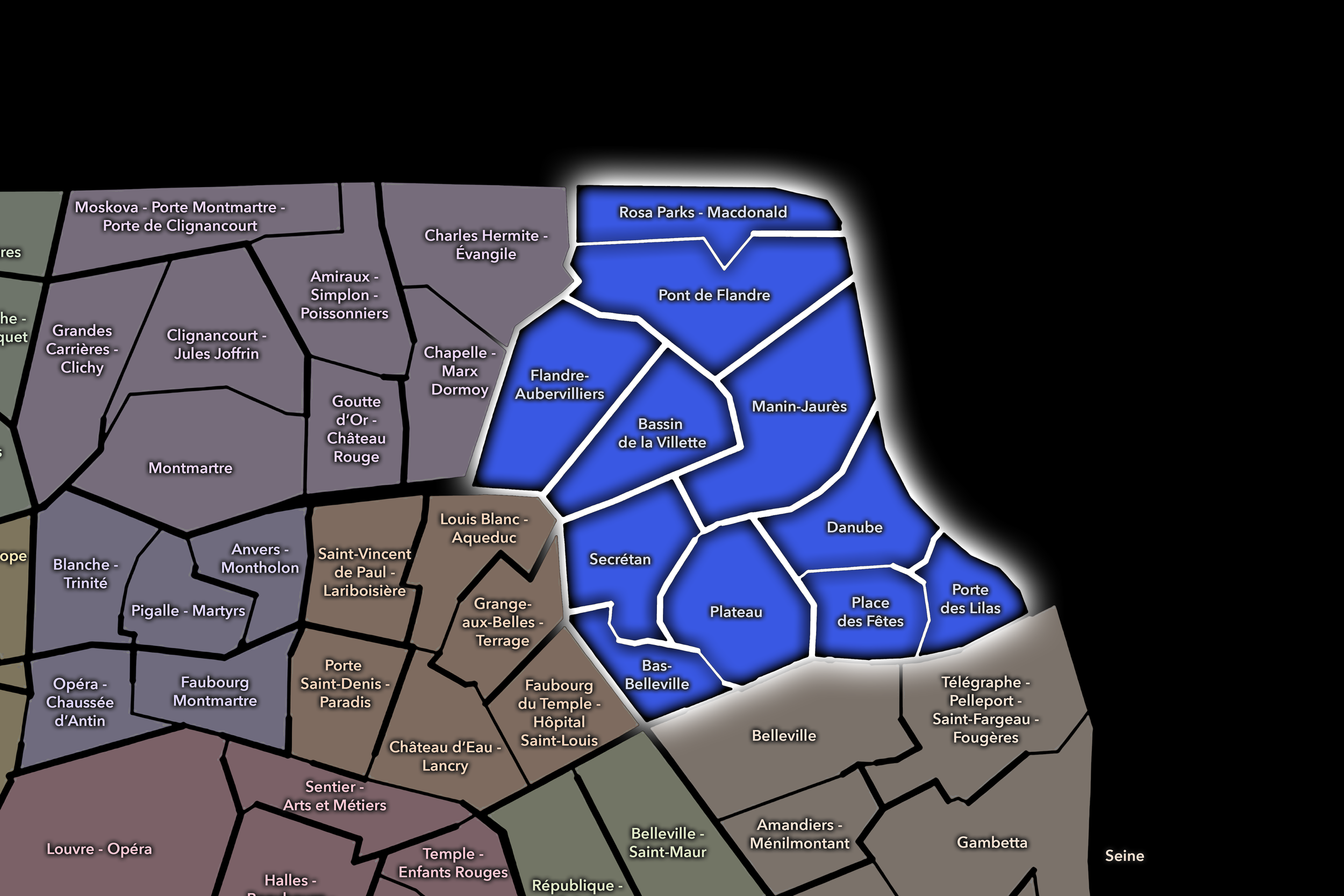
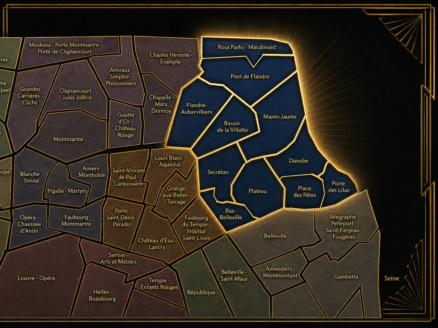
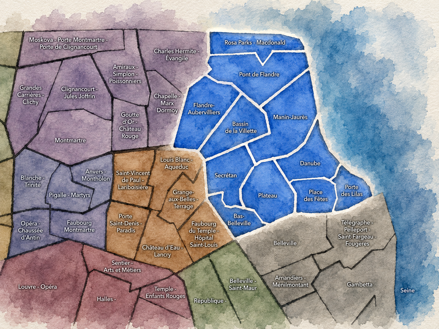
The Conseils de Quartier of the 19e organize local civic life across one of northeastern Paris’s most varied and topographically expressive arrondissements. Stretching from the lower slopes of Belleville to the Canal de l’Ourcq, from the Bassin de la Villette to Parc des Buttes-Chaumont, from Place des Fêtes and Danube to Porte des Lilas, Porte de la Villette, Rosa Parks, and the Macdonald edge, the 19e is a district of water, height, infrastructure, housing, parks, cultural institutions, and gateways. Its geography is strongly shaped by contrasts: canal basins and hilltop streets, parkland and dense residential blocks, former industrial corridors and new development, neighborhood squares and northeastern edges of the city.
The 19e’s Conseil de Quartier structure divides this landscape into eleven civic territories: Bas-Belleville, Bassin de la Villette, Danube, Flandre-Aubervilliers, Manin-Jaurès, Place des Fêtes, Plateau, Pont de Flandre, Porte des Lilas, Rosa Parks - Macdonald, and Secrétan. This makes the 19e one of the clearest examples of a CdQ geography that goes well beyond the four official Administrative Quarters. Rather than using broad historic-administrative divisions alone, the arrondissement’s CdQ layer responds to smaller local environments: canal edges, park approaches, housing estates, commercial streets, hilltop districts, transit corridors, cultural zones, and the northern and eastern portes.
Together, these eleven CdQs reveal the 19e as an arrondissement of local micro-geographies. Bassin de la Villette and Pont de Flandre organize the canal and La Villette landscapes; Manin-Jaurès, Secrétan, Danube, Plateau, and Place des Fêtes distinguish the sloped residential and park-adjacent interior; Bas-Belleville connects the arrondissement to the social and commercial texture of eastern Paris; Porte des Lilas, Flandre-Aubervilliers, and Rosa Parks - Macdonald give civic form to edge conditions shaped by infrastructure, redevelopment, social housing, and connections beyond the city boundary. The CdQ layer is especially valuable here because the 19e changes character quickly and repeatedly across its hills, waterways, parks, and gates.
Civic Framework
The 19e’s Conseils de Quartier provide a neighborhood-level civic structure for an arrondissement whose internal complexity calls for a particularly fine civic grain. The district includes canals, major parks, social housing, schools, cultural institutions, shopping streets, transit hubs, former industrial land, new development, hospitals, libraries, sports facilities, and boundary zones where Paris meets Pantin, Aubervilliers, Les Lilas, and the broader northeast. Its CdQs give residents, workers, shopkeepers, families, students, visitors, associations, and local institutions a more precise scale for discussing public space, mobility, housing, greening, services, and neighborhood quality of life.
The eleven-council framework appears especially responsive to the 19e’s physical and social geography. Some CdQs are organized around major public landscapes and movement corridors, such as Bassin de la Villette, Pont de Flandre, Manin-Jaurès, and Porte des Lilas. Others distinguish residential and hilltop environments, such as Danube, Plateau, Place des Fêtes, Secrétan, and Bas-Belleville. Flandre-Aubervilliers and Rosa Parks - Macdonald bring the arrondissement toward its infrastructural and redevelopment edges, where rail lines, large housing blocks, new public spaces, commercial routes, and metropolitan connections shape local civic life. This structure shows how the 19e’s CdQs do not simply subdivide the arrondissement; they interpret its very different lived conditions.
As a civic framework, the 19e’s CdQs help organize questions that are central to northeastern Paris: park and canal access, public-space maintenance, housing and redevelopment, school streets, pedestrian comfort, cultural facilities, market and commercial vitality, greening, mobility, edge infrastructure, and the relationship between established residential communities and rapidly changing urban zones. The CdQ layer is particularly important here because the 19e’s civic identity is not concentrated in one center; it is distributed across a network of parks, slopes, basins, squares, and gateways.
Local Expression
Viewed through its Conseils de Quartier, the 19e becomes a family of northeastern Paris landscapes rather than a single Buttes-Chaumont or La Villette identity. Bassin de la Villette and Pont de Flandre express the arrondissement’s water and culture geography, where canals, quays, cinemas, parks, music venues, science institutions, bridges, and pedestrian routes make the 19e one of Paris’s most distinctive public-space districts. Manin-Jaurès and Secrétan draw the arrondissement toward the park-adjacent fabric around Buttes-Chaumont, local shopping streets, schools, residential blocks, and hillside movement.
Danube, Plateau, and Place des Fêtes reveal a more elevated and residential 19e, shaped by social housing, squares, steep streets, neighborhood commerce, schools, and the everyday civic life of hilltop Paris. Bas-Belleville links the arrondissement to Belleville’s layered social, commercial, and immigrant histories, while Flandre-Aubervilliers, Rosa Parks - Macdonald, and Porte des Lilas show the 19e as a gateway district: infrastructural, transitional, increasingly redeveloped, and closely tied to the northeast beyond the périphérique.
The value of the CdQ layer in the 19e is that it captures an arrondissement whose identity depends on difference. Through its eleven councils, the 19e can be read at the scale of the canal bridge, the park gate, the housing courtyard, the school block, the hilltop square, the library entrance, the tram stop, the redeveloped rail edge, and the commercial street leading toward the suburbs. These CdQs reveal a Paris of water, height, infrastructure, community, and transformation — a district where local civic life is as varied as the landscape itself.
Les Conseils de Quartier
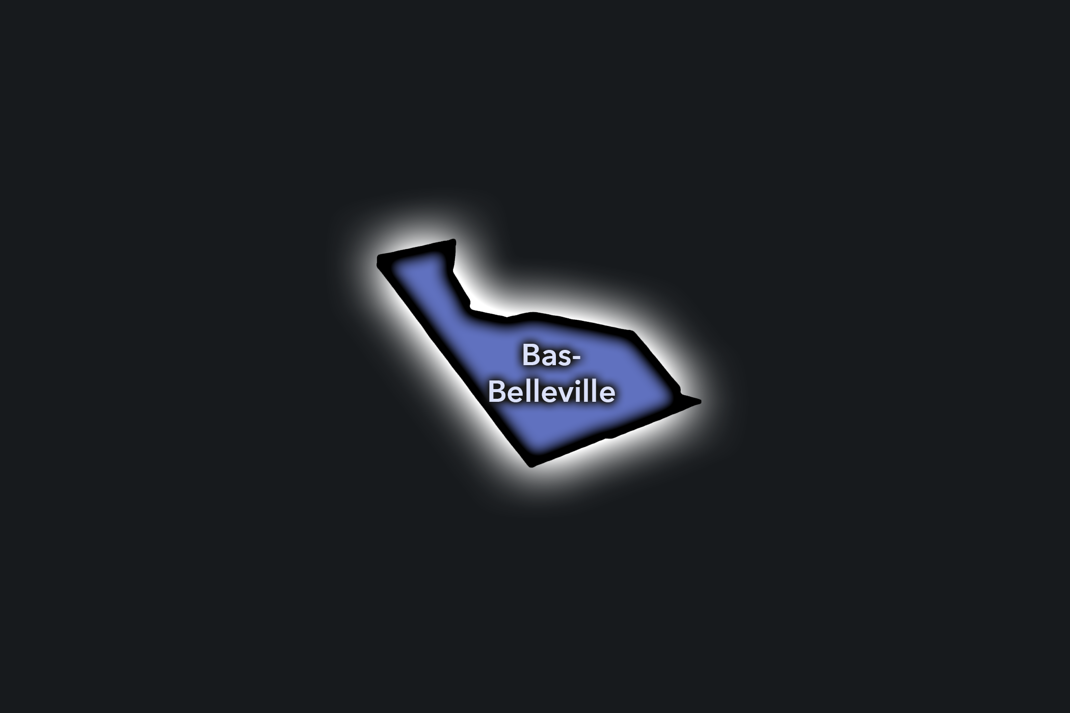
Bas-Belleville
Civic Profile
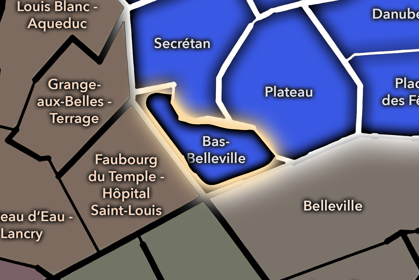
The Bas-Belleville Conseil de Quartier gives civic form to the southwestern edge of the 19e, where the arrondissement meets Belleville, the 10e, the 11e, and the lower slopes of eastern Paris. As a civic territory, it is shaped by dense residential streets, immigrant commercial life, cafés, schools, markets, local associations, public housing, and the strong movement around Belleville and Colonel Fabien. It is one of the 19e’s clearest thresholds: not quite the canal district, not yet the heights of Place des Fêtes, but a lived urban hinge between central eastern Paris and the hillier neighborhoods above.
On the ground, Bas-Belleville feels active, layered, and socially textured. Its civic themes center on commercial vitality, housing and residential quality of life, pedestrian comfort, public-space maintenance, market activity, school streets, and the balance between neighborhood identity and heavy movement along major corridors. The CdQ layer is useful here because it gives civic visibility to a district whose identity comes less from monuments than from everyday public life: food streets, cafés, apartment blocks, local institutions, and the social energy of Belleville’s lower edge.
Bas-Belleville: At a Glance
A curated list for you.
-

Major Streets
Boulevard de la Villette
Rue de Belleville
Rue Rébeval
Rue de Meaux
Avenue Simon Bolivar
-

Public Spaces & Landmarks
Belleville edge
Place du Colonel-Fabien nearby
Parc des Buttes-Chaumont nearby
Église Saint-Jean-Baptiste de Belleville nearby
Square Marcel-Mouloudji nearby
-
Transit Access
Belleville
Colonel Fabien
Bolivar nearby
Jaurès nearby
Pyrénées nearby
-

Shopping & Dining
Rue de Belleville food shops
Boulevard de la Villette cafés
Belleville dining corridor
Le Président
Local bakeries and restaurants around Rébeval
-

Hotels & Attractions
Belleville walking route
Buttes-Chaumont approach nearby
Colonel Fabien / canal edge nearby
Belleville street-art and food corridor
Eastern Paris neighborhood route
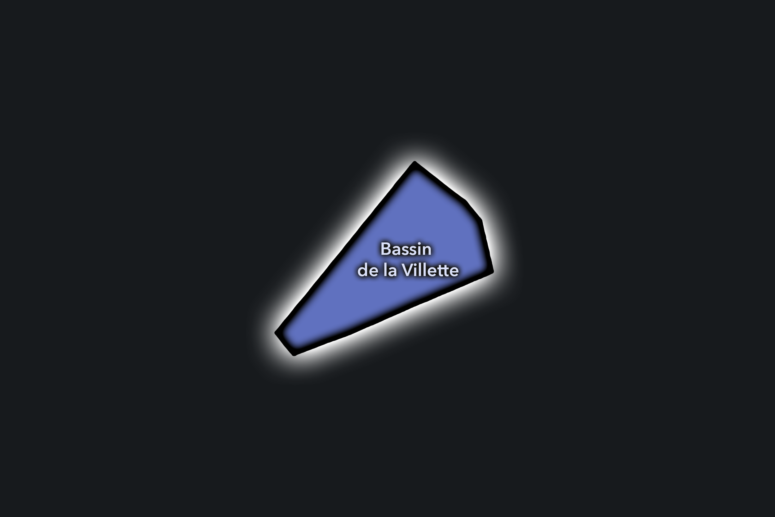
Bassin de la Villette
Civic Profile
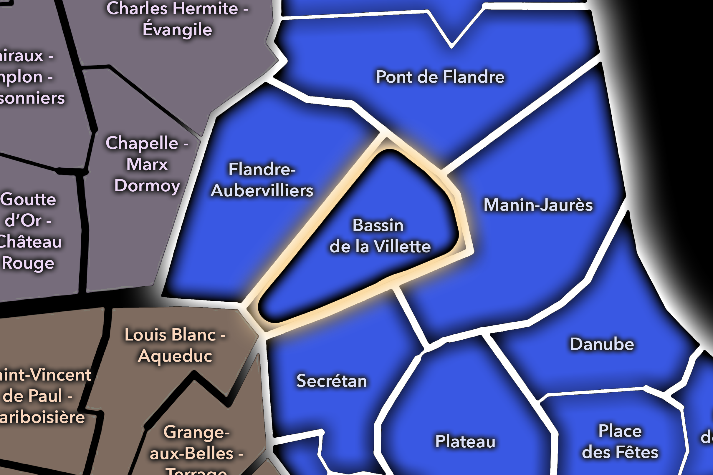
The Bassin de la Villette Conseil de Quartier gives civic shape to one of the 19e’s most visible public-space landscapes, where the Canal de l’Ourcq widens into the Bassin de la Villette and creates a major axis of water, bridges, quays, cinemas, cafés, schools, residential blocks, and leisure activity. As a civic territory, it is defined by the relationship between neighborhood life and public waterfront use: residents, joggers, cyclists, families, students, visitors, boat users, and café terraces all share a highly active linear landscape.
On the ground, Bassin de la Villette feels open, social, and increasingly destination-oriented. Its civic themes center on canal access, pedestrian and bicycle circulation, public-space maintenance, cleanliness, nightlife and terrace use, family recreation, bridge crossings, and the balance between waterfront leisure and local residential life. The CdQ layer is especially useful here because the basin is both a neighborhood anchor and a citywide public space, requiring a local frame for managing how people gather, move, and use the water’s edge.
Bassin de la Villette: At a Glance
A curated list for you.
-
Major Streets
Quai de la Seine
Quai de la Loire
Avenue Jean-Jaurès
Rue de Crimée
Boulevard de la Villette
-
Public Spaces & Landmarks
Bassin de la Villette
Pont de Crimée
Rotonde de la Villette nearby
MK2 Quai de Seine / Quai de Loire
Canal de l’Ourcq
-
Transit Access
Jaurès
Stalingrad
Laumière nearby
Riquet nearby
Crimée nearby
-
Shopping & Dining
Canal-side cafés and restaurants
Paname Brewing Company
Le Pavillon des Canaux
MK2 canal dining area
Jaurès / Laumière neighborhood cafés
-
Hotels & Attractions
Bassin de la Villette waterfront
Canal de l’Ourcq walking route
Pont de Crimée
MK2 canal cinemas
La Villette approach nearby
Danube
Civic Profile
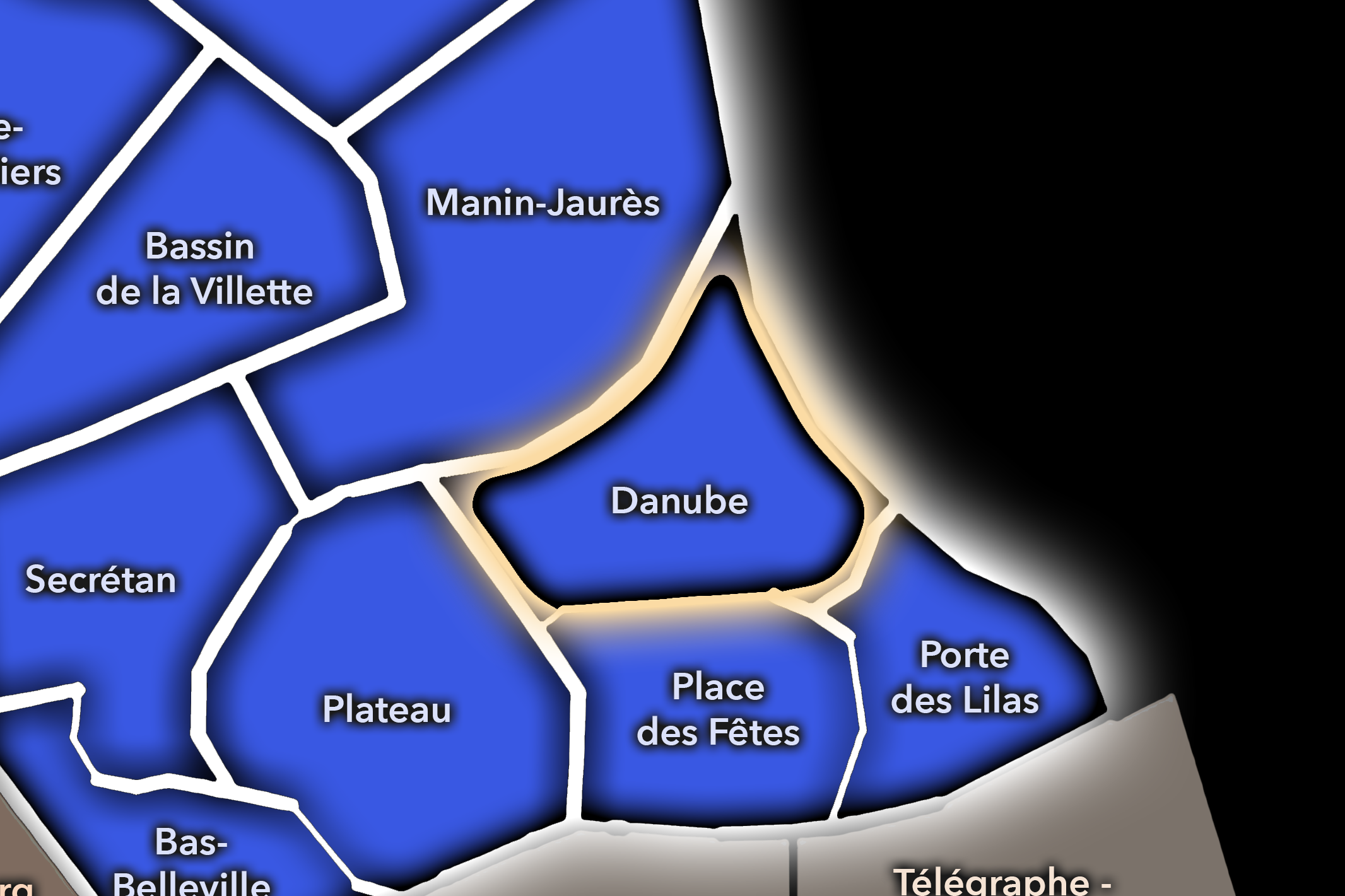
The Danube Conseil de Quartier organizes one of the 19e’s elevated and residential eastern landscapes, where the hill streets around Danube, Buttes-Chaumont, Place des Fêtes, and the approaches toward Porte des Lilas create a distinctive neighborhood geography. As a civic territory, it is shaped by apartment blocks, schools, local shops, public housing, sloped streets, gardens, transit access, and the strong topographic character that gives this part of the 19e a very different feel from the canal districts below.
On the ground, Danube feels residential, high-set, and locally focused. Its civic themes center on pedestrian comfort on sloped streets, access to green space, school and family movement, housing quality, local commerce, public-space maintenance, and the challenge of connecting hilltop neighborhood life to the larger transit and park systems of northeastern Paris. The CdQ layer is valuable here because it distinguishes a quieter but strongly lived part of the 19e, where daily civic life is shaped by elevation, housing, schools, and local public spaces.
Danube: At a Glance
A curated list for you.
-
Major Streets
Rue de Crimée
Avenue Simon Bolivar
Rue Manin
Rue du Général-Brunet
Boulevard Sérurier
-
Public Spaces & Landmarks
Parc des Buttes-Chaumont nearby
Danube neighborhood
Place des Fêtes nearby
Square Eugénie-Cotton nearby
Porte des Lilas nearby
-
Transit Access
Danube
Botzaris nearby
Pré Saint-Gervais nearby
Place des Fêtes nearby
Porte des Lilas nearby
-
Shopping & Dining
Neighborhood shops
Avenue Simon Bolivar cafés
Rue de Crimée local commerce
Place des Fêtes market area nearby
Buttes-Chaumont cafés nearby
-
Hotels & Attractions
Buttes-Chaumont upper approaches
Hillside streets
Place des Fêtes nearby
Porte des Lilas gateway nearby
Northeastern Paris residential walking route
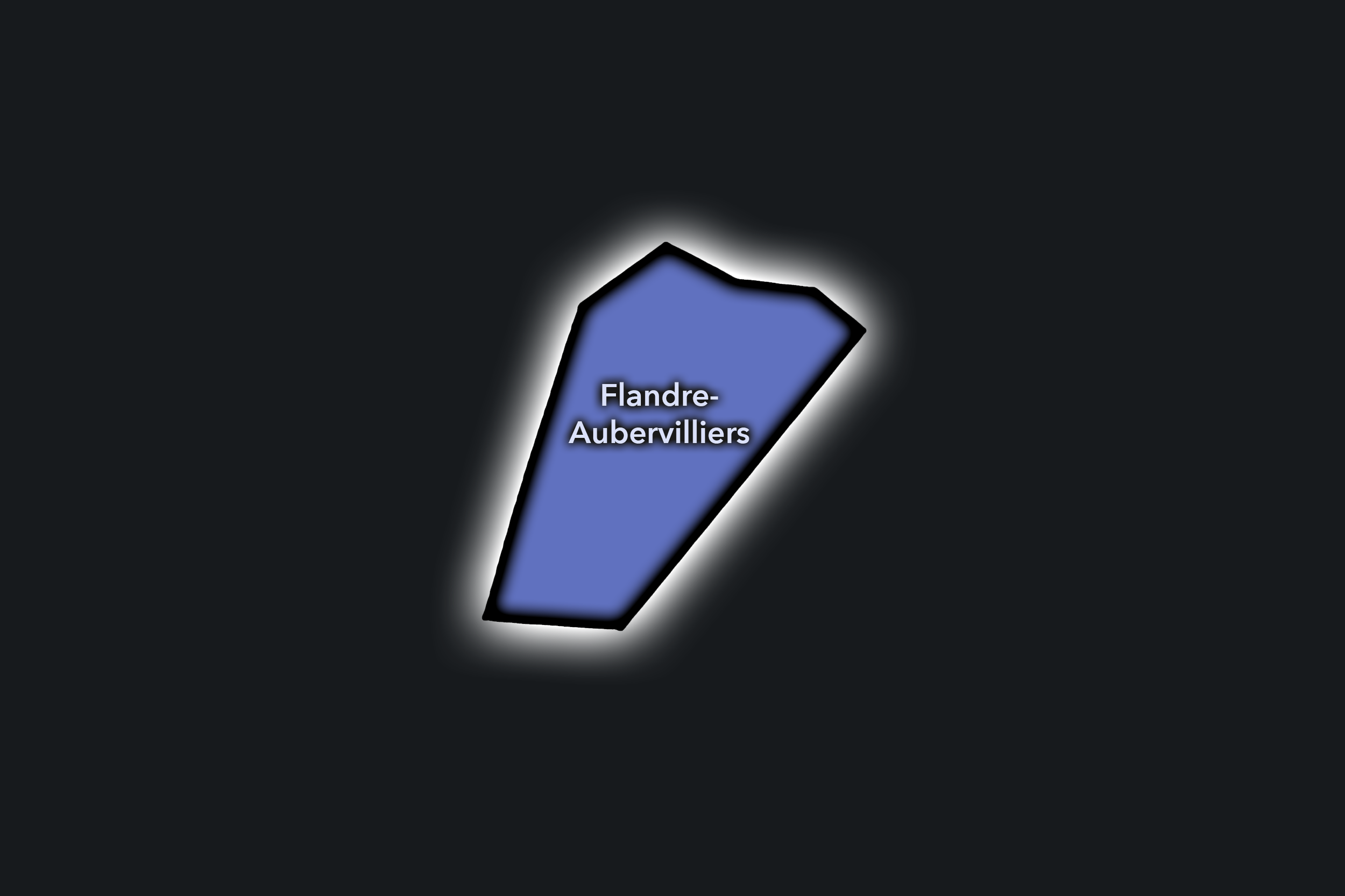
Flandre-Aubervilliers
Civic Profile
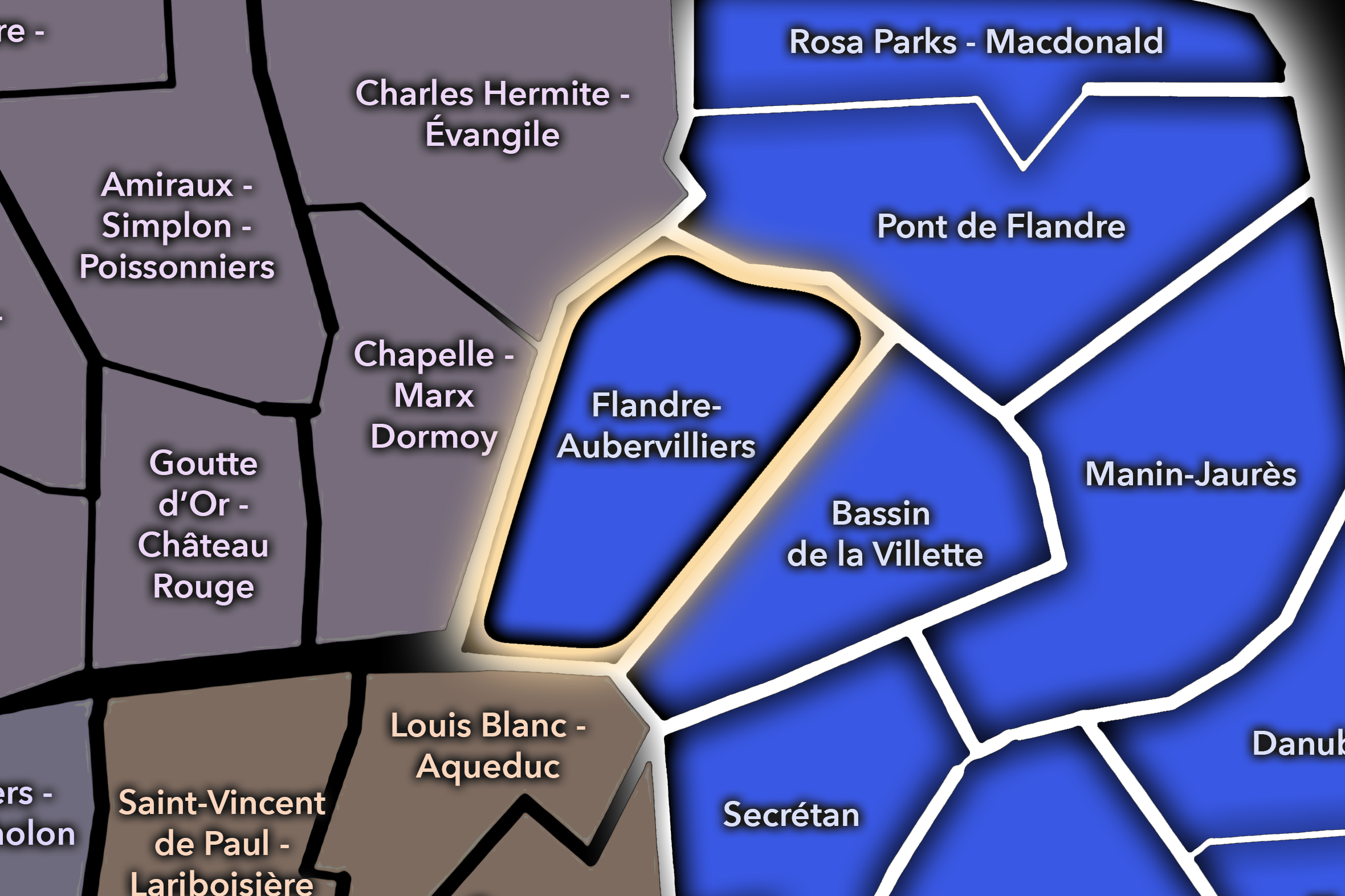
The Flandre-Aubervilliers Conseil de Quartier gives civic form to the northern gateway of the 19e, where Avenue de Flandre, Avenue d’Aubervilliers, residential towers, schools, local commerce, transit corridors, social housing, and the edge toward Aubervilliers shape a dense and outward-facing urban landscape. As a civic territory, it is defined by movement between Paris and the northeast beyond the périphérique, while also remaining a lived district of apartment blocks, shops, cafés, public facilities, and everyday neighborhood routines.
On the ground, Flandre-Aubervilliers feels practical, urban, and strongly connected to the metropolitan edge. Its civic themes center on housing, pedestrian safety, traffic, transit access, public-space maintenance, local commerce, school streets, greening, and the relationship between local residents and the large flows moving along the Flandre and Aubervilliers corridors. The CdQ layer is important here because it gives a clear neighborhood frame to a district often understood through infrastructure and edge conditions, but lived daily through streets, schools, shops, and residential courtyards.
Flandre-Aubervilliers: At a Glance
A curated list for you.
-
Major Streets
Avenue de Flandre
Avenue d’Aubervilliers
Rue de Crimée
Boulevard Macdonald nearby
Quai de la Gironde nearby
-
Public Spaces & Landmarks
Centquatre-Paris nearby
Canal Saint-Denis nearby
Rosa Parks / Macdonald edge nearby
Square Curial nearby
Porte d’Aubervilliers nearby
-
Transit Access
Crimée
Corentin Cariou nearby
Riquet nearby
Rosa Parks nearby
Tramway T3b access nearby
-
Shopping & Dining
Avenue de Flandre shops
Rue de Crimée cafés and local dining
Aubervilliers-edge commerce
Centquatre cafés nearby
Local bakeries around Crimée
-
Hotels & Attractions
Centquatre-Paris nearby
Canal Saint-Denis access
Rosa Parks / Macdonald district nearby
Porte d’Aubervilliers gateway
Northern 19e urban corridor
Manin-Jaurès
Civic Profile
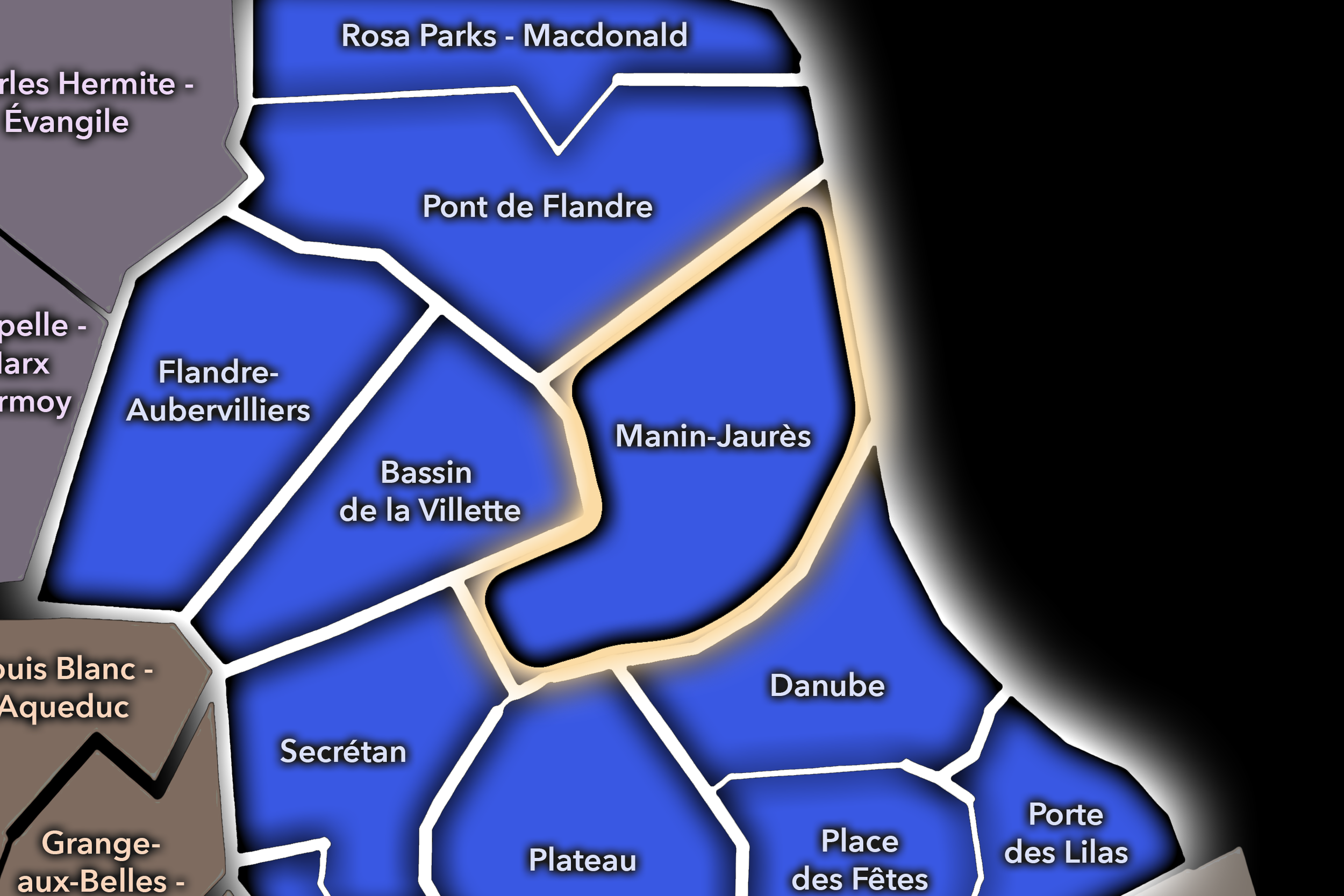
The Manin-Jaurès Conseil de Quartier gives civic form to one of the 19e’s most important park-adjacent landscapes, where Parc des Buttes-Chaumont, Avenue Jean-Jaurès, Rue Manin, local schools, residential streets, cafés, and the movement between Laumière, Ourcq, and the canal districts come together. As a civic territory, it is shaped by the relationship between a major public park and the everyday neighborhood fabric around it: families, runners, students, residents, visitors, and local businesses all using the same hillside, avenue, and park-edge spaces.
On the ground, Manin-Jaurès feels green, residential, and highly used. The Buttes-Chaumont gives the district its strongest visual and civic anchor, while Avenue Jean-Jaurès and the surrounding streets bring shops, cafés, transit, schools, and steady local movement. Its civic themes center on park access and maintenance, pedestrian comfort, school and family movement, traffic along major corridors, local commerce, public-space stewardship, and the balance between neighborhood quiet and the citywide draw of one of Paris’s most beloved parks. Rosa Bonheur and Le Pavillon du Lac both help anchor the park’s dining and gathering life.
Manin-Jaurès: At a Glance
A curated list for you.
-
Major Streets
Avenue Jean-Jaurès
Rue Manin
Rue de Crimée
Rue Petit
Rue Botzaris
-
Public Spaces & Landmarks
Parc des Buttes-Chaumont
Lac des Buttes-Chaumont
Temple de la Sibylle
Mairie du 19e arrondissement nearby
Bassin de la Villette nearby
-
Transit Access
Laumière
Botzaris
Ourcq
Bolivar nearby
Jaurès nearby
-
Shopping & Dining
Rosa Bonheur
Le Pavillon du Lac
Avenue Jean-Jaurès cafés
Laumière neighborhood dining
Local food shops around Rue Manin
-
Hotels & Attractions
Parc des Buttes-Chaumont
Buttes-Chaumont lake and overlooks
Rosa Bonheur / park gathering route
Canal de l’Ourcq nearby
Laumière / Manin neighborhood streets
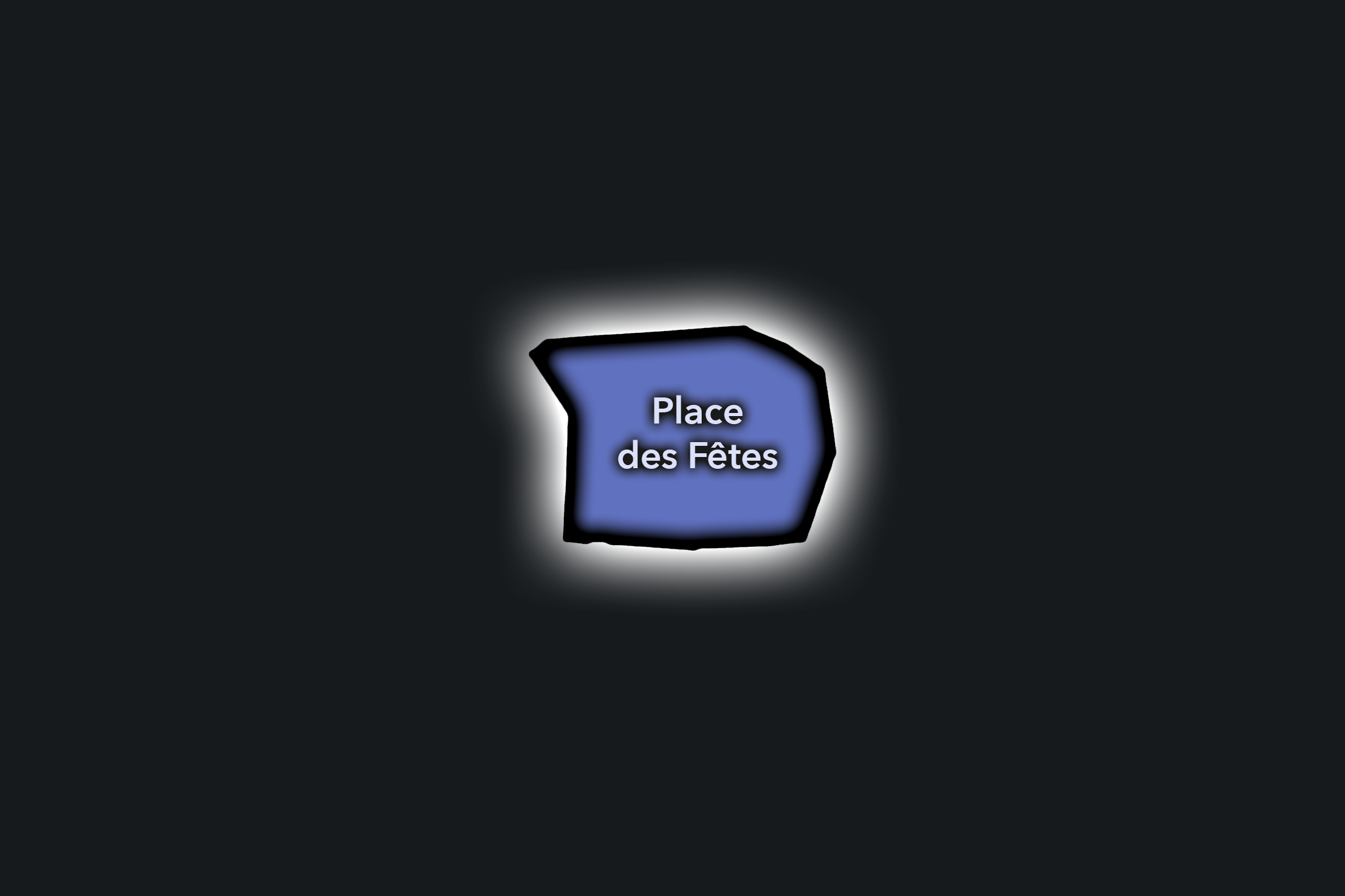
Place des Fêtes
Civic Profile
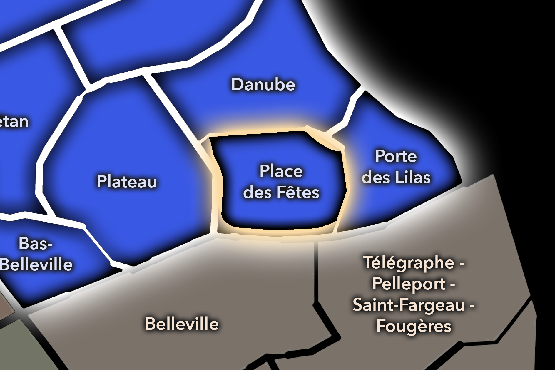
The Place des Fêtes Conseil de Quartier organizes one of the 19e’s clearest hilltop civic centers, where the arrondissement rises into a dense residential landscape of towers, schools, local shops, markets, squares, transit access, and streets linking Belleville, Danube, Télégraphe, and the northeastern edge of Paris. As a civic territory, it is less about monuments than local infrastructure: housing, school routes, market days, Metro access, pedestrian spaces, public facilities, and the everyday public life of a high-set neighborhood center.
On the ground, Place des Fêtes feels urban, residential, and strongly local. The square functions as a civic anchor for the surrounding heights, gathering transit, market activity, apartment blocks, shops, and local routines into one recognizable center. Its civic themes center on public-space comfort, market use, housing quality, pedestrian circulation, greening, school and family movement, and the challenge of making a dense modern neighborhood center feel welcoming and connected. The city’s market listing confirms Marché Place des Fêtes as a formal market at Place des Fêtes.
Place des Fêtes: At a Glance
A curated list for you.
-
Major Streets
Rue de Belleville
Rue Compans
Rue du Pré-Saint-Gervais
Rue des Fêtes
Rue Louise-Thuliez
-
Public Spaces & Landmarks
Place des Fêtes
Marché Place des Fêtes
Église Notre-Dame-de-Fatima
Square Monseigneur-Maillet
Regard de la Lanterne nearby
-
Transit Access
Place des Fêtes
Télégraphe nearby
Jourdain nearby
Pré Saint-Gervais nearby
Danube nearby
-
Shopping & Dining
Marché Place des Fêtes
Place des Fêtes local shops
Rue de Belleville food shops nearby
Jourdain cafés nearby
Neighborhood bakeries around Compans
-
Hotels & Attractions
Place des Fêtes neighborhood center
Belleville hilltop approaches
Buttes-Chaumont nearby
Regard de la Lanterne nearby
Télégraphe / Danube walking routes nearby
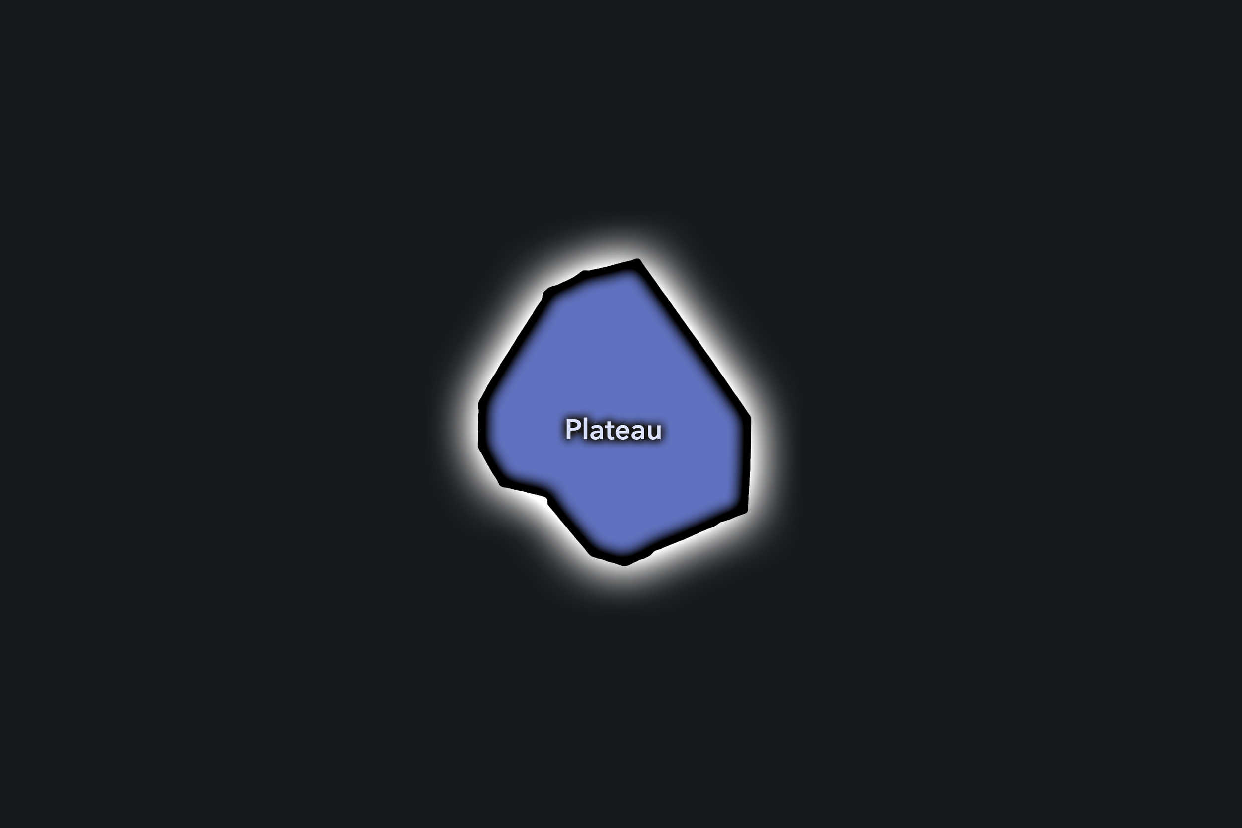
Plateau
Civic Profile
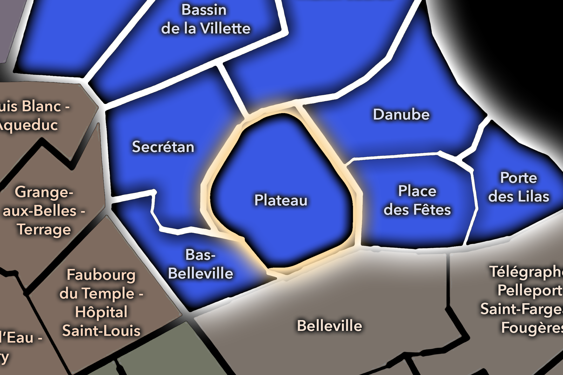
The Plateau Conseil de Quartier gives civic shape to a sloped residential landscape between Belleville, Buttes-Chaumont, Jourdain, and the eastern heights of the 19e. As a civic territory, it gathers hillside streets, schools, apartment blocks, shops, cafés, stairways, small public spaces, and the local routes that connect the park, Belleville, Place des Fêtes, and the quieter upper neighborhoods. Its geography is defined by elevation and everyday use rather than by a single monument.
On the ground, Plateau feels residential, steep, and neighborhood-centered. It is one of the 19e’s clearest examples of civic life shaped by topography: people move through slopes, stair streets, small squares, school corridors, and routes toward parks and Metro stations. Its civic themes center on pedestrian comfort, accessibility on hills, school and family movement, public-space maintenance, greening, traffic calming, local commerce, and the preservation of a neighborhood fabric that feels closely tied to the heights of eastern Paris.
Plateau: At a Glance
A curated list for you.
-
Major Streets
Rue de Belleville
Rue de Crimée
Rue Manin
Rue Botzaris
Rue de Mouzaïa nearby
-
Public Spaces & Landmarks
Parc des Buttes-Chaumont nearby
Jourdain neighborhood edge
Mouzaïa streets nearby
Square Bolivar nearby
Belleville hill streets
-
Transit Access
Botzaris
Jourdain
Place des Fêtes nearby
Danube nearby
Buttes Chaumont nearby
-
Shopping & Dining
Rue de Belleville shops and cafés
Jourdain cafés and dining
Buttes-Chaumont cafés nearby
Local bakeries around Botzaris
Neighborhood restaurants near Rue de Crimée
-
Hotels & Attractions
Buttes-Chaumont upper approaches
Mouzaïa / villa streets nearby
Belleville hill walking route
Jourdain neighborhood route
Plateau residential hillside streets
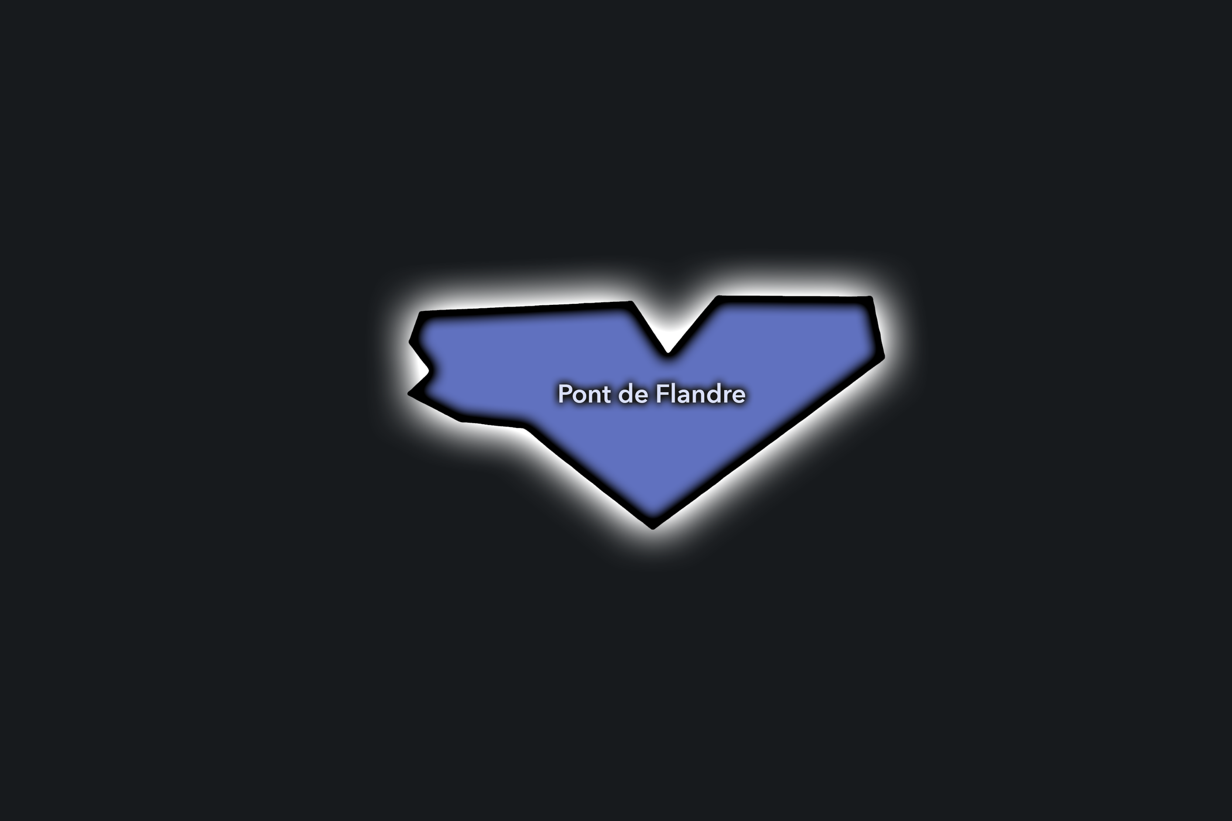
Pont de Flandre
Civic Profile
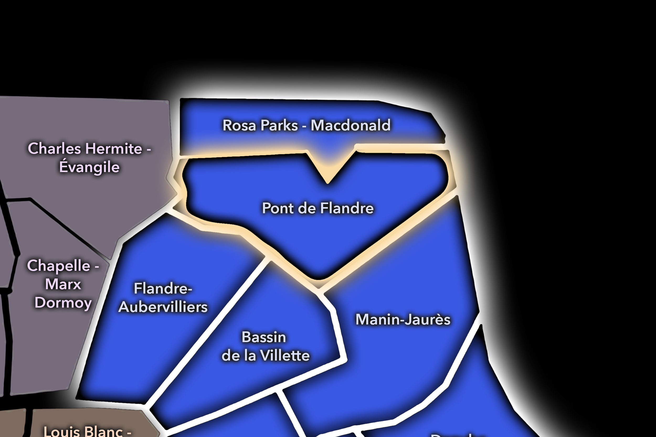
The Pont de Flandre Conseil de Quartier gives civic form to the 19e’s northeastern cultural and infrastructural landscape, where Parc de la Villette, the Canal de l’Ourcq, Porte de Pantin, Cité des Sciences, the Philharmonie, concert venues, schools, housing, offices, and the edge toward Pantin come together. As a civic territory, it is shaped by large public institutions and metropolitan movement, but also by residential streets and everyday neighborhood use around the park, canal, and major transit nodes.
On the ground, Pont de Flandre feels spacious, cultural, and gateway-oriented. Parc de la Villette gives the district one of Paris’s largest contemporary public landscapes, while the Cité des Sciences, Philharmonie, Zénith, Grande Halle, canal paths, hotels, and tram / Metro access bring visitors from across the city and beyond. Its civic themes center on public-space use, event circulation, park access, cultural facilities, pedestrian and bicycle movement, cleanliness, safety, and the relationship between local residents and major destination infrastructure. The Philharmonie describes the Parc de la Villette site as linking urbanism, lifestyle, arts, sciences, Paris, and its suburbs — a fitting summary of this CdQ’s civic role.
Pont de Flandre: At a Glance
A curated list for you.
-
Major Streets
Avenue Jean-Jaurès
Avenue Corentin-Cariou
Quai de la Charente
Boulevard Sérurier
Rue de Crimée
-
Public Spaces & Landmarks
Parc de la Villette
Cité des Sciences et de l’Industrie
Philharmonie de Paris
Grande Halle de la Villette
Canal de l’Ourcq
-
Transit Access
Porte de Pantin
Corentin Cariou
Ourcq nearby
Tramway T3b access
Rosa Parks nearby
-
Shopping & Dining
Parc de la Villette cafés and kiosks
Philharmonie / Porte de Pantin dining
Canal-side cafés near Corentin Cariou
Vill’Up / Cité des Sciences area
Local restaurants along Avenue Jean-Jaurès
-
Hotels & Attractions
Cité des Sciences et de l’Industrie
Philharmonie de Paris
Grande Halle de la Villette
Zénith Paris - La Villette
Canal de l’Ourcq / La Villette walking route
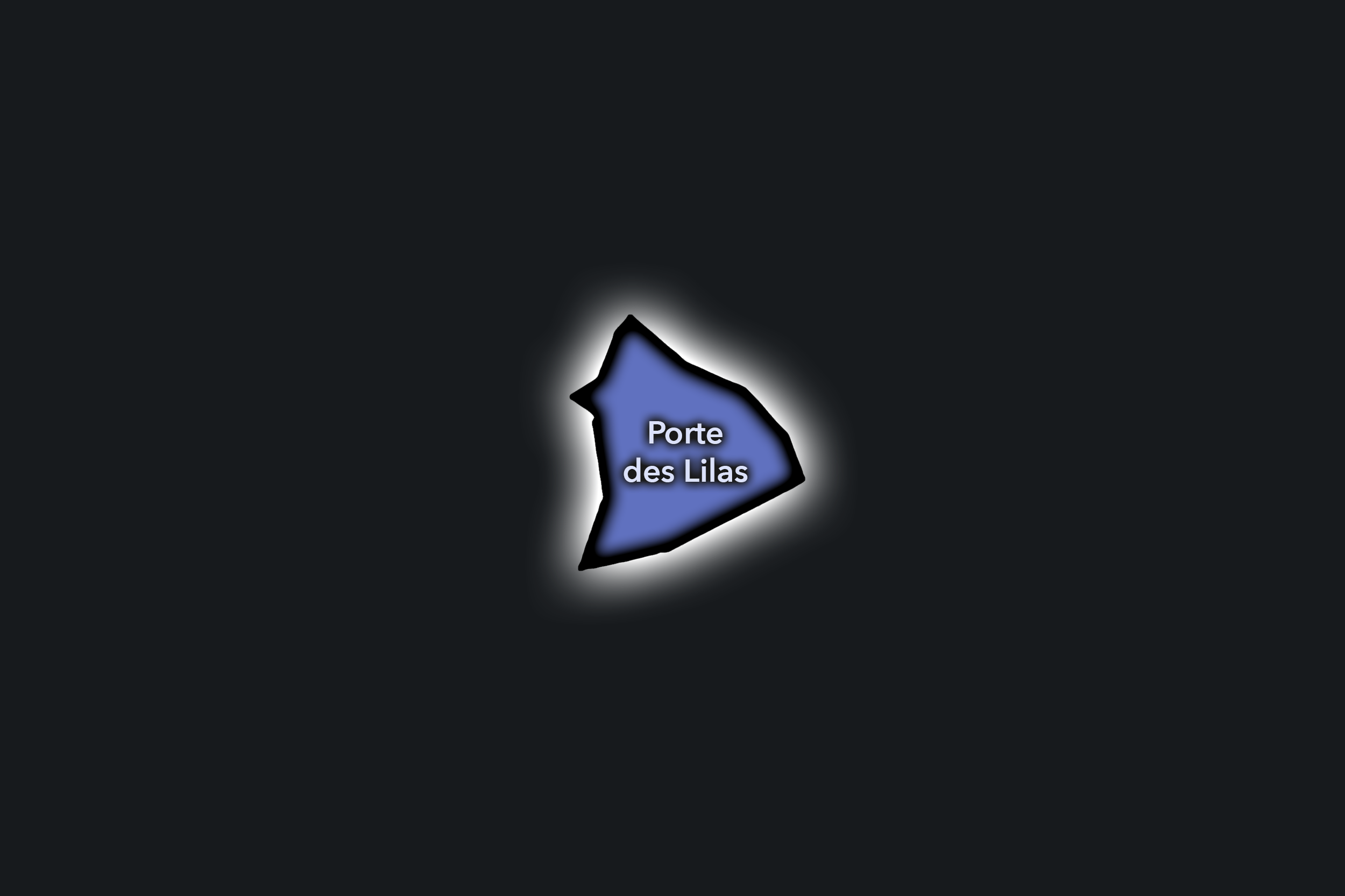
Porte des Lilas
Civic Profile
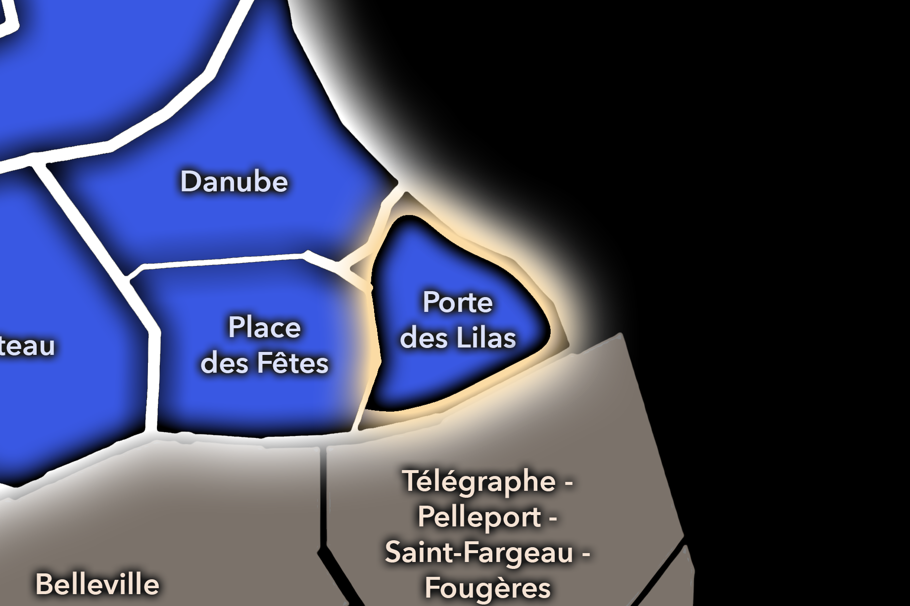
The Porte des Lilas Conseil de Quartier gives civic form to the eastern edge of the 19e, where the arrondissement meets the 20e, Les Lilas, Pré-Saint-Gervais, and the broader northeastern boundary of Paris. As a civic territory, it is shaped by hillside streets, residential blocks, schools, local shops, tramway and Metro access, gateway infrastructure, and the transition between inner Paris and the communes just beyond the périphérique. It is less defined by a single landmark than by the practical civic life of an edge district: movement, housing, transit, local commerce, and everyday public space.
On the ground, Porte des Lilas feels residential, transitional, and strongly connected to the wider northeast. The area’s civic themes center on pedestrian comfort around major roads, access to transit, school and family movement, local services, greening, housing quality, and the challenge of making a city-edge district feel cohesive rather than merely pass-through. The CdQ layer is useful here because it gives a local frame to a part of Paris where neighborhood life and metropolitan boundary conditions are constantly intertwined.
Porte des Lilas: At a Glance
A curated list for you.
-
Major Streets
Avenue de la Porte des Lilas
Boulevard Sérurier
Rue de Belleville
Rue du Pré-Saint-Gervais
Rue des Bois
-
Public Spaces & Landmarks
Porte des Lilas
Regard des Maussins nearby
Square du Docteur Variot nearby
Place des Fêtes nearby
Northeastern Paris edge streets
-
Transit Access
Porte des Lilas
Pré Saint-Gervais nearby
Télégraphe nearby
Place des Fêtes nearby
Tramway T3b access
-
Shopping & Dining
Porte des Lilas local cafés
Rue de Belleville food shops nearby
Pré-Saint-Gervais edge commerce
Neighborhood bakeries around Porte des Lilas
Local brasseries near Boulevard Sérurier
-
Hotels & Attractions
Porte des Lilas gateway
Les Lilas / Pré-Saint-Gervais access
Belleville hilltop route nearby
Place des Fêtes nearby
Northeastern Paris boundary walk
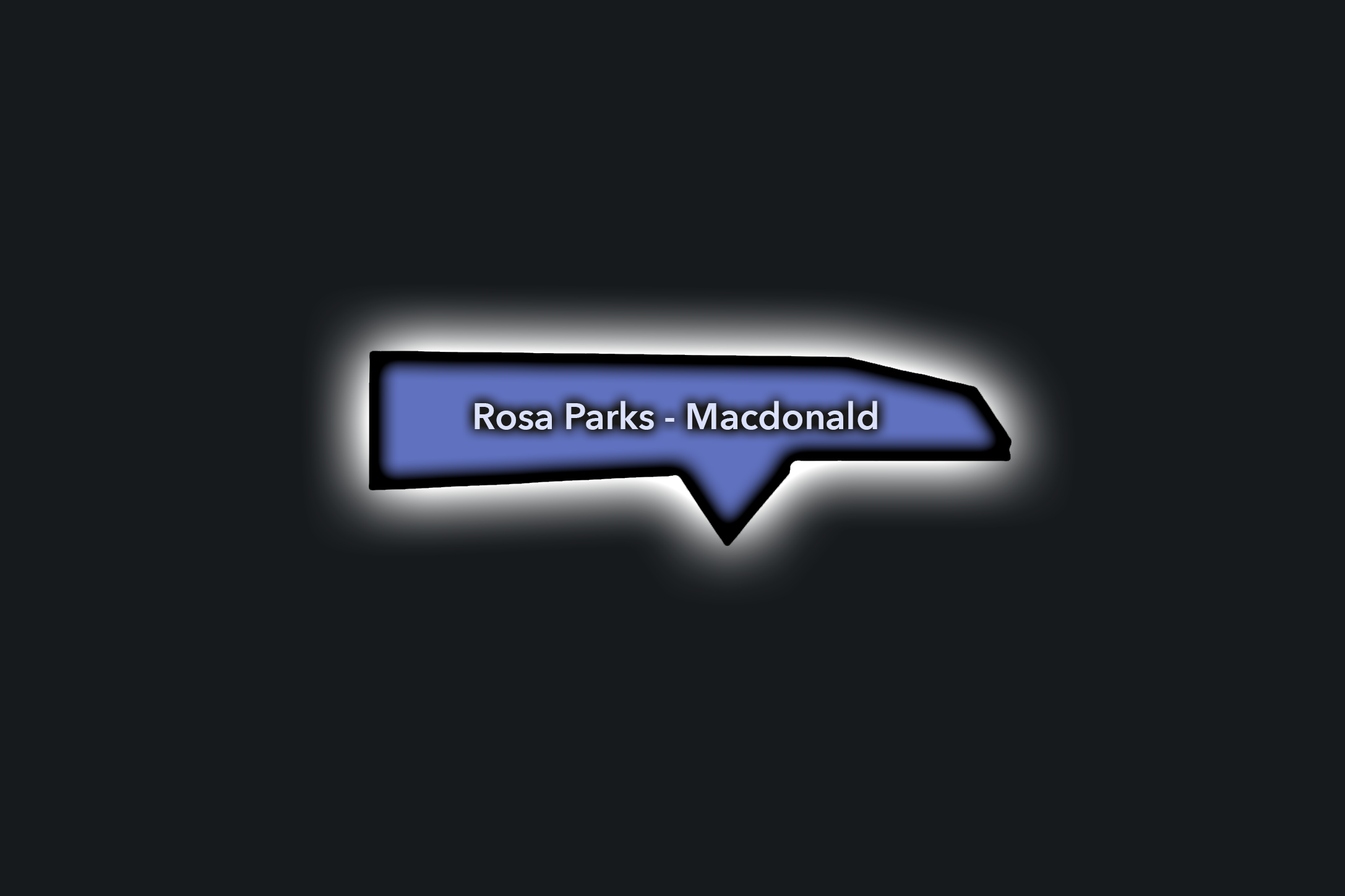
Rosa Parks - Macdonald
Civic Profile
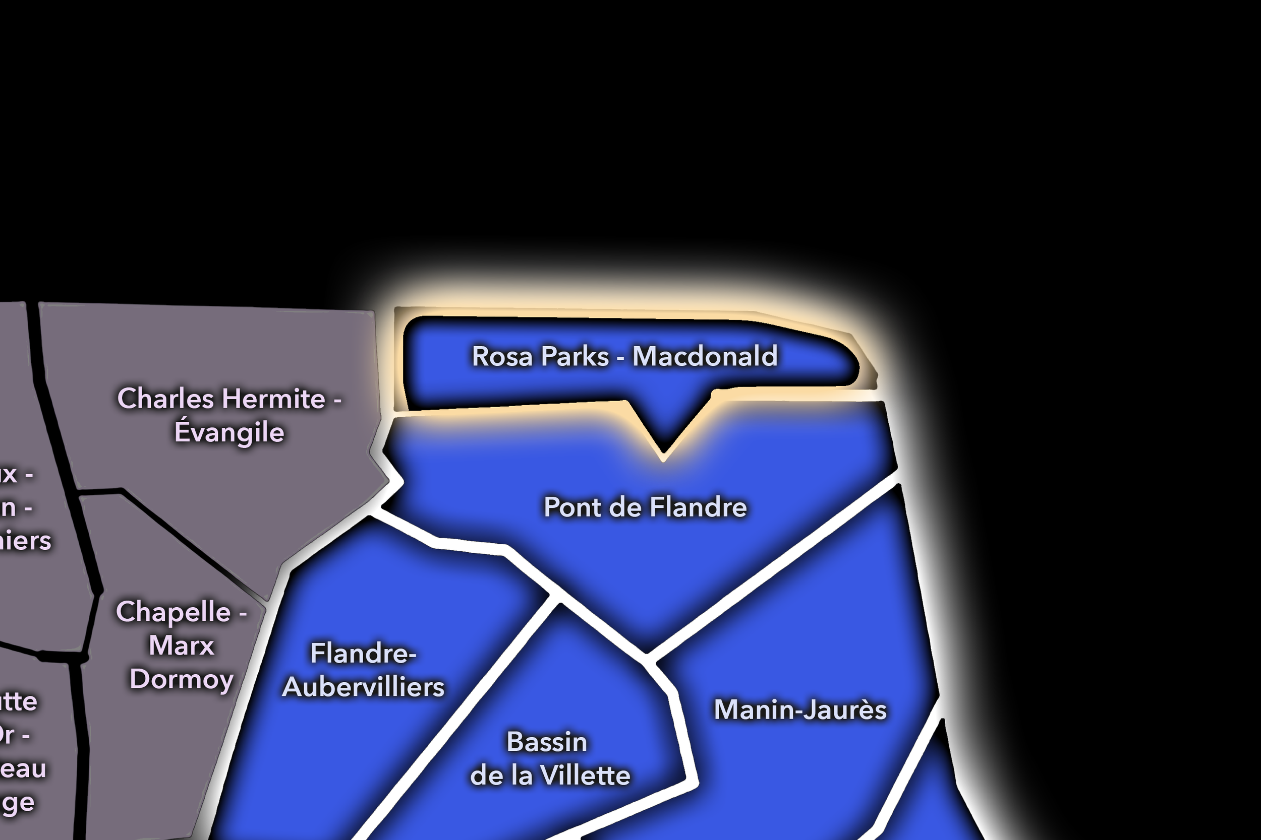
The Rosa Parks - Macdonald Conseil de Quartier gives civic shape to one of the 19e’s most contemporary edge landscapes, where the Rosa Parks station area, Boulevard Macdonald, rail infrastructure, housing, offices, schools, tramway access, shopping, and redevelopment zones meet the northern boundary of Paris. As a civic territory, it reflects a newer kind of northeastern Paris: infrastructural, planned, connected, and still forming its neighborhood identity around transit, housing, public space, and links toward Aubervilliers and the 18e.
On the ground, Rosa Parks - Macdonald feels modern, open, and transitional. It is shaped by large blocks, new public spaces, rail edges, tram stops, apartments, retail, and the movement of commuters, residents, workers, and families through a district that has been substantially reconfigured in recent decades. Its civic themes center on redevelopment, pedestrian comfort, public-space design, housing quality, transit access, school and family movement, greening, and the challenge of turning a large infrastructural corridor into a lived neighborhood with recognizable local anchors.
Rosa Parks - Macdonald: At a Glance
A curated list for you.
-
Major Streets
Boulevard Macdonald
Rue d’Aubervilliers
Rue Gaston-Tessier
Quai de la Gironde nearby
Avenue de Flandre nearby
-
Public Spaces & Landmarks
Rosa Parks station area
Le Parks / Macdonald redevelopment district
Canal Saint-Denis nearby
Centquatre-Paris nearby
Porte d’Aubervilliers nearby
-
Transit Access
Rosa Parks
Tramway T3b access
Corentin Cariou nearby
Crimée nearby
Porte d’Aubervilliers nearby
-
Shopping & Dining
Le Parks shopping and dining area
Boulevard Macdonald local commerce
Rosa Parks cafés and bakeries
Centquatre cafés nearby
Aubervilliers-edge shops nearby
-
Hotels & Attractions
Rosa Parks redevelopment district
Centquatre-Paris nearby
Canal Saint-Denis route
Macdonald / rail-edge urban landscape
Porte d’Aubervilliers gateway
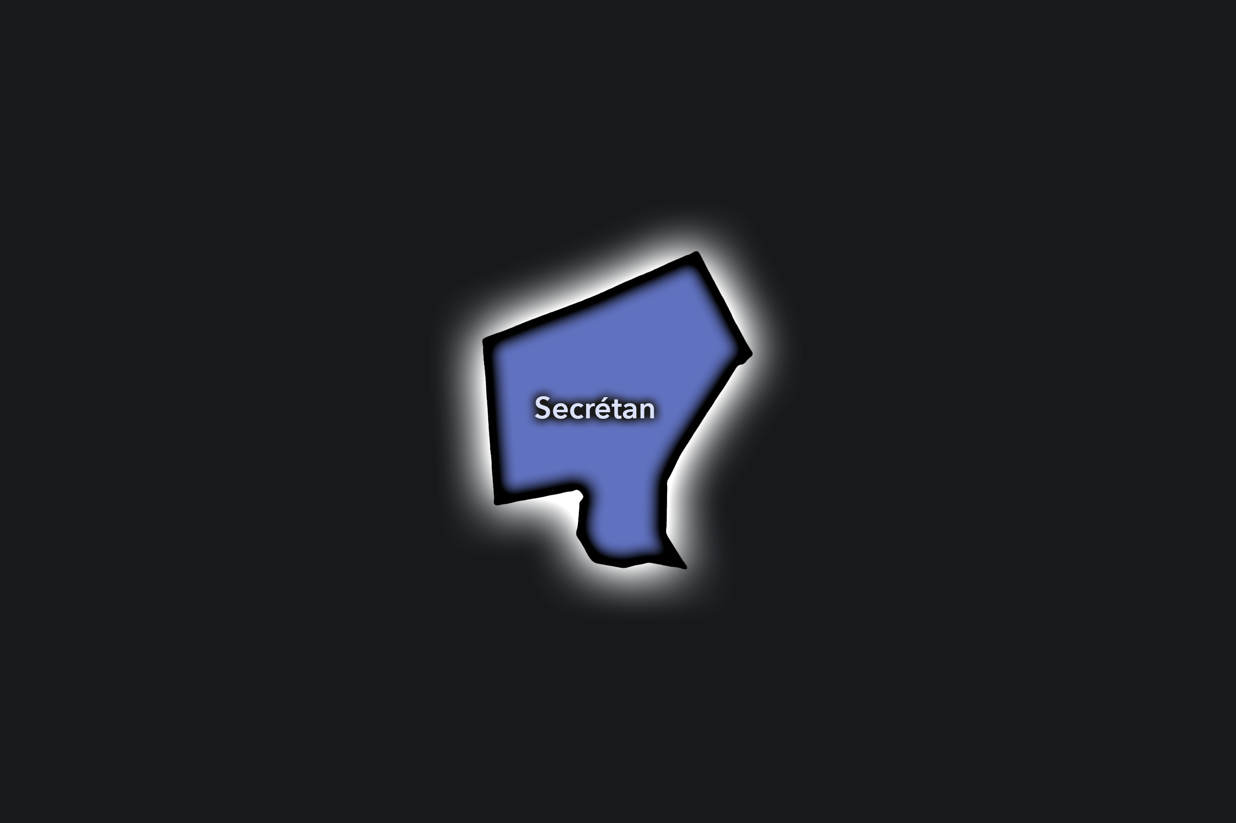
Secrétan
Civic Profile
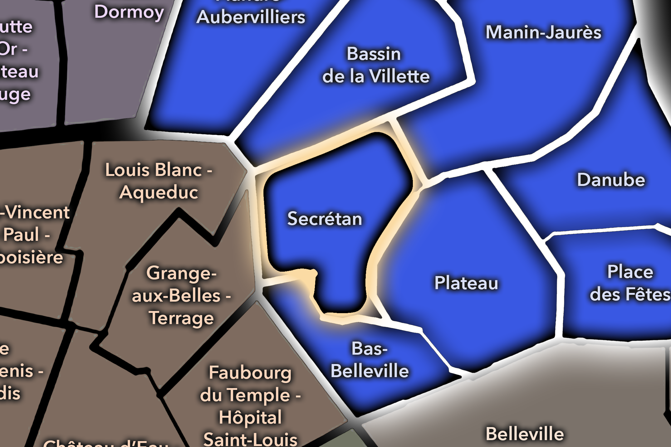
The Secrétan Conseil de Quartier organizes one of the 19e’s most neighborhood-scaled central districts, centered around Avenue Secrétan, Jaurès, Bolivar, local shops, schools, cafés, residential blocks, and the approaches to both the Bassin de la Villette and Parc des Buttes-Chaumont. As a civic territory, it sits between two major public landscapes — water and park — while maintaining its own everyday commercial and residential identity along Avenue Secrétan and the surrounding streets.
On the ground, Secrétan feels local, active, and well-balanced. It is neither as destination-oriented as La Villette nor as hilltop-focused as Place des Fêtes, but it plays an important connective role within the 19e: residents move between shops, schools, cafés, Metro stations, the canal, and the park through a compact neighborhood fabric. Its civic themes center on local commerce, pedestrian comfort, school and family movement, public-space maintenance, traffic along Avenue Secrétan and Avenue Jean-Jaurès, and the balance between daily neighborhood use and proximity to two of northeastern Paris’s major public spaces.
Secrétan: At a Glance
A curated list for you.
-
Major Streets
Avenue Secrétan
Avenue Jean-Jaurès
Rue de Meaux
Rue Manin nearby
Avenue Simon Bolivar
-
Public Spaces & Landmarks
Marché Secrétan
Parc des Buttes-Chaumont nearby
Bassin de la Villette nearby
Square Bolivar nearby
Mairie du 19e arrondissement nearby
-
Transit Access
Bolivar
Jaurès
Laumière nearby
Buttes Chaumont nearby
Colonel Fabien nearby
-
Shopping & Dining
Marché Secrétan
Avenue Secrétan shops and cafés
Laumière neighborhood dining nearby
Canal-side cafés nearby
Local bakeries around Bolivar / Secrétan
-
Hotels & Attractions
Marché Secrétan neighborhood anchor
Buttes-Chaumont access
Bassin de la Villette nearby
Jaurès / canal walking route
Central 19e residential streets
The Photography
Visual Identity

The visual identity of each Paris district begins with its position in the city’s layered geography. Before the photographs arrive, the maps establish a first way of seeing: where the district sits, what civic layer it belongs to, which boundaries define it, and how it connects to the surrounding fabric of Paris. In CityNeighborhoods Paris, cartography is not merely orientation; it is part of the visual language of the project.
As the photographic archive grows, this section will continue to develop through images gathered on foot. Streets, façades, monuments, markets, parks, river edges, passages, signs, textures, and everyday details will gradually reveal how each district presents itself visually. The goal is not only to show what a place looks like, but to trace how its identity becomes visible through form, atmosphere, memory, and use.
Through The Lens

CityNeighborhoods Paris is built from walking, looking, and returning. Each district is approached through photography as a way of paying attention: to the obvious landmarks and the quieter details, to historic structures and ordinary streets, to the moments where civic geography becomes lived experience. The camera becomes a tool for noticing how Paris changes from one district to the next, and how each place holds its own relationship to the larger city.
As photographs are processed and added, this section will become a more specific visual record of the district. Future updates may include dated field notes, galleries, and reflections from individual walks. For now, the page remains part of the larger CityNeighborhoods effort to document every Paris neighborhood through maps, history, identity, and photography — one district, one walk, and one visual encounter at a time.
If you visit Paris, these ideas can help inspire your own photography.


Paris: J’Espere, Je Rêve, Je Vive
Paris Photo Gallery
Paris Flâneur Notes
Flâneur Notes document the walks, photographs, light, and street-level observations behind this neighborhood entry. Learn more about the Spirit of the Flâneur.


Explore Paris
-

The twenty arrondissements form the civic spiral of Paris, organizing the city into its broad local districts of government, identity, and daily life.
-

Each arrondissement is divided into four official administrative quarters, giving Paris a more precise civic and geographic framework.
-

The conseils de quartier bring participation to street level, giving residents a voice in neighborhood needs, public space, and local civic life.
-

Les Deux Rives trace Paris through the Seine’s two banks, revealing how the Rive Droite and Rive Gauche shaped the city’s civic power, commerce, learning, art, and cultural identity.
-

Cultural neighborhoods reveal the Paris people recognize through history, cafés, architecture, memory, atmosphere, and local belonging.