
20e - MÉNILMONTANT
Les Conseils de Quartier
Across the 20e, the conseils de quartier follow the hills and neighborhoods of eastern Paris, linking Belleville, Ménilmontant, Père-Lachaise, Charonne, Saint-Fargeau, and the popular histories that shape the arrondissement’s identity. Part of an ongoing project to walk and photograph every neighborhood in Paris, this page explores the conseils de quartier of 20e Ménilmontant through maps, local identity, civic geography, and photography.
Explore This Page


Explore the Conseils de Quartier of the 20e — Ménilmontant.
Overview
Geographic Setting
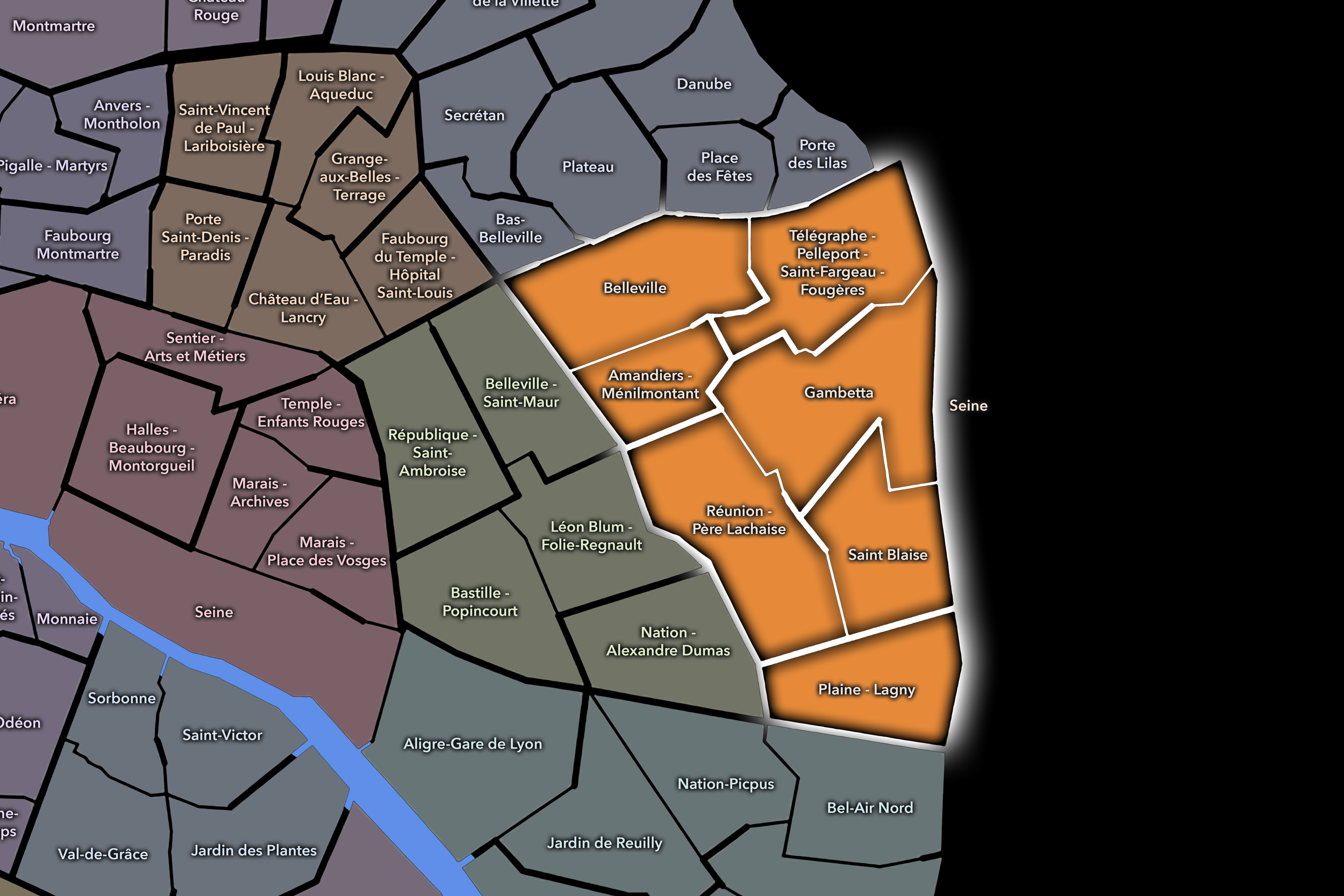
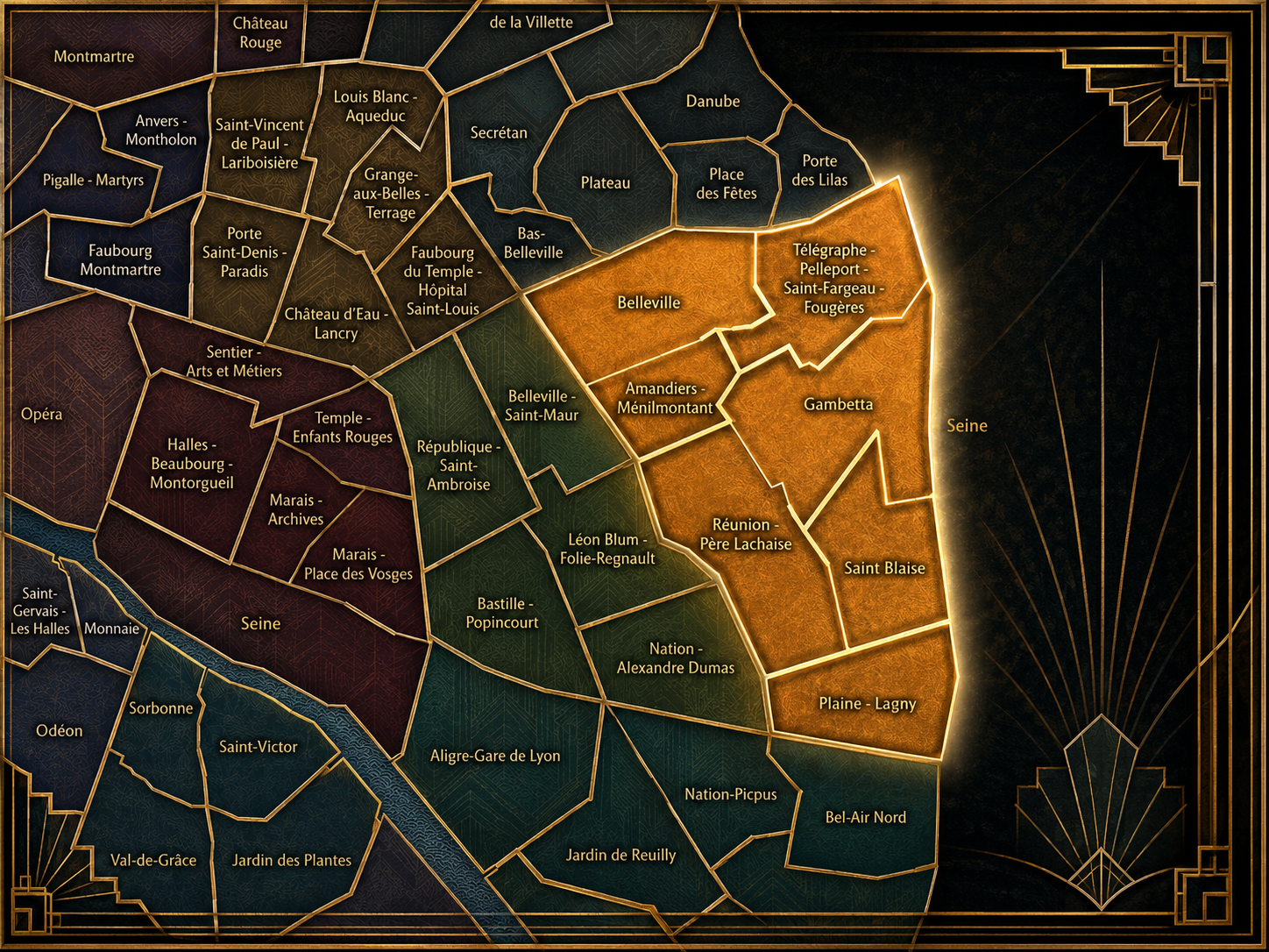
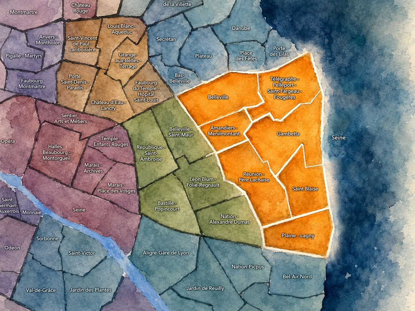
The Conseils de Quartier of the 20e organize local civic life across one of eastern Paris’s most distinctive and neighborhood-rich arrondissements. Stretching from the heights of Belleville and Ménilmontant to Père-Lachaise, Gambetta, Saint-Blaise, Charonne, Lagny, and the eastern portes, the 20e is shaped by hills, cemeteries, former village roads, working-class histories, immigrant communities, residential streets, public housing, schools, markets, cultural life, and the edge conditions where Paris meets Montreuil, Bagnolet, and the wider eastern suburbs. Its geography is strongly local, with identities that often feel older and more lived-in than the administrative lines that contain them.
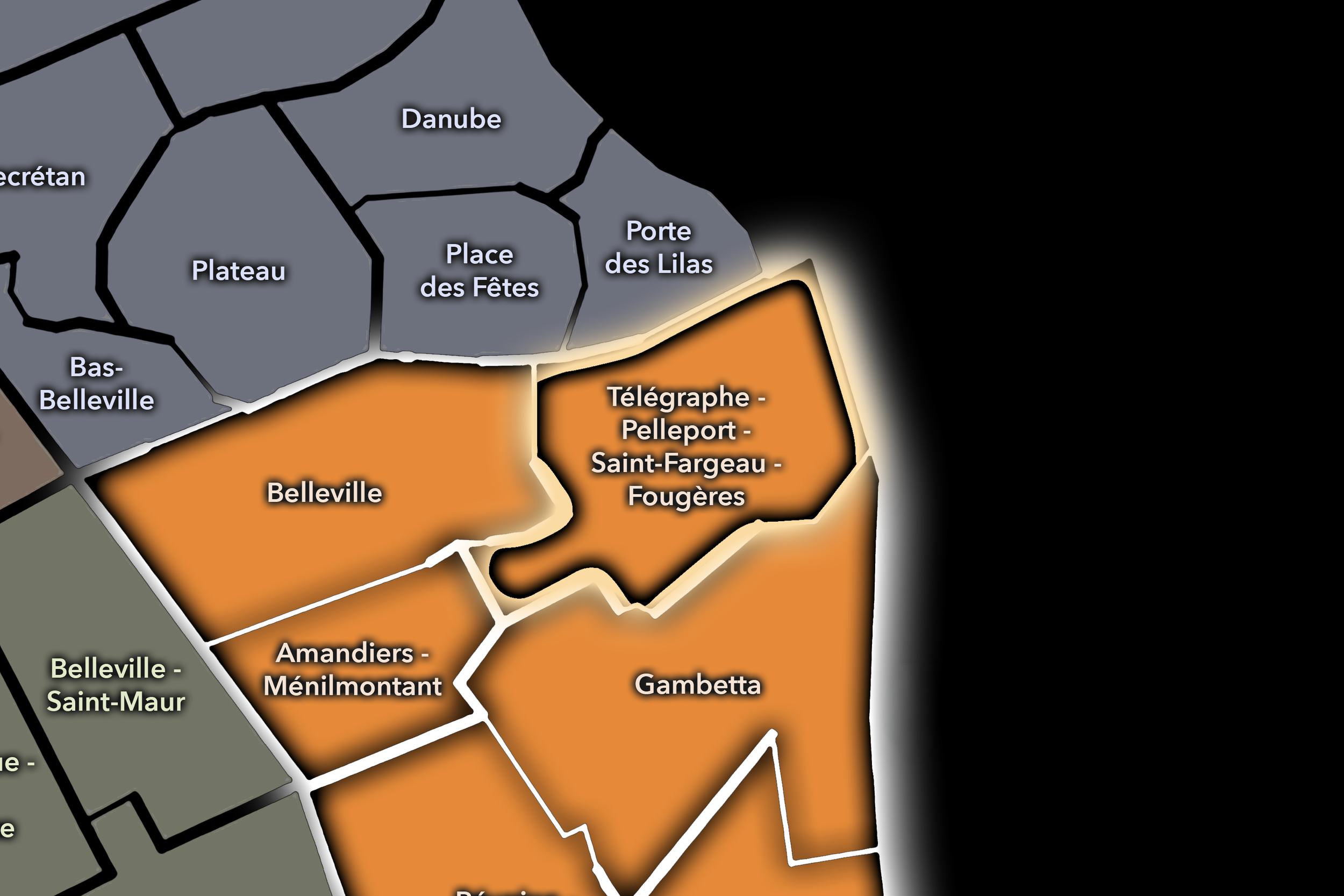
The 20e’s Conseil de Quartier structure divides this landscape into seven civic territories: Amandiers - Ménilmontant, Belleville, Gambetta, Plaine - Lagny, Réunion - Père-Lachaise, Saint-Blaise, and Télégraphe - Pelleport - Saint-Fargeau - Fougères. This seven-council structure gives the arrondissement a more precise participatory geography than the four official Administrative Quarters alone. It distinguishes between the hillside and multicultural life of Belleville, the dense residential and cultural identity of Amandiers - Ménilmontant, the civic center around Gambetta, the cemetery and neighborhood landscapes around Père-Lachaise and Réunion, the historic village fabric of Saint-Blaise, and the eastern residential and gateway districts toward Lagny, Télégraphe, Pelleport, Saint-Fargeau, and Fougères.
Together, these seven CdQs reveal the 20e as an arrondissement of strong local expression rather than a single eastern district. Its civic geography moves through steep streets, small squares, cemetery walls, market corridors, social housing courtyards, village remnants, metro entrances, community spaces, and eastern edges where Paris feels both deeply rooted and outward-facing. The CdQ layer helps make these internal distinctions visible, showing the 20e as a set of lived neighborhood territories shaped by memory, density, diversity, and everyday public life.
Civic Framework
The 20e’s Conseils de Quartier provide a neighborhood-level civic structure for an arrondissement whose identity is unusually grounded in local life. The district includes some of Paris’s strongest neighborhood names — Belleville, Ménilmontant, Charonne, Père-Lachaise, Saint-Blaise — along with residential streets, public housing, schools, markets, cultural venues, cemeteries, parks, transit corridors, and gateways to the eastern suburbs. Its CdQs give residents, shopkeepers, families, workers, students, associations, and local institutions a more precise scale for addressing the practical concerns that shape daily life.
The seven-council framework appears especially responsive to the 20e’s geography of hills, historic villages, and eastern edge conditions. Belleville and Amandiers - Ménilmontant give civic shape to the arrondissement’s elevated western and northwestern districts, where immigrant histories, artistic life, food streets, public housing, cafés, schools, and community organizations intersect. Gambetta functions as a civic and commercial center, while Réunion - Père-Lachaise organizes the area around one of Paris’s most famous cemetery landscapes and the surrounding residential streets. Saint-Blaise preserves a strong village-like identity within the dense modern city, while Plaine - Lagny and Télégraphe - Pelleport - Saint-Fargeau - Fougères bring the arrondissement toward its eastern and northeastern residential sectors, where local services, schools, public space, and connections beyond Paris are especially important.
As a civic framework, the 20e’s CdQs help organize questions of housing, public-space maintenance, school streets, greening, cultural life, market vitality, pedestrian comfort, accessibility on steep streets, cemetery edges, transit access, and the balance between established communities and ongoing neighborhood change. The CdQ layer is valuable here because the 20e’s local identities are strong but unevenly scaled: some are famous across Paris, while others are quieter civic territories best understood through everyday routines, local streets, and resident use.
Local Expression
Viewed through its Conseils de Quartier, the 20e becomes a family of eastern Paris landscapes rather than a single Ménilmontant or Belleville identity. Belleville expresses the arrondissement’s hilltop, multicultural, artistic, and working-city energy, where food streets, immigrant communities, parks, studios, cafés, and dense residential life give the neighborhood one of Paris’s most recognizable local voices. Amandiers - Ménilmontant carries a related but distinct expression, shaped by steep streets, cultural venues, social housing, schools, neighborhood associations, and the memory of a popular eastern Paris.
Gambetta gives the arrondissement a civic and commercial center, with broad movement, local shopping, transit, schools, and the institutional presence of the mairie area. Réunion - Père-Lachaise links residential life to cemetery memory, market streets, local squares, and the quieter edges around one of the city’s most visited landscapes. Saint-Blaise preserves a more intimate historic texture, where village remnants, narrow streets, churches, schools, and dense housing create one of the 20e’s strongest local atmospheres.
Plaine - Lagny and Télégraphe - Pelleport - Saint-Fargeau - Fougères bring the arrondissement toward its eastern and northeastern edges, where residential blocks, local commerce, schools, parks, transit corridors, and connections to Montreuil and Bagnolet shape a more outward-facing civic geography. The value of the CdQ layer in the 20e is that it captures an arrondissement built from intensely local worlds: the cemetery wall, the hill street, the market block, the school entrance, the housing courtyard, the church square, the metro station, the park path, and the eastern porte. These CdQs reveal a Paris of memory, community, density, and strong neighborhood belonging.
Les Conseils de Quartier
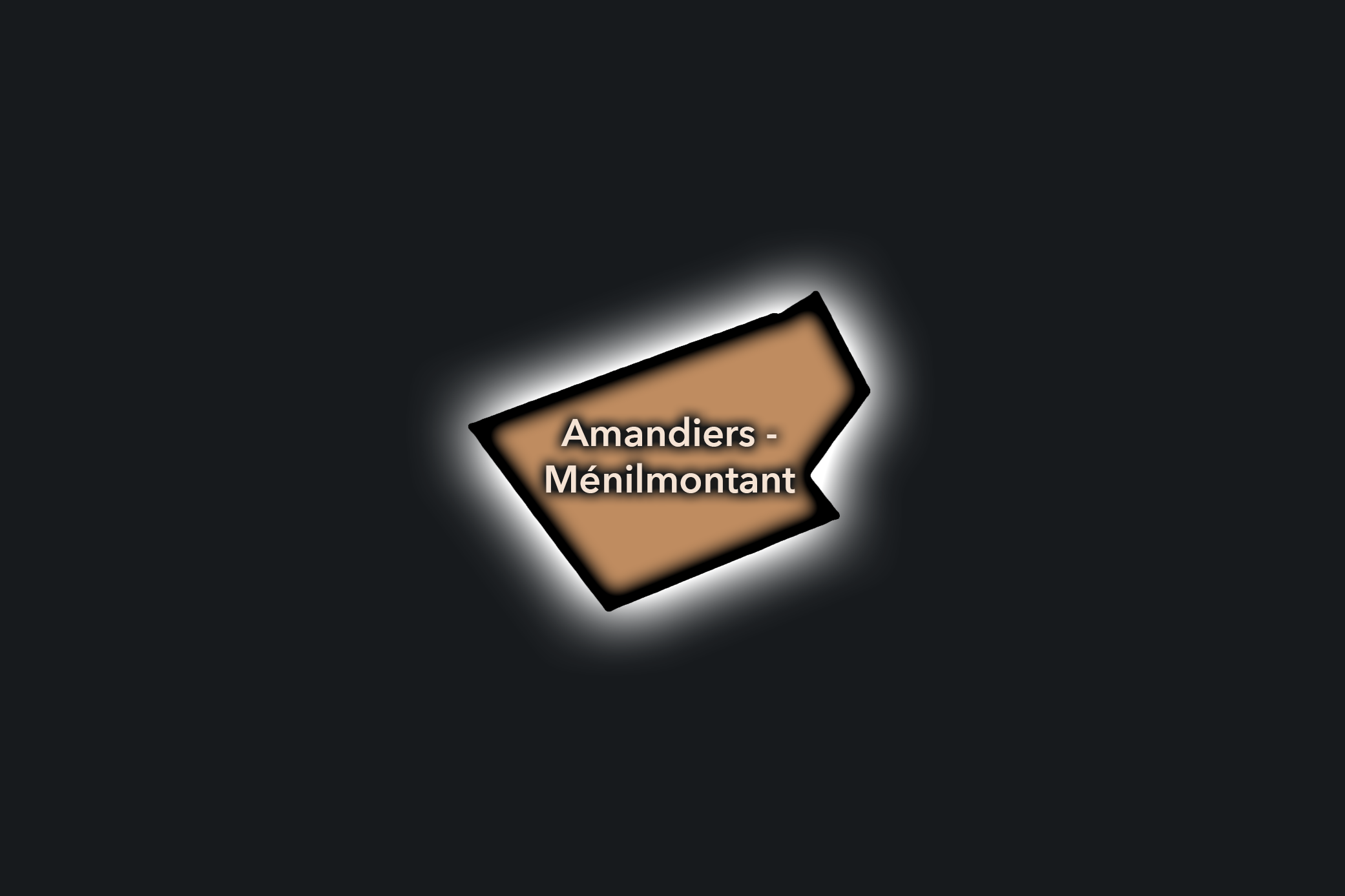
Amandiers - Ménilmontant
Civic Profile
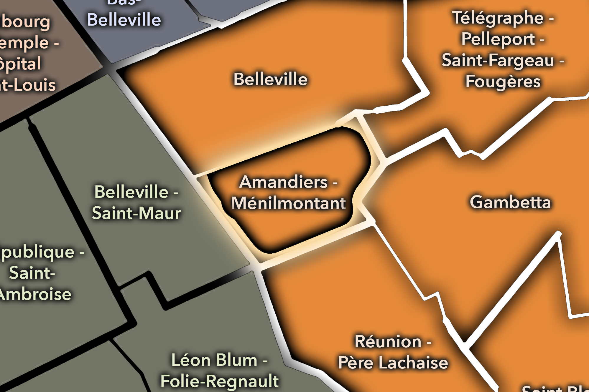
The Amandiers - Ménilmontant Conseil de Quartier gives civic form to one of the 20e’s most expressive hillside districts, where the old popular identity of Ménilmontant meets dense residential streets, social housing, cultural venues, schools, cafés, gardens, stairways, and the western edge of Père-Lachaise. As a civic territory, it is shaped by elevation, neighborhood memory, artistic life, working-class history, and the everyday realities of a district that feels both deeply local and closely tied to the larger Belleville-Ménilmontant landscape.
On the ground, Amandiers - Ménilmontant feels lively, sloped, and socially textured. Its civic themes center on housing, pedestrian comfort on steep streets, public-space maintenance, cultural vitality, school and family movement, local commerce, greening, and the balance between neighborhood continuity and ongoing change. The CdQ layer is valuable here because it gives local shape to a district whose identity is not only historic or cultural, but civic: the stair street, the café corner, the school block, the housing courtyard, the concert venue, and the neighborhood square all matter.
Amandiers - Ménilmontant: At a Glance
A curated list for you.
-

Major Streets
Rue de Ménilmontant
Rue des Amandiers
Rue Sorbier
Rue de la Mare
Boulevard de Ménilmontant
-

Public Spaces & Landmarks
Parc de Belleville nearby
Cimetière du Père-Lachaise nearby
La Maroquinerie
Église Notre-Dame-de-la-Croix nearby
Jardin des Amandiers
-

Transit Access
Ménilmontant
Père Lachaise
Gambetta nearby
Couronnes nearby
Belleville nearby
-

Shopping & Dining
Rue de Ménilmontant cafés and restaurants
La Bellevilloise
Le Baratin nearby
Local bakeries around Rue Sorbier
Ménilmontant neighborhood bars
-

Hotels & Attractions
Ménilmontant hillside walking route
Père-Lachaise western edge
Belleville / Ménilmontant cultural corridor
Parc de Belleville nearby
La Maroquinerie / local music venues
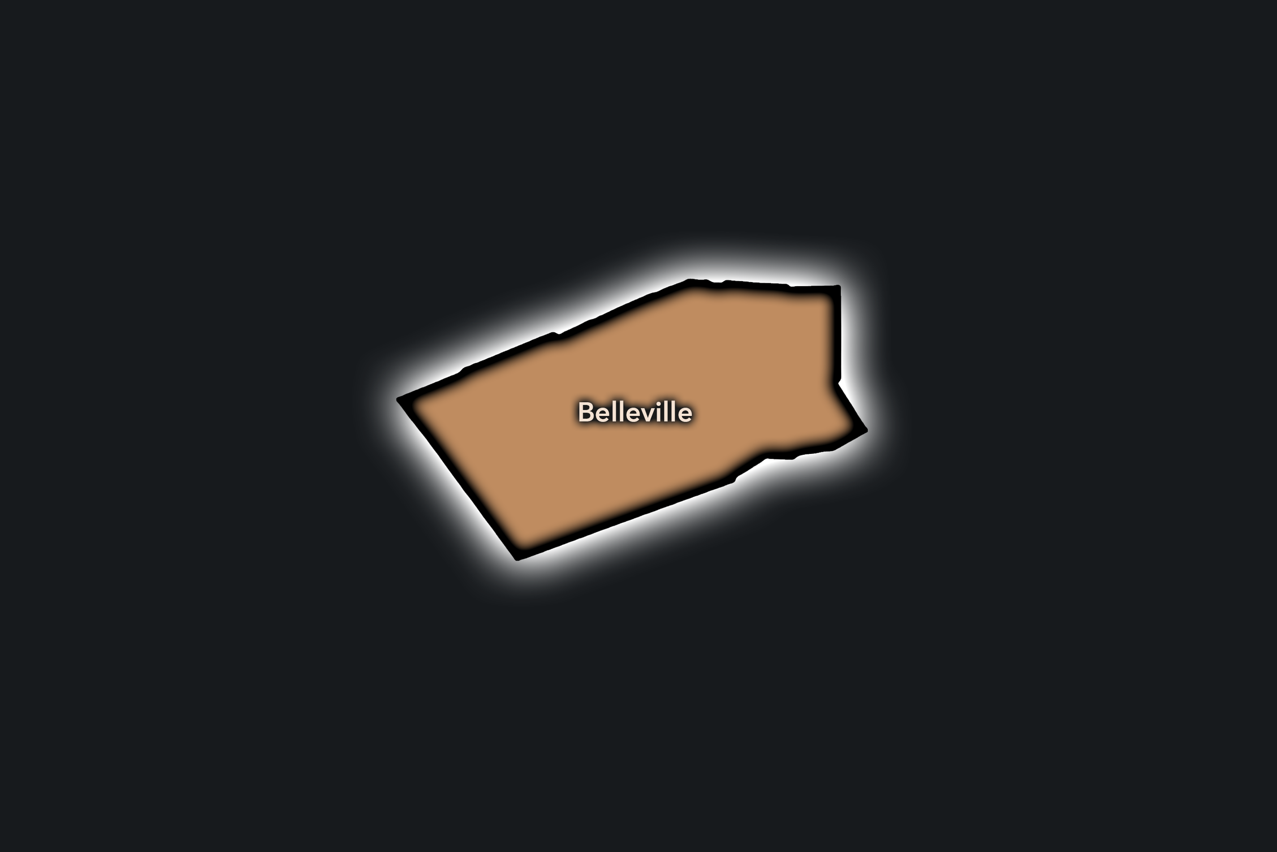
Belleville
Civic Profile
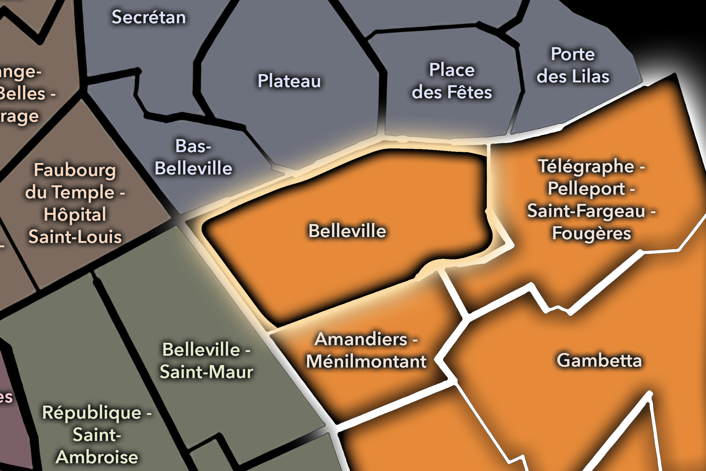
The Belleville Conseil de Quartier gives civic shape to one of eastern Paris’s strongest cultural landscapes, where hillside streets, immigrant commercial corridors, food shops, cafés, parks, schools, social housing, street art, studios, and local associations come together around one of the city’s most recognizable neighborhood names. As a civic territory within the 20e, Belleville reflects a Paris of movement, migration, creativity, density, and local belonging, closely tied to the 19e and 11e while retaining its own strong identity.
On the ground, Belleville feels energetic, multilingual, steep, and intensely lived. Its civic themes center on market and commercial vitality, housing, pedestrian comfort, public-space use, cultural visibility, school streets, greening, cleanliness, and the balance between long-standing communities and the district’s growing appeal to visitors, artists, and younger residents. The CdQ layer helps frame Belleville not as a single mythic neighborhood, but as a working civic territory of streets, shops, parks, homes, and shared public life.
Belleville: At a Glance
A curated list for you.
-
Major Streets
Rue de Belleville
Boulevard de Belleville
Rue des Couronnes
Rue de Tourtille
Rue Piat
-
Public Spaces & Landmarks
Parc de Belleville
Belvédère de Belleville
Église Notre-Dame-de-la-Croix
Rue Denoyez nearby
Belleville street-art corridors
-
Transit Access
Belleville
Pyrénées
Couronnes
Ménilmontant nearby
Jourdain nearby
-
Shopping & Dining
Rue de Belleville food shops
Boulevard de Belleville market corridor
Le Baratin
Aux Folies
Belleville Chinese and North African dining
-
Hotels & Attractions
Parc de Belleville viewpoint
Belleville street-art route
Rue Denoyez nearby
Ménilmontant cultural corridor nearby
Eastern Paris neighborhood walking route
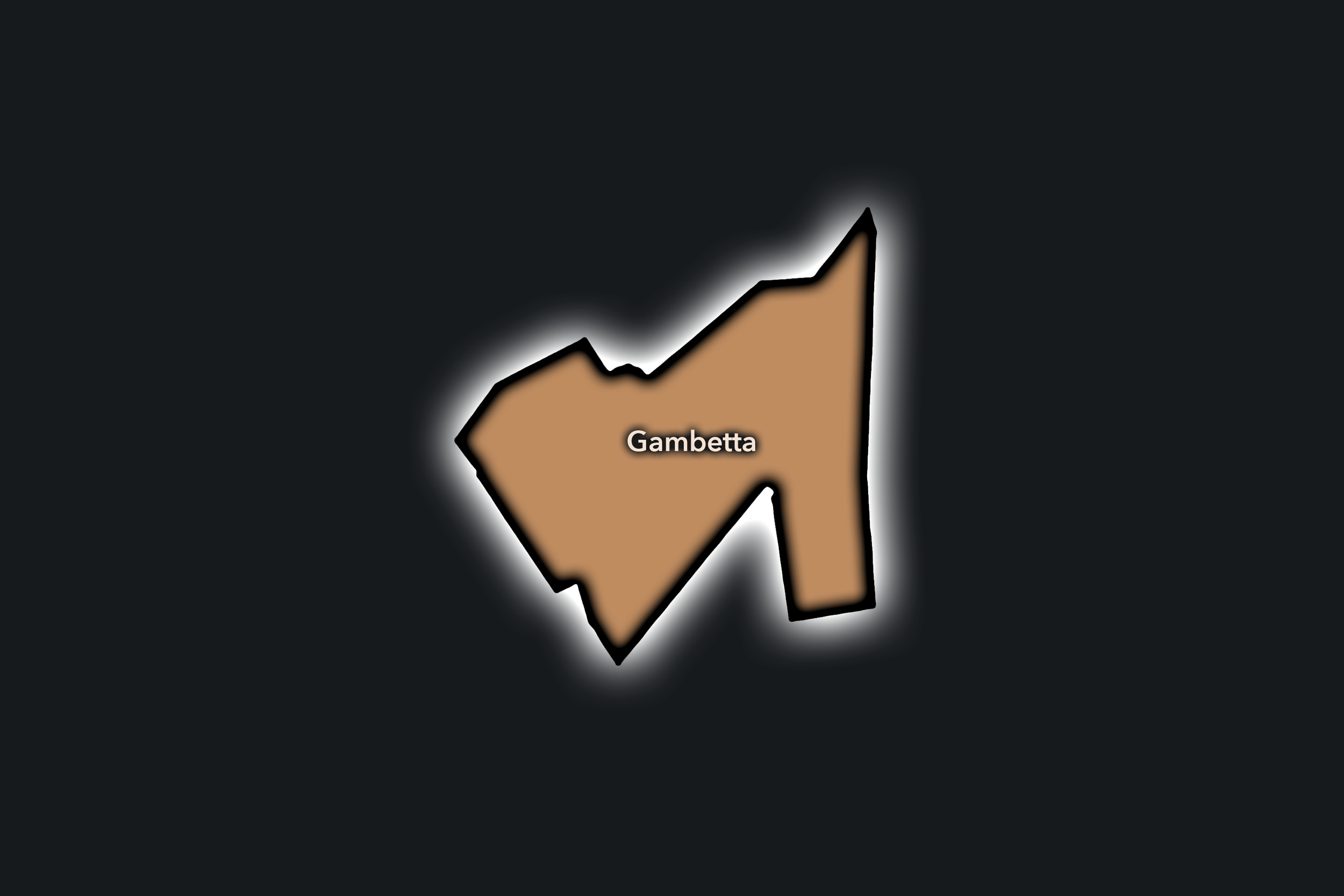
Gambetta
Civic Profile
The Gambetta Conseil de Quartier gives civic form to one of the 20e’s clearest local centers, where the mairie area, Place Gambetta, Avenue Gambetta, residential streets, schools, shops, cafés, cinemas, and the eastern edge of Père-Lachaise come together. As a civic territory, it organizes the arrondissement around a practical center of movement and neighborhood services: transit, municipal life, local commerce, public spaces, and the daily routines of residents from several surrounding districts.
On the ground, Gambetta feels civic, residential, and well anchored. It is less bohemian than Belleville and less village-like than Saint-Blaise, but it plays a central role in the functioning of the 20e: people come here for errands, administration, transit, cafés, shopping, schools, and routes toward Père-Lachaise or the eastern neighborhoods. Its civic themes center on pedestrian circulation, local commerce, public-space quality around Place Gambetta, school and family movement, accessibility, traffic, and the maintenance of a strong arrondissement center that remains genuinely local.
Gambetta: At a Glance
A curated list for you.
-
Major Streets
Avenue Gambetta
Rue Belgrand
Rue des Pyrénées
Rue de Bagnolet
Boulevard de Ménilmontant nearby
-
Public Spaces & Landmarks
Place Gambetta
Mairie du 20e arrondissement
Cimetière du Père-Lachaise nearby
Square Édouard-Vaillant
Théâtre de la Colline
-
Transit Access
Gambetta
Pelleport nearby
Père Lachaise nearby
Saint-Fargeau nearby
Porte de Bagnolet nearby
-
Shopping & Dining
Place Gambetta cafés
Avenue Gambetta shops
Rue Belgrand local commerce
Lou Pascalou nearby
Neighborhood bakeries around Gambetta
-
Hotels & Attractions
Mairie / Place Gambetta civic center
Père-Lachaise eastern edge
Théâtre de la Colline
Eastern 20e walking routes
Bagnolet / Saint-Fargeau access nearby
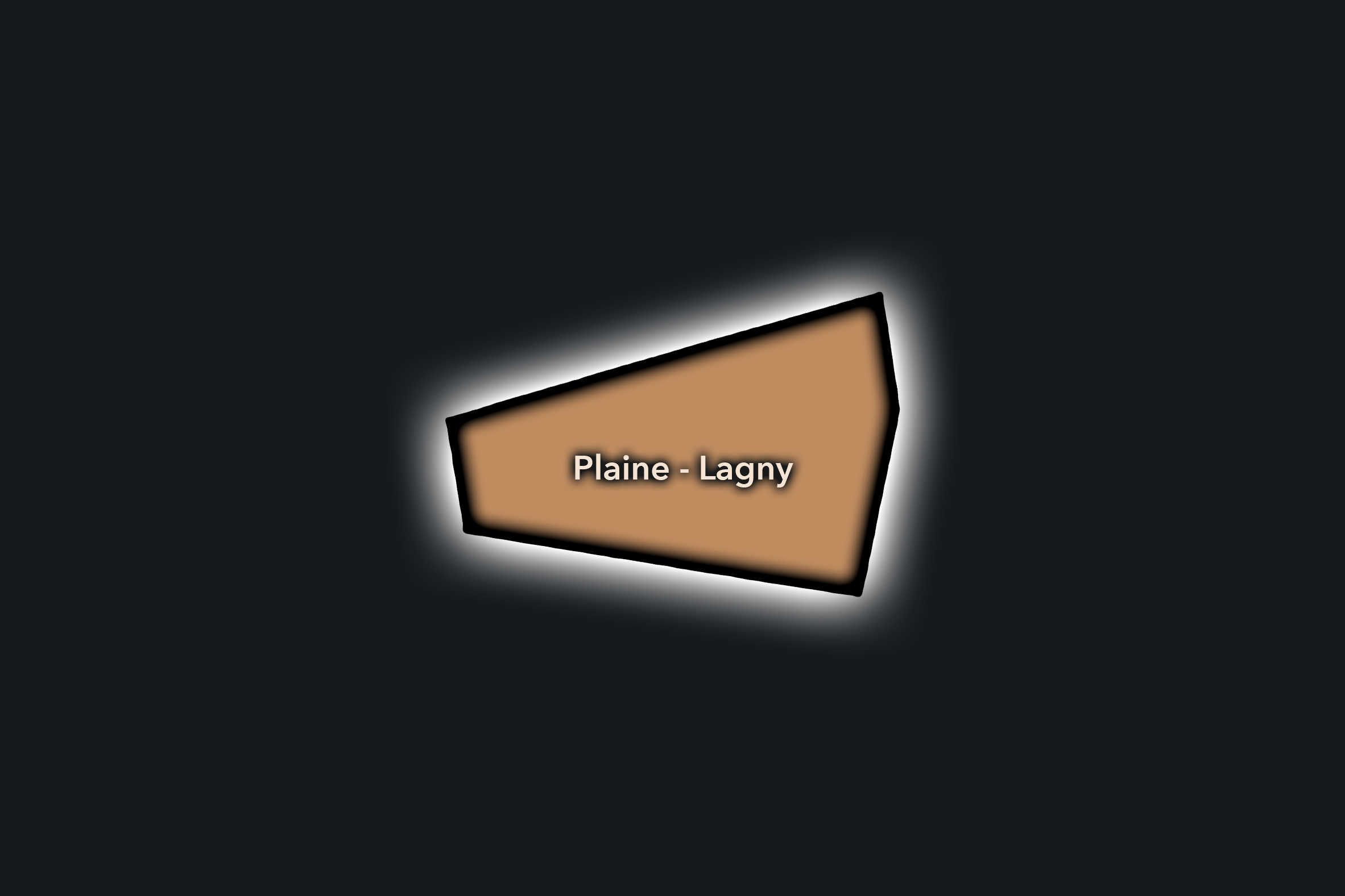
Plaine - Lagny
Civic Profile
The Plaine - Lagny Conseil de Quartier gives civic shape to the southeastern side of the 20e, where residential streets, schools, local shops, transit corridors, public housing, and the edge toward the 12e and eastern suburbs create a practical neighborhood landscape. As a civic territory, it is less defined by iconic landmarks than by everyday urban function: apartment blocks, school routes, small businesses, local parks, Metro access, and the movement between Charonne, Nation, Porte de Vincennes, and the eastern edge of Paris.
On the ground, Plaine - Lagny feels residential, grounded, and outward-facing. Its civic themes center on housing quality, school and family movement, pedestrian comfort, local commerce, greening, public-space maintenance, traffic near major corridors, and the relationship between neighborhood life and eastern gateway infrastructure. The CdQ layer is especially useful here because it gives visibility to a quieter part of the 20e whose importance lies in daily use rather than postcard identity.
Plaine - Lagny: At a Glance
A curated list for you.
-
Major Streets
Rue d’Avron
Rue de Lagny
Boulevard de Charonne
Cours de Vincennes
Rue des Pyrénées nearby
-
Public Spaces & Landmarks
Porte de Vincennes nearby
Place de la Nation nearby
Square Sarah-Bernhardt nearby
Jardin de la Gare de Charonne nearby
Charonne neighborhood edge
-
Transit Access
Maraîchers
Porte de Vincennes
Buzenval
Avron nearby
Nation nearby
-
Shopping & Dining
Rue d’Avron local shops
Rue de Lagny neighborhood commerce
Cours de Vincennes cafés
Charonne-side dining nearby
Local bakeries around Maraîchers
-
Hotels & Attractions
Porte de Vincennes gateway
Nation nearby
Charonne residential walking route
Eastern Paris neighborhood streets
12e / 20e edge access
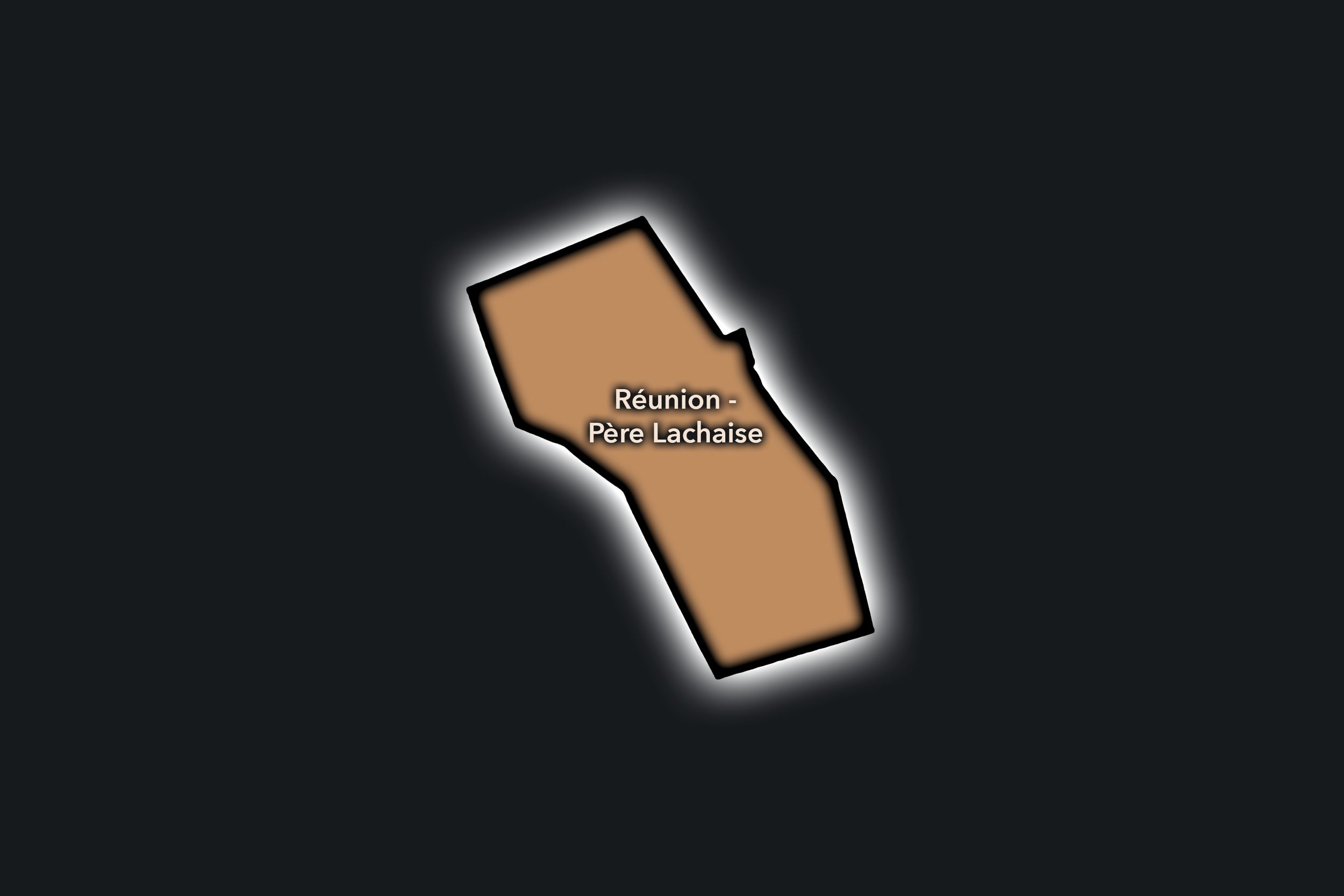
Réunion - Père-Lachaise
Civic Profile
The Réunion - Père-Lachaise Conseil de Quartier gives civic shape to a central-southern portion of the 20e, where the cemetery landscape of Père-Lachaise meets residential streets, schools, market corridors, local cafés, apartment blocks, and the neighborhood life around Réunion and Charonne. As a civic territory, it brings together one of Paris’s most visited memorial landscapes with the everyday public life of eastern Paris: cemetery walls, transit access, school streets, local commerce, and residential routines all share the same civic frame.
On the ground, Réunion - Père-Lachaise feels quieter and more residential than Belleville or Ménilmontant, but its public identity is strongly shaped by the presence of the cemetery and the streets that gather around it. Its civic themes center on pedestrian circulation near Père-Lachaise, preservation of residential quality of life, school and family movement, public-space maintenance, local market and café activity, traffic near major corridors, and the balance between visitor routes and the lived neighborhood fabric surrounding one of the city’s most famous landscapes.
Réunion - Père-Lachaise: At a Glance
A curated list for you.
-
Major Streets
Rue de Bagnolet
Rue des Pyrénées
Rue de la Réunion
Boulevard de Ménilmontant
Rue d’Avron nearby
-
Public Spaces & Landmarks
Cimetière du Père-Lachaise
Place de la Réunion
Église Saint-Germain de Charonne nearby
Square Sarah-Bernhardt nearby
Jardin naturel Pierre-Emmanuel nearby
-
Transit Access
Père Lachaise
Alexandre Dumas
Buzenval nearby
Gambetta nearby
Philippe Auguste nearby
-
Shopping & Dining
Place de la Réunion cafés
Rue de Bagnolet local shops
Rue des Pyrénées neighborhood commerce
Mama Shelter dining nearby
Local bakeries around Réunion
-
Hotels & Attractions
Père-Lachaise visitor route
Charonne village streets nearby
Place de la Réunion neighborhood center
Eastern 20e residential walking route
Belleville / Ménilmontant nearby
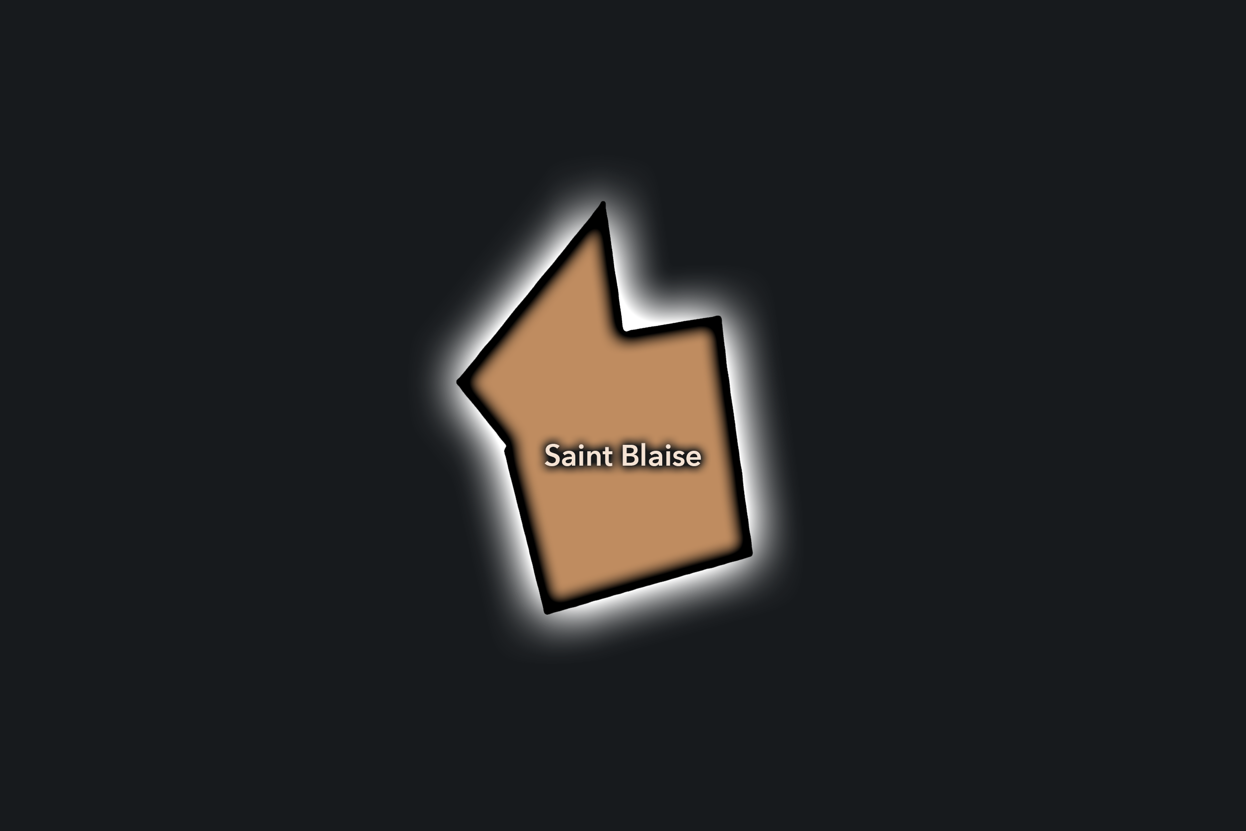
Saint-Blaise
Civic Profile
The Saint-Blaise Conseil de Quartier gives civic form to one of the 20e’s most intimate historic landscapes, where the old village fabric of Charonne survives within a dense modern arrondissement. Centered around Rue Saint-Blaise, Église Saint-Germain de Charonne, small passages, residential blocks, schools, local shops, and the surrounding streets near Porte de Montreuil and Rue de Bagnolet, this CdQ gathers a distinctive village memory into a contemporary civic frame.
On the ground, Saint-Blaise feels unusually enclosed, local, and textured. Narrow streets, older buildings, church walls, small businesses, schools, and apartment blocks create a district that feels different from both the hillier Belleville-Ménilmontant side of the 20e and the broader gateway corridors to the east. Its civic themes center on heritage preservation, pedestrian comfort, school and residential life, local commerce, public-space quality, traffic near the portes, and the challenge of protecting a small-scale neighborhood atmosphere within a dense and heavily used eastern Paris district.
Saint-Blaise: At a Glance
A curated list for you.
-
Major Streets
Rue Saint-Blaise
Rue de Bagnolet
Boulevard Davout
Rue des Pyrénées nearby
Rue Vitruve nearby
-
Public Spaces & Landmarks
Église Saint-Germain de Charonne
Charonne village streets
Square des Grès
Jardin naturel Pierre-Emmanuel nearby
Porte de Montreuil nearby
-
Transit Access
Porte de Bagnolet
Porte de Montreuil
Maraîchers nearby
Gambetta nearby
Alexandre Dumas nearby
-
Shopping & Dining
Rue Saint-Blaise local shops
Rue de Bagnolet cafés and restaurants
Charonne neighborhood bakeries
Mama Shelter nearby
Local dining around Porte de Bagnolet
-
Hotels & Attractions
Saint-Blaise village walking route
Église Saint-Germain de Charonne
Charonne historic streets
Porte de Bagnolet gateway
Père-Lachaise nearby
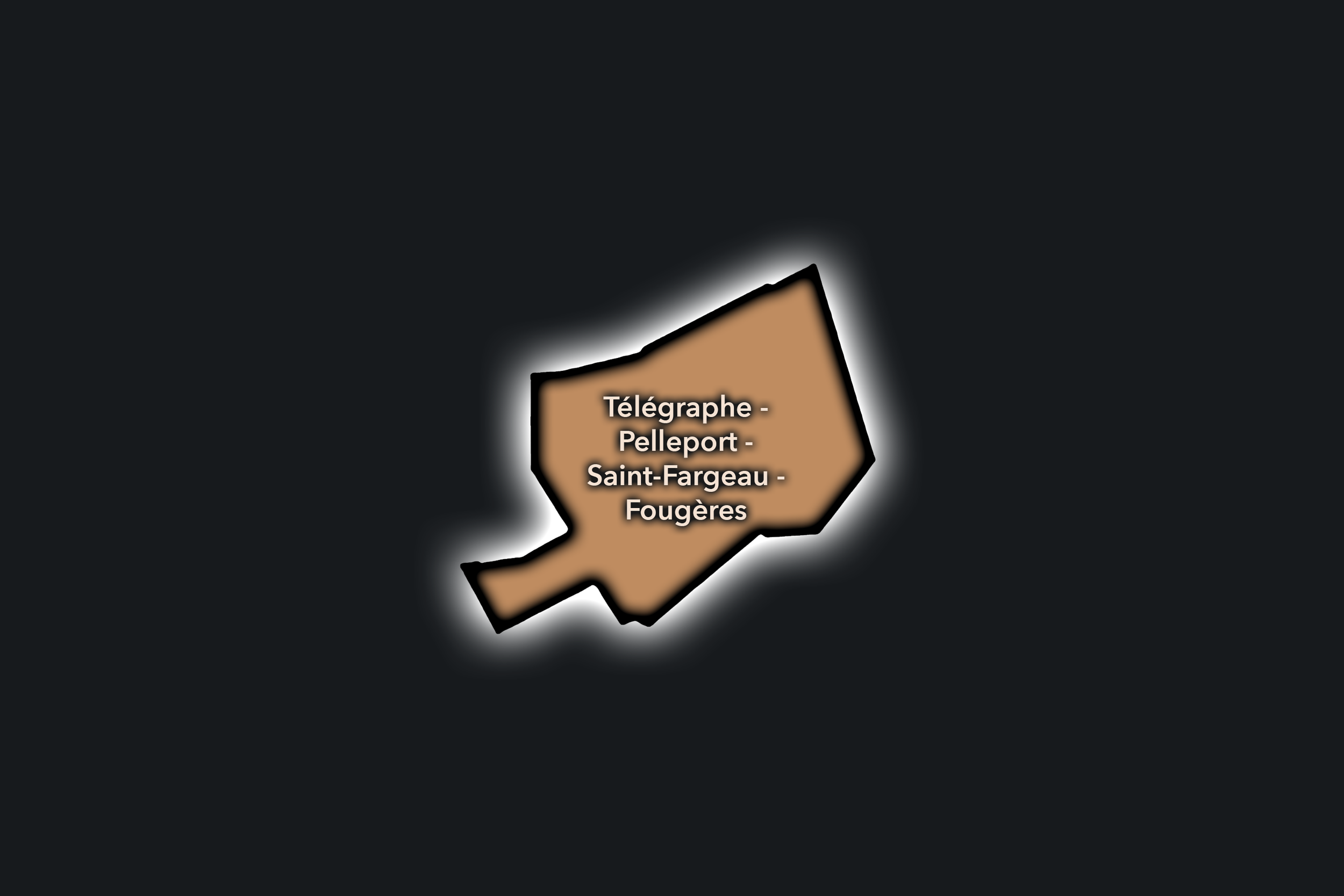
Télégraphe - Pelleport - Saint-Fargeau
Civic Profile
The Télégraphe - Pelleport - Saint-Fargeau Conseil de Quartier organizes the northeastern side of the 20e, where the arrondissement rises toward some of Paris’s highest ground and turns outward toward Porte des Lilas, Bagnolet, and the eastern edge of the city. As a civic territory, it is shaped by residential streets, schools, apartment blocks, local shops, transit corridors, public housing, small parks, and the practical relationship between hilltop Paris and the communes beyond the périphérique.
On the ground, Télégraphe - Pelleport - Saint-Fargeau feels residential, elevated, and edge-oriented. It is less visitor-facing than Belleville or Père-Lachaise, but it carries a strong local civic role through schools, Metro access, family routines, neighborhood commerce, and public spaces serving residents on the heights of eastern Paris. Its civic themes center on pedestrian comfort on sloped streets, transit access, housing quality, school and family movement, greening, traffic near the portes, and the challenge of making an outward-facing district feel locally cohesive.
Télégraphe - Pelleport - Saint-Fargeau: At a Glance
A curated list for you.
-
Major Streets
Rue de Belleville
Rue Pelleport
Rue Haxo
Avenue Gambetta
Boulevard Mortier
-
Public Spaces & Landmarks
Télégraphe high ground
Hôpital Robert-Debré nearby
Porte des Lilas nearby
Square Séverine nearby
Saint-Fargeau neighborhood streets
-
Transit Access
Télégraphe
Pelleport
Saint-Fargeau
Porte des Lilas nearby
Pré Saint-Gervais nearby
-
Shopping & Dining
Rue de Belleville local shops
Pelleport neighborhood cafés
Saint-Fargeau bakeries and food shops
Porte des Lilas cafés nearby
Local dining around Avenue Gambetta
-
Hotels & Attractions
Télégraphe hilltop route
Porte des Lilas gateway
Saint-Fargeau residential streets
Belleville upper approaches nearby
Eastern Paris boundary walk
The Photography
Visual Identity

The visual identity of each Paris district begins with its position in the city’s layered geography. Before the photographs arrive, the maps establish a first way of seeing: where the district sits, what civic layer it belongs to, which boundaries define it, and how it connects to the surrounding fabric of Paris. In CityNeighborhoods Paris, cartography is not merely orientation; it is part of the visual language of the project.
As the photographic archive grows, this section will continue to develop through images gathered on foot. Streets, façades, monuments, markets, parks, river edges, passages, signs, textures, and everyday details will gradually reveal how each district presents itself visually. The goal is not only to show what a place looks like, but to trace how its identity becomes visible through form, atmosphere, memory, and use.
Through The Lens

CityNeighborhoods Paris is built from walking, looking, and returning. Each district is approached through photography as a way of paying attention: to the obvious landmarks and the quieter details, to historic structures and ordinary streets, to the moments where civic geography becomes lived experience. The camera becomes a tool for noticing how Paris changes from one district to the next, and how each place holds its own relationship to the larger city.
As photographs are processed and added, this section will become a more specific visual record of the district. Future updates may include dated field notes, galleries, and reflections from individual walks. For now, the page remains part of the larger CityNeighborhoods effort to document every Paris neighborhood through maps, history, identity, and photography — one district, one walk, and one visual encounter at a time.
If you visit Paris, these ideas can help inspire your own photography.


Paris: J’Espere, Je Rêve, Je Vive
Paris Photo Gallery
Paris Flâneur Notes
Flâneur Notes document the walks, photographs, light, and street-level observations behind this neighborhood entry. Learn more about the Spirit of the Flâneur.


Explore Paris
-

The twenty arrondissements form the civic spiral of Paris, organizing the city into its broad local districts of government, identity, and daily life.
-

Each arrondissement is divided into four official administrative quarters, giving Paris a more precise civic and geographic framework.
-

The conseils de quartier bring participation to street level, giving residents a voice in neighborhood needs, public space, and local civic life.
-

Les Deux Rives trace Paris through the Seine’s two banks, revealing how the Rive Droite and Rive Gauche shaped the city’s civic power, commerce, learning, art, and cultural identity.
-

Cultural neighborhoods reveal the Paris people recognize through history, cafés, architecture, memory, atmosphere, and local belonging.