
6e - LUXEMBOURG
Les Conseils de Quartier
The conseils de quartier of the 6e divide one of Paris’s most storied Left Bank landscapes into local civic spaces, carrying Saint-Germain-des-Prés, Odéon, Luxembourg, and Montparnasse-adjacent streets into a more intimate neighborhood frame. Part of an ongoing project to walk and photograph every neighborhood in Paris, this page explores the conseils de quartier of 6e Luxembourg through maps, local identity, civic geography, and photography.
Explore This Page


Explore the Conseils de Quartier of the 6e — Luxembourg.

Overview
Geographic Setting
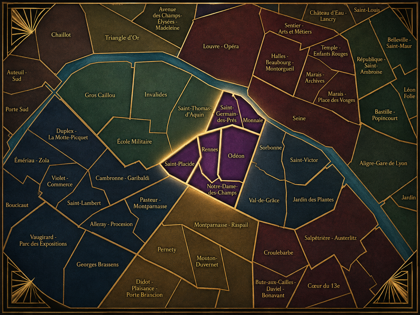
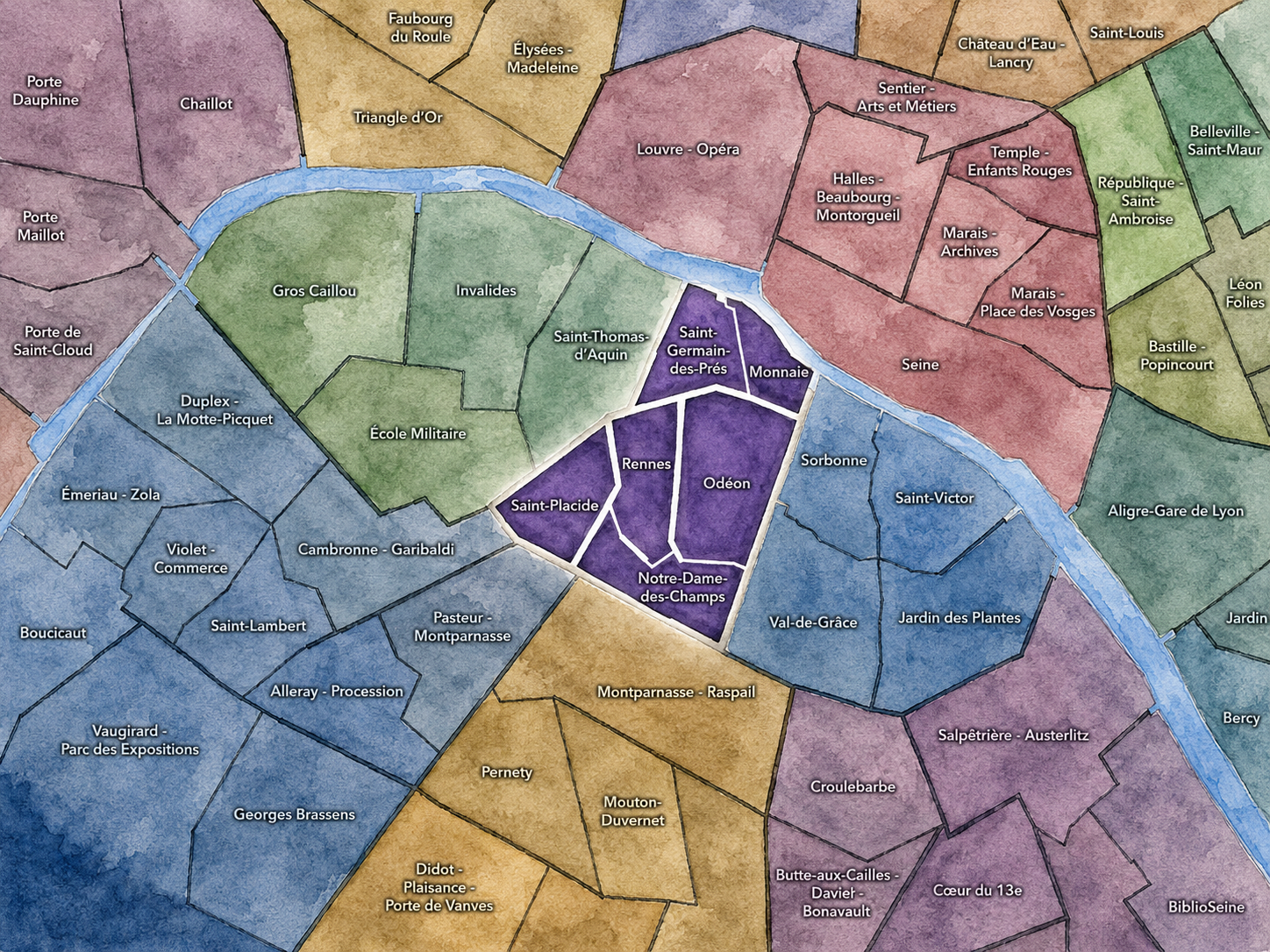
The Conseils de Quartier of the 6e organize local civic life across one of the most symbolically recognizable districts of the Left Bank. Set between the Seine and the southern approaches toward Montparnasse, the 6e moves from riverfront institutions and historic bridges through Saint-Germain-des-Prés, Odéon, the Luxembourg Garden, Rennes, Saint-Placide, and Notre-Dame-des-Champs. It is compact, elegant, and intensely layered: literary cafés, publishing streets, religious institutions, schools, galleries, theaters, embassies, residential blocks, commercial corridors, and one of Paris’s great public gardens all pressed into a relatively small arrondissement.
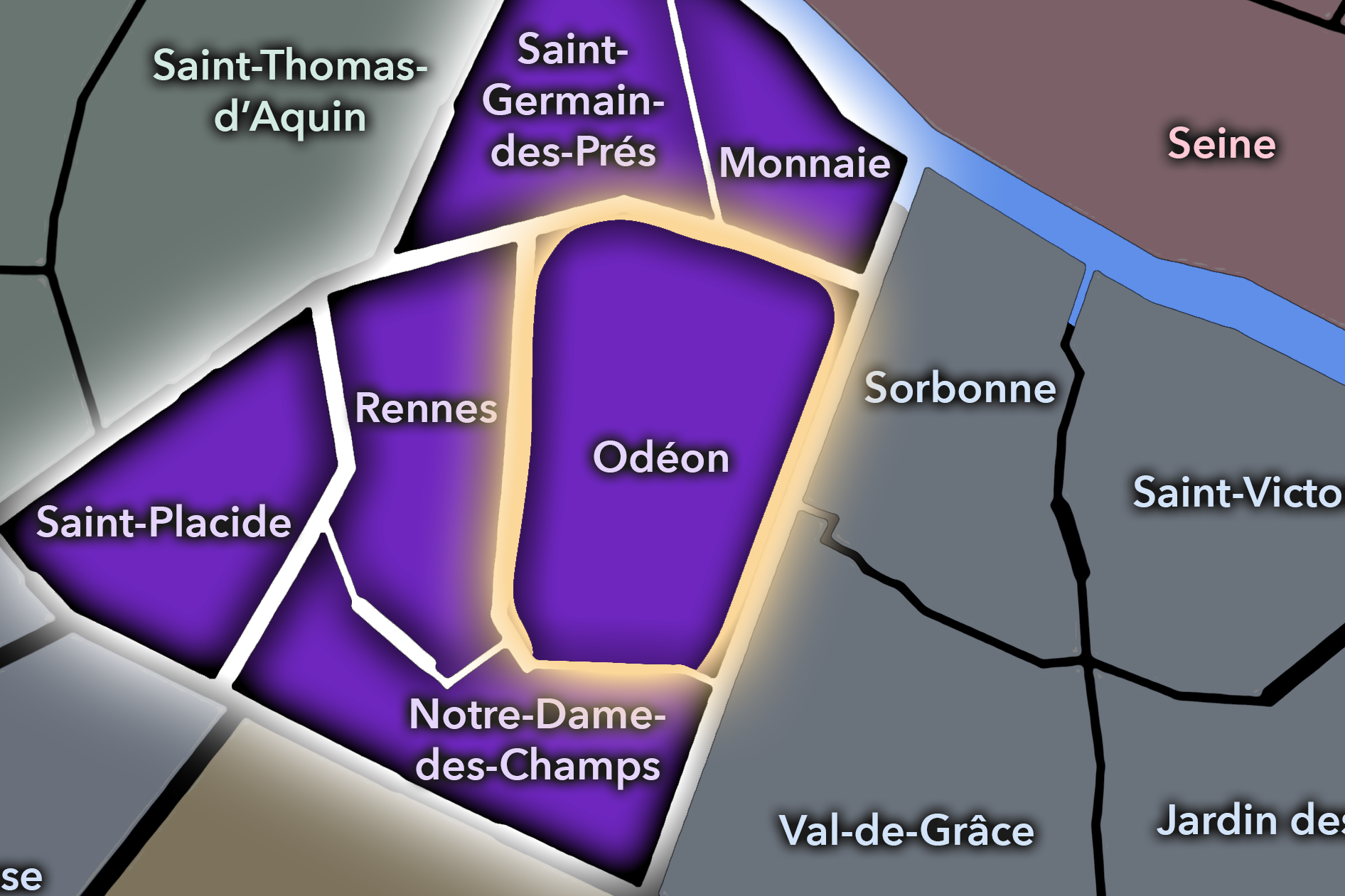
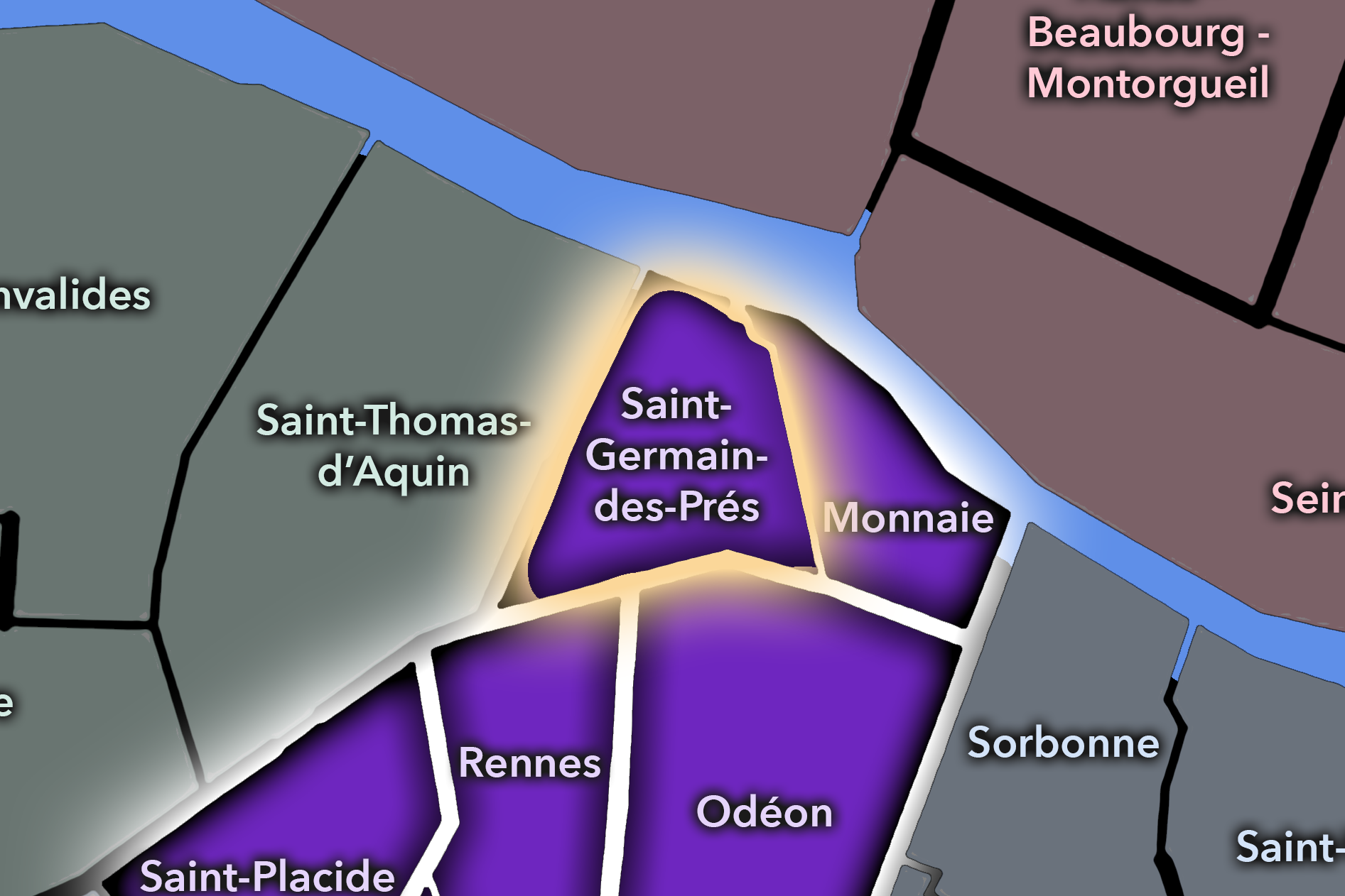
The 6e’s Conseil de Quartier structure divides this landscape into six local civic territories: Monnaie, Odéon, Rennes, Saint-Placide, Notre-Dame-des-Champs, and Saint-Germain-des-Prés. Unlike the 5e, where the CdQs correspond directly to the four Administrative Quarters, the 6e uses a more granular participatory structure. Its councils do not simply repeat the older four-quarter grid; they break the arrondissement into smaller civic areas shaped by local streets, institutional anchors, commercial corridors, garden edges, and historic neighborhood identities.
Together, these six CdQs reveal the 6e as more than a single Left Bank image. Monnaie gives civic form to the river-facing western edge near the Seine and the Institut de France; Saint-Germain-des-Prés gathers one of Paris’s most famous cultural districts into a local framework; Odéon centers the theater, university, and literary terrain around the Luxembourg’s northern approaches; Rennes and Saint-Placide organize the arrondissement’s commercial and residential corridors; and Notre-Dame-des-Champs links the southern 6e to the garden, schools, churches, studios, and quieter streets leading toward Montparnasse.
Civic Framework
The 6e’s Conseils de Quartier provide a neighborhood-level civic structure for an arrondissement whose identity is both intensely local and internationally recognizable. They give residents, shopkeepers, cultural institutions, schools, religious communities, students, workers, and visitors a more precise scale for local participation than the arrondissement as a whole. This matters in a district where heritage streets, luxury commerce, cafés, schools, galleries, tourism, public gardens, theater traffic, and residential life often occupy the same narrow urban spaces.
The six-council structure suggests that the 6e benefits from a finer civic grain than its official Administrative Quarters alone can provide. Rather than treating the arrondissement as four broad historic units, the CdQ map distinguishes smaller areas of use and identity: the riverfront and institutional Monnaie quarter, the Saint-Germain-des-Prés cultural core, the Odéon theater and academic district, the Rennes commercial spine, the Saint-Placide residential and shopping corridor, and the Notre-Dame-des-Champs / Luxembourg / Montparnasse-facing edge. This makes the CdQ layer especially useful in the 6e, where small shifts of a few blocks can change the feel of the city considerably.
As a civic framework, the 6e’s CdQs help organize the practical questions that come with a prestigious but lived-in Left Bank district: pedestrian movement, tourist pressure, café and restaurant use, preservation of historic streets, commercial vitality, school and residential routines, garden access, event traffic, and the ongoing balance between local neighborhood life and the global image of Saint-Germain and the Latin-Left-Bank tradition.
Local Expression
Viewed through its Conseils de Quartier, the 6e becomes a collection of smaller Left Bank worlds rather than a single postcard of literary Paris. Saint-Germain-des-Prés expresses the arrondissement’s famous café, gallery, church, and publishing identity, while Monnaie draws the district toward the Seine, bridges, academies, riverfront institutions, and the older western edge of the Left Bank. Odéon brings together theater, books, cinemas, university life, and the northern approaches to the Luxembourg Garden.
Rennes and Saint-Placide reveal a more everyday commercial and residential 6e: shopping streets, local services, apartment blocks, schools, cafés, and the practical movement of residents and visitors between Montparnasse, Saint-Germain, and the Luxembourg area. Notre-Dame-des-Champs gives the arrondissement a quieter southern expression, shaped by studios, churches, schools, garden edges, and streets that feel closer to Montparnasse than to the riverfront.
The value of the CdQ layer in the 6e is that it breaks apart a district often reduced to a few celebrated images. Through its six councils, the arrondissement can be read at the level of local civic experience: the café terrace, the bookshop street, the garden gate, the school block, the market route, the theater entrance, the river crossing, and the residential side street. These CdQs make visible the practical neighborhood life beneath one of Paris’s most enduring cultural myths.
Les Conseils de Quartier
Monnaie
Civic Profile
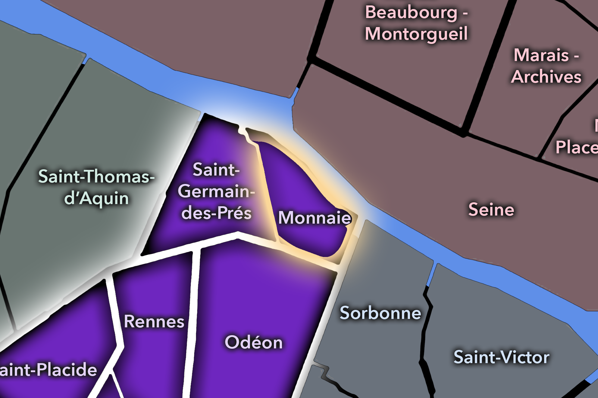
The Monnaie Conseil de Quartier gives civic form to the river-facing western edge of the 6e, where the Left Bank meets the Seine, the Pont Neuf, the Institut de France, the École des Beaux-Arts, and the historic streets between Saint-Germain-des-Prés and the Latin Quarter. As a civic territory, it gathers some of the arrondissement’s oldest urban fabric into a compact local frame shaped by bridges, quays, galleries, academic institutions, visitor routes, residential streets, and the cultural weight of the riverfront. The 6e mairie identifies Monnaie as one of the arrondissement’s six Conseils de Quartier.
On the ground, Monnaie feels dense, historic, and unusually connected to the wider center of Paris. Its streets move between river views, art schools, antique galleries, cafés, small hotels, bookshops, and quiet residential passages, while its bridges place it in constant conversation with the Louvre, Île de la Cité, and the Right Bank. Its civic themes center on pedestrian circulation near the Seine, preservation of historic streets, cultural access, gallery and visitor activity, riverfront use, and the balance between local life and one of the most photographed approaches to the Left Bank.
Monnaie: At a Glance
A curated list for you.
-

Major Streets
Quai de Conti
Rue de Seine
Rue Bonaparte
Rue Mazarine
Rue Dauphine
-

Public Spaces & Landmarks
Monnaie de Paris
Institut de France
École nationale supérieure des Beaux-Arts
Pont Neuf
Square Gabriel-Pierné
-

Transit Access
Pont Neuf
Odéon nearby
Saint-Germain-des-Prés nearby
Mabillon nearby
Saint-Michel - Notre-Dame nearby
-

Shopping & Dining
Rue de Seine galleries and cafés
Rue Mazarine restaurants
Le Procope nearby
La Palette
Semilla
-

Hotels & Attractions
Monnaie de Paris visitor route
Institut de France riverfront
Pont Neuf and Seine walks
École des Beaux-Arts area
Left Bank gallery district
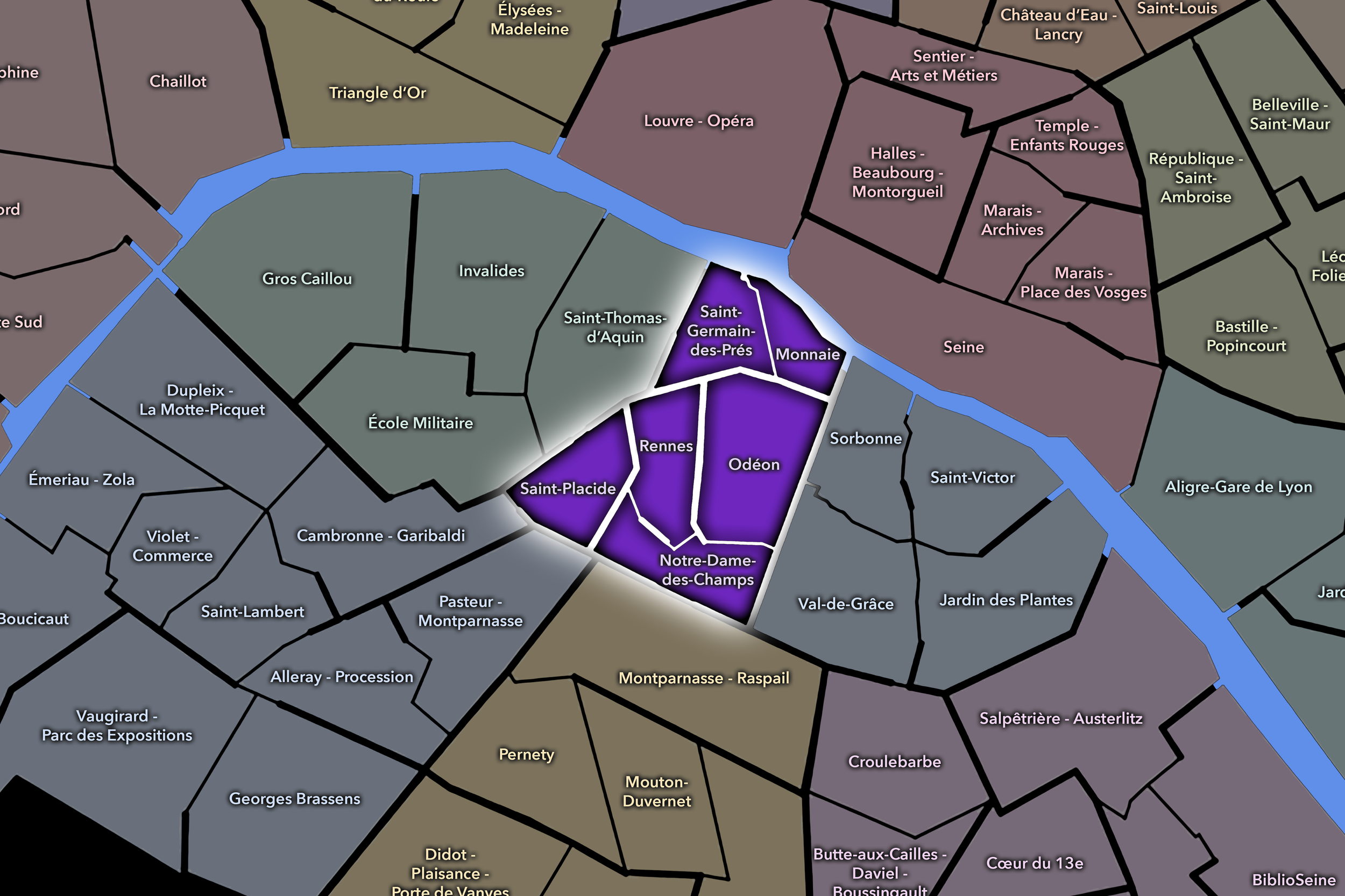
Notre-Dame-des-Champs
Civic Profile
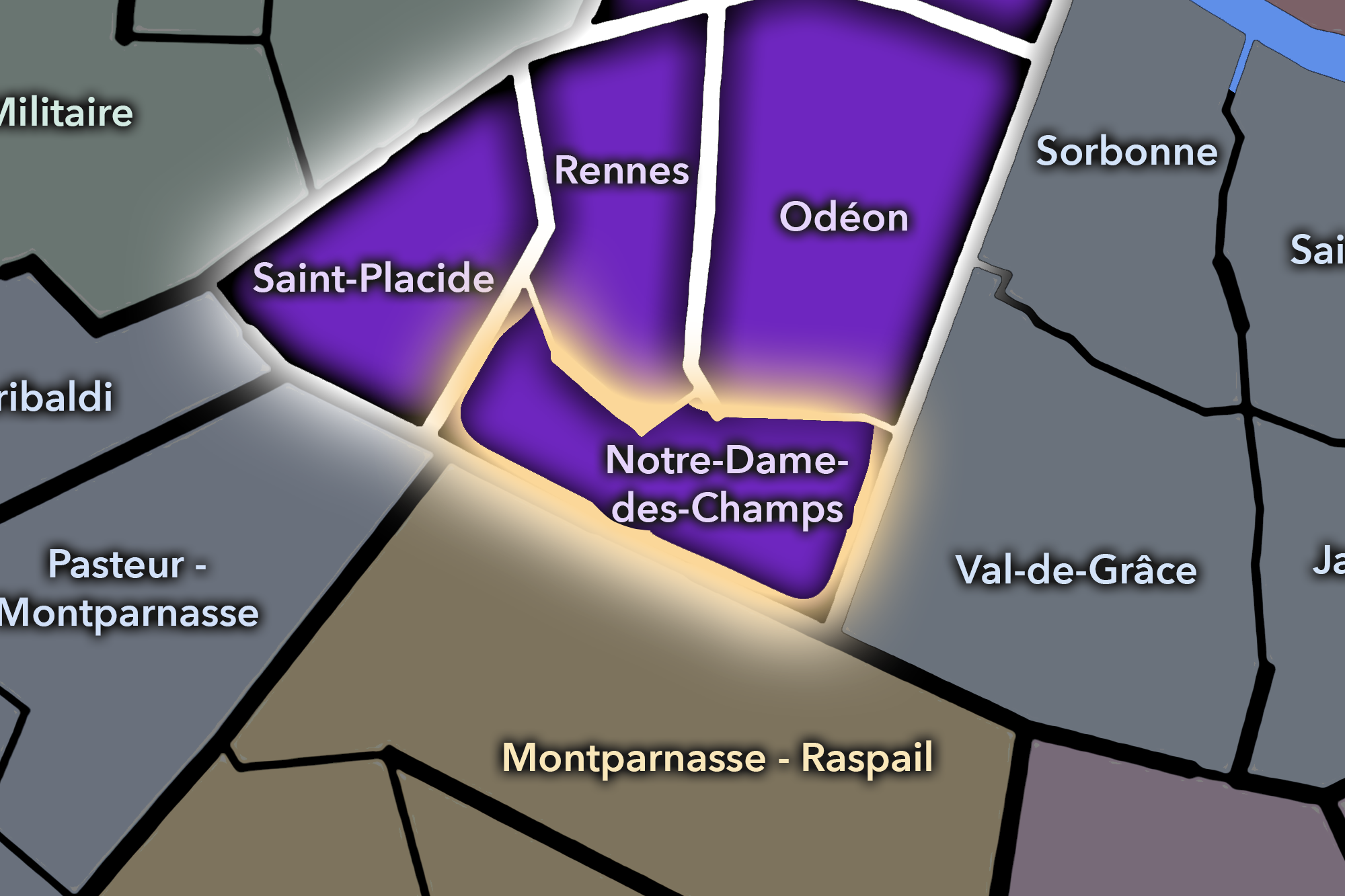
The Notre-Dame-des-Champs Conseil de Quartier organizes the southern and southeastern portion of the 6e, where the arrondissement turns toward the Luxembourg Garden, Port-Royal, Montparnasse, and the educational and religious streets south of Saint-Germain. Its civic geography is defined by garden edges, schools, churches, studios, apartment blocks, small hotels, cafés, and the steady movement between the Latin Quarter, Montparnasse, and the residential Left Bank. It is one of the 6e’s more quietly local districts, less dominated by visitor landmarks than by institutions, side streets, and daily circulation.
On the ground, Notre-Dame-des-Champs feels scholarly, residential, and gently transitional. It draws some of its identity from the Luxembourg Garden and the church of Notre-Dame-des-Champs, but much of its civic life unfolds in the ordinary spaces between them: school entrances, café corners, residential streets, bookish corridors, and routes toward Montparnasse. Its civic themes center on garden access, school and student movement, residential quality of life, pedestrian comfort, traffic along major boulevards, and the preservation of quieter local streets within a district surrounded by better-known Left Bank destinations.
Notre-Dame-des-Champs: At a Glance
A curated list for you.
-
Major Streets
Rue Notre-Dame-des-Champs
Boulevard du Montparnasse
Rue d’Assas
Rue de Vaugirard
Boulevard Raspail
-
Public Spaces & Landmarks
Jardin du Luxembourg
Église Notre-Dame-des-Champs
Institut Catholique de Paris
Théâtre de Poche-Montparnasse
Musée Zadkine nearby
-
Transit Access
Notre-Dame-des-Champs
Vavin
Rennes
Raspail nearby
Luxembourg nearby
-
Shopping & Dining
Boulevard du Montparnasse cafés
Rue Notre-Dame-des-Champs dining
La Closerie des Lilas nearby
La Rotonde nearby
Le Dôme nearby
-
Hotels & Attractions
Luxembourg Garden southern edge
Montparnasse café circuit
Musée Zadkine nearby
Notre-Dame-des-Champs church and local streets
Port-Royal / Raspail walking route
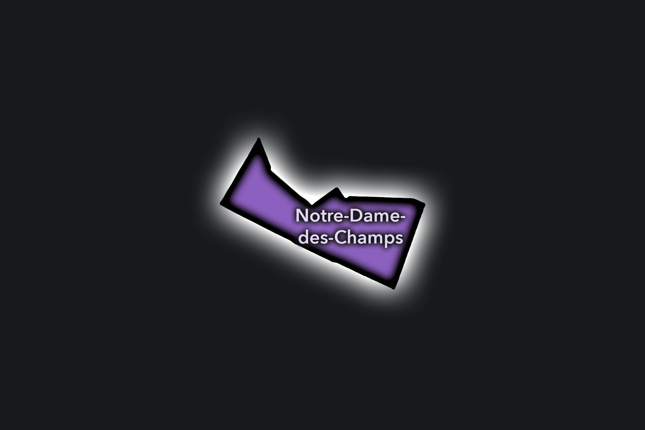
Odéon
Civic Profile
The Danube Conseil de Quartier organizes one of the 19e’s elevated and residential eastern landscapes, where the hill streets around Danube, Buttes-Chaumont, Place des Fêtes, and the approaches toward Porte des Lilas create a distinctive neighborhood geography. As a civic territory, it is shaped by apartment blocks, schools, local shops, public housing, sloped streets, gardens, transit access, and the strong topographic character that gives this part of the 19e a very different feel from the canal districts below.
On the ground, Danube feels residential, high-set, and locally focused. Its civic themes center on pedestrian comfort on sloped streets, access to green space, school and family movement, housing quality, local commerce, public-space maintenance, and the challenge of connecting hilltop neighborhood life to the larger transit and park systems of northeastern Paris. The CdQ layer is valuable here because it distinguishes a quieter but strongly lived part of the 19e, where daily civic life is shaped by elevation, housing, schools, and local public spaces.
Odéon: At a Glance
A curated list for you.
-
Major Streets
Boulevard Saint-Germain
Boulevard Saint-Michel
Rue de l’Ancienne Comédie
Rue de Buci
Rue de l’Odéon
-
Public Spaces & Landmarks
Théâtre de l’Odéon
Place de l’Odéon
Cour du Commerce Saint-André
Jardin du Luxembourg nearby
Église Saint-Sulpice nearby
-
Transit Access
Odéon
Mabillon
Saint-Germain-des-Prés
Luxembourg nearby
Cluny - La Sorbonne nearby
-
Shopping & Dining
Le Procope
Rue de Buci cafés and food shops
Marché Saint-Germain nearby
Brasserie Lipp nearby
Prescription Cocktail Club
-
Hotels & Attractions
Odéon theater district
Cour du Commerce Saint-André
Saint-Germain / Latin Quarter walking route
Luxembourg Garden approaches
Historic café and literary circuit
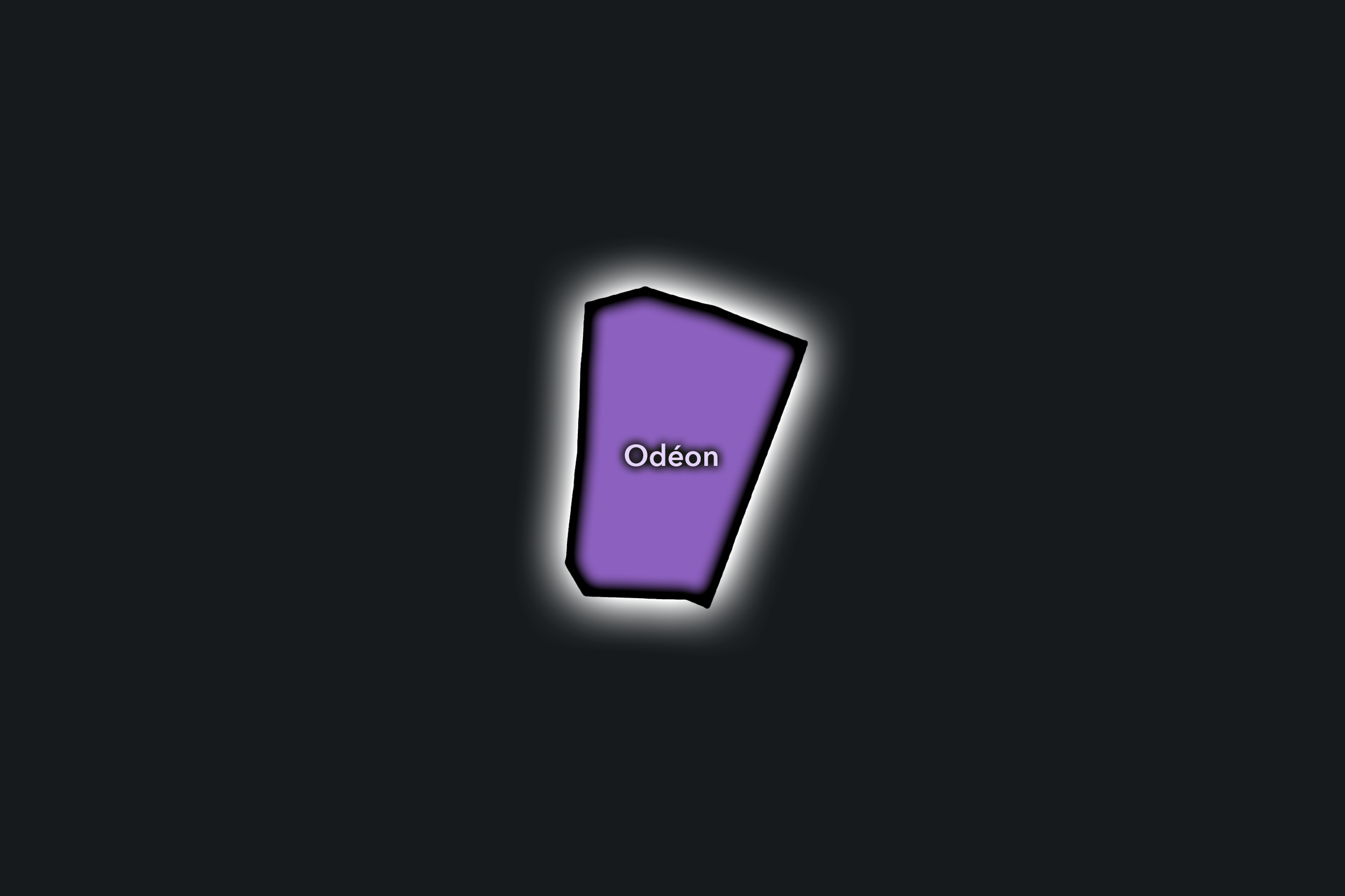
Rennes
Civic Profile
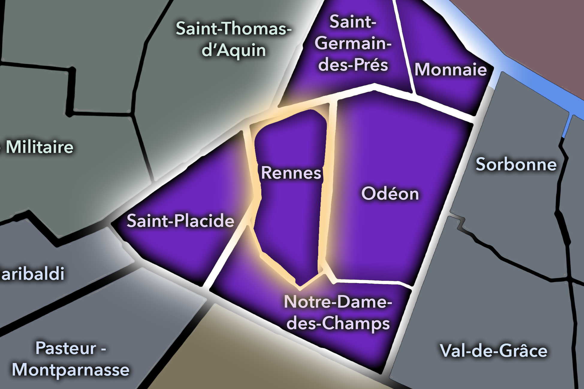
The Rennes Conseil de Quartier gives civic shape to one of the 6e’s strongest commercial and movement corridors, organized around Rue de Rennes and the streets linking Saint-Germain-des-Prés, Saint-Sulpice, Sèvres-Babylone, and Montparnasse. Unlike the river-facing Monnaie or the theater-centered Odéon, Rennes is defined by circulation: shopping streets, Metro access, churches, schools, residential blocks, cafés, department-store proximity, and the steady flow between the Left Bank’s cultural core and its southern transit landscapes.
On the ground, Rennes feels practical, urban, and highly used. It carries some of the 6e’s most everyday commercial life, balancing chain retail and local shops, café terraces, residential side streets, religious and cultural landmarks, and the movement of commuters, students, shoppers, and visitors. Its civic themes center on pedestrian comfort, commercial vitality, traffic and transit access, public-space quality around major intersections, and the balance between the 6e as a destination and the 6e as a lived neighborhood.
Rennes: At a Glance
A curated list for you.
-
Major Streets
Rue de Rennes
Boulevard Saint-Germain
Rue du Four
Rue de Sèvres
Rue Bonaparte
-
Public Spaces & Landmarks
Église Saint-Sulpice
Place Saint-Sulpice
Marché Saint-Germain
Square Félix-Desruelles
Le Bon Marché nearby
-
Transit Access
Saint-Sulpice
Sèvres - Babylone
Rennes
Saint-Placide nearby
Mabillon nearby
-
Shopping & Dining
Rue de Rennes shopping corridor
Marché Saint-Germain
Brasserie Lipp
Pierre Hermé Bonaparte
Poilâne nearby
-
Hotels & Attractions
Saint-Sulpice visitor route
Saint-Germain-des-Prés café district nearby
Le Bon Marché / Sèvres-Babylone shopping district
Luxembourg Garden nearby
Montparnasse approach corridor
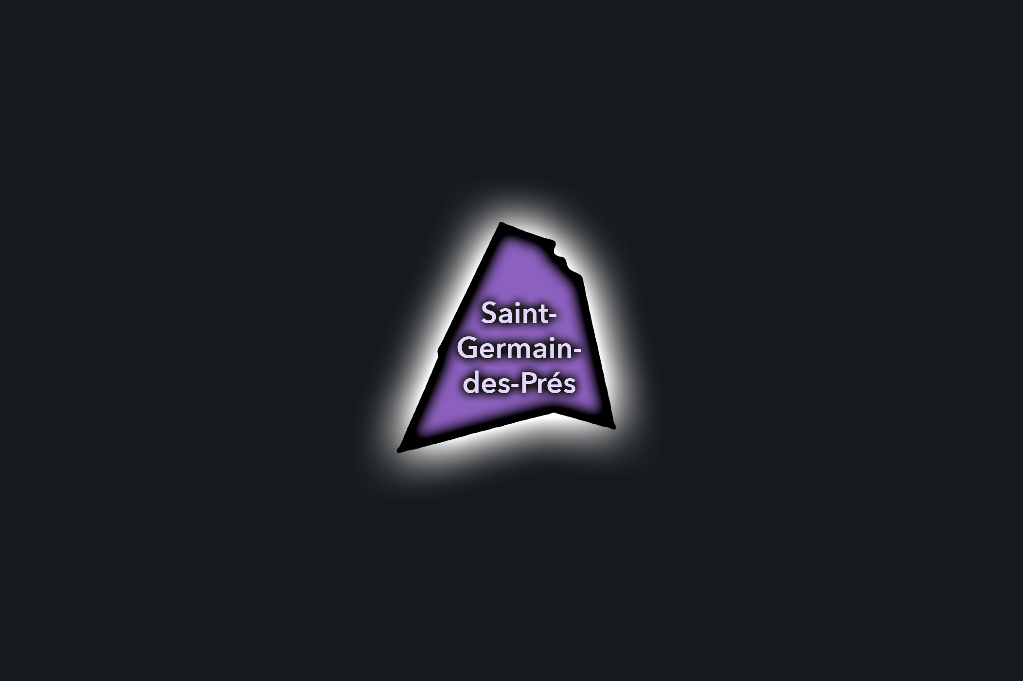
Saint-Germain-des-Prés
Civic Profile
The Saint-Germain-des-Prés Conseil de Quartier gives civic form to one of Paris’s most famous cultural landscapes: the church, cafés, galleries, publishing streets, hotels, boutiques, and residential blocks clustered around Boulevard Saint-Germain and the historic abbey quarter. As a local civic territory, it must hold together two realities at once: Saint-Germain as a globally recognized symbol of literary, artistic, and café culture, and Saint-Germain as a lived neighborhood of residents, shops, schools, churches, public spaces, and daily routines. The 6e mairie lists Saint-Germain-des-Prés among the arrondissement’s six Conseils de Quartier.
On the ground, Saint-Germain-des-Prés feels polished, historic, and intensely used. Café terraces, luxury shops, galleries, churches, small hotels, and visitor routes create a constant public rhythm, while side streets still hold quieter residential and institutional textures. Its civic themes center on pedestrian circulation, café and terrace use, commercial pressure, preservation of historic streets, visitor management, and the challenge of keeping a legendary Parisian district locally habitable. Les Deux Magots and Café de Flore remain two of the district’s most recognizable café anchors, both closely associated with Saint-Germain-des-Prés’s literary and cultural image.
Saint-Germain-des-Prés: At a Glance
A curated list for you.
-
Major Streets
Boulevard Saint-Germain
Rue Bonaparte
Rue de Rennes
Rue Jacob
Rue de l’Abbaye
-
Public Spaces & Landmarks
Église Saint-Germain-des-Prés
Place Saint-Germain-des-Prés
Musée national Eugène-Delacroix
Square Laurent-Prache
Institut de France nearby
-
Transit Access
Saint-Germain-des-Prés
Mabillon
Saint-Sulpice
Odéon nearby
Sèvres - Babylone
-
Shopping & Dining
Café de Flore
Les Deux Magots
Brasserie Lipp
Rue Bonaparte boutiques and cafés
Boulevard Saint-Germain shopping
-
Hotels & Attractions
Saint-Germain-des-Prés café circuit
Église Saint-Germain-des-Prés
Musée Delacroix
Left Bank gallery district
Saint-Sulpice nearby
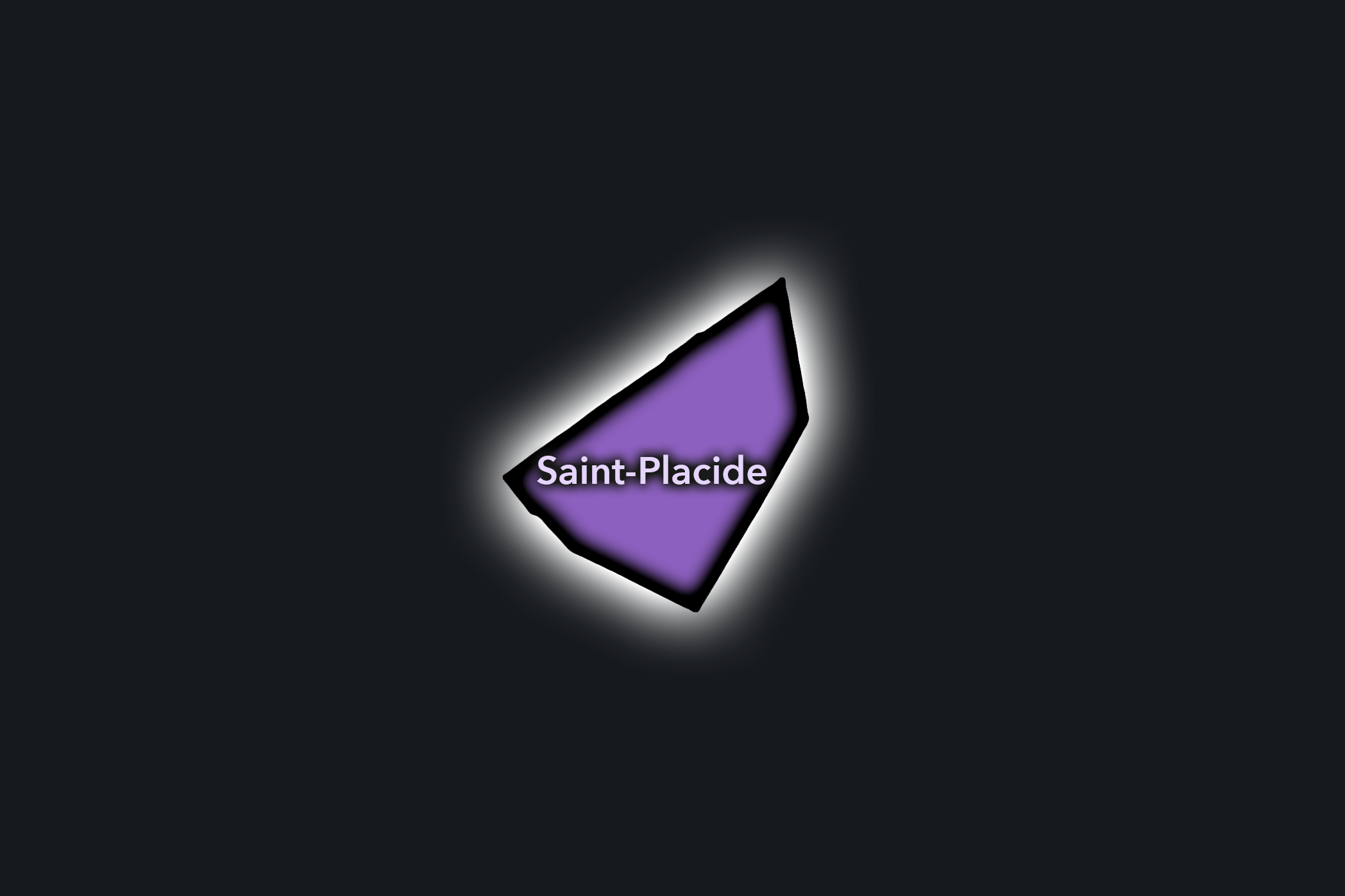
Saint-Placide
Civic Profile
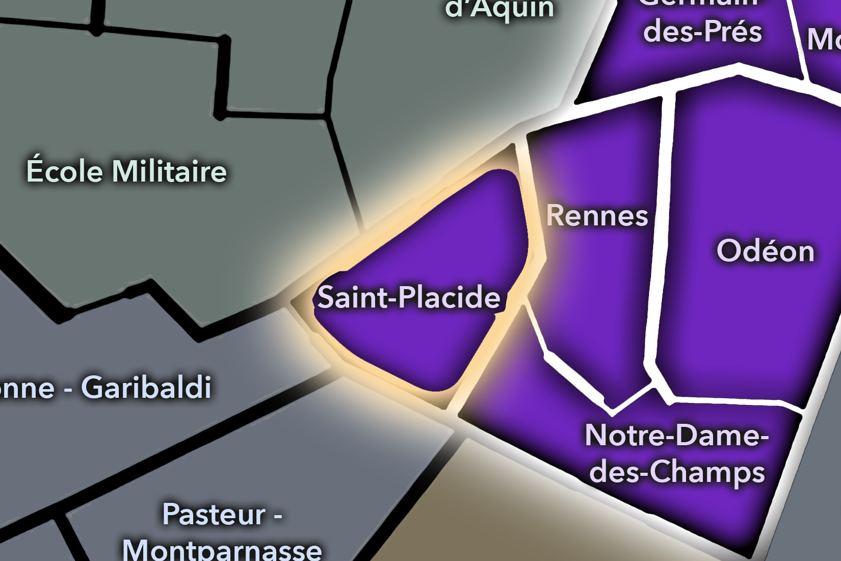
The Saint-Placide Conseil de Quartier gives civic shape to the southwestern interior of the 6e, where the arrondissement turns from Saint-Germain-des-Prés toward Sèvres-Babylone, Rennes, Montparnasse, and the quieter residential streets around Notre-Dame-des-Champs. Its local geography is shaped by shopping corridors, schools, religious institutions, apartment blocks, cafés, hotels, and the practical movement between the 6e, 7e, and 15e. Compared with the more symbolic Saint-Germain or Odéon districts, Saint-Placide feels more transitional and everyday: a lived Left Bank territory where residents, students, shoppers, workers, and visitors cross paths.
On the ground, Saint-Placide balances local routine with destination commerce. Rue de Rennes and Rue de Sèvres bring shopping, transit, and steady pedestrian movement, while side streets around Saint-Placide and Cherche-Midi hold a calmer residential and café texture. Its civic themes center on pedestrian comfort, commercial vitality, school and residential routines, traffic around major intersections, and the relationship between neighborhood life and the larger Sèvres-Babylone / Montparnasse movement corridor. Le Bon Marché, just across the arrondissement edge at 24 rue de Sèvres, acts as a major nearby shopping anchor for this part of the Left Bank.
Saint-Placide: At a Glance
A curated list for you.
-
Major Streets
Rue de Rennes
Rue de Sèvres
Rue du Cherche-Midi
Rue Notre-Dame-des-Champs
Rue de Vaugirard
-
Public Spaces & Landmarks
Église Saint-Ignace
Square Ozanam
Chapelle Notre-Dame-des-Anges
Institut Catholique de Paris nearby
Le Bon Marché nearby
-
Transit Access
Saint-Placide
Sèvres - Babylone
Rennes
Notre-Dame-des-Champs nearby
Montparnasse - Bienvenüe nearby
-
Shopping & Dining
Rue de Rennes shopping corridor
Rue du Cherche-Midi cafés and restaurants
Le Bon Marché / Grande Épicerie nearby
Poilâne
Joséphine Chez Dumonet
-
Hotels & Attractions
Sèvres-Babylone shopping district
Cherche-Midi walking route
Montparnasse approach corridor
Saint-Germain-des-Prés nearby
Luxembourg Garden nearby
The Photography
Visual Identity

The visual identity of each Paris district begins with its position in the city’s layered geography. Before the photographs arrive, the maps establish a first way of seeing: where the district sits, what civic layer it belongs to, which boundaries define it, and how it connects to the surrounding fabric of Paris. In CityNeighborhoods Paris, cartography is not merely orientation; it is part of the visual language of the project.
As the photographic archive grows, this section will continue to develop through images gathered on foot. Streets, façades, monuments, markets, parks, river edges, passages, signs, textures, and everyday details will gradually reveal how each district presents itself visually. The goal is not only to show what a place looks like, but to trace how its identity becomes visible through form, atmosphere, memory, and use.
Through The Lens

CityNeighborhoods Paris is built from walking, looking, and returning. Each district is approached through photography as a way of paying attention: to the obvious landmarks and the quieter details, to historic structures and ordinary streets, to the moments where civic geography becomes lived experience. The camera becomes a tool for noticing how Paris changes from one district to the next, and how each place holds its own relationship to the larger city.
As photographs are processed and added, this section will become a more specific visual record of the district. Future updates may include dated field notes, galleries, and reflections from individual walks. For now, the page remains part of the larger CityNeighborhoods effort to document every Paris neighborhood through maps, history, identity, and photography — one district, one walk, and one visual encounter at a time.
If you visit Paris, these ideas can help inspire your own photography.


Paris: J’Espere, Je Rêve, Je Vive
Paris Photo Gallery
Paris Flâneur Notes
Flâneur Notes document the walks, photographs, light, and street-level observations behind this neighborhood entry. Learn more about the Spirit of the Flâneur.


Explore Paris
-

The twenty arrondissements form the civic spiral of Paris, organizing the city into its broad local districts of government, identity, and daily life.
-

Each arrondissement is divided into four official administrative quarters, giving Paris a more precise civic and geographic framework.
-

The conseils de quartier bring participation to street level, giving residents a voice in neighborhood needs, public space, and local civic life.
-

Les Deux Rives trace Paris through the Seine’s two banks, revealing how the Rive Droite and Rive Gauche shaped the city’s civic power, commerce, learning, art, and cultural identity.
-

Cultural neighborhoods reveal the Paris people recognize through history, cafés, architecture, memory, atmosphere, and local belonging.