
10e - PORTE SAINT-DENIS
Quartiers Administratifs
Welcome to the Porte-Saint-Denis neighborhood page! Porte-Saint-Denis is a quartier administratif — an administrative quarter — one of 80 such districts across Paris. As a quartier administratif of the 10e Arrondissement - Entrepôt, Porte-Saint-Denis belongs to a formal layer of Parisian geography and takes its name from the triumphal arch and historic route north from Paris. Porte-Saint-Denis is where boulevard theaters, commercial streets, and the dense urban fabric around Strasbourg–Saint-Denis carry the energy of the old city gates.
Part of an ongoing project to walk and photograph every neighborhood in Paris, this page explores 10e Porte-Saint-Denis through maps, district identity, history, and photography.


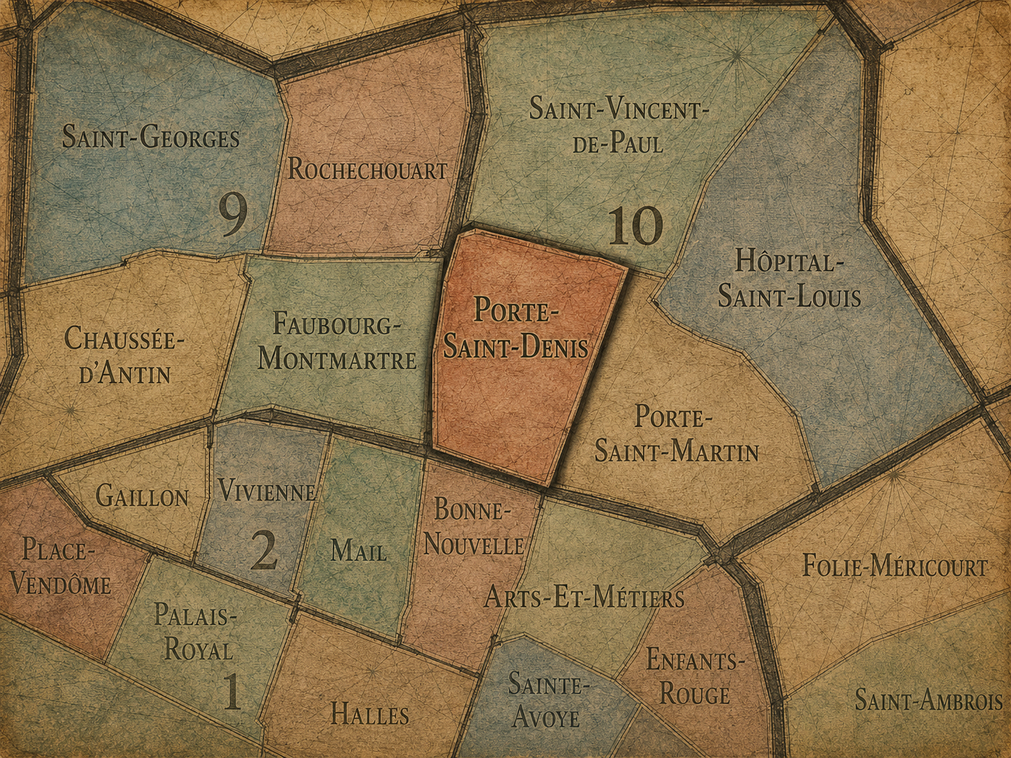
The Map
Geographic Setting
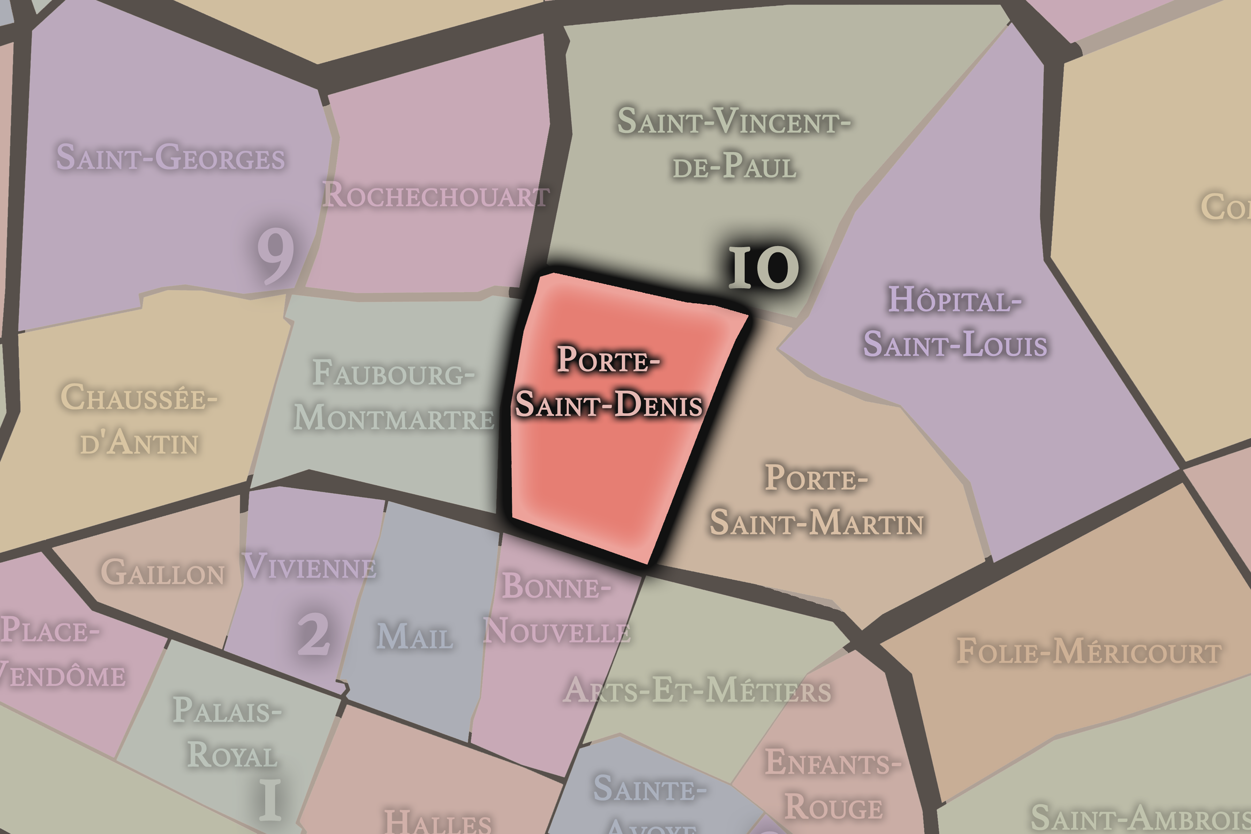
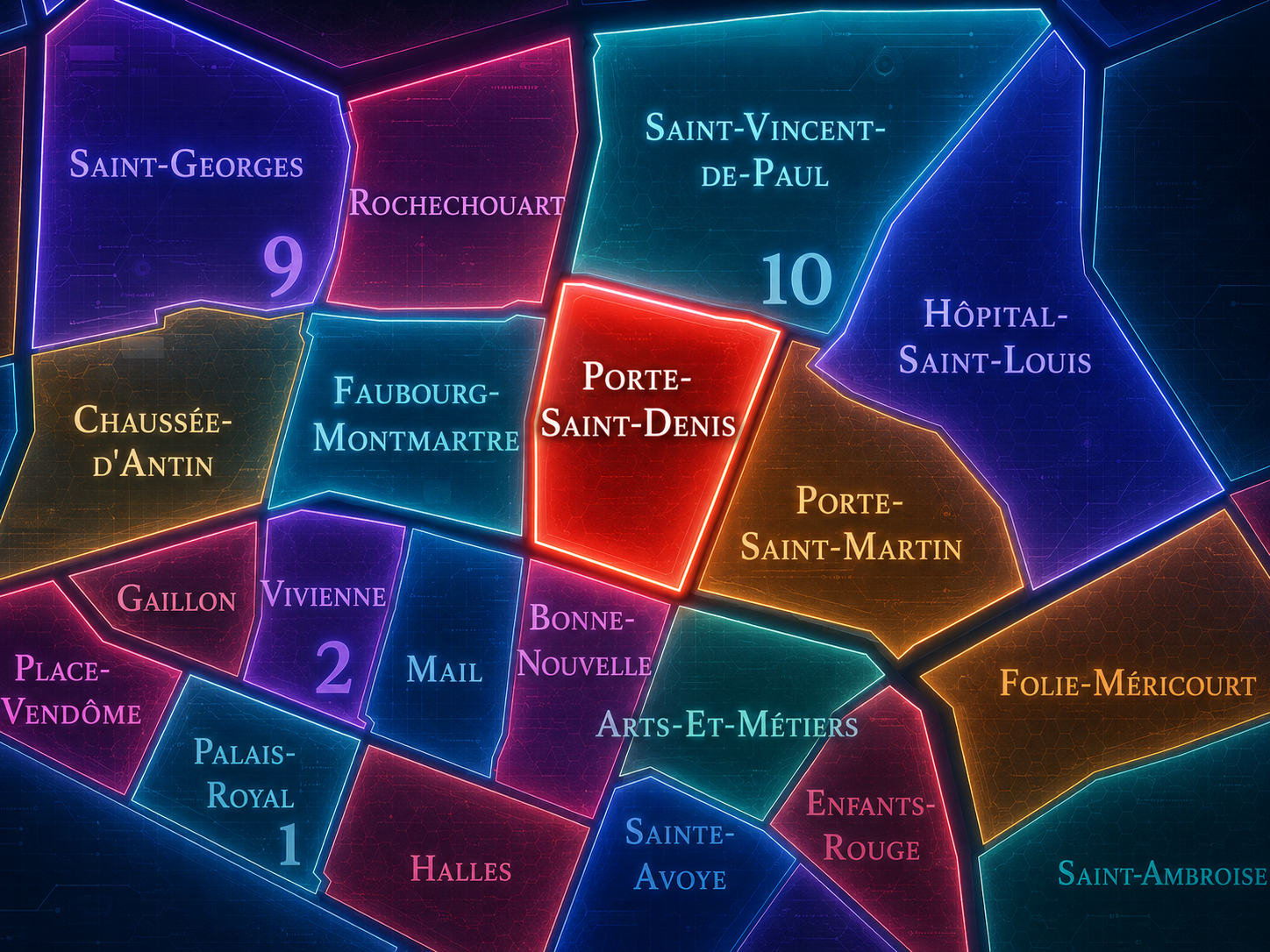
Porte Saint-Denis occupies the southwestern portion of the 10th arrondissement, where the old northern approaches to Paris meet the Grands Boulevards, the Faubourg Saint-Denis, the eastern edge of the 2nd arrondissement, and the dense commercial corridors leading toward Strasbourg-Saint-Denis, Gare de l’Est, and the historic routes northward. It is one of the great threshold quarters of Paris: a place where the memory of the city wall, the boulevard, the faubourg, and the road beyond all remain visible in the urban fabric.
The quarter is anchored by the Porte Saint-Denis, the triumphal arch that stands near the meeting of Boulevard Saint-Denis, Boulevard de Bonne-Nouvelle, Rue Saint-Denis, and Rue du Faubourg-Saint-Denis. Around it extend Rue d’Enghien, Rue du Faubourg-Saint-Denis, Rue d’Hauteville, Rue de Paradis, Rue de l’Échiquier, Passage Brady, and the lively streets that connect the 10th arrondissement to the older commercial center of the Right Bank. This is a district of movement: gates, routes, passages, theaters, restaurants, workshops, hotels, migrant commerce, and the constant flow between central Paris and the northern city.
Unlike Saint-Vincent-de-Paul, whose identity is strongly shaped by the Gare du Nord and Gare de l’Est, or Hôpital-Saint-Louis, whose geography gathers around medical care and the Canal Saint-Martin, Porte Saint-Denis is defined by entry. Its streets remember the old line between city and faubourg, even though the modern city has long since absorbed both sides. It is Paris at the former gate — no longer a boundary, but still a crossing.
Administrative Quarter Identity
Etymology and Origins
The name Porte Saint-Denis comes from the historic gate on the road leading toward Saint-Denis, the town north of Paris associated with the Basilica of Saint-Denis and the burial place of French kings. “Porte” means gate, and in this case the name preserves the memory of a city entrance on one of the most important northern routes out of Paris. Saint-Denis was not merely another destination; it was a royal, religious, and symbolic landscape tied to the deep history of France.
The present Porte Saint-Denis is not a medieval defensive gate in its original form, but a 17th-century triumphal arch built under Louis XIV to commemorate military victories. That gives the name a layered meaning. It refers to an entrance, but also to a monument. It recalls a city wall, but also royal propaganda. It marks the passage toward Saint-Denis, but it also turns that passage into an architectural statement of power.
As an administrative quarter name, Porte Saint-Denis therefore carries one of Paris’s essential stories: the transformation of fortification into boulevard, and of defensive threshold into public monument. The gate that once marked the city’s edge became a symbol inside the city. The boundary became an address.
Civic Framework
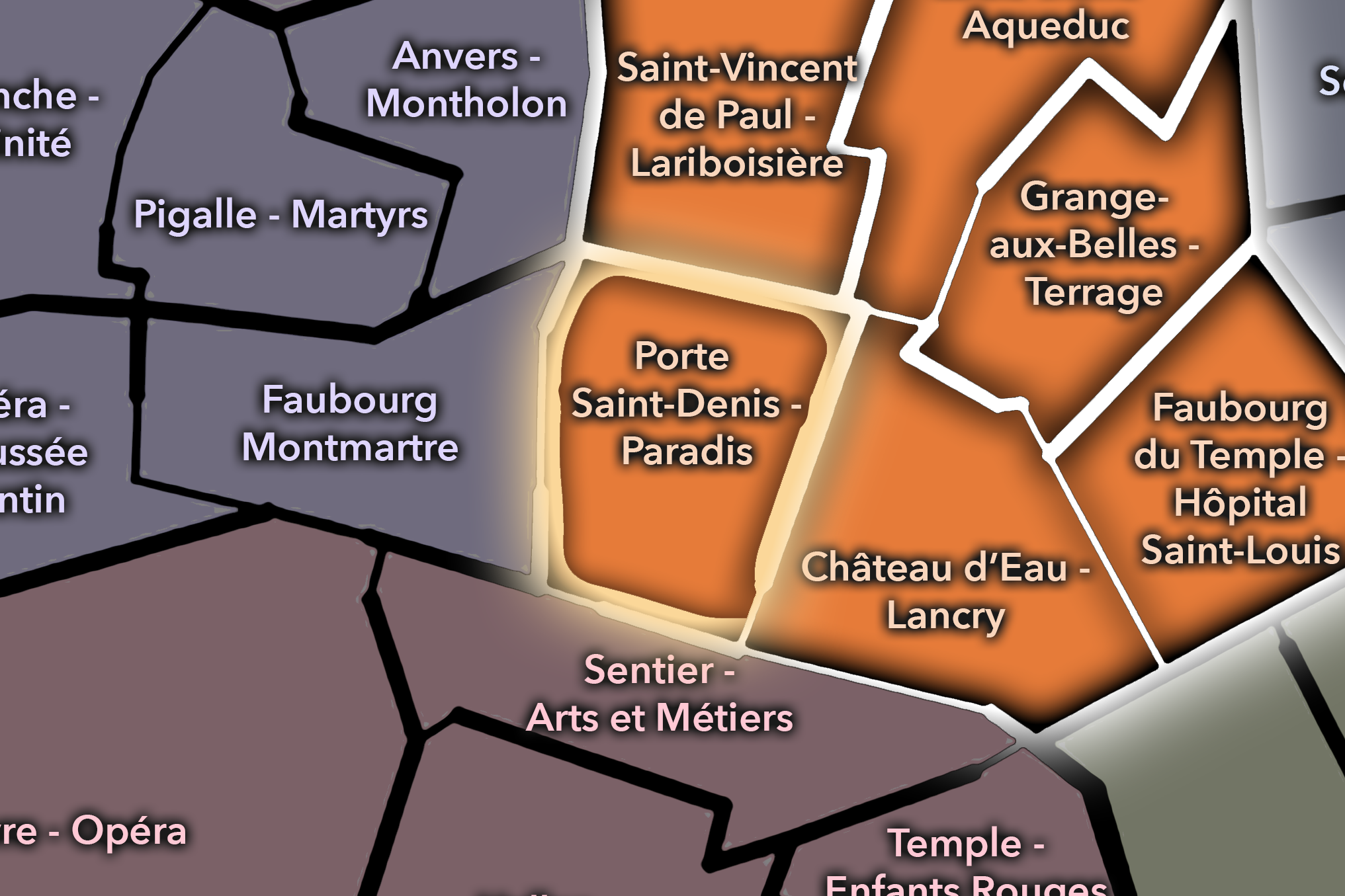
Within the official geography of Paris, Porte Saint-Denis is one of the four administrative quarters of the 10th arrondissement, alongside Saint-Vincent-de-Paul, Porte-Saint-Martin, and Hôpital-Saint-Louis. It occupies the arrondissement’s southwestern sector, placing it directly against the 2nd arrondissement’s Bonne-Nouvelle and Mail quarters and near the lively meeting point of the Grands Boulevards, Strasbourg-Saint-Denis, and the Faubourg Saint-Denis.
As an administrative quarter, Porte Saint-Denis gives formal civic shape to an area that is often described through overlapping names: Strasbourg-Saint-Denis, Faubourg Saint-Denis, the Grands Boulevards, Passage Brady, Château d’Eau, or the lower 10th. The official name anchors those identities in the historic gate, reminding us that the neighborhood’s present-day energy is rooted in one of the city’s older structures of movement.
This civic frame is especially useful because the quarter sits at a complicated seam. It belongs to the 10th arrondissement, but its southern edge is deeply tied to the old central Right Bank. It faces the 2nd arrondissement across the boulevard line, while its northern streets point toward the railway districts and the more diverse, working, and immigrant histories of northeastern Paris. Porte Saint-Denis is one of the places where the map teaches the city’s expansion.
Neighborhood Distinction
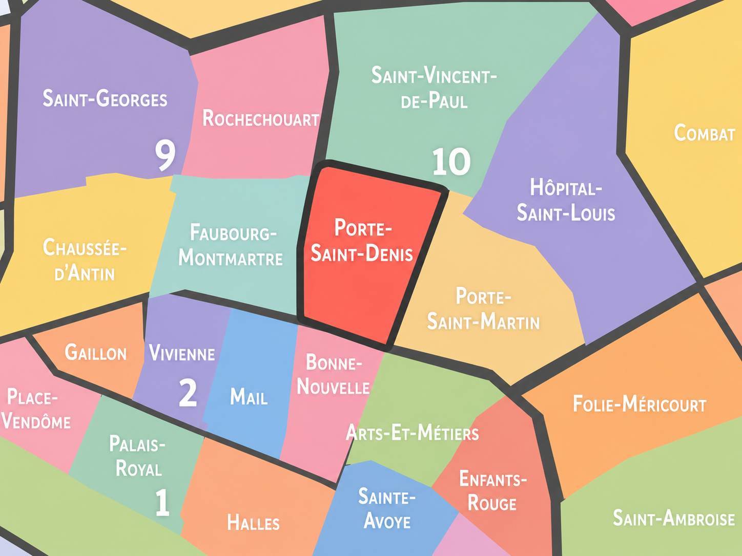
Porte Saint-Denis differs from the other quarters of the 10th arrondissement through its relationship to the old gate, the Grands Boulevards, and the historic road between central Paris and the northern faubourgs. Porte-Saint-Martin, nearby, shares a similar gate-and-boulevard identity, but its atmosphere tilts more toward theaters, République, and the eastern boulevard corridor. Saint-Vincent-de-Paul is the quarter of the great railway stations, churches, and arrival landscapes. Hôpital-Saint-Louis is more inward, medical, canal-adjacent, and residential.
Porte Saint-Denis is more openly a quarter of passage and exchange. It gathers the monumentality of the arch, the commercial density of the faubourg, the restaurants and shops of Passage Brady and surrounding streets, the movement of Strasbourg-Saint-Denis, and the lingering energy of the old road north. Its identity is neither purely ceremonial nor purely local. It is the city’s former edge turned into a dense urban crossroads.
It should also be distinguished from the broader Faubourg Saint-Denis. The faubourg is a cultural and street identity extending north along Rue du Faubourg-Saint-Denis, while the administrative quarter is the mapped civic area around the gate and its surrounding streets. The two overlap closely, but they are not identical. Porte Saint-Denis is the official frame; Faubourg Saint-Denis is one of the living cultural corridors within and beyond it.
Parisian Identity
Porte Saint-Denis expresses Paris as a city of thresholds transformed into life. The quarter’s original logic was boundary: inside and outside, city and faubourg, gate and road. But modern Paris turned that boundary into movement, commerce, food, theater, immigration, nightlife, and dense street exchange. What was once a controlled passage became one of the city’s most animated urban seams.
This gives the quarter a distinctly Parisian complexity. The triumphal arch still speaks the language of royal power, but the streets around it speak many other languages: everyday commerce, working-class history, migrant settlement, restaurant culture, hotel life, textiles, wholesale trade, and the layered social mixtures of the lower 10th. Porte Saint-Denis is not a polished monument district. It is a monument embedded in a living, noisy, adaptive neighborhood.
The quarter also challenges simple ideas of beauty. Its beauty is not always serene. It is found in contrast: stone arch and neon sign, old boulevard and crowded sidewalk, passageway and restaurant window, royal inscription and contemporary street life. Porte Saint-Denis is Paris as collision — and that collision is precisely what keeps it alive.
Neighborhood Connections
Every neighborhood belongs to a wider Parisian fabric.
-
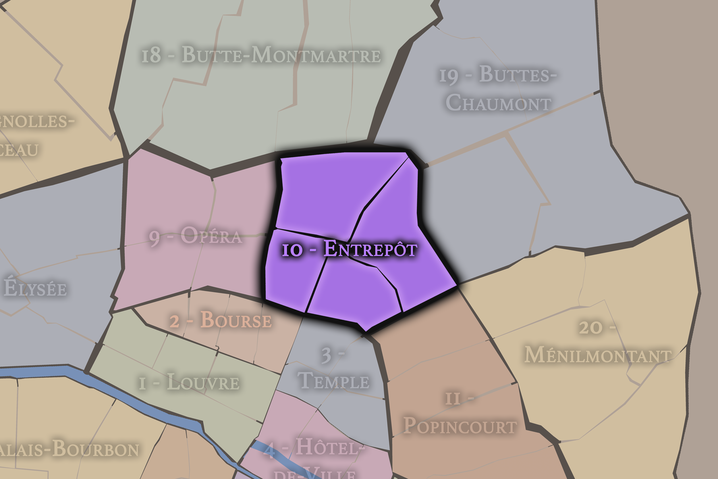
10e — Entrepôt
-
Porte Saint-Denis - Paradis
-

Rive Droite
The History
Origins
The origins of Porte Saint-Denis lie in the northern route from Paris toward Saint-Denis. Long before the modern administrative quarter existed, this route was one of the great lines of movement connecting the city to royal and religious landscapes beyond its walls. Gates controlled access, roads carried goods and travelers, and faubourgs developed outside the fortified city where movement created opportunity.
The area’s early identity was therefore shaped by the relationship between city wall and road. The gate marked the limit of Paris, while the faubourg beyond it grew through commerce, lodging, services, workshops, and the practical needs of those entering or leaving the city. As with many Parisian thresholds, the boundary did not stop urban life. It generated it.
Over time, the defensive meaning of the gate weakened, but the route remained important. The later triumphal arch transformed the site from practical entrance to symbolic monument, yet the deeper origin persisted: this was a place made by passage.
16th–17th Century
In the 16th and 17th centuries, the Porte Saint-Denis area stood at the northern edge of Paris, where fortifications, gates, roads, and faubourg settlement shaped the urban landscape. The old gate controlled one of the principal approaches to the city, while Rue Saint-Denis and Rue du Faubourg-Saint-Denis formed the continuous route leading outward toward Saint-Denis.
The 17th century brought the decisive monumental transformation. Under Louis XIV, the present Porte Saint-Denis was built as a triumphal arch, replacing the older gate function with an architecture of royal celebration. The monument commemorated military victories and turned the old threshold into a statement of power, victory, and dynastic image.
This transformation is central to the quarter’s identity. A city gate became a triumphal monument, but the site did not lose its role as a crossing. The arch stood over the same urban logic of movement. The old edge was now dressed in stone glory, while the streets around it continued to carry the practical life of the city.
18th Century
In the 18th century, Porte Saint-Denis became increasingly tied to the life of the Grands Boulevards. As the old fortification lines lost their defensive purpose, the boulevard spaces along them became promenades, entertainment corridors, and commercial districts. The gate no longer functioned as the hard edge of Paris in the old military sense. Instead, it became part of a lively urban sequence.
The surrounding streets drew shops, cafés, lodging houses, workshops, and popular amusements. The faubourg beyond the gate continued to grow, while the boulevard side became a place of strolling, spectacle, and social exchange. Porte Saint-Denis therefore belonged to two worlds at once: the monumental memory of royal power and the everyday vitality of the expanding city.
By the revolutionary period, this older royal monument stood within a city radically reinterpreting the meaning of authority. Gates, statues, inscriptions, churches, and public spaces all became politically charged. Porte Saint-Denis entered the modern era as a monument of monarchy embedded in an increasingly popular and restless urban environment.
19th Century
In the early and mid 20th century, Porte Saint-Denis remained a district of commerce, hotels, small businesses, workshops, theaters, restaurants, and dense movement. Its location near the Grands Boulevards, railway approaches, and northern faubourgs gave it a practical and diverse urban life. It was central, but not elite; historic, but not museum-like; active, but often rough-edged.
The quarter’s streets absorbed many waves of social and economic change. Workers, travelers, migrants, merchants, and visitors all passed through or settled nearby. The hotels and commercial streets around the lower 10th reflected the neighborhood’s role as a place of arrival and transit. Its identity was shaped less by stable enclosure than by circulation.
During the upheavals of war, occupation, liberation, and postwar recovery, the quarter’s centrality and diversity gave it a layered history of survival and adaptation. Places of passage often become places where crisis is felt sharply: through scarcity, movement, control, commerce, and the shifting uses of public space. Porte Saint-Denis remained a working piece of Paris through these difficult decades.
Early–Mid 20th Century
In the late 20th century, Porte Saint-Denis became increasingly associated with the multicultural and immigrant life of the lower 10th arrondissement. Passage Brady and the surrounding streets gained a strong South Asian identity, especially through restaurants, groceries, shops, and cultural commerce connected to Indian, Pakistani, Bangladeshi, and Sri Lankan communities. This added a vivid contemporary layer to the old faubourg landscape.
The quarter also experienced the pressures and possibilities of central-city change. Some parts were associated with inexpensive hotels, wholesale trade, nightlife, informal economies, and working-class or migrant networks. Other parts began to attract new restaurants, bars, cultural venues, and reinvestment. The area’s reputation was mixed, but its vitality was undeniable.
This period is essential to the quarter’s identity because it shows the old threshold function continuing in modern form. Porte Saint-Denis remained a place of entry — not into the walled city, but into Parisian possibility. New communities, cuisines, businesses, and urban cultures passed through the same old corridor and made it their own.
Late 20th Century
In the 21st century, Porte Saint-Denis remains one of Paris’s most dynamic threshold quarters. The arch still anchors the historic landscape, while the streets around Strasbourg-Saint-Denis, Passage Brady, Rue du Faubourg-Saint-Denis, and the Grands Boulevards mix restaurants, bars, hotels, theaters, shops, offices, apartments, and an unusually diverse street life. The quarter has become increasingly fashionable in places, but it has not lost the complexity that gives it meaning.
Today, Porte Saint-Denis sits at the meeting point of heritage, immigration, nightlife, food culture, tourism, and everyday commerce. Its old monumentality is still present, but it is no longer the only story. The quarter’s contemporary identity is carried just as strongly by restaurant signs, crowded sidewalks, market-like shops, late-night streets, and the constant movement between the 2nd, 10th, and 9th arrondissements.
For CityNeighborhoods: Paris, Porte Saint-Denis is essential because it shows how an administrative quarter can reveal the city’s transformation from walled capital to open metropolis. The gate remains, but the wall is gone. The route remains, but the meanings have multiplied. The quarter is no longer a place that separates inside from outside. It is a place where inside and outside continually meet.
21st Century
In the 21st century, Hôpital-Saint-Louis remains one of the 10th arrondissement’s most meaningful quarters. The hospital continues to anchor the neighborhood, while the surrounding streets participate in the contemporary identity of the Canal Saint-Martin area: cafés, bridges, restaurants, apartments, shops, schools, nightlife, and a steady flow of walkers moving between République, Goncourt, and the northern stations.
Today, the quarter’s identity depends on balance. The canal-side atmosphere can make the area feel lively, youthful, and recreational, but the hospital reminds the neighborhood of an older and more serious civic purpose. In a city increasingly shaped by lifestyle districts and visual branding, Hôpital-Saint-Louis keeps the reality of public care at the center of the map.
For CityNeighborhoods: Paris, Hôpital-Saint-Louis is essential because it shows how an administrative quarter can be defined by responsibility. It is not only a historic hospital district, not only a canal neighborhood, and not only a residential section of the 10th. It is a place where Paris’s public health history, institutional architecture, working-class surroundings, and contemporary urban life remain deeply intertwined.
Spirit and Legacy
Porte Saint-Denis is the quarter of the old gate made restless. Its spirit is monumental, crowded, adaptive, and alive with passage. It belongs to royal stone and migrant restaurants, boulevard theaters and faubourg shops, covered passages and busy crossroads, old routes and new arrivals. It is one of the places where Paris refuses to be one thing at a time.
Its legacy is the transformation of boundary into exchange. A defensive gate became a triumphal arch. A faubourg road became a commercial corridor. A royal monument became the backdrop to popular, immigrant, and metropolitan life. Through each transformation, the quarter kept its essential function: it remained a place of crossing.
To walk Porte Saint-Denis is to encounter Paris at a seam. The city’s past stands above the street in carved stone, while its present moves below in food, language, traffic, trade, and night life. In this quarter, neighborhood identity is not polished into stillness. It is made by arrival — again and again — at the old entrance to the city.
The Photography
Visual Identity

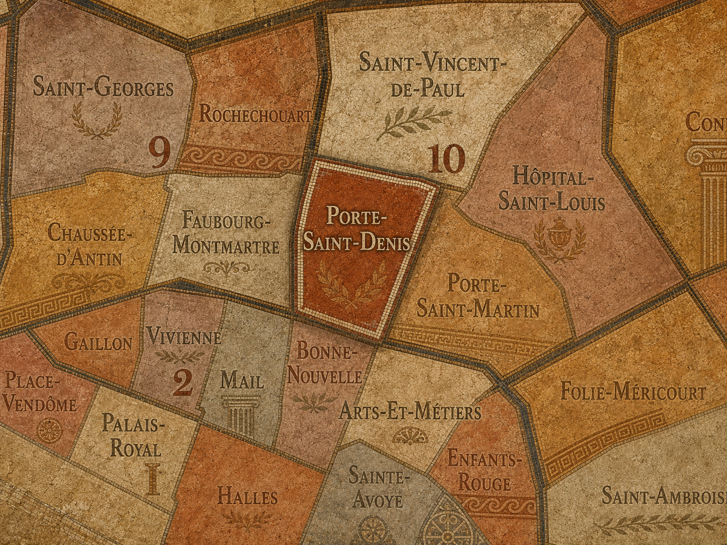
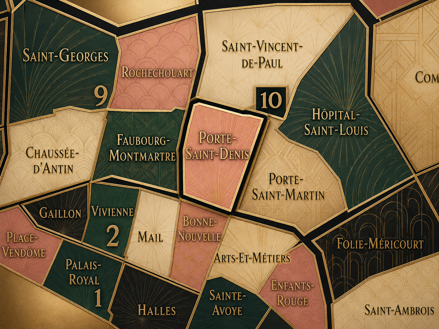
The visual identity of each Paris district begins with its position in the city’s layered geography. Before the photographs arrive, the maps establish a first way of seeing: where the district sits, what civic layer it belongs to, which boundaries define it, and how it connects to the surrounding fabric of Paris. In CityNeighborhoods Paris, cartography is not merely orientation; it is part of the visual language of the project.
As the photographic archive grows, this section will continue to develop through images gathered on foot. Streets, façades, monuments, markets, parks, river edges, passages, signs, textures, and everyday details will gradually reveal how each district presents itself visually. The goal is not only to show what a place looks like, but to trace how its identity becomes visible through form, atmosphere, memory, and use.
Through The Lens

CityNeighborhoods Paris is built from walking, looking, and returning. Each district is approached through photography as a way of paying attention: to the obvious landmarks and the quieter details, to historic structures and ordinary streets, to the moments where civic geography becomes lived experience. The camera becomes a tool for noticing how Paris changes from one district to the next, and how each place holds its own relationship to the larger city.
As photographs are processed and added, this section will become a more specific visual record of the district. Future updates may include dated field notes, galleries, and reflections from individual walks. For now, the page remains part of the larger CityNeighborhoods effort to document every Paris neighborhood through maps, history, identity, and photography — one district, one walk, and one visual encounter at a time.
If you visit Paris, these ideas can help inspire your own photography.


Paris: J’Espere, Je Rêve, Je Vive
Paris Photo Gallery
Paris Flâneur Notes
Flâneur Notes document the walks, photographs, light, and street-level observations behind this neighborhood entry. Learn more about the Spirit of the Flâneur.


Explore Paris
-

The twenty arrondissements form the civic spiral of Paris, organizing the city into its broad local districts of government, identity, and daily life.
-

Each arrondissement is divided into four official administrative quarters, giving Paris a more precise civic and geographic framework.
-

The conseils de quartier bring participation to street level, giving residents a voice in neighborhood needs, public space, and local civic life.
-

Les Deux Rives trace Paris through the Seine’s two banks, revealing how the Rive Droite and Rive Gauche shaped the city’s civic power, commerce, learning, art, and cultural identity.
-

Cultural neighborhoods reveal the Paris people recognize through history, cafés, architecture, memory, atmosphere, and local belonging.