
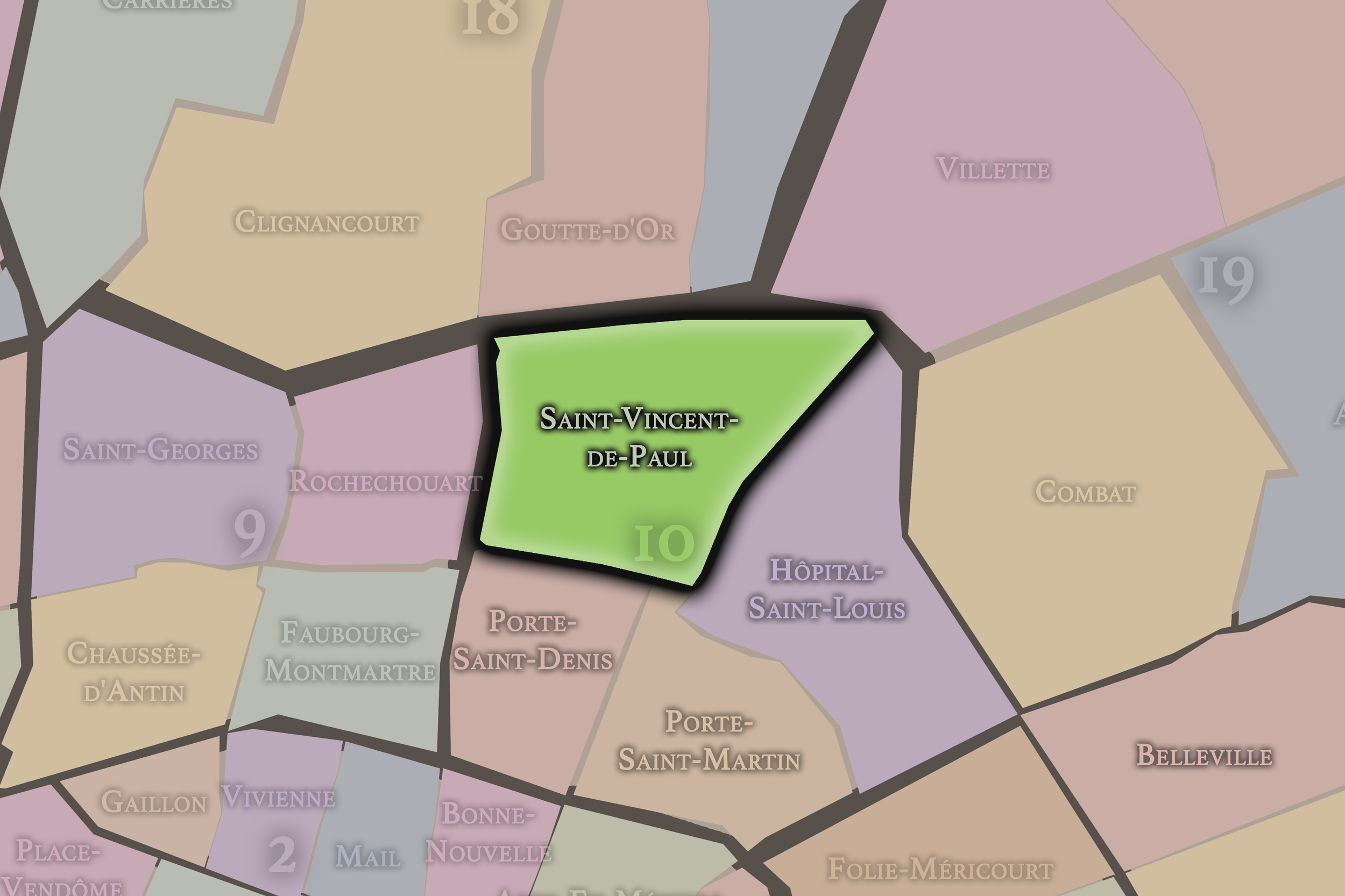
10e - SAINT-VINCENT-DE-PAUL
Quartiers Administratifs
Welcome to the Saint-Vincent-de-Paul neighborhood page! Saint-Vincent-de-Paul is a quartier administratif — an administrative quarter — one of 80 such districts across Paris. As a quartier administratif of the 10e Arrondissement - Entrepôt, Saint-Vincent-de-Paul belongs to a formal layer of Parisian geography and is shaped by arrival and movement, with Gare du Nord, Gare de l’Est, and the church of Saint-Vincent-de-Paul anchoring one of Paris’s most important transport and migration landscapes.
Part of an ongoing project to walk and photograph every neighborhood in Paris, this page explores 10e Saint-Vincent-de-Paul through maps, district identity, history, and photography.


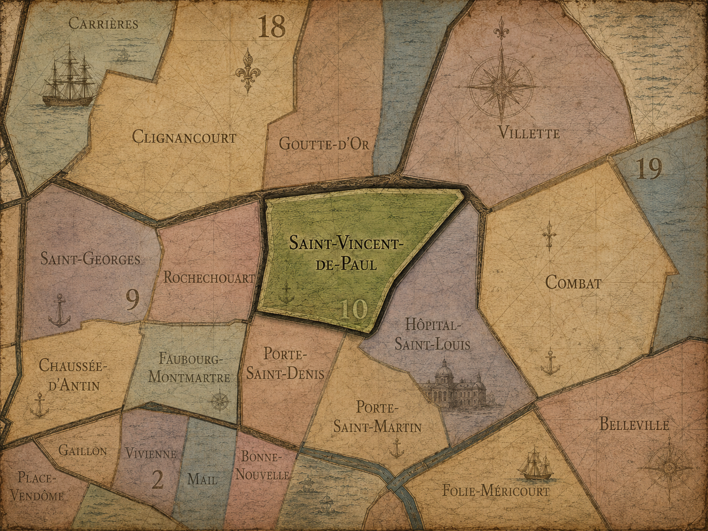
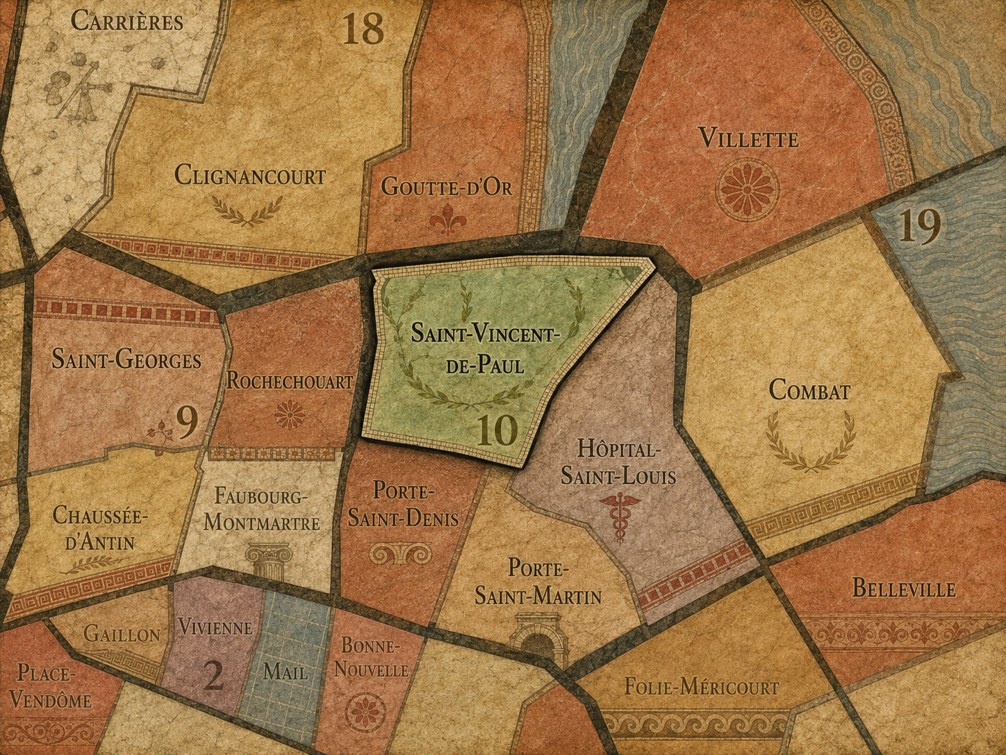
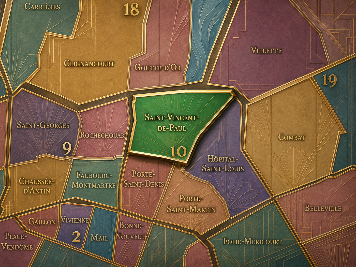
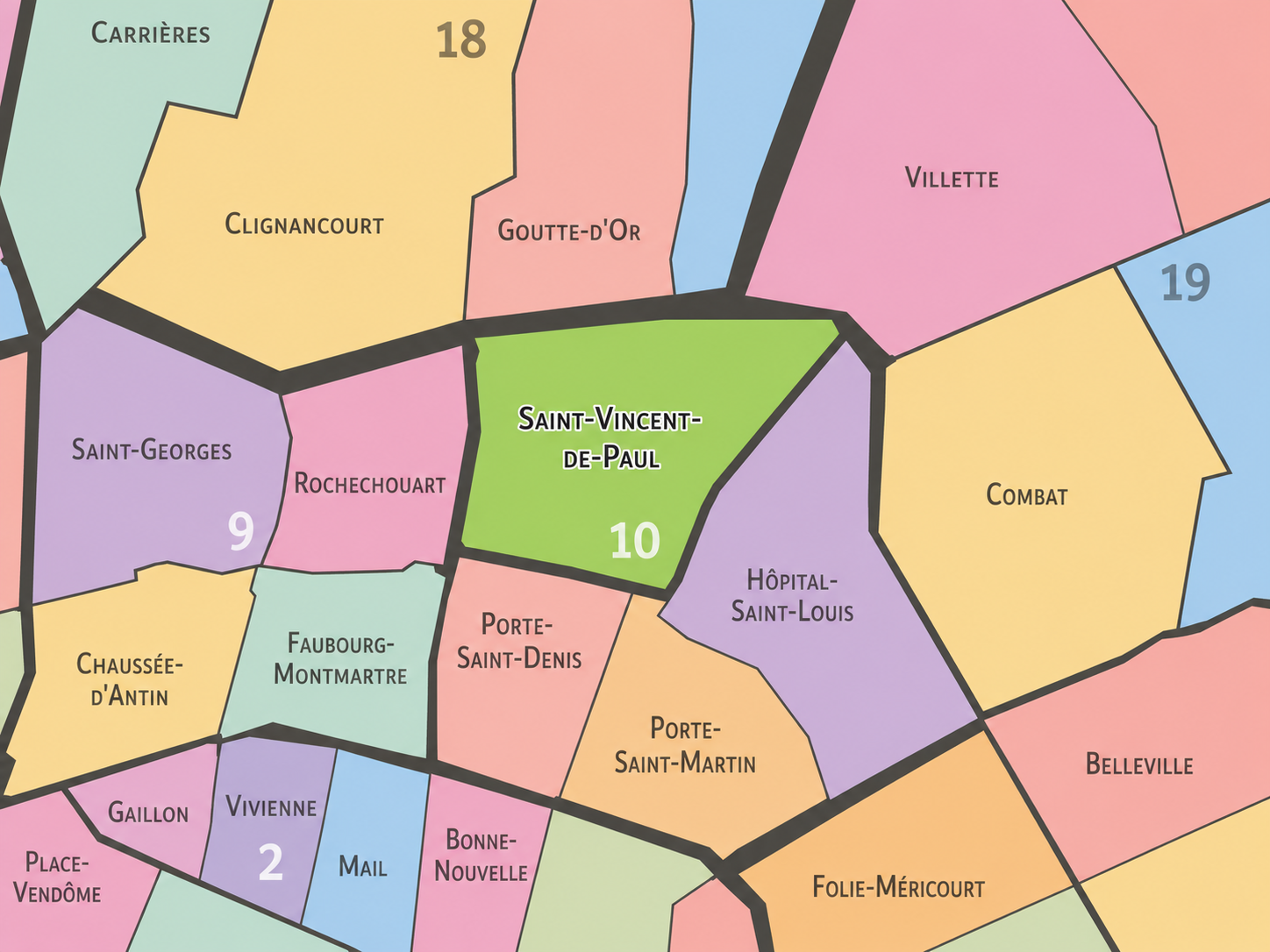
The Map
Geographic Setting
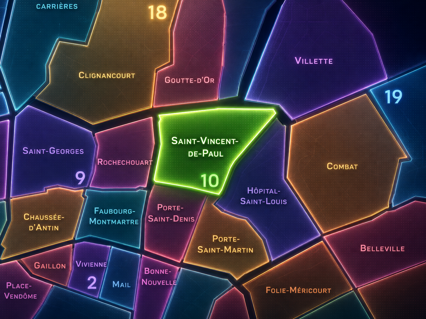
Saint-Vincent-de-Paul occupies the northern portion of the 10th arrondissement, where Paris gathers around two of its great railway gateways: Gare du Nord and Gare de l’Est. It lies above Porte Saint-Denis and Porte Saint-Martin, west of Hôpital-Saint-Louis, and along the southern edge of the boulevard line that meets La Chapelle, Barbès, and the northeastern city. Few administrative quarters in Paris are so defined by arrival, departure, transfer, and the dense urban life that forms around major stations.
The quarter’s geography is shaped by the vast rail structures of Gare du Nord and Gare de l’Est, the Church of Saint-Vincent-de-Paul near Place Franz-Liszt, Boulevard de Magenta, Rue La Fayette, Rue du Faubourg-Saint-Denis, Rue du Faubourg-Poissonnière, Rue de Dunkerque, Rue d’Alsace, Rue de Chabrol, and the streets that move between the stations, the lower 10th, and the northern approaches to Paris. District references identify Saint-Vincent-de-Paul as the 37th administrative quarter of Paris, organized around the Gare du Nord and Gare de l’Est, two of the city’s major transportation poles.
Unlike Porte Saint-Denis and Porte Saint-Martin, whose identities are rooted in the memory of old gates and boulevard thresholds, Saint-Vincent-de-Paul is a quarter of modern arrival. It is not where the walled city once opened through a gate, but where the railway city opens through platforms, concourses, bridges, tunnels, hotels, cafés, luggage wheels, commuter flows, international routes, and the constant human choreography of people entering and leaving Paris.
Administrative Quarter Identity
Etymology and Origins
The name Saint-Vincent-de-Paul comes from the Church of Saint-Vincent-de-Paul, dedicated to Vincent de Paul, the 17th-century Catholic priest remembered for his charitable work, his concern for the poor, and his role in organizing religious and social service. The church stands near Place Franz-Liszt, on a raised site above the surrounding streets, giving the quarter a religious and moral name within a landscape now more commonly associated with railway stations.
That contrast is important. The administrative quarter is named not for the Gare du Nord or Gare de l’Est, even though those stations dominate its geography, but for a saint associated with care, charity, and service. The name gives the district a human and ethical center beneath its infrastructural intensity. Saint-Vincent-de-Paul is therefore not only a station quarter. It is a quarter where movement, poverty, arrival, displacement, hospitality, and public service have long existed side by side.
The church itself belongs to the 19th-century transformation of the area. It was inaugurated in 1844 and is often associated with the architect Jacques-Ignace Hittorff, who would also later design the rebuilt Gare du Nord, creating a striking link between the quarter’s religious monument and its railway monumentality.
Civic Framework
Within the official geography of Paris, Saint-Vincent-de-Paul is one of the four administrative quarters of the 10th arrondissement, alongside Porte Saint-Denis, Porte Saint-Martin, and Hôpital-Saint-Louis. It occupies the arrondissement’s northern sector, bordered by the dense railway landscape and by the corridors that connect the 10th to the 9th, 18th, and 19th arrondissements.
As an administrative quarter, Saint-Vincent-de-Paul gives civic shape to an area that might otherwise be described only through its stations: Gare du Nord, Gare de l’Est, Magenta, La Chapelle, or the northern 10th. The official name restores a different layer. It places the church and saintly dedication alongside the railway city, reminding us that the neighborhood is not only a transportation machine, but an urban district with religious, social, residential, commercial, and migrant histories.
This civic frame is especially useful because the quarter is often experienced hurriedly. People arrive, transfer, wait, navigate crowds, search for a hotel, catch a train, or pass through on the way somewhere else. The administrative quarter asks for a slower reading. It reveals the neighborhood behind the station name.
Neighborhood Distinction
Saint-Vincent-de-Paul differs from the other quarters of the 10th arrondissement through its railway identity and its role as one of Paris’s great arrival landscapes. Porte Saint-Denis and Porte Saint-Martin are older threshold quarters, shaped by gates, boulevards, theaters, and faubourg roads leading into and out of the historic city. Hôpital-Saint-Louis is more inward and institutional, defined by care, enclosure, medicine, and the Canal Saint-Martin edge.
Saint-Vincent-de-Paul is more openly infrastructural. Its identity is shaped by two massive stations, the streets that serve them, the hotels and cafés around them, the commuters and travelers who pass through them, and the diverse urban life that gathers near places of arrival. Gare du Nord was inaugurated in 1846 to connect Paris with northern France and neighboring countries, while Gare de l’Est opened in 1849 under the name “embarcadère de Strasbourg,” linking the capital toward the east.
It should also be distinguished from the broader Gare du Nord / Gare de l’Est district as a cultural shorthand. Those station names describe the dominant infrastructure, but Saint-Vincent-de-Paul is the official quarter that contains and contextualizes them. It is the civic neighborhood behind the transportation node.
Parisian Identity
Saint-Vincent-de-Paul expresses Paris as a city of arrival. It is one of the places where the capital is first encountered by travelers from northern France, Belgium, the Netherlands, Germany, the United Kingdom, and the wider European rail network. For many people, this is not postcard Paris. It is platform Paris, luggage Paris, transfer Paris, hotel Paris, station-clock Paris — a first impression made of motion, density, noise, uncertainty, and possibility.
That makes the quarter deeply Parisian, even when it does not match the polished image of Paris. It is a place where the city’s global, working, immigrant, commuter, and tourist identities all pass through the same streets. Condé Nast Traveler once described the 10th around the stations as not “pristine postcard” Paris but a reflection of everyday Paris life, noting the mix of long-standing immigrant food businesses, newer artisans, cafés, designers, and local routines around Gare de l’Est and Gare du Nord.
The quarter’s Parisian identity is therefore one of friction and reality. It is beautiful in places, difficult in places, crowded in places, generous in places. It does not offer the calm unity of a historic square or the elegance of a museum district. It offers the truth of a city in motion: people arriving with bags, workers crossing between shifts, residents living beside railway walls, visitors finding their way, and Paris constantly receiving the world.
Neighborhood Connections
Every neighborhood belongs to a wider Parisian fabric.
-
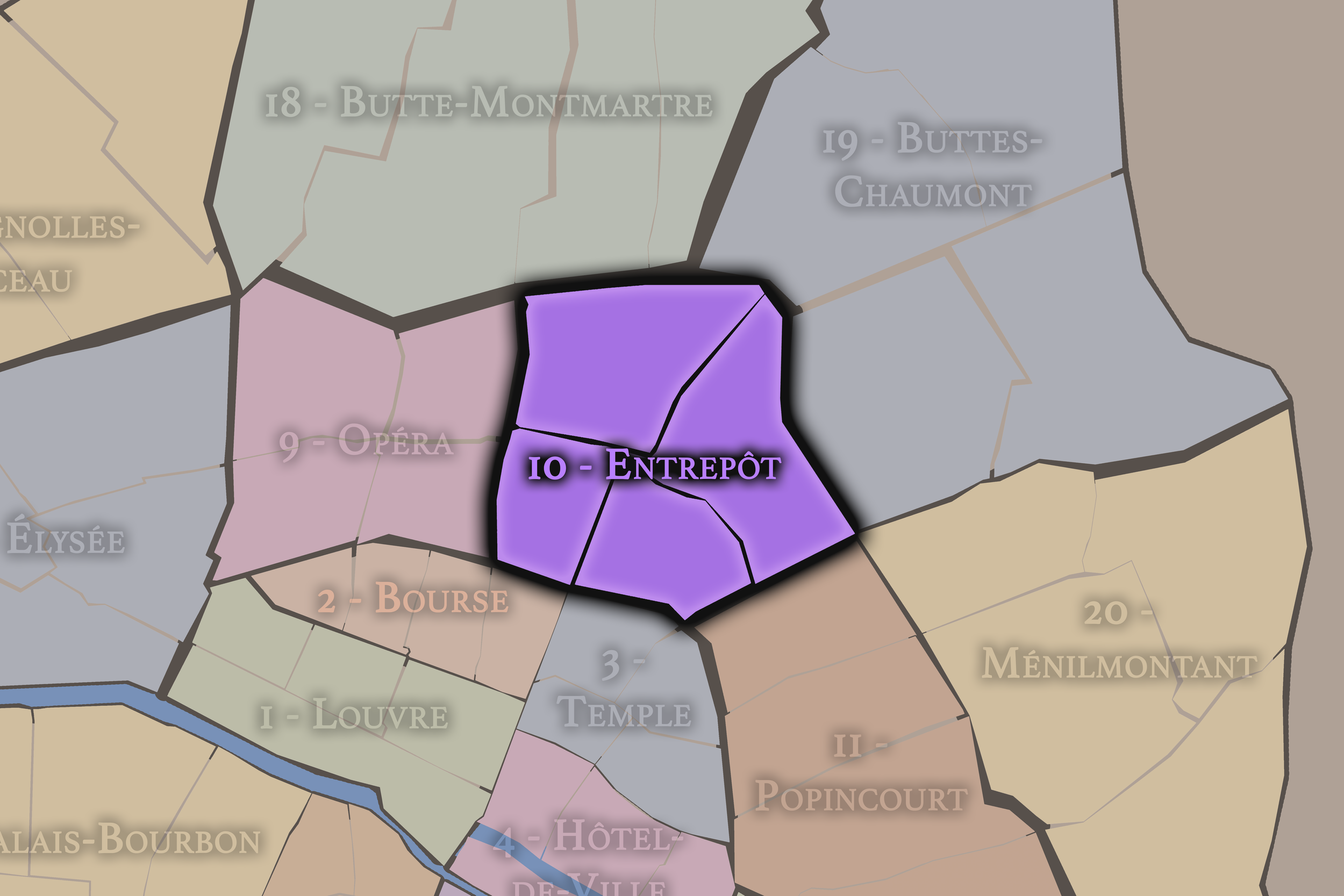
10e — Entrepôt
-
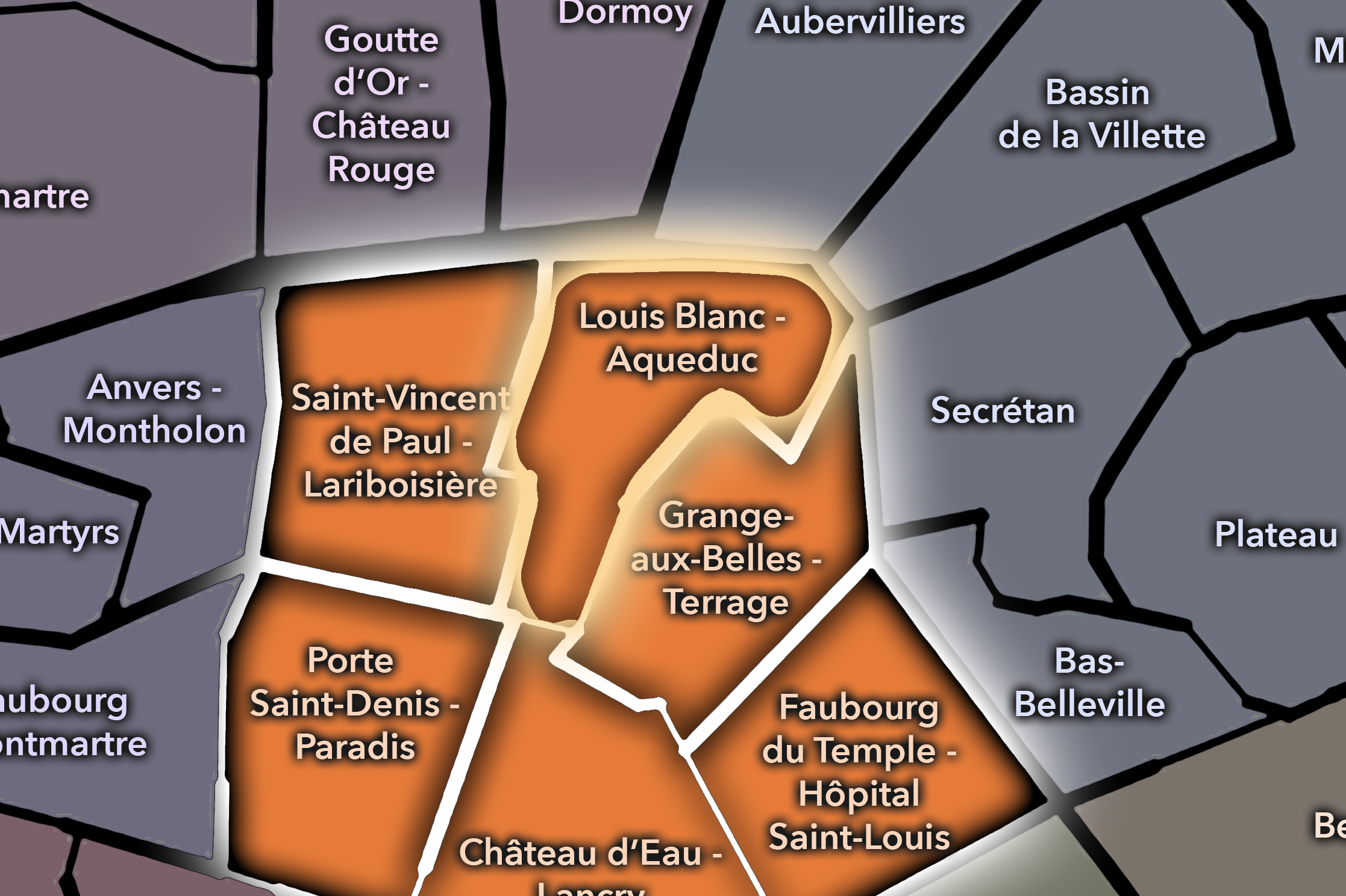
Louis Blanc - Aqueduc
-
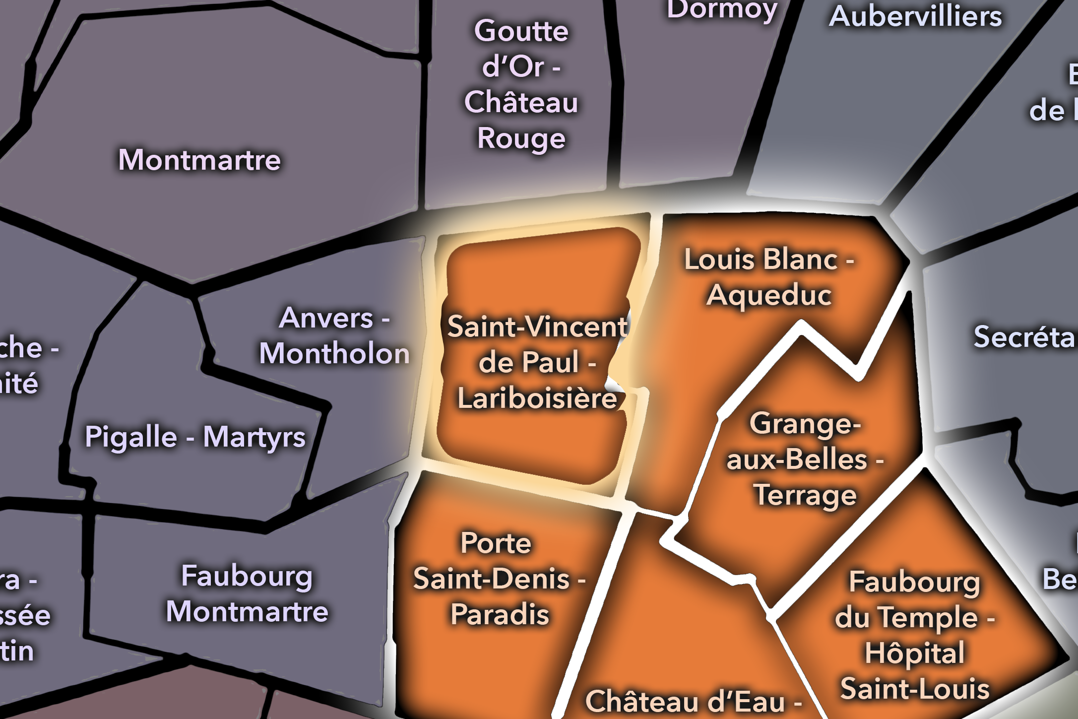
Saint-Vincent de Paul - Lariboisière
-

Rive Droite
The History
Origins
The origins of Saint-Vincent-de-Paul lie in the northern expansion of Paris beyond the older city. Before the railway stations transformed the district, this area belonged to the outer landscape of faubourgs, roads, religious lands, gardens, fields, and gradually urbanizing settlement north of the historic Right Bank. It was close to the routes that led toward Saint-Denis, La Chapelle, and the northern approaches to the capital.
The area’s early identity was therefore shaped by movement even before the railways arrived. Roads led outward. Faubourgs developed beyond old walls. Services gathered around routes of passage. The quarter’s later railway role did not create movement from nothing; it intensified a much older geography of arrival and departure.
The Church of Saint-Vincent-de-Paul gave the district one of its major 19th-century anchors, while the railway stations soon transformed the surrounding area at a much larger scale. The quarter’s origins are therefore best understood as a sequence: outer road landscape, religious and residential development, railway expansion, and modern station district.
16th–17th Century
In the 16th and 17th centuries, the future Saint-Vincent-de-Paul quarter remained outside the densest core of Paris. The area north of the old Right Bank was tied to routes, faubourg development, religious institutions, cultivated land, and the gradual outward pressure of the city. It was not yet the urban station quarter that would later define the 10th arrondissement.
The broader northern landscape was shaped by the relationship between Paris and the roads beyond it. The routes toward Saint-Denis, La Chapelle, and the northern countryside brought movement, trade, lodging, and service functions to the edges of the city. The district’s later identity as a place of passage has deep roots in this earlier geography.
During this period, the name Saint-Vincent-de-Paul was not yet attached to the administrative quarter in its modern sense. But the saint’s life and legacy belonged to the same century of Catholic reform, charity, and urban poverty that would later give the quarter its name. This gives the district’s naming an added resonance: a saint of service remembered in a part of Paris where need, movement, and arrival have remained visible.
18th Century
In the 18th century, the area continued to urbanize as Paris expanded northward. The faubourgs became denser, roads became more active, and the lands between the old city and the northern villages were increasingly drawn into the capital’s economic and social life. The district remained outside the most formal western and central landscapes of power, but it was increasingly important to the practical movement of Paris.
This was also a period when questions of poverty, charity, public order, and urban service became more pressing across the growing city. The later dedication to Saint Vincent de Paul would suit this environment well. The northern faubourgs were not only routes of commerce; they were also landscapes of labor, modest housing, religious service, and social need.
By the revolutionary era, the old structures of church, charity, property, and urban administration were being transformed. The future Saint-Vincent-de-Paul quarter entered the modern age as part of a rapidly changing northern city, ready to be reshaped by the most powerful infrastructure of the next century: the railway.
19th Century
The 19th century created the modern identity of Saint-Vincent-de-Paul. The Church of Saint-Vincent-de-Paul was inaugurated in 1844, giving the quarter a monumental religious presence on Place Franz-Liszt. Shortly afterward, the railways transformed the area. Gare du Nord opened in 1846, and Gare de l’Est opened in 1849, placing the neighborhood at the center of Paris’s connections to northern and eastern France and to wider Europe.
This railway development changed everything. The quarter became a place of platforms, hotels, cafés, luggage, railway workers, travelers, goods, carriages, omnibuses, and later metro connections. Streets that had once belonged to faubourg expansion became part of a modern transportation district. The neighborhood’s scale and rhythm were reorganized around departure and arrival.
The architecture of the century also shaped the quarter’s identity. The church, the stations, the new streets, and the urban fabric around them gave Saint-Vincent-de-Paul a powerful 19th-century character. It became a district where religious monumentality and railway modernity stood within the same field of view.
Early–Mid 20th Century
In the early and mid 20th century, Saint-Vincent-de-Paul remained one of Paris’s great railway quarters. Gare du Nord and Gare de l’Est continued to shape the daily life of the district, bringing commuters, soldiers, migrants, tourists, workers, and goods through the northern edge of central Paris. The quarter’s identity was not quiet or enclosed. It was public, functional, and constantly in motion.
The two world wars gave the stations and surrounding streets additional emotional weight. Railway stations are places of departure, return, separation, mobilization, exile, and reunion. In a century shaped by conflict, the platforms of the northern and eastern stations carried experiences far beyond ordinary travel. Saint-Vincent-de-Paul became one of the places where the history of France and Europe passed through Paris in human form.
The surrounding neighborhood continued to develop as a dense working and residential district, with hotels, cafés, shops, religious institutions, and services oriented toward both locals and travelers. Its identity was practical and mixed: not only a gateway for visitors, but a place of daily life for people whose routines unfolded beside the great stations.
Late 20th Century
In the late 20th century, Saint-Vincent-de-Paul became increasingly shaped by international movement, immigration, commuter traffic, and the changing reputation of the northern 10th arrondissement. Gare du Nord and Gare de l’Est remained essential transportation nodes, but the streets around them also carried the pressures of congestion, poverty, informal economies, hotels, social services, and the complex urban life that often gathers near major stations.
The quarter’s social texture became more visibly diverse. North African, South Asian, Turkish, Kurdish, West African, and other communities contributed to the commercial and cultural life of the surrounding streets and nearby corridors. Food shops, restaurants, cafés, call shops, travel agencies, hotels, and small businesses made the district one of Paris’s clearest landscapes of arrival and adaptation.
This period also brought renewed urban attention to station districts. Places once seen primarily as gritty or transitional began to be reconsidered as central, connected, and culturally dynamic. Saint-Vincent-de-Paul’s challenge became one of recognition: how to see the quarter not merely as a problem zone around stations, but as an essential gateway neighborhood with a complex social and historical identity.
21st Century
In the 21st century, Saint-Vincent-de-Paul remains one of the busiest and most important arrival quarters in Paris. Gare du Nord and Gare de l’Est continue to connect the city to regional, national, and international networks, while the streets around them mix hotels, cafés, offices, restaurants, social services, residences, schools, churches, shops, and the constant movement of people navigating the northern city.
Today, the quarter is also part of a broader revaluation of the 10th arrondissement. Nearby areas around the Canal Saint-Martin, Faubourg Saint-Denis, and Gare de l’Est have drawn new restaurants, cafés, designers, and creative businesses, while older immigrant and working-class networks remain central to the district’s character. The result is not simple gentrification or simple continuity, but a layered and sometimes tense coexistence of old and new urban forms.
For CityNeighborhoods: Paris, Saint-Vincent-de-Paul is essential because it shows how a neighborhood can be defined by arrival without losing depth. Many people pass through it too quickly to see it. But the quarter holds one of the city’s most important truths: Paris is not only where people arrive after they have settled into beauty. It is also the crowded, uncertain, practical, and deeply human place where arrival begins.
Spirit and Legacy
Saint-Vincent-de-Paul is the quarter where Paris receives the world by rail. Its spirit is busy, human, imperfect, and generous in the deepest urban sense. It belongs to church steps and station halls, hotel signs and commuter flows, cafés and luggage wheels, departure boards and crowded sidewalks, social service and daily resilience.
Its legacy is the transformation of northern edge into gateway. A faubourg landscape became a railway district. A church dedicated to charity stood beside the machinery of modern arrival. Stations connected Paris to France, Europe, migration, war, work, tourism, and return. Around them, a neighborhood formed — not always polished, but always essential.
To walk Saint-Vincent-de-Paul is to encounter Paris in the act of opening. The quarter is not a finished postcard. It is a threshold, a first breath, a crossing of platforms and streets. In Saint-Vincent-de-Paul, neighborhood identity is made from arrival — from all the people who step into the city, pass through it, leave it, return to it, and carry some version of Paris with them.
The Photography
Visual Identity

The visual identity of each Paris district begins with its position in the city’s layered geography. Before the photographs arrive, the maps establish a first way of seeing: where the district sits, what civic layer it belongs to, which boundaries define it, and how it connects to the surrounding fabric of Paris. In CityNeighborhoods Paris, cartography is not merely orientation; it is part of the visual language of the project.
As the photographic archive grows, this section will continue to develop through images gathered on foot. Streets, façades, monuments, markets, parks, river edges, passages, signs, textures, and everyday details will gradually reveal how each district presents itself visually. The goal is not only to show what a place looks like, but to trace how its identity becomes visible through form, atmosphere, memory, and use.
Through The Lens

CityNeighborhoods Paris is built from walking, looking, and returning. Each district is approached through photography as a way of paying attention: to the obvious landmarks and the quieter details, to historic structures and ordinary streets, to the moments where civic geography becomes lived experience. The camera becomes a tool for noticing how Paris changes from one district to the next, and how each place holds its own relationship to the larger city.
As photographs are processed and added, this section will become a more specific visual record of the district. Future updates may include dated field notes, galleries, and reflections from individual walks. For now, the page remains part of the larger CityNeighborhoods effort to document every Paris neighborhood through maps, history, identity, and photography — one district, one walk, and one visual encounter at a time.
If you visit Paris, these ideas can help inspire your own photography.


Paris: J’Espere, Je Rêve, Je Vive
Paris Photo Gallery
Paris Flâneur Notes
Flâneur Notes document the walks, photographs, light, and street-level observations behind this neighborhood entry. Learn more about the Spirit of the Flâneur.


Explore Paris
-

The twenty arrondissements form the civic spiral of Paris, organizing the city into its broad local districts of government, identity, and daily life.
-

Each arrondissement is divided into four official administrative quarters, giving Paris a more precise civic and geographic framework.
-

The conseils de quartier bring participation to street level, giving residents a voice in neighborhood needs, public space, and local civic life.
-

Les Deux Rives trace Paris through the Seine’s two banks, revealing how the Rive Droite and Rive Gauche shaped the city’s civic power, commerce, learning, art, and cultural identity.
-

Cultural neighborhoods reveal the Paris people recognize through history, cafés, architecture, memory, atmosphere, and local belonging.