
12e - BERCY
Quartiers Administratifs
Welcome to the Bercy neighborhood page! Bercy is a quartier administratif — an administrative quarter — one of 80 such districts across Paris. As a quartier administratif of the 12e Arrondissement - Reuilly, Bercy belongs to a formal layer of Parisian geography and carries the memory of wine warehouses, rail yards, and riverfront commerce, now transformed through Bercy Village, Parc de Bercy, the Accor Arena, and the contemporary Seine-side landscape.
Part of an ongoing project to walk and photograph every neighborhood in Paris, this page explores 12e Bercy through maps, district identity, history, and photography.


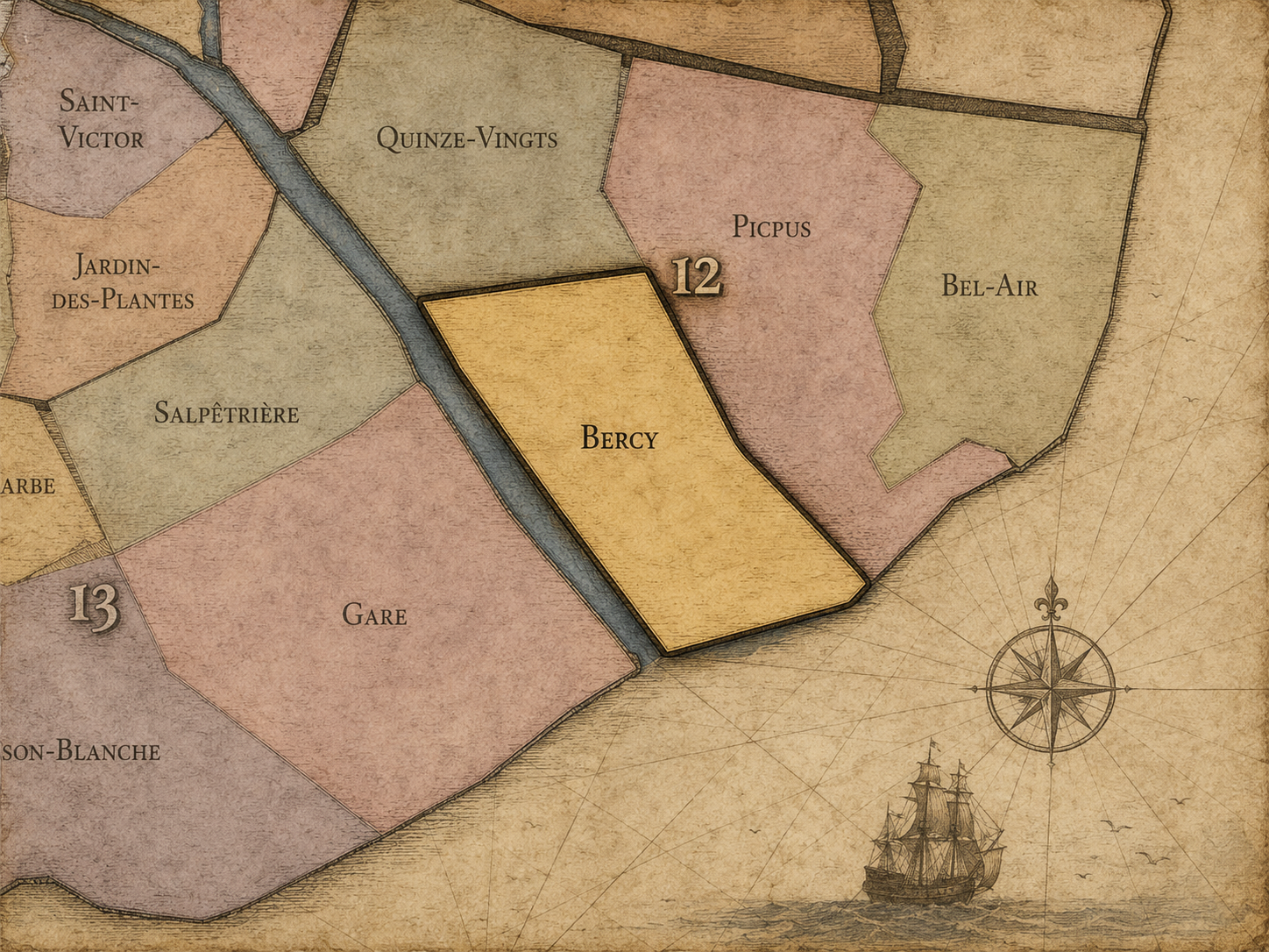
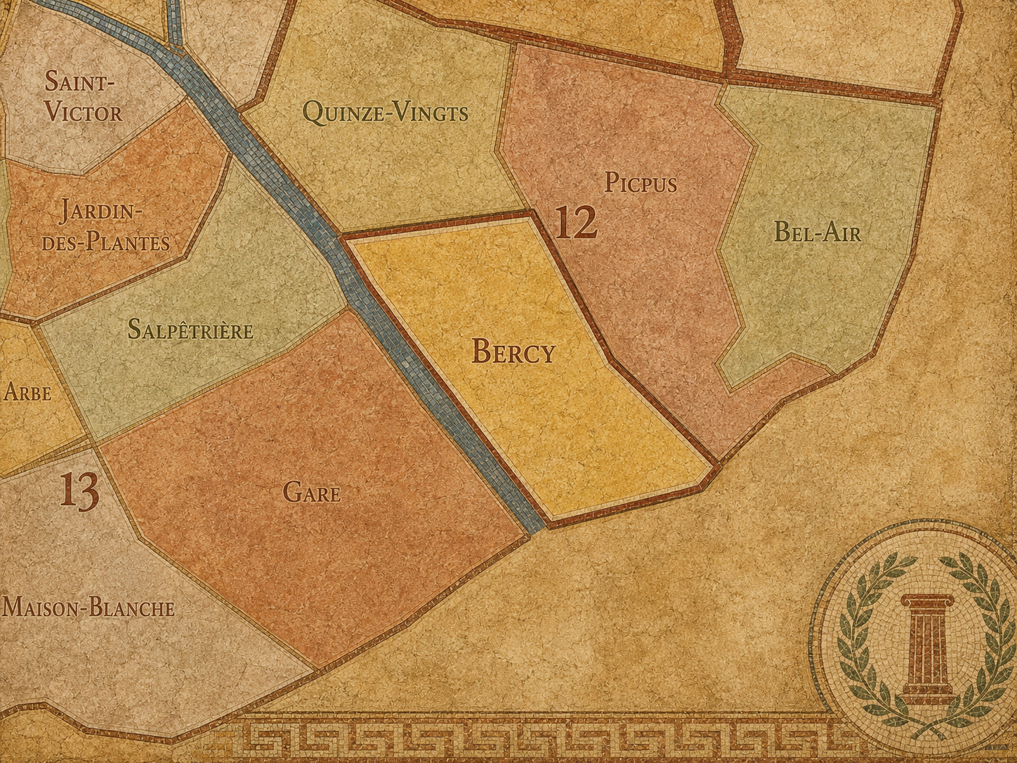
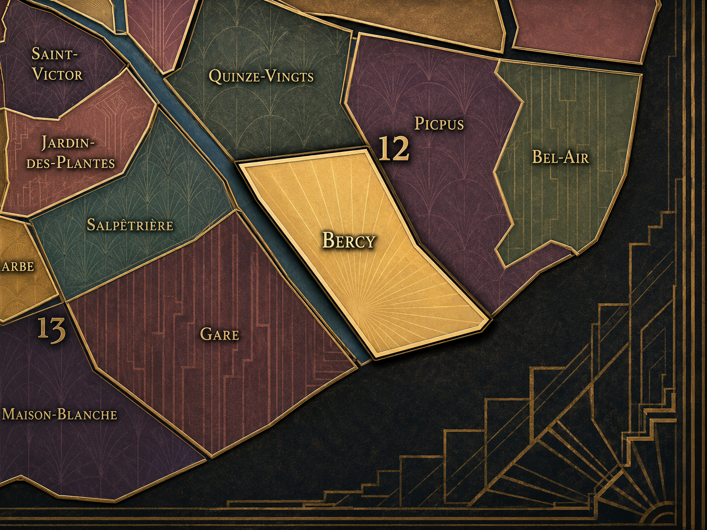
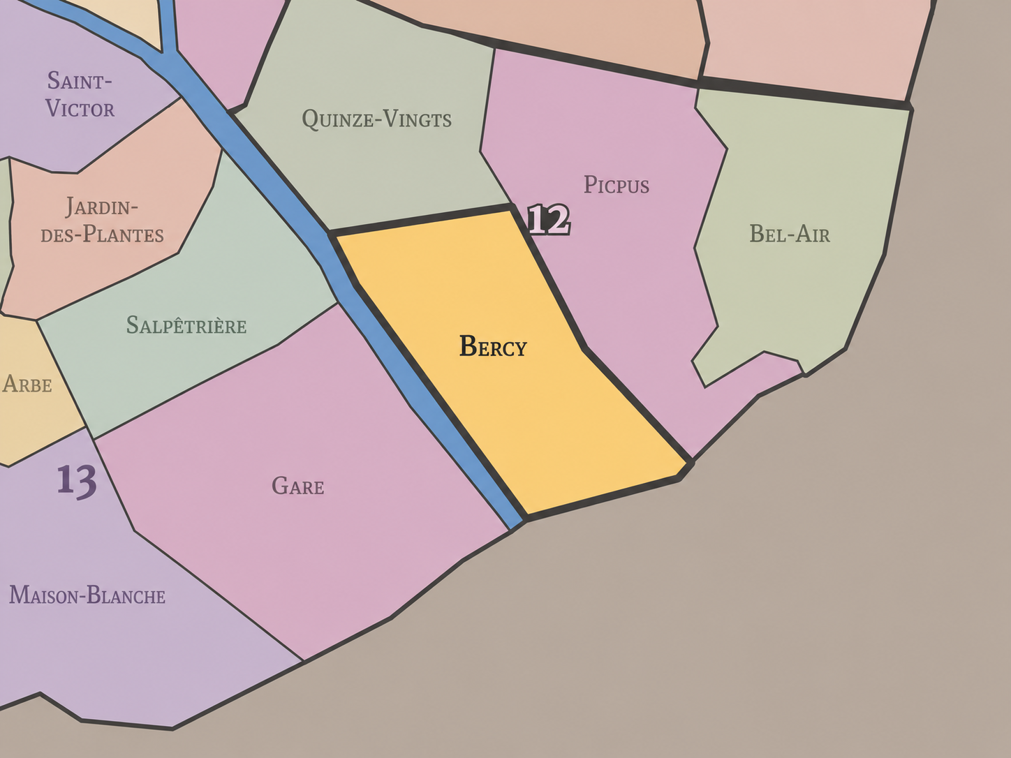
The Map
Geographic Setting
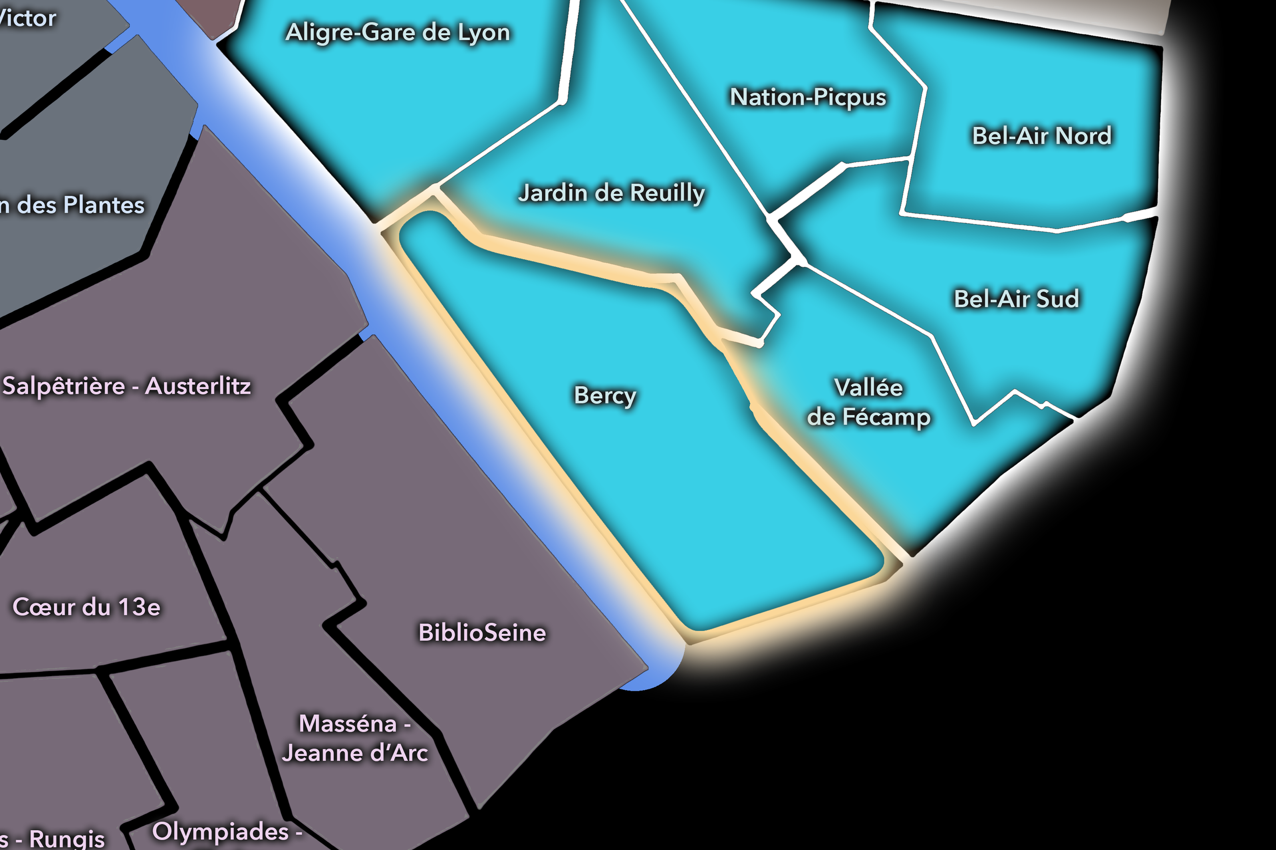
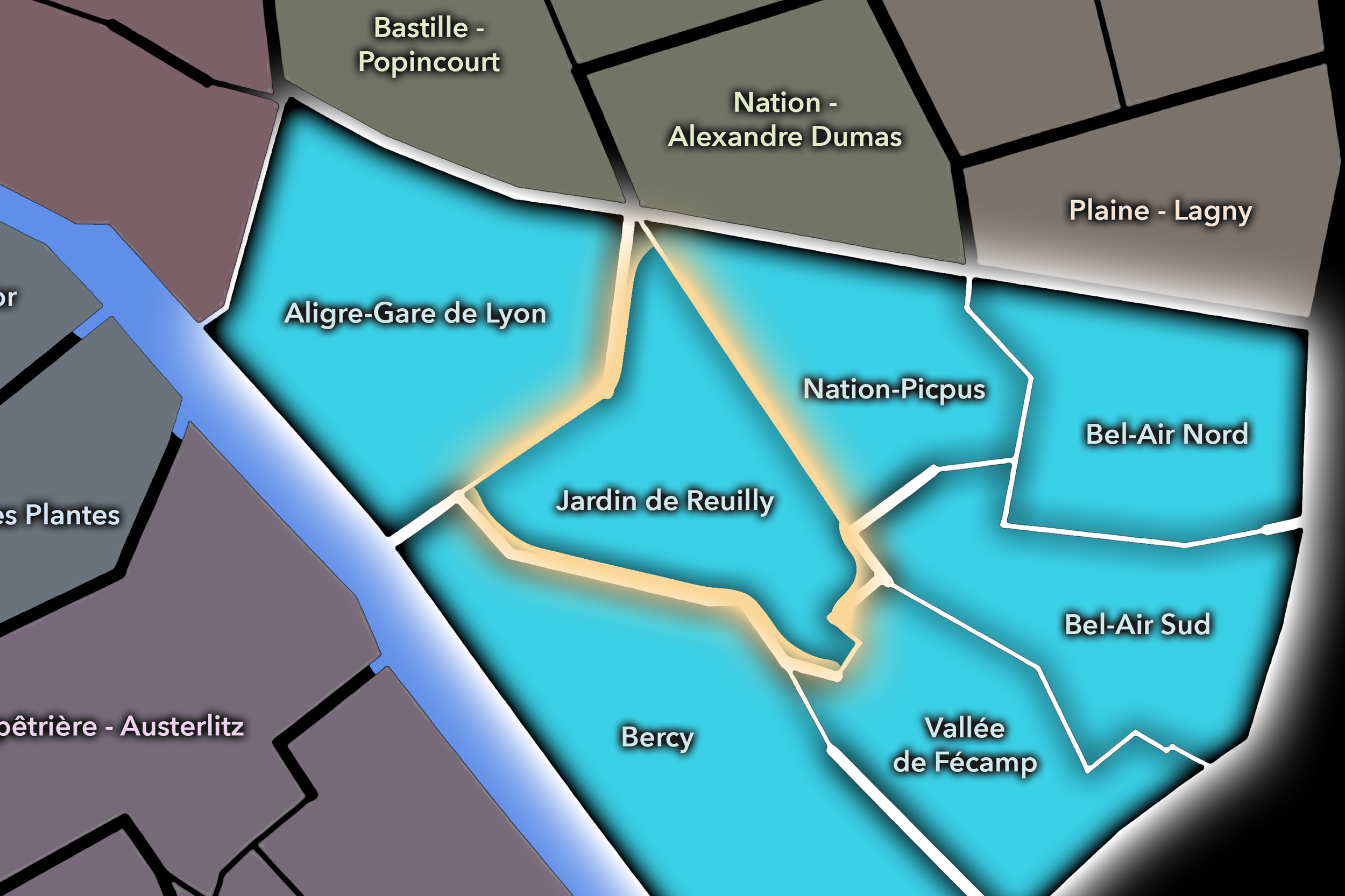
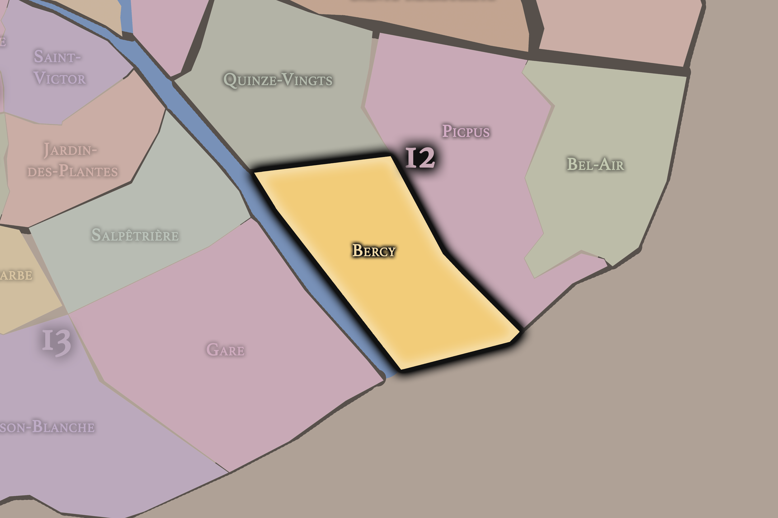
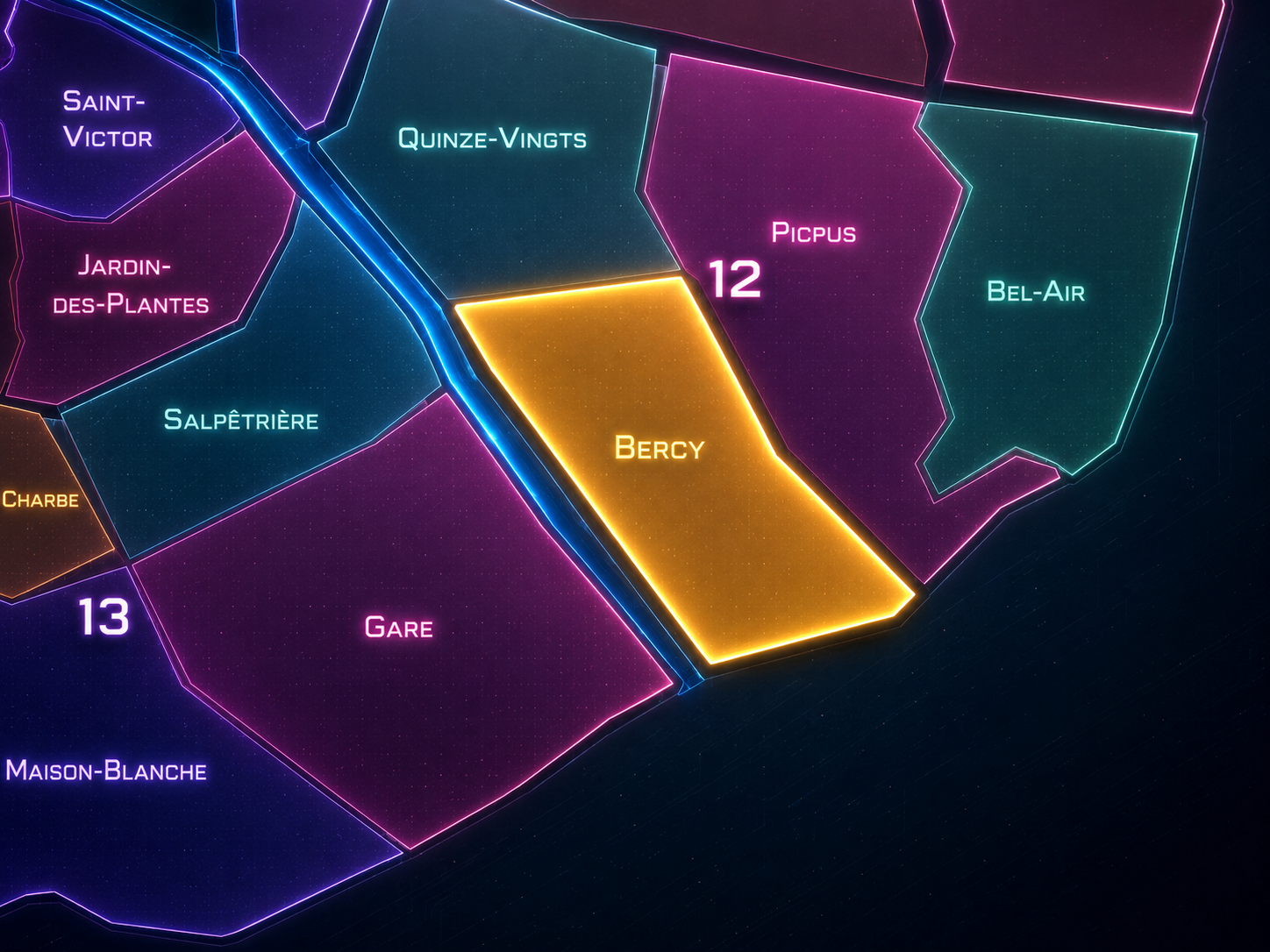
Bercy occupies the southeastern riverfront of the 12th arrondissement, where Paris follows the Seine toward Charenton, Ivry, the Bois de Vincennes, and the eastern gateways of the city. It lies south of Picpus and Bel-Air, east and southeast of Quinze-Vingts, and across the river from the 13th arrondissement’s modern Seine-side districts. Its geography is shaped by water, rail, warehouses, parkland, sports and performance venues, contemporary development, and the memory of a former wine-trade landscape that once made this quarter one of the great commercial thresholds of Paris.
The quarter’s defining places include the Parc de Bercy, Bercy Village, the Cour Saint-Émilion, the Accor Arena, the Ministère de l’Économie et des Finances, the Cinémathèque française, the Seine quays, the former wine warehouses, the rail corridors near Gare de Lyon and the southeastern approaches, and the modern streets that connect Bercy to the Bibliothèque François-Mitterrand across the river. Bercy is one of the places where the 12th arrondissement feels most transformed: older industrial and commercial ground converted into park, culture, commerce, administration, housing, and leisure.
Unlike Bel-Air, whose identity is more residential and green-edged near the Bois de Vincennes, or Picpus, whose name carries deeper religious, revolutionary, and faubourg memory, Bercy is a quarter of large-scale reinvention. It is Paris as former edge remade into contemporary district — a place where the infrastructure of trade became the architecture of public life.
Administrative Quarter Identity
Etymology and Origins
The name Bercy comes from the former village and domain of Bercy, an old settlement east of Paris whose identity developed along the Seine before being absorbed into the capital. The name predates the modern administrative quarter and recalls a time when this area stood outside the dense city, oriented toward river traffic, estates, warehouses, and the roadways leading toward Charenton and the southeast.
Bercy is not a saint’s name, not a church quarter, not a gate, and not an institutional title. It is a place-name rooted in an older local geography. That gives it a different character from many central Parisian administrative quarters. The name preserves the memory of a former village-like and commercial landscape that Paris later engulfed, reorganized, and reinvented.
Over time, Bercy became especially associated with wine. Its riverside location made it ideal for receiving, storing, taxing, blending, and distributing wine brought toward Paris. The name Bercy therefore came to evoke not only a locality, but a whole economy of barrels, cellars, warehouses, merchants, rail links, river transport, and popular consumption. In the modern quarter, that memory survives most visibly in Bercy Village and the preserved warehouse architecture of the Cour Saint-Émilion.
Civic Framework
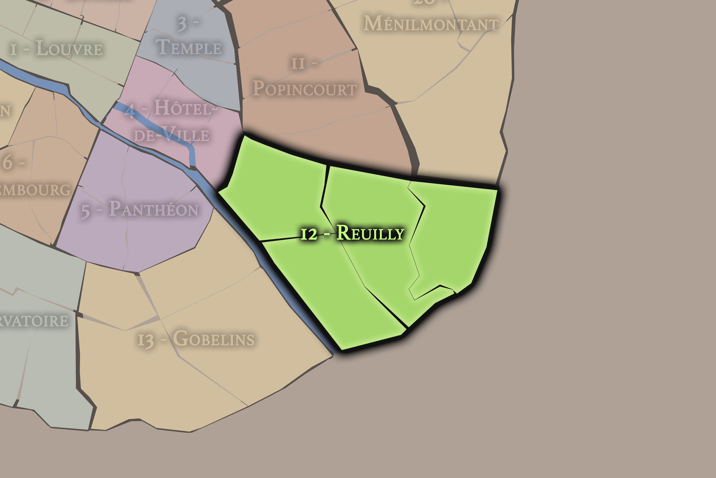
Within the official geography of Paris, Bercy is one of the four administrative quarters of the 12th arrondissement, alongside Quinze-Vingts, Picpus, and Bel-Air. It occupies the arrondissement’s southern and southeastern sector, giving formal civic shape to the Seine-side landscape between Gare de Lyon, Charenton, the eastern edge of Paris, and the modern developments that have transformed the former warehouse district.
As an administrative quarter, Bercy clarifies an area that is often described through individual landmarks or redevelopment projects: Bercy Village, Parc de Bercy, the arena, the finance ministry, Cour Saint-Émilion, or the Seine-side 12th. The official quarter name gathers these pieces into one mapped civic unit and connects contemporary Bercy to the older village and wine-trade landscape beneath it.
This frame is especially useful because Bercy is one of the clearest examples of modern Parisian redevelopment. It is not simply an old neighborhood preserved in place. It is a quarter where former industrial, commercial, and infrastructural land was reorganized into a new urban composition. The administrative name gives continuity to that transformation, allowing the old Bercy and the new Bercy to be read together.
Neighborhood Distinction
Bercy differs from the other quarters of the 12th arrondissement through its riverfront, warehouse, and redevelopment identity. Quinze-Vingts is tied to Bastille, Gare de Lyon, the old hospital foundation, the Viaduc des Arts, and the western entrance into the 12th. Picpus carries religious, revolutionary, cemetery, and residential memory, along with the broader inheritance of the eastern faubourgs. Bel-Air is quieter and more residential, defined by the city’s eastern edge, the Porte de Vincennes, and the approach to the Bois de Vincennes.
Bercy is more infrastructural and more recently remade. Its identity comes from large plots, riverside trade, wine warehouses, rail and road access, public parkland, modern cultural facilities, sports venues, and contemporary planning. It is the 12th arrondissement’s clearest example of an old working landscape converted into a new urban district.
It should also be distinguished from the broader Seine Rive Gauche redevelopment across the river in the 13th arrondissement. Both Bercy and the opposite bank reveal modern eastern Paris remaking former industrial and rail-related land, but they have different histories and atmospheres. Bercy retains the memory of wine warehouses and village name; the 13th’s opposite bank is more strongly associated with the national library, new urbanism, university development, and contemporary high-density planning. Together, they form one of the great modern riverfront conversations of eastern Paris.
Parisian Identity
Bercy expresses Paris as a city of conversion. It is one of the places where the capital has most visibly transformed a working commercial landscape into a contemporary public district. Wine warehouses became shops, restaurants, and cultural spaces. Industrial ground became parkland. Rail and river infrastructure became urban setting. A once peripheral trade district became a destination.
This gives Bercy a different Parisian identity from the older quarters of the city. It is not defined by medieval streets, aristocratic mansions, revolutionary squares, or literary cafés. It is defined by adaptive reuse, planning, memory, and the reimagining of industrial heritage. Its beauty is not always antique; it is often transitional — old stone warehouses beside contemporary buildings, broad park paths where commercial yards once stood, public venues rising from former logistical ground.
Bercy also reveals a Paris that looks eastward. For a long time, much of the city’s monumental image favored the center and west. Bercy belongs to the modern rebalancing of the city’s eastern side: making new parks, cultural sites, public venues, river crossings, and residential districts from land once dominated by storage, transit, and trade. It is Paris renewing itself through the places it once used but did not always celebrate.
Neighborhood Connections
Every neighborhood belongs to a wider Parisian fabric.
-
12e — Reuilly
-
Bercy
-
Jardin de Reuilly
-

Rive Droite
The History
Origins
The origins of Bercy lie outside the older city of Paris, in a riverside settlement and domain along the Seine near the routes toward Charenton and the southeast. Before it became part of the modern 12th arrondissement, Bercy existed as a locality with its own relationship to river movement, estates, agriculture, trade, and the expanding capital nearby.
Its position along the Seine was essential. The river made the area useful long before it became fashionable or redeveloped. Goods could arrive by water, and land outside the city’s older limits allowed storage, handling, and commercial activities that required space. Bercy’s later wine identity grew from this geography of access.
The quarter’s origin story is therefore one of service to the city from its edge. Bercy was not initially a ceremonial landscape. It was a practical one: land near water, road, and later rail, positioned to receive and distribute what Paris consumed. That practical origin remained central for centuries.
16th–17th Century
In the 16th and 17th centuries, Bercy remained outside the dense fabric of Paris, connected to the city but not yet absorbed into it. The area was shaped by the Seine, estates, cultivated land, roads, and riverside activity. Its distance from the crowded center made it suitable for uses that depended on space and access rather than prestige.
During this period, Bercy’s relationship to the eastern approaches of Paris grew stronger. The river corridor and roads toward Charenton and beyond gave the locality strategic value. It was not central in the symbolic sense, but it was useful — and usefulness is often the foundation of later urban identity.
The old village and domain landscape also gave Bercy a pre-Parisian memory. Like many places later incorporated into the capital, Bercy had a life before it became an arrondissement quarter. That earlier identity remained embedded in the name even after the city expanded around it.
18th Century
In the 18th century, Bercy’s role as a commercial and riverside landscape became increasingly important. The area developed more strongly around storage, trade, and the movement of goods into Paris. Wine became one of the great defining commodities of the district, supported by the Seine and by Bercy’s position just outside the densest city.
The quarter’s relationship to taxation and distribution was also important. Goods entering Paris were subject to systems of regulation and duty, and locations near the city boundary could become important spaces of storage and commercial negotiation. Bercy’s position at the edge made it useful for the wine trade and for the broader economy of provisioning the capital.
By the end of the century, the older village and riverside trade landscape was increasingly tied to the urban appetite of Paris. Bercy was becoming less a separate locality and more a commercial extension of the city’s needs. Its future as a warehouse and wine district was already taking shape.
19th Century
The 19th century made Bercy one of the great wine-trade districts of Paris. Warehouses, cellars, yards, merchants, coopers, barrels, and transport networks gave the quarter a strong commercial identity. Wine arrived by river and later by rail, was stored and handled in Bercy, and then moved onward into the markets, cafés, restaurants, and homes of the capital. The district became one of the places where Paris’s pleasures were made logistically possible.
The incorporation of Bercy into Paris in 1860, as part of the city’s major expansion, formally brought this former edge into the capital. This was a crucial turning point. Bercy was no longer outside Paris; it became part of the modern 12th arrondissement. Yet its warehouse identity remained strong, and its urban form continued to reflect large-scale commercial use rather than traditional neighborhood intimacy.
The 19th century also intensified the area’s relationship to rail and industrial infrastructure. Gare de Lyon and the southeastern rail corridors strengthened the quarter’s logistical role, while the Seine continued to structure its economy. Bercy became Paris as storage, movement, and distribution — a working district whose importance lay in what it carried for the city.
Early–Mid 20th Century
In the early and mid 20th century, Bercy remained strongly associated with wine warehouses and related trades. The district’s landscape of storage buildings, paved yards, rails, barrels, and commercial movement gave it a character quite different from the residential quarters nearby. It was a working landscape at the edge of central Paris, shaped by supply, labor, and the material realities of consumption.
The wine trade gave Bercy a social world as well as an economic one. Merchants, workers, transporters, coopers, café suppliers, and related businesses formed a dense network of activity. The district’s identity was practical, but not anonymous. It had sounds, smells, textures, and rhythms: carts, barrels, cellars, deliveries, conversations, and the routines of a trade that connected countryside, river, rail, and city.
During the upheavals of war, occupation, liberation, and postwar recovery, Bercy’s role as a provisioning and storage district remained significant. Working landscapes such as Bercy often reveal how cities survive: not through monuments, but through supply lines, warehouses, labor, and the stubborn continuity of distribution.
Late 20th Century
In the late 20th century, Bercy underwent one of the most dramatic transformations in eastern Paris. As the traditional wine warehouse economy declined and commercial logistics changed, large areas of the quarter became available for redevelopment. Rather than leaving the old warehouse district to disappear entirely, the city reimagined Bercy as a major landscape of parkland, culture, sport, administration, commerce, and new urban life.
The Parc de Bercy, developed on former wine warehouse land, became one of the great public spaces of the 12th arrondissement. Its design preserved traces of the old district while converting industrial ground into gardens, lawns, paths, and civic breathing room. Nearby, the former wine warehouses of the Cour Saint-Émilion were adapted into Bercy Village, turning commercial heritage into restaurants, shops, and pedestrian space.
The construction of major institutions and venues also transformed the quarter. The sports and concert arena, the Ministry of Economy and Finance, and later cultural institutions helped give Bercy a new metropolitan identity. The quarter moved from storage to destination, from logistical ground to public district.
21st Century
In the 21st century, Bercy is one of the clearest examples of contemporary eastern Paris. It is historic and newly built, commercial and green, river-facing and infrastructural, local and destination-oriented. The Parc de Bercy provides open space; Bercy Village preserves and repurposes the wine warehouse memory; the arena draws large crowds for concerts and sporting events; the finance ministry gives the quarter national administrative weight; and the Seine connects Bercy visually and physically to the redeveloped Left Bank across the water.
Today, the quarter’s identity depends on the success of its transformations. It can feel modern, planned, and somewhat less organically dense than older Parisian quarters, but that is part of its story. Bercy is not pretending to be medieval or village-like in the same way as some older districts. It is a quarter made from reuse, reinvention, and large-scale urban repair.
For CityNeighborhoods: Paris, Bercy is essential because it shows how administrative quarters can document not only deep historical continuity, but modern urban change. Bercy is one of the places where Paris reveals what it does with obsolete infrastructure: it remembers, adapts, builds, plants, programs, and reopens former working land to public life.
Spirit and Legacy
Bercy is the quarter where Paris turns storage into landscape. Its spirit is riverine, adaptive, and transformative. It belongs to wine barrels and warehouse stones, rail lines and river quays, park paths and performance crowds, old commercial yards and new cultural destinations. It is a place where the working memory of the city has been reshaped without being entirely erased.
Its legacy is the transformation of use into renewal. A former village became a trade district. A trade district became a wine warehouse landscape. A warehouse landscape became park, village, arena, ministry, cinema, and contemporary riverfront quarter. Each layer changed the meaning of Bercy, but the theme remained consistent: this is a place where Paris reorganizes what it needs.
To walk Bercy is to encounter Paris not as untouched preservation, but as deliberate reinvention. The quarter reminds us that cities survive by reusing themselves. In Bercy, neighborhood identity is made from conversion — from river trade to public park, from warehouse to café, from logistical edge to one of eastern Paris’s most legible modern landscapes.
The Photography
Visual Identity

The visual identity of each Paris district begins with its position in the city’s layered geography. Before the photographs arrive, the maps establish a first way of seeing: where the district sits, what civic layer it belongs to, which boundaries define it, and how it connects to the surrounding fabric of Paris. In CityNeighborhoods Paris, cartography is not merely orientation; it is part of the visual language of the project.
As the photographic archive grows, this section will continue to develop through images gathered on foot. Streets, façades, monuments, markets, parks, river edges, passages, signs, textures, and everyday details will gradually reveal how each district presents itself visually. The goal is not only to show what a place looks like, but to trace how its identity becomes visible through form, atmosphere, memory, and use.
Through The Lens

CityNeighborhoods Paris is built from walking, looking, and returning. Each district is approached through photography as a way of paying attention: to the obvious landmarks and the quieter details, to historic structures and ordinary streets, to the moments where civic geography becomes lived experience. The camera becomes a tool for noticing how Paris changes from one district to the next, and how each place holds its own relationship to the larger city.
As photographs are processed and added, this section will become a more specific visual record of the district. Future updates may include dated field notes, galleries, and reflections from individual walks. For now, the page remains part of the larger CityNeighborhoods effort to document every Paris neighborhood through maps, history, identity, and photography — one district, one walk, and one visual encounter at a time.
If you visit Paris, these ideas can help inspire your own photography.


Paris: J’Espere, Je Rêve, Je Vive
Paris Photo Gallery
Paris Flâneur Notes
Flâneur Notes document the walks, photographs, light, and street-level observations behind this neighborhood entry. Learn more about the Spirit of the Flâneur.


Explore Paris
-

The twenty arrondissements form the civic spiral of Paris, organizing the city into its broad local districts of government, identity, and daily life.
-

Each arrondissement is divided into four official administrative quarters, giving Paris a more precise civic and geographic framework.
-

The conseils de quartier bring participation to street level, giving residents a voice in neighborhood needs, public space, and local civic life.
-

Les Deux Rives trace Paris through the Seine’s two banks, revealing how the Rive Droite and Rive Gauche shaped the city’s civic power, commerce, learning, art, and cultural identity.
-

Cultural neighborhoods reveal the Paris people recognize through history, cafés, architecture, memory, atmosphere, and local belonging.