
13e - SALPÊTRIÉRE
Quartiers Administratifs
Welcome to the Salpêtrière neighborhood page! Salpêtrière is a quartier administratif — an administrative quarter — one of 80 such districts across Paris. As a quartier administratif of the 13e Arrondissement - Gobelins, Salpêtrière belongs to a formal layer of Parisian geography and is anchored by the vast hospital complex that gives the quarter its name, while nearby Gare d’Austerlitz, the Seine, and the edges of the Jardin des Plantes connect medical history with transport and riverfront change.
Part of an ongoing project to walk and photograph every neighborhood in Paris, this page explores 13e Salpêtrière through maps, district identity, history, and photography.


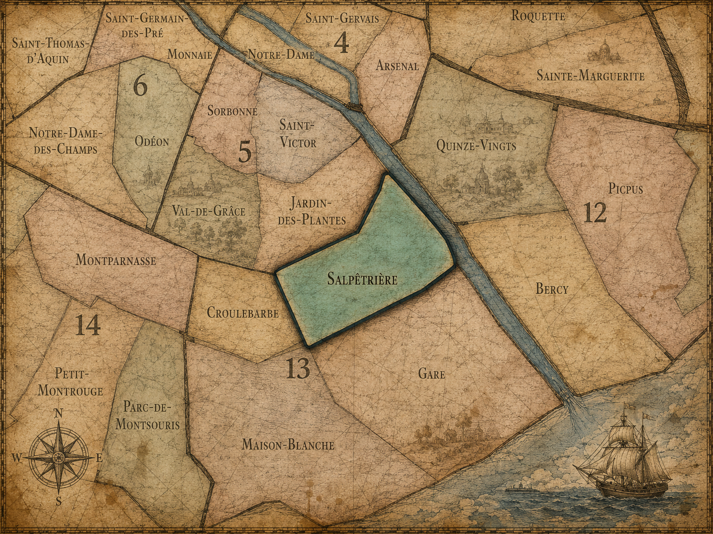
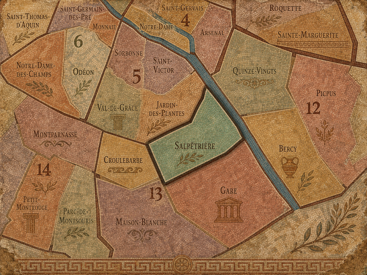
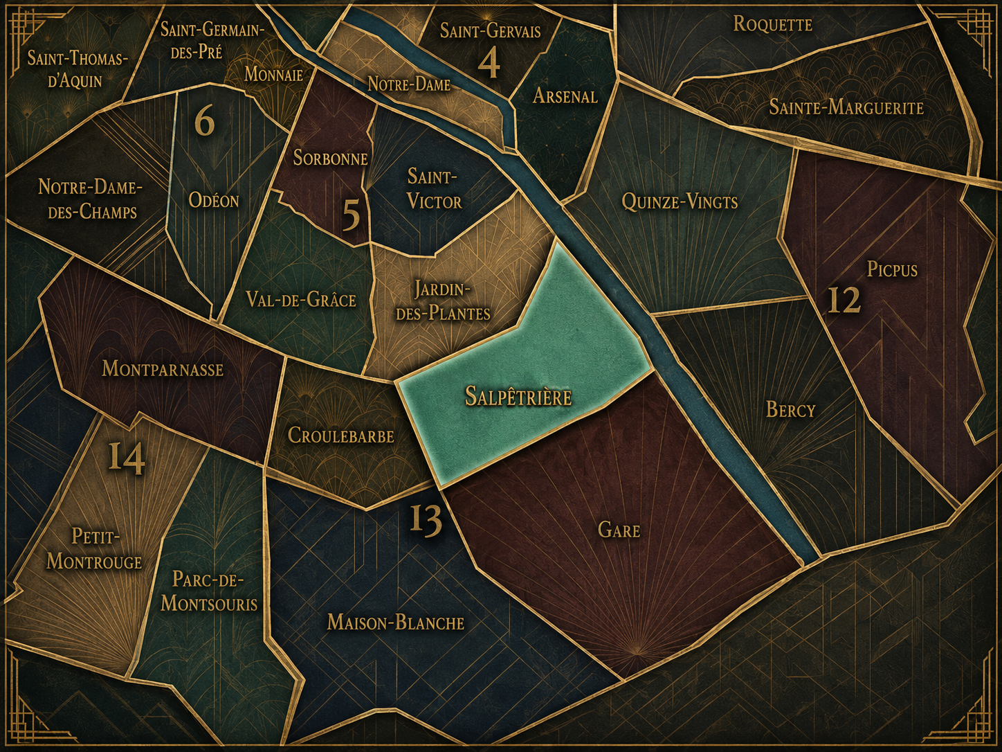
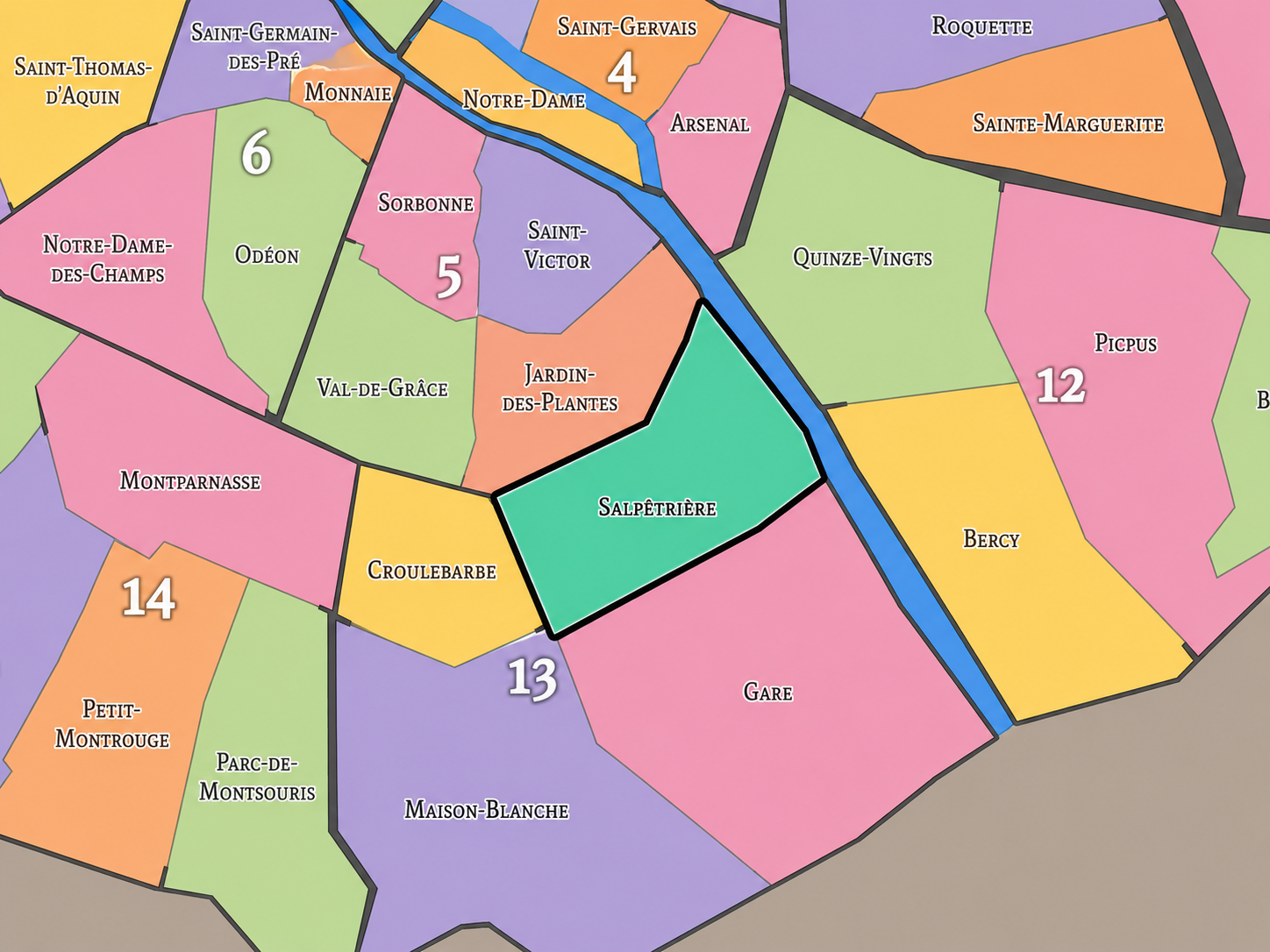
The Map
Geographic Setting
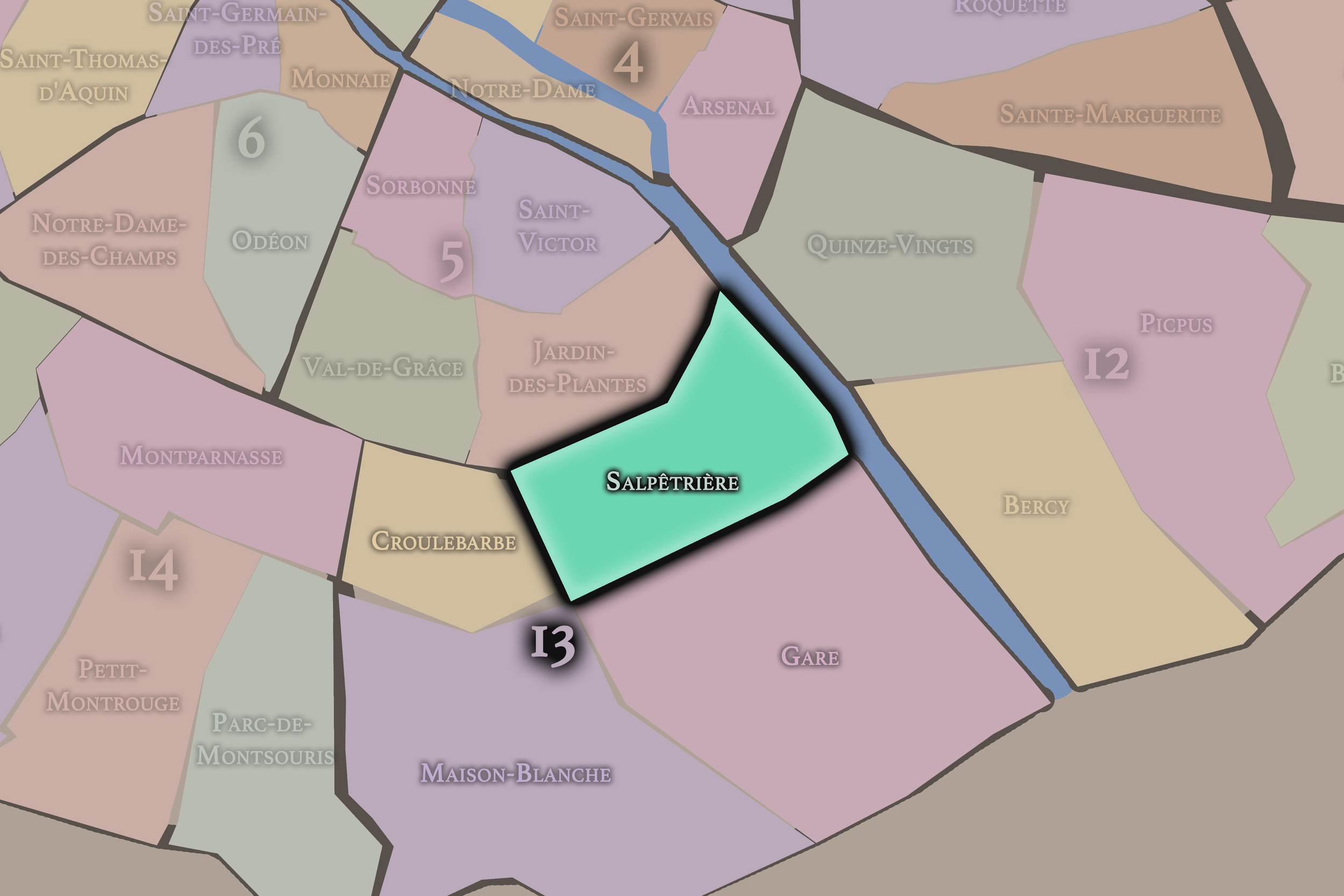
Salpêtrière occupies the northeastern portion of the 13th arrondissement, where the Left Bank’s old institutional edge meets the Seine, the rail approaches to Austerlitz, the hospital landscapes of eastern Paris, and the modern transformations of Paris Rive Gauche. It lies east of Croulebarbe, north and northwest of Gare, and northeast of Maison-Blanche, forming one of the 13th arrondissement’s most powerful landscapes of medicine, infrastructure, enclosure, and urban transition.
The quarter is anchored by the Pitié-Salpêtrière hospital complex, one of the great medical institutions of Paris, whose vast grounds sit between Boulevard de l’Hôpital, the Seine-facing rail corridors, Gare d’Austerlitz, and the older streets leading toward the Jardin des Plantes and the 5th arrondissement. Nearby are Place Valhubert, Quai d’Austerlitz, Boulevard Vincent-Auriol, Rue Jenner, Rue Esquirol, Rue Geoffroy-Saint-Hilaire, and the northern approaches toward the Seine and Austerlitz station. This is a quarter where Paris feels institutional and infrastructural before it feels intimate: hospital walls, rail lines, broad boulevards, medical buildings, and the city’s southeastern systems all meet here.
Unlike Croulebarbe, whose identity is compact and tied to the hidden Bièvre and Gobelins craft tradition, or Gare, whose character is shaped by rail yards, riverfront redevelopment, towers, and contemporary planning, Salpêtrière is defined by care at monumental scale. It is the 13th arrondissement as hospital city — a place where medicine, confinement, public health, teaching, and research have shaped urban identity for centuries.
Administrative Quarter Identity
Etymology and Origins
The name Salpêtrière comes from salpêtre, or saltpeter, an ingredient used in the production of gunpowder. Before the site became famous as a hospital, it was associated with the manufacture and storage of saltpeter under the monarchy. District histories note that Louis XIII had built a powder-related installation here, and that Louis XIV later transformed the site into part of the Hôpital Général system.
That origin gives the quarter one of the most striking transformations among the administrative quarters of Paris. A place connected to gunpowder and war became a place associated with confinement, illness, poverty, medicine, psychiatry, neurology, teaching, and public health. The name still remembers the chemical and military beginning, even though the site’s later history belongs overwhelmingly to the body, the hospital, and the city’s treatment of vulnerability.
The word itself has a hard material quality. It does not sound pastoral, devotional, or decorative. It speaks of substance, storage, and state power. Yet in Parisian memory, Salpêtrière now evokes one of the deepest institutional histories in the city: women confined, patients treated, doctors teaching, neurological medicine advancing, and the complex moral history of care and control unfolding behind hospital walls.
Civic Framework
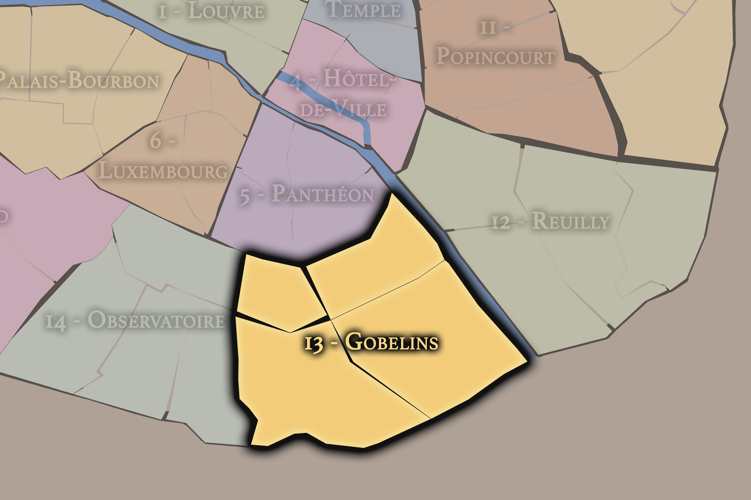
Within the official geography of Paris, Salpêtrière is one of the four administrative quarters of the 13th arrondissement, alongside Croulebarbe, Gare, and Maison-Blanche. It is traditionally counted as the 49th administrative quarter of Paris and forms the northern / northeastern sector of the arrondissement. District references identify it as a quarter of the 13th shaped by the Pitié-Salpêtrière hospital, the Austerlitz area, and the northern edge of the arrondissement.
As an administrative quarter, Salpêtrière gives civic shape to an area often described through stronger landmarks: Pitié-Salpêtrière, Gare d’Austerlitz, Boulevard de l’Hôpital, Austerlitz, the Jardin des Plantes edge, or Paris Rive Gauche. The official name gathers these pieces into one mapped unit and places the hospital at the center of the quarter’s identity.
This frame is especially useful because the district can otherwise feel divided between institutions and infrastructure. The hospital occupies enormous historical and physical weight, while Austerlitz and the rail corridors pull the quarter toward movement, transit, and redevelopment. Salpêtrière as an administrative quarter allows these systems to be read together: care, confinement, teaching, rail, river, and modern urban change.
Neighborhood Distinction
Salpêtrière differs from the other quarters of the 13th arrondissement through its medical, institutional, and northern-edge character. Croulebarbe is smaller and older in texture, shaped by the hidden Bièvre and the Gobelins manufactory. Gare is more infrastructural and redevelopment-driven, defined by rail, riverfront land, Olympiades, the Bibliothèque François-Mitterrand, and Paris Rive Gauche. Maison-Blanche is broader and more residential, holding Place d’Italie, Butte-aux-Cailles, Asian commercial corridors, tower landscapes, and the southern edge of the arrondissement.
Salpêtrière is more enclosed and monumental in institutional meaning. Its identity comes from the hospital complex: not just as a building, but as a vast urban world with its own courtyards, wards, chapels, research spaces, teaching histories, and moral contradictions. It is a quarter where Paris placed some of its most difficult responsibilities: care for the sick, confinement of the poor, management of mental illness, medical classification, and later scientific specialization.
It should also be distinguished from Austerlitz as a transit identity. Gare d’Austerlitz is a powerful landmark within the broader geography of the quarter, but Salpêtrière is not simply a station district. The hospital gives the quarter a longer and more profound institutional history than the rail landscape alone can explain.
Parisian Identity
Salpêtrière expresses Paris as a city of care and control. That duality is essential. The site has been a hospital, hospice, asylum, prison-like institution, teaching center, and research landscape. It represents medicine, but also the older systems by which cities confined poverty, disability, madness, age, and social vulnerability. Salpêtrière is therefore not a simple story of progress. It is a place where compassion and authority were often intertwined.
This makes the quarter one of the most morally complex landscapes in Paris. The Pitié-Salpêtrière has produced extraordinary medical knowledge, especially in neurology and clinical teaching. Jean-Martin Charcot’s work at the Salpêtrière in the 19th century helped make the hospital one of Europe’s most important neurological centers; Britannica describes him as a founder of modern neurology and notes that he opened a major neurological clinic there in 1882.
At the same time, the quarter’s history includes the confinement of women, the poor, the elderly, the sick, and those categorized as mentally ill. Salpêtrière is Paris as medical institution, but also Paris as social system: the city deciding who belongs in public, who must be enclosed, who must be treated, who must be studied, and who becomes part of scientific history.
Neighborhood Connections
Every neighborhood belongs to a wider Parisian fabric.
-
13e — Gobelins
-
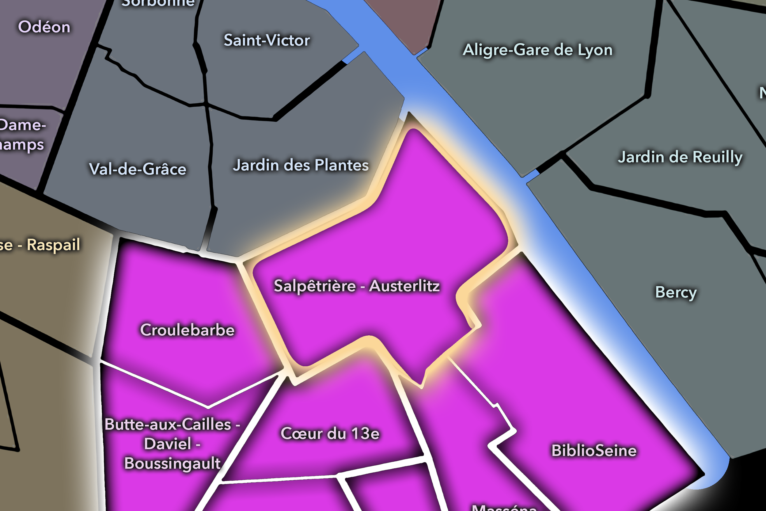
Salpêtrière - Austerlitz
-
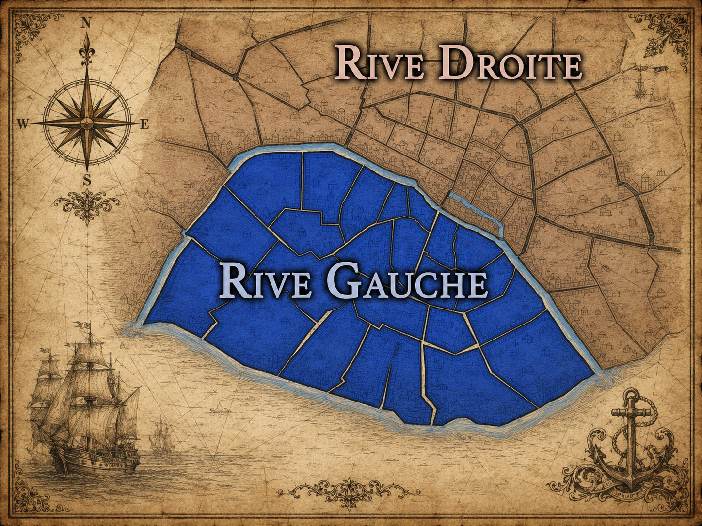
Rive Gauche
The History
Origins
The origins of Salpêtrière lie in the southeastern edge of Paris, beyond the older dense Left Bank but close to the Seine, the Jardin des Plantes area, and the routes leading toward Ivry and the eastern approaches of the city. Before the hospital complex gave the quarter its defining identity, the site belonged to a practical and somewhat marginal urban landscape suitable for storage, production, and large institutional use.
The saltpeter association is central to that origin. The site’s early connection to gunpowder production placed it within the military and material infrastructure of the monarchy. It was not a prestigious ceremonial landscape; it was useful ground. That usefulness made later transformation possible. A place already tied to state function could be repurposed into another kind of state institution.
In the mid-17th century, Louis XIV created the Hôpital Général system, and Salpêtrière became one of its largest and most important establishments. This marked the beginning of its long institutional life, especially as a place for women, the poor, the sick, and those considered socially marginal.
16th–17th Century
In the 16th century, the future Salpêtrière quarter remained outside the densest fabric of Paris, in a southeastern Left Bank landscape shaped by river access, roads, institutional land, and practical uses that required space. It did not yet have the identity of a hospital quarter, but its position made it suitable for large-scale functions beyond the crowded core of the city.
The 17th century gave Salpêtrière its decisive identity. After its association with saltpeter and powder production, the site was transformed under Louis XIV into part of the Hôpital Général. This was not a hospital in the modern sense alone; it was also a system of enclosure and social regulation. The Salpêtrière became a vast institution for women, including the poor, elderly, disabled, mentally ill, and socially vulnerable.
This period established the quarter’s enduring duality. It was created as a place of care, but also as a place of confinement. Its architecture and urban position expressed that tension: large, ordered, enclosed, and set apart from ordinary street life, yet deeply bound to the city’s social anxieties.
18th Century
In the 18th century, Salpêtrière continued as one of Paris’s major institutions of confinement and care. It housed large numbers of women across categories that modern society would now separate more carefully: poverty, illness, age, disability, mental distress, social vulnerability, and punishment. The institution functioned as both refuge and instrument of control, reflecting the limits and assumptions of early modern public welfare.
The Enlightenment brought new attention to classification, medicine, social reform, and the treatment of those confined in hospitals, hospices, and asylums. Salpêtrière became part of this changing conversation. Its population, scale, and complexity made it a place where the city’s medical, moral, and administrative systems confronted one another.
The Revolution intensified these questions. Institutions tied to monarchy, church, charity, and confinement were reinterpreted in the new civic order. Salpêtrière did not disappear; it became part of the modern state’s evolving relationship to medicine, poverty, women, and public care. The quarter entered the 19th century carrying both the old regime’s institutional weight and the new era’s reformist ambitions.
19th Century
The 19th century transformed Salpêtrière into one of the most important medical and neurological landscapes in Europe. The institution remained a hospital and asylum, but it increasingly became a place of clinical observation, teaching, specialization, and scientific reputation. Its vast patient population made it a major site for the study and classification of disease.
Jean-Martin Charcot’s work gave the Salpêtrière international significance. He became associated with the development of modern neurology and with clinical teaching that drew students and observers from across Europe. Britannica notes his lifelong association with the hospital beginning in 1862 and his opening of a major neurological clinic there in 1882.
The century also gave Salpêtrière some of its most difficult modern legacy. Patients, particularly women diagnosed with hysteria or other neurological and psychiatric conditions, became subjects of intense medical observation and public demonstration. The hospital helped advance medicine, but it also exposed the unequal power relationships between doctor and patient, institution and individual, scientific gaze and vulnerable body.
Early–Mid 20th Century
In the early and mid 20th century, Salpêtrière remained a major hospital landscape within a changing 13th arrondissement. Its medical, neurological, psychiatric, and teaching functions continued, while the surrounding quarter was shaped by the expansion of rail, the activity of Gare d’Austerlitz, residential growth, and the broader modernization of southeastern Paris.
The hospital’s role during war, occupation, liberation, and postwar reconstruction was significant as part of the city’s medical infrastructure. Large hospitals become especially important during periods of crisis, when injury, disease, scarcity, and public health needs place extraordinary demands on institutions. Salpêtrière’s long history of care and confinement entered a new century of modern medicine, public hospitals, and scientific specialization.
During this period, the quarter’s identity remained institutional rather than picturesque. The hospital complex dominated the area’s historical meaning, while the nearby rail and river landscapes reinforced the sense that Salpêtrière belonged to the working systems of the city: treatment, transport, movement, and recovery.
Late 20th Century
In the late 20th century, Salpêtrière became part of the modern university-hospital landscape of Paris. The Pitié and Salpêtrière institutions were joined administratively in the 1960s into the Pitié-Salpêtrière hospital group, creating one of the largest and most important hospital centers in the city. Contemporary hospital histories note the 1964 formation of the Pitié-Salpêtrière group within the Assistance Publique–Hôpitaux de Paris system.
The surrounding quarter also changed as the 13th arrondissement began to undergo major urban transformations. The rail lands and Seine-side areas to the east and south entered long processes of redevelopment, while the hospital maintained continuity amid a changing urban environment. Salpêtrière stood as one of the quarter’s enduring institutional anchors while Paris Rive Gauche and other modern projects reshaped nearby landscapes.
This period also brought renewed historical attention to the hospital’s psychiatric and neurological past. Charcot, the history of hysteria, the treatment of women, the evolution of neurology, and the ethics of medical observation all became subjects of scholarship and critique. Salpêtrière’s legacy was no longer only celebrated; it was also reexamined.
21st Century

In the 21st century, Salpêtrière remains one of Paris’s most important medical quarters. The Pitié-Salpêtrière hospital continues to function as a major hospital and university medical center, while the surrounding district connects to Gare d’Austerlitz, the Jardin des Plantes edge, Paris Rive Gauche, and the broader transformation of the 13th arrondissement. The quarter remains deeply institutional, but it is increasingly part of a larger urban field of transit, research, public health, and redevelopment.
Today, the quarter’s identity is shaped by both continuity and reconsideration. The hospital continues its work of care, teaching, and research, but its long history invites a more nuanced reading of medicine and power. Salpêtrière is admired for medical achievement, but it also reminds us that institutions have histories of exclusion, confinement, misclassification, and unequal authority. That complexity makes the quarter more important, not less.
For CityNeighborhoods: Paris, Salpêtrière is essential because it shows how an administrative quarter can be defined by an institution whose meaning has changed across centuries. Saltpeter works became hospital. Hospital became hospice and asylum. Asylum became clinical teaching center. Teaching center became modern university hospital. Each layer remains part of the story.
Spirit and Legacy
Salpêtrière is the quarter where Paris confronts the body at institutional scale. Its spirit is solemn, powerful, and deeply complicated. It belongs to saltpeter and hospital walls, women’s wards and medical amphitheaters, neurological clinics and patient histories, railway edges and modern hospital corridors. It is a place where the city’s duty to care has always existed alongside the power to classify, confine, and observe.
Its legacy is transformation through medicine — but medicine understood in its full moral weight. A site of gunpowder production became a landscape of public welfare. A place of confinement became a center of clinical knowledge. A hospital associated with some of the most vulnerable people in Paris became one of the great medical institutions of Europe. That legacy includes achievement, suffering, reform, and unresolved questions.
To walk Salpêtrière is to encounter Paris behind walls of care. The quarter does not offer easy beauty. It asks for seriousness. It reminds us that neighborhoods are not only made from markets, churches, cafés, or monuments. They can also be made from institutions that hold the city’s most fragile lives. In Salpêtrière, neighborhood identity becomes responsibility — the long, difficult responsibility of caring for the body within the city.
The Photography
Visual Identity

The visual identity of each Paris district begins with its position in the city’s layered geography. Before the photographs arrive, the maps establish a first way of seeing: where the district sits, what civic layer it belongs to, which boundaries define it, and how it connects to the surrounding fabric of Paris. In CityNeighborhoods Paris, cartography is not merely orientation; it is part of the visual language of the project.
As the photographic archive grows, this section will continue to develop through images gathered on foot. Streets, façades, monuments, markets, parks, river edges, passages, signs, textures, and everyday details will gradually reveal how each district presents itself visually. The goal is not only to show what a place looks like, but to trace how its identity becomes visible through form, atmosphere, memory, and use.
Through The Lens

CityNeighborhoods Paris is built from walking, looking, and returning. Each district is approached through photography as a way of paying attention: to the obvious landmarks and the quieter details, to historic structures and ordinary streets, to the moments where civic geography becomes lived experience. The camera becomes a tool for noticing how Paris changes from one district to the next, and how each place holds its own relationship to the larger city.
As photographs are processed and added, this section will become a more specific visual record of the district. Future updates may include dated field notes, galleries, and reflections from individual walks. For now, the page remains part of the larger CityNeighborhoods effort to document every Paris neighborhood through maps, history, identity, and photography — one district, one walk, and one visual encounter at a time.
If you visit Paris, these ideas can help inspire your own photography.


Paris: J’Espere, Je Rêve, Je Vive
Paris Photo Gallery
Paris Flâneur Notes
Flâneur Notes document the walks, photographs, light, and street-level observations behind this neighborhood entry. Learn more about the Spirit of the Flâneur.


Explore Paris
-

The twenty arrondissements form the civic spiral of Paris, organizing the city into its broad local districts of government, identity, and daily life.
-

Each arrondissement is divided into four official administrative quarters, giving Paris a more precise civic and geographic framework.
-

The conseils de quartier bring participation to street level, giving residents a voice in neighborhood needs, public space, and local civic life.
-

Les Deux Rives trace Paris through the Seine’s two banks, revealing how the Rive Droite and Rive Gauche shaped the city’s civic power, commerce, learning, art, and cultural identity.
-

Cultural neighborhoods reveal the Paris people recognize through history, cafés, architecture, memory, atmosphere, and local belonging.