
18e - CLIGNANCOURT
Quartiers Administratifs
Welcome to the Clignancourt neighborhood page! Clignancourt is a quartier administratif — an administrative quarter — one of 80 such districts across Paris. As a quartier administratif of the 18e Arrondissement - Butte-Montmartre, Clignancourt belongs to a formal layer of Parisian geography and stretches across the northern side of Montmartre toward Porte de Clignancourt. Clignancourt joins hillside streets, market life, Sacré-Cœur’s wider orbit, and the threshold of the famous flea-market landscape beyond the city’s edge.
Part of an ongoing project to walk and photograph every neighborhood in Paris, this page explores 18e Clignancourt through maps, district identity, history, and photography.

The Map
Geographic Setting
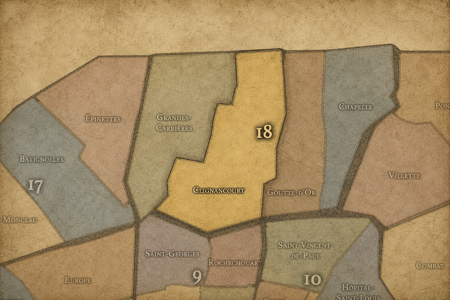
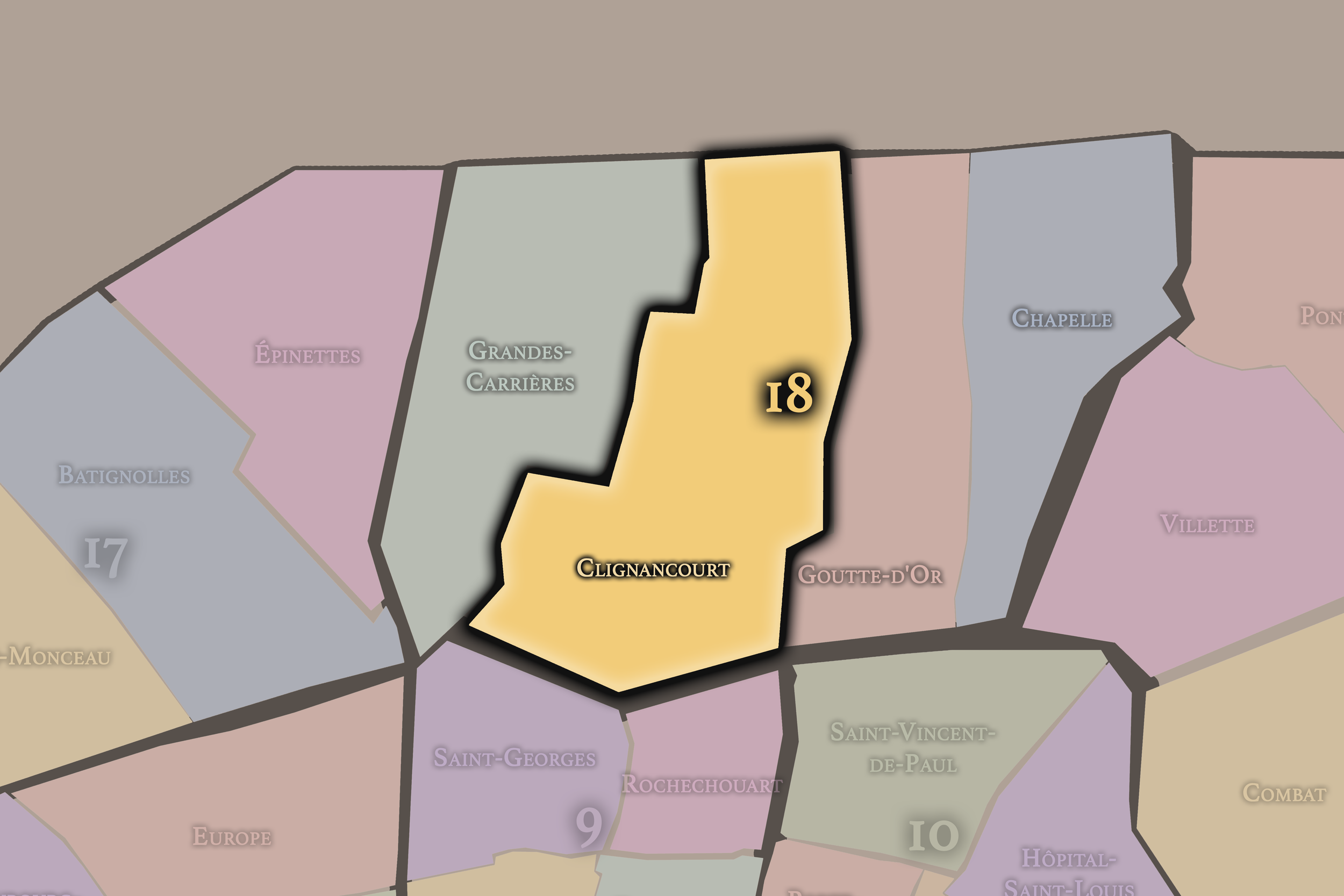
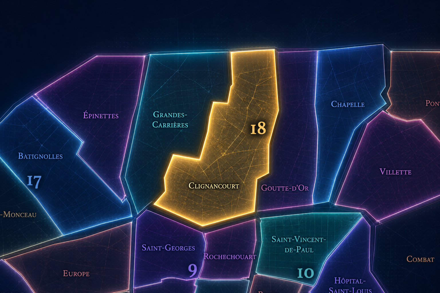
Clignancourt occupies the northern portion of the 18th arrondissement, where the slopes and summit-world of Montmartre give way to the dense northern edge of Paris, the Porte de Clignancourt, the boulevard des Maréchaux, and the boundary with Saint-Ouen. It lies north of Grandes-Carrières and Montmartre, west of La Chapelle, and along one of the capital’s most active thresholds between inner Paris and the northern suburbs. It is a quarter of contrast: hill and plain, old village and city edge, market streets and boundary roads, residential blocks and metropolitan flow.
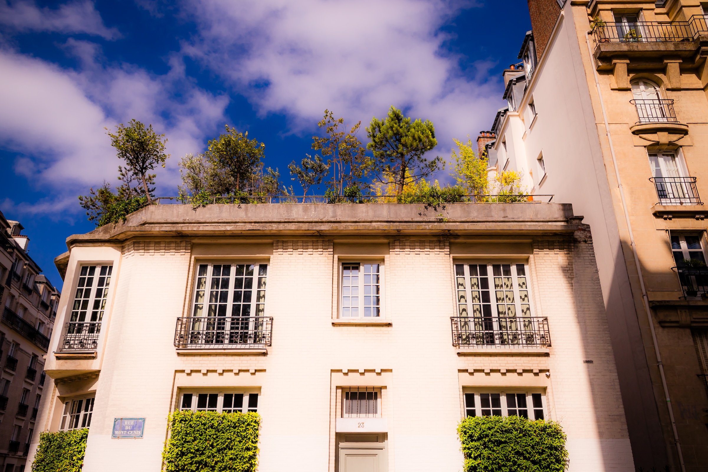
The quarter’s geography is shaped by Rue Ordener, Boulevard Ornano, Rue du Mont-Cenis, Rue Championnet, Rue Marcadet, Rue du Poteau, Rue Damrémont, Boulevard Ney, Porte de Clignancourt, and the streets that climb toward Montmartre or stretch outward toward Saint-Ouen. Its northern edge is strongly associated with the flea-market world beyond the city boundary, especially the Marché aux Puces de Saint-Ouen, while its interior contains one of the 18th arrondissement’s most lived-in residential fabrics: shops, schools, apartment blocks, cafés, markets, churches, social housing, and the mixed everyday life of northern Paris.
Unlike Montmartre, whose identity is globally mythologized through the hill, the basilica, artists, cabarets, and village imagery, Clignancourt is less theatrical and more boundary-conscious. Unlike Grandes-Carrières, whose identity is tied to quarries, cemeteries, and the western flank of Montmartre, Clignancourt turns more directly toward the northern city and the Paris-Saint-Ouen seam. It is the 18th arrondissement as urban edge: practical, dense, socially mixed, and marked by the long transformation of a former village into a working Parisian quarter.
Administrative Quarter Identity
Etymology and Origins
The name Clignancourt comes from an old locality north of Paris, long predating its incorporation into the capital. Like Auteuil, Passy, Batignolles, and other former villages or settlements absorbed by Paris, Clignancourt preserves a pre-annexation identity within the modern administrative map. The name refers to a place that once stood outside the city, connected to Montmartre, Saint-Ouen, the northern roads, and the open lands beyond the old urban core.
Its exact etymology is rooted in older place-name traditions rather than in a clear modern descriptive meaning. That is part of its importance. Clignancourt does not name a saint, a gate, a monument, or a single institution. It names a former settlement — a local geography that existed before the city expanded around it. The administrative quarter keeps that older name visible even though modern Clignancourt is now fully embedded in the dense fabric of Paris.
Over time, the name became associated not only with the former village, but with the northern threshold of Paris. “Porte de Clignancourt” is one of the capital’s recognizable edge names, tied to metro movement, boundary crossings, flea-market culture, and the passage toward Saint-Ouen. The name therefore carries two identities at once: the old village within the 18th and the gate through which Paris opens to the north.
Civic Framework
Within the official geography of Paris, Clignancourt is one of the four administrative quarters of the 18th arrondissement, alongside Montmartre, Grandes-Carrières, and La Chapelle. It occupies the arrondissement’s northern sector, giving civic shape to the area between Montmartre’s upper slopes, Porte de Clignancourt, Boulevard Ney, Rue Ordener, and the boundary with Saint-Ouen.
As an administrative quarter, Clignancourt clarifies a district often described through smaller or overlapping names: Jules Joffrin, Simplon, Porte de Clignancourt, Marcadet, Rue du Poteau, northern Montmartre, or the Saint-Ouen edge. These names all matter, but each captures only part of the quarter. Clignancourt is the official frame that gathers the former village, the residential streets, the boundary zone, the commercial corridors, and the northern approaches into one mapped unit.
This civic frame is especially useful because the 18th arrondissement is often dominated in the imagination by Montmartre. Clignancourt helps correct that imbalance. It shows that the arrondissement is not only a hilltop myth, but also a lived northern district of ordinary streets, social mixture, local commerce, immigration, public housing, market culture, and metropolitan edge conditions. The administrative quarter gives this less romantic but deeply Parisian layer a name.
Neighborhood Distinction
Clignancourt differs from the other quarters of the 18th arrondissement through its northern boundary position, its former-village identity, and its relationship to Saint-Ouen and the Porte de Clignancourt. Montmartre is the symbolic heart of the arrondissement: elevated, artistic, religious, touristic, and globally recognized. Grandes-Carrières is more western and slope-bound, tied to the quarry landscape, cemetery edges, and the quieter residential descent from Montmartre toward the 17th. La Chapelle is more eastern and infrastructural, shaped by rail corridors, immigrant commerce, industrial memory, and the Parisian north around Gare du Nord and Porte de la Chapelle.
Clignancourt sits between the hill and the boundary. It is less monumental than Montmartre, less quarry-defined than Grandes-Carrières, and less railway-dominated than La Chapelle. Its distinction lies in the way it combines neighborhood density with edge energy. Around Jules Joffrin and Rue du Poteau, it can feel like a strong local center; around Porte de Clignancourt and Boulevard Ney, it becomes a metropolitan threshold; near the slopes rising toward Montmartre, it carries the residue of the hill without becoming the myth itself.
It should also be distinguished from Saint-Ouen and the flea market world beyond the périphérique. The Marché aux Puces de Saint-Ouen is culturally tied to the Porte de Clignancourt name, and many visitors associate “Clignancourt” with the flea markets. But administratively, the market lies largely beyond Paris in Saint-Ouen. Clignancourt is the Parisian quarter at the gate, the neighborhood whose edge opens toward that broader market geography.
Parisian Identity
Clignancourt expresses Paris as a city of edges lived from within. It is not the ceremonial western gate of Porte-Dauphine, nor the royal-monumental threshold of Porte Saint-Denis, nor the picturesque village surface of Montmartre. It is a northern threshold shaped by residents, commuters, shoppers, vendors, families, students, migrants, bargain-hunters, and people moving between Paris and the suburbs every day. Its identity is made from use.
This makes Clignancourt essential to understanding the real 18th arrondissement. The quarter carries some of the tension and vitality of northern Paris: dense housing, mixed incomes, local markets, ethnic and social diversity, schools, cafés, public services, changing commerce, and the continual pressure of the city boundary. It is Paris as daily negotiation, not Paris as preserved image.
The quarter also reveals how powerful a gate name can become. Porte de Clignancourt is more than a point on the metro map. It is an entrance into a world of boundary commerce, flea-market memory, street vending, transit flow, and the complicated relationship between Paris and its neighboring communes. In Clignancourt, Paris does not end cleanly. It frays, trades, crosses, and continues.
Neighborhood Connections
Every neighborhood belongs to a wider Parisian fabric.
-
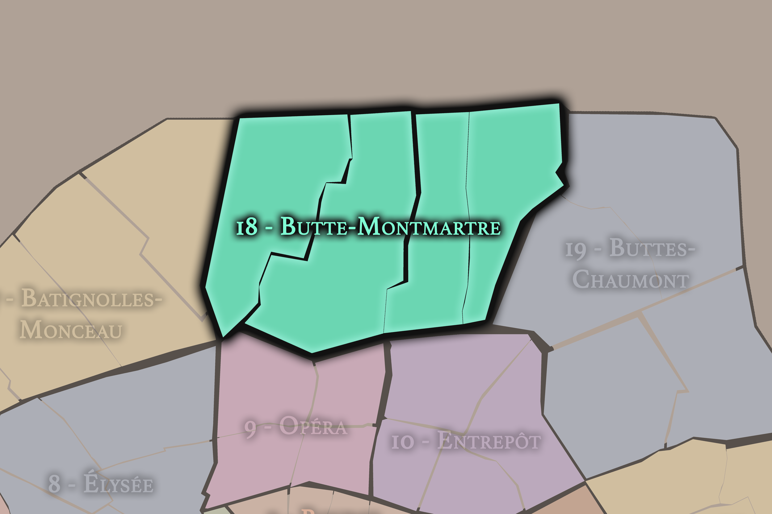
18e — Butte-Montmartre
-

Amiraux - Simplon - Poissonniers
-
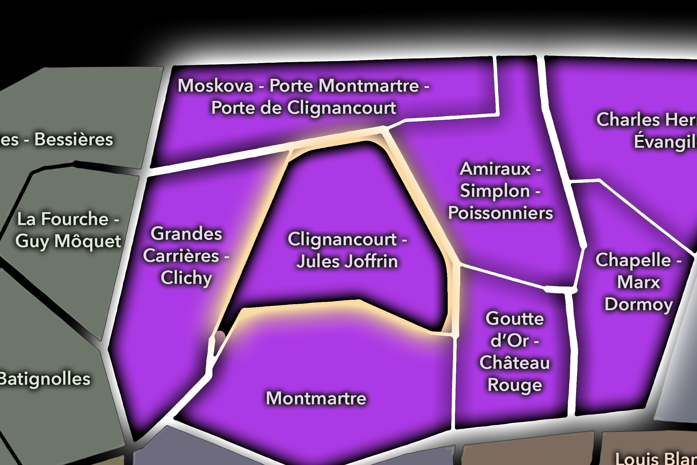
Clignancourt - Jules Joffrin
-
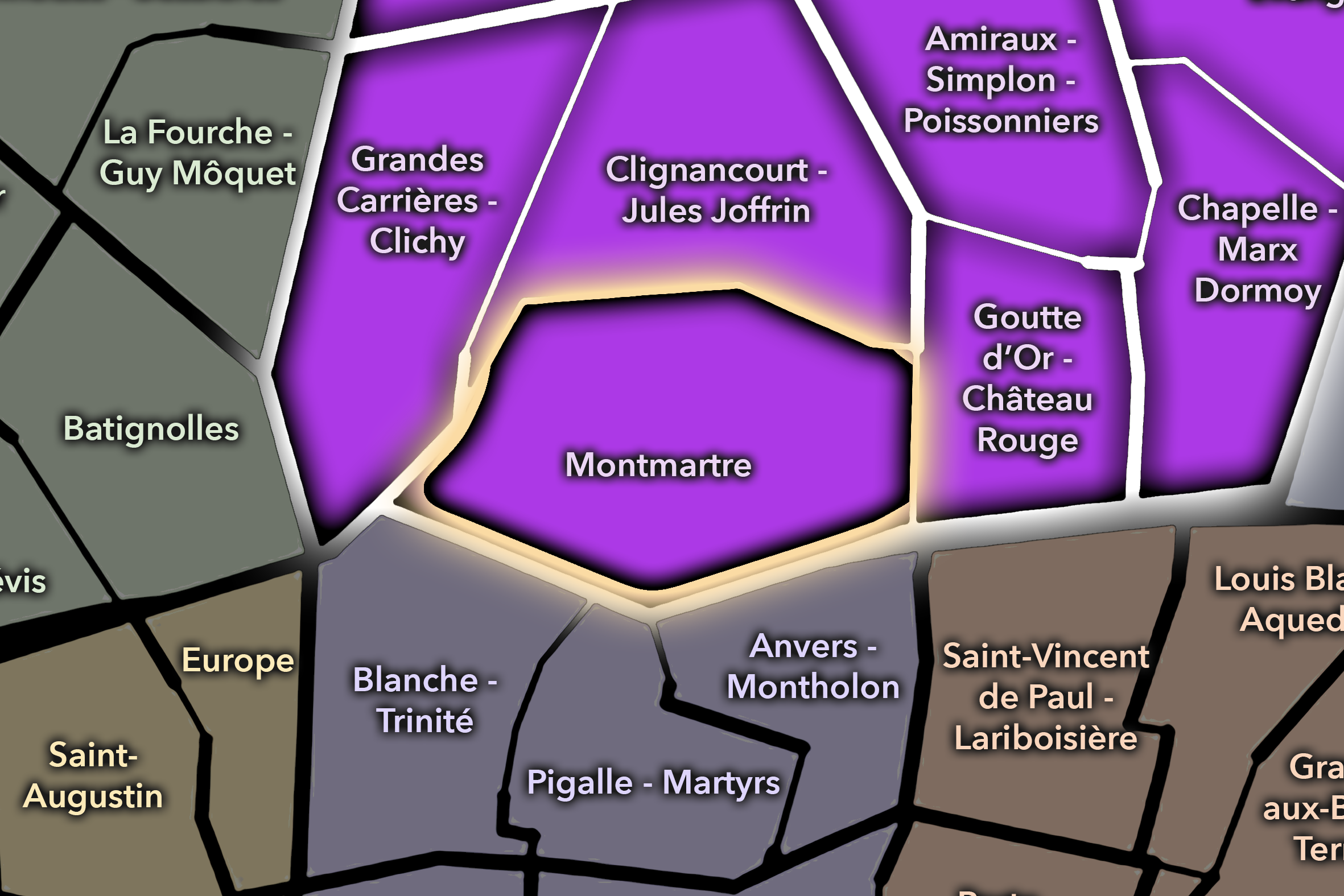
Montmartre
-
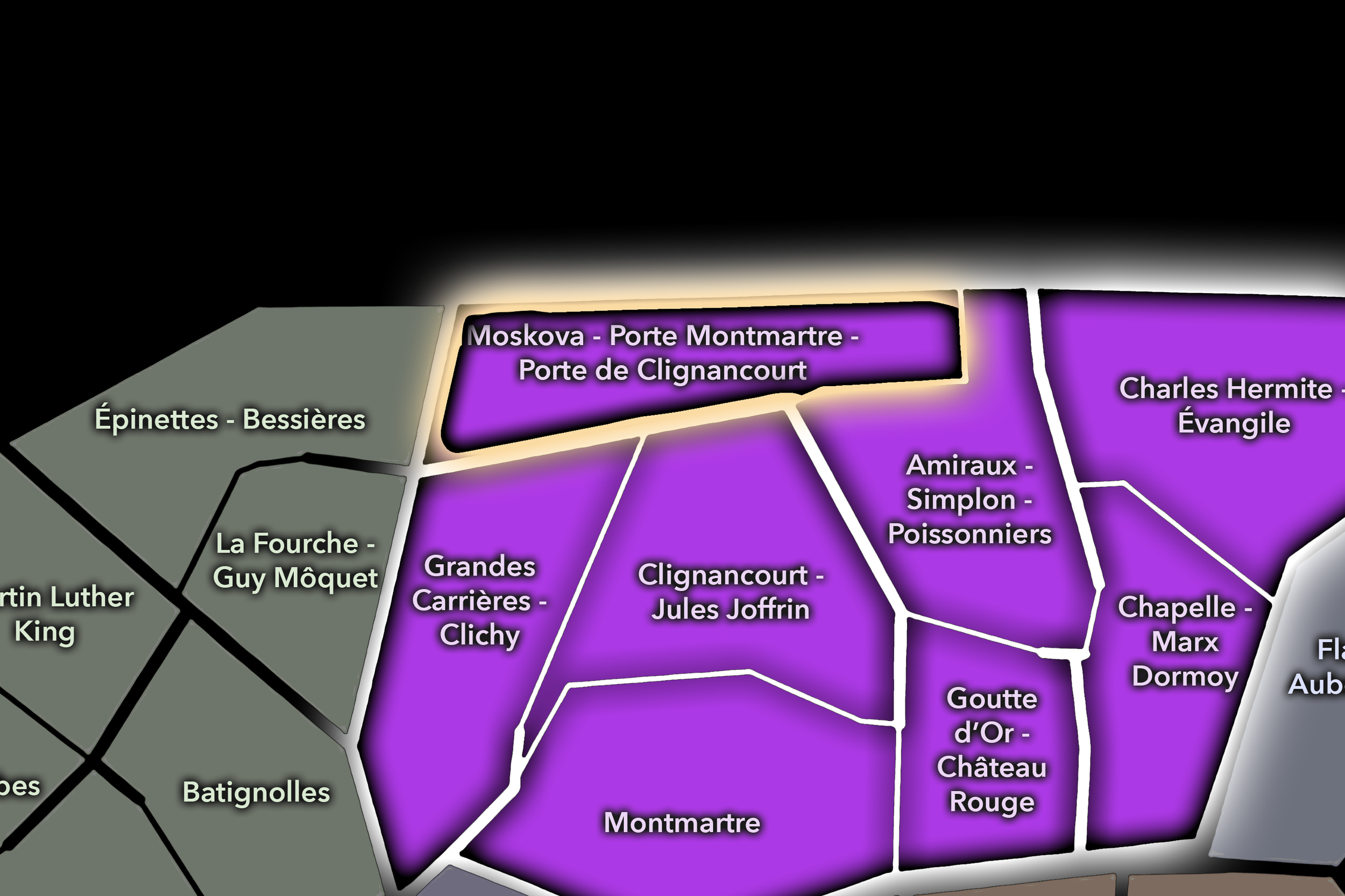
Moskova - Porte Montmartre - Porte de Clignancourt
-

Rive Droite
-
Montmartre
The History
Origins
The origins of Clignancourt lie in the northern outskirts beyond old Paris, near the village-world of Montmartre and the routes leading toward Saint-Ouen and the northern plain. Before the modern 18th arrondissement existed, this area belonged to a landscape of fields, roads, vineyards, gardens, religious properties, quarries in the wider Montmartre region, and small settlements that developed outside the city’s official limits.
Clignancourt’s early identity was tied to the same outer geography that shaped Montmartre and its surrounding hamlets. These were places close to Paris but not yet inside it — useful for agriculture, quarrying, religious landholding, roadside activity, and settlement beyond the crowded center. The old village identity mattered because it gave the area a local coherence before annexation.
Its origin story is therefore one of proximity without full incorporation. Clignancourt was connected to Paris long before it became Paris. The city’s needs, markets, roads, and population pressure all shaped the district, but the name preserves a time when this northern landscape still stood apart.
16th–17th Century
In the 16th and 17th centuries, the future Clignancourt quarter lay outside the dense urban fabric of Paris, within the northern landscape associated with Montmartre, Saint-Ouen, and the surrounding countryside. The area was shaped by roads, vineyards, cultivated land, small settlements, religious holdings, and the practical uses of ground beyond the city’s walls.
This outer condition helped define the district’s later identity. Clignancourt was never one of the old central Parisian quarters formed around medieval streets and parish density. It emerged from the edge, from land that served the city while remaining outside it. That former separateness would remain visible even after the quarter became part of the capital.
By the end of the 17th century, Paris was expanding, and the northern villages and roads were increasingly connected to the city’s economic life. Clignancourt remained outside the formal city, but the boundary between Paris and its northern outskirts was becoming more porous. The future quarter was already being drawn into the orbit of the capital.
18th Century
In the 18th century, Clignancourt became more closely tied to the growth of Paris while retaining its identity as an outer settlement near Montmartre. The northern outskirts supported gardens, vineyards, modest houses, workshops, roadside commerce, and activities connected to the expanding capital. The district was not remote countryside; it was part of the lived belt around Paris, shaped by the city’s needs but not yet fully absorbed into it.
The broader Montmartre landscape remained socially and economically varied. Religious institutions, quarrying, agriculture, windmills, taverns, and village life all contributed to the northern edge’s distinctive identity. Clignancourt shared in that environment while developing its own local geography toward the north and northwest of the hill.
By the revolutionary era, the old boundaries between Paris and its outskirts were increasingly unstable. The villages around the capital were tied to the city through labor, supply, political movement, and urban growth. Clignancourt entered the modern age as a place ready to be transformed by population pressure, industrial change, and the eventual annexation of the northern communes.
19th Century
The 19th century transformed Clignancourt from outer village landscape into Parisian quarter. The area became part of the commune of Montmartre before the major annexation of 1860 brought Montmartre and surrounding districts into Paris, creating the modern 18th arrondissement. With that incorporation, Clignancourt became an official part of the capital while retaining the memory of its former local identity.
Urbanization accelerated rapidly. Streets were extended, apartment buildings rose, local shops opened, churches and civic institutions served the growing population, and the northern slopes and plains became densely inhabited. The quarter’s relationship to Montmartre remained important, but Clignancourt developed a more residential and boundary-oriented identity than the hilltop village and entertainment zones.
The 19th century also strengthened the quarter’s connection to working and popular Paris. Northern districts absorbed populations who needed housing near the city’s industrial, commercial, and service economies. Clignancourt became part of the dense, socially mixed Paris that grew beyond the old central core — a neighborhood of expansion, not inheritance.
Early–Mid 20th Century
In the early and mid 20th century, Clignancourt consolidated its identity as a northern Parisian residential quarter. Its streets held apartment buildings, cafés, markets, schools, churches, workshops, small businesses, and the daily routines of a district tied closely to both Montmartre and the city’s northern edge. Rue du Poteau and nearby commercial streets strengthened the quarter’s local shopping identity, while Porte de Clignancourt connected it to the broader metropolitan north.
The flea-market culture associated with Saint-Ouen and the Porte de Clignancourt also became increasingly important to the area’s image. Even when the markets themselves lay beyond the city boundary, the gate and quarter became part of the approach to that world of antiques, secondhand goods, stalls, dealers, collectors, and informal commerce. This gave Clignancourt a distinct relationship to objects and reuse — a northern echo of Paris as a city of accumulation, exchange, and rediscovery.
During war, occupation, liberation, and postwar recovery, Clignancourt shared the hardships of northern residential Paris: shortages, political tension, social solidarity, demographic change, and the persistence of everyday life. The quarter was not insulated by prestige. It belonged to a more exposed and practical urban world, where history pressed directly into local streets.
Late 20th Century
In the late 20th century, Clignancourt continued to evolve as one of the 18th arrondissement’s dense and socially mixed quarters. The area remained residential and local, but it also absorbed the pressures common to northern Paris: changing demographics, immigration, housing challenges, commercial turnover, public-space conflicts, and the broader transformation of the city’s relationship to its periphery.
The Porte de Clignancourt area became especially associated with boundary commerce, transit flow, flea-market tourism, street vending, and the complicated interface between Paris and Saint-Ouen. This gave the northern edge of the quarter a distinct atmosphere from the more intimate streets around Jules Joffrin or the slopes leading toward Montmartre. Clignancourt held several urban moods at once: neighborhood, edge, market approach, and transit gateway.
At the same time, parts of the quarter became increasingly desirable as the 18th arrondissement’s reputation shifted. The appeal of Montmartre, the strength of local shopping streets, and the relative affordability compared with more central districts brought new residents and gradual gentrification pressures. Clignancourt’s older social fabric began to change, but its edge identity remained strong.
21st Century
In the 21st century, Clignancourt remains one of the 18th arrondissement’s most layered and active quarters. It combines residential streets, local markets, public housing, schools, cafés, churches, diverse commerce, the Jules Joffrin civic-commercial area, the Porte de Clignancourt gateway, and the continuing pull of Saint-Ouen’s flea-market landscape beyond the city line. It is a quarter where the official map, lived neighborhood, and metropolitan boundary all meet.
Today, Clignancourt is shaped by both continuity and pressure. It remains strongly local, especially around the everyday commercial streets that serve residents. But it is also affected by rising desirability, tourism spillover from Montmartre, redevelopment near the northern edge, debates over public space, and the broader reconfiguration of Paris’s relationship with its suburbs. The quarter is no longer a simple edge, but it still feels like one.
For CityNeighborhoods: Paris, Clignancourt is essential because it shows how administrative quarters can reveal the city beyond its most famous myths. The 18th is not only Sacré-Cœur and artists’ Montmartre. It is also Clignancourt: former village, northern gate, residential district, market approach, social seam, and lived Paris at the boundary. It is one of the places where the capital’s edges become most human.
Spirit and Legacy
Clignancourt is the quarter where northern Paris turns boundary into neighborhood. Its spirit is dense, mixed, practical, and restless with movement. It belongs to old village memory and apartment streets, Rue du Poteau markets and Porte de Clignancourt crossings, Montmartre’s shadow and Saint-Ouen’s pull, local routines and the metropolitan edge beyond the boulevard.
Its legacy is the transformation of outside into urban belonging. Fields and village land became a Parisian quarter. A northern gate became a transit and market threshold. The edge of the city became a place of residence, commerce, social mixture, and daily return. Clignancourt does not erase its boundary condition; it lives through it.
To walk Clignancourt is to encounter Paris where the city refuses to end neatly. The quarter reminds us that neighborhoods are often strongest where maps become complicated — where village memory, official geography, working history, immigration, commerce, and suburb-facing movement overlap. In Clignancourt, neighborhood identity becomes the life of the edge: Paris continuing beyond the image, into the streets where it is lived.
The Photography
Visual Identity
-
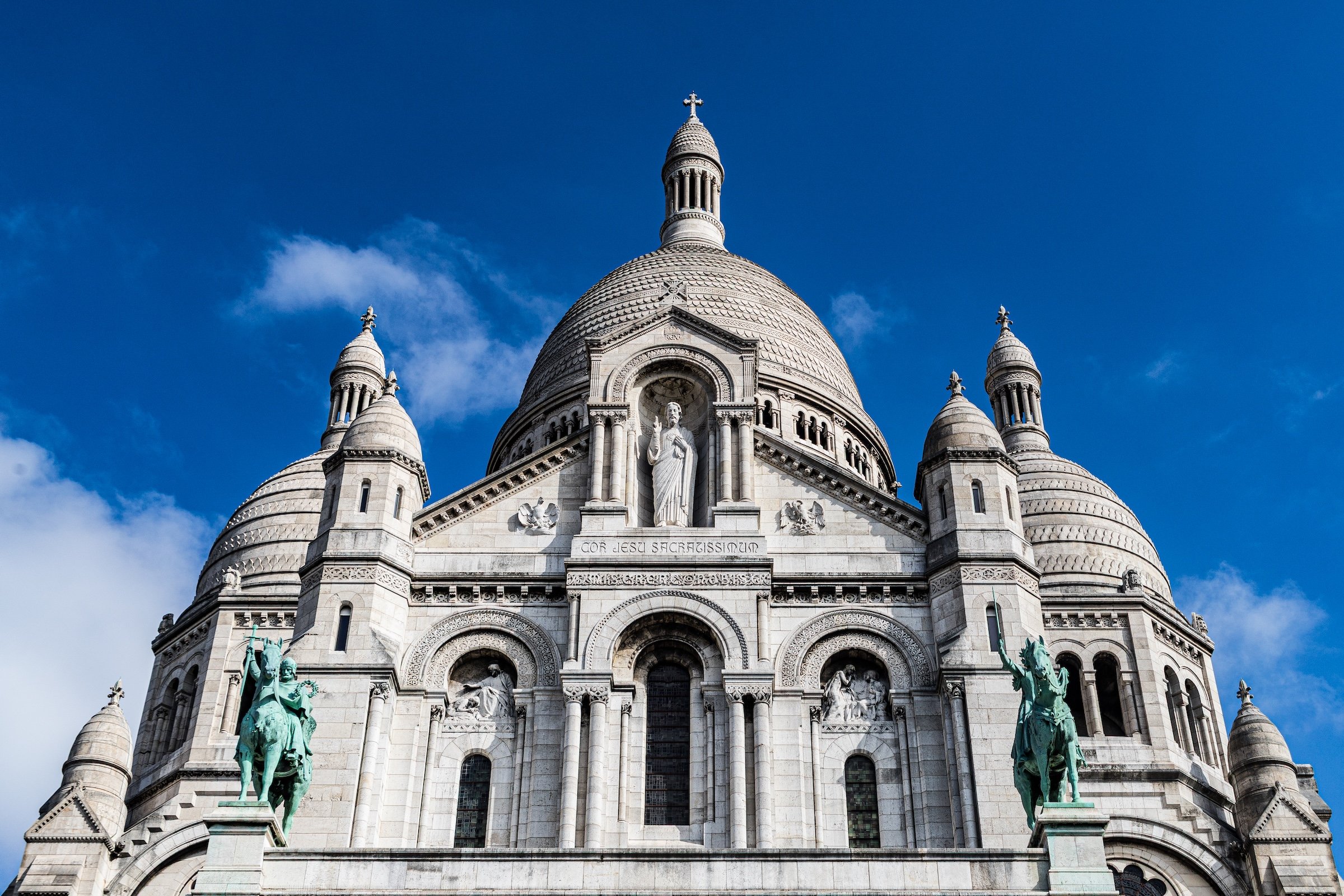
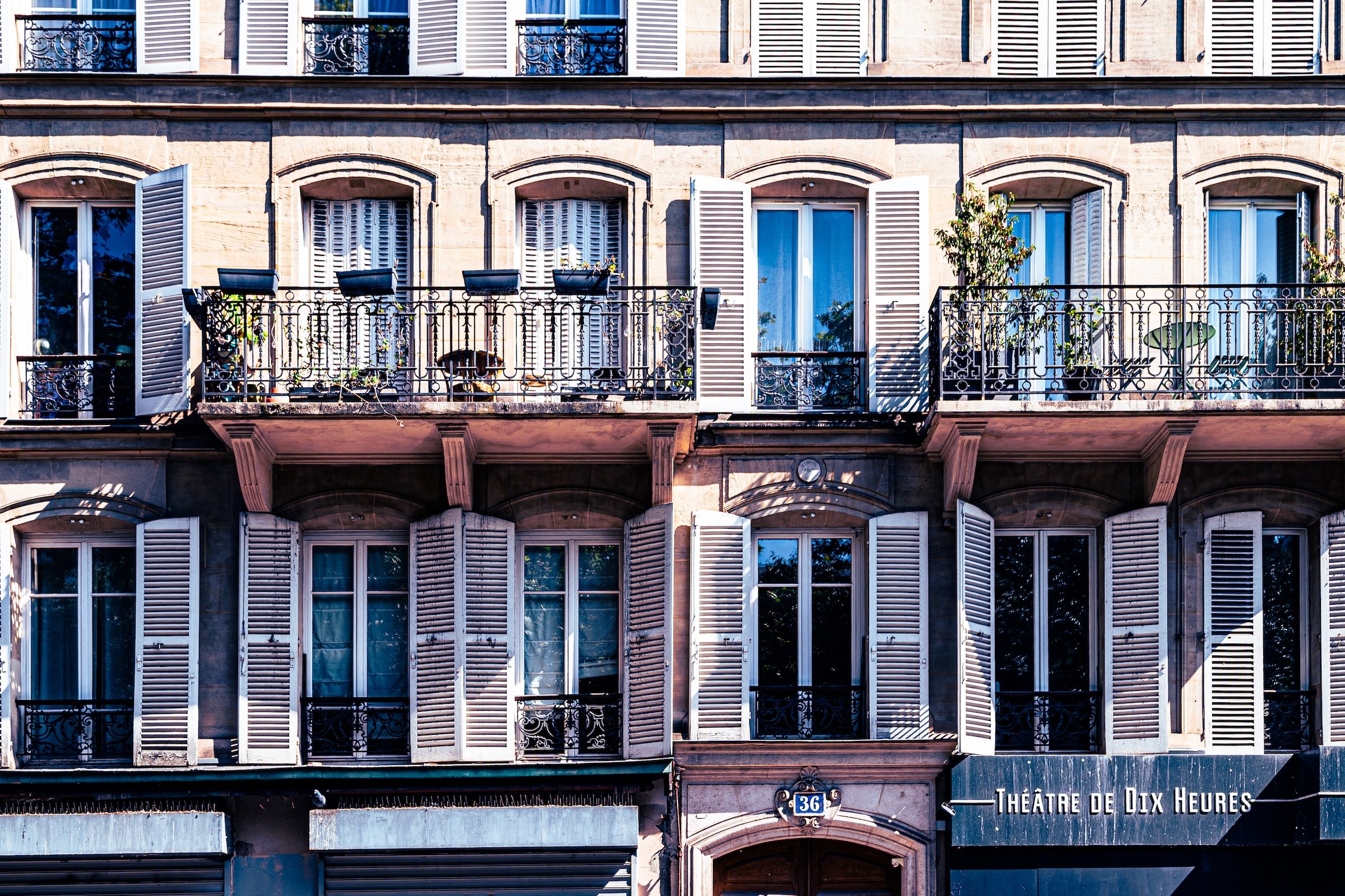
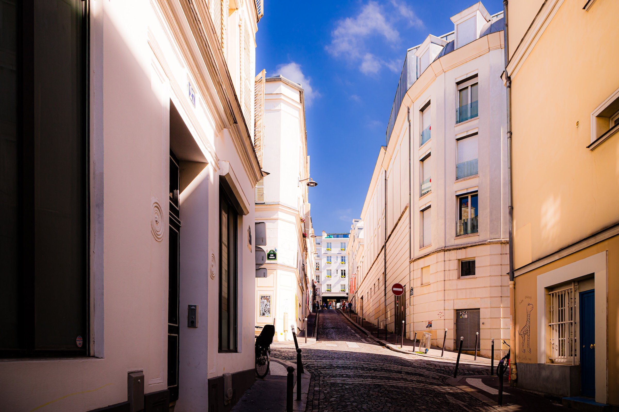
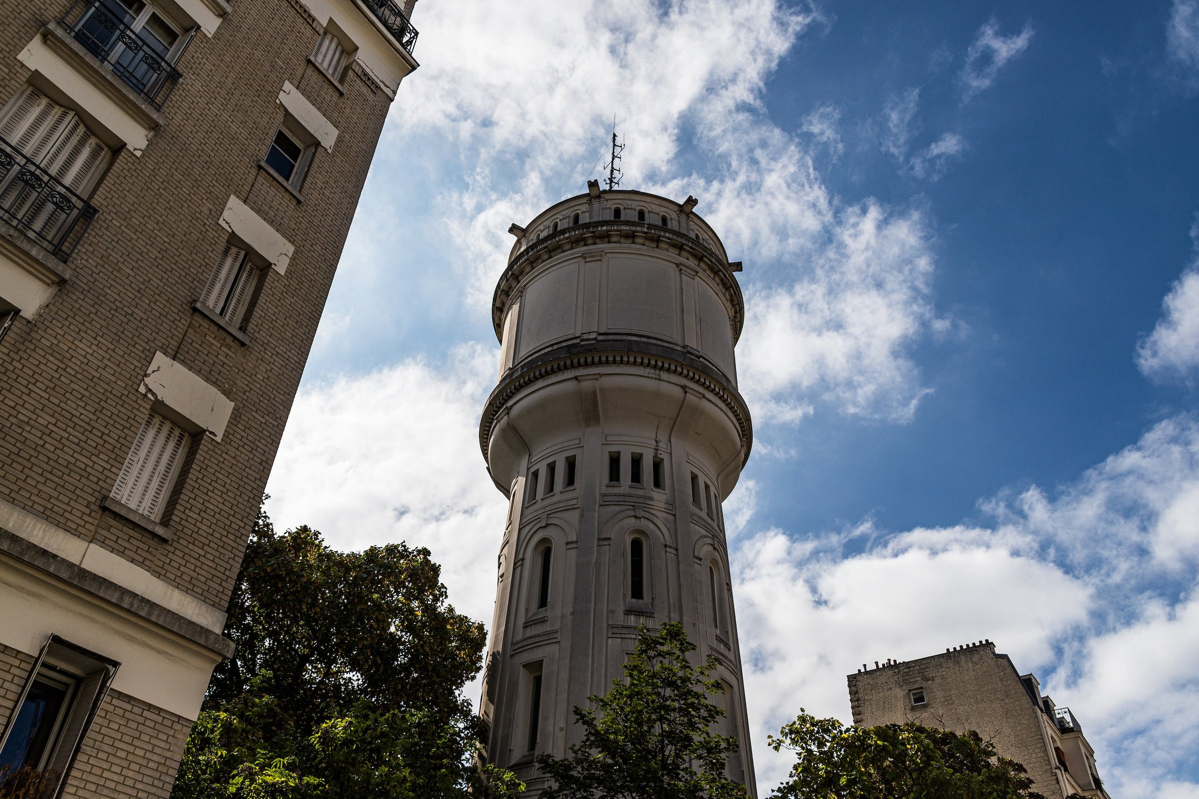
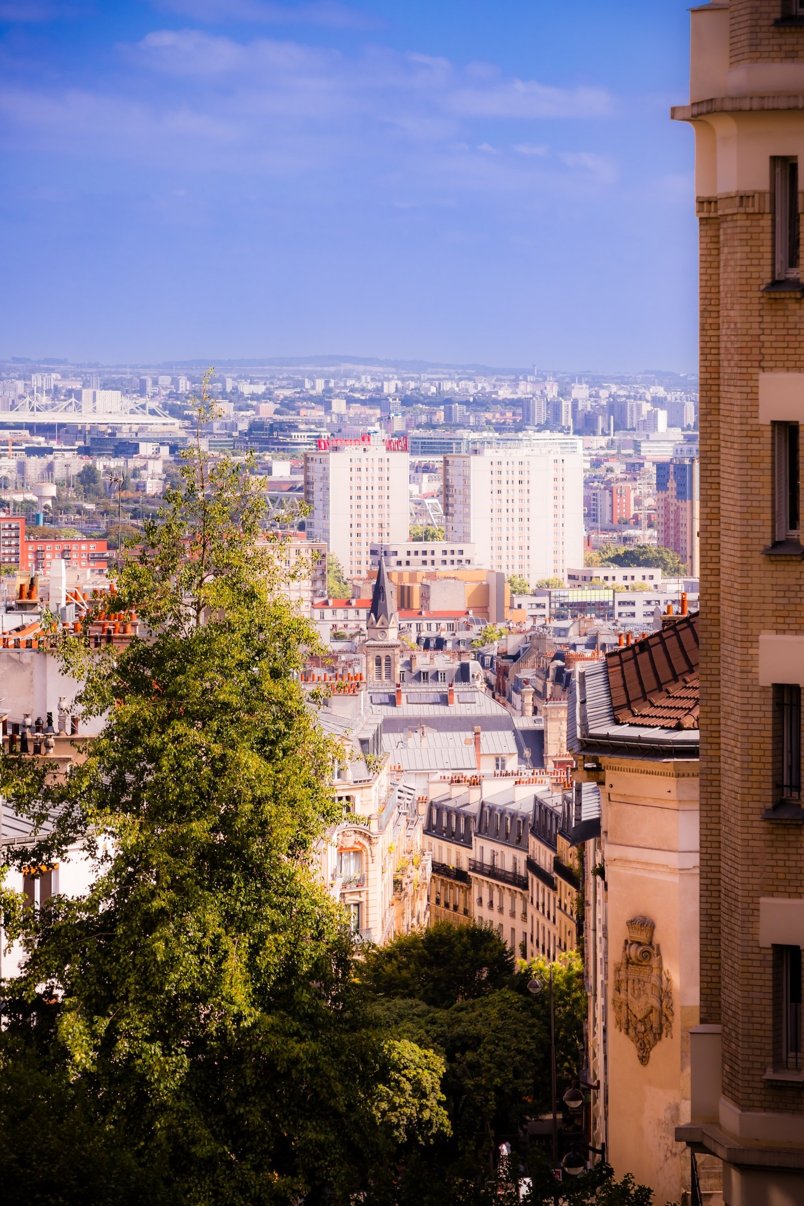
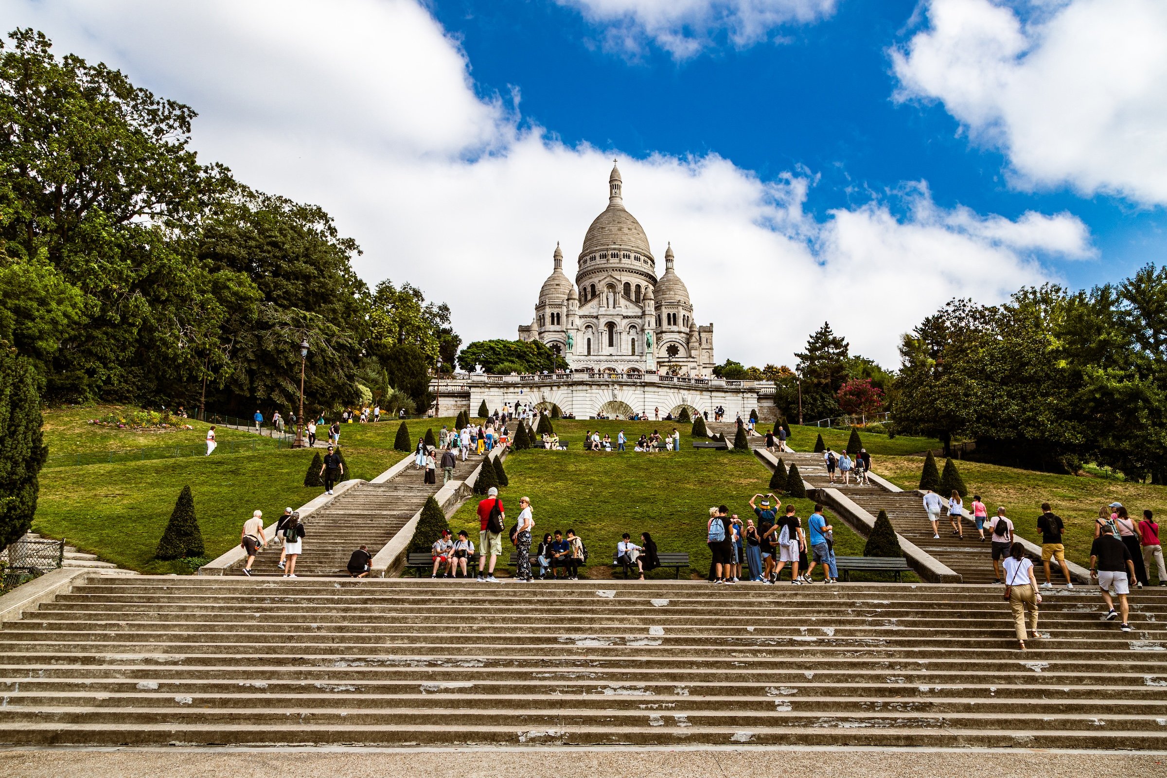
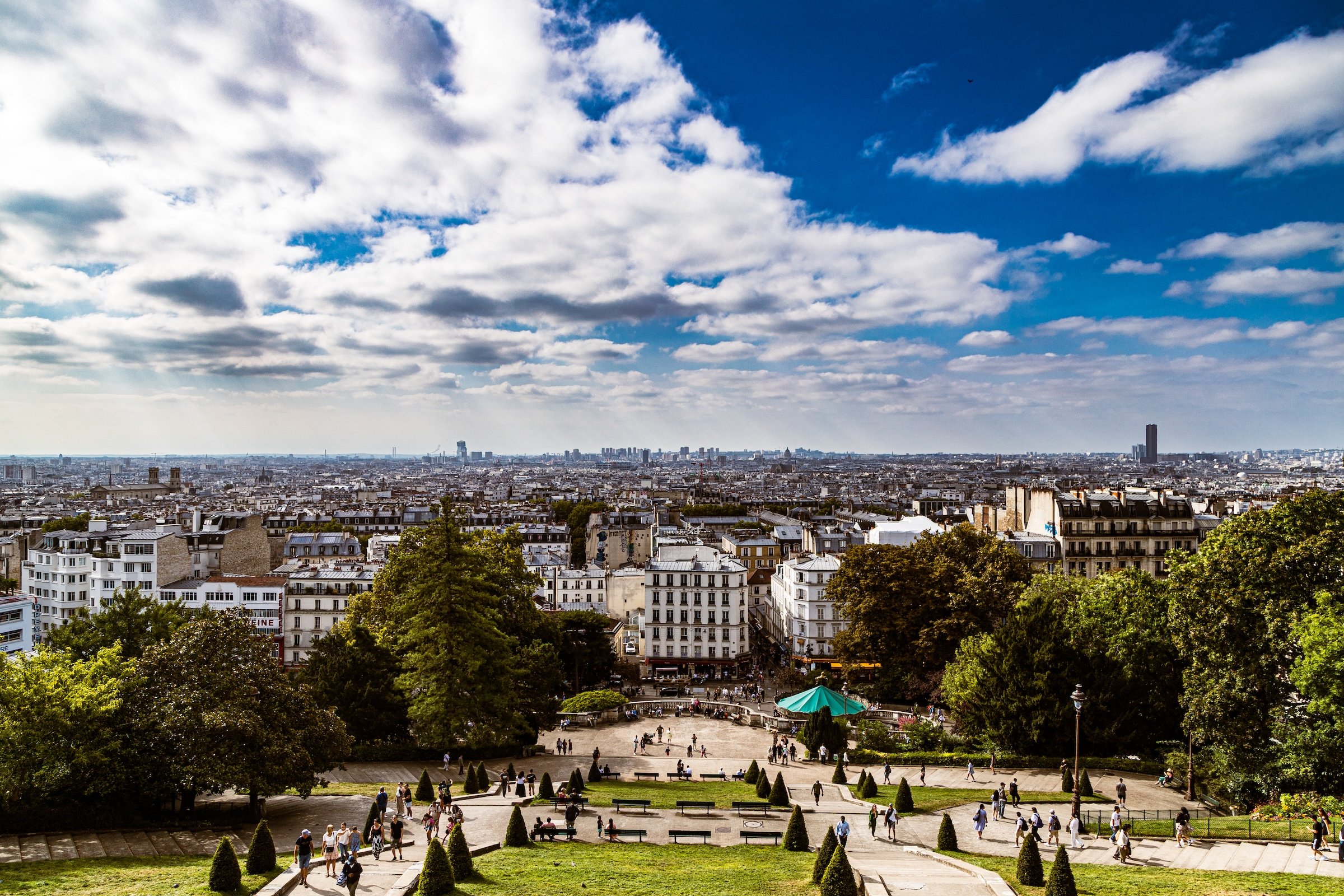
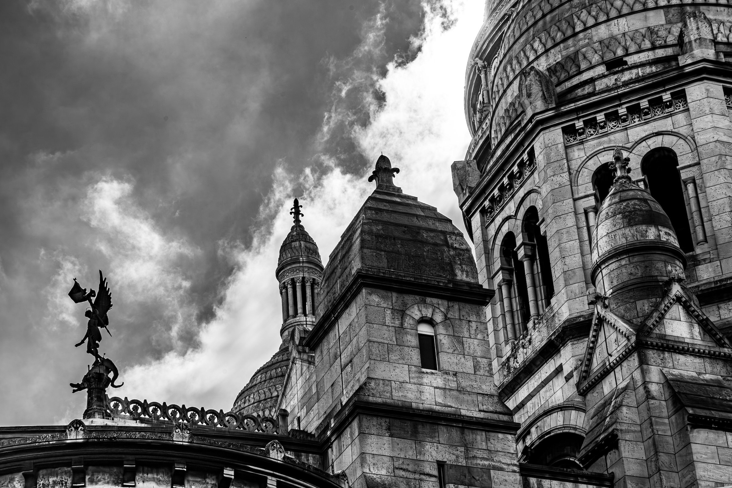
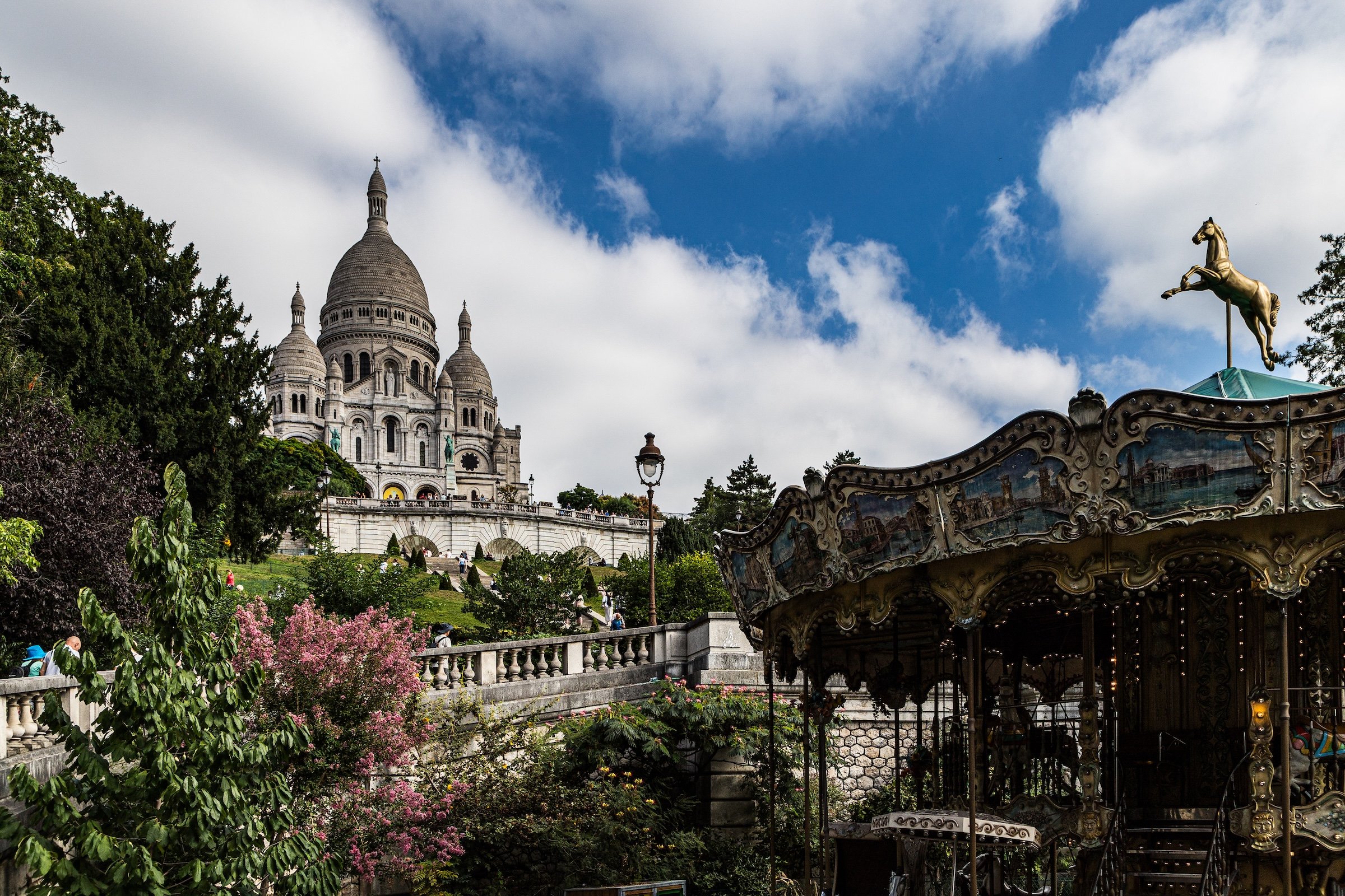
Clignancourt’s visual identity is shaped by height, pilgrimage, and village texture. Sacré-Cœur dominates the opening impression, rising above the city in brilliant white and turning the hill into one of Paris’s most recognizable visual stages. From its steps and approaches, the flatness of Paris stretches outward, making the quarter feel like both a lookout and a threshold into Montmartre.
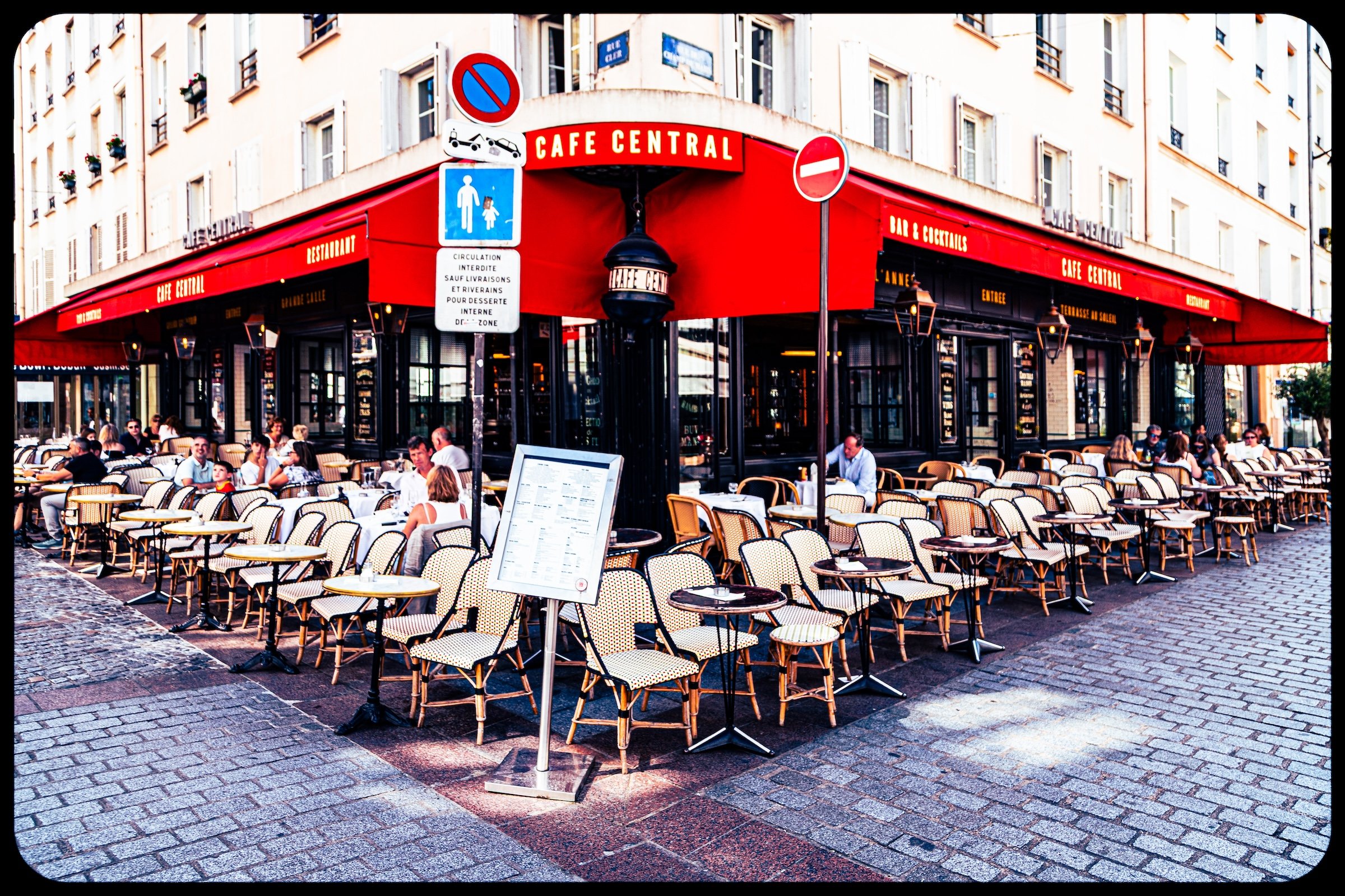
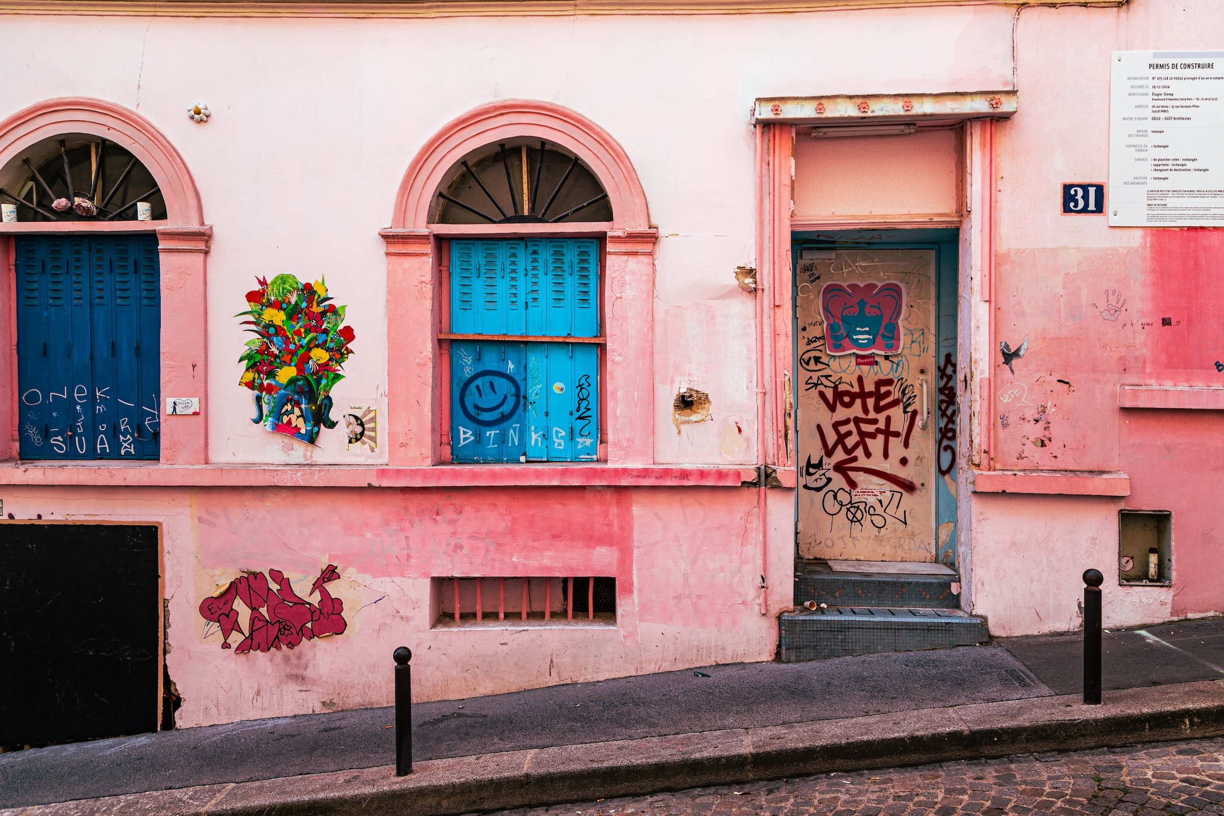
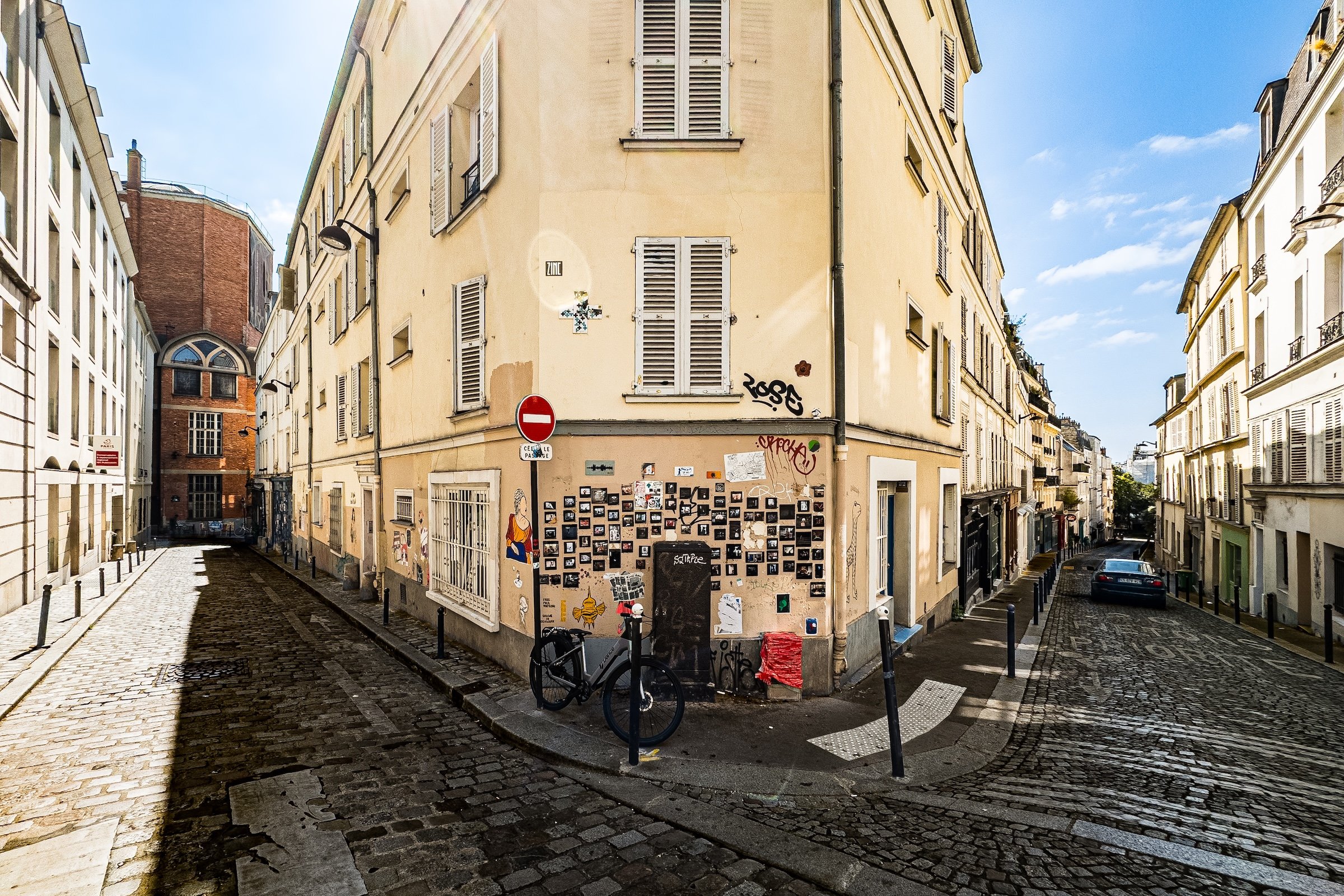
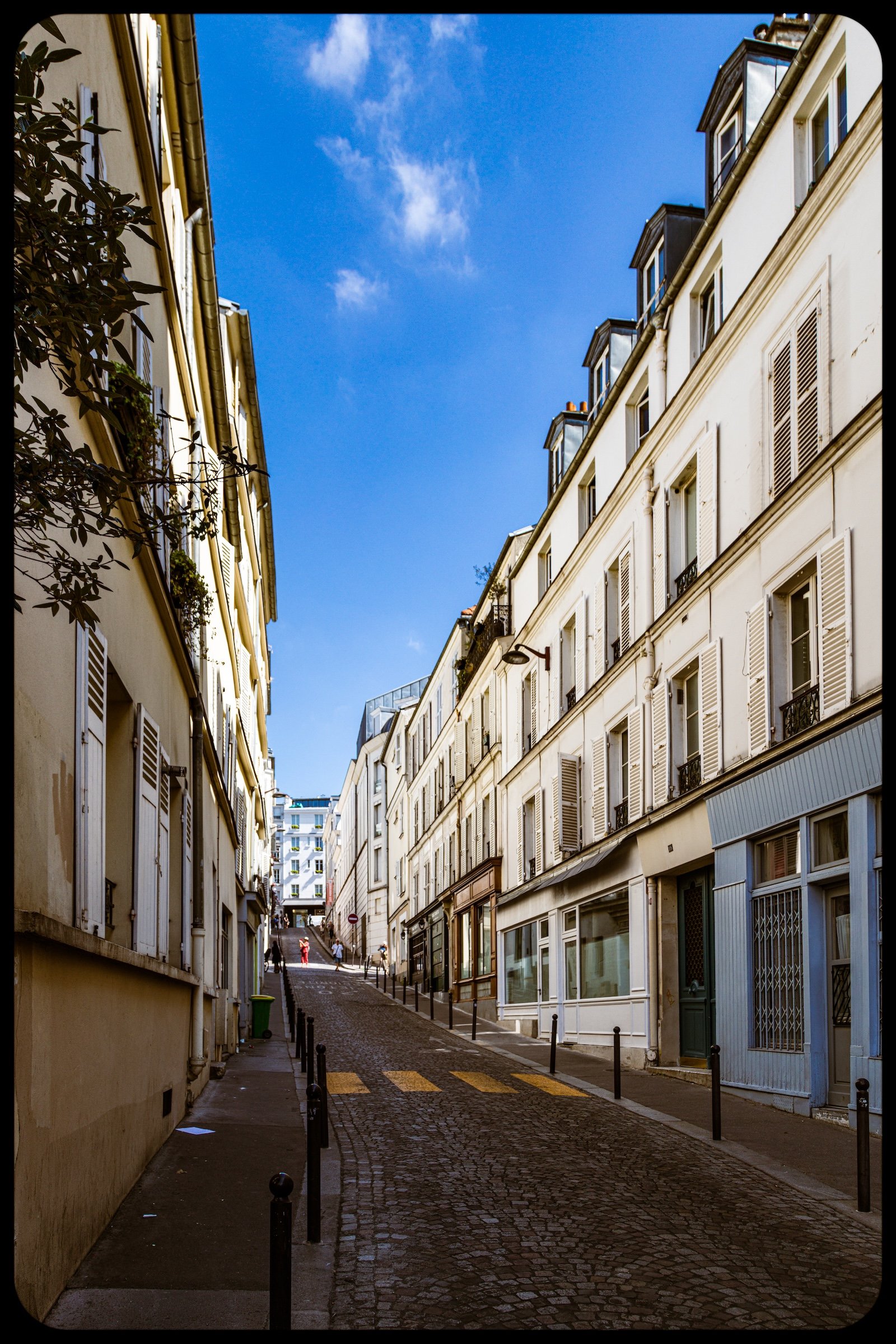
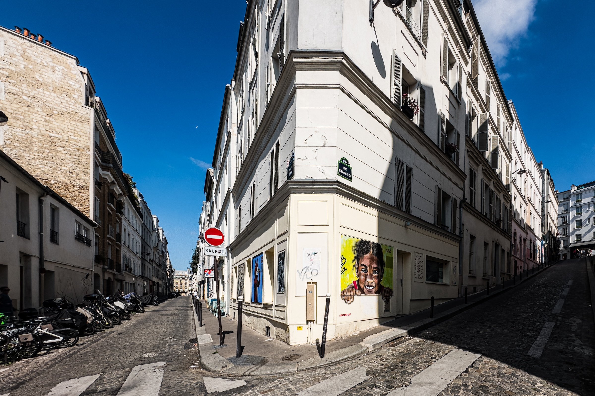
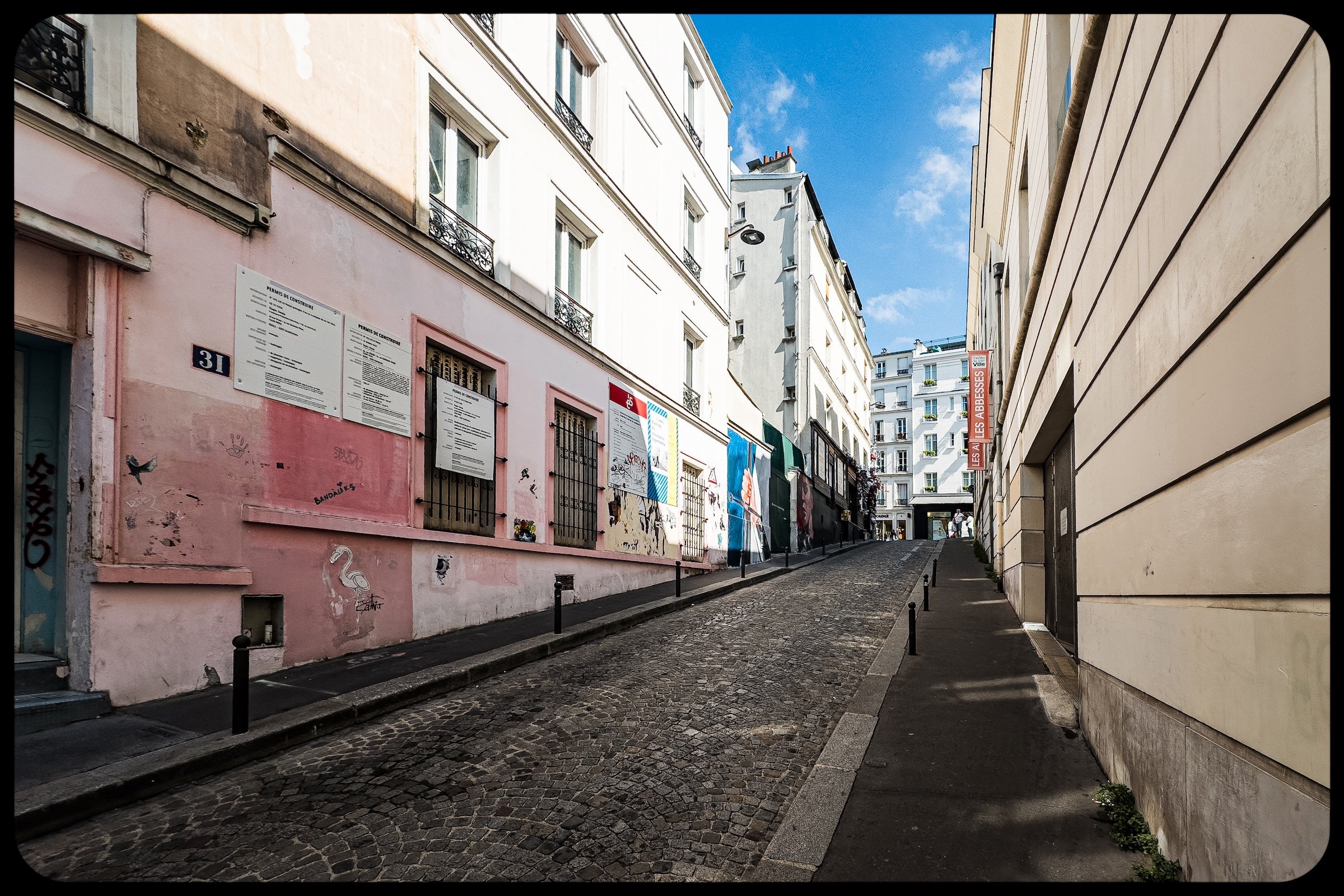
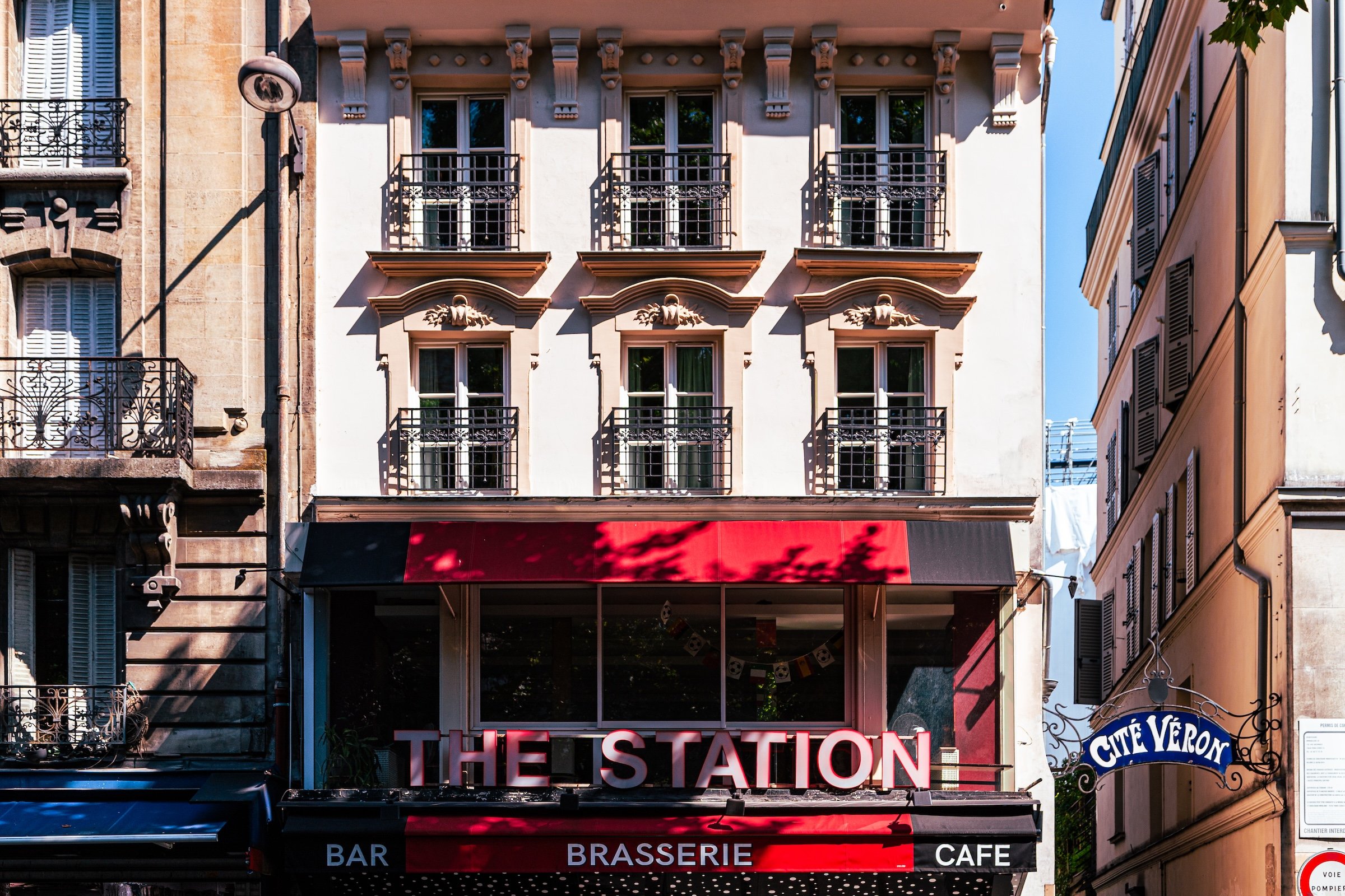
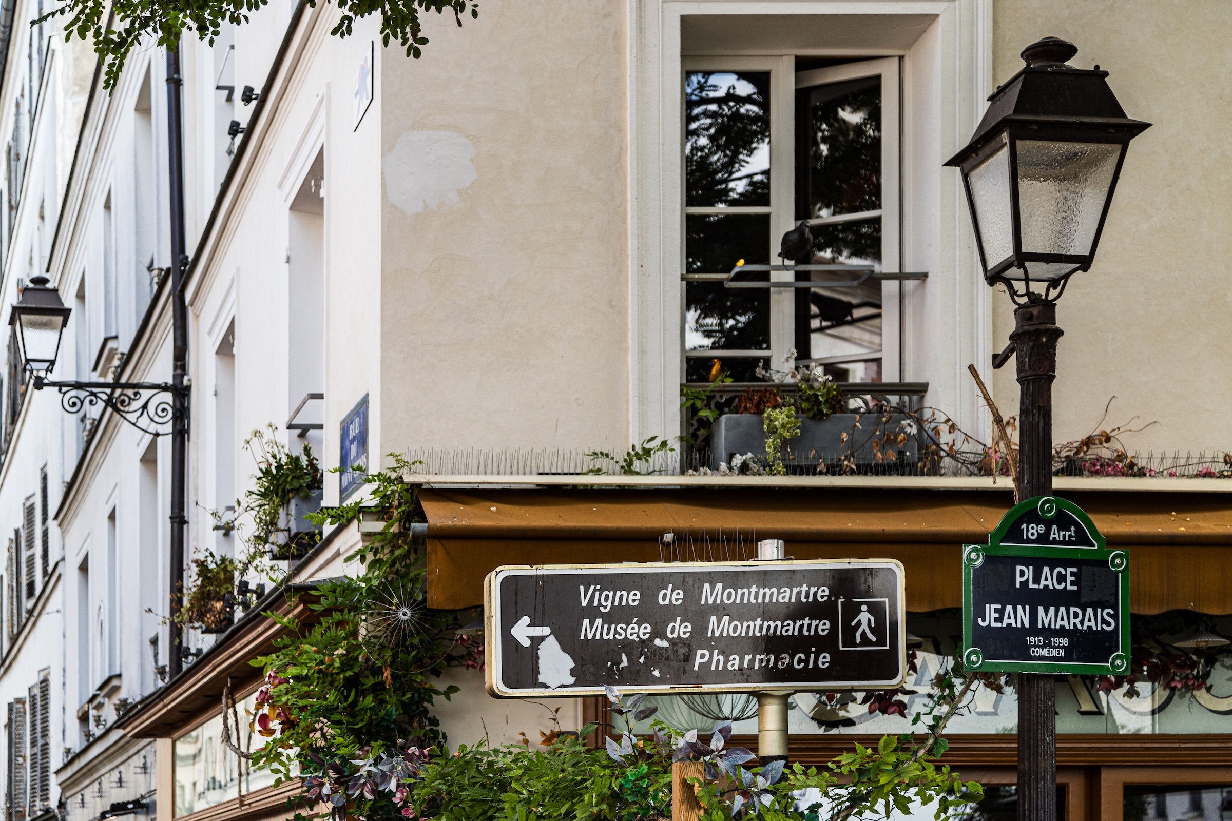
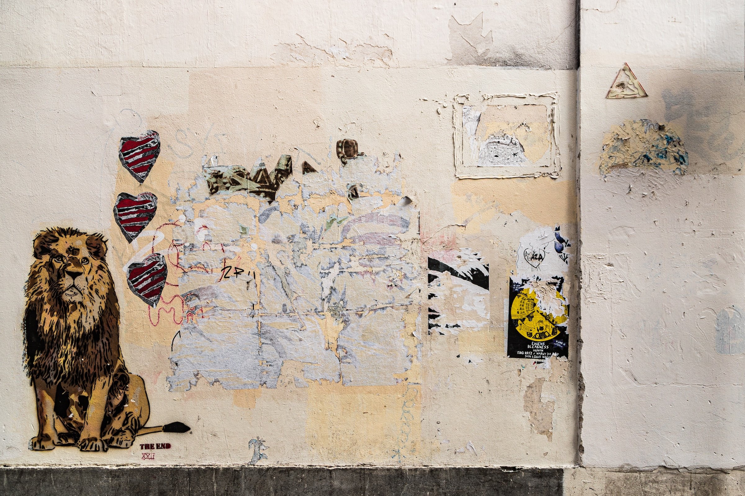
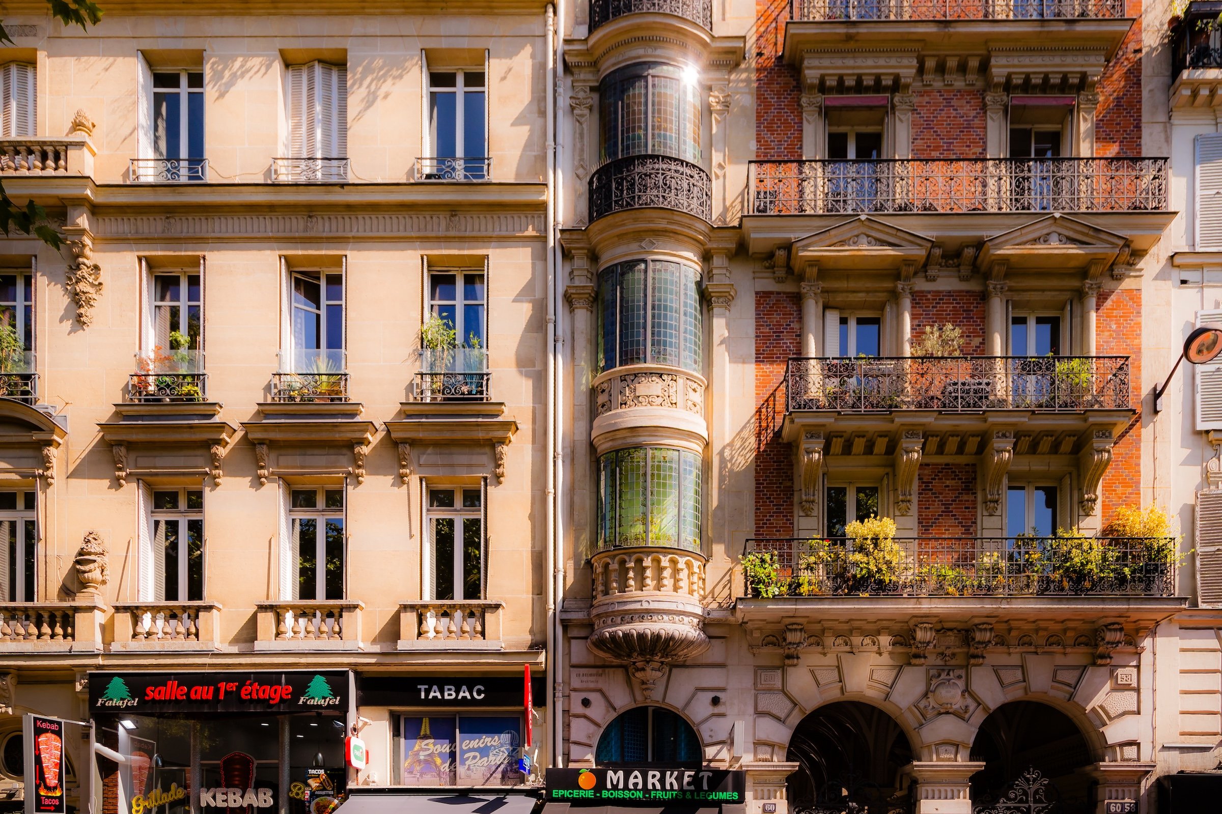
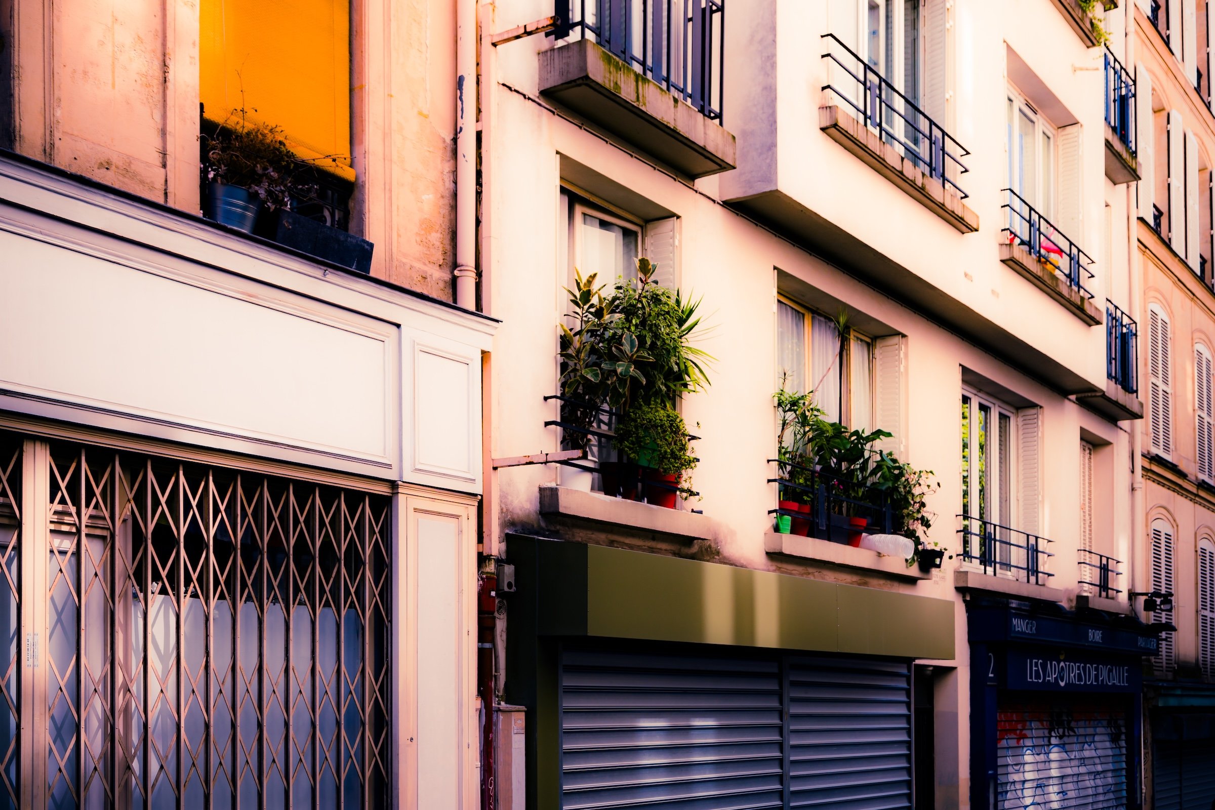
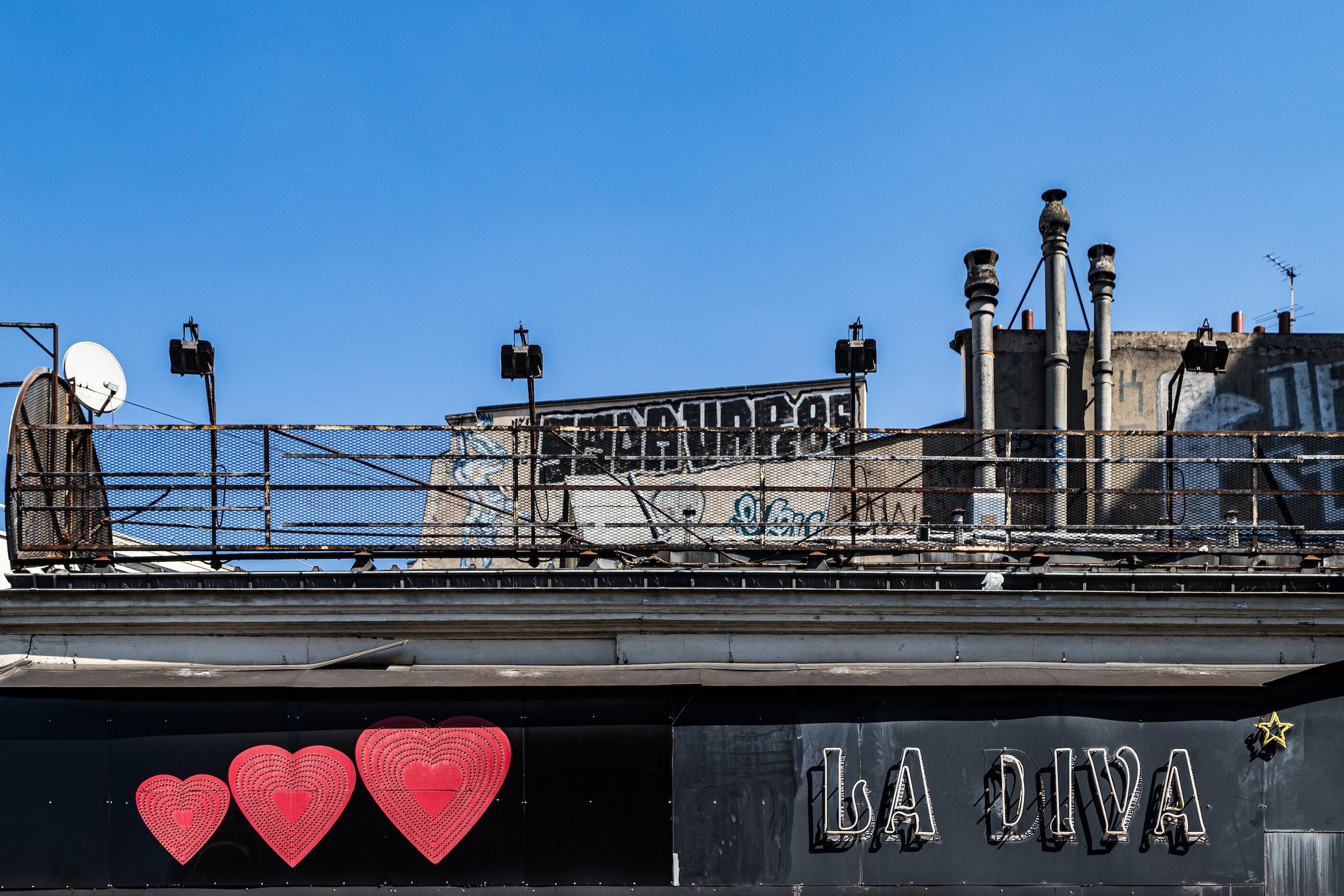
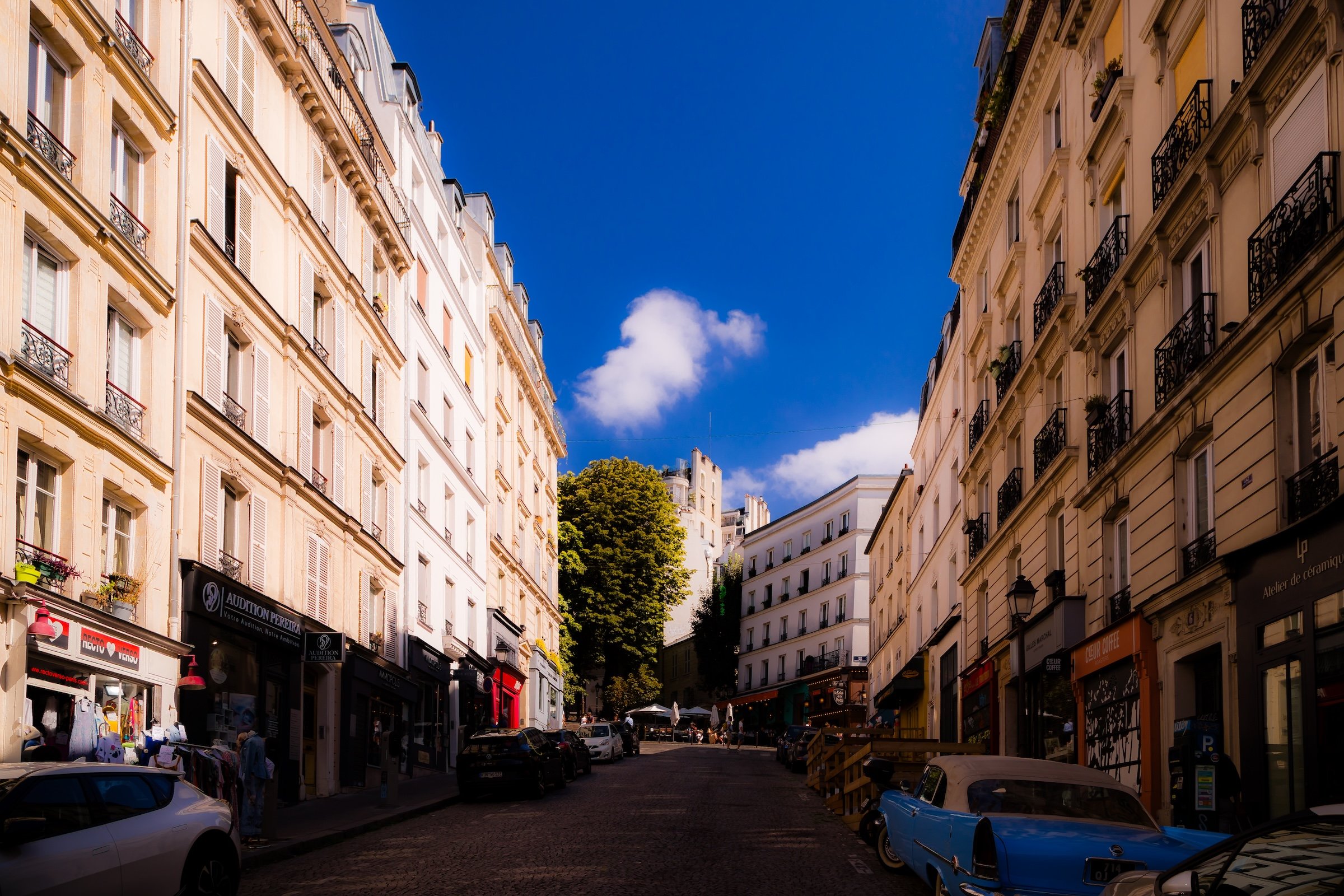
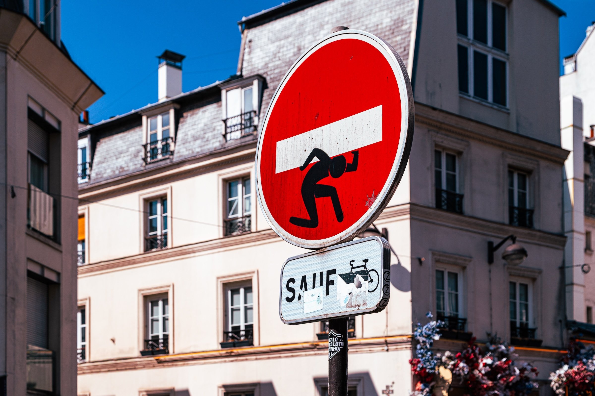
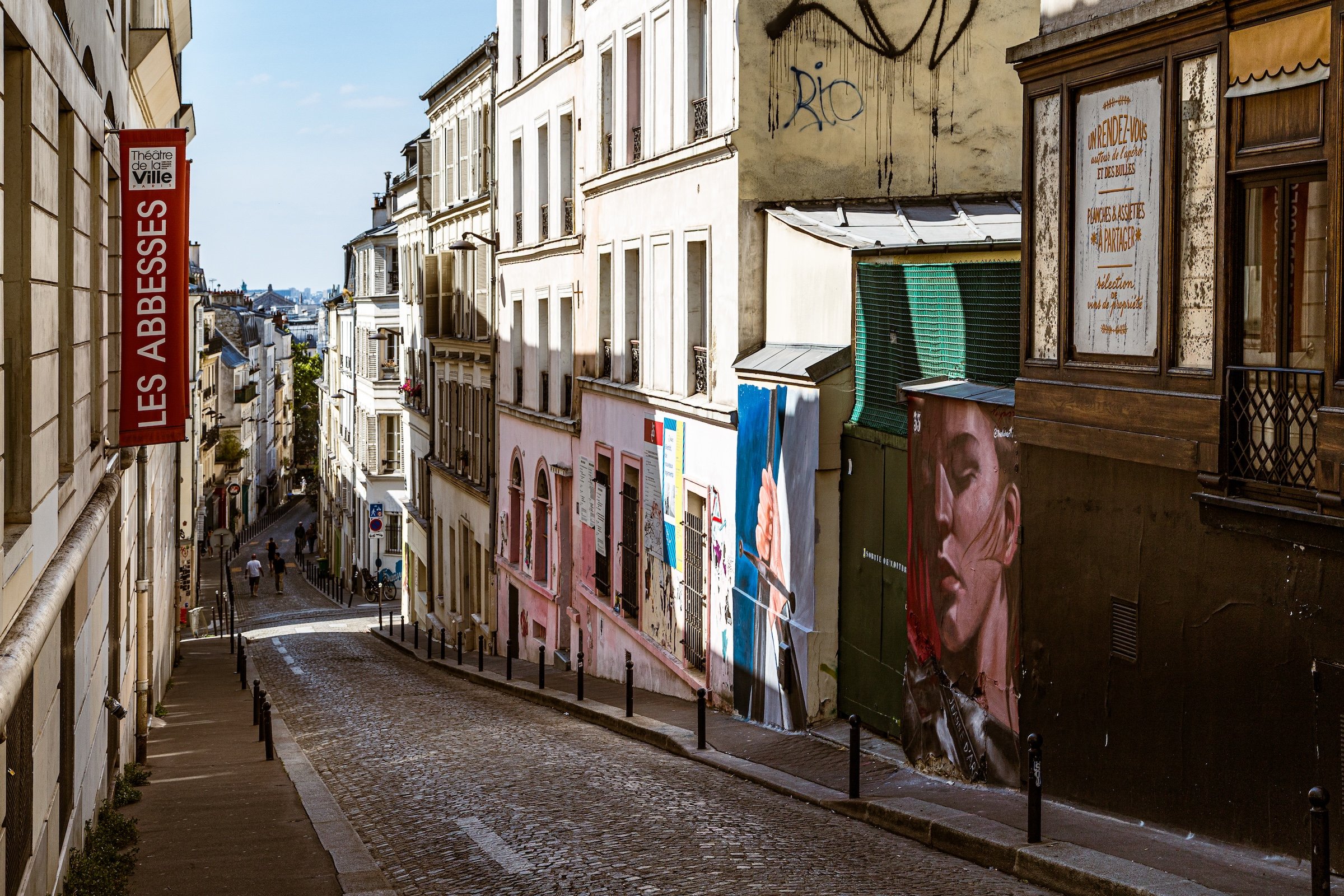
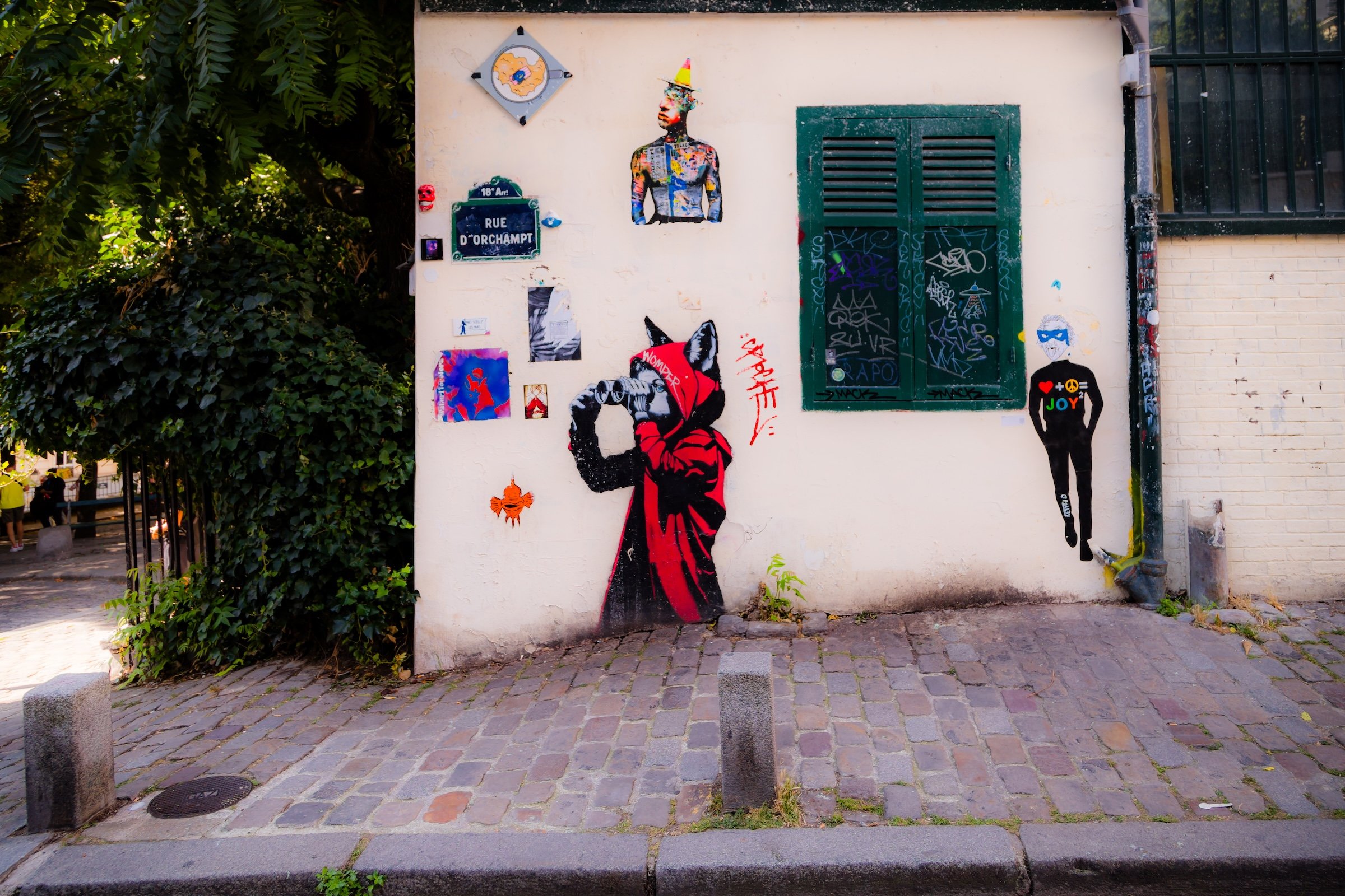
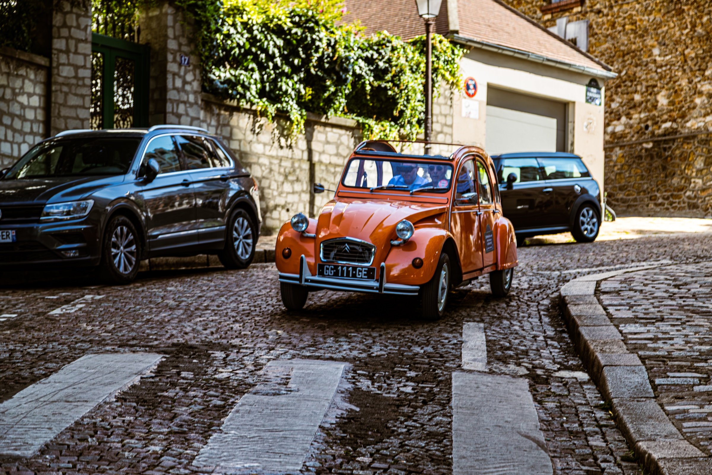
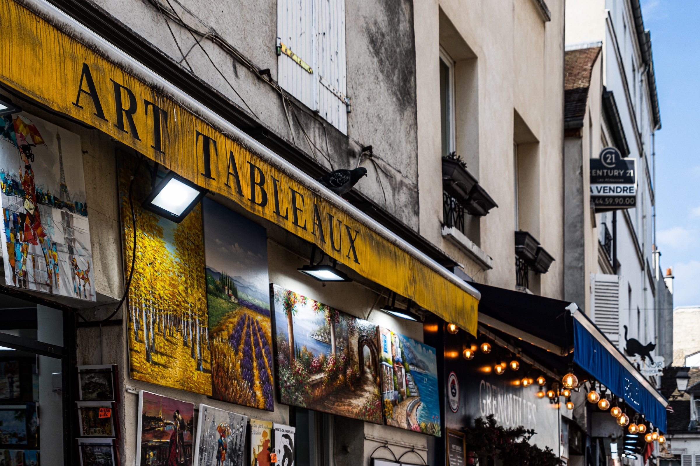
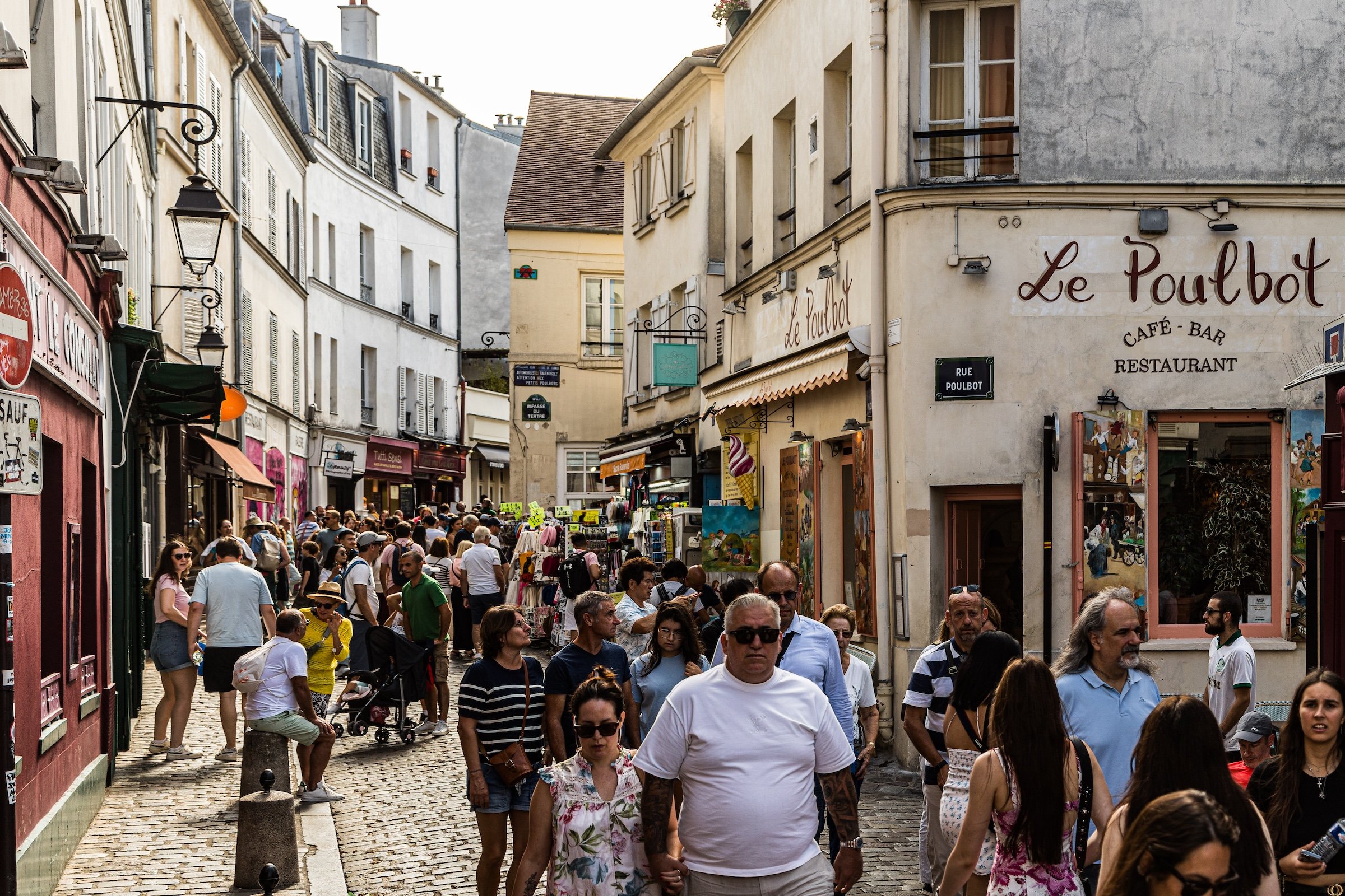
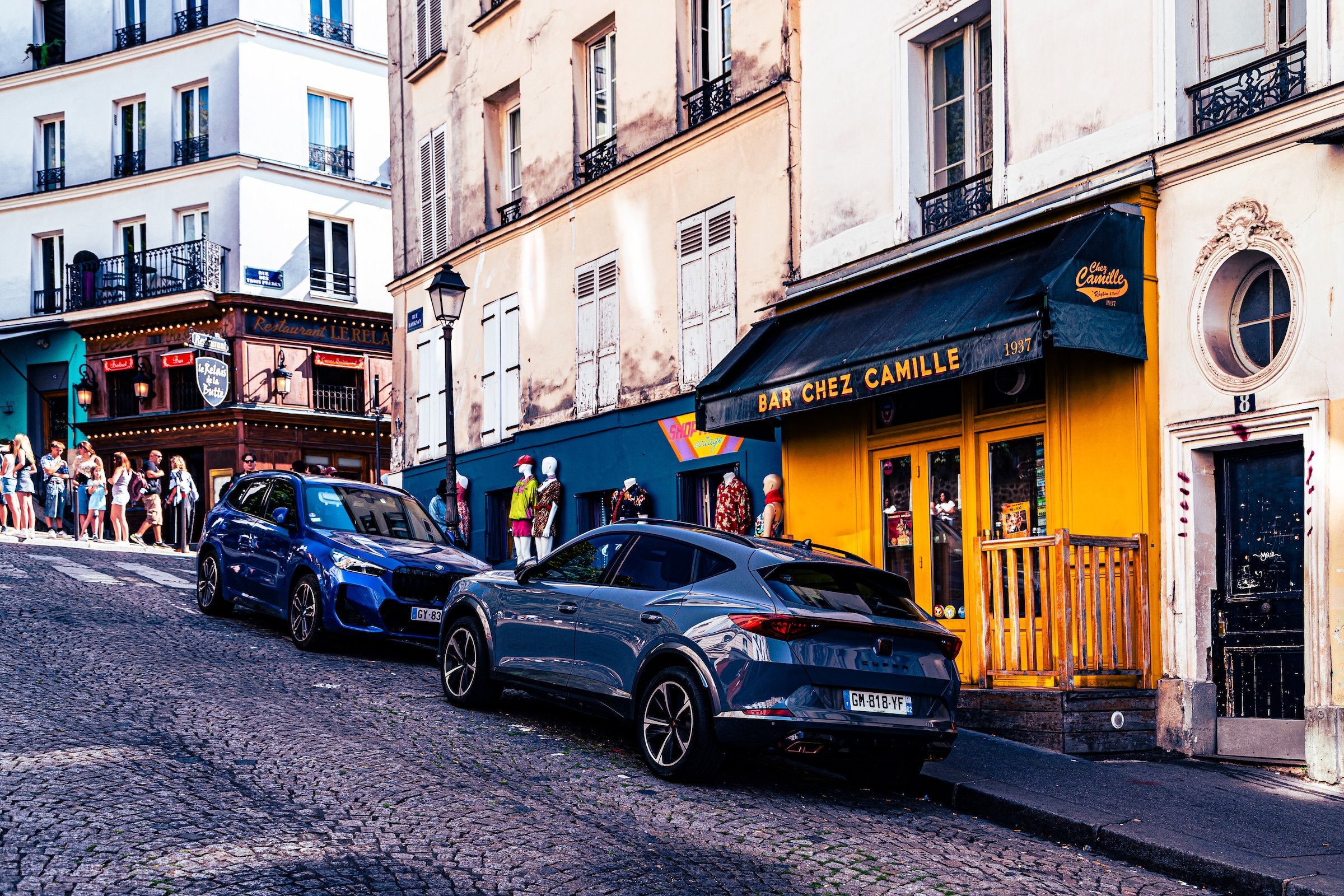
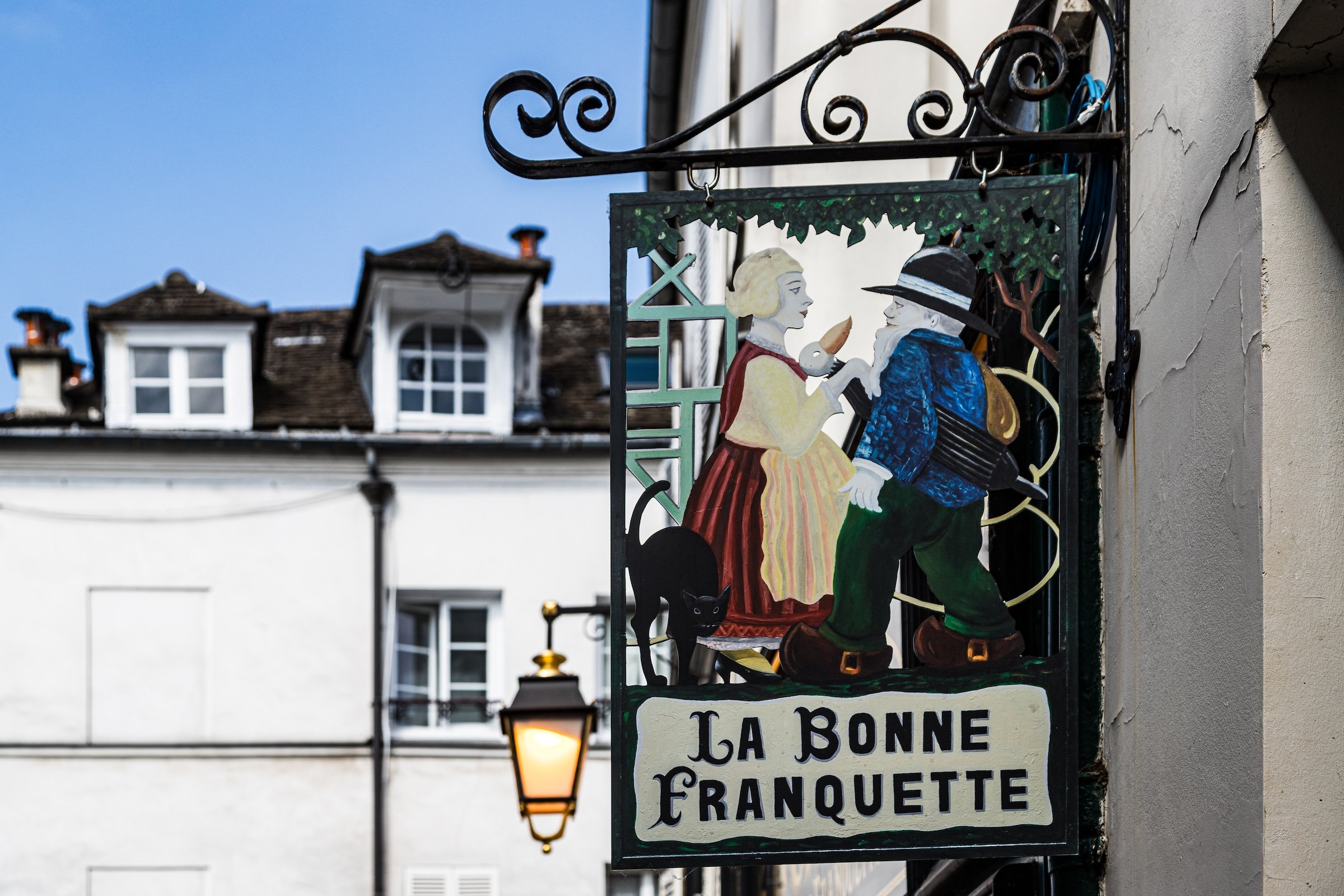
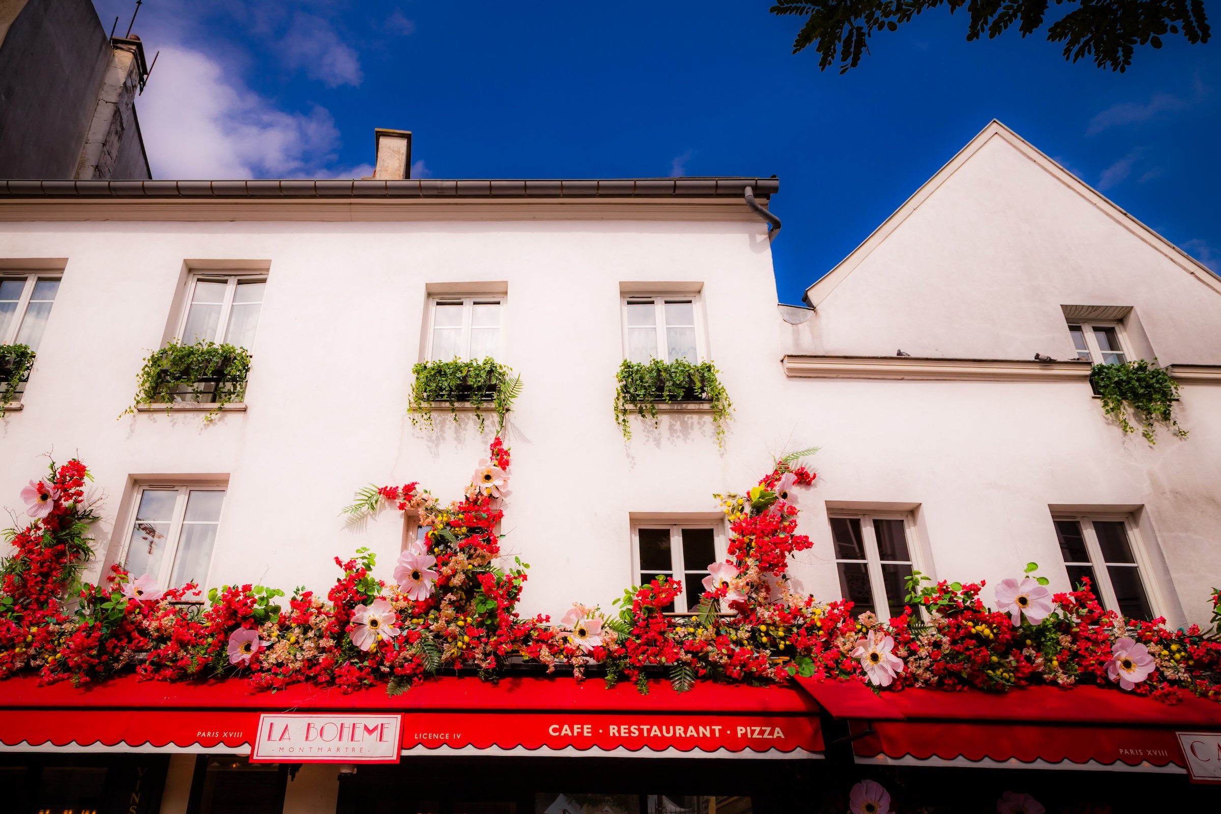
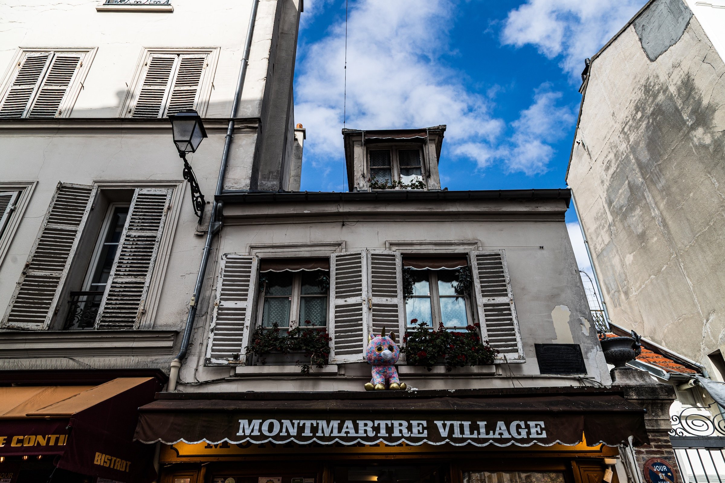
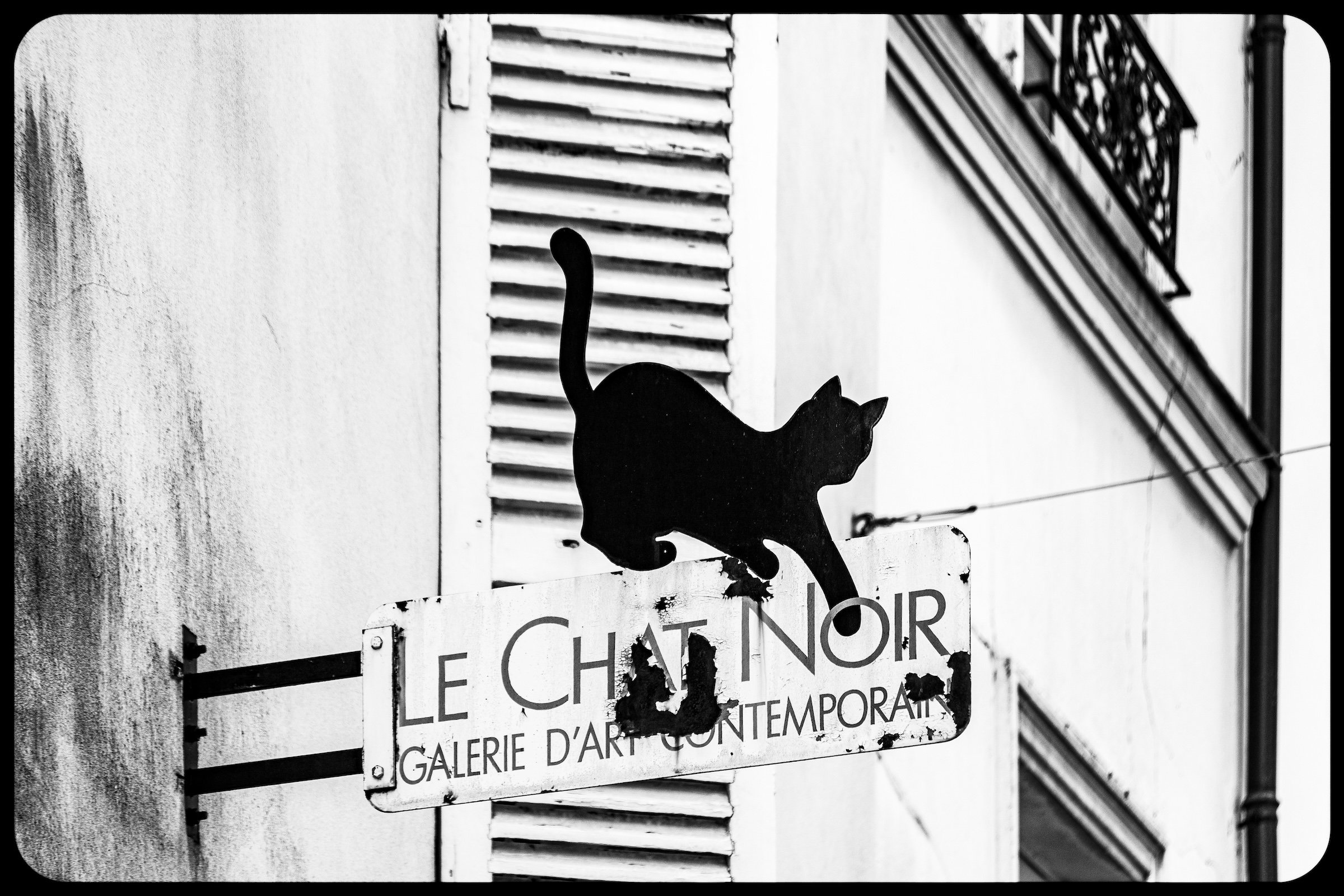
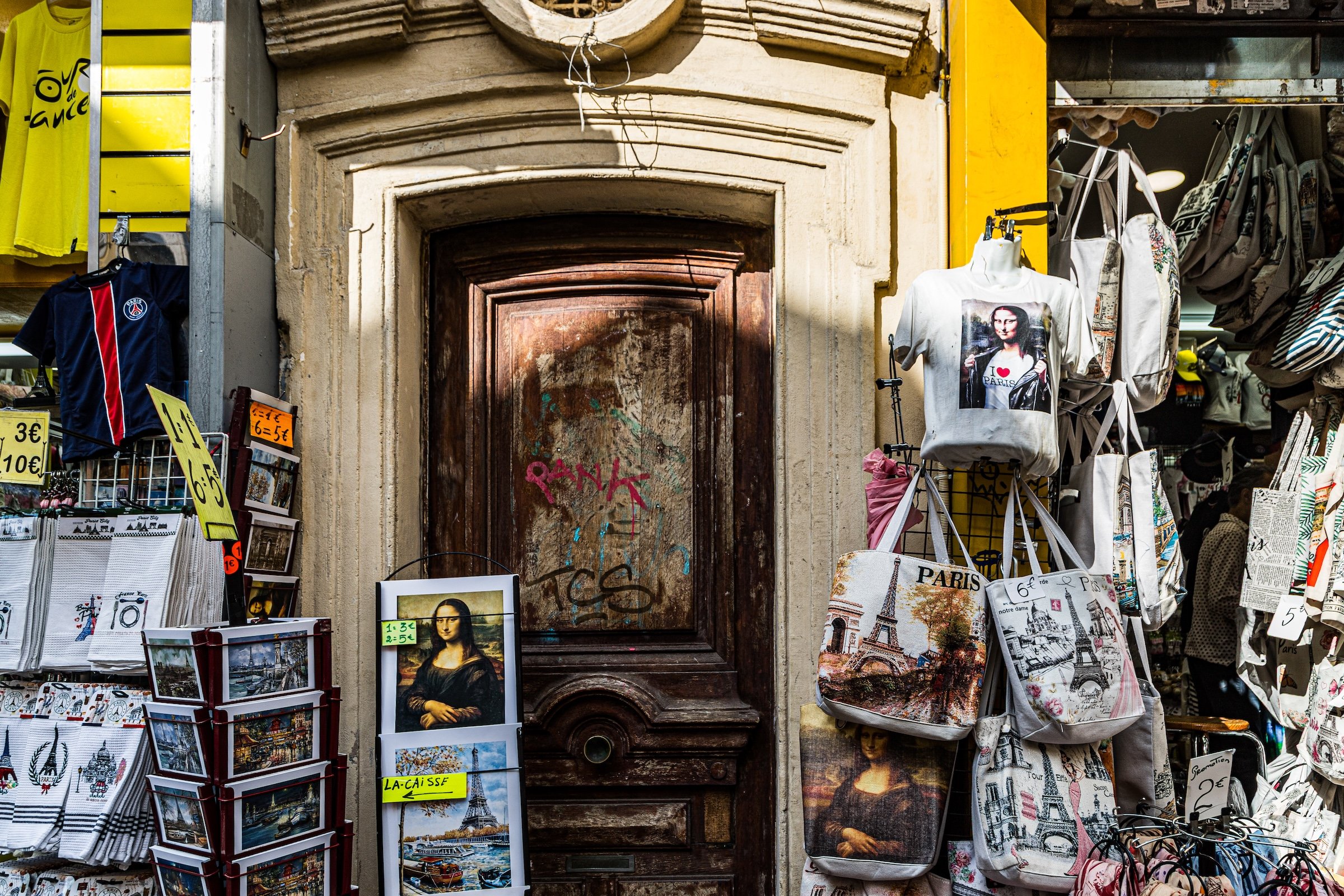
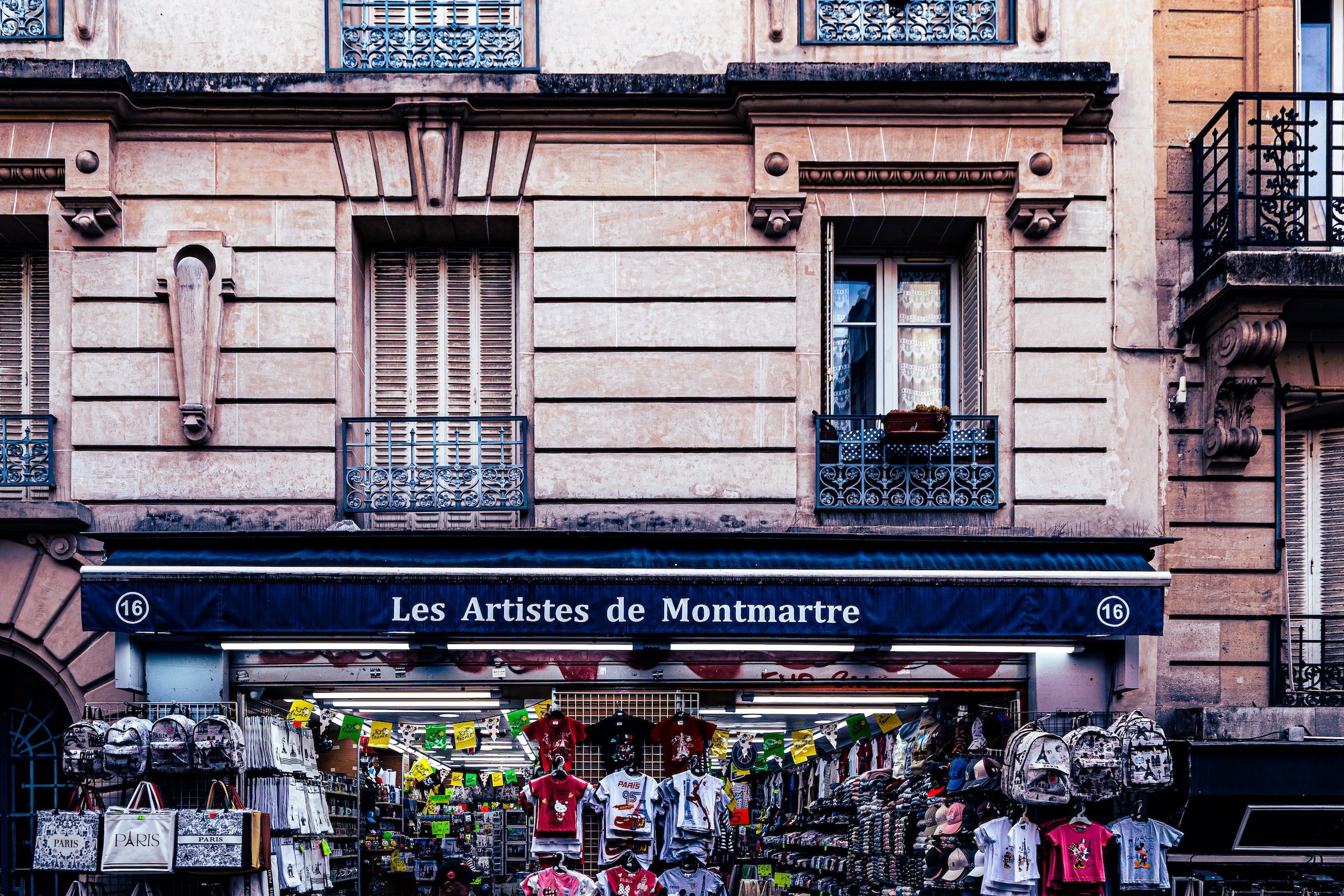
Beyond the basilica, the quarter’s identity becomes more intimate and bohemian. Streets curve and climb; cafés, galleries, murals, signs, and cobblestones replace the grand regularity of central Paris. Visually, Clignancourt is a district of contrast: sacred white above, artistic life below; panorama and alley; spectacle and village. It is one of the places where Paris most clearly escapes its own formal order.
Through The Lens

-
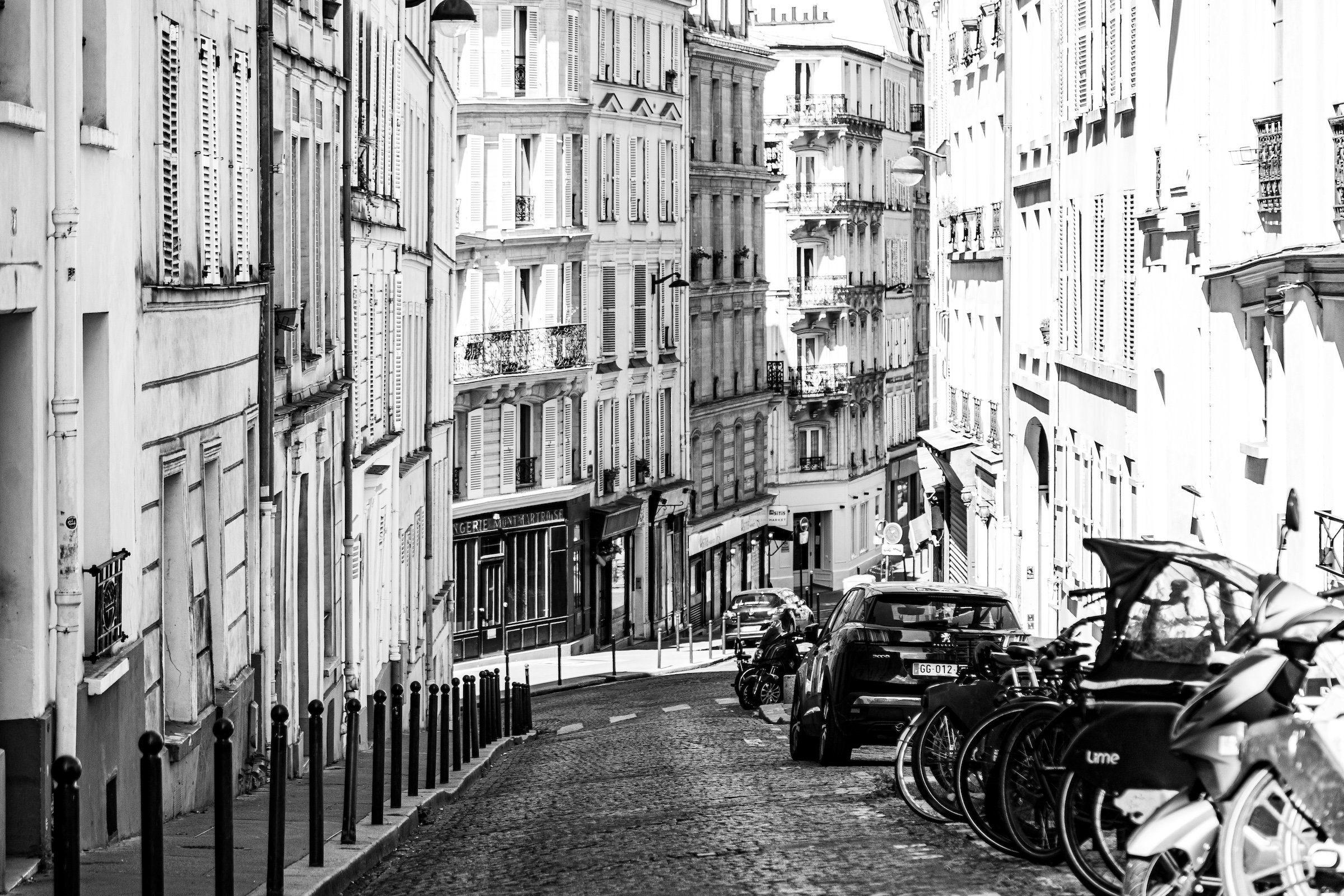
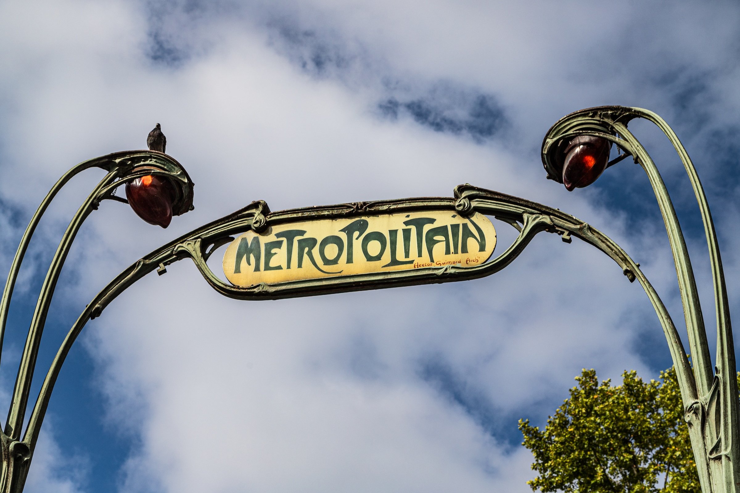
Clignancourt photographed with discovery and intensity. The contact sheet moves from Metro arrival and Sacré-Cœur iconography into the dense visual language of Montmartre: murals, storefronts, stairs, cobblestones, signs, cafés, narrow streets, hill views, and small details that feel personal rather than monumental. The district gives the camera both grandeur and play.
What makes the images especially strong is the change in scale. Sacré-Cœur provides the dramatic overview, but Montmartre provides the intimacy. The lens keeps finding places where the city bends, climbs, narrows, and surprises. Clignancourt becomes the day’s proof that Paris is not only majestic and ordered; it is also irregular, spirited, artistic, and joyfully alive.
If you visit Paris, these ideas can help inspire your own photography.


Paris: J’Espere, Je Rêve, Je Vive
Clignancourt Photo Gallery
Clignancourt Flâneur Notes
-
10:17 AM - 12:15 PM
Conditions: 19°C (67°F) | Humidity: 57%
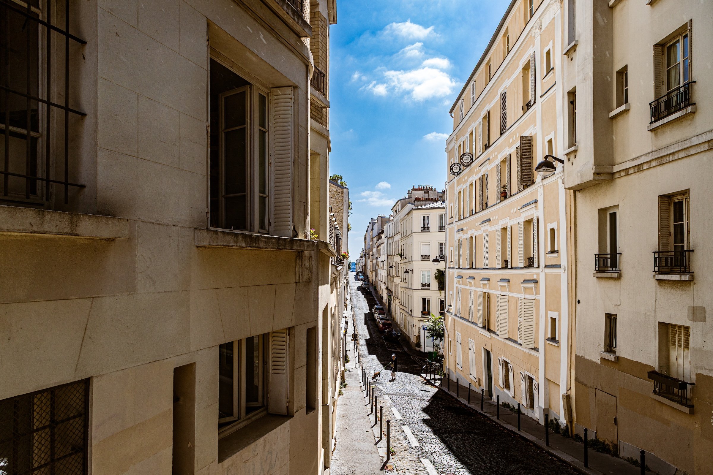
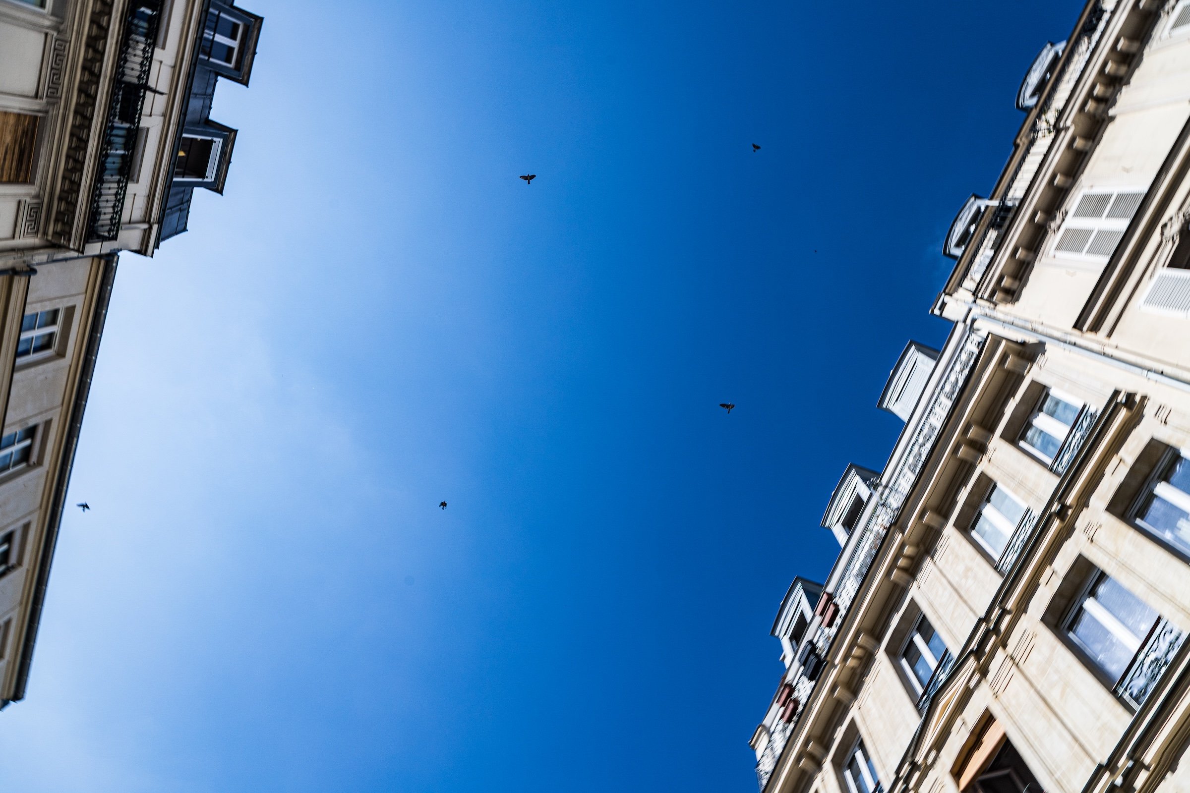
Clignancourt became the day’s first great revelation. From Anvers, the walk rose along Rue de Steinkerque toward the steps of Sacré-Cœur, with the city opening gradually into hill, vista, and expectation. The view over Paris emphasized the city’s striking flatness: orderly, serene, and almost horizontal compared with the restless verticality of Manhattan. Turning back toward the basilica, the quarter shifted from panorama to brilliance. Sacré-Cœur’s white façade, domes, and pinnacles shone under blue sky and passing cloud, while its statues, grotesques, gargoyles, and decorative stonework offered close, dramatic moments for the camera.
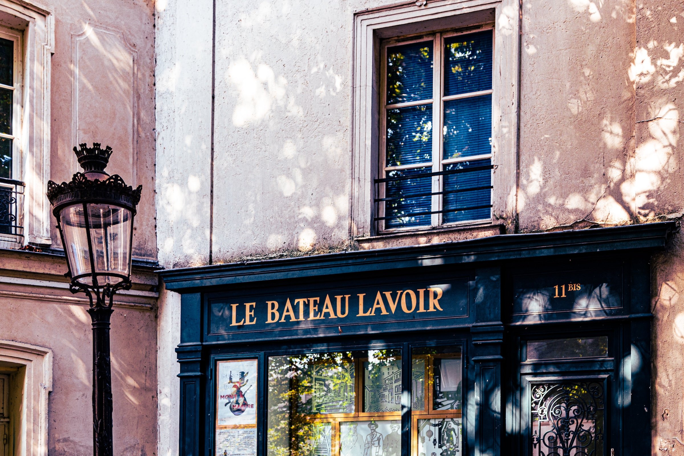
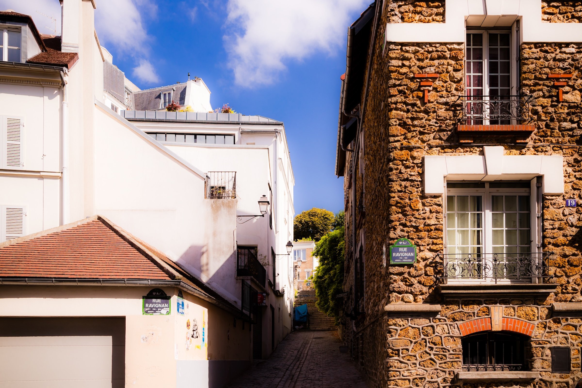
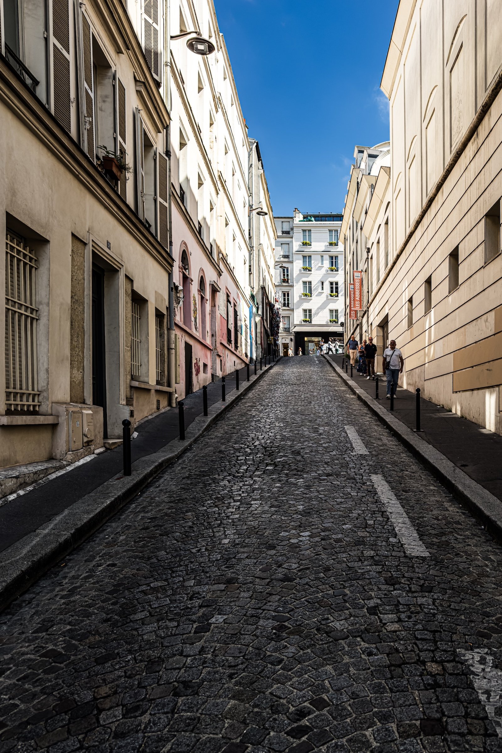
But the true revelation came after Sacré-Cœur, in the streets of Montmartre itself. Here, the broad order of Haussmannian Paris fell away into something older, freer, and more intimate: winding streets, cobblestones, stairways, cafés, galleries, murals, shopfronts, and narrow passages clinging to the hillside. Montmartre was not only a cultural neighborhood layered within Clignancourt; it was also a Conseil de Quartier, a living civic and cultural district whose identity could be felt immediately in the shape of the streets and the energy of the place. It did not feel like a decorative historic quarter preserved for visitors. It felt like a village of art, memory, performance, and daily life still rippling with bohemian force.
This was the moment when Paris became personal. The city had already impressed; Montmartre made it beloved. Its hillside irregularity, its artistic inheritance, its street-level warmth, and its refusal to behave like the grand boulevards below gave the walk a sense of discovery that felt both romantic and real. From cafés to galleries, from painted walls to sunlit façades, from steep lanes to sudden openings, Montmartre seemed to gather everything that made Paris feel alive: history, beauty, defiance, theatricality, intimacy, and the pleasure of wandering without wanting the walk to end.
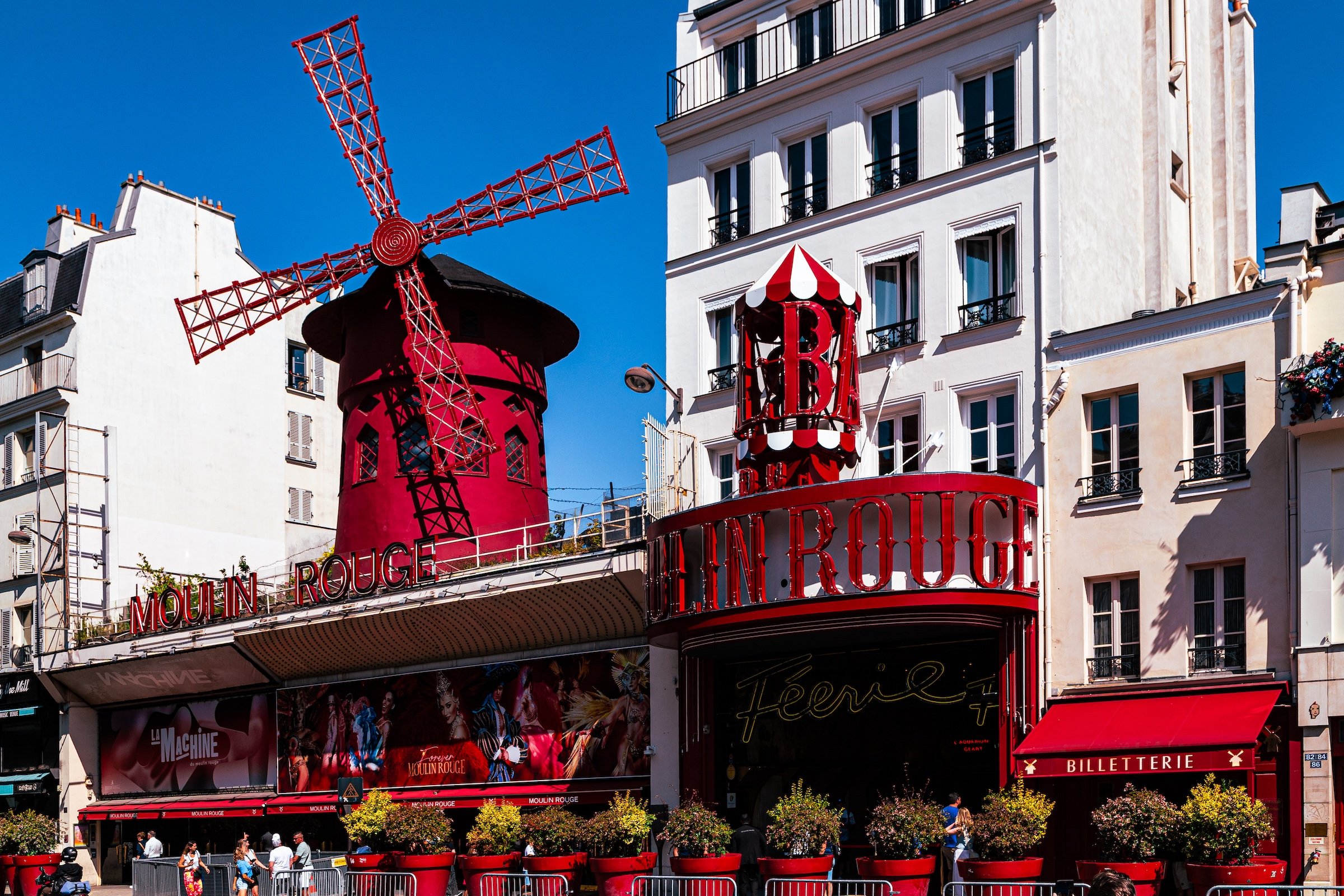
By the time the route descended toward Boulevard de Clichy, Clignancourt had become more than a photographed district. It had become a turning point. Sacré-Cœur supplied the spectacle and the view; Montmartre supplied the emotional center. In that passage through the hilltop neighborhood, the spirit of the flâneur no longer felt like an idea being applied to Paris. It felt like the natural way to meet the city.
Other neighborhoods visited:


Explore Paris
-

The twenty arrondissements form the civic spiral of Paris, organizing the city into its broad local districts of government, identity, and daily life.
-

Each arrondissement is divided into four official administrative quarters, giving Paris a more precise civic and geographic framework.
-

The conseils de quartier bring participation to street level, giving residents a voice in neighborhood needs, public space, and local civic life.
-

Les Deux Rives trace Paris through the Seine’s two banks, revealing how the Rive Droite and Rive Gauche shaped the city’s civic power, commerce, learning, art, and cultural identity.
-

Cultural neighborhoods reveal the Paris people recognize through history, cafés, architecture, memory, atmosphere, and local belonging.