
2e - MAIL
Quartiers Administratifs
Welcome to the Mail neighborhood page! Mail is a quartier administratif — an administrative quarter — one of 80 such districts across Paris. As a quartier administratif of the 2e Arrondissement - Bourse, Mail belongs to a formal layer of Parisian geography and reflects a compact but influential Paris of textile trade, publishing, workshops, and narrow commercial streets, especially around Rue du Mail, Rue Montmartre, and the approaches to the old newspaper district.
Part of an ongoing project to walk and photograph every neighborhood in Paris, this page explores 2e Mail through maps, district identity, history, and photography.


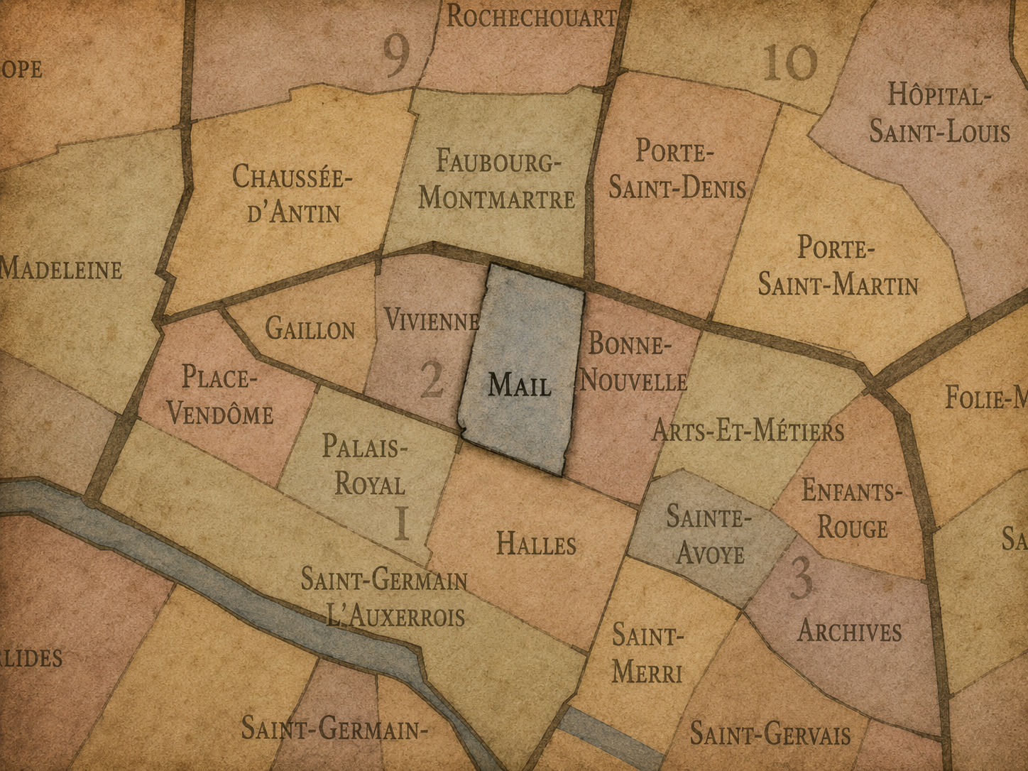
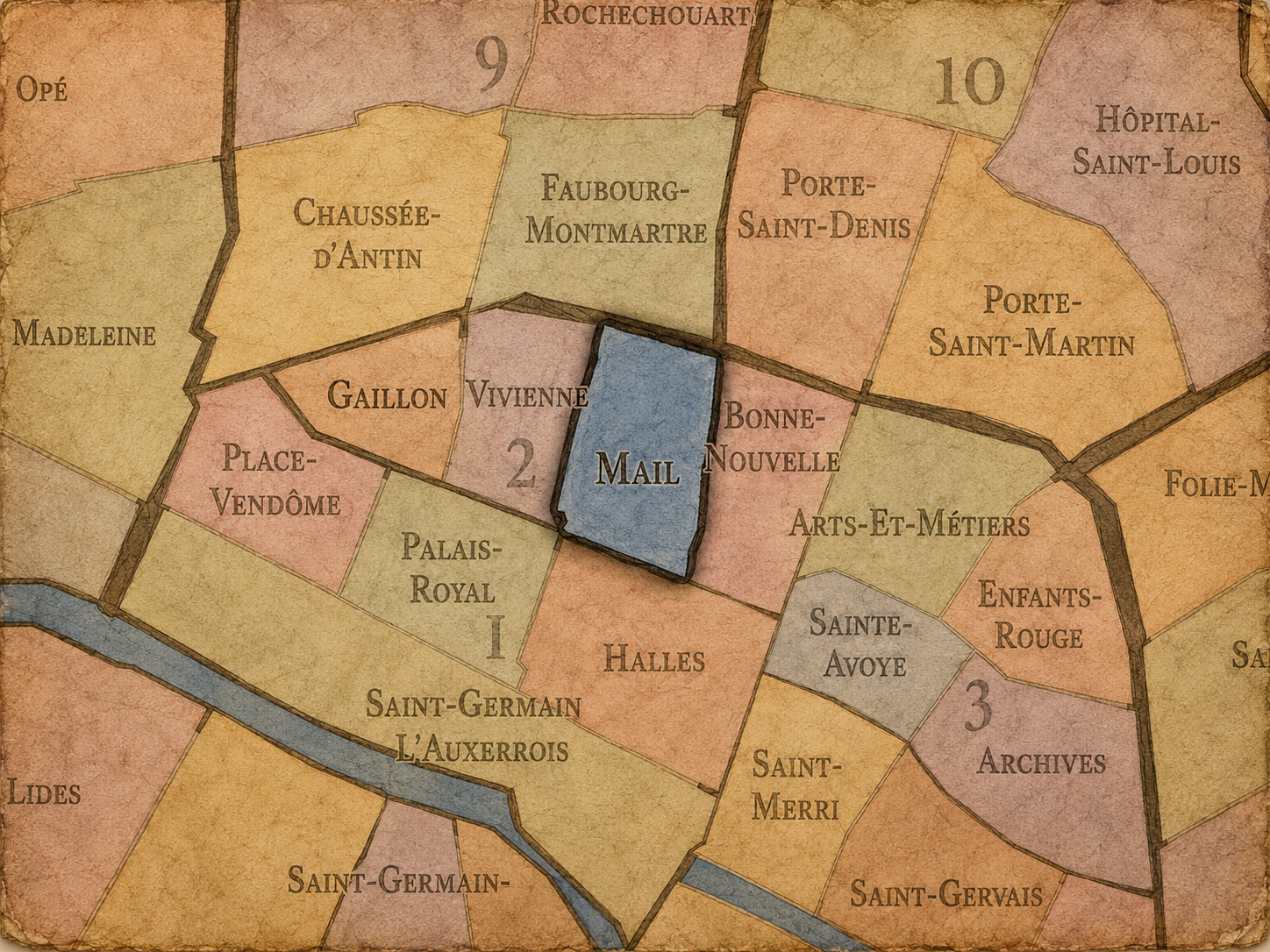
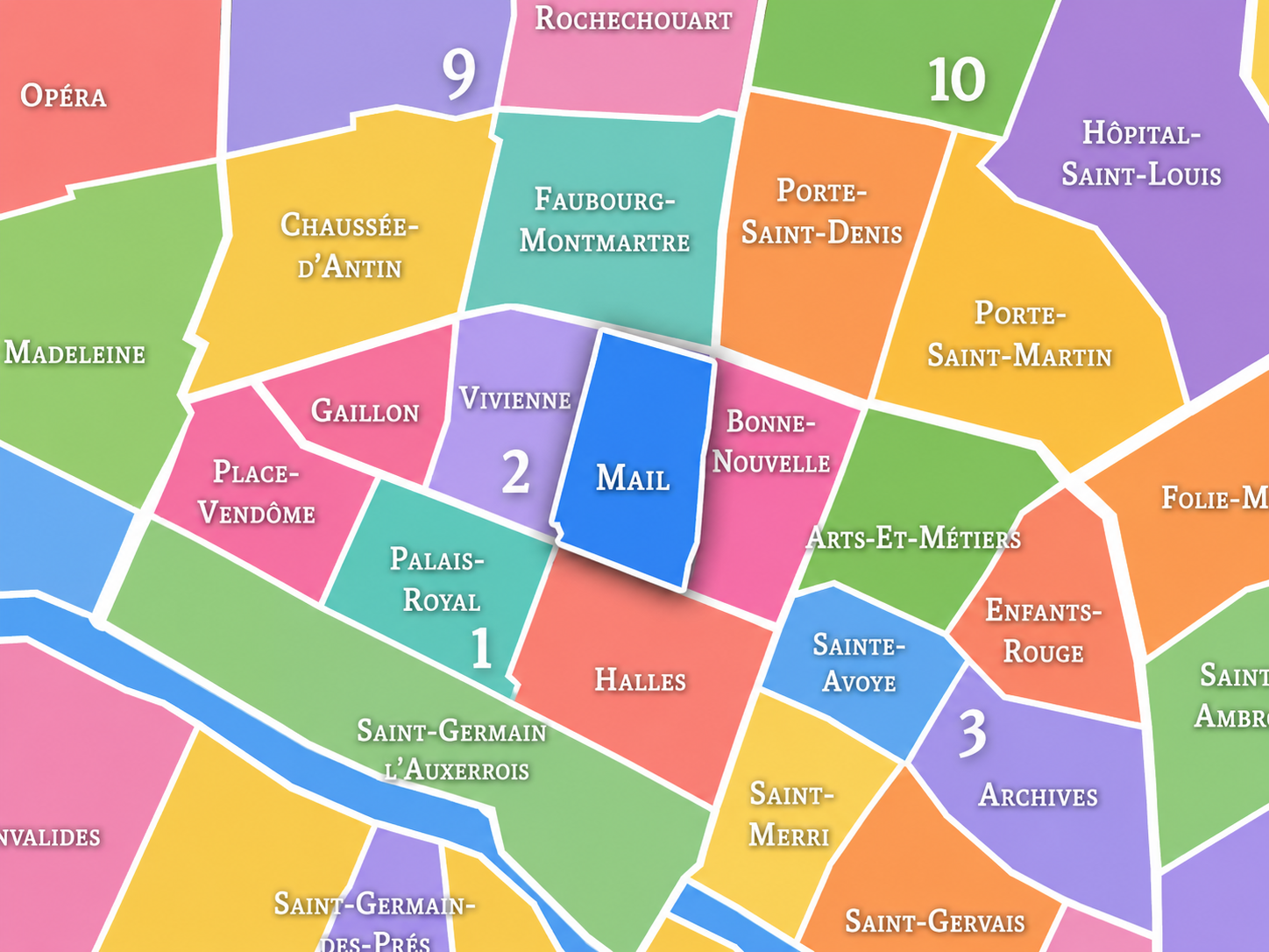
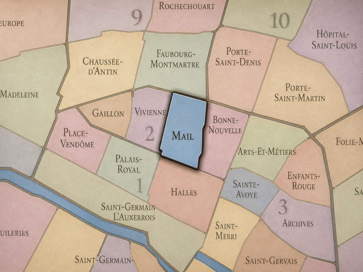
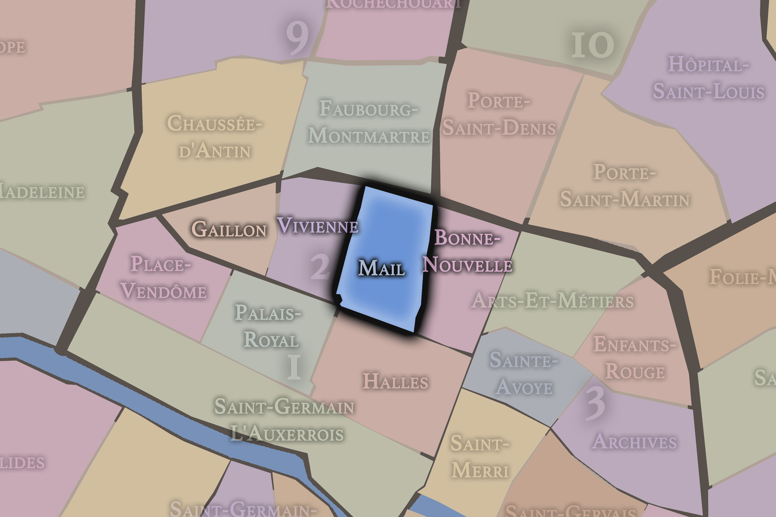
The Map
Geographic Setting
Mail occupies the central-southern portion of the 2nd arrondissement, set within one of the densest commercial fabrics of the Right Bank. It lies between the refined financial and institutional atmosphere of Vivienne to the west, the boulevard threshold of Bonne-Nouvelle to the east, the old market and commercial districts leading toward Les Halles to the south, and the Sentier’s historic textile corridors to the north. Compact in size but rich in urban texture, Mail is a quarter of narrow streets, passages, offices, workshops, storefronts, and layered commercial memory.
Unlike Gaillon, which opens toward Opéra and the western elegance of the Right Bank, or Bonne-Nouvelle, which looks toward the Grands Boulevards and the old northern gates, Mail belongs more fully to the interior commercial body of central Paris. It is not organized around a single grand square, palace, or monument. Its identity comes from street fabric: Rue du Mail, Rue Montmartre, Rue Saint-Fiacre, Rue d’Aboukir, Rue des Jeûneurs, Rue Notre-Dame-des-Victoires, and the surrounding network of passages and working streets. This is Paris at the scale of trade, print, textiles, offices, cafés, and urban density.
Administrative Quarter Identity
Etymology and Origins
The name Mail comes from Rue du Mail, which preserves the memory of a mail, or mall, once associated with a game similar to pall-mall. In early modern European cities, a mail could refer to a long, open space or alley where the game was played, and later to a promenade or linear public space. In Paris, the name survived in the street and then in the administrative quarter, even after the original recreational landscape had vanished beneath urban development.
That origin gives Mail a quiet but revealing identity. The quarter’s name does not come from a church, palace, market hall, or noble title, but from a former leisure ground absorbed into the growing city. It speaks to a Paris before the district became one of the commercial hearts of the Right Bank — a Paris of open ground, games, promenades, and gradual transformation.
The name is modest, almost easy to overlook. Yet it captures one of the recurring patterns of Parisian geography: a place once defined by a specific use becomes urbanized, commercialized, and densely built, while the old word remains embedded in the map. Mail is a reminder that even the most crowded central quarters may preserve traces of vanished spaces.
Civic Framework
Within the official geography of Paris, Mail is one of the four administrative quarters of the 2nd arrondissement, alongside Gaillon, Vivienne, and Bonne-Nouvelle. It is one of the small named units that give the 2nd arrondissement its fine civic grain, situated between the Bourse-adjacent west and the boulevard-driven east.
The quarter’s civic role is especially important because Mail could otherwise disappear into broader nearby identities: Sentier, Bourse, Montorgueil, Bonne-Nouvelle, or the old commercial Right Bank. As an administrative quarter, Mail gives a formal name to this interior landscape of commerce and street density. It helps distinguish the central working fabric of the 2nd arrondissement from the more monumental or better-known districts surrounding it.
Mail also reflects the particular character of the 2nd arrondissement as a whole. This is Paris’s smallest arrondissement, but it is exceptionally dense in history and function. Its quarters do not unfold through large residential expanses. They compress financial institutions, textile history, passages, theaters, restaurants, offices, and old commercial routes into a tight urban field. Mail is one of the clearest expressions of that compression.
Neighborhood Distinction
Mail differs from the other quarters of the 2nd arrondissement through its strongly commercial and interior character. Gaillon is shaped by proximity to Opéra, restaurants, theaters, and the western prestige of central Paris. Vivienne is associated with the Bourse, the Bibliothèque nationale, arcaded passages, and the elegance of financial and literary institutions. Bonne-Nouvelle belongs to the Grands Boulevards, the old northern thresholds, and the restless movement around Rue Saint-Denis and Boulevard de Bonne-Nouvelle.
Mail is more embedded. It does not face outward toward a grand threshold or monumental institution in the same way. Instead, it occupies the working middle of the arrondissement: a quarter of small streets, specialized commerce, former textile networks, office buildings, passages, and everyday central-city business. Its identity is built from accumulation rather than spectacle.
It also differs from the cultural idea of the Sentier, though the two are closely related. The Sentier is a broader textile and commercial identity that overlaps parts of the 2nd arrondissement, especially around Rue du Sentier, Rue d’Aboukir, Rue Réaumur, and nearby streets. Mail belongs within that larger commercial world, but as an administrative quarter it gives a more precise civic frame to one portion of it. The distinction matters: Mail is the official quarter; Sentier is the broader commercial and cultural identity.
Parisian Identity
Mail expresses Paris as a city of trade, adaptation, and interior labor. It is not the Paris of postcard monuments, but the Paris of rooms above shops, narrow sidewalks, courtyards, wholesalers, offices, restaurants, old commercial signs, and streets that have changed function without losing density. Its identity is practical, urban, and quietly resilient.
This is a quarter where Paris’s commercial intelligence can be felt. For centuries, central Right Bank districts like Mail have adapted to the needs of changing economies: textiles, printing, banking, fashion, technology, food, office work, and small business. The quarter’s streets have not been frozen in one historical image. They have been reused, repurposed, and reoccupied by successive forms of urban enterprise.
That gives Mail a distinctly Parisian character. It shows that the city’s identity does not rest only in monuments or preserved façades. It also lives in the ability of old streets to keep working. Mail is one of those places where Paris remains productive, dense, and alert — a city of commerce hidden behind the elegance of its central map.
Neighborhood Connections
Every neighborhood belongs to a wider Parisian fabric.
-
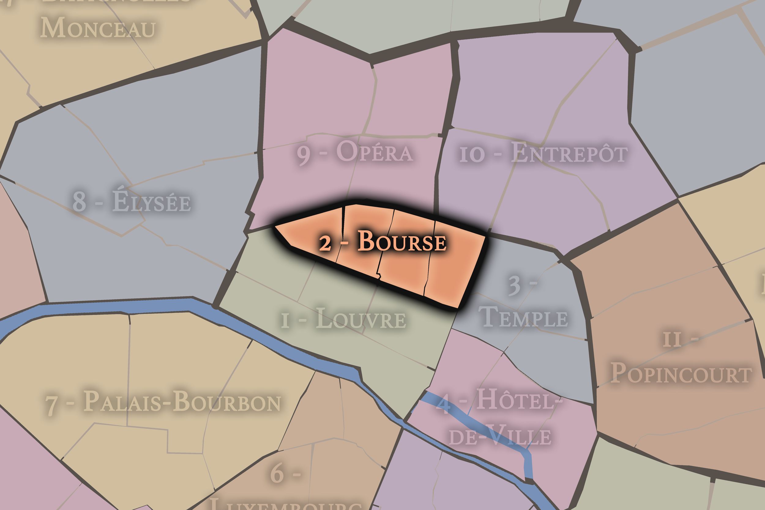
2e — Bourse
-
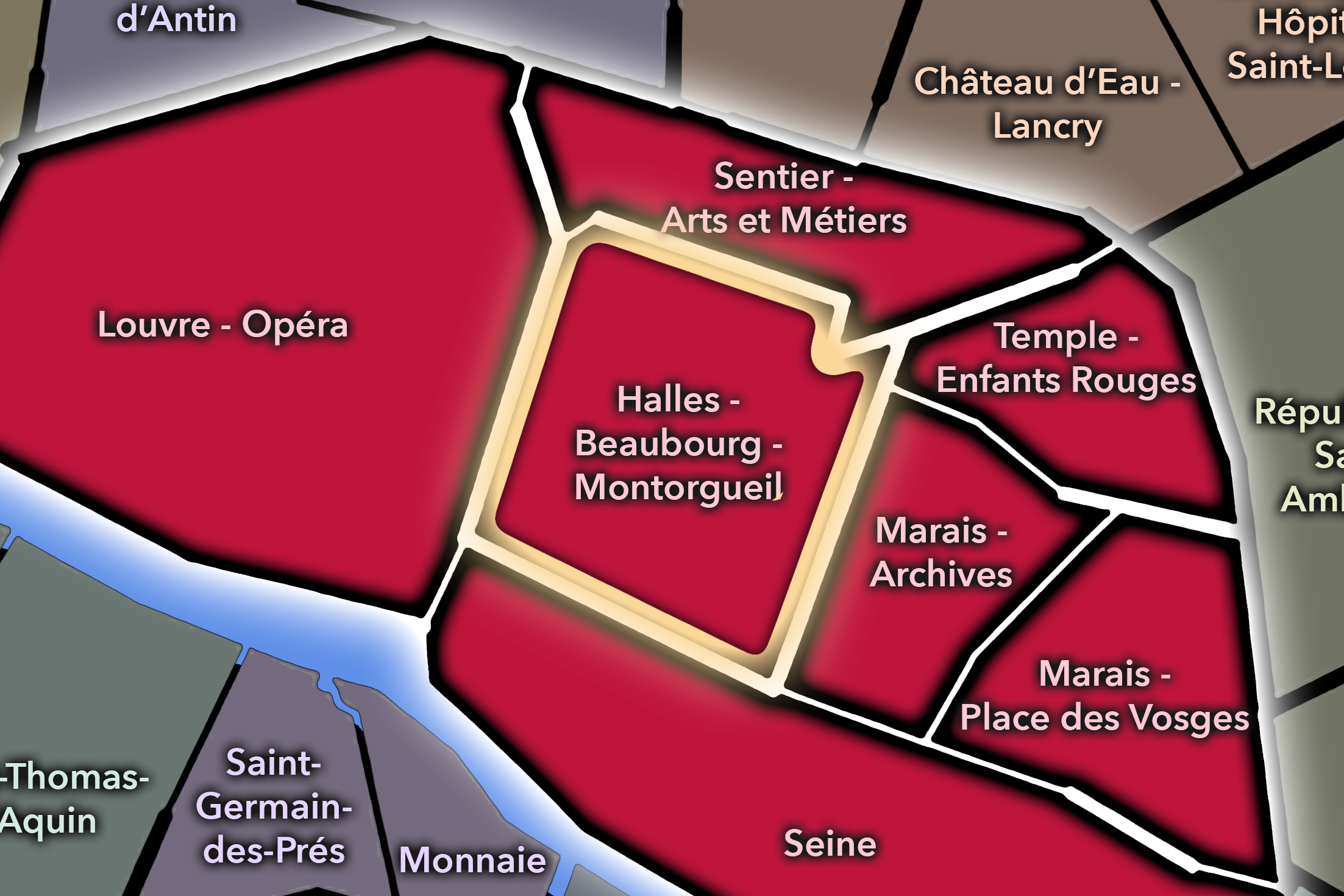
Halles - Beaubourg - Montorgueil
-
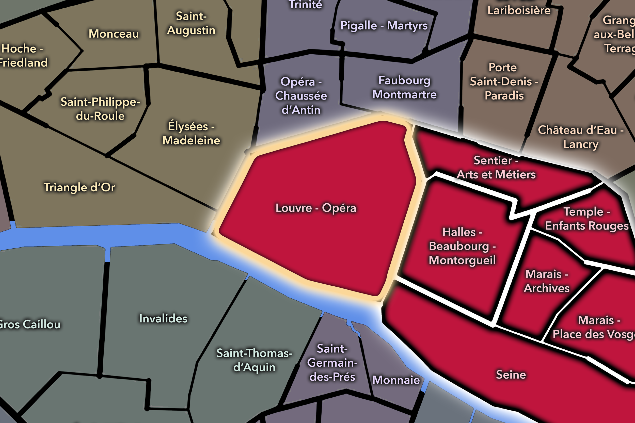
Louvre - Opéra
-
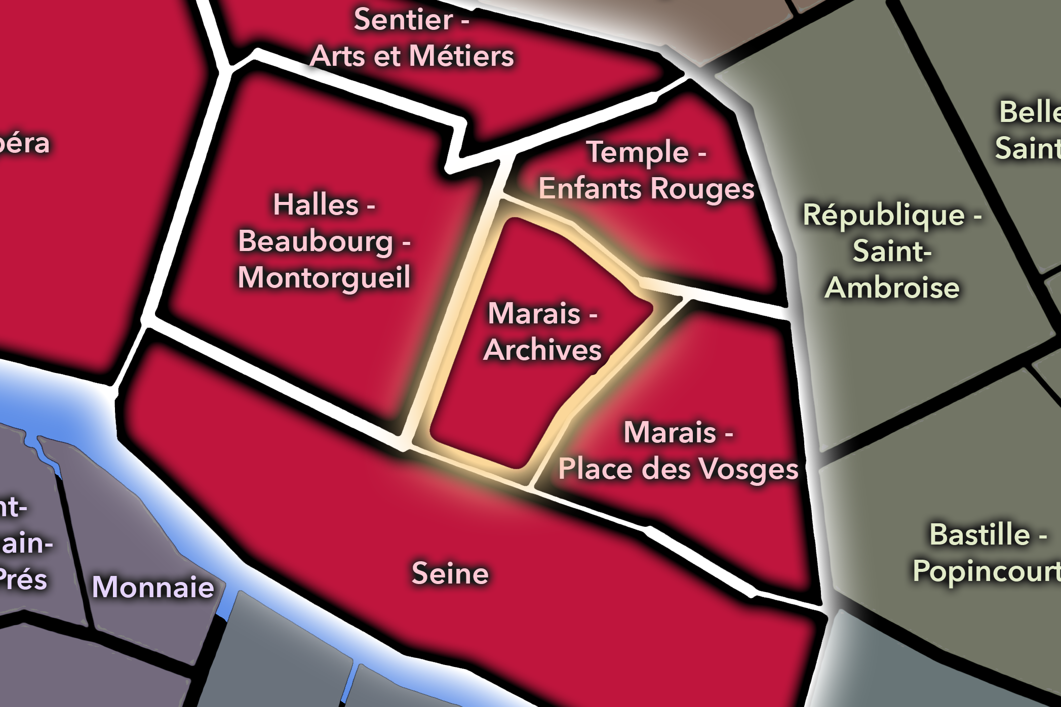
Sentier - Arts et Métiers
-

Rive Droite
The History
Origins
The origins of Mail lie in the gradual development of the Right Bank north of Les Halles and east of the royal and financial districts. In earlier periods, this part of Paris sat near the expanding commercial core of the city, shaped by roads leading northward, market activity, religious institutions, and the growth of urban property beyond the oldest medieval center.
Before it became a dense commercial quarter, the area contained spaces that were less tightly built than they are today. The memory of the mail itself points to a former leisure or promenade landscape, later absorbed into the growing city. As Paris expanded, recreational grounds, gardens, estates, and peripheral streets were transformed into urban fabric.
Mail’s deeper origin story is therefore one of conversion. Open or semi-open ground became street. Street became commerce. Commerce became neighborhood identity. The quarter’s name preserves the earlier layer, while its present form reveals the intensity of later urbanization.
16th–17th Century
In the 16th and 17th centuries, the future Mail quarter became increasingly drawn into the commercial and social life of the Right Bank. Paris was expanding beyond its older medieval constraints, and the area north of Les Halles and east of the royal districts grew in density and importance. Streets were laid out, properties developed, and the district became more closely connected to the trade routes and markets that shaped central Paris.
The memory of the mail belongs to this early modern landscape. A place associated with leisure, game-playing, or promenade gradually became part of a more urbanized network. The transformation reflects the pressure of the growing capital: spaces once used for recreation or open movement were built over, narrowed, and absorbed into the city’s commercial body.
By the 17th century, this part of Paris was increasingly defined by proximity to several powerful urban systems: Les Halles to the south, the Bourse-adjacent commercial world to the west, the northern faubourg routes, and the expanding density of streets tied to trade and services. Mail’s later identity as a compact commercial quarter began to take form in this period.
18th Century
In the 18th century, Mail became part of the dense commercial Right Bank that helped sustain Paris’s growing economy. The district around Rue Montmartre, Rue du Mail, and nearby streets developed through shops, workshops, residences, offices, and small-scale trades. It was not a landscape of grand royal planning, but of accumulated urban use.
This was a century when central Paris became increasingly animated by commerce, print culture, finance, and public sociability. Streets near Mail connected the market world of Les Halles, the commercial corridors of the Right Bank, and the emerging business districts around the future Bourse landscape. The quarter’s identity was shaped by proximity to circulation rather than by a single monument.
By the revolutionary era, districts like Mail were part of the city’s practical and political bloodstream. They were places where news, goods, labor, and opinion moved quickly. Even when not a primary stage of revolutionary spectacle, the quarter belonged to the wider urban environment that made Paris politically and socially combustible.
19th Century
The 19th century gave Mail much of its modern commercial character. As Paris industrialized, modernized, and reorganized, the central Right Bank became increasingly important for textiles, wholesale commerce, finance, printing, and office work. The broader Sentier district emerged as one of Paris’s key textile and garment-related zones, and Mail was closely connected to that commercial world.
Urban transformations changed the surrounding fabric without erasing the quarter’s density. The development of Rue Réaumur, the growth of commercial architecture, and the modernization of business districts helped integrate Mail into the expanding economy of modern Paris. Older narrow streets remained, but new building types and new commercial functions layered themselves into the district.
This combination of old street pattern and modern commerce is central to Mail’s identity. It did not become a grand boulevard quarter in the style of Haussmann’s most ceremonial avenues. Instead, it became part of the working interior of the modern city: offices, showrooms, wholesalers, merchants, passages, and streets where economic change could be read in the storefronts.
Early–Mid 20th Century
In the early and mid 20th century, Mail remained tied to the working and commercial life of central Paris. The quarter’s streets supported textile trades, small businesses, offices, cafés, restaurants, and the practical routines of a district where commerce often took place behind modest façades. It was a neighborhood of transactions, appointments, deliveries, and specialized knowledge.
The area’s identity was especially connected to the broader Sentier economy. Clothing, fabric, wholesale activity, and related trades gave nearby streets a distinctive rhythm. Unlike luxury fashion districts, where the finished image was displayed, Mail and its surroundings belonged more to the backstage of commerce: materials, samples, negotiation, production, distribution, and office work.
Through the disruptions of war, occupation, liberation, and postwar recovery, the quarter retained its central commercial role. Its importance lay less in dramatic reconstruction than in continuity. Businesses adapted. Streets stayed active. The old Right Bank commercial fabric continued to function, even as the city around it changed.
Late 20th Century
In the late 20th century, Mail experienced the broader transformation of central Paris’s working districts. Textile and wholesale activities continued but faced pressure from globalization, rising rents, changing production systems, and the shift from manufacturing and distribution toward services, offices, restaurants, and creative industries. The Sentier itself became associated not only with textiles, but also with new forms of entrepreneurship and technology.
This transition altered the quarter’s atmosphere. Some older trades diminished or moved elsewhere, while offices, start-ups, food culture, and renovated commercial spaces took on greater importance. The physical fabric remained dense, but the uses behind the doors changed. Mail became a place where the old economy of fabric and the new economy of information could overlap.
The late 20th century therefore gave the quarter a new kind of layered identity. It was no longer only a traditional commercial district, but not yet fully remade into a polished cultural or luxury zone. Its strength lay in adaptation — the ability of small streets and old buildings to absorb new functions without losing their central-city intensity.
21st Century
In the 21st century, Mail remains one of the compact, working interiors of central Paris. Its streets are now shaped by a mixture of offices, restaurants, creative businesses, remnants of textile history, digital-era enterprise, and the everyday movement of workers, residents, and visitors passing between Sentier, Bourse, Montorgueil, Bonne-Nouvelle, and Palais-Royal.
The quarter’s identity is not always obvious at first glance. It does not announce itself with a single grand landmark. Instead, it reveals itself through texture: old commercial façades, narrow streets, unexpected restaurants, small courtyards, renovated office buildings, and the continued density of use that has long defined this part of the Right Bank.
For CityNeighborhoods: Paris, Mail is valuable because it shows how administrative quarters can preserve less glamorous but essential forms of urban identity. This is not the Paris of a single famous monument. It is the Paris of commercial continuity — a neighborhood where history survives through work, reuse, and the persistent energy of the street.
Spirit and Legacy
Mail is the quarter of the working interior. Its spirit is not ceremonial, theatrical, or monumental. It is concentrated, practical, and adaptive. It belongs to the Paris of trades, offices, passages, courtyards, storefronts, cafés, and streets whose importance lies in continued use rather than spectacle.
Its legacy is one of transformation without disappearance. A former mail gave the quarter its name. Urban development erased the old open ground. Commerce filled the streets. Textiles, print, offices, restaurants, and new businesses came and went. Yet the quarter remained what it had long been: a dense central place where Paris works.
To walk Mail is to read the city through its commercial grain. It reminds us that not every neighborhood identity is born from monument or mythology. Some are formed through labor, repetition, exchange, and adaptation. In Mail, Paris reveals one of its quieter truths: the city endures not only because it is beautiful, but because it keeps finding ways to function.
The Photography
Visual Identity

The visual identity of each Paris district begins with its position in the city’s layered geography. Before the photographs arrive, the maps establish a first way of seeing: where the district sits, what civic layer it belongs to, which boundaries define it, and how it connects to the surrounding fabric of Paris. In CityNeighborhoods Paris, cartography is not merely orientation; it is part of the visual language of the project.
As the photographic archive grows, this section will continue to develop through images gathered on foot. Streets, façades, monuments, markets, parks, river edges, passages, signs, textures, and everyday details will gradually reveal how each district presents itself visually. The goal is not only to show what a place looks like, but to trace how its identity becomes visible through form, atmosphere, memory, and use.
Through The Lens

CityNeighborhoods Paris is built from walking, looking, and returning. Each district is approached through photography as a way of paying attention: to the obvious landmarks and the quieter details, to historic structures and ordinary streets, to the moments where civic geography becomes lived experience. The camera becomes a tool for noticing how Paris changes from one district to the next, and how each place holds its own relationship to the larger city.
As photographs are processed and added, this section will become a more specific visual record of the district. Future updates may include dated field notes, galleries, and reflections from individual walks. For now, the page remains part of the larger CityNeighborhoods effort to document every Paris neighborhood through maps, history, identity, and photography — one district, one walk, and one visual encounter at a time.
If you visit Paris, these ideas can help inspire your own photography.


Paris: J’Espere, Je Rêve, Je Vive
Paris Photo Gallery
Paris Flâneur Notes
Flâneur Notes document the walks, photographs, light, and street-level observations behind this neighborhood entry. Learn more about the Spirit of the Flâneur.


Explore Paris
-

The twenty arrondissements form the civic spiral of Paris, organizing the city into its broad local districts of government, identity, and daily life.
-

Each arrondissement is divided into four official administrative quarters, giving Paris a more precise civic and geographic framework.
-

The conseils de quartier bring participation to street level, giving residents a voice in neighborhood needs, public space, and local civic life.
-

Les Deux Rives trace Paris through the Seine’s two banks, revealing how the Rive Droite and Rive Gauche shaped the city’s civic power, commerce, learning, art, and cultural identity.
-

Cultural neighborhoods reveal the Paris people recognize through history, cafés, architecture, memory, atmosphere, and local belonging.