
8e - MADELEINE
Quartiers Administratifs
Welcome to the Madeleine neighborhood page! Madeleine is a quartier administratif — an administrative quarter — one of 80 such districts across Paris. As a quartier administratif of the 8e Arrondissement - Élysées, Madeleine belongs to a formal layer of Parisian geography and is shaped by the monumental church that gives the quarter its name, along with the grand streets linking the Opéra, Place de la Concorde, luxury commerce, and the ceremonial core of western Paris.
Part of an ongoing project to walk and photograph every neighborhood in Paris, this page explores 8e Madeleine through maps, district identity, history, and photography.


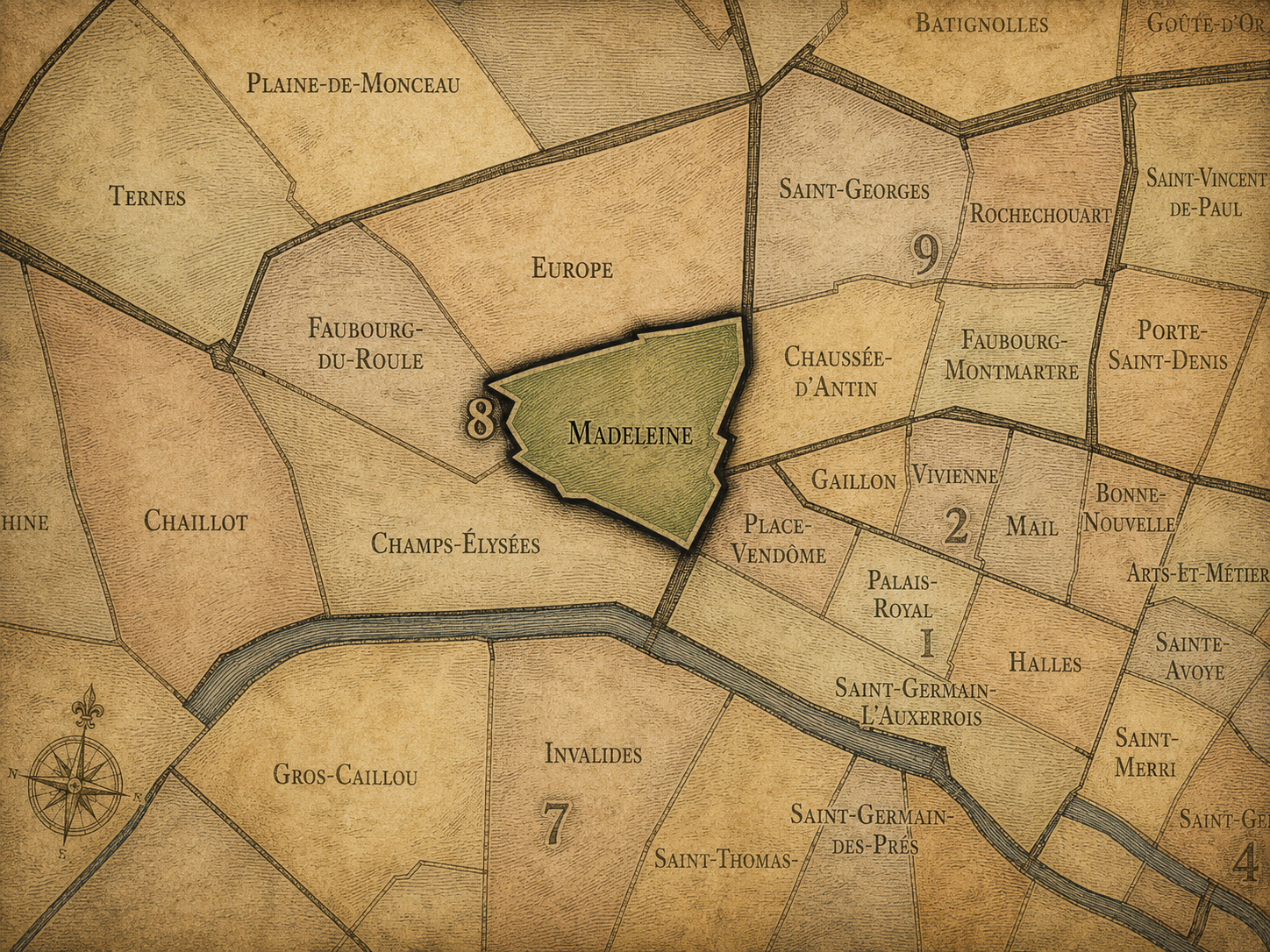
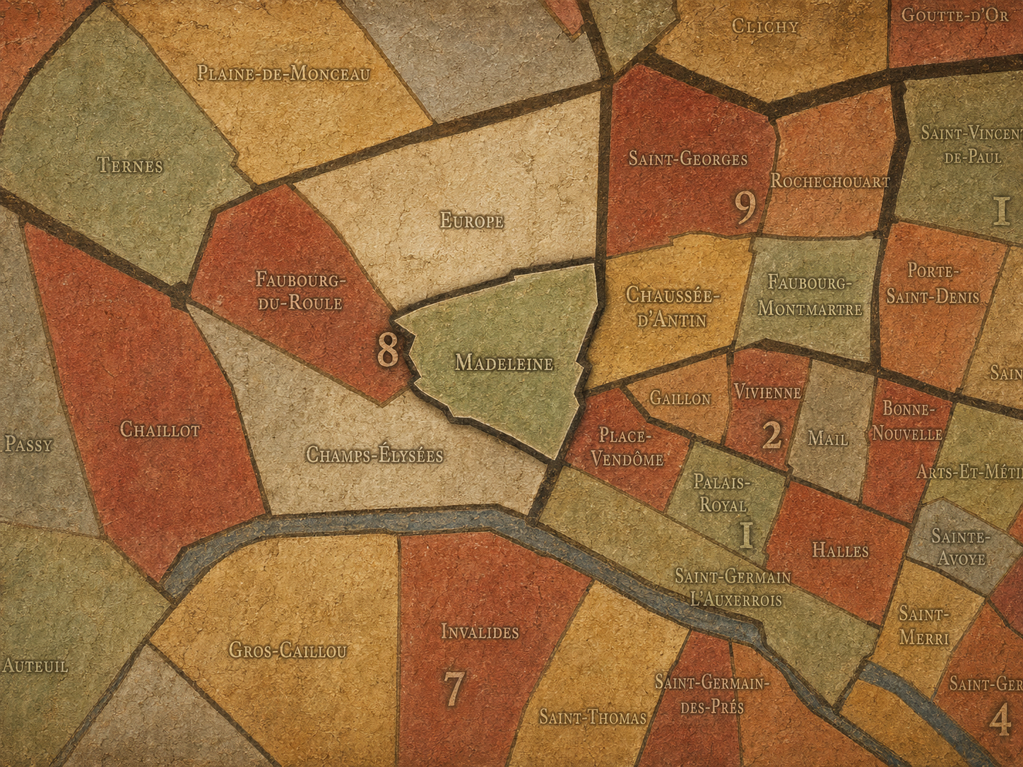
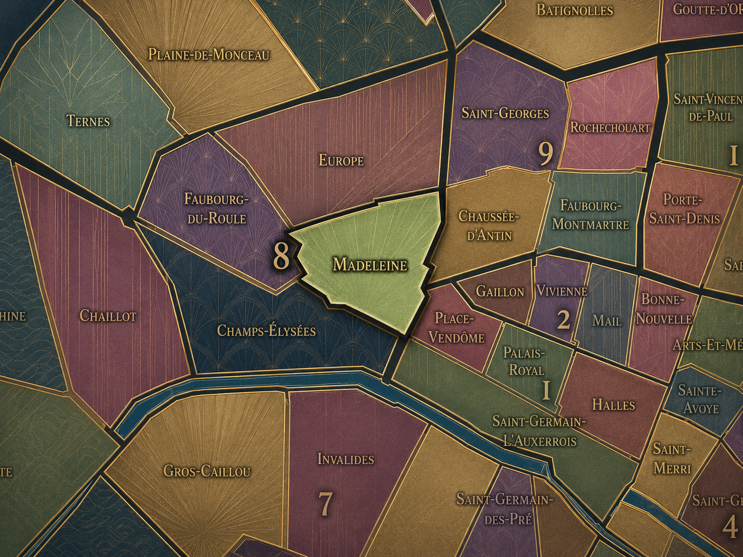
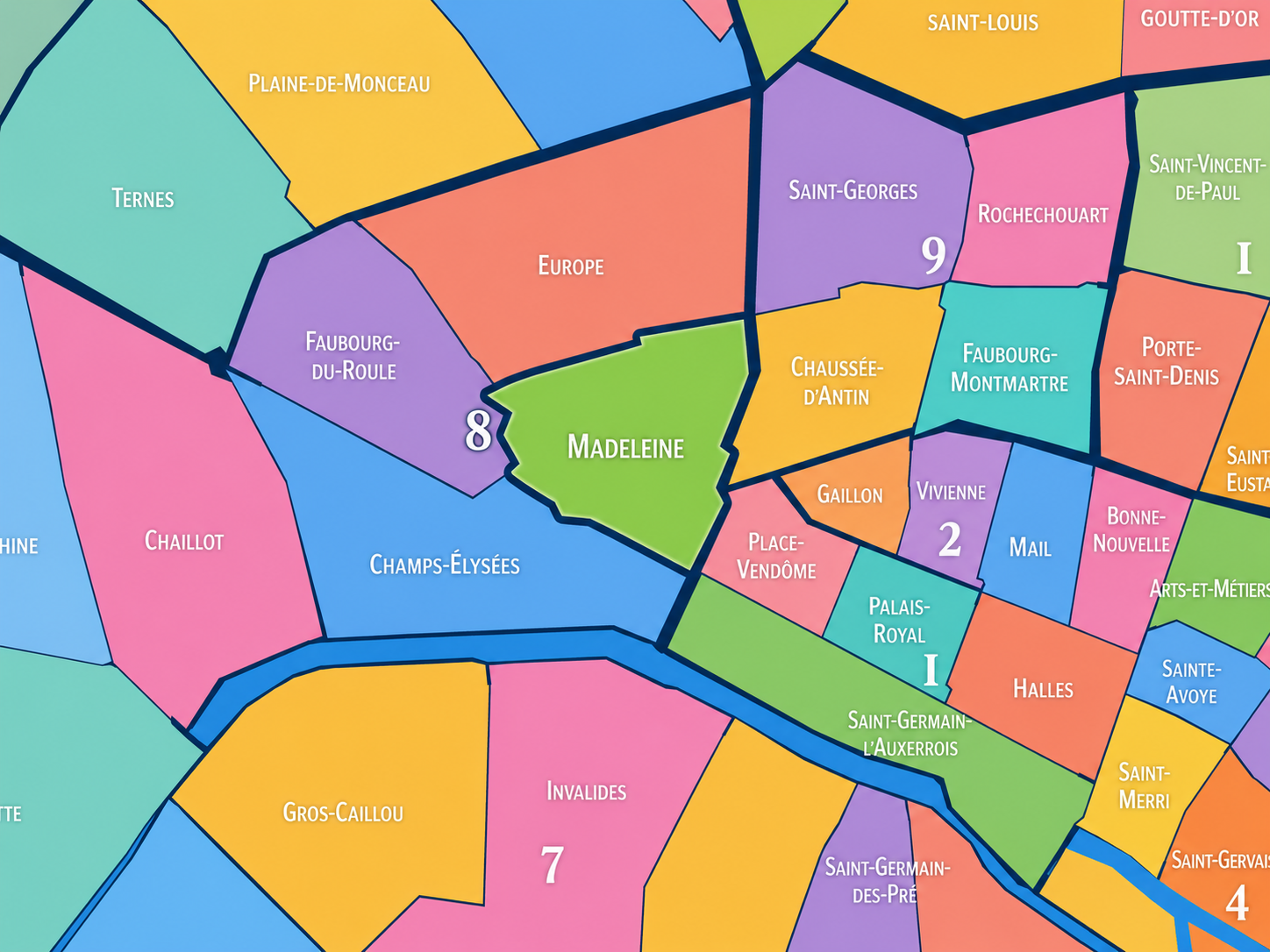
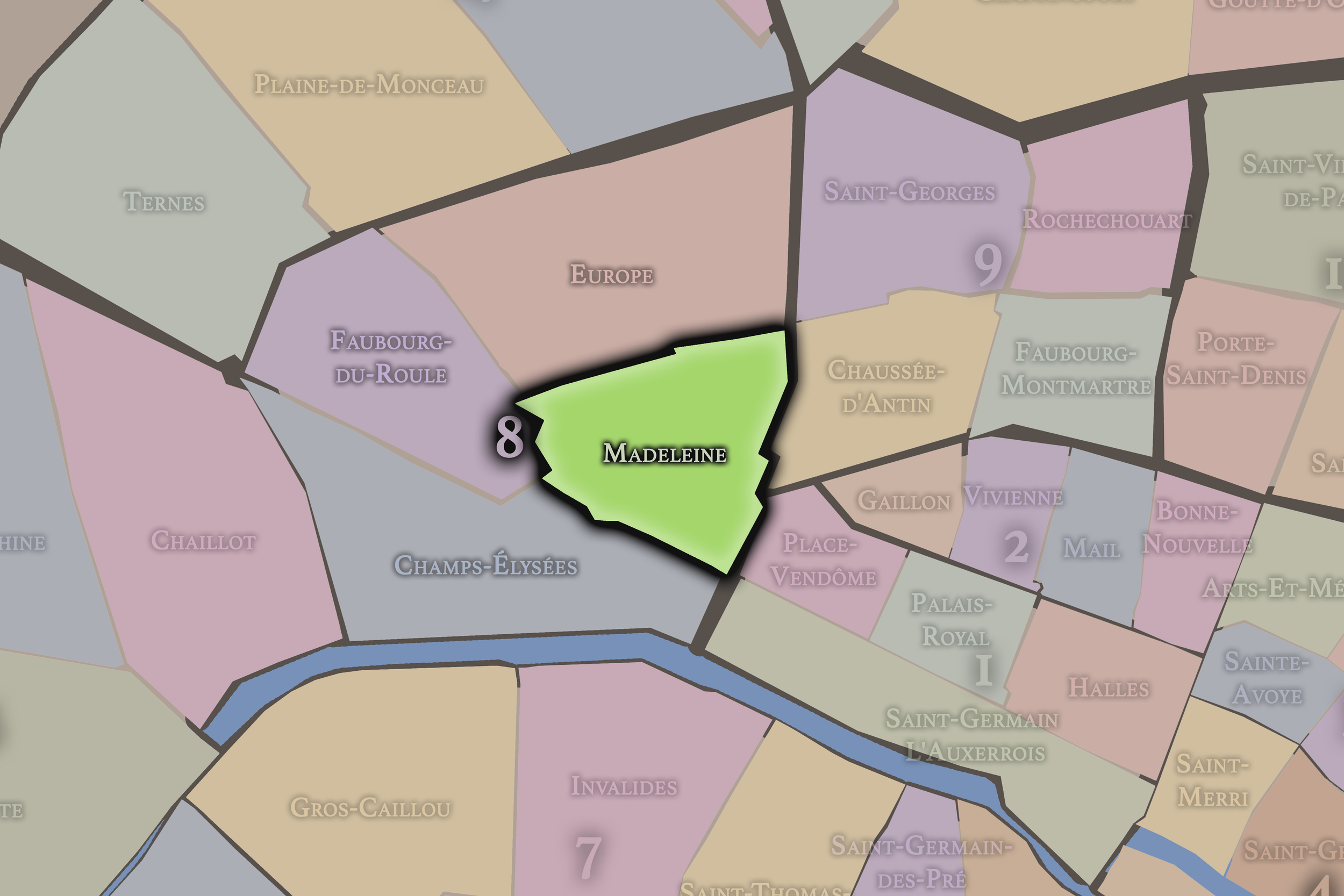
The Map
Geographic Setting
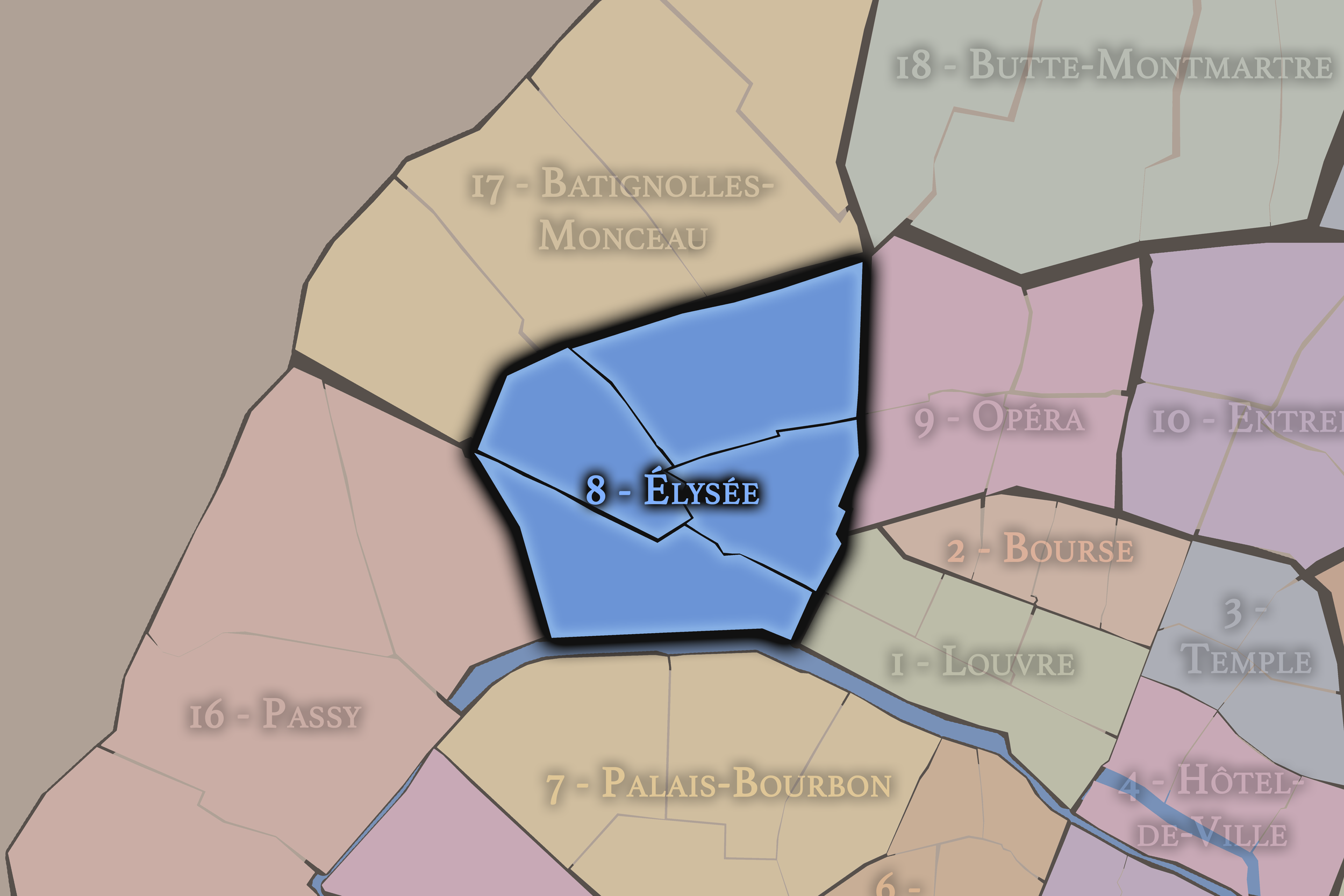
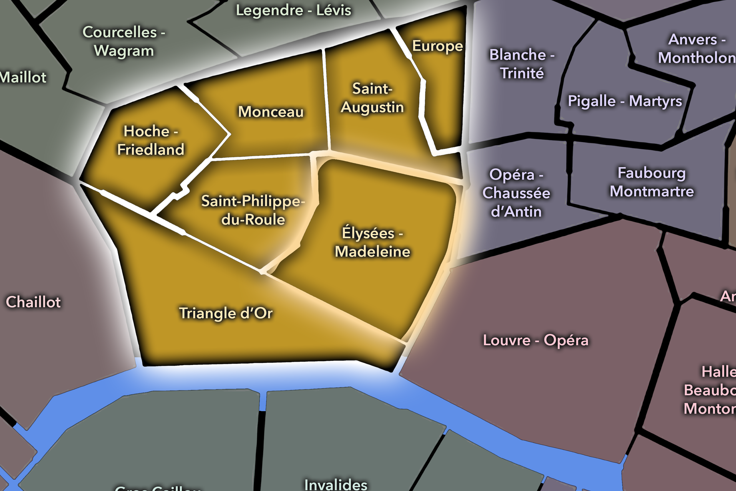
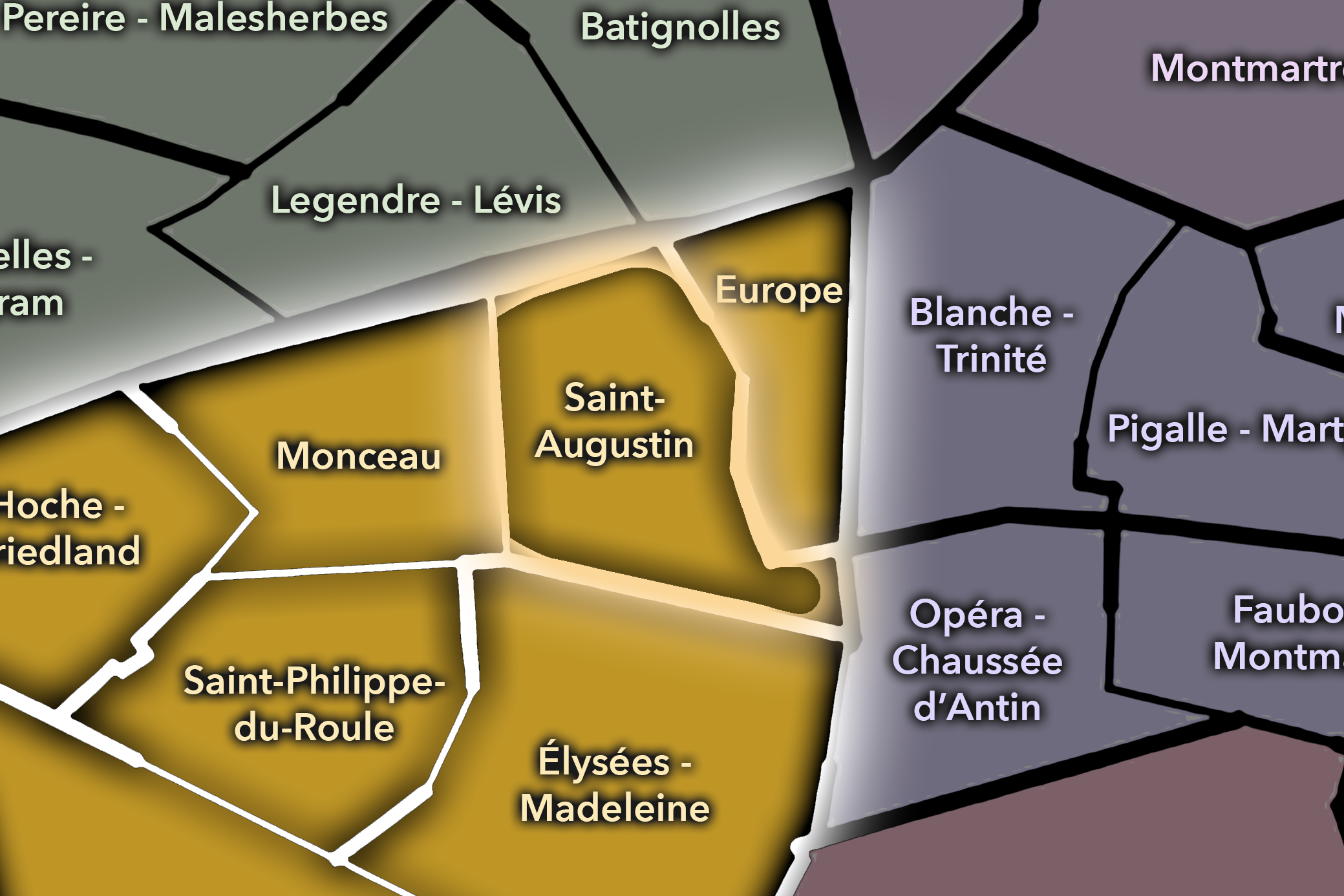
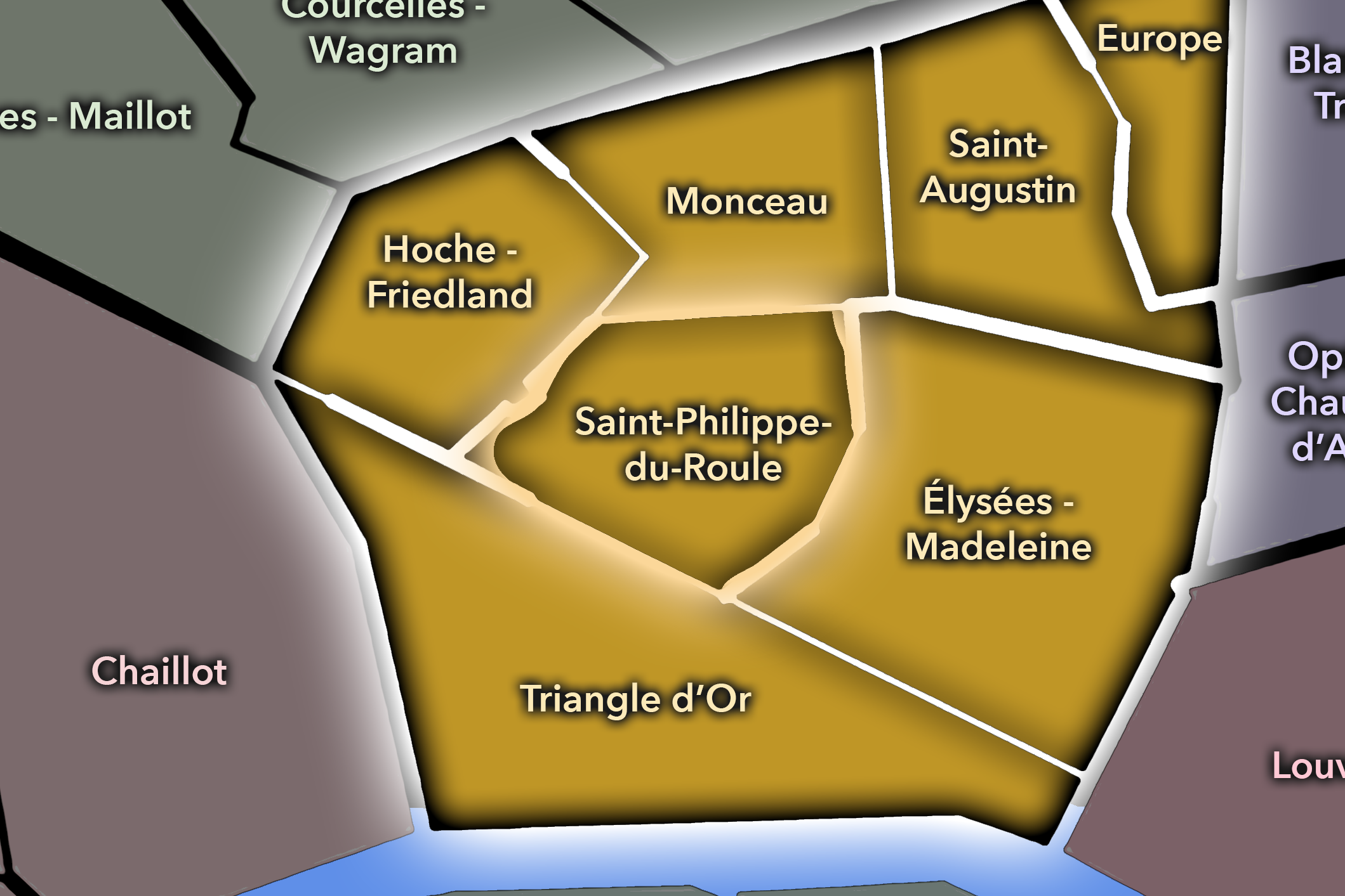
Madeleine occupies the southeastern portion of the 8th arrondissement, where the formal urban landscapes of Concorde, Opéra, Saint-Lazare, Faubourg Saint-Honoré, and the Grands Boulevards converge around one of Paris’s most distinctive church-squares. It lies east of the Champs-Élysées quarter, south of Europe, southeast of Faubourg-du-Roule, and along the borderlands where the 8th opens toward the 1st and 9th arrondissements. Its geography is shaped by Place de la Madeleine, Rue Royale, Boulevard Malesherbes, Boulevard de la Madeleine, Boulevard des Capucines, Rue Tronchet, Rue du Faubourg-Saint-Honoré, and the ceremonial approach toward Place de la Concorde.
The quarter is compact but unusually theatrical. The Église de la Madeleine stands at its center like a classical temple, facing south along Rue Royale toward Concorde and the National Assembly beyond the Seine. Around it gather luxury food halls, florists, boutiques, offices, embassies, hotels, restaurants, and the polished commercial world that links Opéra to Saint-Honoré and the western Right Bank. Madeleine is not as axial and expansive as Champs-Élysées, not as railway-structured as Europe, and not as residential-prestige oriented as Faubourg-du-Roule. It is more concentrated: a quarter of formal stone, luxury commerce, church architecture, and metropolitan refinement.
This is one of the places where Paris feels staged through proportion. The church, the square, the colonnades, the approach from Concorde, and the surrounding streets create a district of composed urban presence. Madeleine is not merely a point on the map. It is a hinge between royal planning, Napoleonic ambition, Catholic worship, luxury retail, and the modern business district of the 8th.
Administrative Quarter Identity
Etymology and Origins
The name Madeleine comes from Sainte Marie-Madeleine, or Mary Magdalene, to whom the church on Place de la Madeleine is dedicated. The quarter takes its name from that church, whose long and complicated construction history shaped the surrounding district. The present Église de la Madeleine replaced an older parish church that had become too small, and the 8th arrondissement’s official history describes the church as the symbol of the quarter.
The name carries a religious origin, but the building complicates that identity. La Madeleine looks outwardly like a Roman temple rather than a conventional Parisian parish church, and its history passed through multiple political intentions before it became the Catholic church known today. Britannica notes that Napoleon commissioned Pierre-Alexandre Vignon’s design in 1806 and that the building’s intended commemorative role was later assumed by the Arc de Triomphe; in 1816, under the restored Bourbon monarchy, the Madeleine was made a church.
This gives the name Madeleine unusual depth. It is devotional, but also imperial, classical, urbanistic, and political. The quarter’s name is inherited from a saint, but its built form carries the memory of regimes that used architecture to define authority. In Madeleine, a church name becomes a civic and metropolitan identity.
Civic Framework
Within the official geography of Paris, Madeleine is one of the four administrative quarters of the 8th arrondissement, alongside Champs-Élysées, Faubourg-du-Roule, and Europe. It is traditionally counted as the 31st administrative quarter of Paris, and district references identify it as owing its name to the church on Place de la Madeleine, built between 1763 and 1842.
As an administrative quarter, Madeleine gives formal civic shape to a landscape that might otherwise be described through adjoining names: Opéra, Concorde, Saint-Honoré, Grands Boulevards, Saint-Lazare, or the luxury food district around Place de la Madeleine. The official quarter name gathers those identities into one mapped unit centered on the church and its square.
This civic frame is especially useful because Madeleine sits at one of the great transition points of western central Paris. It belongs to the 8th arrondissement, but visually and functionally it reaches toward the 1st, 9th, and the institutional landscapes across the Seine. It is a quarter of overlap: church and commerce, business and luxury, boulevard and square, state image and everyday metropolitan movement.
Neighborhood Distinction
Madeleine differs from the other quarters of the 8th arrondissement through its compact formal elegance and its concentration of church, luxury commerce, and metropolitan transition. Champs-Élysées is the arrondissement’s ceremonial axis, shaped by the avenue, Arc de Triomphe, public celebrations, tourism, and national spectacle. Europe is defined by railways, Saint-Lazare, Haussmannian streets, and the city names of the 19th-century street grid. Faubourg-du-Roule is more interior and prestige-residential, connecting the upper Champs-Élysées, Saint-Honoré, Courcelles, and Monceau.
Madeleine is more architectural and culinary in its public image. Its identity gathers the temple-like church, the square, Rue Royale, luxury food houses, florists, hotels, office buildings, and the formal approaches between Opéra and Concorde. It is not a neighborhood of hidden intimacy in the manner of older quarters, nor a vast public stage like the Champs-Élysées. Its power lies in concentration.
It should also be distinguished from the Opéra district just to the east and north. Madeleine participates in the same world of boulevards, department stores, performance, and luxury, but its center is not a theater or commercial palace. It is a church-square whose architectural form and urban setting create a more ceremonial and classical identity. Madeleine is the 8th arrondissement’s polished threshold between sacred architecture and secular refinement.
Parisian Identity
Madeleine expresses Paris as a city of formal appetite. That phrase belongs to the quarter in two senses. First, its architecture is formal: the church’s colonnaded exterior, the axial view down Rue Royale, the careful relationship to Concorde, and the surrounding blocks of ordered stone. Second, the quarter is associated with appetite in the literal sense: luxury food, fine groceries, chocolates, flowers, restaurants, and the cultivated rituals of Parisian taste.
The result is a highly Parisian combination of severity and pleasure. La Madeleine itself can appear almost austere from the outside: monumental columns, temple form, disciplined stone. Around it, the district becomes sensual and commercial: windows filled with pastries, truffles, flowers, wines, prepared foods, and carefully staged abundance. The quarter turns consumption into ceremony.
Madeleine also shows how Paris folds political history into everyday elegance. A building once tied to imperial commemoration became a church. A square associated with formal power became a center of luxury commerce. The surrounding streets became part of the city’s business and shopping life. In Madeleine, Parisian identity is not one layer replacing another; it is the graceful compression of several ambitions into one district.
Neighborhood Connections
Every neighborhood belongs to a wider Parisian fabric.
-
8e — Élysée
-
Élysée-Madeleine
-
Saint-Augustin
-
Saint-Philippe du Roule
-

Rive Droite
The History
Origins
The origins of Madeleine lie in the western growth of Paris beyond the older Right Bank core. Before the quarter became a formal district of church, luxury, and prestige commerce, the area belonged to a landscape of roads, religious sites, developing faubourgs, and gradually urbanizing land between the Tuileries / Concorde axis and the northern boulevards. Its later significance emerged from its position between royal planning, westward expansion, and the route toward the future Opéra and Saint-Lazare districts.
The older church dedicated to Mary Magdalene gave the district its religious anchor before the current monumental building was completed. As the surrounding area grew more urban and more prestigious, the older parish church became insufficient for the scale and ambitions of the district. The 8th arrondissement’s history notes that the present church replaced an earlier parish church that had become too small for the neighborhood.
From its origins, then, Madeleine was tied to expansion. The quarter’s history is not medieval density slowly preserved, but outer ground formalized by the growth of western Paris. It became important because the city moved toward it — westward, ceremonially, commercially, and politically.
16th–17th Century
In the 16th and 17th centuries, the future Madeleine quarter stood beyond the oldest central fabric of Paris, in a western Right Bank landscape still shaped by roads, religious landmarks, gardens, and the gradual extension of the city beyond its medieval and early modern core. It was not yet the polished urban district that would later connect Concorde, Opéra, Saint-Honoré, and the Grands Boulevards.
The western movement of Parisian prestige began to give this area increasing importance. The Tuileries and the royal landscapes to the south and east shifted attention westward, while roads and faubourgs prepared the ground for later development. Madeleine’s later identity as a formal threshold between several major districts began in this transitional geography.
During this period, the religious dedication to Mary Magdalene gave local meaning to the area, even before the current church imposed its monumental form. The quarter’s future name was already present, but its architectural destiny had not yet been determined.
18th Century
The 18th century was decisive for Madeleine’s transformation. Construction of the present church began in the 1760s, as the district required a new and more ambitious religious building. District references date the church’s construction from 1763 to 1842, a long span that reflects the interruptions, regime changes, and shifting intentions that shaped the monument.
The surrounding quarter became increasingly tied to the formal urbanism of western Paris. Place Louis XV, later Place de la Concorde, gave the southern axis a powerful ceremonial anchor, while Rue Royale linked the Madeleine site to that great square. The church was therefore not only a parish building; it became part of a larger composition of power, perspective, and urban display.
The French Revolution disrupted both the church’s construction and the symbolic order around it. Sacred architecture, monarchy, public space, and civic authority were all reinterpreted in the revolutionary city. Madeleine’s long building history reflects this instability. The district entered the modern era with a monument whose meaning was still unresolved.
19th Century
The 19th century gave Madeleine its final monumental identity. Under Napoleon, the building was reconceived as a temple to the glory of the Grande Armée, with Pierre-Alexandre Vignon’s classical design selected in 1806. After political changes and the restoration of the monarchy, the structure was ultimately consecrated as a church, and the building was completed in 1842. Britannica summarizes this arc from Napoleonic commemorative ambition to Bourbon-era church function.
This layered history makes La Madeleine one of the most politically legible churches in Paris. Its form speaks in the language of antiquity and empire, while its dedication returns it to Christian worship. It is both church and monument, both sacred space and state image, both religious building and urban theater.
The 19th century also consolidated the quarter’s luxury and commercial identity. The surrounding streets became associated with fine foods, hotels, restaurants, offices, and refined shops serving the growing prestige of the 8th arrondissement. Madeleine stood at the meeting point of boulevard culture, Opéra-adjacent commerce, Concorde formality, and Saint-Honoré luxury.
Early–Mid 20th Century
In the early and mid 20th century, Madeleine remained one of the central nodes of elegant Parisian commerce and metropolitan movement. The church continued to dominate the square, while the surrounding streets gathered luxury food houses, florists, restaurants, hotels, offices, and shoppers moving between Opéra, Saint-Lazare, Concorde, and the Faubourg Saint-Honoré. The district had become a place of refined consumption as much as religious identity.
The quarter’s position gave it resilience through upheaval. During the wars, occupation, liberation, and postwar recovery, Madeleine remained tied to the public and commercial life of central Paris. Its formal setting and prestigious addresses continued to signal continuity, even as the city’s political and social realities changed dramatically around them.
The Madeleine church also remained a major ceremonial and musical space. Its organ, funerals, religious services, and public events reinforced the building’s role as more than an architectural landmark. The quarter’s identity rested in the way the church continued to structure civic and cultural memory, even while the streets around it became increasingly commercial and business-oriented.
Late 20th Century
In the late 20th century, Madeleine became more strongly associated with luxury retail, gastronomy, offices, and the international image of refined Paris. Food houses, boutiques, hotels, and commercial spaces reinforced the quarter’s role as a district of taste. The area’s proximity to Opéra, Concorde, Saint-Honoré, and the department-store world made it attractive to visitors and professionals alike.
At the same time, the quarter’s historic form gained new heritage value. The church, square, and surrounding streets were increasingly understood as part of a prestigious urban ensemble rather than simply a working commercial district. Madeleine became a place where architectural monument and commercial brand reinforced one another.
This period also brought the familiar pressures of central Paris: rising rents, office expansion, changing retail patterns, tourism, and a reduced ordinary residential presence in many parts of the 8th. Madeleine remained active, but its activity was often more professional and commercial than neighborhood-intimate. Its challenge became how to remain urban rather than merely polished.
21st Century
In the 21st century, Madeleine remains one of the most elegant and strategically placed quarters of the 8th arrondissement. The church still dominates the square, while the surrounding streets connect luxury shopping, fine food, offices, hotels, embassies, restaurants, and major transit corridors. It is a quarter constantly crossed by workers, shoppers, visitors, worshippers, and people moving between Opéra, Concorde, Saint-Lazare, Saint-Honoré, and the Grands Boulevards.
The quarter today is also part of broader efforts to improve public space around major Parisian squares. The City of Paris has described the transformation of Place de la Madeleine as part of efforts to give more space and comfort to pedestrians, greening, and new urban uses around the church. This contemporary layer matters because Madeleine has long been dominated by circulation; its future depends partly on how the city rebalances traffic, walking, heritage, and public life.
For CityNeighborhoods: Paris, Madeleine is essential because it reveals how an administrative quarter can hold religious naming, imperial ambition, luxury commerce, urban form, and contemporary public-space questions within one compact district. It is not only a church quarter, not only a shopping district, not only an Opéra-adjacent threshold. It is a place where Paris repeatedly converts form into prestige.
Spirit and Legacy
Madeleine is the quarter where Paris turns ceremony into taste. Its spirit is formal, polished, and layered: a church shaped like a temple, a square shaped by movement, a district shaped by luxury, and streets that connect some of the most prestigious landscapes of the western Right Bank. It belongs to columns and shop windows, flowers and stone, worship and commerce, traffic and procession.
Its legacy is the transformation of sacred dedication into metropolitan identity. A parish name became a monumental church. A church became an imperial project, then a church again. A square became a luxury node. A quarter became a hinge between Concorde, Opéra, Saint-Honoré, and Saint-Lazare. Each era added meaning without erasing the older ones.
To walk Madeleine is to encounter Paris in one of its most composed forms. The quarter does not have the intimacy of a village street or the disorder of an old market district. Its power lies in arrangement: axis, façade, colonnade, boutique, boulevard, square. In Madeleine, neighborhood identity becomes refinement — but refinement with history beneath it, and ambition built into every stone.
The Photography
Visual Identity

The visual identity of each Paris district begins with its position in the city’s layered geography. Before the photographs arrive, the maps establish a first way of seeing: where the district sits, what civic layer it belongs to, which boundaries define it, and how it connects to the surrounding fabric of Paris. In CityNeighborhoods Paris, cartography is not merely orientation; it is part of the visual language of the project.
As the photographic archive grows, this section will continue to develop through images gathered on foot. Streets, façades, monuments, markets, parks, river edges, passages, signs, textures, and everyday details will gradually reveal how each district presents itself visually. The goal is not only to show what a place looks like, but to trace how its identity becomes visible through form, atmosphere, memory, and use.
Through The Lens

CityNeighborhoods Paris is built from walking, looking, and returning. Each district is approached through photography as a way of paying attention: to the obvious landmarks and the quieter details, to historic structures and ordinary streets, to the moments where civic geography becomes lived experience. The camera becomes a tool for noticing how Paris changes from one district to the next, and how each place holds its own relationship to the larger city.
As photographs are processed and added, this section will become a more specific visual record of the district. Future updates may include dated field notes, galleries, and reflections from individual walks. For now, the page remains part of the larger CityNeighborhoods effort to document every Paris neighborhood through maps, history, identity, and photography — one district, one walk, and one visual encounter at a time.
If you visit Paris, these ideas can help inspire your own photography.


Paris: J’Espere, Je Rêve, Je Vive
Paris Photo Gallery
Paris Flâneur Notes
Flâneur Notes document the walks, photographs, light, and street-level observations behind this neighborhood entry. Learn more about the Spirit of the Flâneur.


Explore Paris
-

The twenty arrondissements form the civic spiral of Paris, organizing the city into its broad local districts of government, identity, and daily life.
-

Each arrondissement is divided into four official administrative quarters, giving Paris a more precise civic and geographic framework.
-

The conseils de quartier bring participation to street level, giving residents a voice in neighborhood needs, public space, and local civic life.
-

Les Deux Rives trace Paris through the Seine’s two banks, revealing how the Rive Droite and Rive Gauche shaped the city’s civic power, commerce, learning, art, and cultural identity.
-

Cultural neighborhoods reveal the Paris people recognize through history, cafés, architecture, memory, atmosphere, and local belonging.