
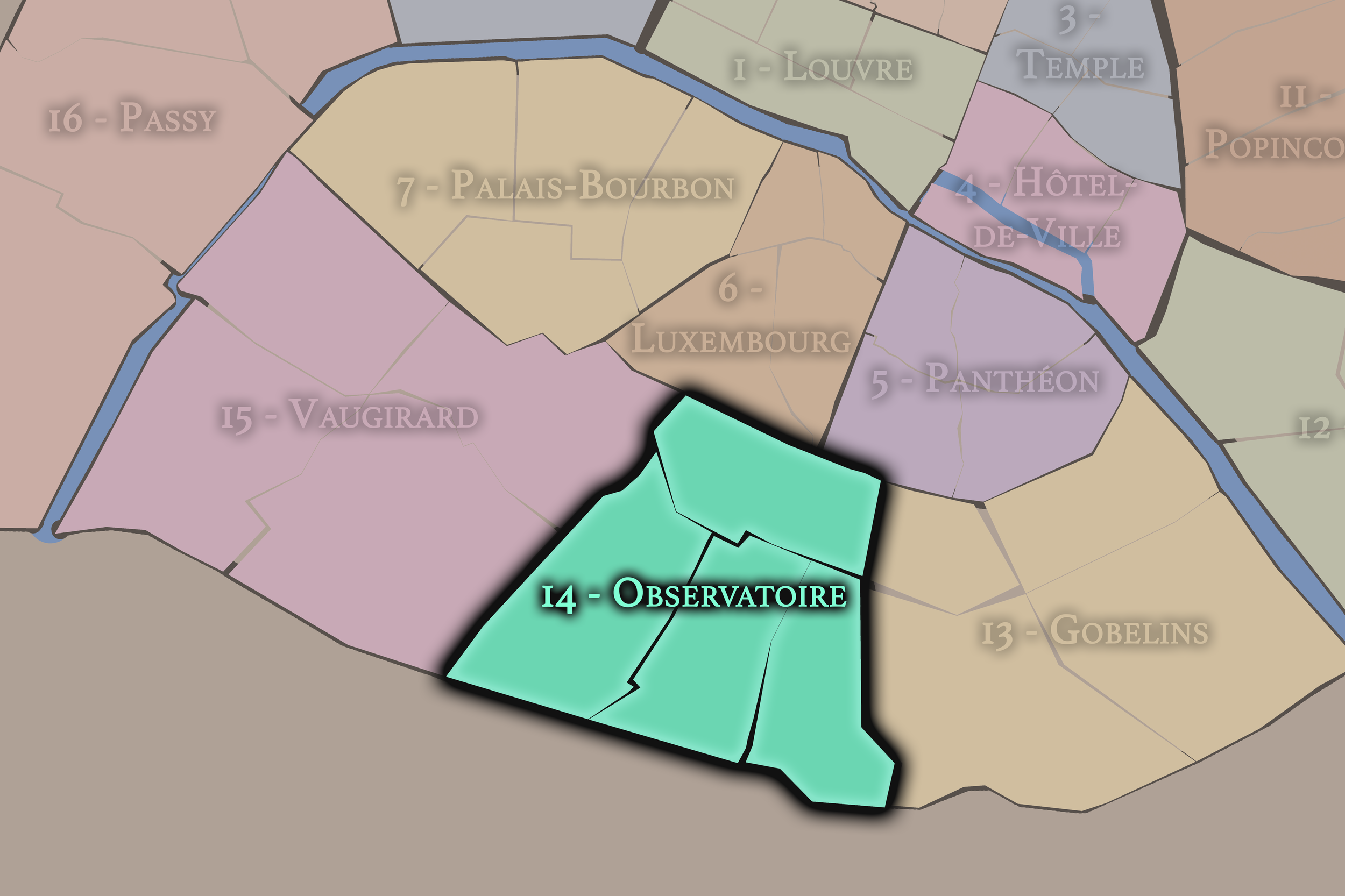
14e - OBSERVATOIRE
Arrondissements
Welcome to the 14e - Observatoire neighborhood page! Here at CityNeighborhoods Paris, we explore 14e - Observatoire as an arrondissement, one of 20 primary civic districts in Paris — the broad organizing layers that contain administrative quarters, neighborhood councils, cultural neighborhoods, histories, monuments, and lived local identities. The 14e Arrondissement - Observatoire extends from Montparnasse and the Paris Observatory to Parc Montsouris and the city’s southern edge. It is a district of artists’ studios, cemetery landscapes, university life, working-class memory, and quieter residential streets beyond the central tourist routes. Part of an ongoing project to walk and photograph every neighborhood in Paris, this page explores 14e - Observatoire through maps, district identity, history, and photography.
Part of an ongoing project to walk and photograph every neighborhood in Paris, this page explores the 14e - Observatoire through maps, district identity, history, and photography.


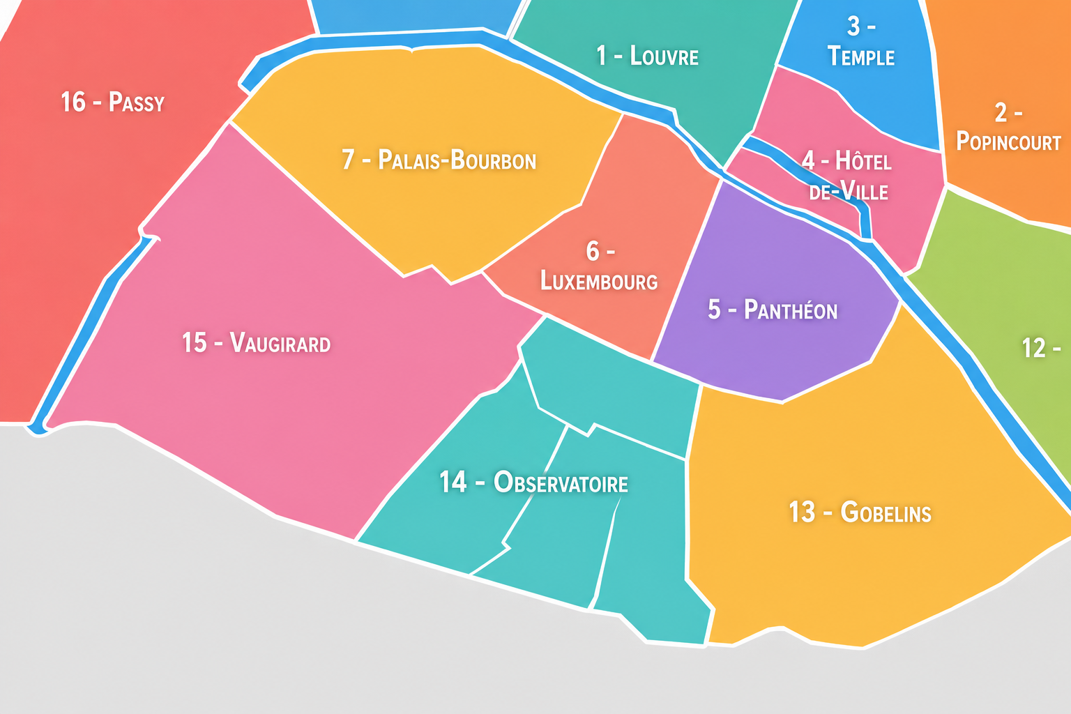
The Map
Geographic Setting
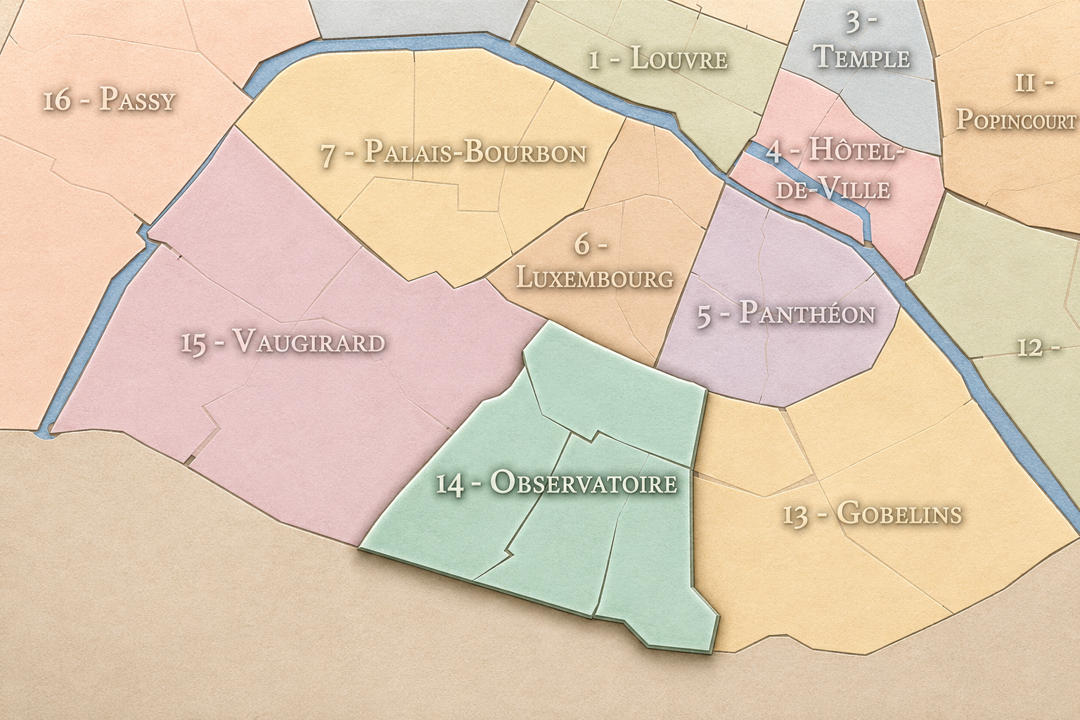
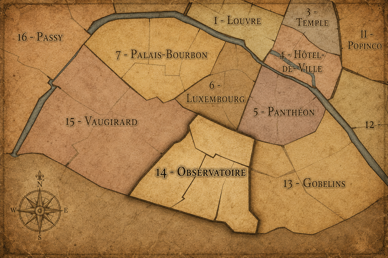
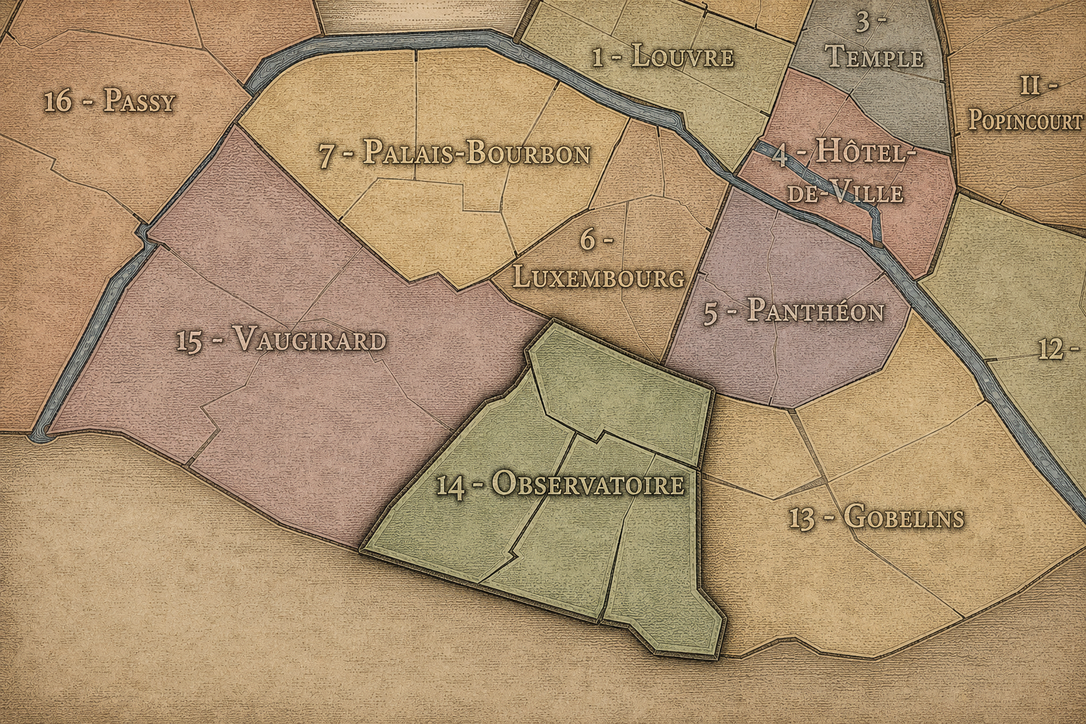
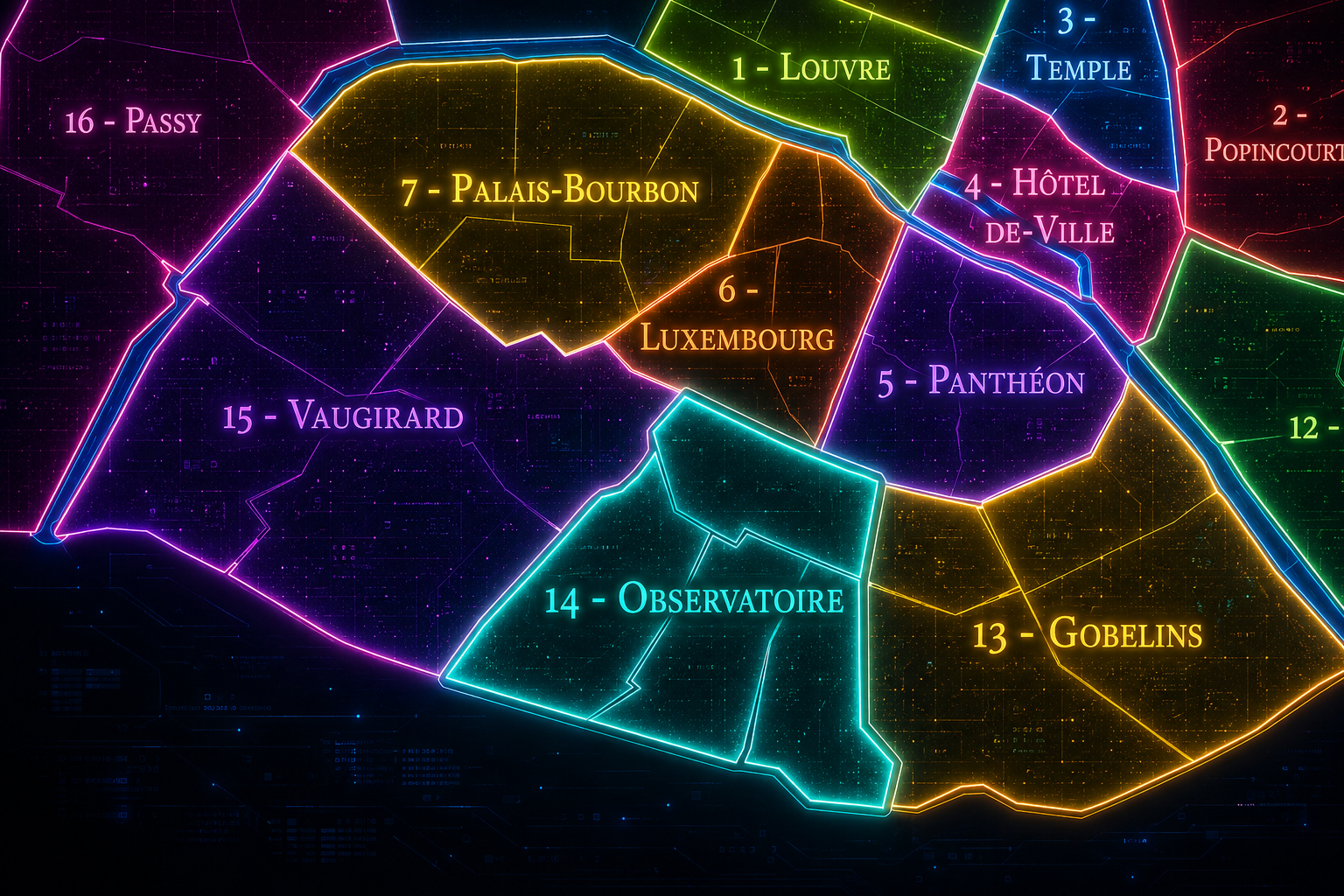
The 14e arrondissement occupies a broad southern position on the Left Bank of Paris, where the older central city gives way to the boulevards, cemeteries, rail corridors, former village landscapes, and residential districts of the southern edge. It is bordered by the 5e and 6e arrondissements to the north, the 13e to the east, the 15e to the west, and the suburban communes beyond the southern boundary of Paris. Its geography places it between Montparnasse, the Paris Observatory, the old village of Montrouge, the southern hospitals, the Catacombs, Parc Montsouris, and the rail lines leading out of the city.
The arrondissement is defined by a mixture of institutional gravity and neighborhood calm. Its northern edge is tied to the intellectual and artistic worlds of Montparnasse and the Left Bank. Its center is marked by the Paris Observatory, the avenue that bears its name, the Catacombs, and the great north-south axis around Denfert-Rochereau. Farther south and east, the arrondissement becomes more residential, green, and edge-like, especially around Parc Montsouris, Cité Universitaire, and the former village territories absorbed into Paris.
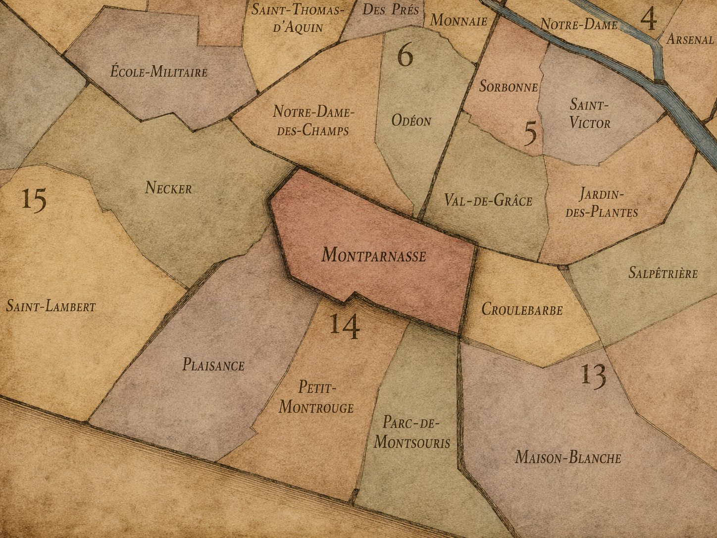
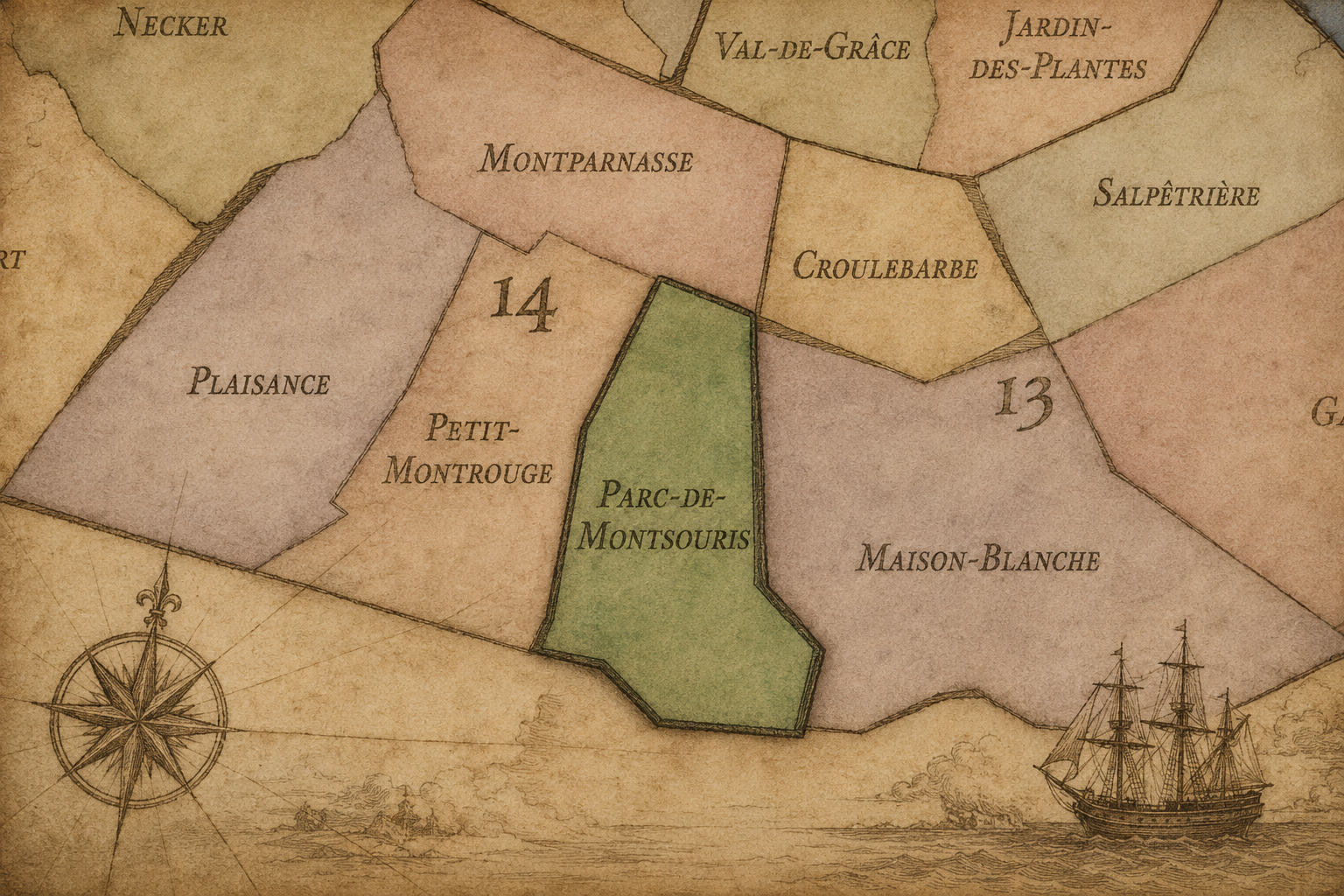
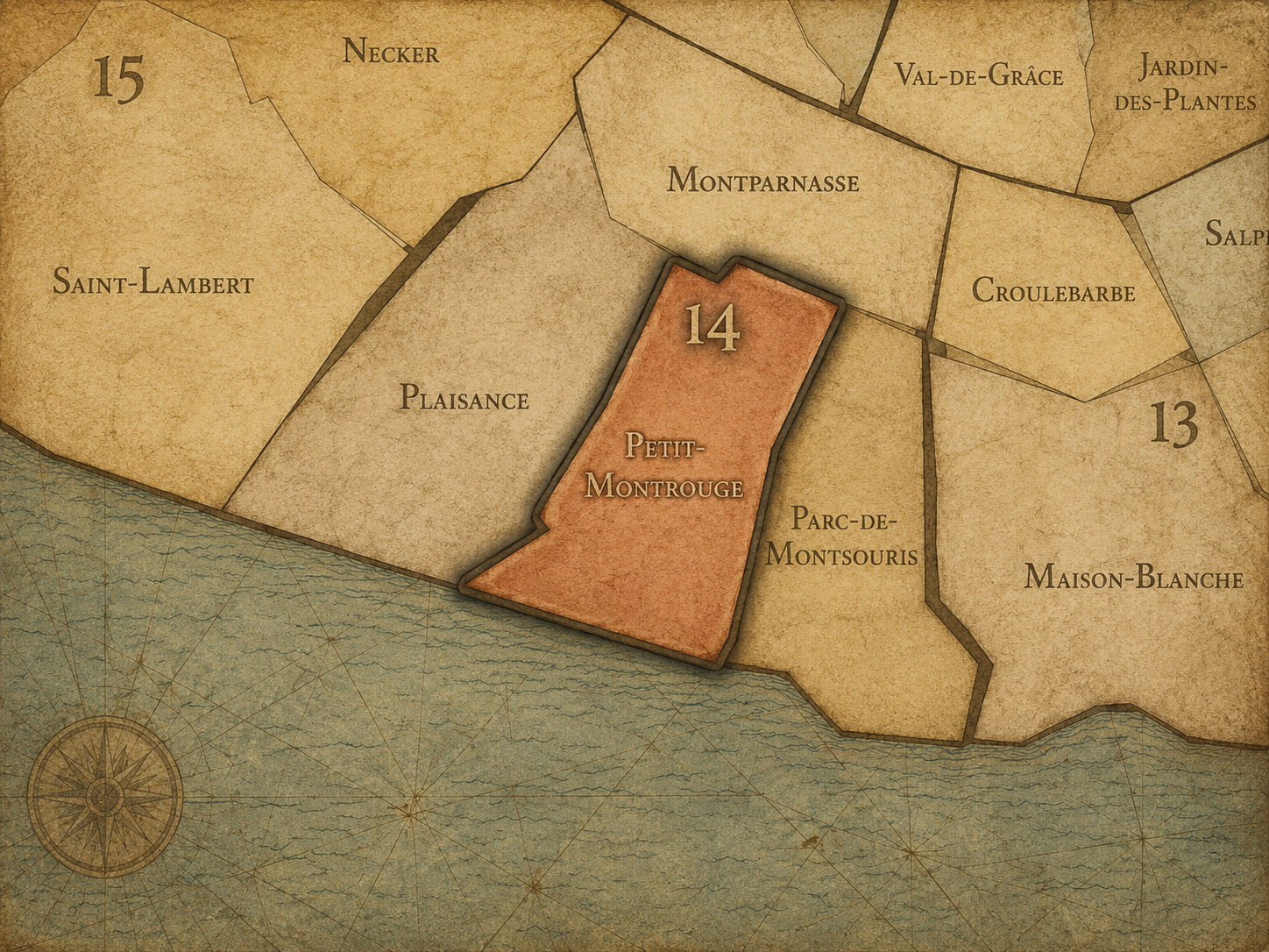
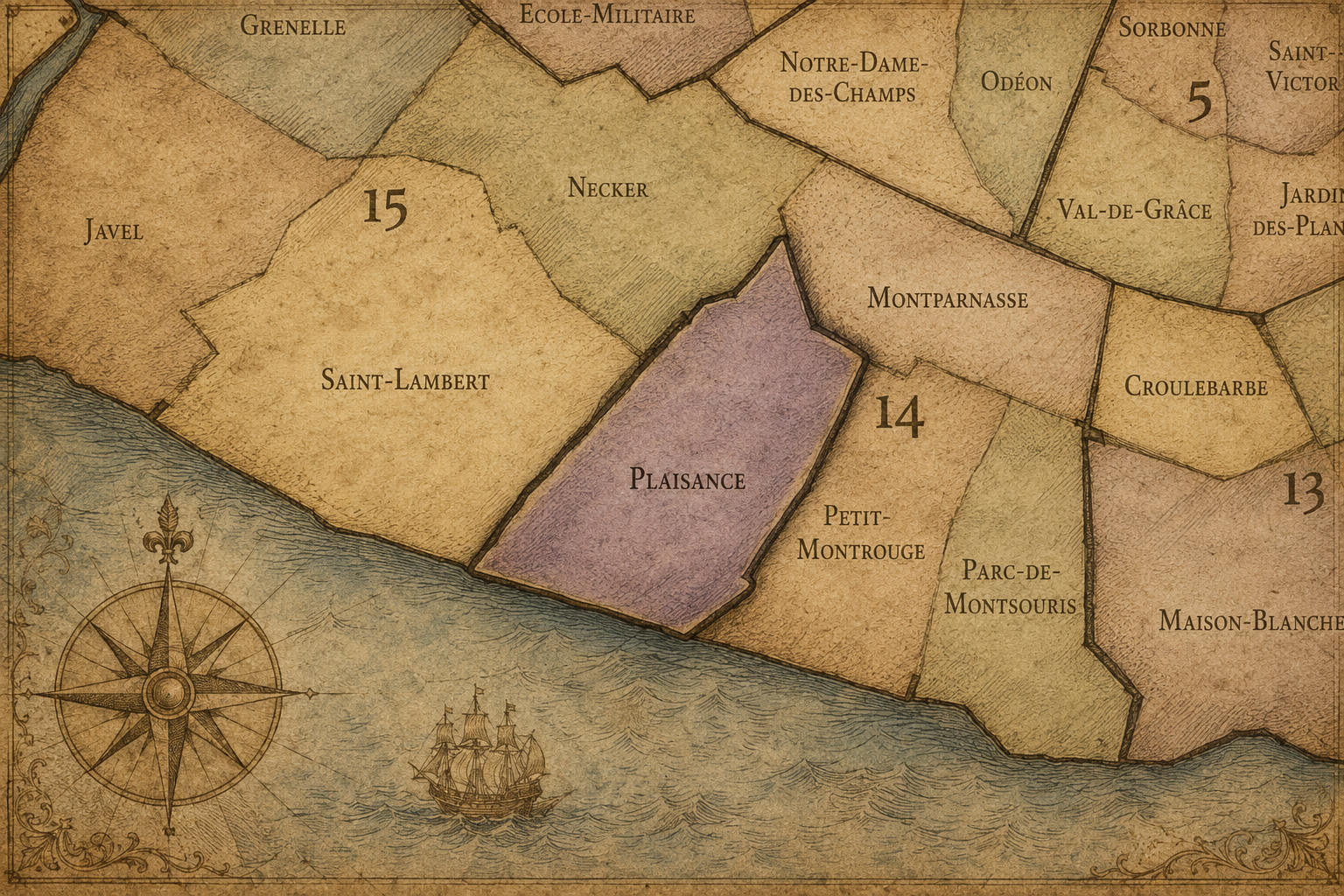
The 14e arrondissement is divided into four administrative quarters: Montparnasse, Parc-de-Montsouris, Petit-Montrouge, and Plaisance. Together, they form a district of considerable variety. Montparnasse gives the arrondissement its artistic, literary, railway, and café identity. Parc-de-Montsouris connects it to the southern greenbelt, university residences, and landscaped public space. Petit-Montrouge preserves the memory of suburban settlement and village incorporation. Plaisance carries a more residential and working-class history, tied to railway edges, small streets, and the expansion of southern Paris.
The 14e is therefore an arrondissement of thresholds: between the old Left Bank and the southern suburbs, between intellectual Paris and everyday residential Paris, between cemetery and observatory, between rail infrastructure and garden space, between village memory and metropolitan growth.
Arrondissement Identity
Etymology and Origins
The arrondissement’s administrative name, Observatoire, comes from the Paris Observatory, one of the great scientific institutions of the city. Built in the 17th century, the observatory gives the arrondissement a name associated with astronomy, measurement, time, science, and the study of the heavens. Unlike arrondissement names drawn from palaces, churches, markets, or theaters, Observatoire points toward knowledge gathered through observation and precision.
The name is especially fitting because the 14e has long been shaped by institutions that look beyond ordinary street life: the Observatory, the Catacombs, hospitals, cemeteries, railways, schools, and later the Cité Internationale Universitaire. These are places where Paris thinks about mortality, science, movement, health, education, and the city’s relationship to the world beyond itself.
Yet the origins of the arrondissement extend beyond the Observatory. Much of the future 14e developed from land outside the older city: rural roads, quarries, religious holdings, cemeteries, mills, suburban settlements, and villages such as Montrouge and Vaugirard-adjacent areas. Its modern identity formed as Paris expanded southward, absorbing older settlements and giving them new urban roles. The name Observatoire identifies a scientific landmark, but the arrondissement’s deeper origins lie in the southern edge of Paris: open land, stone beneath the ground, villages beyond the wall, and routes leading outward.
Civic Framework
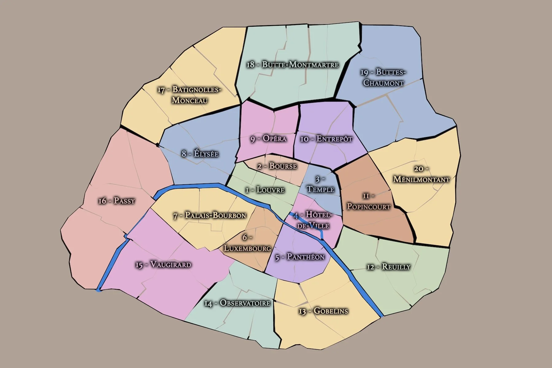
The 14e arrondissement is one of the twenty municipal arrondissements of Paris and remains a distinct local civic unit with its own mairie. It is not part of Paris Centre, which includes only the 1er, 2e, 3e, and 4e arrondissements. Its civic identity is shaped by its southern location, its residential population, its major institutions, and its role as a bridge between central Paris and the city’s southern edge.
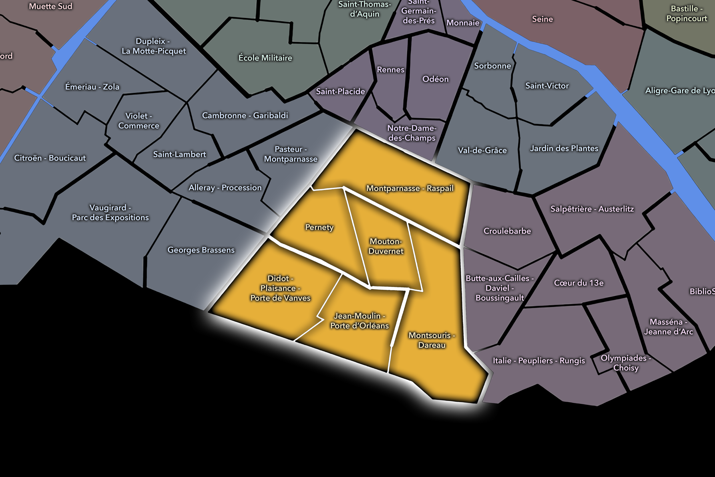
The arrondissement’s four administrative quarters — Montparnasse, Parc-de-Montsouris, Petit-Montrouge, and Plaisance — provide its official internal structure. These quarters are especially important because the 14e is often understood through several overlapping identities: Montparnasse, Denfert-Rochereau, the Catacombs, the Observatory, Alésia, Parc Montsouris, Plaisance, Porte d’Orléans, and the Cité Universitaire. The official quarters help organize these identities into a clearer civic geography.
For this project, the 14e is treated as both an official geographic layer and a cultural-historical district. Its civic framework helps distinguish the arrondissement from the intellectual and ancient identity of the 5e, the literary and gardened identity of the 6e, the modern southeastern transformation of the 13e, and the broad residential western Left Bank identity of the 15e. The 14e is southern Left Bank Paris: observant, residential, artistic, infrastructural, and deeply shaped by the memory of the city’s edge.
Parisian Identity
The 14e arrondissement holds a distinctive place in Paris as a district of artists, scientists, students, cemeteries, railways, gardens, and southern neighborhood life. It is less polished than the 6e, less ancient than the 5e, and less experimental in modern form than the 13e, but it carries one of the most human and layered identities on the Left Bank.
Its Parisian identity is strongly tied to Montparnasse. In the early 20th century, Montparnasse became one of the great centers of artistic and literary modernism, associated with cafés, studios, expatriate writers, painters, sculptors, and avant-garde life. This gave the arrondissement a global cultural aura, even as the broader 14e remained more residential, practical, and local.
The arrondissement also represents Paris as a city of thresholds between life and death, earth and sky, center and periphery. The Observatory looks upward. The Catacombs descend underground. Montparnasse Cemetery preserves the memory of writers, artists, philosophers, and public figures. Parc Montsouris opens the district toward landscape and leisure. The railways and southern gates connect the city outward. Few arrondissements contain such a vivid vertical imagination: above, below, within, and beyond Paris.
Neighborhood Distinction
The 14e arrondissement is distinguished by its layered southern identity. It is not dominated by a single monument or one symbolic avenue. Instead, it is held together by a set of strong but varied landscapes: Montparnasse cafés and cemetery, the Paris Observatory, Denfert-Rochereau and the Catacombs, the residential streets of Petit-Montrouge and Plaisance, the railway edges, Parc Montsouris, and the Cité Universitaire.
Its four administrative quarters express this range. Montparnasse gives the arrondissement its artistic, literary, cemetery, and railway identity. Parc-de-Montsouris gives it a green, academic, and southern-edge character, shaped by the park and the Cité Internationale Universitaire. Petit-Montrouge preserves the memory of a former suburban settlement absorbed into Paris and gives the arrondissement a strong residential and neighborhood identity. Plaisance carries a more working and local history, with smaller streets, rail influences, and a residential fabric that contrasts with the grand cultural mythology of Montparnasse.
The arrondissement’s distinction lies in this mixture of myth and ordinariness. Montparnasse may be internationally famous, but much of the 14e is lived at a quieter scale: schools, markets, apartment buildings, bakeries, churches, small squares, parks, and transit corridors. It is an arrondissement where the legendary and the everyday remain unusually close.
Neighborhood Connections
Every neighborhood belongs to a wider Parisian fabric.
-
Montparnasse
-
Parc-de-Montsouris
-
Petit-Montrouge
-
Plaisance
-
14e — Observatoire
-
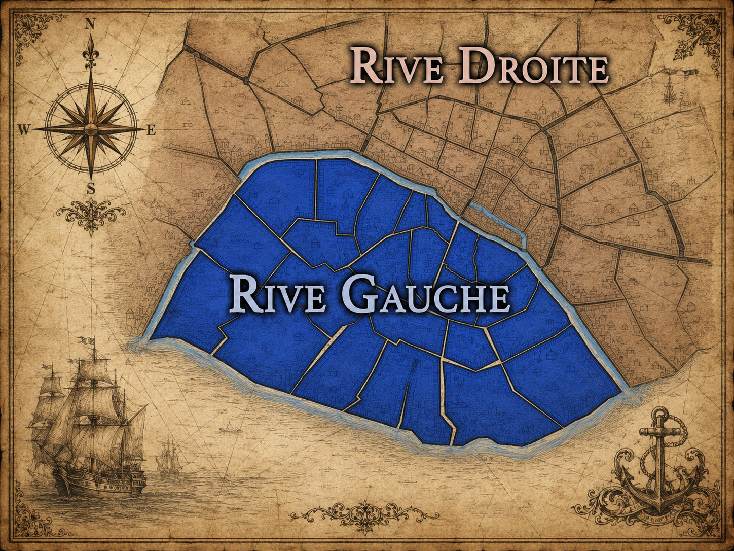
Rive Gauche
The History
Origins
The origins of the 14e arrondissement lie in the lands south of the old Left Bank city, beyond the dense medieval core of Paris. For centuries, much of this territory consisted of roads, fields, religious properties, quarry lands, cemeteries, scattered houses, and suburban settlements. It was not originally one unified urban district, but a collection of southern approaches and local landscapes later absorbed into Paris.
The ground itself played an important role. The southern Left Bank contained extensive quarries, whose stone helped build Paris and whose underground voids later became part of the city’s subterranean history. This relationship between surface and underground would become one of the defining features of the arrondissement, especially through the Catacombs.
The area also developed through routes leading south from Paris. Roads toward Orléans and other destinations shaped movement through the future arrondissement, while settlements such as Montrouge and Plaisance gradually became tied to the growing capital. The 14e began as a fringe landscape: useful, peripheral, connected, and gradually urbanizing.
16th–17th Century
During the 16th and 17th centuries, the future 14e arrondissement remained outside the densest areas of Paris, but its relationship to the city grew stronger. Roads, religious houses, quarrying, agricultural land, and suburban properties marked the area, while the growth of Paris placed increasing pressure on its southern edge.
The founding of the Paris Observatory in the 17th century gave the future arrondissement one of its most important institutions. Built south of the older city, the Observatory reflected a new relationship between Paris, science, measurement, and the cosmos. Its placement in this southern landscape gave the district a scientific identity long before it became a fully urban arrondissement.
The 17th century therefore gave the future 14e one of its defining contrasts: open land and scientific institution, peripheral territory and universal observation. The district remained at the edge of Paris, but the Observatory connected that edge to a broader world of knowledge, astronomy, and time.
18th Century
In the 18th century, the future 14e arrondissement continued to develop as a southern fringe of Paris shaped by roads, quarries, institutions, cemeteries, and growing suburban settlement. The Observatory remained a major scientific landmark, while the surrounding land retained a mixture of open, institutional, and semi-rural uses.
The underground quarries became increasingly important to the city’s management of death and space. As Paris faced overcrowded cemeteries and public health concerns, the former quarry networks south of the city were eventually adapted into ossuaries, creating what would become the Catacombs. This transformation gave the district one of its most haunting and enduring identities: the hidden city beneath the city.
By the end of the 18th century, the future 14e had become a landscape of profound contrasts. It was still partly peripheral, but it held institutions and spaces central to the life of the capital: the Observatory above ground, the quarries below, routes leading south, and settlements gradually drawn into the orbit of Paris.
19th Century
The 19th century transformed the 14e arrondissement into a fully urban district. The annexation of surrounding territories and the creation of the modern arrondissement structure incorporated former suburban areas such as Petit-Montrouge and Plaisance into Paris. What had been edge and village became part of the municipal city.
Montparnasse rose to increasing importance during this period. Railway development, boulevards, cafés, theaters, studios, and cemeteries helped shape the northern part of the arrondissement as a major urban and cultural landscape. Montparnasse Cemetery became an important place of burial and memory, while the surrounding streets began to develop the cultural identity that would become famous in the 20th century.
The century also brought major public works and green space. Parc Montsouris was created as part of the larger transformation of Paris’s parks and public landscapes, giving the southern arrondissement an important recreational and scenic anchor. Railways, roads, sewers, cemeteries, and urban planning all reshaped the district.
By the end of the 19th century, the 14e had become a varied arrondissement of science, burial, transit, residence, parks, and emerging cultural life — no longer a southern edge, but not yet absorbed into the mythologies that would later define Montparnasse.
Early–Mid 20th Century
In the early and mid 20th century, the 14e arrondissement became one of the great centers of artistic and literary Paris. Montparnasse attracted painters, writers, sculptors, photographers, philosophers, performers, political exiles, and expatriates from across Europe and beyond. Its cafés and studios became part of the mythology of modernism.
This artistic life did not define the entire arrondissement, but it gave the 14e a global cultural identity. Around the boulevards and cafés of Montparnasse, Paris appeared as a city of experiment, poverty, genius, conversation, and nightlife. The district became associated with modern painting, literature, sculpture, jazz, and the intellectual energy of the interwar period.
At the same time, the broader 14e remained residential and practical. Petit-Montrouge, Plaisance, Parc-de-Montsouris, and the streets around Alésia and Porte d’Orléans sustained ordinary neighborhood life. The Observatory, hospitals, schools, cemeteries, railways, and local markets continued to shape the arrondissement. The 14e was therefore both legendary and everyday: a place of famous cafés and quiet apartment streets, artists’ studios and local routines.
Late 20th Century
The late 20th century brought major changes to the 14e arrondissement’s urban and cultural identity. Montparnasse changed dramatically with the redevelopment of the station area and the construction of the Tour Montparnasse. The tower introduced a new vertical presence into a district long associated with cafés, studios, and railway movement, becoming one of the most debated modern landmarks in Paris.
The artistic mythology of Montparnasse remained powerful, but the neighborhood’s social realities shifted. Many of the old bohemian conditions that had supported its early 20th-century cultural life faded, replaced by offices, commercial spaces, restaurants, housing, transit, and a more polished urban environment. The memory of artistic Montparnasse became heritage as much as living culture.
Elsewhere in the arrondissement, residential life continued to define much of the district. Plaisance, Petit-Montrouge, and the areas around Parc Montsouris remained important southern neighborhoods. The Cité Internationale Universitaire reinforced the arrondissement’s international student and academic identity. The 14e entered the late 20th century as a district balancing memory, modernization, residential stability, and cultural tourism.
21st Century
In the 21st century, the 14e arrondissement remains one of the most livable and layered districts of the Left Bank. It is still tied to Montparnasse, but its identity extends far beyond that name. The arrondissement includes the Catacombs, the Observatory, Parc Montsouris, Cité Universitaire, Montparnasse Cemetery, Alésia, Plaisance, Petit-Montrouge, and the southern edge of Paris.
Contemporary life in the 14e is marked by balance. The arrondissement is central enough to carry major cultural and transit functions, but residential enough to feel calmer than many inner districts. Its streets hold schools, hospitals, shops, cafés, markets, theaters, offices, gardens, and apartment buildings. It is a district of daily life with deep historical shadows beneath it and scientific memory above it.
The 14e also faces modern pressures: housing costs, transit demands, debates around Montparnasse redevelopment, preservation of neighborhood character, and the challenge of sustaining local life in a city increasingly shaped by tourism and real estate value. Yet it remains less overwhelmed by visitors than many central arrondissements, allowing much of its identity to remain rooted in residents and neighborhoods.
Today, the 14e is Paris as grounded imagination: artists remembered in cafés and cemeteries, scientists remembered through the Observatory, the dead remembered beneath the streets, students housed at the city’s edge, and everyday life continuing in southern neighborhoods that remain deeply Parisian without needing constant spectacle.
Spirit and Legacy
The 14e arrondissement is Paris as threshold and depth. Its legacy is written in the Observatory and the Catacombs, in Montparnasse cafés and cemetery paths, in the former village streets of Petit-Montrouge, in the residential fabric of Plaisance, and in the green space of Parc Montsouris.
It is one of the city’s great districts of vertical memory. Above, the Observatory looks outward toward the sky. Below, the Catacombs hold the remains of the city’s dead. At street level, Montparnasse carries the memory of artists, writers, exiles, and modernist reinvention. Around it, ordinary neighborhoods sustain the quieter continuity of southern Paris.
The name Observatoire gives the arrondissement a scientific identity, but its deeper spirit is broader. The 14e observes Paris from the edge: watching the city expand, modernize, remember, and live. It is an arrondissement of artists and astronomers, quarries and gardens, stations and cemeteries, myth and neighborhood life — a southern district where Paris looks upward, downward, inward, and beyond itself.
The Photography
Visual Identity

The visual identity of each Paris district begins with its position in the city’s layered geography. Before the photographs arrive, the maps establish a first way of seeing: where the district sits, what civic layer it belongs to, which boundaries define it, and how it connects to the surrounding fabric of Paris. In CityNeighborhoods Paris, cartography is not merely orientation; it is part of the visual language of the project.
As the photographic archive grows, this section will continue to develop through images gathered on foot. Streets, façades, monuments, markets, parks, river edges, passages, signs, textures, and everyday details will gradually reveal how each district presents itself visually. The goal is not only to show what a place looks like, but to trace how its identity becomes visible through form, atmosphere, memory, and use.
Through The Lens

CityNeighborhoods Paris is built from walking, looking, and returning. Each district is approached through photography as a way of paying attention: to the obvious landmarks and the quieter details, to historic structures and ordinary streets, to the moments where civic geography becomes lived experience. The camera becomes a tool for noticing how Paris changes from one district to the next, and how each place holds its own relationship to the larger city.
As photographs are processed and added, this section will become a more specific visual record of the district. Future updates may include dated field notes, galleries, and reflections from individual walks. For now, the page remains part of the larger CityNeighborhoods effort to document every Paris neighborhood through maps, history, identity, and photography — one district, one walk, and one visual encounter at a time.
If you visit Paris, these ideas can help inspire your own photography.


Paris: J’Espere, Je Rêve, Je Vive
Paris Photo Gallery
Paris Flâneur Notes
Flâneur Notes document the walks, photographs, light, and street-level observations behind this neighborhood entry. Learn more about the Spirit of the Flâneur.


Explore Paris
-

The twenty arrondissements form the civic spiral of Paris, organizing the city into its broad local districts of government, identity, and daily life.
-

Each arrondissement is divided into four official administrative quarters, giving Paris a more precise civic and geographic framework.
-

The conseils de quartier bring participation to street level, giving residents a voice in neighborhood needs, public space, and local civic life.
-

Les Deux Rives trace Paris through the Seine’s two banks, revealing how the Rive Droite and Rive Gauche shaped the city’s civic power, commerce, learning, art, and cultural identity.
-

Cultural neighborhoods reveal the Paris people recognize through history, cafés, architecture, memory, atmosphere, and local belonging.