
11e - FOLIE-MÉRICOURT
Quartiers Administratifs
Welcome to the Folie-Méricourt neighborhood page! Folie-Méricourt is a quartier administratif — an administrative quarter — one of 80 such districts across Paris. As a quartier administratif of the 11e Arrondissement - Popincourt, Folie-Méricourt belongs to a formal layer of Parisian geography and sits between République, Oberkampf, and the old working streets of northeastern Paris. Folie-Méricourt carries an energetic mix of nightlife, workshops, cafés, murals, and dense residential life.
Part of an ongoing project to walk and photograph every neighborhood in Paris, this page explores 11e Folie-Méricourt through maps, district identity, history, and photography.


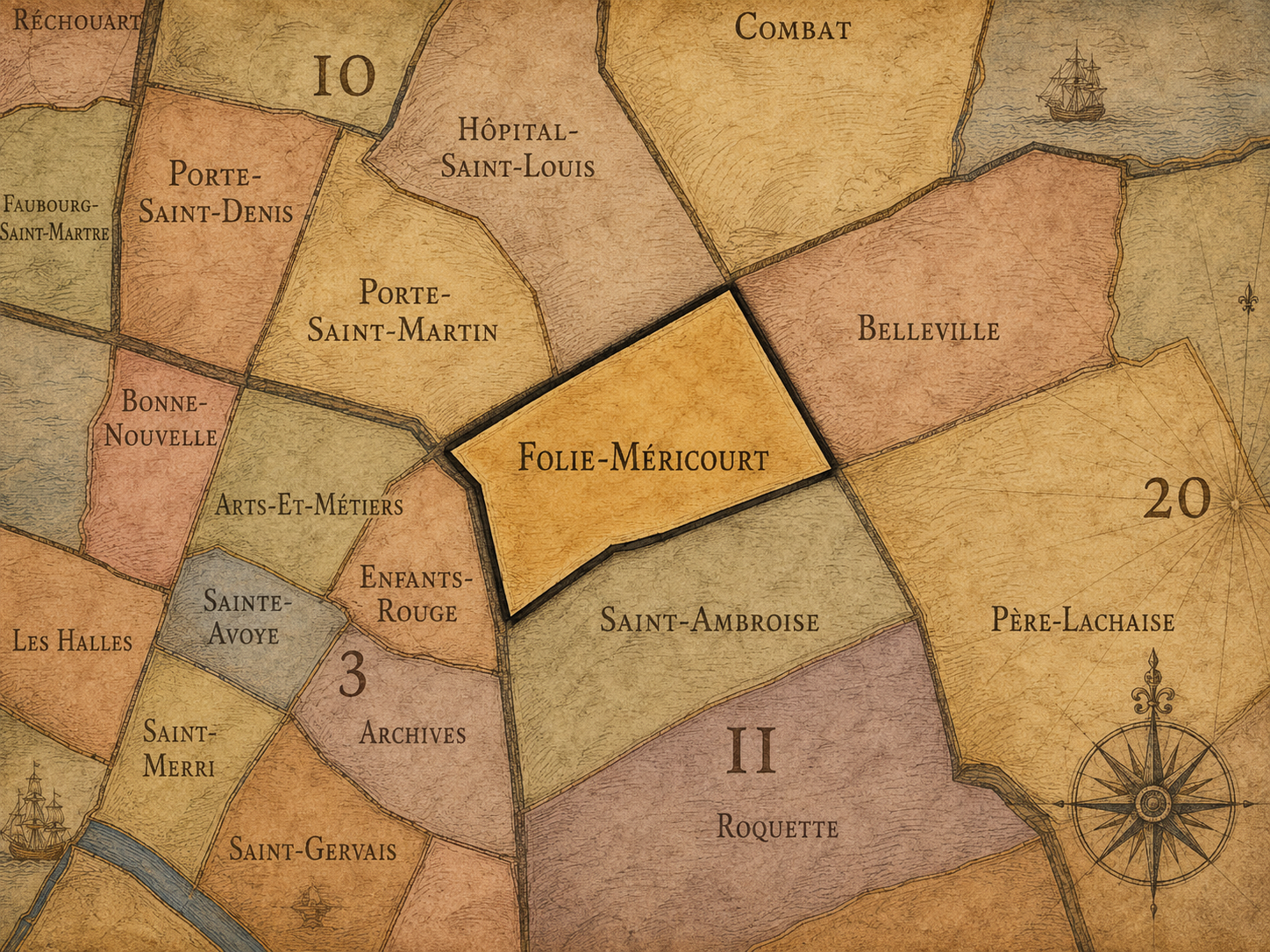
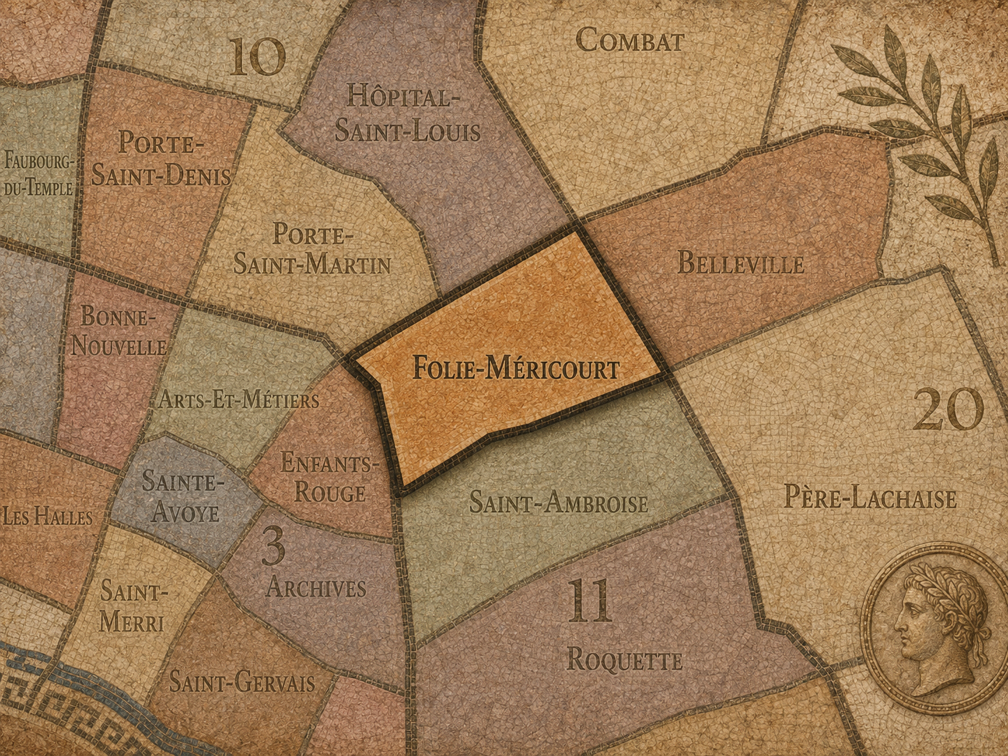
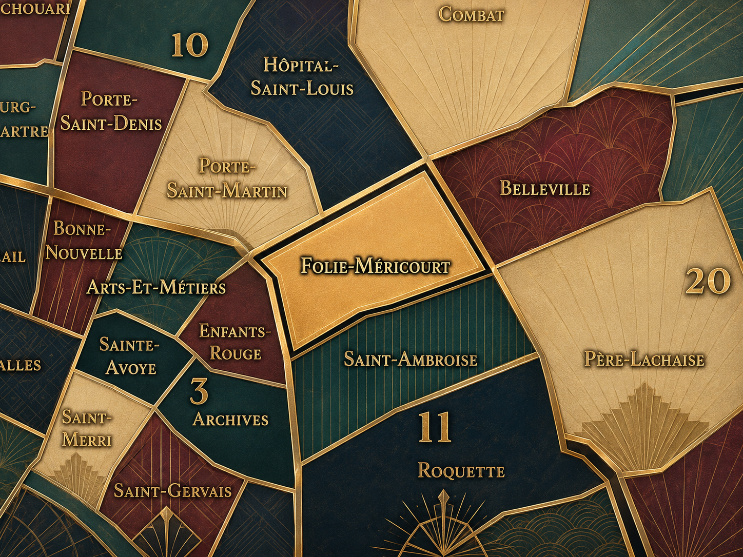
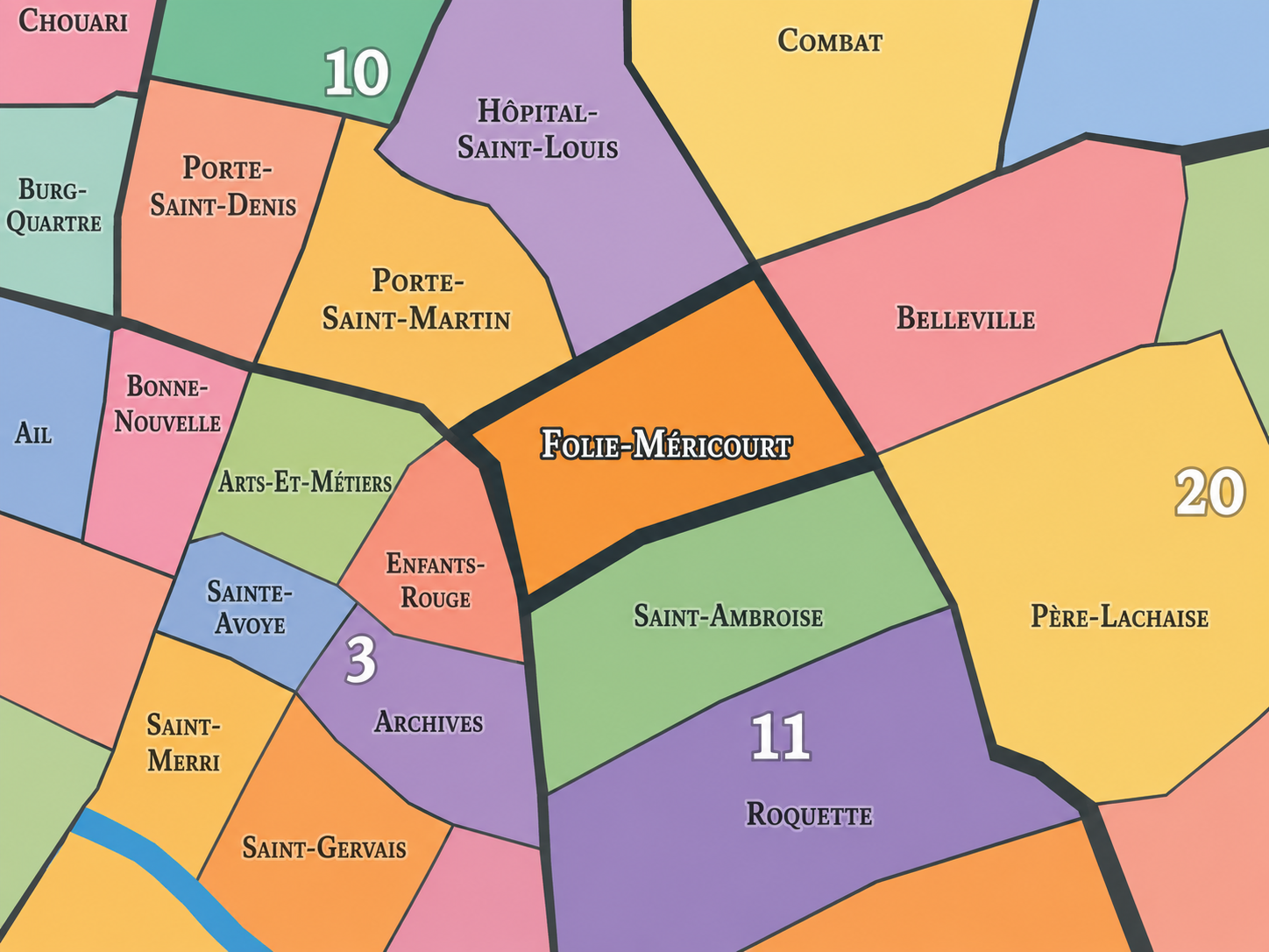
The Map
Geographic Setting
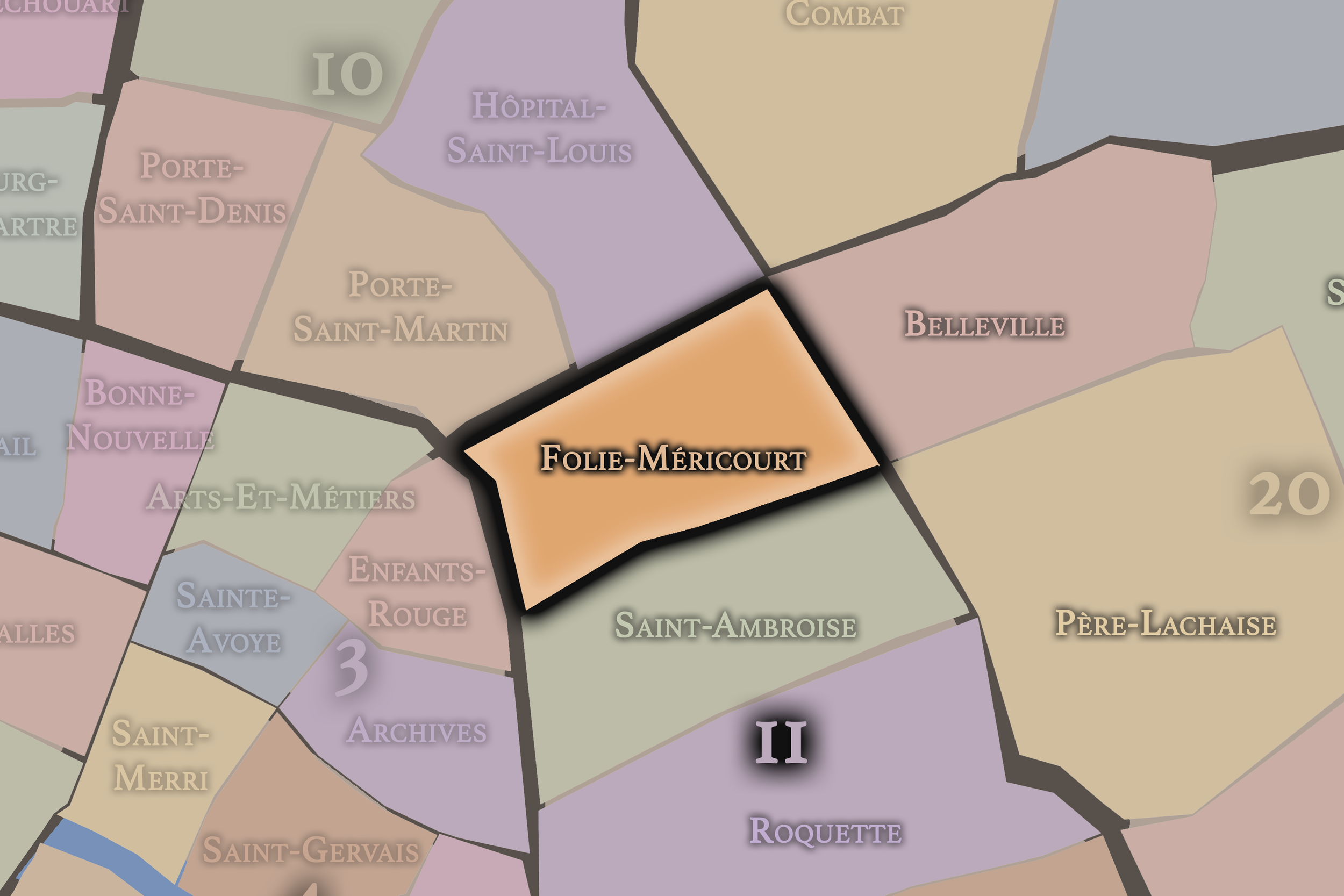
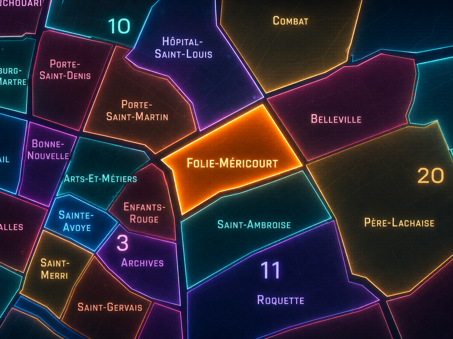
Folie-Méricourt occupies the northwestern portion of the 11th arrondissement, where République, Oberkampf, Parmentier, the Faubourg du Temple, and the lower edges of Belleville meet in one of Paris’s most animated inner-eastern landscapes. It lies east of the Canal Saint-Martin and Hôpital-Saint-Louis quarter, south of Belleville’s slopes, west of Saint-Ambroise, and north of the deeper Bastille / Popincourt fabric of the 11th. This is a quarter of dense streets, bars, cafés, workshops, apartment buildings, small businesses, music venues, food corridors, and the restless social energy that has long defined the eastern side of central Paris.
Its geography is strongly shaped by Rue Oberkampf, Rue Jean-Pierre-Timbaud, Rue Saint-Maur, Rue de la Fontaine-au-Roi, Rue du Faubourg-du-Temple, Boulevard du Temple, Boulevard Jules-Ferry, and the approaches to Place de la République. District references identify Folie-Méricourt as the 41st administrative quarter of Paris, located within the 11th arrondissement and served by stations such as Parmentier, Oberkampf, Goncourt, and Hôpital Saint-Louis.
Unlike the monumental quarters of western Paris or the older island and Left Bank districts, Folie-Méricourt is defined less by ceremony than by urban pulse. It is a quarter of movement, conversation, nightlife, commerce, working memory, and neighborhood density — Paris not as grand composition, but as compressed social life.
Administrative Quarter Identity
Etymology and Origins
The name Folie-Méricourt comes from Rue de la Folie-Méricourt and the older local geography around it. The word folie in Parisian place-names often refers not to madness, but to a country house, pleasure house, or semi-rural retreat once located outside the denser city. “Méricourt” likely preserves a property or family name connected to that older landscape. Together, the name suggests a place that began not as a dense urban quarter, but as an outer district marked by estates, roads, and landholdings before the city fully absorbed it.
That etymology gives Folie-Méricourt a striking contrast. The modern quarter is urban, dense, social, and often loud; its name points back toward a semi-rural edge of Paris, where a folie may once have stood beyond the city’s more crowded center. Like many Parisian names, it preserves a vanished geography beneath the contemporary street.
The name also has a certain poetic ambiguity. “Folie” can sound eccentric, playful, or unruly to modern ears, and that accidental resonance suits the quarter surprisingly well. Folie-Méricourt has long carried a spirit of intensity: popular streets, workshops, bars, activism, music, migration, reinvention, and nightlife. The historical folie became urban vitality.
Civic Framework
Within the official geography of Paris, Folie-Méricourt is one of the four administrative quarters of the 11th arrondissement, alongside Saint-Ambroise, Roquette, and Sainte-Marguerite. It occupies the arrondissement’s northwestern sector and forms the 11th’s closest relationship to République, the Canal Saint-Martin, and the lower Belleville / Faubourg du Temple corridor.
As an administrative quarter, Folie-Méricourt gives civic form to an area that is often described through stronger everyday names: Oberkampf, République, Parmentier, Goncourt, Jean-Pierre-Timbaud, or the northern 11th. The official name helps gather these overlapping identities into one mapped unit. It shows that the nightlife and café geography of Oberkampf is only one layer of a larger administrative quarter with older street, working-class, and faubourg histories.
This civic frame is especially valuable because Folie-Méricourt sits at a seam between several Parisian systems. It belongs to the 11th arrondissement, but it looks toward the 10th, Belleville, République, and the old boulevard edge. It is both local quarter and crossing zone — a place where official geography, cultural shorthand, and lived neighborhood identity constantly overlap.
Neighborhood Distinction
Folie-Méricourt differs from the other quarters of the 11th arrondissement through its relationship to République, Oberkampf, nightlife, working streets, and the lower northern edge of the arrondissement. Saint-Ambroise is more centered around parish, residential streets, and the civic-ecclesiastical structure of the mid-11th. Roquette carries the memory of prisons, Bastille-adjacent streets, Père-Lachaise approaches, and a strong popular-revolutionary atmosphere. Sainte-Marguerite looks more toward Faubourg Saint-Antoine, craft history, furniture trades, and the eastern extension of Bastille’s working-class identity.
Folie-Méricourt is more social and outward-facing. It is the 11th arrondissement’s quarter of bars, food corridors, live music, workshops, street murals, small storefronts, and the constant spillover between République and Belleville. Rue Oberkampf, which crosses the arrondissement from west to east, has retained traces of industrial and working origins even as it has become known for restaurants, nightlife, and an eclectic contemporary mix.
It should also be distinguished from Oberkampf as a cultural district. Oberkampf is one of the quarter’s strongest lived identities, but Folie-Méricourt is the official administrative frame. Oberkampf names a street and atmosphere; Folie-Méricourt names the broader civic quarter that contains and contextualizes it.
Parisian Identity
Folie-Méricourt expresses Paris as a city of social density. It is one of those quarters where the life of the street feels less curated than improvised: café terraces, bar entrances, corner shops, apartment windows, late-night conversations, deliveries, bicycles, posters, music, protest routes, and the daily choreography of people moving between République, Parmentier, Belleville, and the canal.
The quarter’s Parisian identity is strongly eastern and popular. It does not belong to the city’s ceremonial west, nor to the postcard monumental center. Its identity is closer to the Paris of workshops, mixed housing, migration, nightlife, activism, small venues, and everyday reinvention. It is a neighborhood where the city’s social and cultural changes appear quickly at street level.
This makes Folie-Méricourt particularly important to the layered Paris project. It shows that neighborhood identity is not only made by historic monuments or preserved village cores. It can also be made by use: where people gather, eat, work, drink, perform, argue, organize, and return. Folie-Méricourt is Paris as lived intensity.
Neighborhood Connections
Every neighborhood belongs to a wider Parisian fabric.
-
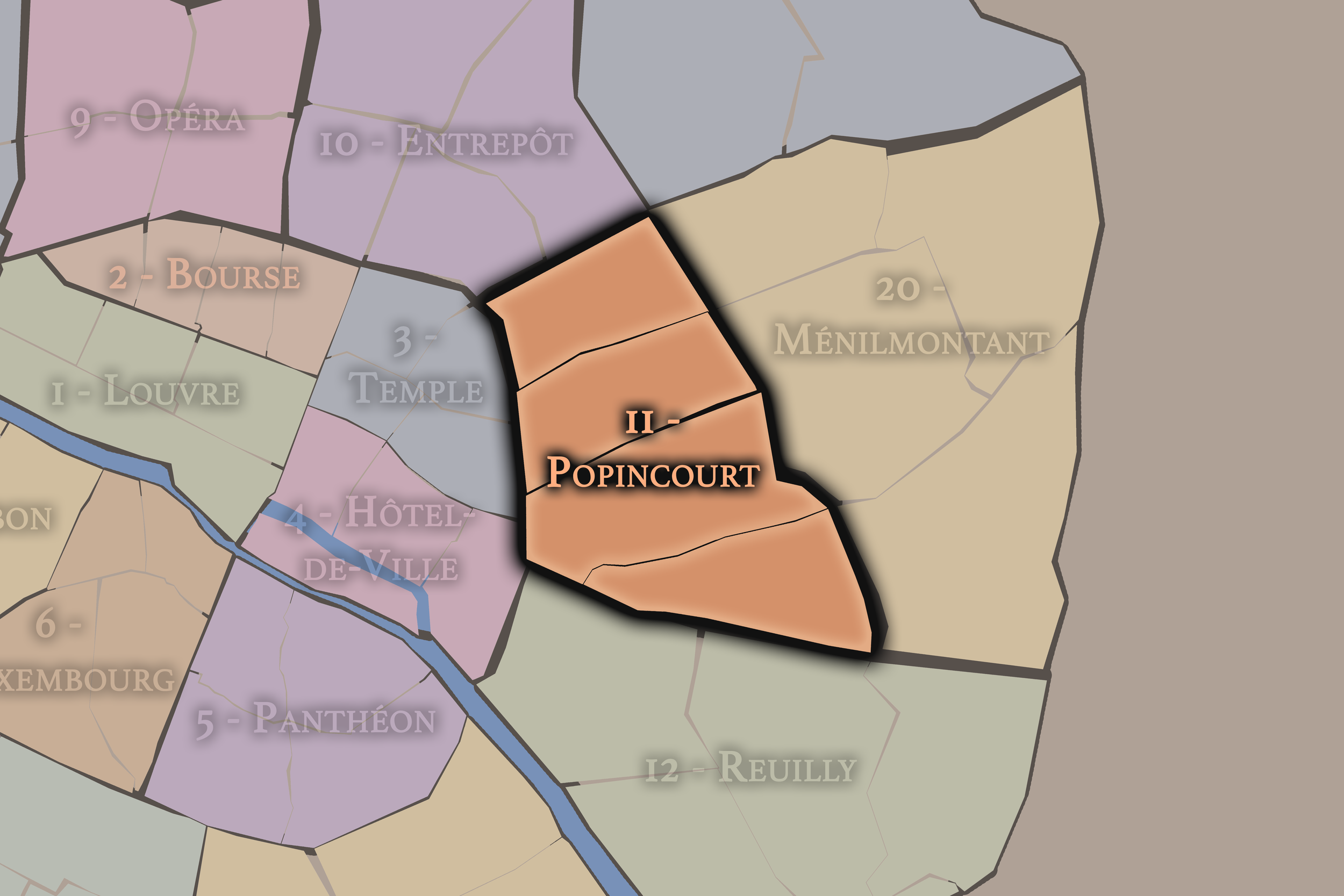
11e — Popincourt
-
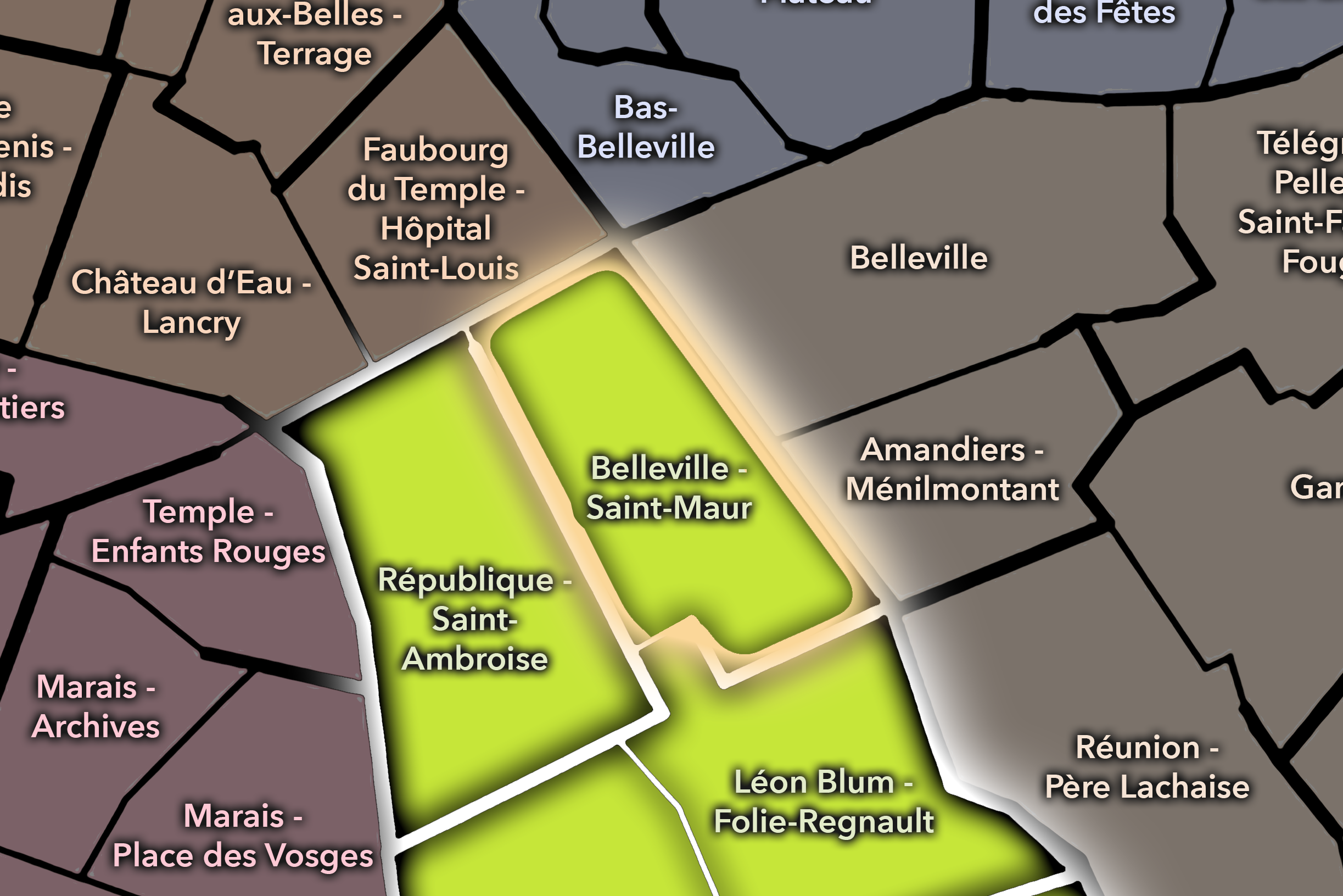
Belleville - Saint-Maur
-
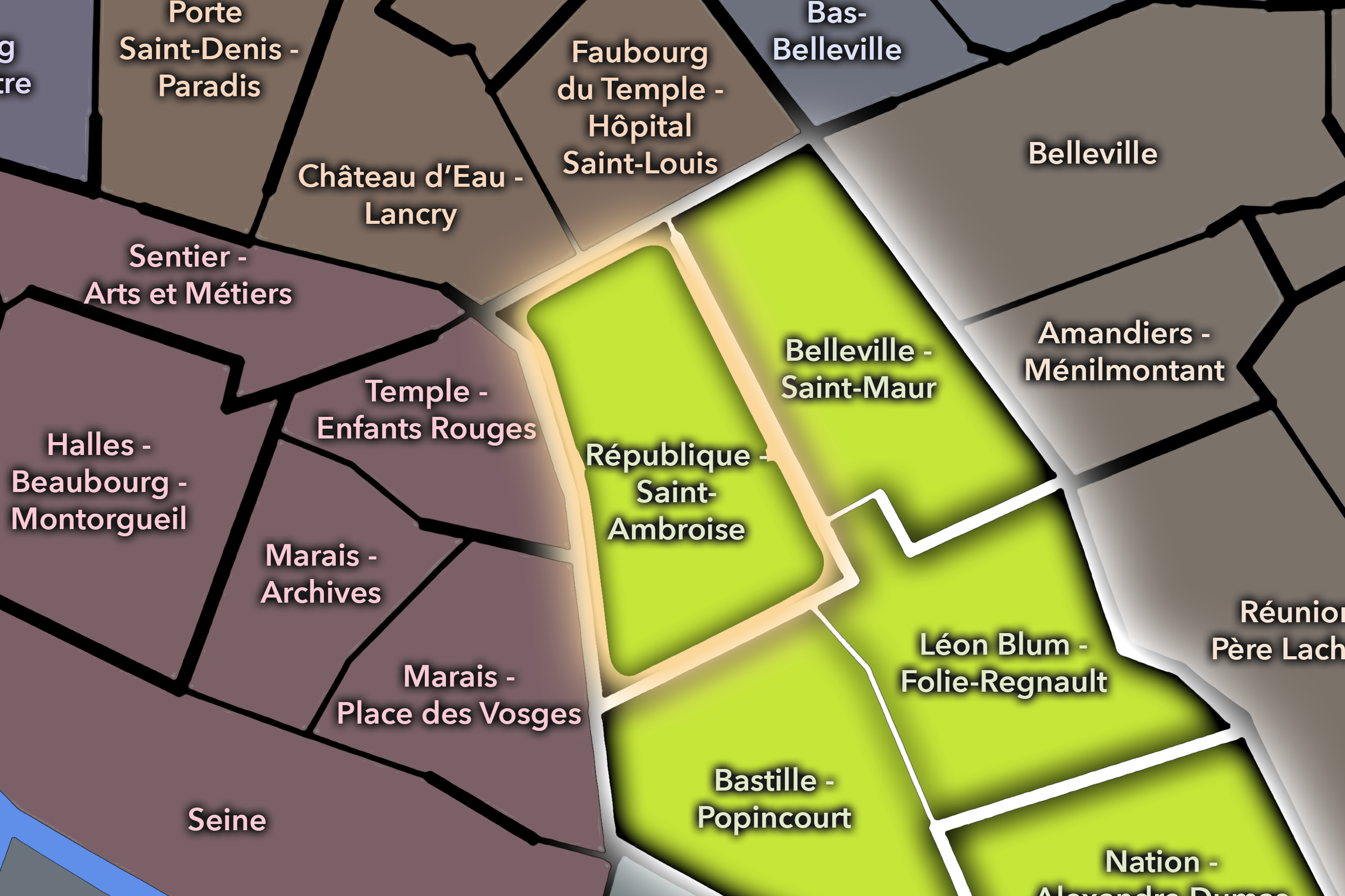
République - Saint-Ambroise
-

Rive Droite
The History
Origins
The origins of Folie-Méricourt lie in the northeastern expansion of Paris beyond the older center and along the faubourg routes leading toward Belleville, Ménilmontant, and the roads beyond the city. Before the modern quarter took shape, the area included outer lands, gardens, roads, small settlements, workshops, and properties outside the densest fabric of central Paris.
The older folie suggested by the name points toward this pre-urban or semi-urban condition. Like many places that later became central to the city’s popular life, Folie-Méricourt began at the edge — close enough to Paris to be drawn into its growth, but far enough from the core to develop with a different social and economic character.
Its origin is therefore tied to the faubourg pattern: roads outward, workers’ settlements, trades, practical services, and gradually thickening urban fabric. The quarter’s modern liveliness is not accidental. It grew from an older geography of movement, work, and expansion beyond the formal center.
16th–17th Century
In the 16th and 17th centuries, the future Folie-Méricourt quarter stood beyond the dense central city, within the northeastern fringe of Paris. The area was shaped by roads, cultivated land, estates, religious properties, and the early growth of faubourg settlements. It was not yet the compact urban district recognized today, but it already belonged to the outer world through which Paris was expanding.
This peripheral position mattered. The eastern and northeastern edges of Paris often attracted trades, workshops, and activities that required space or existed slightly outside the most regulated central quarters. These districts developed practical identities long before they became fashionable or culturally branded.
By the end of the 17th century, the old city’s expansion and the growing importance of the boulevard and faubourg systems were beginning to draw this landscape closer to Paris. Folie-Méricourt’s future as an urban quarter depended on that gradual absorption: the city reaching outward, and outer roads becoming neighborhood streets.
18th Century
In the 18th century, Folie-Méricourt became increasingly tied to the developing faubourg landscape northeast of central Paris. The roads toward Belleville and Ménilmontant grew more active, while the surrounding area filled with housing, workshops, gardens, and small-scale commerce. The quarter’s identity became more urban, but still retained the texture of a district shaped by work and outward movement.
The area around the future Rue Oberkampf and nearby streets developed through successive names and uses before becoming the modern corridor known today. Local historical accounts note that as the old chemin urbanized in the late 18th century, different sections carried different names before later being unified under the Oberkampf name in the 19th century.
The French Revolution and the urban unrest of the eastern districts helped give this part of Paris a more political and popular identity. The eastern faubourgs were not passive edges of the city. They became central to the social energy of revolutionary and post-revolutionary Paris. Folie-Méricourt inherited that atmosphere of popular intensity.
19th Century
The 19th century transformed Folie-Méricourt into a fully urban quarter of workers, workshops, industry, housing, and dense street life. As Paris expanded and the 11th arrondissement took its modern form, the area became part of the city’s great eastern working landscape. Metalwork, small manufacturing, furniture-related trades, printing, food businesses, and many other urban industries contributed to the surrounding streets.
Rue Oberkampf was officially named in 1864 for Christophe-Philippe Oberkampf, the German-born French industrialist associated with the famous Toile de Jouy manufactory. The street had earlier segments with names such as Rue de Ménilmontant, Rue Chapus or Chapuy, Rue de la Roulette, and Rue de la Haute-Borne, reflecting the layered development of the route before its modern identity was fixed.
The quarter’s 19th-century identity was therefore rooted in labor and urban growth. It was not a district of elite display, but of production, housing, popular commerce, and the street life of eastern Paris. Its later reputation for nightlife and creative energy grew from this older density of use.
Early–Mid 20th Century
In the early and mid 20th century, Folie-Méricourt remained a working and residential quarter shaped by small industries, workshops, cafés, modest housing, and the social life of the eastern arrondissements. Its streets were practical and lively, closely tied to the rhythms of labor, local commerce, and the wider political culture of Paris’s east.
Rue Oberkampf and surrounding streets retained industrial traces well into the 20th century. Local historical accounts describe buildings such as the municipal bathhouses at 40–42 Rue Oberkampf, created between 1923 and 1932, as evidence of the social and public-health infrastructure that served working neighborhoods.
During the upheavals of war, occupation, liberation, and postwar recovery, the quarter’s popular and working identity remained central. Like much of eastern Paris, Folie-Méricourt carried memories of labor, resistance, hardship, and neighborhood solidarity. Its importance lay not in a single monument, but in the everyday persistence of urban life under pressure.
Late 20th Century
In the late 20th century, Folie-Méricourt began to change visibly as older industrial and workshop functions declined or moved outward, while bars, restaurants, music venues, artists, students, and new residents increasingly reshaped the quarter’s atmosphere. The Oberkampf area became especially associated with nightlife and independent urban culture, giving the neighborhood a reputation for energy, youth, and creative informality.
This transformation did not erase the older working district; it layered over it. Former workshops became studios, offices, bars, or apartments. Industrial traces remained in courtyards and passages. Streets once defined by labor became associated with leisure, music, food, and sociability. The quarter became one of the places where eastern Paris’s working history was converted into contemporary cultural life.
The late 20th century also brought the tensions of gentrification. Rising rents, new businesses, nightlife pressure, and changing demographics altered the social balance of the neighborhood. Folie-Méricourt became more desirable, more visible, and more expensive, but its identity remained grounded in the mix and friction that had long defined it.
21st Century
In the 21st century, Folie-Méricourt is one of the most active and recognizable quarters of the 11th arrondissement. Its streets mix cafés, restaurants, bars, bakeries, small shops, coworking spaces, design studios, apartment buildings, music venues, and remnants of older workshop life. The quarter is crossed by residents, night crowds, workers, visitors, and people moving between République, Canal Saint-Martin, Belleville, and the deeper east of Paris.
Today, the quarter’s identity is shaped by both appeal and pressure. It is lively, walkable, and culturally rich, but also affected by rising costs, nightlife conflict, commercial turnover, and the broader transformation of eastern Paris. Folie-Méricourt has become fashionable without becoming fully polished; that unfinished quality remains central to its atmosphere.
For CityNeighborhoods: Paris, Folie-Méricourt is essential because it shows how an administrative quarter can hold the living evolution of a city. It is not best understood through a single monument. It is understood through street use: work becoming nightlife, workshops becoming cafés, faubourg routes becoming cultural corridors, and a once-outer district becoming one of Paris’s most socially expressive neighborhoods.
Spirit and Legacy
Folie-Méricourt is the quarter of eastern Paris in motion. Its spirit is restless, social, mixed, and alive at street level. It belongs to old faubourg roads and crowded bars, workshops and murals, cafés and music rooms, apartment windows and late-night corners, public baths and private courtyards, labor memory and contemporary reinvention.
Its legacy is the transformation of edge into energy. A semi-rural outer landscape became a working district. A working district became a neighborhood of nightlife, food, creativity, and social mixture. The old folie disappeared, but the name remained — and with it, a sense that this quarter has always carried a little unruly life at the edge of the formal city.
To walk Folie-Méricourt is to encounter Paris as a living rhythm rather than a fixed image. The quarter does not ask to be admired from a distance. It asks to be entered, heard, tasted, crossed, and lived with. In Folie-Méricourt, neighborhood identity is made from intensity — the daily and nightly pulse of a city still remaking itself from the street up.
The Photography
Visual Identity

The visual identity of each Paris district begins with its position in the city’s layered geography. Before the photographs arrive, the maps establish a first way of seeing: where the district sits, what civic layer it belongs to, which boundaries define it, and how it connects to the surrounding fabric of Paris. In CityNeighborhoods Paris, cartography is not merely orientation; it is part of the visual language of the project.
As the photographic archive grows, this section will continue to develop through images gathered on foot. Streets, façades, monuments, markets, parks, river edges, passages, signs, textures, and everyday details will gradually reveal how each district presents itself visually. The goal is not only to show what a place looks like, but to trace how its identity becomes visible through form, atmosphere, memory, and use.
Through The Lens

CityNeighborhoods Paris is built from walking, looking, and returning. Each district is approached through photography as a way of paying attention: to the obvious landmarks and the quieter details, to historic structures and ordinary streets, to the moments where civic geography becomes lived experience. The camera becomes a tool for noticing how Paris changes from one district to the next, and how each place holds its own relationship to the larger city.
As photographs are processed and added, this section will become a more specific visual record of the district. Future updates may include dated field notes, galleries, and reflections from individual walks. For now, the page remains part of the larger CityNeighborhoods effort to document every Paris neighborhood through maps, history, identity, and photography — one district, one walk, and one visual encounter at a time.
If you visit Paris, these ideas can help inspire your own photography.


Paris: J’Espere, Je Rêve, Je Vive
Paris Photo Gallery
Paris Flâneur Notes
Flâneur Notes document the walks, photographs, light, and street-level observations behind this neighborhood entry. Learn more about the Spirit of the Flâneur.


Explore Paris
-

The twenty arrondissements form the civic spiral of Paris, organizing the city into its broad local districts of government, identity, and daily life.
-

Each arrondissement is divided into four official administrative quarters, giving Paris a more precise civic and geographic framework.
-

The conseils de quartier bring participation to street level, giving residents a voice in neighborhood needs, public space, and local civic life.
-

Les Deux Rives trace Paris through the Seine’s two banks, revealing how the Rive Droite and Rive Gauche shaped the city’s civic power, commerce, learning, art, and cultural identity.
-

Cultural neighborhoods reveal the Paris people recognize through history, cafés, architecture, memory, atmosphere, and local belonging.