
4e - ARSENAL
Quartiers Administratifs
Welcome to the Arsenal neighborhood page! Arsenal is a quartier administratif — an administrative quarter — one of 80 such districts across Paris. As a quartier administratif of the 4e Arrondissement - Hôtel-de-Ville, Arsenal belongs to a formal layer of Parisian geography and stretches from the Bastille edge toward the Seine. Arsenal is shaped by the Port de l’Arsenal, the Bibliothèque de l’Arsenal, and the transition between royal military memory, riverfront infrastructure, and eastern Paris
Part of an ongoing project to walk and photograph every neighborhood in Paris, this page explores 4e Arsenal through maps, district identity, history, and photography.


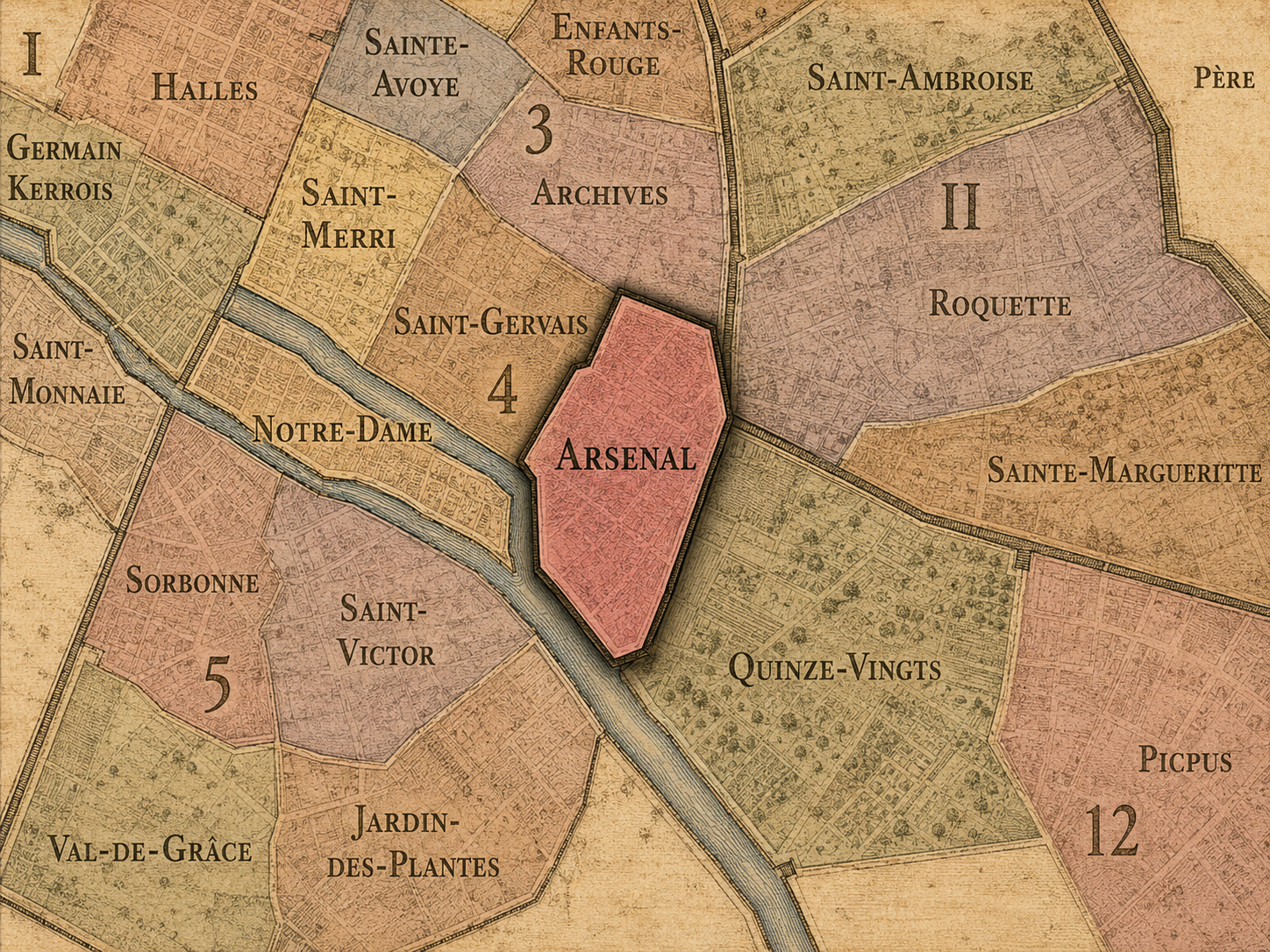
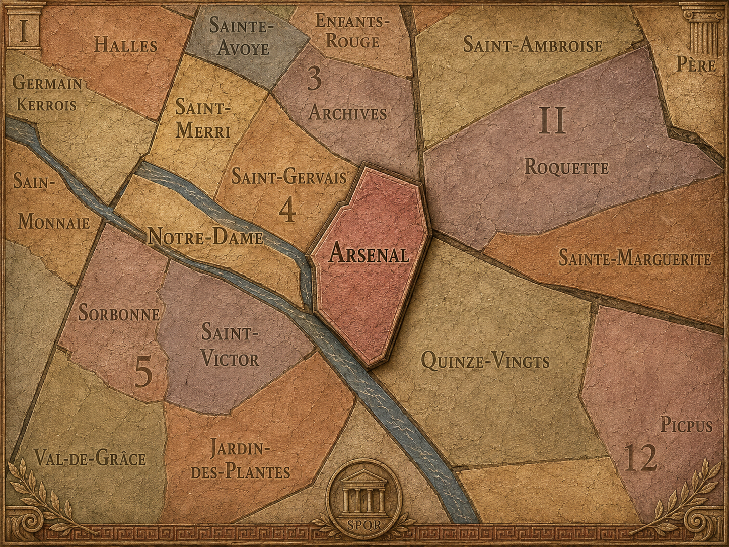
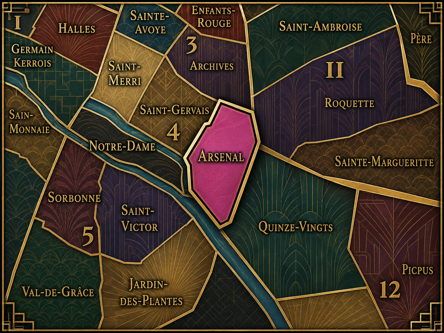
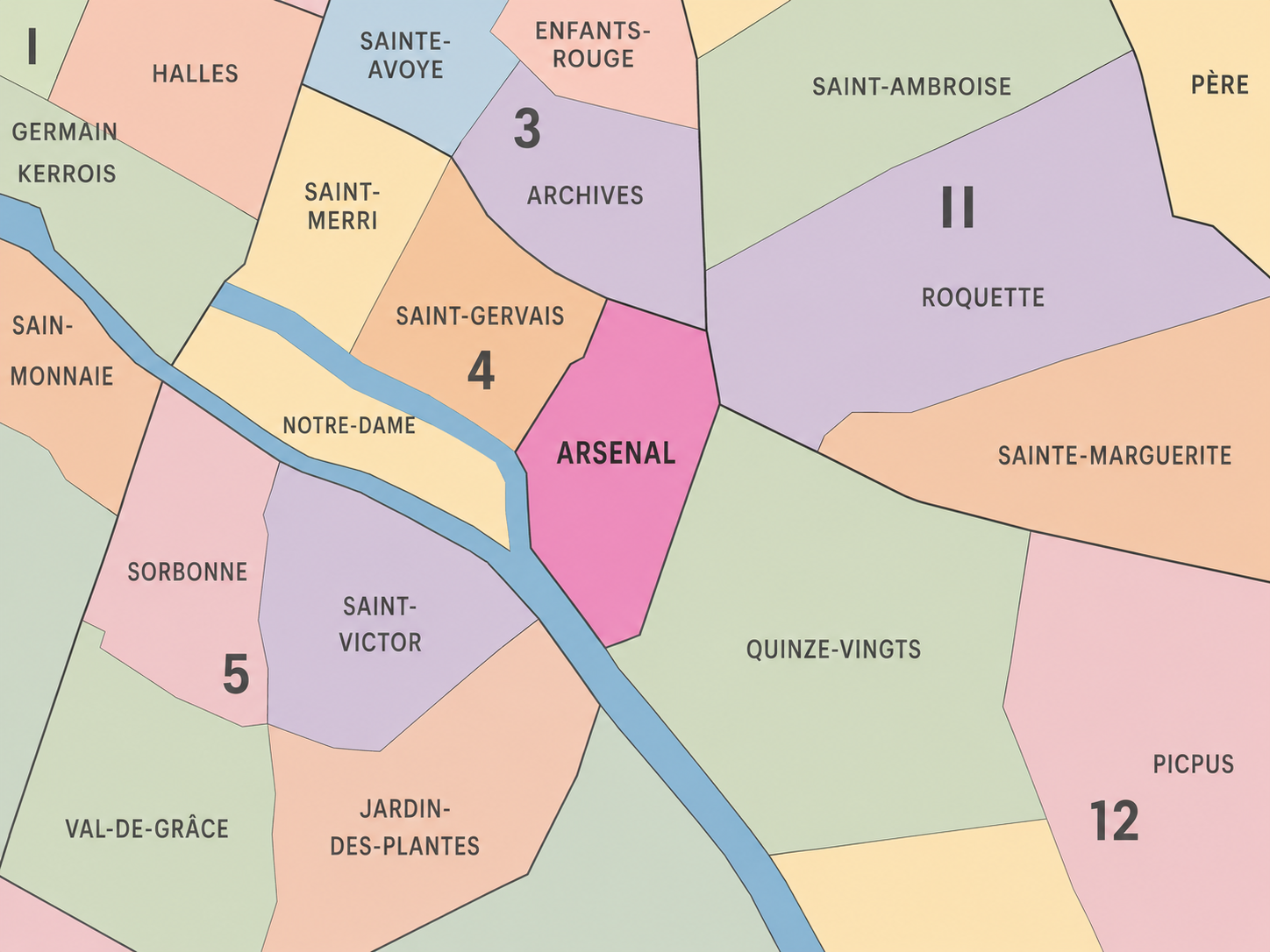
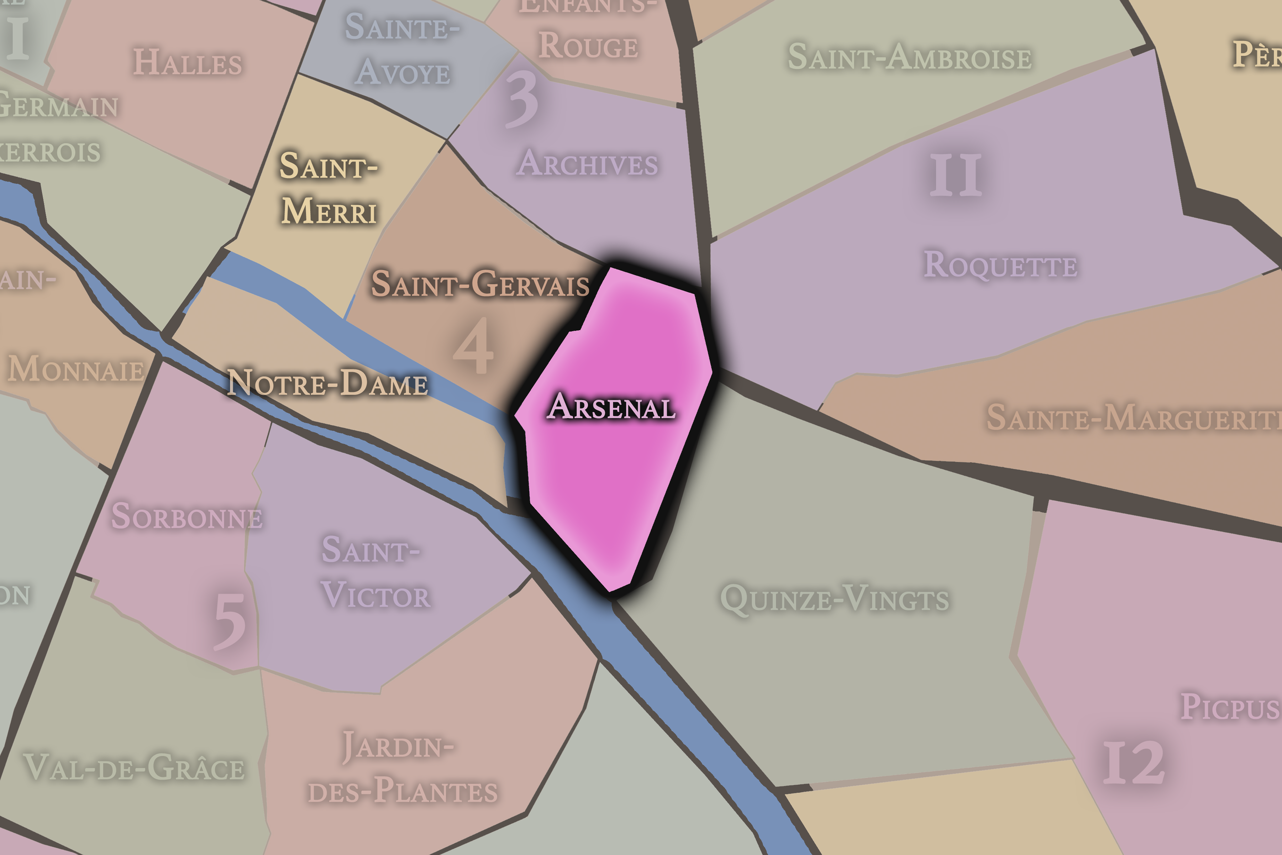
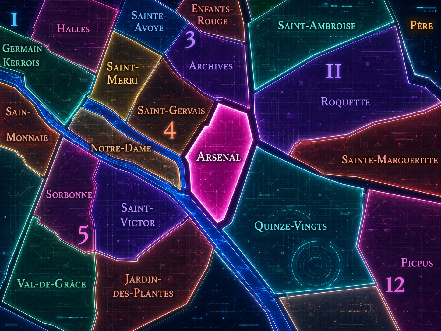
The Map
Geographic Setting
Arsenal occupies the southeastern portion of Paris Centre, where the 4th arrondissement meets the Seine, the Bastille, the Marais, and the threshold of eastern Paris. It lies below Saint-Gervais and Notre-Dame, east of the older Marais fabric, and west of the 12th arrondissement across the Bastille and the Port de l’Arsenal. The quarter is shaped by a distinctive geography of edges: riverfront, former fortification, canal basin, boulevard, institutional grounds, and the historic transition from central Paris toward the faubourgs.
The quarter’s defining landmarks include the Bassin de l’Arsenal, the Place de la Bastille, the Bibliothèque de l’Arsenal, the Boulevard Henri-IV, the Pavillon de l’Arsenal, and the Seine-side quays near Quai Henri-IV. Its streets and spaces move between the intimacy of the Marais and the openness of the river and basin. Compared with Saint-Gervais, whose identity is tied more closely to the old Right Bank and Hôtel de Ville, or Notre-Dame, whose geography is concentrated around the islands, Arsenal is a quarter of hinge and passage: a place where Paris’s old military edge became a landscape of water, memory, planning, and movement.
Administrative Quarter Identity
Etymology and Origins
The name Arsenal comes from the royal arsenal that once occupied this part of Paris. An arsenal is a place for the storage, manufacture, or administration of arms and military equipment, and in this quarter the term refers to the former Arsenal of Paris, connected to the crown’s artillery and the eastern defensive edge of the city. The Bibliothèque nationale de France describes the Bibliothèque de l’Arsenal as the former residence of the grand masters of artillery, preserving the memory of this military landscape within a cultural institution.
The name therefore carries a sharp contrast. Today, Arsenal may suggest books, boats, gardens, urban exhibitions, and quiet passages near the basin. But its origin lies in weaponry, state power, and the city’s fortified eastern side. The quarter’s identity begins with military function and later turns toward knowledge, leisure, architecture, and civic memory.
This transformation gives the name particular depth. Arsenal is not merely a historical label. It marks one of Paris’s great conversions: from a landscape of arms to a landscape of archives, libraries, waterways, and urban reflection.
Civic Framework
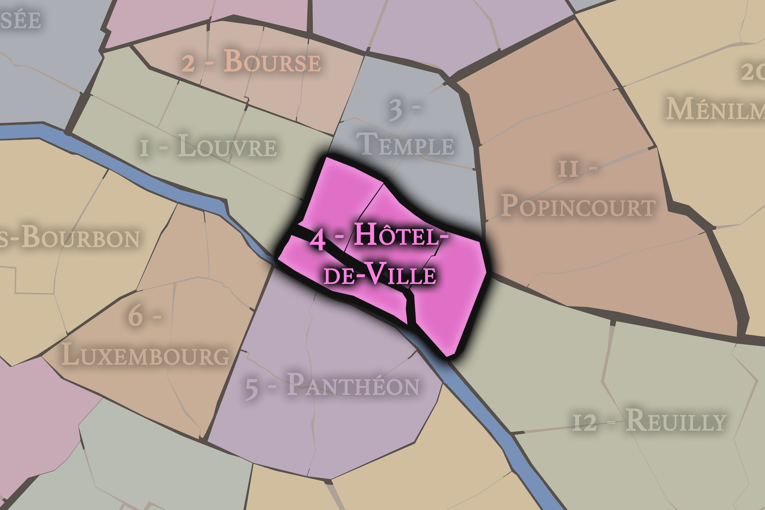
Within the official geography of Paris, Arsenal is one of the four administrative quarters of the 4th arrondissement, alongside Saint-Merri, Saint-Gervais, and Notre-Dame. It occupies the arrondissement’s southeastern sector and belongs to the modern municipal structure of Paris Centre, which groups the 1st, 2nd, 3rd, and 4th arrondissements for local governance.
As an administrative quarter, Arsenal gives a clear civic frame to an area that is often described through overlapping names: Bastille, Marais, Port de l’Arsenal, Quai Henri-IV, or the eastern edge of Paris Centre. The official quarter name is useful because it gathers these related landscapes into one mapped unit. It acknowledges that the Bastille and the basin are not only symbols or landmarks, but part of a wider neighborhood fabric shaped by defense, water, administration, memory, and redevelopment.
Arsenal also reveals the importance of border quarters in Paris. It sits within the 4th arrondissement, but its identity repeatedly looks outward: toward the 12th, toward the Canal Saint-Martin system, toward the eastern faubourgs, and toward the Seine. It is central Paris at the point where centrality begins to loosen into passage.
Neighborhood Distinction
Arsenal differs from the other quarters of the 4th arrondissement through its relationship to military memory, water infrastructure, and the Bastille threshold. Saint-Merri is shaped by Beaubourg, church streets, and the modern cultural energy around the Centre Pompidou. Saint-Gervais carries the older Right Bank fabric of the Marais, Hôtel de Ville, Jewish history, and parish memory. Notre-Dame gathers the islands, cathedral, palace, judicial, and river origins of the city.
Arsenal, by contrast, is defined by edge conditions. It is the quarter of the former arsenal, the Bastille, the basin, the eastern approach, and the riverfront transition. Its identity is less medieval-island or Marais-interior and more infrastructural. It holds the memory of fortifications and the later reinvention of those spaces into civic and leisure landscapes.
It should also be distinguished from the broader Bastille district. Bastille as a cultural and historical name reaches across arrondissement boundaries into the 11th and 12th arrondissements. Arsenal is the official administrative quarter on the 4th arrondissement side of that larger Bastille world. It does not contain the entire Bastille identity, but it contains one of its most important historical and spatial anchors.
Parisian Identity
Arsenal expresses Paris as a city of conversion. Few quarters show so clearly how a military and defensive landscape can become a place of books, boats, public gardens, urban exhibitions, and everyday movement. The old arsenal gave the district its name; the Bibliothèque de l’Arsenal turned part of that military inheritance into a repository of literature and historical collections; the Bassin de l’Arsenal transformed the defensive ditch of the Bastille landscape into a basin and port linking the Seine to the city’s canal system.
The quarter also carries a powerful Parisian tension between rupture and continuity. The Bastille has vanished, but the place remains charged by its memory. The military function has gone, but the name remains. The old defensive edge has become an urban seam. The result is not a neighborhood that forgets its past, but one that repeatedly repurposes it.
This makes Arsenal one of the most conceptually rich quarters of Paris Centre. It is a place where history does not sit still. It is dismantled, renamed, excavated, canalized, collected, exhibited, and walked. Arsenal is Paris as transformation made visible.
Neighborhood Connections
Every neighborhood belongs to a wider Parisian fabric.
-
4e — Hôtel-de-Ville
-
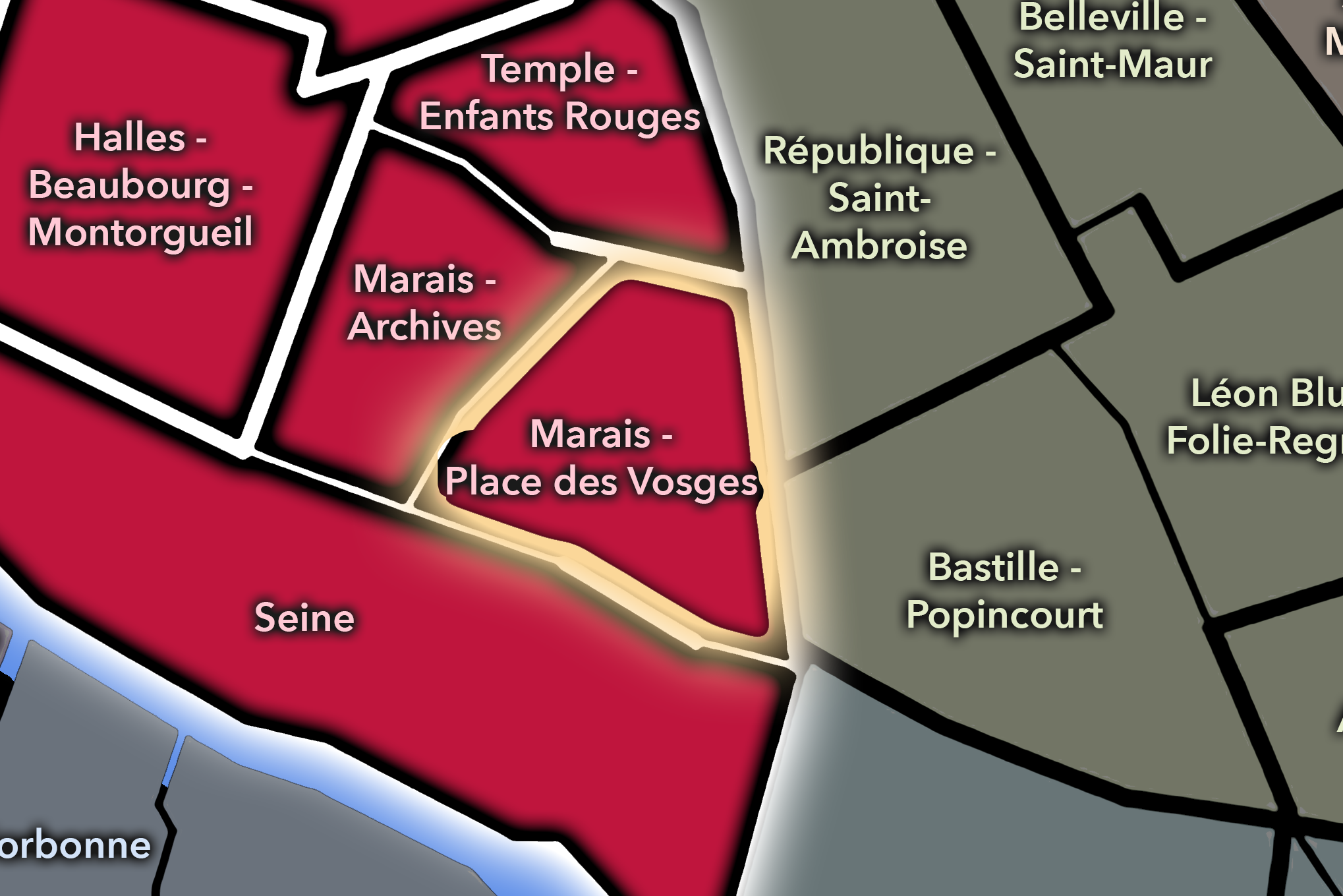
Marais - Place Des Vosges
-
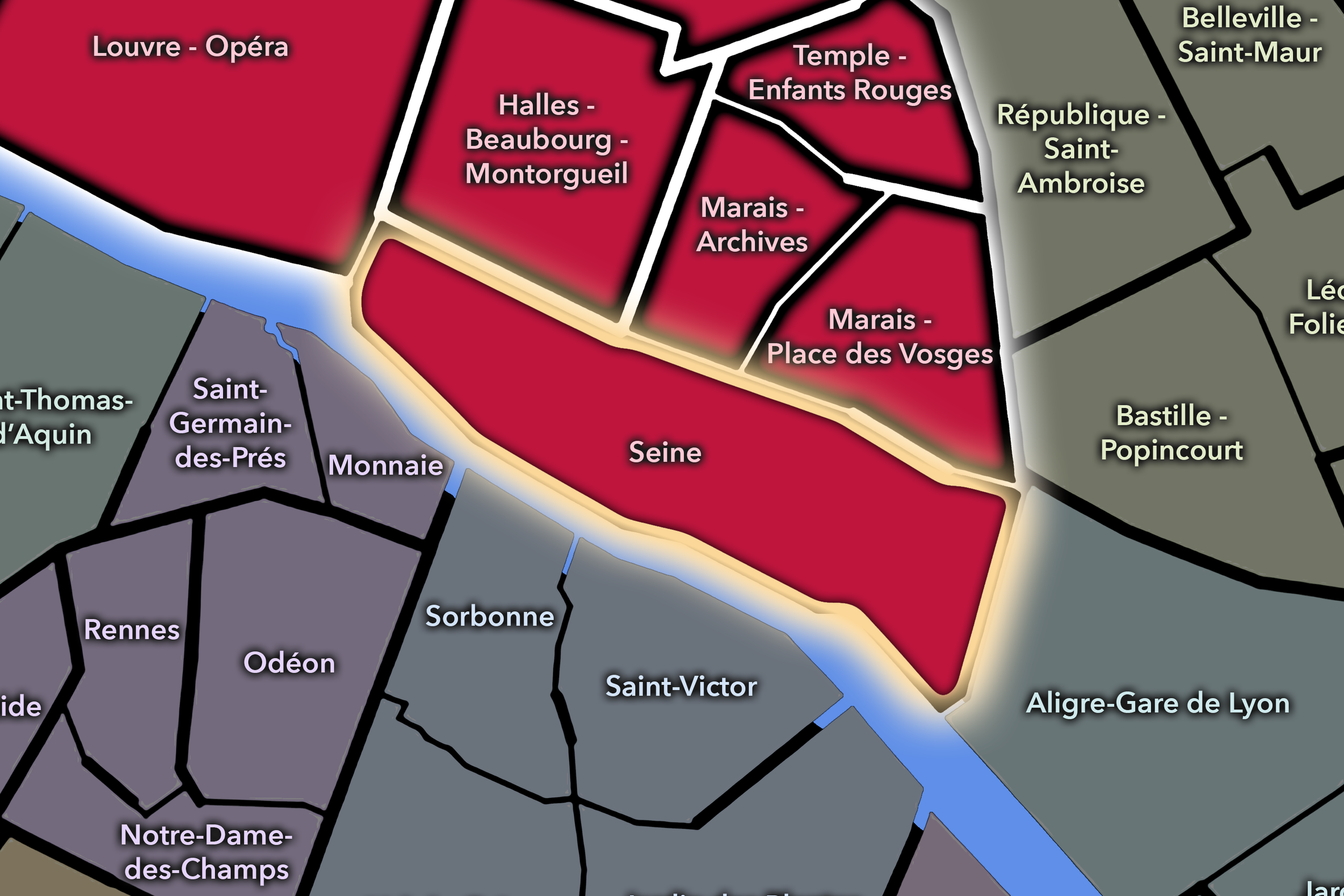
Seine
-

Rive Droite
-
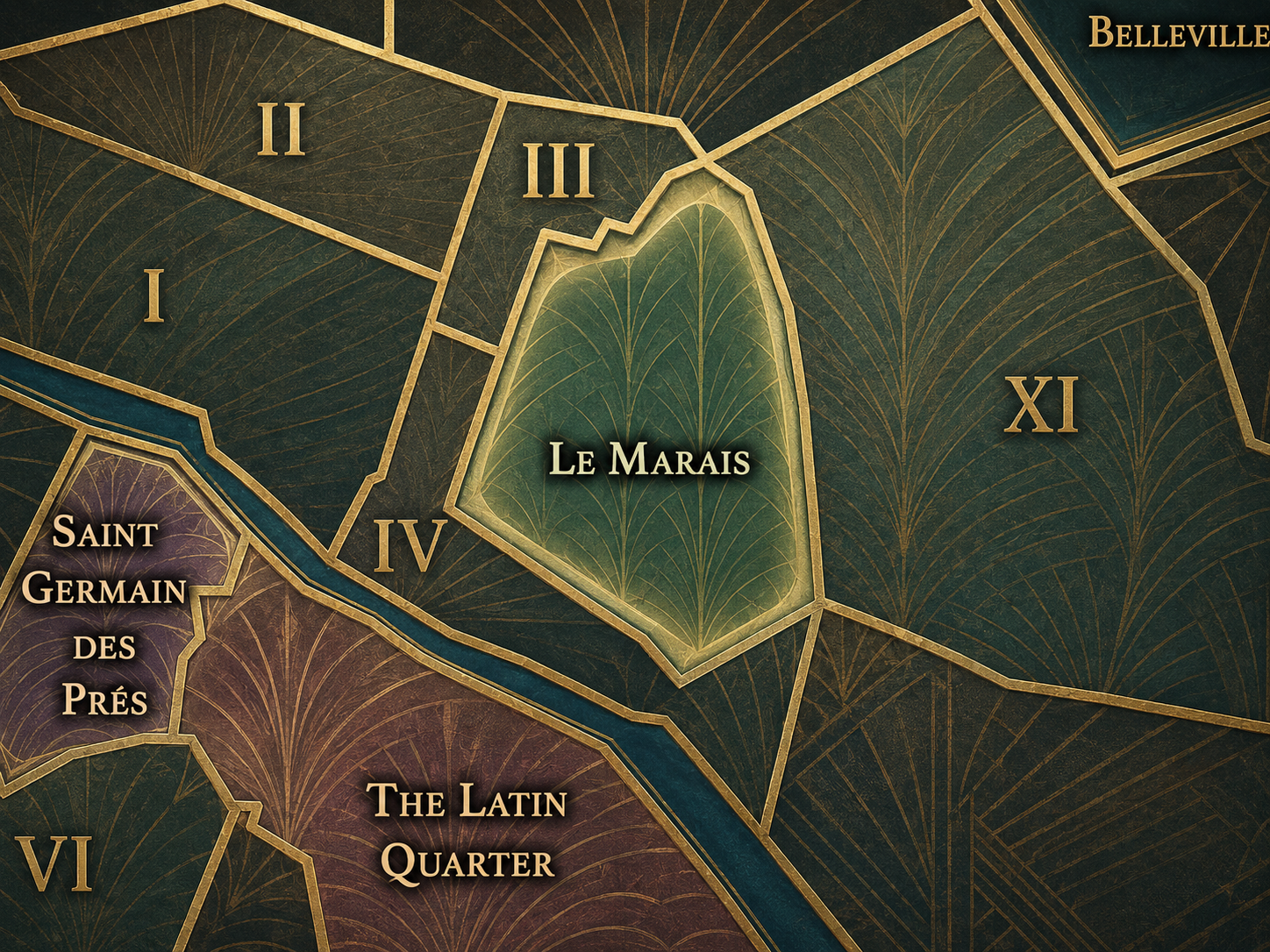
Le Marais
The History
Origins
The origins of Arsenal lie in the eastern defensive and military geography of Paris. This part of the city developed near the Wall of Charles V, the Bastille fortress, and the lands connected to royal artillery and storage. Unlike the older commercial and parish landscapes closer to Hôtel de Ville, Arsenal’s early identity was tied more directly to the needs of protection, weaponry, and state power.
The royal arsenal, or Grand Arsenal, occupied land near the Seine and the old fortifications. Over time, the district became associated with artillery administration, military storage, and the official residence of artillery authorities. This military identity set the quarter apart from neighboring parts of the Marais, whose histories were more strongly tied to aristocratic houses, religious institutions, and dense residential streets.
From the beginning, Arsenal was therefore shaped by strategic position. It stood at the eastern side of central Paris, near water, walls, gates, and roads outward. It was a place of storage and defense, but also of connection — a quality that would remain central even after the military landscape disappeared.
16th–17th Century
In the 16th and 17th centuries, Arsenal became increasingly important as part of the royal and military infrastructure of Paris. The former arsenal took shape along the eastern edge of the city, near the Seine and the Bastille, placing weapons, artillery, and state military administration within reach of both the river and the fortified boundary.
This was also a period when the Marais and eastern Right Bank were undergoing major changes. Aristocratic residences, religious institutions, and royal projects transformed nearby neighborhoods, while the Bastille remained a powerful symbol and instrument of royal authority. Arsenal belonged to this same world of state presence, but through a more practical and martial function.
The quarter’s later cultural identity began, paradoxically, in this environment of military administration. The residence and institutional buildings associated with the artillery authorities would eventually become tied to collections, books, archives, and library culture. Even in its military age, Arsenal was preparing the physical frame for a later intellectual identity.
18th Century
In the 18th century, Arsenal began to shift from a purely military landscape toward a place of collection, scholarship, and elite intellectual life. The Bibliothèque de l’Arsenal traces its origin to the library assembled by Antoine-René d’Argenson, marquis de Paulmy, in the residence of the grand masters of artillery. The BnF identifies this collection as the origin of the Arsenal library and notes the library’s exceptional 18th-century setting.
This transformation is central to the quarter’s meaning. A residence tied to artillery became a house of books. The landscape of arms began to contain a landscape of letters. The quarter’s name still pointed to military function, but its future identity was already expanding toward literature, documents, and cultural preservation.
The French Revolution then altered the entire eastern edge of the quarter. The Bastille was dismantled after 1789, and the area around it entered a new symbolic order. Arsenal became connected not only to royal military history, but to the revolutionary remaking of Parisian space. The old instruments of authority were being dismantled, repurposed, or transformed into civic memory.
19th Century
The 19th century gave Arsenal much of its modern geography. After the destruction of the Bastille, the former defensive ditch was transformed into what became the Bassin de l’Arsenal, a basin connecting the Seine with the Canal Saint-Martin system. Historical accounts of the basin emphasize this post-Bastille transformation, in which a military and defensive feature became a waterway and urban port.
This change reshaped the quarter’s identity. Arsenal was no longer primarily a place of weapons and fortification. It became a place of water, transport, and urban infrastructure. Boats, quays, bridges, and canal connections joined the older memory of the arsenal and the Bastille. The quarter’s eastern edge became both practical and scenic.
The 19th century also strengthened the Bibliothèque de l’Arsenal as a major cultural institution. The library’s collections expanded through revolutionary confiscations, literary holdings, and historic archives, including materials connected to the Bastille and Parisian institutional life. The quarter thus held two major inheritances of the old regime: the dismantled fortress remembered through documents, and the military residence repurposed as a library.
Early–Mid 20th Century
In the early and mid 20th century, Arsenal remained a quarter of layered institutions, water infrastructure, and Bastille memory. The Bassin de l’Arsenal continued to shape the quarter’s eastern edge, while the Bibliothèque de l’Arsenal preserved the intellectual and documentary legacy of the former military site. In 1934, the Bibliothèque de l’Arsenal became part of the Bibliothèque nationale de France, strengthening its role within the national library system.
The quarter’s position near Bastille gave it a constant relationship to political memory and urban movement. Place de la Bastille itself became one of the great symbolic spaces of Paris, while the surrounding streets and basin linked central Paris to the eastern districts. Arsenal remained both historic and functional: a district of institutions, roads, quays, and passage.
During the upheavals of war, occupation, liberation, and postwar reconstruction, Arsenal’s identity as a place of memory deepened. Its landmarks spoke to vanished fortifications, revolutionary rupture, state collections, and the continued life of the city around the basin. It was not a purely residential quarter, nor a purely monumental one. It was a hinge between history and infrastructure.
Late 20th Century
In the late 20th century, Arsenal became increasingly associated with heritage, urban planning, and leisure. The Bassin de l’Arsenal was transformed into a marina and public landscape, giving the quarter a quieter recreational identity alongside its older military and infrastructural memory. The basin, once tied to defense and transport, became a place of moored boats, gardens, walking paths, and views toward the Bastille.
The Pavillon de l’Arsenal also gave the quarter a major contemporary civic role. Located near Boulevard Morland, it became a center for exhibitions and documentation on the architecture, urban planning, and development of Paris. This institution added another layer to the quarter’s identity: Arsenal was not only a place shaped by historical transformations, but a place where the city reflects on its own urban form.
This is one of the quarter’s most elegant ironies. The old arsenal stored weapons; the library stored texts; the Pavillon de l’Arsenal stores and presents the city’s architectural imagination. Across centuries, the quarter repeatedly turns instruments of power into instruments of understanding.
21st Century
In the 21st century, Arsenal remains one of the most layered quarters of Paris Centre. It connects the Marais, Bastille, the Seine, the 12th arrondissement, the Canal Saint-Martin system, and the civic institutions clustered around the former arsenal landscape. The quarter is at once historic, residential, cultural, and infrastructural — a place where central Paris opens toward water and movement.
The Port de l’Arsenal gives the district a distinctive atmosphere within the historic center. Boats, gardens, quays, bridges, and the lowered basin create a different spatial experience from the dense Marais streets nearby. At the same time, the Bibliothèque de l’Arsenal and Pavillon de l’Arsenal anchor the quarter in memory and urban thought: one preserving literature and documents, the other presenting the architectural and planning life of Paris.
For CityNeighborhoods: Paris, Arsenal is essential because it shows how administrative quarters can reveal the hidden transformations of urban space. The quarter is not defined by one function, but by a sequence: military storage, royal authority, revolutionary rupture, library, basin, port, planning center, and public landscape. It is Paris as reuse.
Spirit and Legacy
Arsenal is the quarter where Paris converts power into memory. Its spirit lies in transformation: weapons into books, fortress ditch into basin, military ground into civic culture, defensive edge into passage, state architecture into public reflection. It is one of the city’s great examples of how history can be dismantled without disappearing.
Its legacy is not only the memory of the Bastille or the royal arsenal, but the layered uses that followed. The Bibliothèque de l’Arsenal keeps the written traces of old regimes and literary worlds. The Bassin de l’Arsenal keeps the waterline of a vanished defensive landscape. The Pavillon de l’Arsenal keeps the city’s architectural imagination visible to the public.
To walk Arsenal is to move along one of Paris’s most meaningful seams. The quarter binds the Marais to Bastille, central Paris to eastern Paris, river to canal, and military memory to civic life. It reminds us that neighborhoods are not only places that preserve the past. They are places where the past is converted — again and again — into new forms of urban meaning.
The Photography
Visual Identity

The visual identity of each Paris district begins with its position in the city’s layered geography. Before the photographs arrive, the maps establish a first way of seeing: where the district sits, what civic layer it belongs to, which boundaries define it, and how it connects to the surrounding fabric of Paris. In CityNeighborhoods Paris, cartography is not merely orientation; it is part of the visual language of the project.
As the photographic archive grows, this section will continue to develop through images gathered on foot. Streets, façades, monuments, markets, parks, river edges, passages, signs, textures, and everyday details will gradually reveal how each district presents itself visually. The goal is not only to show what a place looks like, but to trace how its identity becomes visible through form, atmosphere, memory, and use.
Through The Lens

CityNeighborhoods Paris is built from walking, looking, and returning. Each district is approached through photography as a way of paying attention: to the obvious landmarks and the quieter details, to historic structures and ordinary streets, to the moments where civic geography becomes lived experience. The camera becomes a tool for noticing how Paris changes from one district to the next, and how each place holds its own relationship to the larger city.
As photographs are processed and added, this section will become a more specific visual record of the district. Future updates may include dated field notes, galleries, and reflections from individual walks. For now, the page remains part of the larger CityNeighborhoods effort to document every Paris neighborhood through maps, history, identity, and photography — one district, one walk, and one visual encounter at a time.
If you visit Paris, these ideas can help inspire your own photography.


Paris: J’Espere, Je Rêve, Je Vive
Paris Photo Gallery
Paris Flâneur Notes
Flâneur Notes document the walks, photographs, light, and street-level observations behind this neighborhood entry. Learn more about the Spirit of the Flâneur.


Explore Paris
-

The twenty arrondissements form the civic spiral of Paris, organizing the city into its broad local districts of government, identity, and daily life.
-

Each arrondissement is divided into four official administrative quarters, giving Paris a more precise civic and geographic framework.
-

The conseils de quartier bring participation to street level, giving residents a voice in neighborhood needs, public space, and local civic life.
-

Les Deux Rives trace Paris through the Seine’s two banks, revealing how the Rive Droite and Rive Gauche shaped the city’s civic power, commerce, learning, art, and cultural identity.
-

Cultural neighborhoods reveal the Paris people recognize through history, cafés, architecture, memory, atmosphere, and local belonging.